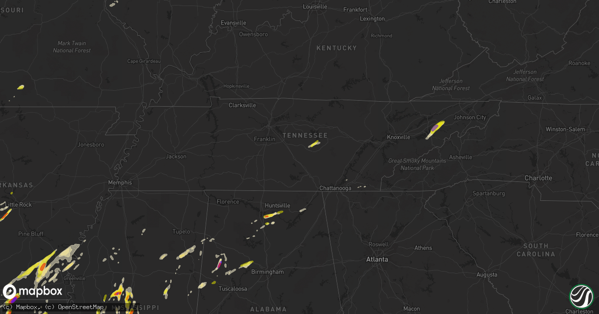
Hail Map in Tennessee on April 7, 2019
Get this storm
April 7 map
$229
one time, instant access
Download today. No call, no setup
Keep the $229
Bought the map and want the full workflow? Apply the entire $229 to a subscription within 7 days. None of it is wasted.
Every map, not just this one
This buys you this map. Subscription and you get every map we run, in the markets you choose from a few cities to whole states to nationwide. Plus real-time alerts the moment a storm fires.
Contact data
Name, contact info, occupancy, even credit band for addresses in the footprint. You go from where it hit to who to call.
Become the source they trust
Unlimited branding weather history reports on demand. You already have the documented answer ready for the property owner, and you are the one who showed up with it.
Property data and RoofTrace estimates
Pull up any address you have got, its value and the exact code rules for that jurisdiction, straight from One Click Code. Then RoofTrace estimates the squares, pitch, and roof value, priced the way you price.
Storm reports in Tennessee
Tennessee
| Date | Description |
|---|---|
| 04/07/20195:45 PM CDT | A local report indicates 1.50 inch wind near MIDWAY |
| 04/07/20195:30 PM CDT | Multiple trees down around the bybee area. |
| 04/07/20195:18 PM CDT | Reported through media outlet in belk... Tn. Thanks to davis nolan. |
| 04/07/20191:23 AM CDT | At 623 PM EDT, a severe thunderstorm was located near Parrottsville, or 7 miles north of Newport, moving northeast at 35 mph. HAZARD...60 mph wind gusts and half dollar size hail. SOURCE...Radar indicated. IMPACT...Hail damage to vehicles is expected. Expect wind damage to roofs, siding, and trees. Locations impacted include... Morristown, Greeneville, Newport, Rogersville, Tusculum, Parrottsville, Mosheim, Bulls Gap, Baileyton, Caney Branch, Romeo, McCloud, Bybee, St. Clair, Kepler, Lowland, Mohawk and Jearoldstown. |
| 04/07/20191:17 AM CDT | At 616 PM EDT, a severe thunderstorm was located over Cohutta Wilderness, or 10 miles west of Ducktown, moving northeast at 15 mph. HAZARD...60 mph wind gusts and quarter size hail. SOURCE...Radar indicated. IMPACT...Hail damage to vehicles is expected. Expect wind damage to roofs, siding, and trees. Locations impacted include... Cohutta Wilderness. |
| 04/07/201912:13 AM CDT | At 513 PM CDT, a severe thunderstorm was located 8 miles north of McMinnville, moving northeast at 40 mph. HAZARD...60 mph wind gusts and quarter size hail. SOURCE...Radar indicated. IMPACT...Hail damage to vehicles is expected. Expect wind damage to roofs, siding, and trees. Locations impacted include... Sparta, Doyle, Rock Island State Park and Bakers Crossroads. |
| 04/06/201910:48 PM CDT | At 347 PM CDT, severe thunderstorms were located along a line extending from near Burns to 10 miles east of Centerville, moving northeast at 45 mph. HAZARD...60 mph wind gusts. SOURCE...Radar indicated. IMPACT...Expect damage to roofs, siding, and trees. Locations impacted include... Spring Hill, Kingston Springs, Thompson's Station, Pegram, Fairview, Bon Aqua, Primm Springs, Leipers Fork, Lyles and Natchez Trace At Highway 96. |
All States Impacted by Hail Map on April 7, 2019
Cities Impacted by Hail Map on April 7, 2019
- Junction City, AR
- Lillie, LA
- Jefferson, TX
- Fountain Hill, AR
- Hamburg, AR
- Monticello, AR
- Amory, MS
- Aberdeen, MS
- Prairie, MS
- Okolona, MS
- Orange Grove, TX
- Sandia, TX
- Port Arthur, TX
- Alice, TX
- Delhi, LA
- Ledbetter, TX
- Carmine, TX
- Marshall, TX
- Beckville, TX
- Tatum, TX
- Strong, AR
- Huttig, AR
- Spearsville, LA
- Marion, LA
- Roma, TX
- Rio Grande City, TX
- Falkville, AL
- Lexington, MS
- Cruger, MS
- Durant, MS
- Pittsfield, IL
- New Canton, IL
- Pleasant Hill, IL
- Barry, IL
- Rockport, IL
- Biggsville, IL
- Burlington, IA
- Sperry, IA
- Gladstone, IL
- Oquawka, IL
- Holden, LA
- Walker, LA
- Somerville, TX
- Murrayville, IL
- Roodhouse, IL
- Atlanta, TX
- Queen City, TX
- Nebo, IL
- Pearl, IL
- Mosheim, TN
- Midway, TN
- Newport, TN
- Bybee, TN
- Mohawk, TN
- Smithville, TX
- Rosanky, TX
- Perry, MO
- El Dorado, AR
- Unionville, MO
- Gainesville, MO
- Goodman, MS
- Sallis, MS
- Canton, MS
- Pickens, MS
- West, MS
- Brandon, MS
- Camden, MS
- Lott, TX
- Newton, IA
- Colfax, IA
- Waelder, TX
- Birmingham, IA
- Valhermoso Springs, AL
- Decatur, AL
- Somerville, AL
- Hartselle, AL
- Hillview, IL
- Monroe, LA
- Bernice, LA
- Farmerville, LA
- Marquez, TX
- College Station, TX
- Benton, AR
- Danforth, IL
- Grapeland, TX
- Magnolia, AR
- Shongaloo, LA
- Emerson, AR
- Springhill, LA
- Taylor, AR
- Fayette, AL
- Bankston, AL
- Winfield, AL
- Ocoee, TN
- Old Fort, TN
- Bremond, TX
- Madisonville, TX
- Normangee, TX
- Leona, TX
- Centerville, TX
- Midway, TX
- Crockett, TX
- Bivins, TX
- Linden, TX
- Victoria, TX
- Pattonsburg, MO
- McFall, MO
- Douds, IA
- Newellton, LA
- Cleveland, TX
- Stephens, AR
- Nemo, TX
- Jonesville, LA
- Mansura, LA
- Evergreen, LA
- Bunkie, LA
- Cottonport, LA
- Scottsboro, AL
- Northport, AL
- Berry, AL
- Bryant, AR
- Rusk, TX
- Oak Ridge, LA
- Mer Rouge, LA
- Ferriday, LA
- Beeville, TX
- Paris, MO
- Macon, MS
- Bloomburg, TX
- Hughes Springs, TX
- Palestine, TX
- Franklin, TX
- North Zulch, TX
- Yazoo City, MS
- Bentonia, MS
- Washington, TX
- Houston, TX
- Katy, TX
- Cypress, TX
- Dumas, AR
- Hermitage, AR
- Warren, AR
- Pickens, AR
- Wilmar, AR
- Tillar, AR
- Greenwood Springs, MS
- Eva, AL
- Monroe City, MO
- New London, MO
- Bowling Green, MO
- Louisiana, MO
- Clarksville, MO
- Center, MO
- Frankford, MO
- Stoutsville, MO
- Bucklin, MO
- Brookfield, MO
- Waskom, TX
- Marlin, TX
- Reagan, TX
- Arkansas City, AR
- Rohwer, AR
- Dermott, AR
- Bryan, TX
- Hockley, TX
- Little Rock, AR
- Alexander, AR
- Paron, AR
- Duncan, MS
- Douglassville, TX
- Doddridge, AR
- Rayville, LA
- Huffman, TX
- Skidmore, TX
- Louisville, MS
- Starkville, MS
- Gloster, MS
- Greeneville, TN
- Macon, MO
- Bevier, MO
- New Cambria, MO
- Ethel, MO
- Callao, MO
- Sterlington, LA
- Ariton, AL
- Brazoria, TX
- Kennedy, AL
- Dubach, LA
- Watson, AR
- Beaumont, TX
- Chamois, MO
- Bonnots Mill, MO
- Parrish, AL
- Quinton, AL
- Oakman, AL
- Winchester, IL
- Granbury, TX
- Rainbow, TX
- Glen Rose, TX
- Carrollton, AL
- Waterloo, IL
- McGehee, AR
- Arley, AL
- Addison, AL
- Houston, AL
- Bay City, TX
- Corpus Christi, TX
- Mcminnville, TN
- Smithville, TN
- Columbia, LA
- West Monroe, LA
- Comanche, TX
- Thayer, IA
- Ellston, IA
- Zephyr, TX
- Tolar, TX
- Vaughan, MS
- Matagorda, TX
- Cameron, LA
- Kirkwood, IL
- Yarmouth, IA
- Hamilton, AL
- Liberty, TX
- Cascilla, MS
- Lacona, IA
- Knoxville, IA
- Melcher Dallas, IA
- Alexandria, LA
- Water Valley, MS
- Oxford, MS
- Cordova, AL
- Kosciusko, MS
- Carthage, MS
- Caledonia, MS
- Brookeland, TX
- Thorndale, TX
- Dayton, TX
- Saint Landry, LA
- Bastrop, LA
- Rock Island, TN
- Bauxite, AR
- Edna, TX
- Brooksville, MS
- Girard, IL
- Huntsville, TX
- Mathis, TX
- George West, TX
- White Hall, IL
- Harwood, TX
- Vinemont, AL
- Hearne, TX
- Kosse, TX
- Valmeyer, IL
- Fults, IL
- Gattman, MS
- Benoit, MS
- Hamilton, MS
- Palmyra, IL
- Shelbyville, TX
- Coila, MS
- Bastrop, TX
- Cushing, TX
- Montrose, AR
- Henderson, TX
- Clio, AL
- Dora, MO
- Grady, AR
- Woodville, MS
- Pennington, TX
- Kennard, TX
- Madison, AL
- Beulah, MS
- Winnfield, LA
- Pride, LA
- Greenwell Springs, LA
- Baton Rouge, LA
- Batavia, IA
- Libertyville, IA
- Giddings, TX
- La Grange, TX
- Grinnell, IA
- Saint Francisville, LA
- Wilson, LA
- Ethel, LA
- Crosby, MS
- Jackson, LA
- Norwood, LA
- Centreville, MS
- Roxie, MS
- Rosebud, TX
- Lake Jackson, TX
- Freeport, TX
- Banks, AL
- Satartia, MS
- Alto, TX
- Merryville, LA
- Angleton, TX
- Traskwood, AR
- Jarreau, LA
- Ventress, LA
- Mantee, MS
- Woodland, MS
- Montezuma, IA
- Searsboro, IA
- Eldon, IA
- Haynesville, LA
- Hampton, AR
- Jewett, TX
- Burlington, TX
- New Caney, TX
- Stockdale, TX
- Danville, AL
- Charleston, MS
- Boling, TX
- Needville, TX
- Coffey, MO
- Bethany, MO
- Saratoga, AR
- Marthaville, LA
- Richmond, TX
- Collinston, LA
- Harrison, TN
- Ooltewah, TN
- Ottumwa, IA
- Cleveland, TN
- Texarkana, TX
- Minden, LA
- Cotton Valley, LA
- Tomball, TX
- Paige, TX
- Floresville, TX
- Bonita, LA
- Mooringsport, LA
- Rosenberg, TX
- Sikes, LA
- Walling, TN
- Denham Springs, LA
- Livingston, LA
- Caldwell, TX
- Jasper, TX
- Kinderhook, IL
- Avinger, TX
- Karnack, TX
- Logan, AL
- Cullman, AL
- Clute, TX
- Ganado, TX
- Yoakum, TX
- Ville Platte, LA
- Eunice, LA
- Homer, LA
- Coldspring, TX
- Quitman, LA
- Minter City, MS
- Philipp, MS
- Kenedy, TX
- Malvern, AR
- Lonsdale, AR
- Jacksonville, TX
- Gonzales, TX
- Cleburne, TX
- Detroit, AL
- Tremont, MS
- Cedarbluff, MS
- West Point, MS
- Cameron, TX
- Goliad, TX
- Gunnison, MS
- Crossett, AR
- Snow Lake, AR
- Banks, AR
- Rosedale, MS
- Jersey, AR
- Sturgis, MS
- Louisville, AL
- Clayton, AL
- Channelview, TX
- Atlanta, MO
- La Plata, MO
- Mamou, LA
- Basile, LA
- Lincoln, TX
- Flatonia, TX
- Eagle Lake, TX
- El Campo, TX
- Garwood, TX
- Oakwood, TX
- Whatley, AL
- Pasadena, TX
- Mount Pleasant, IA
- Mount Union, IA
- Baxter, IA
- Jena, LA
- Olla, LA
- Trout, LA
- California, MO
- Centertown, MO
- Dandridge, TN
- Columbia, IL
- East Carondelet, IL
- Thrall, TX
- Seadrift, TX
- Greenwood, MS
- Holcomb, MS
- Round Top, TX
- Burton, TX
- Sugar Land, TX
- Gordo, AL
- Benton, MS
- Tinsley, MS
- Novelty, MO
- Sulphur, LA
- Gladbrook, IA
- Beaman, IA
- Jones, LA
- Brookshire, TX
- Mount Holly, AR
- Gladewater, TX
- Winona, TX
- Bloomfield, IA
- Buckholts, TX
- Sarepta, LA
- Leonard, MO
- Laceys Spring, AL
- Huntsville, AL
- New Waverly, TX
- Willis, TX
- Reform, AL
- Millport, AL
- Cat Spring, TX
- Sealy, TX
- Silver City, MS
- Tchula, MS
- Owens Cross Roads, AL
- Parrottsville, TN
- Mediapolis, IA
- Mayflower, AR


