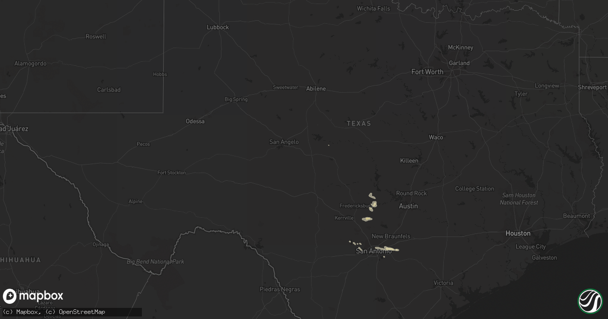
Hail Map in Texas on April 7, 2014
Get this storm
April 7 map
$229
one time, instant access
Download today. No call, no setup
Keep the $229
Bought the map and want the full workflow? Apply the entire $229 to a subscription within 7 days. None of it is wasted.
Every map, not just this one
This buys you this map. Subscription and you get every map we run, in the markets you choose from a few cities to whole states to nationwide. Plus real-time alerts the moment a storm fires.
Contact data
Name, contact info, occupancy, even credit band for addresses in the footprint. You go from where it hit to who to call.
Become the source they trust
Unlimited branding weather history reports on demand. You already have the documented answer ready for the property owner, and you are the one who showed up with it.
Property data and RoofTrace estimates
Pull up any address you have got, its value and the exact code rules for that jurisdiction, straight from One Click Code. Then RoofTrace estimates the squares, pitch, and roof value, priced the way you price.
Storm reports in Texas
Texas
| Date | Description |
|---|---|
| 04/06/20149:15 PM CDT | Numerous trees down across the northern half of fayette county. The awos at la grange reported a wind gusts to 47 mph. |
| 04/06/20148:30 PM CDT | Large live oak tree blown over along with several large limbs from other trees. |
| 04/06/20147:55 PM CDT | Large tree was blown into power lines knocking out power to the area. |
| 04/06/20147:38 PM CDT | Ktki reported a wind gust to 50 knots. |
| 04/06/20147:35 PM CDT | Strong winds blew down a large tree near 24th street and san jacinto. Time is estimated by radar. |
All States Impacted by Hail Map on April 7, 2014
Cities Impacted by Hail Map on April 7, 2014
- Hye, TX
- Troy, AL
- Mayfield, KY
- Sedalia, KY
- Davidson, OK
- Round Mountain, TX
- Llano, TX
- Johnson City, TX
- Marion, TX
- Jbsa Ft Sam Houston, TX
- Seguin, TX
- Schertz, TX
- San Antonio, TX
- Converse, TX
- Saint Hedwig, TX
- La Vernia, TX
- Banks, AL
- Blanco, TX
- Pipe Creek, TX
- Mico, TX
- Rio Medina, TX
- Lohn, TX
- Pantego, NC
- Fulton, KY
- Water Valley, KY
- Eglin Afb, FL
- Robertsdale, AL
- Cantonment, FL
- Kendalia, TX
- Boerne, TX
- Benton, KY
- Helotes, TX
- Adkins, TX
- Bandera, TX
- Loreauville, LA
- Erath, LA
- Saint Martinville, LA
- New Iberia, LA
- Walker, LA
- Greenwell Springs, LA
- Denham Springs, LA
- Baton Rouge, LA
- Addis, LA


