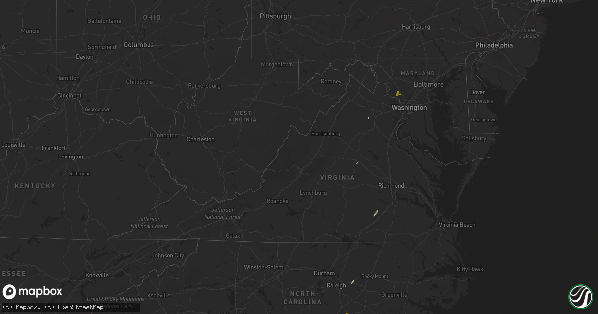
Hail Map in Virginia on April 6, 2017
Get this storm
April 6 map
$229
one time, instant access
Download today. No call, no setup
Keep the $229
Bought the map and want the full workflow? Apply the entire $229 to a subscription within 7 days. None of it is wasted.
Every map, not just this one
This buys you this map. Subscription and you get every map we run, in the markets you choose from a few cities to whole states to nationwide. Plus real-time alerts the moment a storm fires.
Contact data
Name, contact info, occupancy, even credit band for addresses in the footprint. You go from where it hit to who to call.
Become the source they trust
Unlimited branding weather history reports on demand. You already have the documented answer ready for the property owner, and you are the one who showed up with it.
Property data and RoofTrace estimates
Pull up any address you have got, its value and the exact code rules for that jurisdiction, straight from One Click Code. Then RoofTrace estimates the squares, pitch, and roof value, priced the way you price.
Storm reports in Virginia
Virginia
| Date | Description |
|---|---|
| 04/06/20171:13 PM CDT | Large tree down blocking part of sugarland rd just west of landerset dr |
| 04/06/20171:11 PM CDT | Tree uprooted... Siding missing |
| 04/06/201712:56 PM CDT | Damage to metal roof with several trees down or snapped on property. |
| 04/06/201712:40 PM CDT | Large tree down blocking part of sugarland rd just west of landerset dr |
| 04/06/201712:40 PM CDT | Shutter blown off house |
| 04/06/201712:40 PM CDT | Pentagon parking lot light tower damaged |
| 04/06/201712:40 PM CDT | Multiple trees down in back yard across from dranesville elementary school |
| 04/06/201712:39 PM CDT | Trees snapped along i-395 near army navy country club |
| 04/06/201712:38 PM CDT | Several trees and power poles snapped. |
| 04/06/201712:37 PM CDT | Several small trees snapped in sugarland run stream valley park in herndon. |
| 04/06/201712:37 PM CDT | Few large trees down near intersection of east holly ave and elizabeth ct |
| 04/06/201712:36 PM CDT | Ef-0 tornado. Max winds 70 mph. Path length 3.3 miles...max width 25 yards. Several dozen trees snapped and uprooted...several fences blown over. |
| 04/06/201712:35 PM CDT | Tree down at courtyard hotel in herndon. |
| 04/06/201712:31 PM CDT | Several trees down on philip road. |
| 04/06/201712:31 PM CDT | 2 ft dia tree uprooted and fell on power lines. |
| 04/06/201712:30 PM CDT | Shutter blown off house |
| 04/06/201712:30 PM CDT | Tree on house. |
| 04/06/201712:29 PM CDT | About two dozen trees snapped near the intersection of gum spring road and lennox hale drive. |
| 04/06/201712:29 PM CDT | Large tree split house in half. |
| 04/06/201712:27 PM CDT | Tree uprooted |
| 04/06/201712:27 PM CDT | Tree on car. |
| 04/06/201712:24 PM CDT | Large tree down blocking part of southbound fairfax county parkway near intersection of burke center parkway |
| 04/06/201712:21 PM CDT | A local report indicates 59 MPH wind near 1 E MANASSAS |
| 04/06/201712:21 PM CDT | Trees down just north of the intersection of bull run post office road and u.s. 29 lee highway. |
| 04/06/201712:19 PM CDT | Tree fell onto house and deck. |
| 04/06/201712:18 PM CDT | Tree down on house. |
| 04/06/201712:18 PM CDT | Tree on power lines blocking lomond drive near powhatan street. |
| 04/06/201712:15 PM CDT | Tree on power lines. |
| 04/06/201712:15 PM CDT | Large pine tree snapped at the base...took down two other small trees and damaged fence as it fell. |
| 04/06/201712:15 PM CDT | A local report indicates 59 MPH wind near INDEPENDENT HILL |
| 04/06/201712:14 PM CDT | Trees down off sudley manor road. |
| 04/06/201712:14 PM CDT | Tree down on power lines on old delaney road. |
| 04/06/201712:13 PM CDT | Tree damage ends along blantyre road. |
| 04/06/201712:13 PM CDT | Tree down on power lines. |
| 04/06/201712:12 PM CDT | Trees downed along blantyre rd. |
| 04/06/201712:12 PM CDT | Trees down and traffic lights bent near bristow. |
| 04/06/201712:12 PM CDT | Dozens of trees snapped and uprooted near south end of beverlys mill road. |
| 04/06/201712:11 PM CDT | Midpoint of 5.9 mile long 75 yard wide ef-0 tornado. Dozens of large uprooted and snapped trees. Max winds 85 mph. |
| 04/06/201712:11 PM CDT | Tree down on power line. |
| 04/06/201712:11 PM CDT | Trees downed along blantyre road. |
| 04/06/201712:10 PM CDT | Trees down in king george along 301. One into house. |
| 04/06/201712:10 PM CDT | Numerous trees down and outbuildings damaged in the area of fairview lane and beverlys mill road near new baltimore. |
| 04/06/201712:10 PM CDT | Numerous trees down along blantyre road. |
| 04/06/201712:10 PM CDT | Multiple trees snapped on along airlie road |
| 04/06/201712:10 PM CDT | Numerous trees and lines down in the hickory area along south battlefield... Delia rd... Head of river and ehteridge. |
| 04/06/201712:10 PM CDT | Nws storm survey confirmed an ef0 tornado in the hickory area of the city of chesapeake. The earlier report included numerous trees and lines down in the hickory area a |
| 04/06/201712:09 PM CDT | Dozens of trees down. |
| 04/06/201712:09 PM CDT | Several trees snapped |
| 04/06/201712:08 PM CDT | Ef-0 tornado. Max winds 85 mph. Path length 1 mile. Path width 75 yards. Several destroyed outbuildings along with dozens of snapped and uprooted trees. |
| 04/06/201712:02 PM CDT | Numerous trees down along waterloo farm road |
| 04/06/201712:00 PM CDT | Outbuilding destroyed...large tree down and branches blown through exterior wall of house in 9000 block of donnybrook drive. |
| 04/06/201711:59 AM CDT | Brief ef-0 tornado. Max winds 80 mph. 0.3 mile long 50 yard wide path. Dozens of uprooted hardwood trees near harts mill road and woodbourne lane. |
| 04/06/201711:59 AM CDT | Greenhouse destroyed in 7000 block of tacketts mill road. |
| 04/06/201711:58 AM CDT | Trees down in the 2000 block of aquia road. |
| 04/06/201711:56 AM CDT | Several trees down |
| 04/06/201711:56 AM CDT | Damage to metal roof with several trees down or snapped on property. |
| 04/06/201711:54 AM CDT | Trees down |
| 04/06/201711:54 AM CDT | Metal roof peeled off house... Fence blown over... Multiple snapped and downed trees in 13100 block sillamon rd |
| 04/06/201711:54 AM CDT | Trees down |
| 04/06/201711:54 AM CDT | Trees down near the intersection of goldmine road and blackwood forest drive. |
| 04/06/201711:53 AM CDT | Trees down and barn collapsed in the 11000 block of cemetery road. |
| 04/06/201711:53 AM CDT | Several downed and snapped trees along the 13000 block of sillamon rd |
| 04/06/201711:52 AM CDT | Several downed and snapped trees near sillamon rd and clovers oak ln |
| 04/06/201711:52 AM CDT | 7 large oaks downed on property. |
| 04/06/201711:51 AM CDT | Part of roof torn off house on east main street. |
| 04/06/201711:51 AM CDT | Trees down in the 3500 block of sumerduck road. |
| 04/06/201711:50 AM CDT | Numerous trees and power lines down along summerduck road near maryann lane. |
| 04/06/201711:50 AM CDT | Trees down in remington. |
| 04/06/201711:45 AM CDT | Trees down on power lines in richardsville. |
| 04/06/201711:45 AM CDT | Trees down at horizons apartments near indian river rd. Tatemstown rd and kemet rd. |
| 04/06/201711:45 AM CDT | Trees and power lines down along risby town rd on gwynn island. |
| 04/06/201711:45 AM CDT | Trees down and roof damage to a house near the intersection of alanthus road and farley road. |
| 04/06/201711:43 AM CDT | Trees down in stevensburg. |
| 04/06/201711:43 AM CDT | Trees and power lines down at richmond and jackson ave. |
| 04/06/201711:36 AM CDT | Numerous trees snapped and uprooted in the 31000 block of deep meadow lane. |
| 04/06/201711:35 AM CDT | Numerous trees down and small shed destroyed. |
| 04/06/201711:33 AM CDT | Multiple trees more than 1 ft in diameter down. Structural damage from wind and a barn was blown down |
| 04/06/201711:31 AM CDT | Ef-0 tornado. Max winds 85 mph. 2.7 mile long 175 yard wide path of extensive tree damage and some minor structural damage...most extensive in area of u.s. 522 and ida |
| 04/06/201711:31 AM CDT | Numerous trees down on property |
| 04/06/201711:27 AM CDT | A local report indicates 61 MPH wind near 1 WSW NASONS |
| 04/06/201711:20 AM CDT | Numerous trees down around louisa and across the county. Trees blocked west bound lanes on interstate 64 between mile marker 132 and 140. |
| 04/06/201711:15 AM CDT | Damage to the hospital in kilmarnock. Numerous trees down with other possible property damage. Nws to survey possible tornado. |
| 04/06/201711:15 AM CDT | Tree downed and damaged a house. |
| 04/06/201711:15 AM CDT | Numerous trees down from irvington to kilmarnock. |
| 04/06/201711:12 AM CDT | Hardwood trees uprooted in kilmarnock. Wind gusts estimated up to 75 mph. |
| 04/06/201711:11 AM CDT | Broken windows including clear story windows or skylights at a small professional building in kilmarnock. Wind gust estimated near 75 mph. |
| 04/06/201711:04 AM CDT | Trees down along interstate 64. |
| 04/06/201710:55 AM CDT | A few trees down near saluda. |
| 04/06/20178:36 AM CDT | Few trees down near dorey park. |
| 04/06/20178:36 AM CDT | Few trees down near dorey park. |


