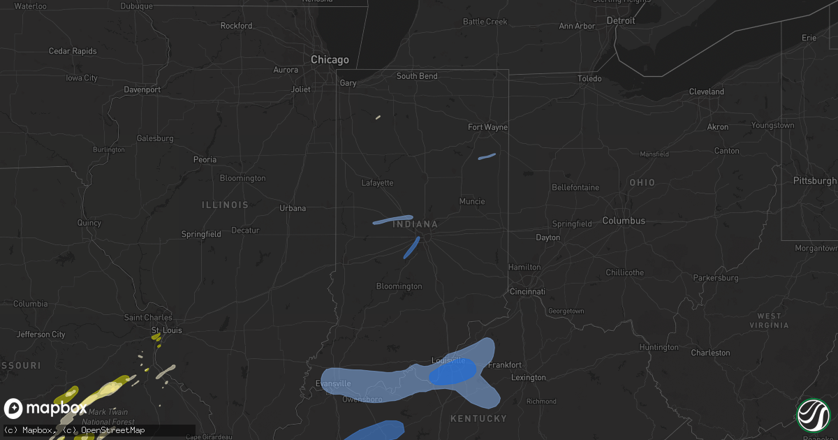
Hail Map in Indiana on April 5, 2023
Get this storm
April 5 map
$229
one time, instant access
Download today. No call, no setup
Keep the $229
Bought the map and want the full workflow? Apply the entire $229 to a subscription within 7 days. None of it is wasted.
Every map, not just this one
This buys you this map. Subscription and you get every map we run, in the markets you choose from a few cities to whole states to nationwide. Plus real-time alerts the moment a storm fires.
Contact data
Name, contact info, occupancy, even credit band for addresses in the footprint. You go from where it hit to who to call.
Become the source they trust
Unlimited branding weather history reports on demand. You already have the documented answer ready for the property owner, and you are the one who showed up with it.
Property data and RoofTrace estimates
Pull up any address you have got, its value and the exact code rules for that jurisdiction, straight from One Click Code. Then RoofTrace estimates the squares, pitch, and roof value, priced the way you price.
Storm reports in Indiana
Indiana
| Date | Description |
|---|---|
| 04/05/20233:54 PM CDT | Report of a tree down at a residence off 7 mile ln. |
| 04/05/20233:45 PM CDT | Delayed report: social media photos of significant roof damage to an electrical and hvac building on sr 337 just west of sr 135. |
| 04/05/20233:40 PM CDT | Tree down on a driveway. |
| 04/05/20233:23 PM CDT | Large tree reported down on a house in stephensport. Time estimated from radar. |
| 04/05/20232:57 PM CDT | Delayed report. Power lines down in the 9800 block of s 720w. Time estimated from radar. |
| 04/05/20232:50 PM CDT | Barn destroyed in southern chrisney area. Time estimated via radar. |
| 04/05/20232:17 PM CDT | Measured at the evansville airport asos. |
| 04/05/20232:17 PM CDT | Measured at the evansville airport asos |
| 04/05/20232:16 PM CDT | Large tree down. |
| 04/05/20232:13 PM CDT | Wires down on kansas road & several trees down on kremer road. |
| 04/05/202312:52 PM CDT | Reports of tree damage at the intersection of hoosier highway and e 200 s. |
| 04/05/202312:15 PM CDT | A few trees downed. |
| 04/05/202312:13 PM CDT | Corrects previous tstm wnd dmg report from 2 nne travisville. Reports of tree damage at the intersection of hoosier highway and e 200 s. |
| 04/05/202312:08 PM CDT | Broadcast media reports house struck by lightning at 12310 hummingbird cove. Time estimated by radar. |
| 04/05/202312:00 PM CDT | Mesonet station in008 gas city. |
| 04/05/202311:50 AM CDT | A few trees downed. |
| 04/05/202311:40 AM CDT | Report from mping: 3-inch tree limbs broken; power poles broken. |
| 04/05/202311:18 AM CDT | Semi flipped on interstate 65 by thunderstorm winds. |
| 04/05/202311:18 AM CDT | Corrects previous tstm wnd dmg report from 3 wsw whitestown. Two semi trucks were blown over by thunderstorm winds on interstate 65 at mile marker 136. |
| 04/05/202311:11 AM CDT | Roof and wall damage to a large metal shed. |
| 04/05/202310:58 AM CDT | Damage to a roof and trees. Time estimated from radar. |
| 04/05/202310:58 AM CDT | Tornado tracked 0.25 mile to 1 mile ese of new ross with a width of 20 yards. Peak winds reached 65 mph. |
| 04/05/202310:48 AM CDT | Report from mping: 1-inch tree limbs broken; shingles blown off. |
| 04/05/20239:22 AM CDT | Corrects previous tstm wnd gst report for time from 2 ene remington. Measured at in048. Time based on radar. |
| 04/05/20238:27 AM CDT | A local report indicates 58 MPH wind near GARY AIRPORT |
| 04/05/20238:22 AM CDT | Measured at in048. Time based on radar. |
| 04/05/20238:06 AM CDT | Large tree fell on a car. Time estimated from radar. |
| 04/05/20238:02 AM CDT | Asos station kind indianapolis. |
| 04/05/20238:00 AM CDT | Powerlines down. Time estimated from radar. |
| 04/05/20237:57 AM CDT | A local report indicates 66 MPH wind near 3 ESE VALPARAISO |
| 04/05/20237:55 AM CDT | Large tree and power pole down near 300 n and 950 e. |
| 04/05/20237:55 AM CDT | Report of damage to structure. Time estimated. |
| 04/05/20237:36 AM CDT | Large trees and power poles down. |
| 04/05/20237:35 AM CDT | Added info to previous report. A number of trees down in putnam county. Noted between bainbridge and danville... And also near belle union. |
| 04/05/20237:35 AM CDT | A number of trees down in putnam county. |
| 04/05/20237:32 AM CDT | Tree across road. |
| 04/04/20237:55 PM CDT | Damage to house siding from thunderstorm wind. |
| 04/04/20237:55 PM CDT | Thunder wind blew down 2 large trees on carr road. |
All States Impacted by Hail Map on April 5, 2023
Cities Impacted by Hail Map on April 5, 2023
- Greenwood, AR
- Huntington, AR
- Hackett, AR
- Drury, MO
- Mountain Grove, MO
- Vanzant, MO
- Wasola, MO
- Ava, MO
- Squires, MO
- Norwood, MO
- Cabool, MO
- Elk Creek, MO
- Solo, MO
- Salem, MO
- Cook Sta, MO
- Cherryville, MO
- Martinsville, IN
- Mooresville, IN
- Brooklyn, IN
- West Newton, IN
- Camby, IN
- Indianapolis, IN
- Saint Louis, MO
- Fenton, MO
- Arnold, MO
- House Springs, MO
- Imperial, MO
- High Ridge, MO
- Cedar Hill, MO
- Barnhart, MO
- Hillsboro, MO
- East Carondelet, IL
- Columbia, IL
- Davisville, MO
- Steelville, MO
- Potosi, MO
- Bourbon, MO
- Cadet, MO
- Richwoods, MO
- Houston, MO
- Yukon, MO
- Eunice, MO
- Raymondville, MO
- Mountain View, MO
- Willow Springs, MO
- Summersville, MO
- Eminence, MO
- Hartshorn, MO
- Crawfordsville, IN
- Ladoga, IN
- New Ross, IN
- Jamestown, IN
- Lebanon, IN
- Whitestown, IN
- Zionsville, IN
- Clinton, AR
- De Soto, MO
- Alma, AR
- Red Bud, IL
- Blackwell, MO
- Ullin, IL
- Bixby, MO
- Mineral Point, MO
- Deer, AR
- Copenhagen, NY
- Lowville, NY
- Sainte Genevieve, MO
- Olive Branch, IL
- Tamms, IL
- Miller City, IL
- Thebes, IL
- Hodgen, OK
- Rolla, MO
- Charleston, AR
- Everton, AR
- Saint Joe, AR
- Jerusalem, AR
- Hector, AR
- Noble, MO
- Dora, MO
- Ozark, AR
- Cecil, AR
- Belleville, NY
- Henderson, NY
- Melbourne, AR
- Sage, AR
- Cotton Plant, AR
- Des Arc, AR
- Paris, AR
- Magazine, AR
- Cameron, OK
- Farmington, MO
- Benton, MO
- Bloomsdale, MO
- Festus, MO
- Bradleyville, MO
- Oldfield, MO
- Mount Pleasant, AR
- Batesville, AR
- Fort Smith, AR
- Yellville, AR
- Lamar, AR
- Ozone, AR
- Clarksville, AR
- Hagarville, AR
- Altus, AR
- Hartman, AR
- New Blaine, AR
- Delaware, AR
- Subiaco, AR
- Ratcliff, AR
- Cherry Valley, AR
- Parkin, AR
- Marlin, TX
- Reagan, TX
- Leslie, AR
- Shirley, AR
- Fox, AR
- Mountain View, AR
- Harrison, AR
- Whitesboro, OK
- Taneyville, MO
- Mulberry, AR
- Dennard, AR
- Russellville, AR
- Dover, AR
- San Pierre, IN
- North Judson, IN
- Booneville, AR
- Grand Cane, LA
- Shreveport, LA
- Frierson, LA
- Prairie Du Rocher, IL
- Fults, IL
- Hazen, AR
- Carlisle, AR
- Scranton, AR
- Wynne, AR
- Marked Tree, AR
- Earle, AR
- Eustace, TX
- Zalma, MO
- McGee, MO
- Mena, AR
- Heavener, OK
- Ellington, MO
- Centerville, MO
- Branch, AR
- Henderson, AR
- Oark, AR
- Saint Johns, MI
- Elsie, MI
- Ovid, MI
- Oakley, MI
- Henderson, MI
- Dyer, AR
- Waldron, AR
- Poteau, OK
- Mansfield, AR
- Hartford, AR
- Coal Hill, AR
- Thornfield, MO
- Theodosia, MO
- Gassville, AR
- Mountain Home, AR
- Flippin, AR
- Rodman, NY
- Adams, NY
- Lorraine, NY
- Mannsville, NY
- Adams Center, NY
- Watertown, NY
- Nashville, AR
- Scotland, AR
- Licking, MO
- Hearne, TX
- Bryan, TX
- Lott, TX
- Mountainburg, AR
- Valley Springs, AR
- Elm Grove, LA
- Liberty Center, IN
- Bluffton, IN
- Decatur, IN
- Jackson, TN
- Beech Bluff, TN
- Lexington, TN
- Cedar Grove, TN
- Georgetown, LA
- Dry Prong, LA
- Winnfield, LA
- Atlanta, LA
- Tullos, LA
- Olla, LA
- Sikes, LA
- Grayson, LA
- Evansville, IN
- Haubstadt, IN
- Wadesville, IN
- Poseyville, IN
- Mount Vernon, IN
- Henderson, KY
- Spottsville, KY
- Newburgh, IN
- Reed, KY
- Evanston, IN
- Boonville, IN
- Richland, IN
- Tennyson, IN
- Elberfeld, IN
- Gentryville, IN
- Chandler, IN
- Chrisney, IN
- Grandview, IN
- Lamar, IN
- Owensboro, KY
- Rockport, IN
- Troy, IN
- Lynnville, IN
- Maceo, KY
- Lewisport, KY
- Philpot, KY
- Hawesville, KY
- Whitesville, KY
- Reynolds Station, KY
- Saint Meinrad, IN
- Santa Claus, IN
- Tell City, IN
- Dale, IN
- Lincoln City, IN
- Yazoo City, MS
- Silver City, MS
- Tchula, MS
- Belzoni, MS
- Hardinsburg, KY
- Rome, IN
- Derby, IN
- Cannelton, IN
- Cloverport, KY
- Battletown, KY
- Leopold, IN
- Union Star, KY
- Stephensport, KY
- Payneville, KY
- Branchville, IN
- Coila, MS
- West, MS
- Vaiden, MS
- Irvington, KY
- Rhodelia, KY
- Harned, KY
- Webster, KY
- Guston, KY
- Corydon, IN
- Mauckport, IN
- Brandenburg, KY
- Central, IN
- Leavenworth, IN
- Graham, KY
- Greenville, KY
- Belton, KY
- Hopkinsville, KY
- Beech Creek, KY
- Bremen, KY
- Centertown, KY
- Beechmont, KY
- Madisonville, KY
- Browder, KY
- Crofton, KY
- Powderly, KY
- Central City, KY
- White Plains, KY
- Nortonville, KY
- Drakesboro, KY
- Rochester, KY
- Beaver Dam, KY
- Cromwell, KY
- Horse Branch, KY
- Morgantown, KY
- Hartford, KY
- Rockport, KY
- Olaton, KY
- McHenry, KY
- Rosine, KY
- Caneyville, KY
- Cruger, MS
- Laconia, IN
- Ekron, KY
- Vine Grove, KY
- Winona, MS
- Waynesboro, TN
- Kilmichael, MS
- Lawrenceburg, TN
- Hohenwald, TN
- West Point, KY
- Fort Knox, KY
- Muldraugh, KY
- Elizabeth, IN
- Louisville, KY
- Lanesville, IN
- New Middletown, IN
- Shepherdsville, KY
- Clarksville, IN
- Brooks, KY
- New Albany, IN
- Jeffersonville, IN
- Masonic Home, KY
- Fairdale, KY
- Mount Washington, KY
- Fisherville, KY
- Finchville, KY
- Taylorsville, KY
- Coxs Creek, KY
- Simpsonville, KY
- Shelbyville, KY
- Clermont, KY
- Lebanon Junction, KY
- La Grange, KY
- Pewee Valley, KY
- Smithfield, KY
- Buckner, KY
- Crestwood, KY
- Glenview, KY
- Prospect, KY
- Summertown, TN
- Mount Eden, KY
- Waddy, KY
- Terry, MS
- Raymond, MS
- Byram, MS
- Dickson, TN
- White Bluff, TN
- Charlotte, TN
- Ashland City, TN
- Pegram, TN
- Kingston Springs, TN
- Joelton, TN
- Nashville, TN
- Stewart, MS
- Ethel, MS
- Whites Creek, TN
- Goodlettsville, TN
- Hendersonville, TN
- Lebanon, TN
- Old Hickory, TN
- Madison, TN
- Mount Juliet, TN
- Gallatin, TN
- Jackson, MS
- Pendleton, KY
- Bagdad, KY
- Eminence, KY
- Sulphur, KY
- Campbellsburg, KY
- Pleasureville, KY
- New Castle, KY
- Ethridge, TN
- Mount Pleasant, TN
- Bethlehem, KY
- Turners Station, KY
- Keuka Park, NY
- Penn Yan, NY
- Watertown, TN
- Clinton, MS
- Bolton, MS
- Boston, KY
- Springfield, KY
- Willisburg, KY
- Saint Catharine, KY
- Fairfield, KY
- Bloomfield, KY
- Bardstown, KY
- Brandon, MS
- Flowood, MS
- Mackville, KY
- Chaplin, KY
- Lawrenceburg, KY
- Harrodsburg, KY
- Salvisa, KY
- Perryville, KY
- Kennard, TX
- Crockett, TX
- Grapeland, TX
- Wells, TX
- Alto, TX
- Farmerville, LA
- Red Bay, AL
- Golden, MS
- Belmont, MS
- Franklin, TN
- Fairview, TN
- Collinwood, TN
- Olivehill, TN
- Lutts, TN
- Centerville, TN
- Lobelville, TN
- Only, TN
- Camden, TN
- Joiner, AR
- Drummonds, TN
- Bassett, AR
- Tyronza, AR
- Frenchmans Bayou, AR
- Gilmore, AR
- Turrell, AR
- Duck Hill, MS
- French Camp, MS
- Call, TX
- Bon Wier, TX
- Kirbyville, TX
- Leesville, LA
- Mora, LA
- Dennis, MS
- Sondheimer, LA
- Lake Providence, LA
- Jonesville, LA
- Bastrop, LA
- Buna, TX
- Canton, MS
- Big Sandy, TN
- Tallulah, LA
- Colfax, LA
- Prairie, MS
- Aberdeen, MS
- Cherokee, AL
- West Point, MS
- Cascilla, MS
- Charleston, MS
- Millington, TN
- Cushing, TX
- Rusk, TX
- Richmond, TX
- Katy, TX
- Houston, TX
- Cypress, TX
- Victoria, TX
- Inez, TX
- Edna, TX
- Bellville, TX
- Sealy, TX
- Huntsville, TX
- Trinity, TX
- Chappell Hill, TX
- New Waverly, TX
- Willis, TX
- Groveton, TX
- Guerra, TX
- Hebbronville, TX
- Garwood, TX
- Eagle Lake, TX
- Alleyton, TX
- De Berry, TX
- Waskom, TX
- Greenwood, LA
- Livingston, TX
- Cat Spring, TX
- Woodville, TX
- Calliham, TX
- Jourdanton, TX
- Laredo, TX
- Freer, TX
- Tilden, TX
- Encinal, TX
- Cuero, TX
- Yoakum, TX
- Campbellton, TX
- Hallettsville, TX
- Shiner, TX
- New Ulm, TX
- Anderson, AL
- Rogersville, AL
- Beasley, TX
- Needville, TX
- Rosenberg, TX
- Mabank, TX
- Colmesneil, TX
- Chester, TX
- Henderson, TX
- Laneville, TX
- Carthage, MS
- Hemphill, TX
- Pineland, TX
- Bronson, TX
- Lovelady, TX
- Newellton, LA
- Rueter, MO
- Kissee Mills, MO
- Cedarcreek, MO
- Pearl, MS
- Florence, MS
- Reklaw, TX
- Jacksonville, TX
- Junction City, AR
- Russellville, AL
- Mount Enterprise, TX
- Gibsland, LA
- Dubberly, LA
- Longview, TX
- Kilgore, TX
- Warren, TX
- Sugar Land, TX
- Haynesville, LA
- Haughton, LA
- Minden, LA
- Shongaloo, LA
- Cotton Valley, LA
- Long Branch, TX
- Carthage, TX
- Bethany, LA
- Richland, MS
- Harrisonburg, LA
- Tuscumbia, AL
- Sterlington, LA
- El Dorado, AR
- Tatum, TX
- Hallsville, TX
- Schulenburg, TX
- Ridgeland, MS
- Madison, MS
- Tougaloo, MS
- Douglass, TX
- Moulton, AL
- Brookshire, TX
- Heflin, LA
- Shepherd, TX
- Coldspring, TX
- Cleveland, TX
- Falls City, TX
- Karnes City, TX
- Seguin, TX
- Kingsbury, TX
- San Marcos, TX
- Martindale, TX
- Pleasanton, TX
- Floresville, TX
- Muldrow, OK
- Roland, OK
- Rudy, AR
- Van Buren, AR
- Maxwell, TX
- Lockhart, TX
- La Vernia, TX
- Branson, MO
- Rockaway Beach, MO
- Forsyth, MO
- Sedalia, MO
- Hughesville, MO
- Nelson, MO
- La Monte, MO
- Pilot Grove, MO
- Falls City, NE
- Hiawatha, KS
- Lewistown, MO
- La Belle, MO
- Burlington Junction, MO
- Clearmont, MO
- Fremont, MO
- Alton, MO
- Ellsinore, MO
- Doniphan, MO
- Van Buren, MO
- Grandin, MO
- Mill Spring, MO
- Neosho, MO
- Goodman, MO
- Higbee, MO
- Fayette, MO
- Madison, MO
- Moberly, MO
- Clark, MO
- Anabel, MO
- Clarence, MO
- Riverton, KS
- Webb City, MO
- Galena, KS
- Joplin, MO
- Oronogo, MO
- Columbus, KS
- Carl Junction, MO
- Baxter Springs, KS
- Forest City, MO
- Mound City, MO
- Maitland, MO
- Fillmore, MO
- Oregon, MO
- Maryville, MO
- Hopkins, MO
- Pickering, MO
- Bedford, IA
- Graham, MO
- Barnard, MO
- Skidmore, MO
- Appleton City, MO
- Butler, MO
- Clinton, MO
- Osceola, MO
- Montrose, MO
- Greenfield, MO
- Dadeville, MO
- Fair Play, MO
- Aldrich, MO
- Lockwood, MO
- Half Way, MO
- Buffalo, MO
- Bolivar, MO
- Louisburg, MO
- Polk, MO
- Everton, MO
- Dunnegan, MO
- Canton, MO
- Warsaw, IL
- Rayville, MO
- Liberty, MO
- Excelsior Springs, MO
- Lawson, MO
- Kansas City, KS
- Kansas City, MO
- Kearney, MO
- Sturgeon, MO
- Rocheport, MO
- Franklin, MO
- New Franklin, MO
- Centralia, MO
- Columbia, MO
- Harrisburg, MO
- Mexico, MO
- Santa Fe, MO
- Boonville, MO
- Thompson, MO
- Monticello, MO
- Ewing, MO
- La Grange, MO
- Leavenworth, KS
- Weston, MO
- Platte City, MO
- Fort Leavenworth, KS
- Dearborn, MO
- Carthage, MO
- Reeds, MO
- Ursa, IL
- Shelbyville, MO
- Mendon, IL
- Loraine, IL
- Macon, MO
- Basco, IL
- West Point, IL
- Sutter, IL
- Newark, MO
- Excello, MO
- Leonard, MO
- Carthage, IL
- Bethel, MO
- Jacksonville, MO
- Nevada, MO
- Rockville, MO
- Harwood, MO
- Walker, MO
- Schell City, MO
- Middletown, MO
- Auxvasse, MO
- Vandalia, MO
- Ashland, MO
- Wellsville, MO
- Kingdom City, MO
- Fulton, MO
- Martinsburg, MO
- Leeton, MO
- Paris, MO
- Marshall, MO
- Perry, MO
- Warrensburg, MO
- Urich, MO
- Stoutsville, MO
- Chilhowee, MO
- Knob Noster, MO
- Blairstown, MO
- Windsor, MO
- Houstonia, MO
- Green Ridge, MO
- Blackwater, MO
- Knox City, MO
- Williamsville, MO
- Greenville, MO
- Piedmont, MO
- Eagle Rock, MO
- Cassville, MO
- Golden, MO
- Eureka Springs, AR
- Shell Knob, MO
- Deepwater, MO
- Rich Hill, MO
- Craig, MO
- Calhoun, MO
- Milo, MO
- Sheldon, MO
- El Dorado Springs, MO
- Lamar, MO
- Russellville, MO
- Centertown, MO
- Jefferson City, MO
- Holts Summit, MO
- New Bloomfield, MO
- Hartsburg, MO
- Lohman, MO
- Flemington, MO
- Stockton, MO
- Arcola, MO
- Humansville, MO
- Highland, KS
- Robinson, KS
- Bolckow, MO
- Troy, KS
- Newburg, MO
- Saint James, MO
- Edgar Springs, MO
- Kyle, TX
- Leesville, TX
- Gonzales, TX
- Waelder, TX
- Luling, TX
- Flatonia, TX
- Dale, TX
- Del Valle, TX
- Cedar Creek, TX
- Cotulla, TX
- Concepcion, TX
- Realitos, TX
- San Ygnacio, TX
- Weimar, TX
- Rosanky, TX
- Harwood, TX
- Giddings, TX
- Zapata, TX
- Robstown, TX
- Hempstead, TX
- Milam, TX
- Oakhurst, TX
- Lincoln, TX
- El Campo, TX
- Smithville, TX
- Bedias, TX
- Richards, TX
- Pearsall, TX
- Premont, TX
- Overton, TX
- Whitsett, TX
- Utica, MS
- Crystal Springs, MS
- Odem, TX
- Mathis, TX
- Encino, TX
- Louise, MS
- Camden, MS
- Delhi, LA
- Adkins, TX
- San Diego, TX
- New Braunfels, TX
- Christine, TX
- Plainfield, IN
- Monrovia, IN
- Paragon, IN
- Quincy, IN
- Cloverdale, IN
- Spencer, IN
- Gosport, IN
- Ellettsville, IN
- Poland, IN
- Freedom, IN
- Coal City, IN
- Bowling Green, IN
- Bloomfield, IN
- Worthington, IN
- Clay City, IN
- Jasonville, IN
- Switz City, IN
- Mccordsville, IN
- Greenfield, IN


