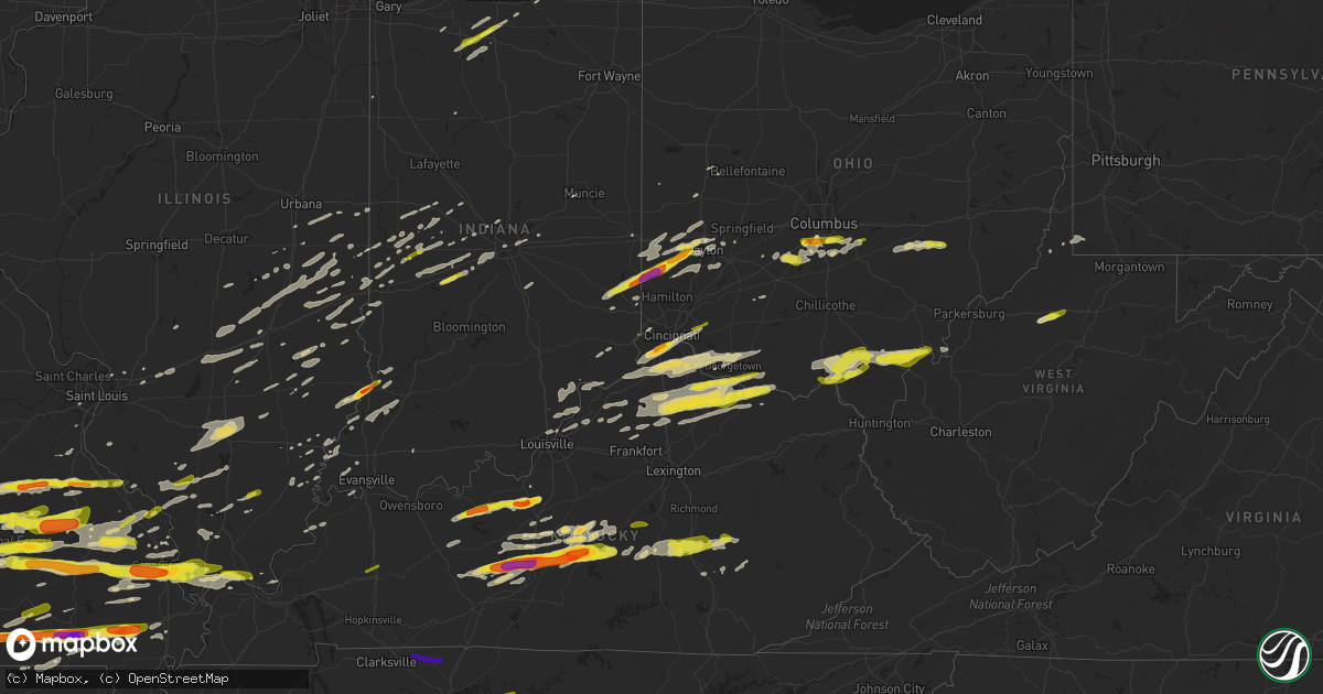
Hail Map on April 3, 2018
Get this storm
April 3 map
$229
one time, instant access
Download today. No call, no setup
Keep the $229
Bought the map and want the full workflow? Apply the entire $229 to a subscription within 7 days. None of it is wasted.
Every map, not just this one
This buys you this map. Subscription and you get every map we run, in the markets you choose from a few cities to whole states to nationwide. Plus real-time alerts the moment a storm fires.
Contact data
Name, contact info, occupancy, even credit band for addresses in the footprint. You go from where it hit to who to call.
Become the source they trust
Unlimited branding weather history reports on demand. You already have the documented answer ready for the property owner, and you are the one who showed up with it.
Property data and RoofTrace estimates
Pull up any address you have got, its value and the exact code rules for that jurisdiction, straight from One Click Code. Then RoofTrace estimates the squares, pitch, and roof value, priced the way you price.
States Impacted by Hail Map on April 3, 2018
Storm reports
Arkansas
| Date | Description |
|---|---|
| 04/03/20186:45 PM CDT | Tree down across county road 679 just south of town. |
| 04/03/20186:45 PM CDT | Approximately 30 power poles and multiple trees downed and snapped from lake village down to the greenville bridge. Most of the area is without power. |
| 04/03/20186:43 PM CDT | There are reports of stoplights... Trees... And power lines down in lake village. |
| 04/03/20186:43 PM CDT | Power pole snapped along highway 65. |
| 04/03/20186:35 PM CDT | Power lines down along highway 61 near the state line. |
| 04/03/20186:34 PM CDT | Power poles down along bill young rd. |
| 04/03/20186:23 PM CDT | Trees down in parkdale. |
| 04/03/20186:15 PM CDT | Large tree falls on car in crossett. |
| 04/03/20186:15 PM CDT | Wide spread trees and power lines down across the county. |
| 04/03/20186:15 PM CDT | Hail ranged from pea to golfball size across town. |
| 04/03/20186:10 PM CDT | Carport damage. |
| 04/03/20186:09 PM CDT | A local report indicates 1.00 inch wind near BEEDEVILLE |
| 04/03/20186:00 PM CDT | Trees down in north crossett. |
| 04/03/20185:55 PM CDT | Hail falling on the southwest side of town. |
| 04/03/20185:53 PM CDT | A local report indicates 1.25 inch wind near DE VALLS BLUFF |
| 04/03/20185:41 PM CDT | A local report indicates 1.00 inch wind near S DENMARK |
| 04/03/20185:40 PM CDT | Power poles leaning on highway 69. |
| 04/03/20185:40 PM CDT | A local report indicates 1.50 inch wind near PARAGOULD |
| 04/03/20185:38 PM CDT | Shed flipped. |
| 04/03/20185:29 PM CDT | A local report indicates 58 MPH wind near NEWPORT |
| 04/03/20185:28 PM CDT | A local report indicates 1.00 inch wind near HAZEN |
| 04/03/20185:25 PM CDT | A local report indicates 2.00 inch wind near PANGBURN |
| 04/03/20185:24 PM CDT | A local report indicates 2.75 inch wind near 3 N PANGBURN |
| 04/03/20185:20 PM CDT | A local report indicates 1.00 inch wind near LIGHT |
| 04/03/20185:15 PM CDT | A local report indicates 1.00 inch wind near SSW CARLISLE |
| 04/03/20185:13 PM CDT | A tree was blown down on airport road. |
| 04/03/20185:13 PM CDT | A local report indicates 1.75 inch wind near SE MAGNESS |
| 04/03/20185:06 PM CDT | A local report indicates 1.25 inch wind near 3 SSW SALADO |
| 04/03/20185:00 PM CDT | A local report indicates 1.00 inch wind near STRAWBERRY |
| 04/03/20184:50 PM CDT | Nickel to quarter sized hail fell. |
| 04/03/20184:49 PM CDT | A local report indicates 1.00 inch wind near 1 NNE BRYANT |
| 04/03/20184:48 PM CDT | A tree was blown into an outbuilding. The roof of a barn was lifted... But not blown off. The tops of several trees were snapped. The damage survey was performed by mon |
| 04/03/20184:31 PM CDT | A local report indicates 1.00 inch wind near CAVE CITY |
| 04/03/20184:22 PM CDT | A local report indicates 1.00 inch wind near SW SIDNEY |
| 04/03/20184:16 PM CDT | A local report indicates 1.75 inch wind near ALREAD |
| 04/03/20184:16 PM CDT | A local report indicates 1.75 inch wind near BOTKINBURG |
| 04/03/20184:16 PM CDT | A local report indicates 1.00 inch wind near CRABTREE |
| 04/03/20184:15 PM CDT | A local report indicates 1.00 inch wind near PLEASANT PLAINS |
| 04/03/20184:09 PM CDT | A local report indicates 1.75 inch wind near 2 SE BOTKINBURG |
| 04/03/20184:08 PM CDT | A local report indicates 1.00 inch wind near 3 ENE BOTKINBURG |
| 04/03/20184:05 PM CDT | A local report indicates 1.00 inch wind near MELBOURNE |
| 04/03/20184:03 PM CDT | A local report indicates 1.00 inch wind near 2 N CRABTREE |
| 04/03/20184:01 PM CDT | A local report indicates 1.25 inch wind near MELBOURNE |
| 04/03/20183:55 PM CDT | A local report indicates 1.75 inch wind near ALREAD |
| 04/03/20183:53 PM CDT | A local report indicates 1.75 inch wind near 2 ENE SYLAMORE BIKE TRA |
| 04/03/20183:22 PM CDT | A local report indicates 1.00 inch wind near SW SIDNEY |
| 04/03/20183:13 PM CDT | A local report indicates 2.50 inch wind near MENA |
| 04/03/20182:24 PM CDT | Mping report |
| 04/03/20181:43 AM CDT | At 642 PM CDT, severe thunderstorms were located along a line extending from near Kilbourne to near Rayville, moving east at 50 mph. HAZARD...60 mph wind gusts and nickel size hail. SOURCE...Law enforcement. This line of storms downed trees and powerlines in Morehouse Parish. IMPACT...Expect damage to roofs, siding, and trees. Locations impacted include... Lake Providence, Rolling Fork, Transylvania, Valley Park, Anguilla, Sondheimer, Grace, Panther Burn, Shelburn, Monticello, Nitta Yuma, Gassoway, Onward, Delta City, Alsatia, Millikin, Fitler, Mayersville and Cary. |
| 04/03/20181:38 AM CDT | At 637 PM CDT, severe thunderstorms were located along a line extending from near White River National Wildlife Refuge to near Trusten Holder WMA to near Rohwer, moving east at 45 mph. HAZARD...60 mph wind gusts and quarter size hail. SOURCE...Radar indicated. IMPACT...Hail damage to vehicles is expected. Expect wind damage to roofs, siding, and trees. Locations impacted include... Shelby, Rosedale, Mound Bayou, Gunnison, Deeson, Merigold, Duncan, Beulah, Pace, Alligator and Winstonville. |
| 04/03/20181:33 AM CDT | At 633 PM CDT, a severe thunderstorm was located over Marianna, moving east at 55 mph. HAZARD...60 mph wind gusts and quarter size hail. SOURCE...Radar indicated. IMPACT...Hail damage to vehicles is expected. Expect wind damage to roofs, siding, and trees. Locations impacted include... Marianna, Marvell, Helena, West Helena, St Francis National Park, Tunica, Lexa, Rondo, Aubrey, Haynes, Lake Cormorant, Dubbs, Brickeys, North Tunica, Dundee, Robinsonville, Little Texas, Lagrange, Cody and Clack. |
| 04/03/20181:27 AM CDT | At 627 PM CDT, severe thunderstorms were located along a line extending from near Montrose to near Wilmot, moving northeast at 55 mph. HAZARD...60 mph wind gusts. SOURCE...Radar indicated. IMPACT...Expect damage to roofs, siding, and trees. Locations impacted include... Greenville, Cleveland, Leland, Hollandale, Lake Village, Dermott, Eudora, Shaw, Avon, Scott, Metcalfe, Renova, Boyle, Benoit, Darlove, Wayside, Lamont, Mcmillan Corner, Estill and Tribbett. |
| 04/03/20181:01 AM CDT | At 601 PM CDT, severe thunderstorms were located along a line extending from Farmerville to Calhoun to Sikes, moving east at 45 mph. HAZARD...60 mph wind gusts. SOURCE...Radar indicated. IMPACT...Expect damage to roofs, siding, and trees. Locations impacted include... Bastrop, Rayville, Mangham, Start, Delhi, Oak Grove, Warden, Goodwill, Buckner, Darnell, Holly Ridge, Archibald, Alto, Epps, Mer Rouge, Kilbourne, Forest, Collinston, Pioneer and Oak Ridge. |
| 04/03/201812:46 AM CDT | At 545 PM CDT, a cluster of severe thunderstorms were located over De Valls Bluff, moving east at 40 mph. HAZARD...Quarter size hail. SOURCE...Radar indicated. IMPACT...Damage to vehicles is expected. Locations impacted include... Brinkley... Hazen... De Valls Bluff... Fredonia... Alfrey... Allendale... Dobbs Landing... Peppers Landing... Hallsville... Cotton Plant... Fargo... Tollville... Brasfield... Dagmar WMA... Keevil... Center Point... Zent... |
| 04/03/201812:30 AM CDT | At 529 PM CDT, a severe thunderstorm was located over Tuckerman, or near Newport, moving east at 60 mph. HAZARD...60 mph wind gusts and quarter size hail. SOURCE...Radar indicated. IMPACT...Hail damage to vehicles is expected. Expect wind damage to roofs, siding, and trees. Locations impacted include... Jonesboro, Trumann, Harrisburg, Lake City, Lepanto, Bay, Caraway, Weiner, Cash, Egypt, Waldenburg, Greenfield, Black Oak, Apt, Valley View, Gum Point, Farrville, Promised Land, Alto and Judd Hill. |
| 04/03/201812:18 AM CDT | At 517 PM CDT, a severe thunderstorm was located over Carlisle, or 8 miles west of Hazen, moving east at 35 mph. HAZARD...60 mph wind gusts and quarter size hail. SOURCE...Radar indicated. IMPACT...Hail damage to vehicles is expected. Expect wind damage to roofs, siding, and trees. Locations impacted include... Hazen... De Valls Bluff... Carlisle... Fredonia... Barrettsville... McCreanor... Prairie Center... Peppers Landing... Hallsville... Screeton... Center Point... Brasfield... |
| 04/03/201812:13 AM CDT | At 513 PM CDT, a severe thunderstorm was located near Magness, or 7 miles southeast of Batesville, moving east at 60 mph. Half dollar sized hail has already been reported with this storm, and hail up to golf ball size is likely! HAZARD...Golf ball size hail and 60 mph wind gusts. SOURCE...Radar indicated. IMPACT...People and animals outdoors will be injured. Expect hail damage to roofs, siding, windows, and vehicles. Expect wind damage to roofs, siding, and trees. Locations impacted include... Newport... Tuckerman... Diaz... Newark... Swifton... Grubbs... Oil Trough... Jacksonport... Magness... Salado... Sulphur Rock... Campbell Station... Amagon... Balch... Charlotte... Rosie... Stegall... Erwin... Kenyon... Elgin... |
| 04/03/201812:11 AM CDT | At 511 PM CDT, a severe thunderstorm was located near Heber Springs, moving east at 45 mph. HAZARD...60 mph wind gusts and quarter size hail. SOURCE...Radar indicated. IMPACT...Hail damage to vehicles is expected. Expect wind damage to roofs, siding, and trees. Locations impacted include... Heber Springs... Pangburn... Steprock... Letona... Dam Site Marina... Hickory Flat... Clay... Wilburn... Providence... Dewey... Hopewell in Cleburne County... Sunnydale... Roosevelt... |
| 04/03/201812:02 AM CDT | At 502 PM CDT, a severe thunderstorm was located near Lofton, or 15 miles southwest of Hot Springs, moving east at 50 mph. HAZARD...Quarter size hail. SOURCE...Radar indicated. IMPACT...Damage to vehicles is expected. Locations impacted include... Hot Springs... Malvern... Mountain Pine... Rockport... Hot Springs Memorial Field... Meyers... Lofton... Rockwell... Hot Springs National Park... Magnet Cove... Red Oak... Oaklawn Racetrack... Bonnerdale... Social Hill... Sunshine... Royal... Lake Catherine State Park... Gulpha Gorge... Pettyview... Hempwallace... |
| 04/02/201811:54 PM CDT | At 454 PM CDT, a severe thunderstorm was located near Concord, or 11 miles southwest of Batesville, moving east at 45 mph. HAZARD...60 mph wind gusts and half dollar size hail. SOURCE...Radar indicated. IMPACT...Hail damage to vehicles is expected. Expect wind damage to roofs, siding, and trees. Locations impacted include... Batesville... Newark... Oil Trough... Concord... Magness... Moorefield... Salado... Southside in Independence Count... Sulphur Rock... Bethesda... Almond... Thida... Marcella... Rosie... Gainesboro... Desha... Pfeiffer... Locust Grove... Huff... Hutchinson... |
| 04/02/201811:45 PM CDT | At 444 PM CDT, a cluster of severe thunderstorms were located over Bryant, moving east at 25 mph. HAZARD...Quarter size hail. SOURCE...Radar indicated. IMPACT...Damage to vehicles is expected. Locations impacted include... Little Rock... North Little Rock... Benton... Bryant... Downtown Little Rock... Southwest Little Rock... Shannon Hills... Wrightsville... Otter Creek... Ironton... Sweet Home... Geyer Springs... Mabelvale... Salem in Saline County... State Fairgrounds... East End... Alexander... Baseline... Bauxite... Higgins... |
| 04/02/201811:44 PM CDT | At 444 PM CDT, a severe thunderstorm was located over Fairbanks, or 8 miles south of Fairfield Bay, moving east at 50 mph. HAZARD...60 mph wind gusts and quarter size hail. SOURCE...Radar indicated. IMPACT...Hail damage to vehicles is expected. Expect wind damage to roofs, siding, and trees. Locations impacted include... Heber Springs... Greers Ferry... Quitman... Guy... Pangburn... Rose Bud... Damascus... Twin Groves... Higden... Fairbanks... Sugar Loaf Recreation Area... Letona... Bee Branch... Wilburn... Brownsville... Sidon... Hopewell in Cleburne County... Pearson... Narrows Marina... Pickens in White County... |
| 04/02/201811:42 PM CDT | At 442 PM CDT, a severe thunderstorm was located near Norman, or 10 miles south of Mount Ida, moving east at 25 mph. HAZARD...60 mph wind gusts and quarter size hail. SOURCE...Radar indicated. IMPACT...Hail damage to vehicles is expected. Expect wind damage to roofs, siding, and trees. Locations impacted include... Meyers... Bonnerdale... Crystal Springs Landing... Welsh... Pearcy... Caddo Gap... Crystal Springs... |
| 04/02/201811:38 PM CDT | At 437 PM CDT, a cluster of severe thunderstorms was located near Jacksonville, moving east at 25 mph. HAZARD...Quarter size hail. SOURCE...Radar indicated. IMPACT...Damage to vehicles is expected. Locations impacted include... North Little Rock... Jacksonville... Cabot... Lonoke... Parnell... Meto... South Bend... McAlmont... Furlow... Woodlawn... Kerr... Galloway... Fairview in Lonoke County... |
| 04/02/201811:35 PM CDT | At 434 PM CDT, a severe thunderstorm was located 11 miles south of Mountain View, moving east at 45 mph. HAZARD...60 mph wind gusts and half dollar size hail. SOURCE...Radar indicated. IMPACT...Hail damage to vehicles is expected. Expect wind damage to roofs, siding, and trees. Locations impacted include... Batesville... Cushman... Concord... Southside in Independence Count... Bethesda... Ben... Almond... Marcella... Desha... Locust Grove... Drasco... Hutchinson... Wolf Bayou... Saint James... Luber... Ida... |
| 04/02/201811:31 PM CDT | At 430 PM CDT, severe thunderstorms were located along a line extending from near Cullen to near Minden to 14 miles east of Stonewall, moving east northeast at 40 mph. HAZARD...70 mph wind gusts and quarter size hail. SOURCE...Radar indicated. At 400 pm, quarter size hail was reported in South Shreveport. Trees have also been blown down near the Louisiana line with these storms. IMPACT...Hail damage to vehicles is expected. Expect considerable tree damage. Wind damage is also likely to mobile homes, roofs, and outbuildings. Locations impacted include... Shreveport, Bossier City, El Dorado, Minden, Homer, Haughton, Arcadia, Haynesville, Stonewall, Bernice, Ringgold, Sibley, Cullen, Cotton Valley, Gibsland, Sarepta, Doyline, Emerson, Dixie Inn and Dubberly. |
| 04/02/201811:27 PM CDT | At 426 PM CDT, a severe thunderstorm was located over Mount Pleasant, or 11 miles southeast of Melbourne, moving east at 50 mph. HAZARD...Golf ball size hail and 60 mph wind gusts. SOURCE...Radar indicated. IMPACT...People and animals outdoors will be injured. Expect hail damage to roofs, siding, windows, and vehicles. Expect wind damage to roofs, siding, and trees. Locations impacted include... Cave City... Cushman... Sidney... Evening Shade... Aetna... Maxville... Center... Nelsonville... Calamine... Poughkeepsie... Sandtown... |
| 04/02/201811:26 PM CDT | At 425 PM CDT, a severe thunderstorm was located 7 miles southeast of Rockwell, or 9 miles south of Hot Springs, moving east at 35 mph. HAZARD...Half dollar size hail. SOURCE...Radar indicated. IMPACT...Damage to vehicles is expected. Locations impacted include... Malvern... Rockport... Perla... Magnet Cove... Red Oak... De Roche... Lake Catherine State Park... Social Hill... Gifford... Glen Rose... |
| 04/02/201811:24 PM CDT | At 424 PM CDT, a severe thunderstorm was located near Sidney, or 15 miles south of Ash Flat, moving east at 50 mph. HAZARD...Golf ball size hail and 60 mph wind gusts. SOURCE...Radar indicated. IMPACT...People and animals outdoors will be injured. Expect hail damage to roofs, siding, windows, and vehicles. Expect wind damage to roofs, siding, and trees. Locations impacted include... Walnut Ridge, Hoxie, Black Rock, Lake Charles State Park, College City, Portia, Strawberry, Lynn, Alicia, Minturn, Annieville, Sedgwick, Smithville, Powhatan, Strangers Home, Giles Spur, Dicus, Eaton, Lauratown and Clover Bend. |
| 04/02/201811:13 PM CDT | At 411 PM CDT, a severe thunderstorm was located near Albert Pike Recreation Area, or 9 miles northeast of Umpire, moving east at 35 mph. HAZARD...60 mph wind gusts and quarter size hail. SOURCE...Radar indicated. IMPACT...Hail damage to vehicles is expected. Expect wind damage to roofs, siding, and trees. Locations impacted include... Glenwood... Norman... Albert Pike Recreation Area... Little Missouri Falls Recreatio... Black Springs... Fancyhill... Salem in Pike County... Hopper... Lodi... Langley... Caddo Gap... |
| 04/02/201811:06 PM CDT | At 405 PM CDT, a severe thunderstorm was located over Stella, or near Melbourne, moving east at 55 mph. Large hail was recently reported in Melbourne. While not imminent, this storm has a history of rotation, and may produce a tornado with little advanced warning. HAZARD...Golf ball size hail and 60 mph wind gusts. SOURCE...Radar indicated. IMPACT...People and animals outdoors will be injured. Expect hail damage to roofs, siding, windows, and vehicles. Expect wind damage to roofs, siding, and trees. Locations impacted include... Melbourne... Cave City... Cushman... Mount Pleasant... Sidney... Brandenberg... Croker... Lone Star... Gid... Stella... Lunenburg... Lacrosse... Evening Shade... Guion... Aetna... Charlotte... Zion... Calamine... Nelsonville... Sitka... |
| 04/02/201810:50 PM CDT | At 349 PM CDT, a severe thunderstorm was located near Jessieville, or 10 miles northwest of Hot Springs Village, moving east at 35 mph. HAZARD...60 mph wind gusts and half dollar size hail. SOURCE...Radar indicated. IMPACT...Hail damage to vehicles is expected. Expect wind damage to roofs, siding, and trees. Locations impacted include... Williams Junction... Wye Mountain... Reform... Long Mountain... Paron... |
| 04/02/201810:43 PM CDT | At 343 PM CDT, a severe thunderstorm was located near Dabney, or 22 miles west of Clinton, moving east at 35 mph. HAZARD...Ping pong ball size hail. SOURCE...Radar indicated. IMPACT...People and animals outdoors will be injured. Expect damage to roofs, siding, windows, and vehicles. Locations impacted include... Clinton... Fairfield Bay... Shirley... Fairfield Bay Marina... Woolum... Dabney... Rocky Hill... Old Lexington... Alread... Rupert... Chimes... Nogo... South Fork Recreation Area... Botkinburg... Crabtree... |
| 04/02/201810:28 PM CDT | At 327 PM CDT, a severe thunderstorm was located 8 miles southwest of Advance, or 13 miles northeast of Marshall, moving east at 45 mph. HAZARD...Quarter size hail. SOURCE...Radar indicated. IMPACT...Damage to vehicles is expected. Locations impacted include... Mountain View... Calico Rock... Norfork... Salesville... Pineville... Briarcliff... Norfork Dam... Diamond Bay... Brandenberg... Shipp... Lone Star... Gorby... Herron... Herpel... Rodney... Advance... Cartney... Culp... Blanchard Springs Campground... Big Flat... |
| 04/02/201810:25 PM CDT | At 324 PM CDT, a severe thunderstorm was located near Mena Intermountain Airport, or near Mena, moving east at 50 mph. Rotation has been noted with this storm...while not imminent, tornadoes can develop rapidly. HAZARD...Half dollar size hail. SOURCE...Radar indicated. IMPACT...Damage to vehicles is expected. Locations impacted include... Oden... Mauldin... Opal... Pine Ridge... Cherry Hill in Polk County... Ink... Pencil Bluff... Sims... Board Camp... |
| 04/02/201810:16 PM CDT | At 315 PM CDT, a severe thunderstorm was located near Bertha, or 20 miles northeast of Clarksville, moving east at 45 mph. HAZARD...Half dollar size hail. SOURCE...Radar indicated. IMPACT...Damage to vehicles is expected. Locations impacted include... Witts Spring... Dabney... Solo... Bertha... Smyrna... Long Pool Campground... Nogo... Treat... Tilly... Sand Gap... Mountain Man Trailhead... Simpson... Chimes... |
| 04/02/20189:52 PM CDT | At 252 PM CDT, a severe thunderstorm was located near Piercetown, or 10 miles southeast of Jasper, moving east at 55 mph. HAZARD...Quarter size hail. SOURCE...Radar indicated. IMPACT...Damage to vehicles is expected. Locations impacted include... Marshall... Thola... Marsena... Carver... Duff... Point Peter... Maumee... Lion Hill... Rush... Eula... Piercetown... Elberta... Watts... Leslie... St. Joe... Pindall... Big Flat... Gilbert... Zach... Bass... |
| 04/02/20189:47 PM CDT | At 246 PM CDT, a severe thunderstorm was located near Queen Wilhelmina State Park, or 9 miles northwest of Mena, moving east at 45 mph. HAZARD...Ping pong ball size hail. SOURCE...Radar indicated. IMPACT...People and animals outdoors will be injured. Expect damage to roofs, siding, windows, and vehicles. Locations impacted include... Y City... Rich Mountain... Needmore... Cedar Creek... Boles... Parks... Eagleton... |
| 04/02/20189:34 PM CDT | At 232 PM CDT, a severe thunderstorm was located near Wiederkehr Village, moving east at 50 mph. HAZARD...60 mph wind gusts and quarter size hail. SOURCE...Trained weather spotters. At 224 PM, Quarter size hail was reported 2 miles north of Ozark. IMPACT...Hail damage to vehicles is expected. Expect wind damage to roofs, siding, and trees. Locations in or near the path include... Altus... Wiederkehr Village...This includes Interstate 40 in Arkansas between mile markers 37 and42. |
| 04/02/20189:30 PM CDT | At 229 PM CDT, a severe thunderstorm was located near Wiederkehr Village, or near Ozark, moving east at 40 mph. HAZARD...Half dollar size hail. SOURCE...Radar indicated. IMPACT...Damage to vehicles is expected. Locations impacted include... Clarksville... Lamar... Dover... Knoxville... Hartman... Woodland... Hinkle... Broomfield... Hoyt... Spadra... Tokalon... Taral... Holman... Lake Dardanelle... Coal Hill... Morrison Bluff... Oak Grove in Johnson County... Fort Douglas... Yale... Lutherville... |
| 04/02/20189:23 PM CDT | At 223 PM CDT, a severe thunderstorm was located over Morgan Springs, or 12 miles west of Waldron, moving east at 45 mph. HAZARD...Half dollar size hail. SOURCE...Radar indicated. IMPACT...Damage to vehicles is expected. Locations impacted include... Booneville... Waldron... Mansfield... Blue Mountain... Beauchamp... Cardiff... Echo... Oliver... Morgan Springs... Bates... Barber... Black Fork... Olio... Winfield... Liberty... Boles... Grayson... Elm Park... Ione... Union Hill... |
| 04/02/20189:11 PM CDT | At 211 PM CDT, a severe thunderstorm was located near Fort Chaffee, or near Charleston, moving east at 50 mph. HAZARD...Half dollar size hail. SOURCE...Radar indicated. IMPACT...Damage to vehicles is expected. Locations impacted include... Booneville... Paris... Magazine... Knoxville... Subiaco... Scranton... Ratcliff... Blue Mountain... Mt Nebo State Park... Mount Magazine... Midway in Logan County... Mosley... Tokalon... Lake Dardanelle... Lake Dardanelle State Park... Caulksville... Morrison Bluff... Roseville... Dublin... Ludwig... |
| 04/02/20189:07 PM CDT | At 207 PM CDT, a severe thunderstorm was located near Fort Chaffee, moving northeast at 45 mph. HAZARD...60 mph wind gusts and quarter size hail. SOURCE...Radar indicated. IMPACT...Hail damage to vehicles is expected. Expect wind damage to roofs, siding, and trees. Locations in or near the path include... Charleston... Greenwood... Branch... Bloomer... Washburn... Burnville... Fort Chaffee... Caulksville... Milltown... Etna... Peter Pender... Ursula... |
| 04/02/20188:41 PM CDT | At 140 PM CDT, a severe thunderstorm was located 9 miles southwest of Japton, moving east at 50 mph. HAZARD...60 mph wind gusts and quarter size hail. SOURCE...Radar indicated. IMPACT...Hail damage to vehicles is expected. Expect wind damage to roofs, siding, and trees. Locations in or near the path include... St. Paul... Saint Paul... Pettigrew... Japton... Kingston... Witter... Aurora... Boston... Georgetown... Dutton... Red Star... Weathers... Delaney... Brashears... Crosses... Patrick... Combs... |
| 04/02/20188:13 PM CDT | At 113 PM CDT, a severe thunderstorm was located near Strickler, moving east at 45 mph. HAZARD...60 mph wind gusts and half dollar size hail. SOURCE...Radar indicated. IMPACT...Hail damage to vehicles is expected. Expect wind damage to roofs, siding, and trees. Locations in or near the path include... Fayetteville... Elkins... West Fork... Greenland... Winslow... Devils Den State Park... Brentwood... Strickler... Drake Field Airport... Blackburn... Goshen... Wyola... Tuttle... Woolsey... Sulphur City... Mayfield... Arnett... Hicks... Clyde... Canehill...This includes Interstate 49 between mile markers 41 and 59. |
Pennsylvania
| Date | Description |
|---|---|
| 04/03/20183:33 AM CDT | At 833 PM EDT, severe thunderstorms were located along a line extending from Penn Hills to near McMurray, moving northeast at 60 mph. HAZARD...60 mph wind gusts. SOURCE...Radar. IMPACT...Expect damage to trees and power lines, resulting in some power outages. Locations impacted include... Pittsburgh... Penn Hills... Monroeville... Greensburg... McKeesport... Jeannette... Vandergrift... Apollo... Gastonville... Plum... West Mifflin... Baldwin...This includes the following highways... Interstate 70 in Pennsylvania between mile markers 24 and 29. Pennsylvania Turnpike between mile markers 50 and 69. |
| 04/03/20182:57 AM CDT | At 756 PM EDT, a severe thunderstorm was located near West Liberty, moving east at 55 mph. HAZARD...70 mph wind gusts and quarter-size hail. SOURCE...Radar. IMPACT...Minor hail damage to vehicles is possible. Trees snapped and uprooted. Power outages can be expected. Locations impacted include... Wheeling... McMurray... Washington... Canonsburg... Martins Ferry... Warwood... Wellsburg... West Liberty... Avella... Clearview... Upper St. Clair... Robinson Township...This includes the following highways... Interstate 70 in West Virginia between mile markers 1 and 2. Interstate 70 in Pennsylvania between mile markers 16 and 18. Interstate 79 in Pennsylvania between mile markers 22 and 25. |
| 04/02/20187:48 PM CDT | Tree down blocking roadway. |
| 04/02/20187:41 PM CDT | Tree down blocking entire roadway. |
| 04/02/20187:30 PM CDT | Multiple trees and a transformer down on the ground. |
| 04/02/20187:08 PM CDT | Multiple trees down |
| 04/02/20187:05 PM CDT | Barn collapsed |
Texas
| Date | Description |
|---|---|
| 04/03/20186:42 PM CDT | Public reported quarter sized hail in burkeville. Corrected time estimated from radar. |
| 04/03/20185:36 PM CDT | On lcr 456 5 miles south of mexia |
| 04/03/20185:03 PM CDT | Trees and power lines down on cr 3291 off fm 95 near garrison. |
| 04/03/20184:12 PM CDT | Tree down on hwy 84 in logansport... Power line down on hwy 764. |
| 04/03/20184:08 PM CDT | Reports of trees down and roofs off buildings near the square. |
| 04/03/20183:58 PM CDT | Trees down hwy 59 north near the sabine river. |
| 04/03/20183:49 PM CDT | Corrects previous tstm wnd dmg report from 2 e cushing. Trees down sh 204 east of cushing. |
| 04/03/20183:48 PM CDT | Trees down and trees reported down on homes in east waskom. |
| 04/03/20183:40 PM CDT | Large tree down in yard on main street per kytx social media. |
| 04/03/20183:35 PM CDT | Corrects previous tstm wnd dmg report from 3 w cushing to 6 e cushing. Several trees downed and also a tree blown onto a home. Time estimated. |
| 04/03/20183:30 PM CDT | Quarter size hail fell off of highway 84 west of mount enterprise. |
| 04/03/20182:50 PM CDT | Fire dept battling blaze on cr 401 off fm 839 due to lightning strike on tank battery fire... 3 other tanks threatened by the flames. |
| 04/03/20182:30 PM CDT | Public reports quarter size hail near lake striker via broadcast media. |
| 04/03/20182:25 PM CDT | Power line down on hwy 323 outside of overton in nw rusk. |
| 04/03/20181:09 PM CDT | Quarter size hail reported in temple. |
| 04/03/201812:51 PM CDT | Spotter reports quarter size hail at county road 758 1 mile east of thornton. |
| 04/03/201811:30 AM CDT | Picture sent of golf ball sized hail off the north end of the airport runway at klzz. |
| 04/03/201811:17 AM CDT | Ping pong ball sized hail near the intersection of county roads 206 and 207 in northern burnet county. |
| 04/03/201811:10 AM CDT | Report of hailstones up to ping pong balls at c&w ranch in northern burnet county west of us 281. |
| 04/03/201810:58 AM CDT | Emergency manager reports quarter sized hail in the tow area. |
| 04/03/201810:54 AM CDT | Photo of half dollar sized hail at texas hills rv haven in tow. |
| 04/03/201810:54 AM CDT | Quarter size hail reported at hi-line lake resort. |
| 04/03/201810:27 AM CDT | Quarter size on fm 580 |
| 04/03/20187:59 AM CDT | At 1259 PM CDT, a severe thunderstorm was located near Temple, moving east at 45 mph. HAZARD...Quarter size hail. SOURCE...Radar indicated. IMPACT...Damage to vehicles is possible. Locations impacted include... Killeen, Temple, Harker Heights, Belton, Marlin, Fort Hood, Nolanville, Morgan's Point Resort, Little River-Academy, Troy, Rosebud, Lott and Golinda.This includes Interstate 35 between mile markers 288 and 313. |
| 04/03/20187:45 AM CDT | At 1245 PM CDT, a severe thunderstorm was located 7 miles south of Groesbeck, moving east at 60 mph. HAZARD...60 mph wind gusts and quarter size hail. SOURCE...Radar indicated. IMPACT...Hail damage to vehicles is expected. Expect wind damage to roofs, siding, and trees. Locations impacted include... Mexia, Groesbeck, Teague, Fairfield, Fort Parker State Park, Thornton and Kosse.This includes Interstate 45 between mile markers 181 and 204. |
| 04/03/20187:17 AM CDT | At 1216 PM CDT, severe thunderstorms were located along a line extending from near Moody to near Lampasas, moving east at 40 mph. HAZARD...60 mph wind gusts and quarter size hail. SOURCE...Radar indicated. IMPACT...Hail damage to vehicles is expected. Expect wind damage to roofs, siding, and trees. Locations impacted include... Killeen, Temple, Copperas Cove, Harker Heights, Belton, Lampasas, McGregor, Fort Hood, Nolanville, Morgan's Point Resort, Troy, Kempner, Mother Neff State Park and Oglesby.This includes Interstate 35 between mile markers 303 and 312. |
| 04/03/20187:04 AM CDT | At 1204 PM CDT, a severe thunderstorm was located near Bruceville-Eddy, or 8 miles south of Hewitt, moving northeast at 35 mph. HAZARD...60 mph wind gusts and quarter size hail. SOURCE...Radar indicated. IMPACT...Hail damage to vehicles is expected. Expect wind damage to roofs, siding, and trees. Locations impacted include... Waco, Hewitt, Robinson, Bellmead, Woodway, Lacy-Lakeview, Marlin, McGregor, Mart, Beverly Hills, Lorena, Bruceville-Eddy, Moody, Riesel, Crawford, Golinda, Hallsburg, Northcrest and Leroy.This includes Interstate 35 between mile markers 313 and 344. |
| 04/03/20186:53 AM CDT | At 1153 PM CDT, a severe thunderstorm was located over Edgebrook Area, or over South Houston, moving east at 30 mph. HAZARD...Quarter size hail. SOURCE...Radar indicated. IMPACT...Damage to vehicles is expected. Locations impacted include... Pasadena, Pearland, League City, Baytown, Texas City, Friendswood, La Porte, Deer Park, Alvin, Dickinson, South Houston, La Marque, Santa Fe, Seabrook, Galena Park, Jacinto City, Webster, Hitchcock, Beach City and Kemah. |
| 04/03/20186:30 AM CDT | At 1129 AM CDT, severe thunderstorms were located along a line extending from 12 miles south of Evant to Kempner, moving northeast at 60 mph. Another severe thunderstorm is located just northeast of Fort Hood, moving northeast at 55 mph. HAZARD...60 mph wind gusts and quarter size hail. SOURCE...Radar indicated. IMPACT...Hail damage to vehicles is expected. Expect wind damage to roofs, siding, and trees. Locations impacted include... Killeen, Copperas Cove, Harker Heights, Gatesville, McGregor, Fort Hood, Nolanville, Morgan's Point Resort, Fort Gates, Mother Neff State Park, Oglesby and South Mountain. |
| 04/03/20186:13 AM CDT | At 1113 AM CDT, a severe thunderstorm was located near Sunnylane, or near Lampasas, moving northeast at 50 mph. This storm has a history of producing quarter and half-dollar sized hail. HAZARD...60 mph wind gusts and half dollar size hail. SOURCE...Public. IMPACT...Hail damage to vehicles is expected. Expect wind damage to roofs, siding, and trees. Locations impacted include... Lake Victor and Sunnylane. |
| 04/03/20186:03 AM CDT | At 1102 AM CDT, two severe thunderstorms were located along a line extending from near Chappel to near Tow, moving northeast at 45 mph. HAZARD...60 mph wind gusts and quarter size hail. SOURCE...Trained weather spotters. IMPACT...Hail damage to vehicles is expected. Expect wind damage to roofs, siding, and trees. Locations impacted include... Copperas Cove, Lampasas, Kempner and Lometa. |
| 04/03/20185:59 AM CDT | At 1058 AM CDT, a severe thunderstorm was located near Chappel, or 15 miles southeast of San Saba, moving east at 40 mph. HAZARD...Half dollar size hail. SOURCE...Radar indicated. IMPACT...Damage to vehicles is expected. This severe thunderstorm will be near, Bend around 1110 AM CDT. |
| 04/03/20185:44 AM CDT | At 1043 AM CDT, a severe thunderstorm was located near Baby Head, or near Llano, moving northeast at 55 mph. HAZARD...60 mph wind gusts and quarter size hail. SOURCE...Radar indicated. IMPACT...Hail damage to vehicles is expected. Expect wind damage to roofs, siding, and trees. Locations impacted include... Llano, Buchanan Lake Village, Lake Victor, Baby Head, Lone Grove, Stolz, Sunnylane, Watson, Bluffton and Tow. |
| 04/03/20185:29 AM CDT | At 1027 PM CDT, severe thunderstorms were located along a line extending from 7 miles northeast of Pattison to 6 miles northwest of Wallis, moving east at 30 mph. HAZARD...Quarter size hail. SOURCE...Radar indicated. IMPACT...Damage to vehicles is expected. Locations impacted include... Northern Sugar Land, Rosenberg, Katy, Richmond, Sealy, Brookshire, Hunters Creek Village, Bunker Hill Village, Piney Point Village, Town West, Pecan Grove, Spring Branch North, Eldridge / West Oaks, Spring Branch West, Addicks Park Ten, Spring Valley, Mission Bend, Hedwig Village, East Bernard and Wallis. |
| 04/03/20185:10 AM CDT | At 1009 AM CDT, severe thunderstorms were located from 6 miles northwest of Lampasas to near Kempner, moving northeast at 40 mph. HAZARD...60 mph wind gusts and quarter size hail. SOURCE...Radar indicated. IMPACT...Hail damage to vehicles is expected. Expect wind damage to roofs, siding, and trees. Locations impacted include... Killeen, Temple, Copperas Cove, Harker Heights, Gatesville, Lampasas, McGregor, Fort Hood, Nolanville, Morgan's Point Resort, Kempner, Mother Neff State Park, Fort Gates, Oglesby and South Mountain. |
| 04/03/20185:04 AM CDT | At 1004 PM CDT, a severe thunderstorm was located near Stockdale, moving east at 35 mph. HAZARD...60 mph wind gusts and quarter size hail. SOURCE...Radar indicated. IMPACT...Hail damage to vehicles is expected. Expect wind damage to roofs, siding, and trees. Locations impacted include... Stockdale, Nixon, Smiley, Pandora, Gillett, Leesville, Gruenau, Sample, Wrightsboro and New Davy. |
| 04/03/20185:01 AM CDT | At 1001 PM CDT, severe thunderstorms were located along a line extending from near San Felipe to 9 miles east of Columbus, moving east at 35 mph. HAZARD...Quarter size hail. SOURCE...Radar indicated. IMPACT...Damage to vehicles is expected. Locations impacted include... Katy, Sealy, Brookshire, Columbus, Eagle Lake, southwestern Eldridge / West Oaks, East Bernard, Wallis, Fulshear, Pine Island, Simonton, San Felipe, Pattison, Orchard, Cinco Ranch, Weston Lakes, Monaville, Egypt, Cat Spring and Altair. |
| 04/03/20184:56 AM CDT | At 955 PM CDT, severe thunderstorms were located along a line extending from near Hineston to Gist, moving southeast at 15 mph. HAZARD...60 mph wind gusts and quarter size hail. SOURCE...Radar indicated. IMPACT...Hail damage to vehicles is expected. Expect wind damage to roofs, siding, and trees. Locations impacted include... Lake Charles, Alexandria, Sulphur, Oakdale, Westlake, Vinton, Iowa, Kinder, Oberlin, Glenmora, Elton, Cheneyville, Elizabeth, Turkey Creek, Fenton, Reeves, Moss Bluff, Sugartown, Mittie and Dry Creek. |
| 04/03/20184:43 AM CDT | At 942 PM CDT, a severe thunderstorm was located over La Vernia, or 13 miles southeast of Randolph AFB, moving southeast at 20 mph. HAZARD...60 mph wind gusts and quarter size hail. SOURCE...Radar indicated. IMPACT...Hail damage to vehicles is expected. Expect wind damage to roofs, siding, and trees. Locations impacted include... St. Hedwig, La Vernia, New Berlin and Sutherland Springs. |
| 04/03/20184:30 AM CDT | At 929 PM CDT, severe thunderstorms were located along a line extending from near Slagle to near Devils Pocket, moving east at 30 mph. HAZARD...60 mph wind gusts and quarter size hail. SOURCE...Radar indicated. IMPACT...Hail damage to vehicles is expected. Expect wind damage to roofs, siding, and trees. Locations impacted include... Alexandria, Pineville, Leesville, Rosepine, Merryville, Boyce, Dry Creek, Singer, Fort Polk, De Ridder, Alexandria International Airport, Sugartown, Slagle, Ragley, Hineston, Fields, Pitkin, Deridder, Ball and Dequincy. |
| 04/03/20184:12 AM CDT | At 912 PM CDT, a severe thunderstorm was located over Kirby, or 7 miles south of Live Oak, moving east at 15 mph. HAZARD...60 mph wind gusts and quarter size hail. SOURCE...Radar indicated. IMPACT...Hail damage to vehicles is expected. Expect wind damage to roofs, siding, and trees. Locations impacted include... San Antonio, Schertz, Cibolo, Universal City, Live Oak, Selma, Randolph AFB, San Antonio Int Airport, Kirby, Alamo Heights, Windcrest, Terrell Hills, McQueeney, St. Hedwig, La Vernia, China Grove, Marion, Santa Clara, New Berlin and Zuehl. |
| 04/03/20183:53 AM CDT | At 852 PM CDT, a severe thunderstorm was located near Burr Ferry, or near Toledo Bend Dam, moving east at 40 mph. HAZARD...60 mph wind gusts. SOURCE...Radar indicated. IMPACT...Expect damage to roofs, siding, and trees. Locations impacted include... Leesville, Rosepine, Anacoco, Toledo Bend Dam, Fort Polk, Slagle, Burkeville, Deridder, New Llano, Burr Ferry, Stringtown, Wiergate, Evans and Pickering. |
| 04/03/20182:11 AM CDT | At 711 PM CDT, a severe thunderstorm was located 10 miles southeast of Madisonville, moving east at 35 mph. HAZARD...60 mph wind gusts and quarter size hail. SOURCE...Radar indicated. IMPACT...Hail damage to vehicles is expected. Expect wind damage to roofs, siding, and trees. Locations impacted include... Riverside. |
| 04/03/20181:48 AM CDT | At 647 PM CDT, a line of severe thunderstorms was located near Leesville, moving east at 35 mph. HAZARD...60 mph wind gusts. SOURCE...Radar indicated. IMPACT...Expect damage to roofs, siding, and trees. Locations impacted include... Alexandria, Pineville, Leesville, Rosepine, Boyce, Fort Polk, Alexandria International Airport, Slagle, Hineston, Lena, Pitkin, Burkeville, Deridder, Ball, New Llano, Tioga, Timber Trails, Hutton, Esler Regional Airport and Flatwoods. |
| 04/03/20181:00 AM CDT | At 559 PM CDT, severe thunderstorms were located along a line extending from near Montgomery to near Toledo Bend Dam, moving east at 50 mph. HAZARD...60 mph wind gusts and quarter size hail. SOURCE...Radar indicated. IMPACT...Hail damage to vehicles is expected. Expect wind damage to roofs, siding, and trees. Locations impacted include... Alexandria, Natchitoches, Many, Colfax, Montgomery, Midway, Florien, Provencal, Natchez, Pollock, Dry Prong, Fisher, Robeline, Nebo, Kisatchie, Cloutierville, Melrose, Rogers, Catahoula Lake and Belmont. |
| 04/03/201812:38 AM CDT | At 537 PM CDT, a severe thunderstorm was located near Hornbeck, or 10 miles northwest of Anacoco, moving east at 40 mph. HAZARD...60 mph wind gusts and penny size hail. SOURCE...Radar indicated. IMPACT...Expect damage to roofs, siding, and trees. Locations impacted include... Alexandria, Leesville, Glenmora, Boyce, Anacoco, Alexandria International Airport, Slagle, Hineston, Lena, Fort Polk, New Llano, Hornbeck, Timber Trails, Hutton, Flatwoods, Otis, Elmer, Kurthwood, Sieper and Lacamp. |
| 04/03/201812:14 AM CDT | At 514 PM CDT, severe thunderstorms were located along a line extending from 12 miles north of Many to near Pineland, moving southeast at 20 mph. HAZARD...60 mph wind gusts and quarter size hail. SOURCE...Radar indicated. IMPACT...Hail damage to vehicles is expected. Expect wind damage to roofs, siding, and trees. Locations impacted include... Natchitoches, Milam, Many, San Augustine, Zwolle, Hemphill, Pineland, Montgomery, Patroon, Bland Lake, Neuville, Rosevine, Macune, Florien, Provencal, Natchez, Huxley, Noble, Fisher and Broaddus. |
| 04/03/201812:00 AM CDT | At 459 PM CDT, severe thunderstorms were located along a line extending from 16 miles northeast of Mansfield to near Converse, moving east at 25 mph. HAZARD...60 mph wind gusts and quarter size hail. SOURCE...Radar indicated. IMPACT...Hail damage to vehicles is expected. Expect wind damage to roofs, siding, and trees. Locations impacted include... Mansfield, Logansport, Joaquin, Converse, Shelbyville, Oak Grove, Pleasant Hill, Huxley, South Mansfield, Keachi, Grand Cane, Longstreet, Stanley, Gloster, Keat Chie, Carmel, Kingston, Pelican and Reeds Store. |
| 04/02/201811:56 PM CDT | Khou houston hobby airport asos measured 52 knot wind gust. |
| 04/02/201811:52 PM CDT | Hanger at hobby airport damaged along with aircraft. Pilots trapped in jet aviation damaged building on the east side of the airport. |
| 04/02/201811:50 PM CDT | Peak wind gust from hobby airport's asos 5 second wind data. |
| 04/02/201811:50 PM CDT | 80 mph gust surveyed at hobby airport where a hangar sustained heavy damage. 60 mph gust measured at nearby asos. |
| 04/02/201811:43 PM CDT | At 442 PM CDT, a severe thunderstorm was located near Tow, or 11 miles north of Buchanan Dam, moving east at 25 mph. HAZARD...60 mph wind gusts and quarter size hail. SOURCE...Radar indicated. IMPACT...Hail damage to vehicles is expected. Expect wind damage to roofs, siding, and trees. Locations impacted include... Burnet, Buchanan Lake Village, Lake Victor, Sunnylane, Shady Grove, Watson and Tow. |
| 04/02/201811:36 PM CDT | Trees down at intersection of glenarm st and shotwell st in east houston. Report relayed via social media. |
| 04/02/201811:30 PM CDT | At 430 PM CDT, severe thunderstorms were located along a line extending from near Patroon to 11 miles south of Macune, moving southeast at 45 mph. HAZARD...60 mph wind gusts and quarter size hail. SOURCE...Radar indicated. IMPACT...Hail damage to vehicles is expected. Expect wind damage to roofs, siding, and trees. Locations impacted include... Milam, Many, San Augustine, Zwolle, Hemphill, Pineland, Patroon, Bland Lake, Neuville, Rosevine, Macune, Florien, Huxley, Noble, Fisher, Broaddus, Belmont, Bronson, McElroy and Yellowpine. |
| 04/02/201811:02 PM CDT | At 401 PM CDT, a severe thunderstorm was located near Tenaha, or 11 miles south of Carthage, moving east at 40 mph. HAZARD...60 mph wind gusts and quarter size hail. SOURCE...Radar indicated. IMPACT...Hail damage to vehicles is expected. Expect wind damage to roofs, siding, and trees. Locations impacted include... Carthage, Center, Mansfield, Logansport, Tenaha, Timpson, Garrison, Joaquin, Converse, Shelbyville, Oak Grove, Pleasant Hill, Huxley, South Mansfield, Gary City, Keachi, Grand Cane, Longstreet, Stanley and Keat Chie. |
| 04/02/201810:48 PM CDT | At 347 PM CDT, a severe thunderstorm was located over Greenwood, or 9 miles west of Shreveport, moving east at 50 mph. HAZARD...70 mph wind gusts and quarter size hail. SOURCE...Radar indicated. IMPACT...Hail damage to vehicles is expected. Expect considerable tree damage. Wind damage is also likely to mobile homes, roofs, and outbuildings. Locations impacted include... Shreveport, Bossier City, Marshall, Minden, Springhill, Homer, Haughton, Greenwood, Blanchard, Waskom, Benton, Stonewall, Ringgold, Sibley, Cullen, Plain Dealing, Cotton Valley, Oil City, Gibsland and Sarepta. |
| 04/02/201810:21 PM CDT | At 320 PM CDT, a severe thunderstorm was located over Deberry, or 14 miles northeast of Carthage, moving northeast at 55 mph. HAZARD...60 mph wind gusts and quarter size hail. SOURCE...Radar indicated. IMPACT...Hail damage to vehicles is expected. Expect wind damage to roofs, siding, and trees. Locations impacted include... Shreveport, Marshall, Carthage, Hallsville, Greenwood, Blanchard, Waskom, Stonewall, Tatum, Tenaha, Timpson, Oil City, Garrison, Beckville, Mooringsport, Deberry, Elysian Fields, Pinehill, Karnack and Easton. |
| 04/02/20189:51 PM CDT | A local report indicates 1.25 inch wind near 3 E LA VERNIA |
| 04/02/20189:49 PM CDT | At 248 PM CDT, a severe thunderstorm was located 10 miles north of Blossom, or 14 miles northeast of Paris, moving east at 35 mph. HAZARD...60 mph wind gusts and quarter size hail. SOURCE...Radar indicated. IMPACT...Hail damage to vehicles is expected. Expect wind damage to roofs, siding, and trees. Locations impacted include... Clarksville, Idabel, Bagwell, Manchester, Wright City, Valliant, Detroit, Millerton, Annona, Garvin, Farmers Hill, Negley, Woodland, Redland, English, Silver City, Kanawha, Holly Creek, Glover and Kiomatia. |
| 04/02/20189:48 PM CDT | At 247 PM CDT, a severe thunderstorm was located near Maydelle, or near Rusk, moving northeast at 60 mph. HAZARD...60 mph wind gusts and quarter size hail. SOURCE...Radar indicated. IMPACT...Hail damage to vehicles is expected. Expect wind damage to roofs, siding, and trees. Locations impacted include... Jacksonville, Henderson, Rusk, Overton, Troup, Alto, New London, Arp, Ponta, New Salem, Trawick, Mount Selman, Joinerville, Sacul, Mixon, Turnertown, Minden, Maydelle, New Summerfield and Cushing. |
| 04/02/20189:45 PM CDT | Quarter sized hail reported from pizzahut on us highway87 and fm 1346. |
| 04/02/20189:25 PM CDT | Quarter to golfball sized hail. |
| 04/02/20189:20 PM CDT | Quarter sized hail between kirby and china grove reported by public. |
| 04/02/20188:53 PM CDT | Public reported quarter sized hail in burkeville. Time estimated from radar. |
| 04/02/20188:49 PM CDT | Sheriff reported large tree across state hwy 87 just south of burkeville. Time estimated by radar. |
Missouri
| Date | Description |
|---|---|
| 04/03/20186:30 PM CDT | Three farm sheds damaged on dunklin county road 657 just west of town. Possible tornado. |
| 04/03/20186:24 PM CDT | Two structures down as well as power poles along state highway ff near cr820 |
| 04/03/20186:14 PM CDT | Ef-1 tornado with a peak wind of 110 mph was on the ground for 2.5 miles with a maximum width of 125 yards. The tornado touched down at approx. 614 pm cdt... 3 miles nw |
| 04/03/20186:10 PM CDT | Utility pole snapped along highway k near hornersville. Possible tornado. |
| 04/03/20186:05 PM CDT | Video of a tornado near the missouri-arkansas state line between arbyrd and leachville. Tornado may have begun in arkansas. |
| 04/03/20185:58 PM CDT | Ef-0 tornado touched down approximately 4 miles southeast of penermon and lifted 0.5 miles southeast of baker. Path length was 4.5 miles with peak winds of 85mph. Sever |
| 04/03/20185:50 PM CDT | Golf ball size hail reported. |
| 04/03/20185:48 PM CDT | A local report indicates 1.00 inch wind near 3 NE DEXTER |
| 04/03/20185:40 PM CDT | Half dollar size hail report |
| 04/03/20185:34 PM CDT | Quarter size hail reported. |
| 04/03/20185:29 PM CDT | Reported at the cape girardeau regional airport which sets in scott county missouri. One quarter mile visibility reported with this storm. |
| 04/03/20185:25 PM CDT | A local report indicates 1.00 inch wind near 1 E SCOTT CITY |
| 04/03/20185:10 PM CDT | Golfball size hail reported in the communtiy of allenville. |
| 04/03/20185:07 PM CDT | Power outages reported throughout the county. |
| 04/03/20185:06 PM CDT | Straight line wind damage with peak winds of 75 mph and a path length of approximately 2/3 mile. Several homes had shingle or roof damage. One home had soffit damage al |
| 04/03/20184:55 PM CDT | Ping pong hail reported in the community |
| 04/03/20184:53 PM CDT | A local report indicates 2.00 inch wind near 4 W POPLAR BLUFF |
| 04/03/20184:30 PM CDT | Reported west of ellsinore. |
| 04/03/20184:25 PM CDT | Late report. Quarter size hail reported in the community. |
| 04/03/20184:20 PM CDT | Power outages reported throughout the county. |
| 04/03/20184:00 PM CDT | Quarter-size hail at heifer mel's diner. |
| 04/03/20184:00 PM CDT | A local report indicates 1.00 inch wind near IRONTON |
| 04/03/20183:50 PM CDT | A local report indicates 1.00 inch wind near 2 WSW GREER |
| 04/03/20183:49 PM CDT | Social media picture of golf ball size hail north of alton and west-southwest of greer. |
| 04/03/20183:21 PM CDT | Delayed report with photo on social media. Time estimated from radar. |
| 04/03/20183:14 PM CDT | Delayed report on twitter. Central iron county south of council bluff lake. Location approximate. Time estimated from radar. |
| 04/03/20183:11 PM CDT | A local report indicates 1.00 inch wind near 4 SW WEST PLAINS |
| 04/03/20183:10 PM CDT | A local report indicates 1.00 inch wind near POMONA |
| 04/03/20183:07 PM CDT | Corrects previous hail report from bonne terre. Hail larger than quarters. Photo posted to social media. Time estimated from radar. |
| 04/03/20183:02 PM CDT | A local report indicates 1.75 inch wind near POTTERSVILLE |
| 04/03/20182:54 PM CDT | Quarter-size hail in bixby. |
| 04/03/20182:53 PM CDT | Cloud 9 ranch. |
| 04/03/20182:49 PM CDT | A local report indicates 1.00 inch wind near 1 SE POTOSI |
| 04/03/20182:48 PM CDT | 0.75 miles north of potosi on highway 21. |
| 04/03/20182:47 PM CDT | Delayed report from social media. Time estimated from radar. |
| 04/03/20182:37 PM CDT | Delayed report-quarter size hail report via social media video. Time estimated via radar. |
| 04/03/201812:10 AM CDT | At 509 PM CDT, a severe thunderstorm was located over Hoxie, moving east at 65 mph. HAZARD...60 mph wind gusts and quarter size hail. SOURCE...Public. IMPACT...Hail damage to vehicles is expected. Expect wind damage to roofs, siding, and trees. Locations impacted include... Jonesboro, Paragould, Walnut Ridge, Hoxie, Bono, Brookland, Monette, Black Rock, Crowleys Ridge State Park, Lake Frierson State Park, Oak Grove Heights, College City, Portia, Alicia, Minturn, Walcott, Fontaine, Sedgwick, Powhatan and Strangers Home. |
| 04/02/201810:58 PM CDT | At 358 PM CDT, a severe thunderstorm was located 8 miles southwest of Handy, or 22 miles southwest of Van Buren, moving east at 70 mph. HAZARD...60 mph wind gusts and half dollar size hail. SOURCE...Radar indicated. IMPACT...Hail damage to vehicles is expected. Expect wind damage to roofs, siding, and trees. Locations impacted include... Doniphan, Budapest, Oxly, Fairdealing, Handy, Grandin and Briar. |
| 04/02/201810:58 PM CDT | At 358 PM CDT, severe thunderstorms were located along a line extending from near Knob Lick to 6 miles north of Saco, moving east at 50 mph. HAZARD...60 mph wind gusts and quarter size hail. SOURCE...Radar indicated. IMPACT...Hail damage to vehicles is expected. Expect wind damage to roofs, siding, and trees. Locations impacted include... Fredericktown, Junction City, Cobalt, Womac, Knob Lick, Mine La Motte, Libertyville and Catherine Place. |
| 04/02/201810:55 PM CDT | At 355 PM CDT, severe thunderstorms were located along a line extending from near Junction City to 8 miles southwest of Annapolis, moving east at 45 mph. HAZARD...60 mph wind gusts and quarter size hail. SOURCE...Radar indicated. IMPACT...Hail damage to vehicles is expected. Expect wind damage to roofs, siding, and trees. Locations impacted include... Marble Hill, Sam A. Baker State Park, Patton, Alliance, Lodi, Cascade, Leopold, Grassy, Sedgewickville and Glenallen. |
| 04/02/201810:46 PM CDT | At 346 PM CDT, a severe thunderstorm was located near Annapolis, moving east at 45 mph. HAZARD...Golf ball size hail and 60 mph wind gusts. SOURCE...Radar indicated. IMPACT...People and animals outdoors will be injured. Expect hail damage to roofs, siding, windows, and vehicles. Expect wind damage to roofs, siding, and trees. Locations impacted include... Annapolis, Marquand, Buckhorn, Saco, Des Arc, Sabula and Vulcan. |
| 04/02/201810:41 PM CDT | At 341 PM CDT, a severe thunderstorm was located 8 miles west of Alton, or 13 miles north of Thayer, moving east at 50 mph. HAZARD...60 mph wind gusts and quarter size hail. SOURCE...Radar indicated. IMPACT...Hail damage to vehicles is expected. Expect wind damage to roofs, siding, and trees. Locations impacted include... Alton... Thomasville... Greer... Wilderness... |
| 04/02/201810:14 PM CDT | At 314 PM CDT, a severe thunderstorm was located near Belleview, moving east at 45 mph. HAZARD...60 mph wind gusts and quarter size hail. SOURCE...Radar indicated. IMPACT...Hail damage to vehicles is expected. Expect wind damage to roofs, siding, and trees. Locations impacted include... Farmington, Fredericktown, Ironton, Pilot Knob, Iron Mountain Lake, Arcadia, Junction City, Belleview, Knob Lick, Iron Mountain, Roselle, Catherine Place, Granite, Mine La Motte, Libertyville and Doe Run.This also includes Johnsons Shut-Ins State Park, Fort DavidsonHistoric Site, and Elephant Rocks State Park. |
| 04/02/201810:13 PM CDT | At 312 PM CDT, a severe thunderstorm was located over Reynolds, moving east at 45 mph. HAZARD...60 mph wind gusts and quarter size hail. SOURCE...Radar indicated. IMPACT...Hail damage to vehicles is expected. Expect wind damage to roofs, siding, and trees. Locations impacted include... Reynolds, Bunker, Annapolis, Glover, Centerville, Sabula, Chloride, Corridon, Redford, Hogan, Lesterville and Black.This also includes Johnsons Shut-Ins State Park and Taum SaukMountain State Park. |
| 04/02/201810:11 PM CDT | At 311 PM CDT, a severe thunderstorm was located 8 miles southeast of Willow Springs, moving northeast at 50 mph. HAZARD...Quarter size hail. SOURCE...Radar indicated. IMPACT...Damage to vehicles is expected. Locations impacted include... Mountain View... Willow Springs... Pomona... Peace Valley... |
| 04/02/201810:09 PM CDT | At 309 PM CDT, a severe thunderstorm was located 10 miles north of Eminence, or 25 miles northwest of Van Buren, moving east at 50 mph. HAZARD...Quarter size hail. SOURCE...Radar indicated. IMPACT...Damage to vehicles is expected. Locations impacted include... Midridge... |
| 04/02/20189:59 PM CDT | At 259 PM CDT, a severe thunderstorm was located 11 miles north of Bakersfield, or 12 miles west of West Plains, moving east at 50 mph. HAZARD...60 mph wind gusts and quarter size hail. SOURCE...Radar indicated. IMPACT...Hail damage to vehicles is expected. Expect wind damage to roofs, siding, and trees. Locations impacted include... West Plains... South Fork... Brandsville... Pottersville... Caulfield... |
| 04/02/20189:51 PM CDT | At 251 PM CDT, a severe thunderstorm was located over Mineral Point, moving east at 45 mph. HAZARD...60 mph wind gusts and half dollar size hail. SOURCE...Trained weather spotters reported quarter size hail in Potosi. IMPACT...Hail damage to vehicles is expected. Expect wind damage to roofs, siding, and trees. Locations impacted include... Bonne Terre, Desloge, Potosi, Bloomsdale, Mineral Point, Rocky Ridge, Cadet, Valles Mill and French Village.This includes Interstate 55 in Missouri between exits 154 and 162. This also includes St. Francois State Park. |
| 04/02/20189:37 PM CDT | At 236 PM CDT, a severe thunderstorm was located 9 miles southwest of Viburnum, moving east at 50 mph. HAZARD...60 mph wind gusts and quarter size hail. SOURCE...Radar indicated. IMPACT...Hail damage to vehicles is expected. Expect wind damage to roofs, siding, and trees. Locations impacted include... Viburnum, Irondale, Courtois, Belleview, Bixby, Caledonia, Belgrade, Dillard and Granite.This also includes Elephant Rocks State Park and Dillard MillHistoric Site. |
| 04/02/20189:35 PM CDT | At 234 PM CDT, a severe thunderstorm was located 10 miles southwest of Viburnum, or 12 miles east of Salem, moving east at 50 mph. HAZARD...Quarter size hail. SOURCE...Radar indicated. IMPACT...Damage to vehicles is expected. Locations impacted include... Stone Hill... Howes Mill... Boss... |
| 04/02/20189:20 PM CDT | At 220 PM CDT, a severe thunderstorm was located 8 miles northeast of Cherryville, moving east at 40 mph. HAZARD...60 mph wind gusts and quarter size hail. SOURCE...Radar indicated. IMPACT...Hail damage to vehicles is expected. Expect wind damage to roofs, siding, and trees. Locations impacted include... Potosi, Mineral Point, Old Mines, Latty and Shirley. |
Louisiana
| Date | Description |
|---|---|
| 04/03/20186:55 PM CDT | Utility wire downed in the vicinity of ferguson rd and cooper rd south of dunn. |
| 04/03/20186:54 PM CDT | A wire was downed along highland dr. |
| 04/03/20186:53 PM CDT | Power lines down along hwy 577. |
| 04/03/20186:44 PM CDT | A utility pole was broken along vaughan st. |
| 04/03/20186:40 PM CDT | Multiple trees down around alto... Including one tree that fell on a parked car. |
| 04/03/20186:40 PM CDT | A wire was downed along lynn cemetery rd in archibald. |
| 04/03/20186:35 PM CDT | A swath of damaging thunderstorm downburst winds with speeds up to 90 mph swept through central richland parish on tuesday. These high winds blew down numerous trees an |
| 04/03/20186:31 PM CDT | Traffic signal was blown down at la 15 and la 133. |
| 04/03/20186:20 PM CDT | Corrects previous tstm wnd gst report from monroe regional airport. Asos station mlu... Monroe regional airport; 3 gusts measured at 1820... 1822... And 1829. |
| 04/03/20186:20 PM CDT | Several power lines and trees down. |
| 04/03/20186:18 PM CDT | 60 mph wind gust estimated in luna... La. |
| 04/03/20186:15 PM CDT | Trees down in northern morehouse parish along hwy 591 |
| 04/03/20186:15 PM CDT | Down tree on an electrical line. |
| 04/03/20186:13 PM CDT | A wire was downed along yeldell rd. |
| 04/03/20186:11 PM CDT | Utility pole was broken along us 165. |
| 04/03/20186:11 PM CDT | A utility pole was broken near the bastrop airport. |
| 04/03/20185:55 PM CDT | Trees down near exit 107 off of interstate 20. |
| 04/03/20185:30 PM CDT | Large pine tree down on home on brooks lane. |
| 04/03/20185:30 PM CDT | Corrects previous tstm wnd dmg report from hodge. Trees down in hodge and power out. |
| 04/03/20184:50 PM CDT | Numerous trees and large limbs downed across claiborne parish. |
| 04/03/20184:34 PM CDT | Large tree uprooted and fell on home in north minden per ksla facebook post. |
| 04/03/20184:30 PM CDT | Metal carport destroyed in dixie inn. |
| 04/03/20184:22 PM CDT | Nickel to quarter size hail reported ellerbe estates south shreveport. |
| 04/03/20184:12 PM CDT | Large tree on hwy 157 in princeton. |
| 04/03/20184:10 PM CDT | Large tree down on a vehicle in a driveway per ksla social media. |
| 04/03/20183:55 PM CDT | Transformer blows sparking fire outside royal inn on north market street. |
| 04/03/20183:55 PM CDT | Tree and power lines down on anna street in shreveport. |
| 04/03/20183:50 PM CDT | Large tree down across old mooringsport road. |
| 04/03/20183:50 PM CDT | Large tree down in highland neighborhood per ksla social media. |
| 04/03/20183:40 PM CDT | Large carport down per ktbs facebook post. |
| 04/03/20185:58 AM CDT | At 1057 PM CDT, severe thunderstorms were located along a line extending from near Cheneyville to near Chicot State Park to near Pine Prairie, moving east at 45 mph. HAZARD...70 mph wind gusts. SOURCE...Radar indicated. IMPACT...Expect considerable tree damage. Damage is likely to mobile homes, roofs, and outbuildings. Locations impacted include... Ville Platte, Bunkie, Melville, Palmetto, Bayou Current, Morrow, Evergreen, Goudeau, Indian Lake, Chicot State Park, Whiteville, Big Cane, Dupont, Grand Prairie, Lebeau, Bayou Chicot and St. Landry. |
| 04/03/20185:29 AM CDT | At 1028 PM CDT, severe thunderstorms were located along a line extending from 6 miles northwest of Lecompte to near Mittie, moving east at 35 mph. HAZARD...60 mph wind gusts. SOURCE...Radar indicated. IMPACT...Expect damage to roofs, siding, and trees. Locations impacted include... Oakdale, Marksville, Bunkie, Mamou, Basile, Oberlin, Glenmora, Cheneyville, Elizabeth, Turkey Creek, Mittie, Pine Prairie, Lecompte, Hessmer, Bayou Chicot, Duralde, Allen Parish Airport, Poland, Beaver and Echo. |
| 04/03/20184:13 AM CDT | At 911 PM CDT, a severe thunderstorm was located near Merryville, moving east at 40 mph. HAZARD...60 mph wind gusts and quarter size hail. SOURCE...Radar indicated. IMPACT...Hail damage to vehicles is expected. Expect wind damage to roofs, siding, and trees. Locations impacted include... Rosepine, Merryville, Sugartown, De Ridder, Deridder, Tulla, Junction, Cravens and Bundick Lake. |
| 04/03/20184:00 AM CDT | At 900 PM CDT, a severe thunderstorm was located near Slagle, moving east at 40 mph. HAZARD...Golf ball size hail and 60 mph wind gusts. SOURCE...Law enforcement. IMPACT...People and animals outdoors will be injured. Expect hail damage to roofs, siding, windows, and vehicles. Expect wind damage to roofs, siding, and trees. Locations impacted include... Leesville, Hineston, Slagle, Fort Polk, New Llano, Lacamp, Leander, Sieper, Clifton, Calcasieu and Simpson. |
| 04/03/20183:31 AM CDT | At 830 PM CDT, a severe thunderstorm was located over Harrisburg, or 10 miles northeast of Jasper, moving east at 40 mph. HAZARD...60 mph wind gusts. SOURCE...Radar indicated. IMPACT...Expect damage to roofs, siding, and trees. Locations impacted include... Jasper, Toledo Bend Dam, Burkeville, Browndell, Jamestown, Farrsville, Harrisburg, Mayflower, Stringtown and Wiergate. |
| 04/03/20182:26 AM CDT | At 725 PM CDT, severe thunderstorms were located along a line extending from near Valley Park to 6 miles southeast of Tallulah, moving east at 40 mph. HAZARD...60 mph wind gusts. SOURCE...Radar indicated. IMPACT...Expect damage to roofs, siding, and trees. Severe thunderstorms will be near... Valley Park around 730 PM CDT. Redwood around 740 PM CDT. Vicksburg, Oak Ridge and Le Tourneau around 745 PM CDT. Youngton around 755 PM CDT. Bovina around 800 PM CDT. Flowers around 805 PM CDT. |
| 04/03/20182:15 AM CDT | At 714 PM CDT, severe thunderstorms were located along a line extending from near Jigger to 6 miles southwest of Midway, moving east at 25 mph. HAZARD...60 mph wind gusts. SOURCE...Radar indicated. IMPACT...Expect damage to roofs, siding, and trees. Locations impacted include... Columbia, Jena, Olla, Clarks, Grayson, Midway, Urania, Tullos, Georgetown, Spaulding, Vixen, Riverton, Standard, Rochelle, Kelly, Zenoria and Burlington. |
| 04/03/20182:00 AM CDT | At 659 PM CDT, severe thunderstorms were located along a line extending from 8 miles west of Midway to near Clifton, moving east at 40 mph. HAZARD...60 mph wind gusts and penny size hail. SOURCE...Radar indicated. IMPACT...Expect damage to roofs, siding, and trees. Locations impacted include... Alexandria, Colfax, Montgomery, Midway, Pollock, Dry Prong, Nebo, Kisatchie, Cloutierville, Melrose, Rogers, Catahoula Lake, Bellwood, Chopin, Bentley, Lake Iatt, Bermuda, Aloha, Fishville and Williana. |
| 04/03/20181:49 AM CDT | At 649 PM CDT, severe thunderstorms were located along a line extending from Holly Ridge to 7 miles west of Jigger, moving east at 35 mph. HAZARD...70 mph wind gusts and quarter size hail. SOURCE...Radar indicated. IMPACT...Hail damage to vehicles is expected. Expect considerable tree damage. Wind damage is also likely to mobile homes, roofs, and outbuildings. Severe thunderstorms will be near... Wisner and Waverly around 710 PM CDT. Tendal around 715 PM CDT. Cooter Point around 725 PM CDT. Tallulah, Sondheimer and Newlight around 730 PM CDT. Omega and Mansford around 735 PM CDT. Newellton, St. Joseph and Lake Bruin around 745 PM CDT. Other locations impacted by these severe thunderstorms include Mound,Gilbert, Delta and Richmond. |
| 04/03/20181:30 AM CDT | At 629 PM CDT, severe thunderstorms were located along a line extending from 6 miles northeast of Columbia to 15 miles south of Winnfield, moving southeast at 45 mph. HAZARD...60 mph wind gusts and penny size hail. SOURCE...Radar indicated. IMPACT...Expect damage to roofs, siding, and trees. Locations impacted include... Winnfield, Columbia, Jena, Olla, Clarks, Grayson, Midway, Urania, Tullos, Dodson, Georgetown, Calvin, Atlanta, Sikes, Vixen, Riverton, Standard, St. Maurice, Joyce and Burlington. |
| 04/03/20181:15 AM CDT | At 615 PM CDT, a severe thunderstorm was located near Harrisburg, or near Jasper, moving east at 35 mph. HAZARD...60 mph wind gusts and penny size hail. SOURCE...Radar indicated. IMPACT...Expect damage to roofs, siding, and trees. Locations impacted include... Jasper, Burkeville, Jamestown, Farrsville, Harrisburg, Mayflower and Wiergate. |
| 04/03/20181:12 AM CDT | At 612 PM CDT, severe thunderstorms were located along a line extending from near Sterlington to West Monroe to 13 miles southwest of Richwood, moving east at 45 mph. HAZARD...60 mph wind gusts. SOURCE...Radar indicated. IMPACT...Expect damage to roofs, siding, and trees. Locations impacted include... Monroe, Claiborne, West Monroe, Swartz, Brownsville-Bawcom, Brownsville-Bawcomville, Richwood, Sterlington, Drew, Fondale, Fairbanks, Perryville, Bosco, Loch Lomon, Millhaven, Cheniere, Rocky Branch, Pine Grove, Luna and Guthrie. |
| 04/03/201812:44 AM CDT | At 544 PM CDT, severe thunderstorms were located along a line extending from 7 miles north of Lapile to 11 miles northwest of Sterlington, moving east at 50 mph. HAZARD...60 mph wind gusts and nickel size hail. SOURCE...Radar indicated. IMPACT...Expect damage to roofs, siding, and trees. Severe thunderstorms will be near... Beekman around 605 PM CDT. Hamburg, Fountain Hill, Old Milo and Galion around 615 PM CDT. Jones around 625 PM CDT. Wilmot and Snyder around 630 PM CDT. Montrose around 640 PM CDT. Other locations impacted by these severe thunderstorms includeBlanchton and Bonita. |
| 04/03/201812:30 AM CDT | At 529 PM CDT, severe thunderstorms were located along a line extending from near Jonesboro to near Natchitoches, moving east at 55 mph. HAZARD...60 mph wind gusts and penny size hail. SOURCE...Radar indicated. IMPACT...Expect damage to roofs, siding, and trees. Locations impacted include... Natchitoches, Winnfield, Jonesboro, Columbia, Jena, Coushatta, Olla, Campti, Clarks, Grayson, Midway, Allen, Urania, Martin, Clarence, Goldonna, Tullos, Dodson, Georgetown and Hall Summit. |
| 04/03/201812:24 AM CDT | Scattered tree damage east of st francisville especially near la hwy 10 and la hwy 421. |
| 04/03/201812:16 AM CDT | At 515 PM CDT, severe thunderstorms were located along a line extending from just southwest of El Dorado to Cooley to 9 miles north of Grambling to 11 miles west of Jonesboro, moving east at 60 mph. HAZARD...60 mph wind gusts. SOURCE...Radar indicated. Trees were reported down in Webster Parish from these storms. IMPACT...Expect damage to roofs, siding, and trees. Locations impacted include... Monroe, Ruston, El Dorado, Claiborne, West Monroe, Grambling, Huttig, Swartz, Brownsville-Bawcom, Brownsville-Bawcomville, Farmerville, Richwood, Arcadia, Bernice, Sterlington, Strong, Urbana, Lawson, Cooley and Lapile. |
| 04/02/201811:53 PM CDT | Scattered tree and powerline damage across the northern pointe coupee. No path or focused area of damage. |
| 04/02/201811:44 PM CDT | At 444 PM CDT, severe thunderstorms were located along a line extending from 11 miles southwest of Ringgold to near Converse, moving east at 60 mph. HAZARD...60 mph wind gusts and quarter size hail. SOURCE...Radar indicated. IMPACT...Hail damage to vehicles is expected. Expect wind damage to roofs, siding, and trees. Locations impacted include... Natchitoches, Winnfield, Jonesboro, Coushatta, Campti, Allen, Martin, Clarence, Hodge, Goldonna, Dodson, Georgetown, Hall Summit, Saline, Lucky, Ashland, Calvin, Edgefield, Atlanta and Powhatan. |
| 04/02/201811:29 PM CDT | Minor damage to a couple of homes |
| 04/02/201811:14 PM CDT | Public report of quarter sized hail. Time estimated by radar. |
| 04/02/201811:09 PM CDT | Sheriff reported a tree down on hwy 29. Time estimated by radar. |
| 04/02/201811:04 PM CDT | At 403 PM CDT, a severe thunderstorm was located near Woden, or 15 miles southeast of Nacogdoches, moving east at 35 mph. HAZARD...60 mph wind gusts and penny size hail. SOURCE...Radar indicated. IMPACT...Expect damage to roofs, siding, and trees. Locations impacted include... Milam, Huntington, San Augustine, Hemphill, Pineland, Melrose, Patroon, Martinsville, Bland Lake, Neuville, Woden, Rosevine, Etoile, Macune, Chireno, Huxley, Broaddus, Jericho, Bronson and Yellowpine. |
| 04/02/201810:58 PM CDT | Public reported tree down outside of bunkie towards st landry. Via social media page... Time estimated by radar. |
| 04/02/201810:51 PM CDT | Damage to several trees in the area. |
| 04/02/201810:29 PM CDT | Sheriff reported large tree down on hwy 372 near tyler rd. Time estimated by radar. |
| 04/02/20188:53 PM CDT | Sheriffs dept reports golf ball size hail at hq. |
| 04/02/20187:53 PM CDT | Report of a tree down near highway 3252. |
| 04/02/20187:44 PM CDT | Vernon sheriffs dept reports tree down. |
| 04/02/20187:34 PM CDT | A few trees down along county roads just west of st. Joseph. |
| 04/02/20187:13 PM CDT | Tree down on a house in alsatia. |
| 04/02/20187:10 PM CDT | Trees and power lines down in lake providence. |
| 04/02/20187:06 PM CDT | A wire was downed off homestead rd. |
Indiana
| Date | Description |
|---|---|
| 04/03/20186:50 PM CDT | Shed destroyed with person inside... Though not injured. Glider was taken off porch. |
| 04/03/20186:47 PM CDT | Tree blocking road. |
| 04/03/20186:47 PM CDT | Trees and power lines down and camper turned over. Relayed by dispatch. Time estimated by radar. |
| 04/03/20186:46 PM CDT | Approximate location and time. Tree damage and minor roof damage to structures near jasonville. |
| 04/03/20186:40 PM CDT | Time estimated. Grain bin of approximately 30 feet tall by 30 feet wide had its top blown off and the bin was moved off its foundation. Located at 400 east and 400 sout |
| 04/03/20186:35 PM CDT | Estimate reported as 60 plus mph. Time is approximate. |
| 04/03/20186:15 PM CDT | Approximate location. Location is cr750e and cr400n. High winds... Some tree limb debris... Stop signs blowing. |
| 04/03/20186:11 PM CDT | Nws survey confirms an ef0 tornado with a path length of 0.64 miles. |
| 04/03/20186:05 PM CDT | Corrects previous tstm wnd dmg report from lafayette. Multiple mature trees down in lafayette across 9th street near old downtown district. |
| 04/03/20185:30 PM CDT | Corrects previous tornado report from 4 ene covington. Nws survey confirms an ef0 tornado with a path length of 2.36 miles. |
| 04/03/20183:49 PM CDT | Received via social media. |
| 04/03/20183:35 PM CDT | A local report indicates 1.25 inch wind near GROVERTOWN |
| 04/03/20183:33 PM CDT | Time estimated by radar. |
| 04/03/20181:15 PM CDT | Tree down near intersection of bland road and camp branch road of unknown size. |
| 04/03/201812:45 PM CDT | Size was slightly bigger than 1 inch. Approximate location. Delayed report. |
| 04/03/201812:45 PM CDT | Approximate location |
| 04/03/201812:40 PM CDT | Time approximate. |
| 04/03/201812:37 PM CDT | Hail a bit bigger than quarters. |
| 04/03/201811:52 AM CDT | Most were the size of nickels with a few slightly larger than a quarter. |
| 04/03/201810:37 AM CDT | A local report indicates 1.00 inch wind near LITTLE POINT |
| 04/03/20186:31 AM CDT | At 1130 AM EDT, a severe thunderstorm was located near Mooresville, or 18 miles southwest of Indianapolis, moving northeast at 60 mph. HAZARD...60 mph wind gusts and half dollar size hail. SOURCE...Radar indicated. IMPACT...Hail damage to vehicles is expected. Expect wind damage to roofs, siding, and trees. Locations impacted include... Indianapolis, Carmel, Fishers, Lawrence, Plainfield, Beech Grove, Speedway, Mooresville, Danville, Avon, Cumberland, McCordsville, Cloverdale, Meridian Hills, Warren Park, Clermont, Monrovia, Clayton, Rocky Ripple and Coatesville.This includes the following highways... Interstate 65 between mile markers 106 and 122. Interstate 69 between mile markers 200 and 202. Interstate 70 between mile markers 40 and 101. Interstate 74 between mile markers 70 and 94. |
| 04/03/20183:28 AM CDT | At 828 PM EDT, a severe thunderstorm was located near Speedway, or 7 miles southwest of Indianapolis, moving northeast at 60 mph. HAZARD...60 mph wind gusts. SOURCE...Radar indicated. IMPACT...Expect damage to roofs, siding, and trees. Locations impacted include... Indianapolis, Lawrence, Greenfield, Beech Grove, Speedway, Southport, Cumberland, McCordsville, Fortville, New Palestine, Warren Park, Homecroft, Spring Lake, Geist Reservoir, Monument Circle, Indianapolis Int'l Airport, Indiana State Fairgrounds and Camby.This includes the following highways... Interstate 65 between mile markers 103 and 117. Interstate 70 between mile markers 70 and 107. Interstate 74 between mile markers 93 and 98. |
| 04/03/20183:20 AM CDT | At 820 PM CDT, a severe thunderstorm was located near Knottsville, moving east at 60 mph. HAZARD...60 mph wind gusts and quarter size hail. SOURCE...Radar indicated. IMPACT...Hail damage to vehicles is expected. Expect wind damage to roofs, siding, and trees. Locations impacted include... Hardinsburg, Cloverport, Mystic, Goering, Garfield, Sample, Pellville, Victoria Crossroads, Clifton Mills and Floral. |
| 04/03/20182:53 AM CDT | At 753 PM EDT, a severe thunderstorm was located over Mockingbird Valley, moving northeast at 70 mph. HAZARD...60 mph wind gusts and nickel size hail. SOURCE...Radar indicated. IMPACT...Expect damage to roofs, siding, and trees. Locations impacted include... Louisville, Jeffersonville, New Albany, Jeffersontown, St. Matthews, Shively, Lyndon, La Grange, Middletown and Douglass Hills. |
| 04/03/20182:50 AM CDT | At 750 PM CDT, a severe thunderstorm was located near Galatia, or 9 miles northwest of Eldorado, moving northeast at 60 mph. HAZARD...Quarter size hail. SOURCE...Trained weather spotters. IMPACT...Damage to vehicles is expected. Locations impacted include... Carmi, Norris City, Galatia, Crossville, Raleigh, Broughton, Maunie and Phillipstown. |
| 04/03/20182:45 AM CDT | At 744 PM EDT, a severe thunderstorm was located 9 miles northwest of Linton, or 23 miles south of Terre Haute, moving northeast at 60 mph. At 735 PM spotter reported 60 mph winds 2 miles south of Sullivan. HAZARD...60 mph wind gusts and quarter size hail. SOURCE...Radar indicated. IMPACT...Hail damage to vehicles is expected. Expect wind damage to roofs, siding, and trees. Locations impacted include... Spencer, Jasonville, Shelburn, Dugger, Clay City, Hymera, Center Point, Coal City, Bowling Green, McCormicks Creek State Park, Patricksburg, Coalmont, Saline City and Vicksburg. |
| 04/03/20182:11 AM CDT | At 710 PM EDT, a severe thunderstorm was located near Lafayette, moving northeast at 55 mph. HAZARD...60 mph wind gusts and quarter size hail. SOURCE...Radar indicated. IMPACT...Hail damage to vehicles is expected. Expect wind damage to roofs, siding, and trees. Locations impacted include... Lafayette, West Lafayette, Delphi, Flora, Battle Ground, Camden and Purdue University.This includes Interstate 65 between mile markers 169 and 181. |
| 04/02/201811:57 PM CDT | At 457 PM EDT, severe thunderstorms were located along a line extending from 6 miles west of La Grange to Green Spring to Glenview, moving east at 40 mph. HAZARD...60 mph wind gusts and quarter size hail. SOURCE...Radar indicated. IMPACT...Hail damage to vehicles is expected. Expect wind damage to roofs, siding, and trees. Locations impacted include... La Grange, Prospect, Worthington Hills, Barbourmeade, Coldstream, Northfield, Langdon Place, Plantation, Green Spring and Spring Valley. |
| 04/02/201811:42 PM CDT | At 442 PM EDT, a severe thunderstorm was located near Madison, moving east at 50 mph. HAZARD...60 mph wind gusts and quarter size hail. SOURCE...Radar indicated. IMPACT...Minor hail damage to vehicles is possible. Expect wind damage to trees and power lines. Locations impacted include... Carrollton, Walton, Rising Sun, Oakbrook, Burlington, Union, Crittenden, Vevay, Warsaw, Florence, Kentucky Speedway, Pleasant, Glencoe, Fairview, Ghent, Sanders, Sparta, Patriot, Prestonville and Aberdeen.This includes the following Interstates... I-71 in Kentucky between mile markers 40 and 77. I-75 in Kentucky between mile markers 164 and 165, and between milemarkers 170 and 182. |
| 04/02/201810:45 PM CDT | At 345 PM EDT, a severe thunderstorm was located near West College Corner, moving northeast at 60 mph. HAZARD...Two inch hail and 60 mph wind gusts. SOURCE...Radar indicated. IMPACT...People and animals outdoors will be injured. Expect hail damage to roofs, siding, windows, and vehicles. Expect wind damage to trees and power lines. Locations impacted include... Dayton, Kettering, Middletown, Trotwood, Oxford, Miamisburg, Springboro, Englewood, Franklin, Eaton, Moraine, Carlisle, West Carrollton, Camden, West Alexandria, Gratis, Darrtown, Clayton, Brookville and Germantown.This includes the following Interstates... I-70 in Ohio between mile markers 25 and 29. I-75 in Ohio between mile markers 38 and 50. |
| 04/02/20189:11 PM CDT | At 211 PM EDT, a severe thunderstorm was located near Greenfield, or 17 miles south of Anderson, moving northeast at 50 mph. HAZARD...60 mph wind gusts. SOURCE...Radar indicated. IMPACT...Expect damage to roofs, siding, and trees. Locations impacted include... Greenfield, Daleville, Shirley, Markleville, Kennard, Wilkinson, Sulphur Springs, Mount Summit, Cadiz and Springport.This includes the following highways... Interstate 69 between mile markers 228 and 232. Interstate 70 between mile markers 99 and 110. |
| 04/02/20189:10 PM CDT | At 209 PM EDT, a severe thunderstorm was located near Bloomfield, or 21 miles southwest of Bloomington, moving northeast at 65 mph. HAZARD...60 mph wind gusts and quarter size hail. SOURCE...Radar indicated. IMPACT...Hail damage to vehicles is expected. Expect wind damage to roofs, siding, and trees. Locations impacted include... Bloomington, Martinsville, Bloomfield, Nashville, Ellettsville, Morgantown, Switz City, Stinesville, Mahalasville, Indiana University, Smithville, Helmsburg, Lake Lemon, Beanblossom, Yellowwood Lake, Spearsville, Solsberry, Woodville Hills, Owensburg and Unionville. |
| 04/02/20189:06 PM CDT | At 206 PM EDT, a severe thunderstorm was located 7 miles southeast of Lawrence, or 11 miles east of Indianapolis, moving northeast at 25 mph. HAZARD...60 mph wind gusts and quarter size hail. SOURCE...Radar indicated. IMPACT...Hail damage to vehicles is expected. Expect wind damage to roofs, siding, and trees. Locations impacted include... Greenfield, Cumberland, New Palestine, Shirley, Wilkinson and Spring Lake.This includes Interstate 70 between mile markers 94 and 110. |
| 04/02/20187:54 PM CDT | A local report indicates 60 MPH wind near 4 S FORTVILLE |
Florida
| Date | Description |
|---|---|
| 04/03/20185:01 AM CDT | Six trees uprooted in freeport... Fl. Fence was damaged when two of the trees fell on the fence. |
Kentucky
| Date | Description |
|---|---|
| 04/03/20186:59 PM CDT | Reported at vine grove... Ky. |
| 04/03/20186:57 PM CDT | Barn destroyed... Trees down reported at leitchfield... Ky. |
| 04/03/20186:54 PM CDT | An ef-2 tornado touched down 2 miles west of burna travelled 4.3 miles and lifted 3 miles northeast of burna. The peak wind was 125 mph and the maximum width was 300 ya |
| 04/03/20186:53 PM CDT | A nws damage survey found downburst winds gusted as high as 85 mph in a one half by one half mile swath centered on ky hwy 259 north of leitchfield. The winds damaged m |
| 04/03/20186:52 PM CDT | A local report indicates 1.00 inch wind near 2 S VINE GROVE |
| 04/03/20186:52 PM CDT | A nws storm survey confirmed an ef1 tornado touched down approximately 3.5 miles northwest of leitchfield... Ky. The tornado damaged or destroyed multiple large metal o |
| 04/03/20186:47 PM CDT | Barn leveled... Multiple trees down reported at 3500 block lilac rd... Grayson county... Ky. |
| 04/03/20186:25 PM CDT | Roof removed from barn reported at garfield... Ky. |
| 04/03/20186:20 PM CDT | Reported at breckenridge county ky. |
| 04/03/20186:10 PM CDT | Reported at ohio county ky. |
| 04/03/20186:08 PM CDT | ...uncomfirmed...tornado periodic touchdowns on highway 181 near the communtiy. |
| 04/03/20185:52 PM CDT | A local report indicates 1.00 inch wind near 3 WNW MAYSVILLE |
| 04/03/20185:19 PM CDT | Large tree down at highway 22 and highway 159 partially blocking the road |
| 04/03/20185:17 PM CDT | Trees down on highway 330 in places |
| 04/03/20185:17 PM CDT | 4-5 barns down on augusta-berlin road. Time estimated from radar. |
| 04/03/20185:15 PM CDT | Roof off building blocking highway 22 |
| 04/03/20185:12 PM CDT | Roof off barn reported at casey mill rd... Harrison county. |
| 04/03/20184:48 PM CDT | Mobile home off its foundation... Cars blown into other cars... And numerous trees down from 500 block of north main through east of town. Time estimated from radar. |
| 04/03/20183:43 PM CDT | Delayed report...barn destroyed on abbott lane. Time estimated based on radar. |
| 04/03/20186:44 AM CDT | At 1144 PM EDT, a severe thunderstorm was located over Rock Lick, or 7 miles northeast of Jackson, moving east at 45 mph. HAZARD...60 mph wind gusts. SOURCE...Radar indicated. IMPACT...Expect damage to roofs, siding, and trees. Locations impacted include... Paintsville, Prestonsburg, Jackson, Salyersville, Mason, Simpson, Fredville, Burkhart, Fitz, Oil Springs, Gifford, Falcon, Carver, Burning Fork, Noctor, Kernie, Collista, Rock Lick, Dotson and West Royalton Station. |
| 04/03/20186:06 AM CDT | At 1106 PM EDT, a severe thunderstorm was located over Pebworth, or near Beattyville, moving east at 50 mph. HAZARD...60 mph wind gusts. SOURCE...Radar indicated. IMPACT...Expect damage to roofs, siding, and trees. Locations impacted include... Jackson, Salyersville, Beattyville, Booneville, Mason, Simpson, Fincastle, Turin, Travellers Rest, Buck, White Ash, Burkhart, Blake, Lexie, Southfork, Fillmore, Cowcreek, Earnestville, Burning Fork and Noctor. |
| 04/03/20185:53 AM CDT | At 1053 PM EDT, severe thunderstorms were located along a line extending from Tabor to Leeco, moving east at 50 mph. HAZARD...60 mph wind gusts. SOURCE...Radar indicated. IMPACT...Expect damage to roofs, siding, and trees. Locations impacted include... West Liberty, Sandy Hook, Frenchburg, Campton, Henry, Lewis, Wellington, Campsites in the Indian Creek area of the Daniel Boone National Forrest, Zag, Moon, Florress, Cornwell, Leeco, Rothwell, Lick Branch, Pekin, Omer, Pine Ridge, Fagan and Wonnie. |
| 04/03/20185:33 AM CDT | At 1033 PM EDT, severe thunderstorms were located along a line extending from Boone to Mount Vernon, moving east at 50 mph. HAZARD...60 mph wind gusts and quarter size hail. SOURCE...Radar indicated. IMPACT...Hail damage to vehicles is expected. Expect wind damage to roofs, siding, and trees. Locations impacted include... Beattyville, McKee, Booneville, Turin, Donaro, Travellers Rest, Bummer, White Ash, Blake, Robinet, Southfork, Cowcreek, Shop Branch, Tyner, Privett, Earnestville, Climax, Disputanta, Shirley and Ida May. |
| 04/03/20185:15 AM CDT | At 1015 PM EDT, a severe thunderstorm was located 8 miles southwest of Stanford, moving east at 40 mph. HAZARD...60 mph wind gusts and quarter size hail. SOURCE...Radar indicated. IMPACT...Hail damage to vehicles is expected. Expect wind damage to roofs, siding, and trees. Locations impacted include... Stanford, Crab Orchard, Hustonville, South Fork, Boneyville, Kings Mountain, Jumbo, Ottenheim, Mount Salem and Broughtentown. |
| 04/03/20185:12 AM CDT | At 1011 PM EDT, severe thunderstorms were located along a line extending from 7 miles west of Harris Ferry to near Boone, moving east at 50 mph. HAZARD...60 mph wind gusts. SOURCE...Radar indicated. IMPACT...Expect damage to roofs, siding, and trees. Locations impacted include... Stanton, Irvine, Frenchburg, Jeffersonville, Clay City, Ravenna, Campsites in the Indian Creek area of the Daniel Boone National Forrest, Pilot, Torrent, Clay Lick, Bowen, Cornwell, Leeco, Kimbrell, Rothwell, Rice Station, Kings Station, Pinnacle, Fagan and Calloway Crossing. |
| 04/03/20185:04 AM CDT | At 1004 PM EDT, a severe thunderstorm was located near Boone, moving east at 50 mph. HAZARD...60 mph wind gusts and quarter size hail. SOURCE...Radar indicated. IMPACT...Hail damage to vehicles is expected. Expect wind damage to roofs, siding, and trees. Locations impacted include... Richmond, Berea, Silver Creek, Duluth, Peytontown, Bighill, Panola, Kingston, Whites and Buggytown. |
| 04/03/20185:02 AM CDT | At 1001 PM EDT, severe thunderstorms were located along a line extending from 7 miles southwest of Richmond to 6 miles east of Stanford to 9 miles east of Liberty, moving east at 35 mph. HAZARD...60 mph wind gusts and quarter size hail. SOURCE...Radar indicated. IMPACT...Hail damage to vehicles is expected. Expect wind damage to roofs, siding, and trees. Locations impacted include... Irvine, Mount Vernon, Boone, Ravenna, Donaro, Bummer, Threelinks, Robinet, Gum Sulphur, Rice Station, Kings Station, Roundstone, Spiro, Wabp, Climax, Winston, Renfro Valley, Wisemantown, Disputanta and Weedon. |
| 04/03/20184:59 AM CDT | At 959 PM EDT, a severe thunderstorm was located 7 miles northwest of Winchester, moving east at 55 mph. HAZARD...60 mph wind gusts. SOURCE...Radar indicated. IMPACT...Expect damage to roofs, siding, and trees. Locations impacted include... North Middletown, Sidville, Pretty Run, Renick, Stony Point, Bunker Hill, Clintonville, Silver Lake, Plum and Old Pine Grove. |
| 04/03/20184:56 AM CDT | At 955 PM EDT, a severe thunderstorm was located 7 miles northeast of Lancaster, moving east at 50 mph. HAZARD...60 mph wind gusts and penny size hail. SOURCE...Radar indicated. IMPACT...Expect damage to roofs, siding, and trees. Locations impacted include... Richmond, Round Hill, Goffs Corner, Caleast, Vianna, Redhouse, Mina, College Hill, Cotton Branch and Cottonburg. |
| 04/03/20184:47 AM CDT | At 947 PM EDT, a severe thunderstorm was located over Liberty, moving east at 40 mph. HAZARD...60 mph wind gusts and quarter size hail. SOURCE...Radar indicated. IMPACT...Hail damage to vehicles is expected. Expect wind damage to roofs, siding, and trees. Locations impacted include... Liberty, Crab Orchard, South Fork, Lawhorn Hill, Kings Mountain, Ottenheim, Mount Salem, Gilpin, Broughtentown and Walltown. |
| 04/03/20184:41 AM CDT | At 941 PM EDT/841 PM CDT/, a severe thunderstorm was located 12 miles west of Leitchfield, moving east at 65 mph. HAZARD...60 mph wind gusts. SOURCE...Radar indicated. IMPACT...Expect damage to roofs, siding, and trees. Locations impacted include... Leitchfield, Clarkson, Caneyville, Concord, Saint Paul, Eastview, Tousey, Do Stop, Pine Knob and Solway. |
| 04/03/20184:37 AM CDT | At 937 PM EDT, a severe thunderstorm was located near Dunbar High School, moving east at 55 mph. HAZARD...60 mph wind gusts. SOURCE...Radar indicated. IMPACT...Expect damage to roofs, siding, and trees. Locations impacted include... Lexington, Nicholasville, Winchester, Paris, Meadowthorpe, Dunbar High School, Thoroughbred Acres, Cardinal Hill, Cadentown and Northland. |
| 04/03/20184:26 AM CDT | At 926 PM CDT, a severe thunderstorm was located near Cross Plains, or 12 miles northeast of Springfield, moving east at 70 mph. HAZARD...60 mph wind gusts and nickel size hail. SOURCE...Radar indicated. IMPACT...Expect damage to roofs, siding, and trees. Locations impacted include... Lafayette, White House, Westmoreland, Cross Plains, Portland, Orlinda, Mitchellville, Bethpage, Oak Grove and Black Jack.This includes Interstate 65 between mile markers 108 and 121. |
| 04/03/20184:14 AM CDT | At 914 PM EDT, a severe thunderstorm was located 14 miles southeast of Owenton, moving east at 60 mph. HAZARD...60 mph wind gusts and quarter size hail. SOURCE...Radar indicated. IMPACT...Hail damage to vehicles is expected. Expect wind damage to roofs, siding, and trees. Locations impacted include... Breckinridge, Sadieville, Berry, Robinson, Colemansville, Oddville, Renaker, Rutland, Boyd and Stonewall. |
| 04/03/20184:11 AM CDT | At 911 PM CDT, a severe thunderstorm was located 9 miles southwest of Russellville, moving east at 60 mph. HAZARD...60 mph wind gusts. SOURCE...Radar indicated. IMPACT...Expect damage to roofs, siding, and trees. Locations impacted include... Adairville, Black Jack, Neosheo, Dot, Geddes, Lickskillet, Schley, Salmons, Keysburg and Schochoh. |
| 04/03/20184:09 AM CDT | At 908 PM EDT, a severe thunderstorm was located 10 miles southeast of Owenton, moving east at 45 mph. HAZARD...60 mph wind gusts and quarter size hail. SOURCE...Radar indicated. IMPACT...Minor hail damage to vehicles is possible. Expect wind damage to trees and power lines. Locations impacted include... Williamstown, Corinth, Monterey, Elk Lake, Beechwood, Harmony, Cherry Grove, Natlee, Keefer, Camp Northward, New Columbus, Lawrenceville and Cordova.This includes I-75 in Kentucky between mile markers 144 and 153. |
| 04/03/20183:59 AM CDT | At 859 PM EDT/759 PM CDT/, severe thunderstorms were located along a line extending from 7 miles north of Campbellsville to near Munfordville, moving east at 45 mph. HAZARD...60 mph wind gusts and quarter size hail. SOURCE...Radar indicated. IMPACT...Hail damage to vehicles is expected. Expect wind damage to roofs, siding, and trees. Locations impacted include... Liberty, Campbellsville, Greensburg, Munfordville, Monroe, Horse Cave, Hustonville, Absher, Teddy and Logsdon Valley. |
| 04/03/20183:57 AM CDT | At 857 PM EDT, a severe thunderstorm was located over Lebanon, moving east at 50 mph. HAZARD...60 mph wind gusts and quarter size hail. SOURCE...Radar indicated. IMPACT...Hail damage to vehicles is expected. Expect wind damage to roofs, siding, and trees. Locations impacted include... Danville, Harrodsburg, Lebanon, Stanford, Springfield, Junction City, Burgin, Bradfordsville, Mackville and Brumfield. |
| 04/03/20183:54 AM CDT | At 853 PM CDT, severe thunderstorms were located along a line extending from near Clarksville to near Dickson, moving east at 60 mph. HAZARD...60 mph wind gusts and penny size hail. SOURCE...Radar indicated. IMPACT...Expect damage to roofs, siding, and trees. Locations impacted include... Springfield, Dickson, Ashland City, Clarksville, Coopertown, White Bluff, Kingston Springs, Pegram, Burns, Joelton, Pleasant View, Charlotte, Adams, Cedar Hill, Cheatham Dam, Bells Bend and Beaman Park. |
| 04/03/20183:46 AM CDT | At 846 PM CDT, a severe thunderstorm was located 14 miles northeast of Russellville, moving east at 70 mph. HAZARD...60 mph wind gusts. SOURCE...Radar indicated. IMPACT...Expect damage to roofs, siding, and trees. Locations impacted include... Bowling Green, Brownsville, Plum Springs, Crestmoor, Memphis Junction, Mount Victor, Anderson, Smiths Grove, Oakland and Chalybeate. |
| 04/03/20183:34 AM CDT | At 833 PM CDT, severe thunderstorms were located along a line extending from near Big Rock to Hurricane Mills, moving east at 55 mph. HAZARD...60 mph wind gusts and penny size hail. SOURCE...Radar indicated. IMPACT...Expect damage to roofs, siding, and trees. Locations impacted include... Clarksville, Dickson, Waverly, Erin, McEwen, Burns, Tennessee Ridge, Hurricane Mills, Charlotte, Vanleer, Cumberland City, Slayden, Palmyra, Woodlawn, Indian Mound and Cunningham.This includes Interstate 24 between mile markers 1 and 9. |
| 04/03/20183:31 AM CDT | At 831 PM EDT, a severe thunderstorm was located near Hodgenville, moving east at 60 mph. HAZARD...60 mph wind gusts and quarter size hail. SOURCE...Radar indicated. IMPACT...Hail damage to vehicles is expected. Expect wind damage to roofs, siding, and trees. Locations impacted include... Lebanon, Hodgenville, Loretto, Raywick, Burkes Spring, Saint Joseph, Boundary Oak, Howardstown, Dant and Calvary. |
| 04/03/20183:28 AM CDT | At 828 PM EDT/728 PM CDT/, a severe thunderstorm was located 7 miles northwest of Munfordville, moving east at 50 mph. HAZARD...Golf ball size hail and 70 mph wind gusts. SOURCE...Radar indicated. IMPACT...People and animals outdoors will be injured. Expect hail damage to roofs, siding, windows, and vehicles. Expect considerable tree damage. Wind damage is also likely to mobile homes, roofs, and outbuildings. Locations impacted include... Munfordville, Bonnieville, Wabash, Bloyd, Logsdon Valley, Lobb, Lines Mill, Vento, Priceville and Hammonville. |
| 04/03/20183:21 AM CDT | At 820 PM EDT, a severe thunderstorm was located near Bedford, moving northeast at 65 mph. HAZARD...60 mph wind gusts and penny size hail. SOURCE...Radar indicated. IMPACT...Expect damage to roofs, siding, and trees. Locations impacted include... New Castle, Campbellsburg, Port Royal, Drennon Springs, Lacie, Delville, Franklinton, Turners Station and Sulphur. |
| 04/03/20183:13 AM CDT | At 812 PM CDT, a severe thunderstorm was located near Energy, or near Land Between The Lakes Area, moving east at 45 mph. HAZARD...60 mph wind gusts and nickel size hail. SOURCE...Radar indicated. IMPACT...Expect damage to roofs, siding, and trees. Locations impacted include... Cadiz, Land Between The Lakes Area, Cobb, Energy, Rockcastle and Aurora. |
| 04/03/20183:12 AM CDT | At 811 PM EDT, a severe thunderstorm was located 9 miles northeast of Elizabethtown, moving east at 50 mph. HAZARD...Ping pong ball size hail and 60 mph wind gusts. SOURCE...Radar indicated. IMPACT...People and animals outdoors will be injured. Expect hail damage to roofs, siding, windows, and vehicles. Expect wind damage to roofs, siding, and trees. Locations impacted include... Bardstown, Shepherdsville, Lebanon Junction, Highgrove, Samuels Field Airport, Bardstown Junction, Hobbs, Smithville, Scuffletown and Deatsville. |
| 04/03/20183:07 AM CDT | At 807 PM CDT, a severe thunderstorm was located over Hopkinsville, moving east at 65 mph. HAZARD...60 mph wind gusts and quarter size hail. SOURCE...Radar indicated. IMPACT...Hail damage to vehicles is expected. Expect wind damage to roofs, siding, and trees. Locations impacted include... Hopkinsville, Elkton, Pembroke, Clifty and Allegre. |
| 04/03/20183:06 AM CDT | At 805 PM EDT, a severe thunderstorm was located over Crestview Hills, moving northeast at 55 mph. HAZARD...Quarter size hail. SOURCE...Radar indicated. IMPACT...Minor damage to vehicles is possible. Locations impacted include... Cincinnati, Covington, Florence, Independence, Erlanger, Fort Thomas, Newport, Edgewood, Alexandria, Elsmere, Fort Mitchell, Villa Hills, Highland Heights, Milford, Taylor Mill, Bellevue, Fort Wright, Dayton, Southgate and Crescent Springs.This includes I-75 in Kentucky between mile markers 175 and 191. |
| 04/03/20182:55 AM CDT | At 754 PM EDT/654 PM CDT/, a severe thunderstorm was located over Leitchfield, moving east at 55 mph. HAZARD...60 mph wind gusts and quarter size hail. SOURCE...Radar indicated. IMPACT...Hail damage to vehicles is expected. Expect wind damage to roofs, siding, and trees. Locations impacted include... Elizabethtown, Leitchfield, Clarkson, Upton, Sonora, Rock Creek, Seven Corners, Saint Paul, Eastview and Flint Hill. |
| 04/03/20182:36 AM CDT | At 736 PM EDT/636 PM CDT/, a severe thunderstorm was located 11 miles east of Hardinsburg, moving east at 50 mph. HAZARD...Golf ball size hail and 70 mph wind gusts. SOURCE...Radar indicated. IMPACT...People and animals outdoors will be injured. Expect hail damage to roofs, siding, windows, and vehicles. Expect considerable tree damage. Wind damage is also likely to mobile homes, roofs, and outbuildings. Locations impacted include... Elizabethtown, Shepherdsville, Radcliff, Vine Grove, Lebanon Junction, Muldraugh, Dyer, Bardstown Junction, Long View and Belmont. |
| 04/03/20182:36 AM CDT | At 736 PM CDT, a severe thunderstorm was located near Brownsville, moving east at 50 mph. HAZARD...60 mph wind gusts and half dollar size hail. SOURCE...Radar indicated. IMPACT...Hail damage to vehicles is expected. Expect wind damage to roofs, siding, and trees. Locations impacted include... Brownsville, Ollie, Chalybeate, Rhoda, Bee, Girkin, Nick, Big Windy, Glenmore and Stockholm. |
| 04/03/20182:35 AM CDT | At 735 PM EDT, severe thunderstorms were located along a line extending from near Lucasville to 7 miles northeast of Vanceburg, moving east at 45 mph. HAZARD...60 mph wind gusts and nickel size hail. SOURCE...Radar indicated. IMPACT...Expect damage to roofs, siding, and trees. Locations impacted include... Portsmouth, Jackson, Wellston, Oak Hill, Rio Grande, Letitia, Gallia, Vernon, Waterloo, South Shore, Vinton, Wilkesville, Adamsville, Mabee, Radcliffe, Powellsville, Petersburg, Gage, Grays Branch and Centerpoint. |
| 04/03/20182:26 AM CDT | At 725 PM EDT, severe thunderstorms were located along a line extending from 6 miles northwest of Lucasville to near Rome, moving east at 45 mph. HAZARD...60 mph wind gusts. SOURCE...Radar indicated. IMPACT...Expect damage to trees and power lines. Locations impacted include... Portsmouth, Wheelersburg, New Boston, Vanceburg, Greenup, South Webster, Rosemount, Clarktown, Rome, Lucasville, Franklin Furnace, Sciotodale, Otway, Wakefield, Saint Paul, Minford, Sciotoville, Friendship, Mcdermott and Charters. |
| 04/03/20182:18 AM CDT | At 718 PM EDT, a severe thunderstorm was located 8 miles northeast of Cynthiana, moving east at 55 mph. HAZARD...60 mph wind gusts and quarter size hail. SOURCE...Radar indicated. IMPACT...Minor hail damage to vehicles is possible. Expect wind damage to trees and power lines. Locations impacted include... Mount Olivet, Sardis, US Route 62 at State Route 875, Blue Licks Battlefield, Abigail, Murphysville, Burika, Alhambra, Mays Lick, Mitchells Mill, Santa Fe, Peed, Lowell, Helena, Kentontown, Piqua, US Route 62 at State Route 616, Hittville and Blue Licks Springs. |
| 04/03/20182:10 AM CDT | At 709 PM CDT, a severe thunderstorm was located near Elkton, moving east at 60 mph. HAZARD...60 mph wind gusts and quarter size hail. SOURCE...Radar indicated. IMPACT...Hail damage to vehicles is expected. Expect wind damage to roofs, siding, and trees. Locations impacted include... Everett and Allegre. |
| 04/03/20182:06 AM CDT | At 706 PM EDT, a severe thunderstorm was located near Cynthiana, moving east at 60 mph. HAZARD...60 mph wind gusts and half dollar size hail. SOURCE...Radar indicated. IMPACT...Hail damage to vehicles is expected. Expect wind damage to roofs, siding, and trees. Locations impacted include... Cynthiana, Breckinridge, Robinson, Oddville, Renaker, Rutland, Claysville, Connersville, Garnett and Venus. |
| 04/03/20182:03 AM CDT | At 703 PM CDT, a severe thunderstorm was located 14 miles east of Hartford, moving east at 45 mph. HAZARD...60 mph wind gusts and quarter size hail. SOURCE...Radar indicated. IMPACT...Hail damage to vehicles is expected. Expect wind damage to roofs, siding, and trees. Locations impacted include... Concord, Horse Branch, Steff, Se Ree, Tousey, Pine Knob, Duff, Fisher, Cave Spring and Short Creek. |
| 04/03/20181:57 AM CDT | At 657 PM CDT, a severe thunderstorm was located 11 miles east of Morgantown, moving east at 50 mph. HAZARD...60 mph wind gusts and quarter size hail. SOURCE...Radar indicated. IMPACT...Hail damage to vehicles is expected. Expect wind damage to roofs, siding, and trees. Locations impacted include... Munfordville, Brownsville, Lee, Bonnieville, Roundhill, Black Gold, Cub Run, Logsdon Valley, Broad Ford and Peonia. |
| 04/03/20181:46 AM CDT | At 646 PM CDT, a severe thunderstorm was located 7 miles south of Hartford, moving east at 60 mph. HAZARD...60 mph wind gusts and quarter size hail. SOURCE...Radar indicated. IMPACT...Hail damage to vehicles is expected. Expect wind damage to roofs, siding, and trees. Locations impacted include... Hartford, Beaver Dam, Mchenry, Rockport, Prentiss, Horton, Windy Hill, Nineteen, Scottown and Sandefur Crossing. |
| 04/03/20181:43 AM CDT | At 643 PM CDT, a severe thunderstorm was located near Central City, moving northeast at 50 mph. HAZARD...60 mph wind gusts and quarter size hail. SOURCE...Radar indicated. IMPACT...Hail damage to vehicles is expected. Expect wind damage to roofs, siding, and trees. This severe thunderstorm will remain over mainly rural areas of northeastern Muhlenberg County. |
| 04/03/20181:34 AM CDT | At 634 PM EDT, a severe thunderstorm was located 9 miles north of Frankfort, moving east at 45 mph. HAZARD...Ping pong ball size hail and 60 mph wind gusts. SOURCE...Radar indicated. IMPACT...People and animals outdoors will be injured. Expect hail damage to roofs, siding, windows, and vehicles. Expect wind damage to trees and power lines. Locations impacted include... Natlee, Beechwood, New Columbus and Harmony. |
| 04/03/20181:30 AM CDT | At 630 PM CDT, a severe thunderstorm was located 9 miles west of Morgantown, moving east at 65 mph. HAZARD...70 mph wind gusts and quarter size hail. SOURCE...Radar indicated. IMPACT...Hail damage to vehicles is expected. Expect considerable tree damage. Wind damage is also likely to mobile homes, roofs, and outbuildings. Locations impacted include... Morgantown, Brownsville, Casey, Lee, Rochester, Woodbury, Roundhill, Mining City, Dimple and Aberdeen. |
| 04/03/20181:29 AM CDT | At 629 PM CDT, a severe thunderstorm was located 7 miles northeast of Dunmor, or 14 miles east of Greenville In Muhlenberg County, moving northeast at 55 mph. HAZARD...60 mph wind gusts and quarter size hail. SOURCE...Radar indicated. IMPACT...Hail damage to vehicles is expected. Expect wind damage to roofs, siding, and trees. This severe thunderstorm will remain over mainly rural areas of east central Muhlenberg County. |
| 04/03/20181:28 AM CDT | At 628 PM EDT, a severe thunderstorm was located 7 miles north of Frankfort, moving northeast at 50 mph. HAZARD...Ping pong ball size hail and 60 mph wind gusts. SOURCE...Radar indicated. IMPACT...People and animals outdoors will be injured. Expect hail damage to roofs, siding, windows, and vehicles. Expect wind damage to roofs, siding, and trees. Locations impacted include... Sadieville, Longlick, Skinnersburg, Mallard Point, Stonewall, Polsgrove, Muddy Ford, Peaks Mill, Elmville and Flag Fork. |
| 04/03/20181:23 AM CDT | At 622 PM CDT, a severe thunderstorm was located 8 miles east of Hartford, moving east at 50 mph. HAZARD...60 mph wind gusts and quarter size hail. SOURCE...Radar indicated. IMPACT...Hail damage to vehicles is expected. Expect wind damage to roofs, siding, and trees. Locations impacted include... Leitchfield, Clarkson, Caneyville, Concord, Steff, Shreve, Flint Springs, Do Stop, Neafus and Black Rock. |
| 04/03/20181:19 AM CDT | At 619 PM EDT, a severe thunderstorm was located near Augusta, moving east at 50 mph. HAZARD...60 mph wind gusts and half dollar size hail. SOURCE...Radar indicated. IMPACT...Minor hail damage to vehicles is possible. Expect wind damage to trees and power lines. Locations impacted include... Maysville, Georgetown, West Union, Manchester, Peebles, Ripley, Aberdeen, Augusta, Blue Creek, Decatur, Russellville, Dover, Higginsport, Cherry Fork, Germantown, Dunkinsville, Bradysville, Bentonville, South Ripley and Chatham. |
| 04/03/20181:13 AM CDT | At 613 PM CDT, a severe thunderstorm was located near Hardinsburg, moving east at 50 mph. HAZARD...60 mph wind gusts and quarter size hail. SOURCE...Radar indicated. IMPACT...Hail damage to vehicles is expected. Expect wind damage to roofs, siding, and trees. Locations impacted include... Hardinsburg, Irvington, Mcquady, Garfield, Westview, Buras, Locust Hill, Graysville, Kingswood and Tar Fork. |
| 04/03/20181:07 AM CDT | At 607 PM EDT, a severe thunderstorm was located 7 miles southeast of Williamstown, moving east at 50 mph. HAZARD...60 mph wind gusts and penny size hail. SOURCE...Radar indicated. IMPACT...Expect damage to roofs, siding, and trees. Locations impacted include... Berry, Robinson, Colemansville, Oddville, Renaker, Boyd, Claysville, Antioch, US Route 62 at State Route 19 and Garnett. |
| 04/03/20181:00 AM CDT | The roof was blown off of a home on blair adkins road at yellow hill near regina. |
| 04/03/201812:58 AM CDT | *** 1 inj *** a tree was blown down and onto a mobile home at 450 willow tree hollow on marrowbone near regina. A person who was in the trailer at the time was injured. |
| 04/03/201812:55 AM CDT | A local report indicates 70 MPH wind near 13 S PIKEVILLE |
| 04/03/201812:51 AM CDT | Part of the roof of a subway restaurant in shelby was blown off. |
| 04/03/201812:44 AM CDT | Trees were downed along ky 122. |
| 04/03/201812:43 AM CDT | At 543 PM CDT, a severe thunderstorm was located near Essex, or near Dexter, moving east at 45 mph. HAZARD...60 mph wind gusts and quarter size hail. SOURCE...Radar indicated. IMPACT...Hail damage to vehicles is expected. Expect wind damage to roofs, siding, and trees. Locations impacted include... Sikeston, Dexter, Charleston, East Prairie, Bernie, Bloomfield, Miner, Big Oak Tree State Park, Morehouse, Bertrand, Matthews, Essex, Canalou, Anniston, Farrenburg, Baker, Diehlstadt and Penermon. |
| 04/03/201812:43 AM CDT | A tree was blown down on ky 466. |
| 04/03/201812:41 AM CDT | A tree was blown down. |
| 04/03/201812:40 AM CDT | A garage and the roof of a building were both heavily damaged by thunderstorm wind gusts. |
| 04/03/201812:35 AM CDT | Trees were blown down along ky 7 and ky 1086. |
| 04/03/201812:32 AM CDT | A tree was blown onto ky 1393. |
| 04/03/201812:28 AM CDT | A tree was blown donw onto ky 3391. |
| 04/03/201812:25 AM CDT | A tree was blown down onto ky 1231. |
| 04/03/201812:25 AM CDT | Trees were blown down onto ky 1087. |
| 04/03/201812:23 AM CDT | A beauty salon suffered roof damage due to thunderstorm wind gusts. |
| 04/03/201812:20 AM CDT | Trees were blown down onto ky 1087. |
| 04/03/201812:18 AM CDT | Multiple trees down in and around hyden. |
| 04/03/201812:17 AM CDT | Numerous trees reported downed near viper fire department. Roof torn off a mobile home and carport heavily damaged. |
| 04/03/201812:15 AM CDT | A local report indicates 62 MPH wind near 3 WNW HARLAN |
| 04/03/201812:12 AM CDT | Trees down along ky 122 near martin. |
| 04/03/201812:09 AM CDT | Several trees down south of hyden along highway 421. |
| 04/03/201812:09 AM CDT | Tree down. |
| 04/03/201812:02 AM CDT | Trees were blown down along us 119. |
| 04/02/201811:41 PM CDT | At 441 PM EDT, severe thunderstorms were located along a line extending from 11 miles south of Versailles to Bedford, moving northeast at 75 mph. HAZARD...60 mph wind gusts and penny size hail. SOURCE...Radar indicated. IMPACT...Expect damage to roofs, siding, and trees. Locations impacted include... Bedford, Brooksburg, Canaan, Monitor, Manville and China. |
| 04/02/201811:41 PM CDT | A power pole was broken by the thunderstorm wind gusts. |
| 04/02/201811:41 PM CDT | Powerlines were blown down. |
| 04/02/201811:40 PM CDT | A tree was blown down. |
| 04/02/201811:34 PM CDT | Large tree down at the intersection of highways 830 and 1223. |
| 04/02/201811:32 PM CDT | A tree was blown onto a home. |
| 04/02/201811:28 PM CDT | Several trees down in corbin. A restaurant also suffered roof damage. Report via social media. |
| 04/02/201811:19 PM CDT | At 419 PM EDT, severe thunderstorms were located along a line extending from 11 miles south of Vernon to 6 miles east of Scottsburg to 13 miles north of Prospect, moving northeast at 45 mph. HAZARD...60 mph wind gusts and nickel size hail. SOURCE...Radar indicated. IMPACT...Expect damage to roofs, siding, and trees. Locations impacted include... Madison, Lexington, Hanover, Saluda, Smyrna, Milton, Kent, Dupont, Wakefield and Canaan. |
| 04/02/201811:08 PM CDT | Power outages were reported across the county due to broken power poles and downed power lines. |
| 04/02/201811:01 PM CDT | A tree was reported to have been blown down near route 7. |
| 04/02/201810:48 PM CDT | Multiple tree limbs down along hwy 32 |
| 04/02/201810:48 PM CDT | A tree was blown down. |
| 04/02/201810:32 PM CDT | Trees and large limbs were reported to have been blown down. |
| 04/02/201810:23 PM CDT | A tree was blown down on us460. |
| 04/02/20189:58 PM CDT | Large tree fell on house causing major damage. |
| 04/02/20189:52 PM CDT | A local report indicates 1.00 inch wind near MCKEE |
| 04/02/20189:37 PM CDT | 2 trees down in stanton city limits. |
| 04/02/20189:35 PM CDT | A local report indicates 1.00 inch wind near 1 E CONWAY |
| 04/02/20189:34 PM CDT | A local report indicates 1.00 inch wind near BOONE |
| 04/02/20189:26 PM CDT | A local report indicates 1.00 inch wind near 1 N BRODHEAD |
| 04/02/20189:25 PM CDT | Trees downed on power lines on drowning creek road. Time estimated from radar. |
| 04/02/20189:25 PM CDT | A few trees down. |
| 04/02/20189:03 PM CDT | Tree down on crab orchard road. |
| 04/02/20189:03 PM CDT | Tree down on ky 501. |
| 04/02/20188:57 PM CDT | A local report indicates 1.00 inch wind near 2 S DANVILLE |
| 04/02/20188:40 PM CDT | Tree down on sr 243. |
| 04/02/20188:38 PM CDT | Corrects time of previous hail report from 2 s danville. |
| 04/02/20188:35 PM CDT | Reported at boyle county. |
| 04/02/20188:34 PM CDT | A nws storm survey determined an ef-1 tornado with maximum winds of 90-95 mph occurred 5.9 miles west-southwest of danville... Ky. The tornado destroyed or heavily dama |
| 04/02/20188:15 PM CDT | Spotter report relayed via em. |
| 04/02/20188:09 PM CDT | Reported at summersville... Ky. |
| 04/02/20188:08 PM CDT | 2 power poles downed in bradfordsville. Time estimated from radar. |
| 04/02/20188:08 PM CDT | Part of a roof off a building on east ninth street near the intersection of clay street. Time radar estimated. |
| 04/02/20188:07 PM CDT | A local report indicates 1.00 inch wind near 4 N BLACK GNAT |
| 04/02/20188:05 PM CDT | Measured at intersection of i-24 and cox mill road just south of town. |
| 04/02/20188:01 PM CDT | Reported at summersville... Ky. |
| 04/02/20187:55 PM CDT | Barn partially destroyed and blown onto 22 east. |
| 04/02/20187:55 PM CDT | 1 downed power pole. Time estimated from radar. |
| 04/02/20187:50 PM CDT | Structural damage reported at hwy 62 ... Eastview... Ky. |
| 04/02/20187:47 PM CDT | Power lines down and structural damage reported near senora ky. |
| 04/02/20187:41 PM CDT | Trees reported down in the area including on howardstown road and stiles road. |
| 04/02/20187:40 PM CDT | Reported at larue county ky. |
| 04/02/20187:40 PM CDT | Relayed a report of golf-ball sized hail in bonnieville. |
| 04/02/20187:39 PM CDT | A local report indicates 1.75 inch wind near 2 NW GLEANINGS |
| 04/02/20187:36 PM CDT | Confirmed ef-1 tornado with estimated peak winds of 95 mph. Torando began at 736 pm just south of ky highway 1748 w and damaged trees... Some uprooted. It moved northea |
| 04/02/20187:35 PM CDT | Power-lines down at the corner of main st and glendale. |
| 04/02/20187:34 PM CDT | Structural damage east of hodgenville. Roofing material and insulation in road. |
| 04/02/20187:33 PM CDT | Tree across highway 210 in hodgenville. |
| 04/02/20187:30 PM CDT | Double wide trailer blown across road reported at rock creek road... Grayson county... Ky. |
| 04/02/20187:30 PM CDT | Time estimated. Barn and house damaged. |
| 04/02/20187:29 PM CDT | A national weather service storm survey confirmed straight line wind damage near hodgenville... Ky. Peak winds were estimated to be 80-90 mph. Multiple barns sustained |
| 04/02/20187:23 PM CDT | Workshop leveled... Farm machinery damaged. Reported at gilead church road... Ky. |
| 04/02/20187:20 PM CDT | 2 story building leveled/ debris in road and trees. Reported at old senora road... Ky. |
| 04/02/20187:19 PM CDT | *** 1 inj *** a truck... With a male driver... Was blown off of the 2300 block of sonora hardin springs road and into a barn. The driver was taken to hardin memorial ho |
| 04/02/20187:17 PM CDT | Ef-1 tornado with peak winds estimated around 100 mph. Path length was approximately a tenth of a mile and max width was 75 yards. All walls were blown out of a chicken |
| 04/02/20187:11 PM CDT | Tree on mobile home at intersection of state highway 1540 and 58 west. No injuries reported. Rescue squad responded. |
| 04/02/20187:09 PM CDT | Ef-1 tornado with peak winds estimated around 100 mph. Path length was approximately 1/3 mile and max width was 100 yards. Trees were snapped and uprooted... A roof was |
| 04/02/20187:08 PM CDT | A 1.5 mile wide swath of winds gusting to around 95 mph created damage along ky hwy 259. Many barns and outbuildings were destroyed or heavily damaged. Hail shredded vi |
| 04/02/20187:07 PM CDT | Ef-1 tornado with peak winds estimated around 100 mph. Path length was approximately 1/3 mile and max width was 100 yards. Trees were snapped and uprooted... A roof was |
| 04/02/20187:06 PM CDT | A local report indicates 1.00 inch wind near ERLANGER |
| 04/02/20187:03 PM CDT | Based on photo posted on nwsiln twitter page |
| 04/02/20187:02 PM CDT | Tornado reported near the community relayed through trained spotter. |
| 04/02/20187:00 PM CDT | Windows blown out of a house... Antenna blown over. |
| 04/02/20187:00 PM CDT | Cable lines down reported at brownsville... Ky. |
| 04/02/20187:00 PM CDT | Power lines down... Damage to buildings. |
Virginia
| Date | Description |
|---|---|
| 04/03/20182:04 AM CDT | One tree blown down along falls mill road. |
| 04/03/20181:45 AM CDT | A large tree was blown down by thunderstorm winds along daw road. |
| 04/03/20181:40 AM CDT | Numerous trees down... Especially across the upper part of the county. |
| 04/03/20181:38 AM CDT | A tree was blown down by thunderstorm winds near the intersection of bearwallow road and greasey creek road. |
| 04/03/20181:24 AM CDT | Several trees down in the area. |
| 04/03/20181:10 AM CDT | Several trees and power lines down. |
| 04/03/20181:10 AM CDT | Trees down in town. |
| 04/03/201812:54 AM CDT | Trees down. Power outages. Several trees down throughout the county. |
Tennessee
| Date | Description |
|---|---|
| 04/03/20186:44 AM CDT | At 1143 PM CDT, severe thunderstorms were located along a line extending from near Alto to near Sherwood, moving east at 40 mph. HAZARD...70 mph wind gusts and quarter size hail. SOURCE...Radar indicated. IMPACT...Hail damage to vehicles is expected. Expect considerable tree damage. Wind damage is also likely to mobile homes, roofs, and outbuildings. Locations impacted include... Monteagle, Sewanee, Anderson, Alto, St. Andrews, Sherwood and Woods Reservoir. |
| 04/03/20186:42 AM CDT | At 1142 PM EDT, severe thunderstorms were located along a line extending from 7 miles north of Jamestown to 11 miles northeast of Monterey, moving northeast at 65 mph. HAZARD...60 mph wind gusts. SOURCE...Radar indicated. IMPACT...Expect damage to roofs, siding, and trees. Locations impacted include... Oneida, Huntsville, Helenwood, Winfield, Ketchen, Honey Creek State Park, Big South Fork National Park and Rugby State Park. |
| 04/03/20186:29 AM CDT | At 1127 PM CDT, severe thunderstorms were located along a line extending from near Hytop to near Boaz, moving east at 45 mph. HAZARD...60 mph wind gusts. SOURCE...Emergency management. At 1125 PM CDT, emergency managers reported widespread power outages across Scottsboro and Guntersville. This line also has a history of producing widespread wind damage elsewhere across north Alabama. IMPACT...Expect damage to roofs, siding, and trees. Locations impacted include... Scottsboro, Fort Payne, Rainsville, Bridgeport, Little River Canyon National Preserve, Henagar, Stevenson, Crossville and Sylvania. |
| 04/03/20185:58 AM CDT | At 1058 PM CDT, severe thunderstorms were located along a line extending from 14 miles north of Fairfield Glade to 6 miles north of Spencer, moving east at 40 mph. HAZARD...60 mph wind gusts and quarter size hail. SOURCE...Radar indicated. IMPACT...Hail damage to vehicles is expected. Expect wind damage to roofs, siding, and trees. Locations impacted include... Crossville, Fairfield Glade, Crab Orchard, Pleasant Hill, Lake Tansi, Cumberland Mountain State Park, Slate Springs, Indian Rock Lake, Virgin Falls State Natural Area and Fall Creek Falls State Park.This includes Interstate 40 between mile markers 309 and 340. |
| 04/03/20185:28 AM CDT | At 1027 PM CDT, a severe thunderstorm was located near McMinnville, moving northeast at 50 mph. HAZARD...60 mph wind gusts and quarter size hail. SOURCE...Radar indicated. IMPACT...Hail damage to vehicles is expected. Expect wind damage to roofs, siding, and trees. Locations impacted include... Sparta, Spencer, Doyle, Hamptons Crossroads, Bakers Crossroads, Virgin Falls State Natural Area, Rock Island State Park and Fall Creek Falls State Park. |
| 04/03/20185:26 AM CDT | At 1024 PM CDT, severe thunderstorms were located along a line extending from near Elkmont to near Inmanfield, moving east at 55 mph. HAZARD...60 mph wind gusts and quarter size hail. SOURCE...Emergency management. This line of storms has produced widespread wind damage across Lauderdale and Lawrence Counties. IMPACT...Hail damage to vehicles is expected. Expect wind damage to roofs, siding, and trees. Locations impacted include... Huntsville, Decatur, Madison, Athens, Hartselle, Arab, Moores Mill, Meridianville, Redstone Arsenal and Hazel Green. |
| 04/03/20185:23 AM CDT | At 1023 PM CDT, severe thunderstorms were located along a line extending from near Livingston to Cookeville, moving northeast at 75 mph. HAZARD...60 mph wind gusts and quarter size hail. SOURCE...Radar indicated. IMPACT...Hail damage to vehicles is expected. Expect wind damage to roofs, siding, and trees. Locations impacted include... Cookeville, Livingston, Jamestown, Algood, Monterey, Allardt, Grimsley, Slate Springs, Clarkrange, Crawford and Rickman.This includes Interstate 40 between mile markers 284 and 315. |
| 04/03/20184:57 AM CDT | At 956 PM CDT, a severe thunderstorm was located 10 miles east of Scottsville, moving east at 70 mph. HAZARD...60 mph wind gusts. SOURCE...Radar indicated. IMPACT...Expect damage to roofs, siding, and trees. Locations impacted include... Glasgow, Tompkinsville, Edmonton, Gamaliel, Fountain Run, Red Cross, Curtis, Gum Tree, Blythe and Harlan Crossroads. |
| 04/03/20184:34 AM CDT | At 934 PM CDT, a severe thunderstorm was located 8 miles northeast of Portland, moving east at 65 mph. HAZARD...60 mph wind gusts. SOURCE...Radar indicated. IMPACT...Expect damage to roofs, siding, and trees. Locations impacted include... Scottsville, Woodburn, Allen Springs, Oak Forest, West Fork, Maynard, Clare, Austin, Settle and Yesse. |
| 04/03/20184:25 AM CDT | At 925 PM CDT, a severe thunderstorm was located near Lebanon, moving northeast at 55 mph. HAZARD...60 mph wind gusts and nickel size hail. SOURCE...Radar indicated. IMPACT...Expect damage to roofs, siding, and trees. Locations impacted include... Lebanon, Carthage, Watertown, Gordonsville, South Carthage, Tuckers Crossroads, Dixon Springs and Dickerson Chapel Recreation Area.This includes Interstate 40 between mile markers 236 and 261. |
| 04/03/20184:24 AM CDT | At 923 PM CDT, severe thunderstorms were located along a line extending from 11 miles east of Walnut Grove to 8 miles northwest of Hackleburg, moving east at 50 mph. HAZARD...60 mph wind gusts and penny size hail. SOURCE...Radar indicated. At 8:45pm trees were reported down on powerlines in Booneville with these storms. IMPACT...Expect damage to roofs, siding, and trees. Locations impacted include... Florence, Muscle Shoals, Russellville, Sheffield, Tuscumbia, Moulton, Rogersville, Phil Campbell, Killen and Town Creek. |
| 04/03/20184:13 AM CDT | At 913 PM CDT, a severe thunderstorm was located near Rural Hill, or 15 miles southwest of Lebanon, moving northeast at 50 mph. HAZARD...60 mph wind gusts and penny size hail. SOURCE...Radar indicated. IMPACT...Expect damage to roofs, siding, and trees. Locations impacted include... Lebanon, Smyrna, La Vergne, Mount Juliet, Watertown, Rural Hill, Belinda City, Walterhill, Cedars Of Lebanon State Park, Percy Priest Lake, Dickerson Chapel Recreation Area and Gladeville.This includes the following highways... Interstate 40 between mile markers 216 and 244. Interstate 24 between mile markers 60 and 70. Interstate 840 between mile markers 59 and 76. |
| 04/03/20183:43 AM CDT | At 843 PM CDT, a severe thunderstorm was located 10 miles southwest of Fairview, or 17 miles west of Franklin, moving northeast at 55 mph. HAZARD...60 mph wind gusts and nickel size hail. SOURCE...Radar indicated. IMPACT...Expect damage to roofs, siding, and trees. Locations impacted include... Franklin, Fairview, Leipers Fork and Natchez Trace At Highway 96. This includes the following highways... Interstate 65 between mile markers 64 and 66. Interstate 840 between mile markers 6 and 18. |
| 04/03/20183:41 AM CDT | At 841 PM CDT, a severe thunderstorm was located over Oak Hill, or 8 miles north of Franklin, moving northeast at 55 mph. HAZARD...60 mph wind gusts and nickel size hail. SOURCE...Radar indicated. IMPACT...Expect damage to roofs, siding, and trees. Locations impacted include... Franklin, Lebanon, Nashville, Brentwood, La Vergne, Mount Juliet, Nolensville, Forest Hills, Oak Hill, Belle Meade, Lakewood, Hermitage, Rural Hill, Bellevue, Antioch, Belinda City, Berry Hill, Percy Priest Lake and Gladeville. |
| 04/03/20183:38 AM CDT | At 838 PM CDT, a severe thunderstorm was located 9 miles north of Hohenwald, moving east at 50 mph. HAZARD...60 mph wind gusts and penny size hail. SOURCE...Radar indicated. IMPACT...Expect damage to roofs, siding, and trees. Locations impacted include... Centerville, Williamsport and Primm Springs. The Mule Day Wagon Train will also be impacted. |
| 04/03/20183:37 AM CDT | At 837 PM CDT, a severe thunderstorm was located over Bargerton, or near Lexington, moving east at 60 mph. HAZARD...60 mph wind gusts and quarter size hail. SOURCE...Radar indicated. IMPACT...Hail damage to vehicles is expected. Expect wind damage to roofs, siding, and trees. Locations impacted include... Lexington, Natchez Trace State Park, Natchez Trace State Forest, Parsons, Decaturville, Blue Goose, Parkers Crossroads, Darden, Bargerton, Wildersville, Scotts Hill, Busseltown, Cedar Grove, Jeannette, Rock Hill, Union Cross, Juno, Holladay, Mount Tabor and Sugar Tree. |
| 04/03/20182:30 AM CDT | At 730 PM CDT, a severe thunderstorm was located near Chestnut Bluff, or 11 miles east of Ripley, moving east at 45 mph. HAZARD...60 mph wind gusts and quarter size hail. SOURCE...Radar indicated. IMPACT...Hail damage to vehicles is expected. Expect wind damage to roofs, siding, and trees. Locations impacted include... Jackson, Humboldt, Milan, Trenton, Fairview, Alamo, Bells, Halls, Three Way, Chestnut Bluff, Forked Deer, Adair, Carroll, Medina, Maury City, Friendship, Gates, Gadsden, Gibson and Hawkinsville. |
| 04/03/20181:45 AM CDT | At 645 PM CDT, severe thunderstorms were located along a line extending from near Blytheville to near Lepanto, moving east at 50 mph. HAZARD...60 mph wind gusts and quarter size hail. SOURCE...Radar indicated. IMPACT...Hail damage to vehicles is expected. Expect wind damage to roofs, siding, and trees. Locations impacted include... Blytheville, Covington, Ripley, Osceola, Luxora, Wilson, Keiser, Fort Pillow State Park, Munford, Brighton, Halls, Joiner, Dyess, Dell, Burdette, Bassett, Marie, Chestnut Bluff, Ashport and Ft Pillow. |
| 04/03/20181:39 AM CDT | Tree on house off of mountain view ave. |
| 04/03/20181:34 AM CDT | At 634 PM CDT, a severe thunderstorm was located over Cooter, or over Steele, moving east at 55 mph. HAZARD...60 mph wind gusts and quarter size hail. SOURCE...Radar indicated. IMPACT...Hail damage to vehicles is expected. Expect wind damage to roofs, siding, and trees. Locations impacted include... Dyersburg, Caruthersville, Newbern, Obion, Cloverdale, Bradleytown, Heloise, Unionville, Miston, Cottonwood Grove, Trimble, Yorkville, Cat Corner, Fowlkes, Lapata, Bonicord, Central, Locust Grove, Jenkinsville and Maxey. |
| 04/03/20181:15 AM CDT | Several trees down. |
| 04/03/20181:15 AM CDT | Several trees down county-wide. |
| 04/03/20181:11 AM CDT | At 610 PM CDT, a severe thunderstorm was located near Trumann, moving east at 45 mph. HAZARD...60 mph wind gusts and quarter size hail. SOURCE...Radar indicated. IMPACT...Hail damage to vehicles is expected. Expect wind damage to roofs, siding, and trees. Locations impacted include... Jonesboro, Blytheville, Osceola, Trumann, Manila, Harrisburg, Lake City, Leachville, Lepanto, Bay, Monette, Caraway, Luxora, Wilson, Keiser, Dyess, Dell, Burdette, Marie and Greenfield. |
| 04/03/20181:05 AM CDT | Tree down on old aj hwy. |
| 04/03/201812:50 AM CDT | Several trees down across the county. |
| 04/03/201812:40 AM CDT | Trees and power lines down across the county. |
| 04/03/201812:35 AM CDT | Several trees down county-wide. Tree feel on a home in tazewell. |
| 04/03/201812:30 AM CDT | Tree down in the community of muddy creek. |
| 04/03/201812:25 AM CDT | Trees down near cedar grove marina off hwy 33. |
| 04/03/201812:24 AM CDT | Tree fell on house in lenoir city. |
| 04/02/201811:50 PM CDT | Trees reported down near sewanee hwy around cowan and sewanee. |
| 04/02/201811:45 PM CDT | Several trees and powerlines down across the county. |
| 04/02/201811:36 PM CDT | Several trees down. Tree on house with damage. A trailer with roof blown off. |
| 04/02/201811:30 PM CDT | Several trees down county-wide. |
| 04/02/201811:20 PM CDT | Tree down along jamestown hwy |
| 04/02/201811:20 PM CDT | Trees down on chestnut hill road blocking the road |
| 04/02/201811:10 PM CDT | Tree down on genesis road at potter road |
| 04/02/201811:06 PM CDT | Tree fell on train tracks...then a train hit the tree. |
| 04/02/201811:05 PM CDT | Tree down on myrtle avenue |
| 04/02/201810:50 PM CDT | Facebook photo showed spikey golfball size hail in doyle |
| 04/02/201810:50 PM CDT | Facebook photo showed 1.5 inch diameter hail in southern white county |
| 04/02/201810:41 PM CDT | Tree down on leatherwood road in fentress county |
| 04/02/201810:40 PM CDT | Trees and power lines down in jamestown |
| 04/02/201810:35 PM CDT | Reported at rock island state park |
| 04/02/201810:25 PM CDT | Tree down along jamestown hwy |
| 04/02/201810:24 PM CDT | Tree down at 559 west main |
| 04/02/20189:50 PM CDT | Tree blocking road along sowell mill pike |
| 04/02/20189:42 PM CDT | Tree down blocking both lanes at mt olivette rd and bear creek rd |
| 04/02/20189:32 PM CDT | Tree down along hwy 25 and white rd |
| 04/02/20189:22 PM CDT | Tree down in the five oaks subdivision in west lebanon |
| 04/02/20189:21 PM CDT | Delayed report. Several trees down across lebanon including a tree down across the road at 705 vincent-cason avenue at castle heights avenue and another tree down acros |
| 04/02/20189:20 PM CDT | Photo of tree snapped |
| 04/02/20189:15 PM CDT | 50 knot / 58 mph wind gust measured at springfield airport km91 awos |
| 04/02/20189:13 PM CDT | Tree down across roadway at east division street and clemmons road in mount juliet |
| 04/02/20189:11 PM CDT | Tree down on logue road at masters way |
| 04/02/20189:10 PM CDT | Tree down at ground hollow rd and prim springs rd |
| 04/02/20189:08 PM CDT | Tree down on carney winters road in northeast cheatham county |
| 04/02/20189:06 PM CDT | Trees reportedly down on cars and power lines down |
| 04/02/20189:00 PM CDT | Tree blocking road in south nashville at wallace rd |
| 04/02/20188:56 PM CDT | Trees down on haywood lane and keeley dr |
| 04/02/20188:55 PM CDT | Overhead interstate sign blown down and destroyed on i-65 near cool springs in franklin |
| 04/02/20188:48 PM CDT | Numerous trees down in antioch |
| 04/02/20188:42 PM CDT | Tree down along sr 100 |
| 04/02/20188:42 PM CDT | Delayed report. Tree down on deck of residence on hearthstone lane. |
| 04/02/20188:42 PM CDT | Delayed report. Large tree limbs down by granbery elementary school |
| 04/02/20188:41 PM CDT | Tree fell on house along hwy 79 |
| 04/02/20188:35 PM CDT | Tree down at emerald acres and route 49 |
| 04/02/20188:34 PM CDT | Tree down along sr 147 and sr 49 |
| 04/02/20188:34 PM CDT | Tree down on house at 1741 hwy 49 |
| 04/02/20187:45 PM CDT | Power lines and several trees down near the intersection of 190 and 124. A few utility poles were also reported down in and just east of gleason. |
| 04/02/20187:25 PM CDT | Quarter size hail reported in nankipoo community. |
Oklahoma
| Date | Description |
|---|---|
| 04/03/20182:35 PM CDT | Retired co-op observer reports quarter size hail in battiest. |
| 04/02/201810:36 PM CDT | At 335 PM CDT, a severe thunderstorm was located near Broken Bow, or 19 miles west of De Queen, moving east at 35 mph. HAZARD...60 mph wind gusts and quarter size hail. SOURCE...Radar indicated. IMPACT...Hail damage to vehicles is expected. Expect wind damage to roofs, siding, and trees. Locations impacted include... De Queen, Broken Bow, Lockesburg, Gillham, Eagletown, Geneva and West Line. |
| 04/02/20189:50 PM CDT | At 250 PM CDT, a severe thunderstorm was located 7 miles west of Octavia, or 29 miles east of Clayton, moving east at 45 mph. HAZARD...Ping pong ball size hail. SOURCE...Radar indicated. IMPACT...People and animals outdoors will be injured. Expect damage to roofs, siding, windows, and vehicles. Locations impacted include... Mena... Hatfield... Opal... Mountain Fork... Polk County Fairgrounds... Mena Intermountain Airport... Acorn... Board Camp... Rocky... Nunley... Ink... Camp Pioneer... Cherry Hill in Polk County... Potter... Dallas... Shady Grove... |
| 04/02/20189:47 PM CDT | At 247 PM CDT, a severe thunderstorm was located 10 miles north of Blossom, or 11 miles northeast of Paris, moving east at 30 mph. HAZARD...Quarter size hail. SOURCE...Radar indicated. IMPACT...Damage to vehicles is possible. This severe thunderstorm will remain over mainly rural areas of northeastern Lamar County. |
Mississippi
| Date | Description |
|---|---|
| 04/03/20186:57 PM CDT | Numerous trees down in greenville near 82-west ... Edison... And union. |
| 04/03/20186:36 PM CDT | Hail ranged from peas to quarters. |
| 04/03/20185:52 PM CDT | Trees down along county road 429. |
| 04/03/20186:39 AM CDT | At 1138 PM CDT, a severe thunderstorm was located near Simmesport, moving east at 45 mph. HAZARD...60 mph wind gusts and quarter size hail. SOURCE...Radar indicated. IMPACT...Hail damage to vehicles is expected. Expect wind damage to roofs, siding, and trees. This severe thunderstorm will be near, Lettsworth and Batchelor around 1150 PM CDT. St. Francisville around 1210 AM CDT. Wakefield around 1215 AM CDT. |
| 04/03/20185:46 AM CDT | At 1046 PM CDT, severe thunderstorms were located along a line extending from Orange to near Sanford, moving east at 35 mph. HAZARD...60 mph wind gusts. SOURCE...Radar indicated. IMPACT...Expect damage to roofs, siding, and trees. Severe thunderstorms will be near... Orange around 1050 PM CDT. Stonewall around 1055 PM CDT. Quitman, Moselle and Eastabuchie around 1105 PM CDT. Ellisville around 1110 PM CDT. Laurel, Sykes and Middleton around 1115 PM CDT. Crandall around 1125 PM CDT. Ovett around 1130 PM CDT. Other locations impacted by these severe thunderstorms includePachuta, Shubuta and Soso. |
| 04/03/20184:42 AM CDT | At 941 PM CDT, severe thunderstorms were located along a line extending from near Burnside to near Neshoba to near Lawrence, moving east at 35 mph. HAZARD...60 mph wind gusts. SOURCE...Radar indicated. IMPACT...Expect damage to roofs, siding, and trees. Severe thunderstorms will be near... Neshoba and Stratton around 945 PM CDT. Nanih Waiya, House, Little Rock, Bethsaida and Forestdale around 955 PM CDT. Newton, Preston, Herbert Springs, Bluff Springs and Duffee around 1005 PM CDT. Martin around 1010 PM CDT. Damascus around 1015 PM CDT. De Kalb, Liberty and Prismatic around 1020 PM CDT. Daleville, Blackwater and Meehan around 1030 PM CDT. Meridian Station, Savoy and Nellieburg around 1035 PM CDT. Other locations impacted by these severe thunderstorms includeTucker, Chunky, Lake, Scooba and Hickory. |
| 04/03/20184:21 AM CDT | At 920 PM CDT, severe thunderstorms were located along a line extending from near Prairie to just west of Louisville, moving east at 50 mph. HAZARD...60 mph wind gusts. SOURCE...Radar indicated. IMPACT...Expect damage to roofs, siding, and trees. Locations impacted include... Columbus, Columbus AFB, Macon, Brooksville, Caledonia, Crawford, Prairie Point, Bent Oak, Cooksville, Paulette, Deerbrook, Kolola Springs, Steens, Bigbee Valley, Mashulaville, Gholson, Shuqualak and Artesia. |
| 04/03/20184:11 AM CDT | At 910 PM CDT, severe thunderstorms were located along a line extending from 7 miles southeast of Pelahatchie to Hazlehurst, moving southeast at 30 mph. HAZARD...60 mph wind gusts. SOURCE...Emergency management. IMPACT...Expect damage to roofs, siding, and trees. Severe thunderstorms will be near... White Oak around 930 PM CDT. Burns around 935 PM CDT. Rockport around 940 PM CDT. Oma and Sontag around 945 PM CDT. Raleigh around 950 PM CDT. Wanilla around 955 PM CDT. Center Ridge around 1000 PM CDT. Monticello around 1005 PM CDT. Other locations impacted by these severe thunderstorms includeSylvarena, New Hebron, Mize, Silver Creek, Beauregard, Louin,Puckett, Polkville, D'Lo and Montrose. |
| 04/03/20184:10 AM CDT | At 910 PM CDT, severe thunderstorms were located along a line extending from near Longview to near Okolona to Fairview, moving east at 55 mph. HAZARD...70 mph wind gusts. SOURCE...Radar indicated. IMPACT...Expect considerable tree damage. Damage is likely to mobile homes, roofs, and outbuildings. Locations impacted include... Hamilton, Winfield, Vernon, Sulligent, Millport, Guin, Hackleburg, Brilliant, Glen Allen, Kennedy, Detroit, Beaverton, Gu- Win, Weston, Blooming Grove, Lamar County Airport, Brinn, Lake Buttahatchee, Crews and Bedford. |
| 04/03/20183:55 AM CDT | At 854 PM CDT, severe thunderstorms were located along a line extending from 6 miles west of Montpelier to Smyrna, moving east at 55 mph. HAZARD...60 mph wind gusts. SOURCE...Radar indicated. IMPACT...Expect damage to roofs, siding, and trees. Locations impacted include... Starkville, West Point, Louisville, Montpelier, Maben, Sessums, Betheden, Craig Springs, Millcreek, Longview, Oktoc, Griffith, Waverly, Pheba, Tibbee, Muldrow, Pala Alto, Noxapater and Sturgis. |
| 04/03/20183:54 AM CDT | At 851 PM CDT, severe thunderstorms were located along a line extending from near Pickwick Dam to near Mantachie Mississippi, moving east at 50 mph. HAZARD...60 mph wind gusts. SOURCE...Radar indicated. At 820 PM CDT, there were reports of structural damage with this line of storms in New Albany Mississippi. IMPACT...Expect damage to roofs, siding, and trees. Locations impacted include... Red Bay, Cherokee, Belgreen, Underwood-Petersville, Vina, Hodges, Waterloo, Malone and Posey Loop. |
| 04/03/20183:53 AM CDT | At 852 PM CDT, severe thunderstorms were located along a line extending from near Singleton to 6 miles west of Tuscola to near Pelahatchie, moving east at 45 mph. HAZARD...60 mph wind gusts. SOURCE...Emergency management. IMPACT...Expect damage to roofs, siding, and trees. Severe thunderstorms will be near... Tuscola and Renfroe around 900 PM CDT. Harperville around 905 PM CDT. Edinburg, Pulaski and Steele around 910 PM CDT. Madden and Dowdville around 915 PM CDT. Forest, Prospect, Pearl River and Homewood around 920 PM CDT. Philadelphia, Stallo, Conehatta and Dixon around 925 PM CDT. Neshoba and Burnside around 930 PM CDT. Decatur and Stratton around 935 PM CDT. Other locations impacted by these severe thunderstorms include Lena,Walnut Grove, Lake, Redwater, Sebastopol and Standing Pine. |
| 04/03/20183:50 AM CDT | At 850 PM CDT, severe thunderstorms were located along a line extending from 6 miles south of Pontotoc to near Houston to near Clarkson, moving east at 55 mph. HAZARD...60 mph wind gusts. SOURCE...Radar indicated. IMPACT...Expect damage to roofs, siding, and trees. Locations impacted include... Tupelo, Amory, Pontotoc, Aberdeen, Houston, Verona, Okolona, Tombigbee State Park, Shannon, Vardaman, Plantersville, Smithville, Prairie, Troy, Pyland, New Salem, New Wren, Trebloc, Furrs and Houlka. |
| 04/03/20183:19 AM CDT | At 819 PM CDT, severe thunderstorms were located along a line extending from near Gore Springs to near Ebenezer, moving east at 45 mph. HAZARD...60 mph wind gusts. SOURCE...Radar indicated. IMPACT...Expect damage to roofs, siding, and trees. Locations impacted include... Kosciusko, Durant, Eupora, Ackerman, Goodman, Maben, Mathiston, Newport, Clarkson, Smyrna, Embry, Bowling Green, Hesterville, Cumberland, Sherwood, Chester, Zama, Bellefontaine, Mcadams and Reform. |
| 04/03/20183:16 AM CDT | At 816 PM CDT, severe thunderstorms were located along a line extending from New Albany to near Denmark, moving southeast at 55 mph. HAZARD...60 mph wind gusts. SOURCE...Radar indicated. IMPACT...Expect damage to roofs, siding, and trees. Locations impacted include... Tupelo, New Albany, Pontotoc, Baldwyn, Verona, Trace State Park, Tombigbee State Park, Saltillo, Guntown, Shannon, Plantersville, Mantachie, Ecru, Keownville, New Harmony, Pratts Friendship, Troy, Etta, Blair and Furrs. |
| 04/03/20182:55 AM CDT | At 754 PM CDT, severe thunderstorms were located along a line extending from Phoenix to Flowers to near Vicksburg, moving east at 45 mph. HAZARD...60 mph wind gusts and penny size hail. SOURCE...Radar indicated. IMPACT...Expect damage to roofs, siding, and trees. Severe thunderstorms will be near... Edwards around 800 PM CDT. Bolton and Brownsville around 810 PM CDT. Flora around 815 PM CDT. Clinton and Pocahontas around 820 PM CDT. Annandale around 825 PM CDT. Madison, Ridgeland, Raymond, Gluckstadt and Dry Grove around 830 PM CDT. Jackson and Canton around 835 PM CDT. Pearl, Byram, Flowood and Terry around 840 PM CDT. Other locations impacted by these severe thunderstorms includeLearned and Puckett. |
| 04/03/20182:47 AM CDT | At 747 PM CDT, severe thunderstorms were located along a line extending from near Minter City to near Swiftown, moving east at 55 mph. HAZARD...70 mph wind gusts. SOURCE...Radar indicated. IMPACT...Expect considerable tree damage. Damage is likely to mobile homes, roofs, and outbuildings. Locations impacted include... Grenada, Winona, Black Hawk, Leflore, Jefferson, Vaiden, Duck Hill, Kilmichael, North Carrollton, Gore Springs, Teoc, Malmaison, Avalon, Sweatman, Lodi, Holcomb, Poplar Creek, Seven Pines, Coila and Elliott. |
| 04/03/20182:40 AM CDT | At 740 PM CDT, severe thunderstorms were located along a line extending from near Tallulah to 7 miles north of Helena to near Jonesville, moving southeast at 30 mph. HAZARD...60 mph wind gusts and nickel size hail. SOURCE...Radar indicated. IMPACT...Expect damage to roofs, siding, and trees. Severe thunderstorms will be near... Helena around 745 PM CDT. Lake Bruin around 750 PM CDT. St. Joseph around 800 PM CDT. Frogmore around 805 PM CDT. Alcorn around 810 PM CDT. Vicksburg, Ferriday and Monterey around 815 PM CDT. Lorman around 825 PM CDT. Fayette and Deer Park around 830 PM CDT. Other locations impacted by these severe thunderstorms include Mound,Harrisonburg, Sicily Island, Delta, Ridgecrest and Richmond. |
| 04/03/20182:20 AM CDT | At 720 PM CDT, severe thunderstorms were located along a line extending from near Indianola to near Valley Park, moving east at 50 mph. HAZARD...70 mph wind gusts. SOURCE...Radar indicated. IMPACT...Expect considerable tree damage. Damage is likely to mobile homes, roofs, and outbuildings. Locations impacted include... Yazoo City, Durant, Belzoni, Thornton, Benton, Franklin, Tchula, Lexington, Goodman, Pickens, Isola, Coxburg, Tolarville, Brozville, Emory, Howard, Holly Bluff, Phoenix, Ebenezer and Bowling Green. |
| 04/03/20182:07 AM CDT | At 706 PM CDT, severe thunderstorms were located along a line extending from near Clarksdale to near Glen Allan, moving east at 50 mph. HAZARD...70 mph wind gusts. SOURCE...Radar indicated. A 69 mph wind gust was recorded at the Greenville airport. IMPACT...Expect considerable tree damage. Damage is likely to mobile homes, roofs, and outbuildings. Locations impacted include... Greenwood, Indianola, Ruleville, Moorhead, Itta Bena, Drew, Parchman, Sunflower, Inverness, Sidon, Minter City, Quito, Money, Rome, Swiftown, Holly Ridge, Sunnyside, Blaine, Schlater and Morgan City. |
| 04/03/20182:06 AM CDT | At 705 PM CDT, a severe thunderstorm was located near Lake Cormorant, or 12 miles southwest of Horn Lake, moving east at 55 mph. HAZARD...60 mph wind gusts. SOURCE...Radar indicated. IMPACT...Expect damage to roofs, siding, and trees. Locations impacted include... Southaven, Olive Branch, Horn Lake, Hernando, Senatobia, Coldwater, Walls, Lake Cormorant, Strayhorn, Eudora, Lewisburg, Arkabutla, Barr, Phillipp, Independence, Little Texas, Lynchburg, Clack, Trinity and Savage. |
| 04/03/20181:36 AM CDT | At 635 PM CDT, a severe thunderstorm was located over Senatobia, moving northeast at 35 mph. HAZARD...Quarter size hail. SOURCE...Radar indicated. IMPACT...Damage to vehicles is expected. Locations impacted include... Senatobia, Coldwater, Independence, Red Banks, Marianna, Wakefield, Lurline, Victoria, Aiken, Crossroad, Watson, New Garden, Thyatira, Poagville, Bett, New Town, Rockhill and Bluff. |
| 04/03/20181:13 AM CDT | At 612 PM CDT, a severe thunderstorm was located over Gillett, or 17 miles west of White River National Wildlife Refuge, moving northeast at 35 mph. HAZARD...Half dollar size hail. SOURCE...Radar indicated. IMPACT...Damage to vehicles is expected. Locations impacted include... Gillett... St. Charles... Douglas... De Witt... Merrisach Lake... Arkansas Post... Indian Bay... Ethel... De Luce... Weber... Tichnor... Cross Roads in Monroe County... |
| 04/02/201810:57 PM CDT | Tree down on a house. |
| 04/02/201810:05 PM CDT | A few trees down on county roads in the louin area. |
| 04/02/20189:58 PM CDT | Trees down... Some blocking roads... Just to the southeast of newton. |
| 04/02/20189:50 PM CDT | Tree down blocking a road. |
| 04/02/20189:47 PM CDT | Large hardwood tree snapped at dewayne hayes campground. |
| 04/02/20189:45 PM CDT | Tree blocking a portion of hwy 35. |
| 04/02/20189:39 PM CDT | Trees down along county road 614. |
| 04/02/20189:37 PM CDT | Tree across hwy 15 blocking both lanes. |
| 04/02/20189:36 PM CDT | A few trees down around town. |
| 04/02/20189:34 PM CDT | A few trees down around town. |
| 04/02/20189:30 PM CDT | Tree blocking road in aberdeen |
| 04/02/20189:20 PM CDT | Tree down along highway 25 |
| 04/02/20189:17 PM CDT | Trees down along county road 397. |
| 04/02/20189:15 PM CDT | Large tree down on guyton road in bigbee |
| 04/02/20189:12 PM CDT | Numerous trees down across multiple county roads in the north and east portion of the county. |
| 04/02/20189:10 PM CDT | Trees down near post office |
| 04/02/20189:05 PM CDT | Numerous trees down along highway 25 south of iuka |
| 04/02/20189:05 PM CDT | Several trees and power lines down. |
| 04/02/20188:55 PM CDT | Large tree down near highway 371 |
| 04/02/20188:55 PM CDT | Tree down on old highway 12. |
| 04/02/20188:55 PM CDT | Multiple trees down. |
| 04/02/20188:55 PM CDT | Tree fell on a house along adams ave. |
| 04/02/20188:53 PM CDT | Corrects previous tstm wnd dmg report from 6 nnw lena. Trees down at the intersection of hwy 25 and hwy 13. |
| 04/02/20188:53 PM CDT | Corrects previous tstm wnd dmg report from 5 nw redwater. Trees down along county road 429. |
| 04/02/20188:52 PM CDT | Trees down at the intersection of hwy 25 and hwy 13. |
| 04/02/20188:50 PM CDT | Car port blown over and destroyed. |
| 04/02/20188:50 PM CDT | Multiple trees down in the city of kosciusko. |
| 04/02/20188:45 PM CDT | Rv trailer overturned |
| 04/02/20188:45 PM CDT | Tree down on a power line. |
| 04/02/20188:40 PM CDT | Report of trees down. |
| 04/02/20188:40 PM CDT | Damage to above ground pool and trampoline. |
| 04/02/20188:40 PM CDT | Tree down across county road 6831 |
| 04/02/20188:36 PM CDT | Few trees down near the intersection of spillway rd and old fannin rd. |
| 04/02/20188:35 PM CDT | Porch lifted off home |
| 04/02/20188:33 PM CDT | Tree down at springridge rd & kimbell rd in byram. |
| 04/02/20188:33 PM CDT | Numerous trees down across the northern and western part of the county. |
| 04/02/20188:30 PM CDT | Power lines down. |
| 04/02/20188:30 PM CDT | Tree down on robinson rd and arbor vista blvd. |
| 04/02/20188:30 PM CDT | Power lines down. |
| 04/02/20188:30 PM CDT | Power lines down. |
| 04/02/20188:27 PM CDT | Power pole snapped with lines down. |
| 04/02/20188:25 PM CDT | Tree down across highway 348 just east of 121. Relayed through broadcast media |
| 04/02/20188:25 PM CDT | Power line down on intersection way rd and highway 51. |
| 04/02/20188:25 PM CDT | Tree reported down at ratliff rd and pinehill in raymond. |
| 04/02/20188:20 PM CDT | Damage reported to several businesses... Signs... And roofs in new albany. |
| 04/02/20188:15 PM CDT | Public reporting trees down in the carrollton area via social media. |
| 04/02/20188:15 PM CDT | Trees were blown down and some damage occurred to a few structures at the ball park. Some damage also noted to a cell tower. |
| 04/02/20188:12 PM CDT | Power lines down on madison and st. Charles street. |
| 04/02/20188:09 PM CDT | Tree limbs and power lines down along with power outages. |
| 04/02/20188:02 PM CDT | Tree downed on utility equipment near benton. |
| 04/02/20188:00 PM CDT | Reports of tree a landed on a house... A vehicle... And multiple other trees down in the area. |
| 04/02/20187:45 PM CDT | Spotter is reported few down trees and light poles broke in itta bena via social media. |
| 04/02/20187:44 PM CDT | Trees snapped along hwy 16 west of yazoo city... About 2 miles west of river rd. |
| 04/02/20187:41 PM CDT | Trees snapped along 149 south of silver city. |
| 04/02/20187:29 PM CDT | Power lines down. |
| 04/02/20187:15 PM CDT | Trees down between boyle and cleveland. |
| 04/02/20187:08 PM CDT | Tree down in leland. |
| 04/02/20187:00 PM CDT | Measured at kglh. |
Ohio
| Date | Description |
|---|---|
| 04/03/20186:40 PM CDT | Multiple trees down in and around bethesda |
| 04/03/20186:03 PM CDT | A local report indicates 1.00 inch wind near MANCHESTER |
| 04/03/20185:57 PM CDT | Trees down |
| 04/03/20185:46 PM CDT | Right along the morgan/muskingum county line... Relayed via broadcast media |
| 04/03/20185:42 PM CDT | A local report indicates 1.00 inch wind near 1 N BLUE ROCK |
| 04/03/20185:35 PM CDT | Mobile home on ridenour road off sr 13 lifted off its foundation and shifted 3 to 4 feet. Trailer on same road shifted. Camper on same property as trailer picked up and |
| 04/03/20185:30 PM CDT | Dispatcher states multiple trees and powerlines down in the area |
| 04/03/20185:14 PM CDT | An 50 yard wide ef0 tornado skipped along a roughly 1.25 mile path. Three pull-behind campers were tossed around at the beginning of the path near ridenour road. A sing |
| 04/03/20185:05 PM CDT | Trees down countywide. |
| 04/03/20184:59 PM CDT | A local report indicates 1.00 inch wind near BALTIMORE |
| 04/03/20184:47 PM CDT | A local report indicates 1.00 inch wind near GROVEPORT |
| 04/03/20184:43 PM CDT | Photo verified. |
| 04/03/20184:38 PM CDT | Significant roof and chimney damage. Time estimated based on radar. |
| 04/03/20184:37 PM CDT | Nws survey confirms an ef1 tornado in grove city with damage to roofs... Garages... And high transmission power poles. |
| 04/03/20184:37 PM CDT | Multiple utility poles down |
| 04/03/20184:31 PM CDT | Time estimated from radar. |
| 04/03/20184:14 PM CDT | Nws storm survey confirms a brief efo tornado impacting several barns on roberts mill road. |
| 04/03/20183:57 PM CDT | Tornado reported by law enforcement. Moving east. |
| 04/03/20183:56 PM CDT | Nws survey confirms an ef1 tornado west and north of selma with damage to a farm property as well as scattered tree damage. |
| 04/03/20183:45 PM CDT | Nws survey confirmed and ef1 tornado northwest of xenia continuing east north of xenia and ending just south of clifton. Widespread damage occurred to at least 25 prope |
| 04/03/20183:45 PM CDT | Numerous trees down near the intersection of us 68 and route 235 |
| 04/03/20183:42 PM CDT | Two houses with structual damage. Barn damaged. |
| 04/03/20183:40 PM CDT | Trees and fence down on krepps road. Time estimated from radar. |
| 04/03/20183:27 PM CDT | Large branches downed. |
| 04/03/20183:20 PM CDT | Large debris over 741 north of dayton mall. Time estimated from radar. |
| 04/03/20183:13 PM CDT | Also spotted rotating wall cloud |
| 04/03/20182:56 PM CDT | Between a quarter and half dollar. |
| 04/03/20182:53 PM CDT | A local report indicates 1.00 inch wind near CAMDEN |
| 04/03/20182:35 PM CDT | Large tree and power lines down on 732 near hueston woods state park. Time estimated from radar. |
| 04/03/20183:42 AM CDT | At 841 PM EDT, a gust front from a severe thunderstorm was located along a line extending from near Point Pleasant to near Gallipolis, moving east at 50 mph. HAZARD...60 mph wind gusts. SOURCE...Radar indicated. IMPACT...Expect damage to roofs, siding, and trees. Locations impacted include... Point Pleasant, Ripley, Cottageville, Mount Alto and Evans. This includes Interstate 77 in West Virginia between mile markers 135and 145. |
| 04/03/20183:16 AM CDT | At 815 PM EDT, a severe thunderstorm was located over New Washington, or 15 miles northeast of Bucyrus, moving northeast at 65 mph. HAZARD...60 mph wind gusts and quarter size hail. SOURCE...Radar indicated. IMPACT...Minor damage to vehicles is possible. Expect damage to trees and power lines. Locations impacted include... Willard, New London, Plymouth, Wakeman, New Washington, Greenwich, Attica and North Fairfield. |
| 04/03/20182:44 AM CDT | At 743 PM EDT, a severe thunderstorm was located near Lewisburg, moving east at 55 mph. HAZARD...60 mph wind gusts and quarter size hail. SOURCE...Radar indicated. IMPACT...Minor hail damage to vehicles is possible. Expect wind damage to trees and power lines. Locations impacted include... Maysville, Washington, Manchester, Aberdeen, Vanceburg, Lewisburg, Tollesboro, Rome, Concord, Trinity, Murphysville, Mays Lick, Kinniconick, Rectorville, Epworth, Ribolt, Peed, Charters, Helena and Sandy Springs. |
| 04/03/20181:58 AM CDT | At 658 PM EDT, a severe thunderstorm was located near Caldwell, moving east at 55 mph. HAZARD...60 mph wind gusts and quarter-size hail. SOURCE...Radar. IMPACT...Minor hail damage to vehicles is possible. Expect wind damage to trees and power lines, resulting in some power outages. Locations impacted include... Cambridge... St. Clairsville... Barnesville... Woodsfield... Caldwell... New Concord... Byesville... Dudley... Bethesda... Quaker City... Senecaville... Belmont...This includes the following highways... Interstate 70 in Ohio near mile marker 166, between mile markers 168 and 173, and between mile markers 177 and 216. Interstate 77 in Ohio between mile markers 23 and 45. |
| 04/03/20181:40 AM CDT | At 640 PM EDT, severe thunderstorms were located along a line extending from 8 miles southeast of South Zanesville to 9 miles east of New Lexington to Shawnee, moving east at 70 mph. HAZARD...60 mph wind gusts and quarter size hail. SOURCE...Radar indicated. IMPACT...Hail damage to vehicles is expected. Expect wind damage to roofs, siding, and trees. Locations impacted include... McConnelsville, New Straitsville, Malta, Corning, Bristol, Hemlock, Rendville, Eagleport and Hackney. |
| 04/03/20181:30 AM CDT | At 629 PM EDT, a severe thunderstorm was located near Brooksville, moving east at 60 mph. HAZARD...60 mph wind gusts and quarter size hail. SOURCE...Radar indicated. IMPACT...Minor hail damage to vehicles is possible. Expect wind damage to trees and power lines. Locations impacted include... Maysville, Washington, Manchester, Aberdeen, Vanceburg, Lewisburg, Tollesboro, Rome, Mount Olivet, Germantown, Sardis, Concord, Trinity, Murphysville, Bradysville, Stonewall, Rectorville, Ribolt, Charters and Hittville. |
| 04/03/20181:15 AM CDT | At 615 PM EDT, a severe thunderstorm was located near Mount Orab, moving east at 60 mph. HAZARD...60 mph wind gusts and quarter size hail. SOURCE...Radar indicated. IMPACT...Minor hail damage to vehicles is possible. Expect wind damage to trees and power lines. Locations impacted include... Georgetown, Mount Orab, Peebles, Winchester, Marshall, Sardinia, Seaman, Belfast, Rocky Fork Point, Highland Holiday, Cynthiana, New Market, Emerald, Hamersville, Mowrystown, Sinking Spring, May Hill, Locust Grove, State Route 32 at US Route 68 and Fincastle. |
| 04/03/20181:03 AM CDT | At 601 PM EDT, a severe thunderstorm was located over Pleasantville, or 8 miles northeast of Lancaster, moving east at 60 mph. HAZARD...60 mph wind gusts and quarter size hail. SOURCE...Radar indicated. IMPACT...Hail damage to vehicles is expected. Expect wind damage to roofs, siding, and trees. Locations impacted include... New Lexington, Somerset, Perry State Forest, Thornport, Crooksville, Thornville, Junction City and Glenford. |
| 04/03/201812:44 AM CDT | At 544 PM EDT, a severe thunderstorm was located over Ashville, moving east at 50 mph. HAZARD...60 mph wind gusts and quarter size hail. SOURCE...Radar indicated. IMPACT...Minor hail damage to vehicles is possible. Expect wind damage to trees and power lines. Locations impacted include... Lancaster, Circleville, Ashville, South Bloomfield, Bremen, Williamsport, Hide-A-Way Hills, Logan Elm Village, Commercial Point, Royalton, Fox, Amanda, Stoutsville, Sugar Grove, Rushville, Tarlton, Darbyville, West Rushville, Fairfield County Airport and East Ringgold. |
| 04/03/201812:23 AM CDT | At 522 PM EDT, a severe thunderstorm was located over Mount Sterling, moving east at 60 mph. HAZARD...60 mph wind gusts and quarter size hail. SOURCE...Radar indicated. IMPACT...Minor hail damage to vehicles is possible. Expect wind damage to trees and power lines. Locations impacted include... Washington Court House, Circleville, Ashville, Mount Sterling, South Bloomfield, Williamsport, Bloomingburg, New Holland, Commercial Point, Fox, Lockbourne, Darbyville, Deer Creek Lake, Chenoweth, Derby, Duvall, Madison Mills and Pancoastburg.This includes I-71 in Ohio between mile markers 78 and 87. |
| 04/02/201811:19 PM CDT | At 418 PM EDT, a severe thunderstorm was located over Trotwood, moving northeast at 60 mph. HAZARD...70 mph wind gusts. SOURCE...Radar indicated. IMPACT...Expect considerable tree damage. Damage is likely to mobile homes, roofs, and outbuildings. Locations impacted include... Dayton, Springfield, Huber Heights, Trotwood, Vandalia, Englewood, Tipp City, New Carlisle, Enon, St. Paris, Brown, Riverside, Clayton, Union, Brookville, Shiloh, Christiansburg, North Hampton, Donnelsville and Green Meadows.This includes the following Interstates... I-70 in Ohio between mile markers 22 and 54. I-75 in Ohio between mile markers 57 and 70. |
| 04/02/201810:19 PM CDT | At 318 PM EDT, a severe thunderstorm was located near Oldenburg, moving northeast at 50 mph. HAZARD...60 mph wind gusts and quarter size hail. SOURCE...Radar indicated. IMPACT...Minor hail damage to vehicles is possible. Expect wind damage to trees and power lines. Locations impacted include... Oxford, Batesville, Brookville, Liberty, West College Corner, Oldenburg, Darrtown, Salem, Reily, Blooming Grove, Metamora, Laurel, College Corner, Mount Carmel, Dunlapsville, Whitewater State Park, Goodwins Corner, Mounds State Recreation Area, Cottage Grove and Morning Sun. |
| 04/02/201810:11 PM CDT | At 310 PM EDT, a severe thunderstorm was located near Richmond, moving northeast at 55 mph. HAZARD...60 mph wind gusts and quarter size hail. SOURCE...Radar indicated. IMPACT...Minor hail damage to vehicles is possible. Expect wind damage to trees and power lines. Locations impacted include... Richmond, Greenville, Centerville, Arcanum, Lewisburg, New Paris, New Madison, Fountain City, Wayne Lakes, Gettysburg, Eldorado, Verona, West Manchester, Pitsburg, Spring Grove, Bethel, Hollansburg, Gordon, Ithaca and Castine.This includes the following Interstates... I-70 in Indiana between mile markers 145 and 156. I-70 in Ohio between mile markers 0 and 9. |
| 04/02/20187:30 PM CDT | Several trees uprooted and the roof was ripped off part of a mobile home. Time estimated by radar. |
| 04/02/20187:25 PM CDT | A local report indicates 1.00 inch wind near BIDWELL |
| 04/02/20187:09 PM CDT | Couple trees down in the oak hill area |
| 04/02/20187:06 PM CDT | A local report indicates 1.00 inch wind near OAK HILL |
West Virginia
| Date | Description |
|---|---|
| 04/03/20187:53 AM CDT | Trained spotter measured gust before losing power. |
| 04/03/20186:37 AM CDT | At 1137 PM EDT, a severe thunderstorm was located over Moon, or 9 miles south of Sandy Hook, moving east at 55 mph. HAZARD...60 mph wind gusts and penny size hail. SOURCE...Radar indicated. IMPACT...Expect damage to roofs, siding, and trees. Locations impacted include... Louisa, Blaine, Yatesville Lake State Park, Fort Gay, Ulysses, Charley, Martha, Gallup, Clifford, Glenhayes, Buchanan, Houckville and Fallsburg. |
| 04/03/20185:13 AM CDT | At 1013 PM EDT, a severe thunderstorm was located near West Union, or 17 miles northwest of Weston, moving east at 45 mph. HAZARD...60 mph wind gusts and quarter size hail. SOURCE...Radar indicated. IMPACT...Hail damage to vehicles is expected. Expect wind damage to roofs, siding, and trees. Locations impacted include... Clarksburg, Bridgeport, Shinnston, Stonewood, Nutter Fort, Salem, Lumberport, West Union, Anmoore, Enterprise, West Milford, Blandville, Avon, Grove, Leopold, Wolf Summit, New Milton, Wallace, Smithburg and Sedalia.THIS INCLUDES THE FOLLOWING HIGHWAYS... Interstate 79 between mile markers 115 and 128. Route 50 in West Virginia between mile markers 47 and 82. |
| 04/03/20183:15 AM CDT | At 814 PM EDT, severe thunderstorms were located along a line extending from near Wellston to near Oak Hill to 6 miles east of South Webster, moving east at 50 mph. HAZARD...60 mph wind gusts and quarter size hail. SOURCE...Radar indicated. IMPACT...Hail damage to vehicles is expected. Expect wind damage to roofs, siding, and trees. Locations impacted include... Point Pleasant, Gallipolis, Pomeroy, Rio Grande, Racine, Rutland, New Haven, Mason, Middleport, Chester, Syracuse, Hartford City, Henderson, Vinton, Wilkesville, Cheshire, Adamsville, Lakin, Dyesville and Darwin. |
| 04/03/20183:09 AM CDT | At 809 PM EDT, severe thunderstorms were located along a line extending from near Avella to near New Martinsville, moving east at 50 mph. HAZARD...60 mph wind gusts and quarter-size hail. SOURCE...Radar. IMPACT...Minor hail damage to vehicles is possible. Expect wind damage to trees and power lines, resulting in some power outages. Locations impacted include... Washington... Waynesburg... Triadelphia... Valley Grove... Gastonville... Jefferson Hills... Clairton... Monongahela... Bentleyville... East Washington... Fredericktown-Millsboro... Jefferson Boro...This includes the following highways... Interstate 70 in West Virginia between mile markers 8 and 14. Interstate 70 in Pennsylvania between mile markers 0 and 35. Interstate 79 in Pennsylvania between mile markers 6 and 21. |
| 04/03/20182:05 AM CDT | A tree was blown down by thunderstorm winds along red oak ridge. |
| 04/03/20181:42 AM CDT | Doh reports widespread wind damage...trees down... Across most of county including us 52... Wv 16... Wv 83... Wv 161... Cr 1... Cr 3... Cr 7. |
| 04/03/20181:42 AM CDT | Multiple large trees uprooted along river with large limbs and smaller trees down in the area |
| 04/03/20181:30 AM CDT | Multiple trees down in the area of iaeger and panther state forest per post office employee. |
| 04/02/20189:30 PM CDT | A local report indicates 1.00 inch wind near SALEM |
| 04/02/20187:58 PM CDT | Trees down with power outages |
| 04/02/20187:54 PM CDT | Trees down with power outages |
| 04/02/20187:53 PM CDT | Trained spotter measured gust before losing power. |
| 04/02/20187:47 PM CDT | 5 minutes of hail |
| 04/02/20187:45 PM CDT | A local report indicates 1.25 inch wind near CHESHIRE |
| 04/02/20187:40 PM CDT | Two outbuildings damaged |
| 04/02/20187:38 PM CDT | Steeple blown off a church on 22nd street |
| 04/02/20187:38 PM CDT | Trees damaged... Some tops broken off with just trunk left |
| 04/02/20187:10 PM CDT | Several trees down |
Georgia
| Date | Description |
|---|---|
| 04/03/20182:12 AM CDT | A tree was reported down on winfair drive. |
| 04/03/20181:15 AM CDT | A tree snapped and fell in the roadway along clover road near old highway 41. |
| 04/03/201812:40 AM CDT | One tree down along kinnett drive. |
| 04/03/201812:30 AM CDT | 2 trees down in rome. One along vaughn road and another along blacks bluff road. |
| 04/03/201812:18 AM CDT | A tree was reported down on power lines along burning bush road between battleview drive and three knotch road. |
| 04/03/201812:13 AM CDT | A tree down and multiple power lines down in lafayette. |
| 04/03/201812:12 AM CDT | 6 trees were reported down and 2 trees uprooted near the intersection of chattanooga valley road and east ave. 57 mph gust was recorded on a personal weather station. |
| 04/03/201812:05 AM CDT | Multiple trees down in the new home area. |
Alabama
| Date | Description |
|---|---|
| 04/03/201811:42 AM CDT | Em reports power lines down on tabor road. Time estimated by radar. |
| 04/03/20186:49 AM CDT | At 1149 PM CDT, severe thunderstorms were located along a line extending from near Ider to Cherokee Rock Village to near Steele, moving east at 60 mph. HAZARD...60 mph wind gusts. SOURCE...Radar indicated. IMPACT...Expect damage to roofs, siding, and trees. Locations impacted include... Gadsden, Rainbow City, Attalla, Hokes Bluff, Centre, Cedar Bluff, Little River Canyon National Preserve, Forney, Centre Municipal Airport, Glencoe, Steele, Leesburg, Reece City, Sand Rock, Gaylesville, Cherokee Rock Village, Pleasant Gap, Cornwall Furnace Park, Blanche and Eastern Weiss Lake. |
| 04/03/20186:01 AM CDT | At 1059 PM CDT, severe thunderstorms were located along a line extending from near Lynchburg to Holly Pond, moving east at 60 mph. HAZARD...70 mph wind gusts. SOURCE...Emergency management. There have been numerous reports of downed trees and power lines across northwest and north central Alabama, and the Decatur and Huntsville airports have reported wind gusts of at least 70 MPH. IMPACT...Expect considerable tree damage. Damage is likely to mobile homes, roofs, and outbuildings. Locations impacted include... Albertville, Scottsboro, Boaz, Winchester, Guntersville, Arab, Rainsville, Decherd, Estill Springs and Stevenson. |
| 04/03/20185:52 AM CDT | At 1051 PM CDT, severe thunderstorms were located along a line extending from 7 miles east of Falkville to Dodge City to Cordova, moving east at 55 mph. HAZARD...60 mph wind gusts and nickel size hail. SOURCE...Radar indicated. IMPACT...Expect damage to roofs, siding, and trees. Locations impacted include... Trussville, Gardendale, Oneonta, Sumiton, Blountsville, Cleveland, Dallas, Center Point, Clay, Pinson, Argo, Warrior, Kimberly, Graysville, Morris, Brookside, Locust Fork, Altoona, Snead and Susan Moore. |
| 04/03/20185:41 AM CDT | At 1041 PM CDT, severe thunderstorms were located along a line extending from near Petersburg to Ardmore, moving northeast at 50 mph. HAZARD...60 mph wind gusts and penny size hail. SOURCE...Radar indicated. IMPACT...Expect damage to roofs, siding, and trees. Locations impacted include... Fayetteville, Lynchburg, Ardmore, Petersburg, Tims Ford Lake, Lincoln, Howell, Elora, Hurdlow and Mimosa. |
| 04/03/20185:23 AM CDT | At 1023 PM CDT, severe thunderstorms were located along a line extending from near Inmanfield to near Carbon Hill, moving east at 40 mph. HAZARD...60 mph wind gusts and quarter size hail. SOURCE...Radar indicated. IMPACT...Hail damage to vehicles is possible. Expect wind damage to roofs, siding, and trees. Locations impacted include... Cullman, Hanceville, Good Hope, Holly Pond, Dodge City, Baldwin, Vinemont, Baileyton, West Point and Garden City. |
| 04/03/20185:05 AM CDT | At 1002 PM CDT, severe thunderstorms were located along a line extending from near Lexington to 7 miles north of Ashridge, moving east at 50 mph. HAZARD...60 mph wind gusts and penny size hail. SOURCE...Radar indicated. Spotters and Emergency Managers have reported trees down and power outages across Colbert and Lauderdale Counties, specifically in Killen, Florence, Vina, and Waterloo. A 54kt/62mph gust was also recorded at Muscle Shoals Airport earlier in the evening IMPACT...Expect damage to roofs, siding, and trees. Locations impacted include... Decatur, Athens, Hartselle, Moulton, Trinity, Rogersville, Ardmore, Town Creek, Lexington and Courtland. |
| 04/03/20184:51 AM CDT | At 950 PM CDT, severe thunderstorms were located along a line extending from near Guin to near Phil Campbell, moving east at 60 mph. HAZARD...70 mph wind gusts. SOURCE...Radar indicated. IMPACT...Expect considerable tree damage. Damage is likely to mobile homes, roofs, and outbuildings. Locations impacted include... Jasper, Haleyville, Carbon Hill, Lynn, Arley, Double Springs, Addison, Sipsey, Kansas, Nauvoo, Eldridge, Curry, Houston Recreational Area, Camp McDowell, Smith Dam, Nesmith, Ashbank, Brushy Lake, Poplar Springs and Ashridge. |
| 04/03/20184:44 AM CDT | At 944 PM CDT, severe thunderstorms were located along a line extending from near Columbus to 6 miles southeast of Hamilton, moving east at 50 mph. HAZARD...60 mph wind gusts. SOURCE...Radar indicated. IMPACT...Expect damage to roofs, siding, and trees. Locations impacted include... Winfield, Fayette, Berry, Glen Allen, Belk, Gu- Win, Bankston, Boley Springs, Bluff, Stone Wall, Bazemore, Wayside, Richard Arthur Field, Fayette County Public Lake, Bevill State College Fayette, Hubbertville and Fowlers Crossroads. |
| 04/03/20184:29 AM CDT | At 929 PM CDT, severe thunderstorms were located along a line extending from 6 miles west of Weston to 6 miles south of Amory to near West Point, moving east at 50 mph. HAZARD...60 mph wind gusts. SOURCE...Radar indicated. IMPACT...Expect damage to roofs, siding, and trees. Locations impacted include... Amory, Aberdeen, Hatley, Gattman, New Hamilton, Binford, Sipsey Fork, Becker, Quincy, Splunge, Wise Gap, Athens, Strong, East Aberdeen, Greenwood Springs and Parham. |
| 04/03/20183:26 AM CDT | At 826 PM CDT, severe thunderstorms were located along a line extending from near Keownville to near New Harmony to near Ecru, moving east at 65 mph. HAZARD...60 mph wind gusts. SOURCE...Radar indicated. IMPACT...Expect damage to roofs, siding, and trees. Locations impacted include... Tupelo, Booneville, Pontotoc, Fulton, Baldwyn, Verona, Trace State Park, Tombigbee State Park, Saltillo, Guntown, Belmont, Plantersville, Mantachie, Ecru, Tremont, Fairview, Keownville, New Harmony, Pratts Friendship and New Salem. |
| 04/03/201812:40 AM CDT | Em reports power lines down at intersection of cedar springs road and post oak road. |
| 04/03/201812:12 AM CDT | Tree down in roadway along rocky ford point road near cedar bluff. |
| 04/03/201812:12 AM CDT | Tree down near 130 east main street in centre. |
| 04/03/201812:08 AM CDT | Small metal outbuilding destroyed and a couple trees down on county 83 near us 411. |
| 04/03/201812:00 AM CDT | *** 1 inj *** em reports tree on house with 1 injury. Time estimated by radar. |
| 04/03/201812:00 AM CDT | Tree down along county road 166 in leesburg. |
| 04/02/201811:55 PM CDT | Trees downed - cartersville community... Radar time estimated. |
| 04/02/201811:55 PM CDT | Trees downed - radar time estimated. |
| 04/02/201811:54 PM CDT | Power line down on cr97 in pine ridge. |
| 04/02/201811:53 PM CDT | Trees downed - deer head cove - radar estimated. |
| 04/02/201811:50 PM CDT | Em reports trees and power lines down on pope road. Time estimated by radar. |
| 04/02/201811:50 PM CDT | Em reports tree blocking road near mile marker 9 on lay springs road. |
| 04/02/201811:49 PM CDT | Trees downed - radar estimated. |
| 04/02/201811:48 PM CDT | Em reports trees blocking road near 5810 scenic highway. Time estimated by radar. |
| 04/02/201811:48 PM CDT | Trees downed - radar estimated. |
| 04/02/201811:48 PM CDT | Em reports trees down on 431 in etowah county. |
| 04/02/201811:45 PM CDT | Trees downed - radar estimated. |
| 04/02/201811:43 PM CDT | Trees downed - radar estimated. |
| 04/02/201811:42 PM CDT | Corrects previous tstm wnd dmg report from gadsden mall. Em reports trees down on rainbow drive at 759 overpass. Time estimated by radar. |
| 04/02/201811:36 PM CDT | Reports from em of broken power poles and multiple trees down on hwy 431 and coal ridge road. Time estimated by radar. |
| 04/02/201811:30 PM CDT | A tree was knocked down on highway 205 near the golf course. |
| 04/02/201811:28 PM CDT | Tree down on a house near east of scottsboro. |
| 04/02/201811:24 PM CDT | Tree down on power lines near intersection of cr 17 and cr 23. |
| 04/02/201811:22 PM CDT | Partial damage to the roof and adjacent carport awning occurred at a chevron gas station along hwy 72 in the five points area of scottsboro. |
| 04/02/201811:22 PM CDT | A metal carport at holy smokes bbq was flipped onto the roof of an adjacent building along veterans drive in scottsboro. Additionally... A nearby the storage building/s |
| 04/02/201811:20 PM CDT | Trees down along cr 1 near paint rock. |
| 04/02/201811:19 PM CDT | Tree down on bright star road. |
| 04/02/201811:18 PM CDT | Em reports power lines down on briarwood rd in blountsville. |
| 04/02/201811:18 PM CDT | Em reports tree down on old compton rd. Time estimated by radar. |
| 04/02/201811:18 PM CDT | Em reports trees down on rainbow drive at 759 overpass. Time estimated by radar. |
| 04/02/201811:18 PM CDT | Trees down at spunky hollow road and holloway road... On old compton road... And at red valley road and redwood lane. |
| 04/02/201811:14 PM CDT | A tree was knocked down in the road on kelley chapel road in swearengin. |
| 04/02/201811:13 PM CDT | Tree down on deaver walker road. |
| 04/02/201811:11 PM CDT | A tree was knocked down blocking hill avenue. |
| 04/02/201811:11 PM CDT | Power outage and phone lines out in guntersville. |
| 04/02/201811:08 PM CDT | A tree was knocked down and blocking columbus city road. |
| 04/02/201811:08 PM CDT | A tree was knocked down on fish trap road. |
| 04/02/201811:05 PM CDT | Trees down at culwell road and graves gap road... County 7 and fire lane... And on holt circle. |
| 04/02/201811:02 PM CDT | Trees and power lines knocked down off georgia mountain road. |
| 04/02/201811:01 PM CDT | Transformers blowing on gross road. |
| 04/02/201811:00 PM CDT | A tree was down on the road at 6000 union grove road near mountainview church road. |
| 04/02/201811:00 PM CDT | A couple reports of single trees down... Including between millville road and hayes road... On highway 39... And on county road 13. Winds estimated 40-50 mph. |
| 04/02/201811:00 PM CDT | Trees knocked down and damaged an apartment complex in s. Huntsville near golf rd. |
| 04/02/201811:00 PM CDT | Cwop station. |
| 04/02/201811:00 PM CDT | A tree was knocked down at annie lee garden apartments at the intersection of hulaco road and 7th avenue nw. |
| 04/02/201810:49 PM CDT | A large tree 2 to 3 feet in diameter blown down. |
| 04/02/201810:48 PM CDT | Cwop station. |
| 04/02/201810:48 PM CDT | Reports of trees down on old bankhead hwy. Time estimated by radar. |
| 04/02/201810:48 PM CDT | A large tree was uprooted along bradford drive just east of research park blvd. Tree leaning ne. |
| 04/02/201810:47 PM CDT | Pine tree fell onto a picnic table destroying it. |
| 04/02/201810:47 PM CDT | A tree was reported down in the 900 block of larkwood community. |
| 04/02/201810:47 PM CDT | Tree reported down at the intersection of ann street and rosemont avenue nw. |
| 04/02/201810:47 PM CDT | A tree was blown down at this location. |
| 04/02/201810:45 PM CDT | Trees down along california st./locust ave in east huntsville. |
| 04/02/201810:45 PM CDT | Media reports trees down on mountain view road in argo. |
| 04/02/201810:40 PM CDT | Damage reported at the river walk marina in decatur. |
| 04/02/201810:40 PM CDT | Power line reported down at this location. |
| 04/02/201810:40 PM CDT | Several reports of trees down in and around decatur. Tree on house near 8th ave se. |
| 04/02/201810:39 PM CDT | Khsv reports a wind gust to 61 kt |
| 04/02/201810:39 PM CDT | Trees down... Windows blown out of one home... And several homes with some damage. This is along sam thomas road and the magnolia springs subdivision. |
| 04/02/201810:34 PM CDT | Damage to sears building in parkland shopping center. Time estimated by radar. |
| 04/02/201810:33 PM CDT | Rm young anemometer on the university of alabama huntsville max radar unit recorded a 67 mph wind gust at exit 347 off of interstate 65 in limestone county. |
| 04/02/201810:29 PM CDT | Kdcu reports a wind gust of 63 kt |
| 04/02/201810:29 PM CDT | Measured at pryor field |
| 04/02/201810:26 PM CDT | The riverwalk marina dock and approximately 20 large boats were damaged... With approximately 5 boats with major damage. |
| 04/02/201810:25 PM CDT | Numerous trees were knocked down on 4th avenue nw. |
| 04/02/201810:25 PM CDT | From 5th through 22nd streets nw in decatur. Numerous trees and power lines down. Structure and roof damage reported. Windows blown out at least one location. |
| 04/02/201810:25 PM CDT | Numerous trees and power lines were knocked down in hartselle. Some of this resulted in vehicle... Structural and residental damage. Pennylane street se had several of |
| 04/02/201810:25 PM CDT | Roof damage to a building on 2nd avenue se. |
| 04/02/201810:25 PM CDT | Numerous trees and power lines down on 8th street nw. |
| 04/02/201810:22 PM CDT | Trees down and damage to boat docks... Siding... And shingles at multiple locations along county road 3174 and hillside drive. |
| 04/02/201810:22 PM CDT | Numerous trees and power lines were knocked down... Causing some structural and residential damage. This damage occcured throughout central... Southwest... South centra |
| 04/02/201810:20 PM CDT | A local report indicates 64 MPH wind near 5 SSW HILLSBORO |
| 04/02/201810:15 PM CDT | Trees down along cr 249/250. |
| 04/02/201810:11 PM CDT | A tree was knocked down in the roadway at cr 70 at tipton road. |
| 04/02/201810:11 PM CDT | Trees down in roadway along lee st. Near rogersville. |
| 04/02/201810:10 PM CDT | A tree was knocked down on 10th street in grant. |
| 04/02/201810:10 PM CDT | Tree down on vehicle near al 157/33. |
| 04/02/201810:03 PM CDT | A tree was knocked down on cr 656. |
| 04/02/201810:02 PM CDT | A tree was knocked down at cr 50 at cr 547. |
| 04/02/201810:02 PM CDT | A tree was knocked down onto cr 49. |
| 04/02/201810:02 PM CDT | Corrects previous tstm wnd dmg report from 5 nne anderson. A tree was knocked down at 2378 cr 89 in grassy. |
| 04/02/20189:55 PM CDT | A tree was knocked down on cr 48. |
| 04/02/20189:55 PM CDT | Power line was knocked down at 1163 cr 496. |
| 04/02/20189:54 PM CDT | Reports of trees down on newburg rd in haleyville. Time estimated by radar. |
| 04/02/20189:54 PM CDT | Em reports trees down in whitehouse community near state hwy 241 and 278. Time estimated on radar. |
| 04/02/20189:53 PM CDT | A tree was knocked down into power lines on cr 69 near farris drive. |
| 04/02/20189:53 PM CDT | A tree was knocked down at 7425 cr 25. |
| 04/02/20189:53 PM CDT | A tree was knocked down at cr 136 and cr 159. |
| 04/02/20189:53 PM CDT | A tree was knocked down on cr 425. |
| 04/02/20189:52 PM CDT | A tree was knocked down onto cr 69 near cr 68. |
| 04/02/20189:51 PM CDT | Tree down across the road on county road 49. |
| 04/02/20189:50 PM CDT | Numerous reports of trees down in the florence area. |
| 04/02/20189:47 PM CDT | Power lines were knocked down on cr 31 in center star. |
| 04/02/20189:47 PM CDT | Em reports trees down on cr 27 south of hwy 43 in guin. Time estimated by radar. |
| 04/02/20189:46 PM CDT | A tree was knocked down on cr 465. |
| 04/02/20189:46 PM CDT | Kmsl reported a gust to 54 kt |
| 04/02/20189:46 PM CDT | Large tree down on tuxedo ave. |
| 04/02/20189:42 PM CDT | Trees down blocking road near colbert heights area. |
| 04/02/20189:42 PM CDT | Em relayed reports from 911 of trees down in shiloh community near county roads 73 and 20. Time estimated by radar. |
| 04/02/20189:41 PM CDT | A tree was knocked down at 6100 cr 61. |
| 04/02/20189:41 PM CDT | A tree was knocked down at sweetwater road at colorado avenue. |
| 04/02/20189:40 PM CDT | A tree was knocked down onto power lines at 5929 highway 17. |
| 04/02/20189:40 PM CDT | Colbert ema reports trees and powerlines down near ligon springs area. |
| 04/02/20189:40 PM CDT | Em reports trees down in shottsville community near cr 126 and colburn road. Time estimated by radar. |
| 04/02/20189:38 PM CDT | A tree was knocked down at cr 19 between cr and cr 2. |
| 04/02/20189:38 PM CDT | A tree was knocked down at 4389 cr 41. |
| 04/02/20189:37 PM CDT | A tree was knocked down on cr 81 near cr 154. |
| 04/02/20189:37 PM CDT | A tree was knocked down on crown street. |
| 04/02/20189:35 PM CDT | Trees down along natchez trace pkwy near hwy 20. |
| 04/02/20189:35 PM CDT | A tree was knocked down at hermitage drive at nellie avenue. |
| 04/02/20189:27 PM CDT | A tree was down at highway 20 at natchez trace. |
| 04/02/20189:25 PM CDT | Trees were knocked down at 15125 highway 20. |
| 04/02/20189:20 PM CDT | Lauderdale ema reports trees and utility lines down near waterloo. Time est. By radar. |
| 04/02/20189:20 PM CDT | A tree was knocked down at 3009 county road 9. |
| 04/02/20189:19 PM CDT | Trees were knocked down at the campground on cr 1. |
| 04/02/20187:11 PM CDT | A tree was knocked down at 2378 cr 89 in grassy. |
Illinois
| Date | Description |
|---|---|
| 04/03/20186:38 PM CDT | Confirmed ef-1 tornado with estimated peak winds of 110 mph. Tornado began at 638 pm cdt 5 miles northeast of new haven in white county... Il... And ended at 642 pm cdt |
| 04/03/20186:38 PM CDT | Possible tornado. A semi trailer was tipped over and several irrigation pipes were bent in one 20 acre field. Damage path was 50 yards long. Debris thrown 200-400 yards |
| 04/03/20186:29 PM CDT | Ef-0 tornado with estimated peak winds around 85 mph. Path length was approximately 8 miles... Lifting roughly 6 miles northeast of metropolis near loverkamp road. Nume |
| 04/03/20186:12 PM CDT | Report of tornado and damage to home in the galatia area. ...tornado unconfirmed...9 homes damaged along harper road. 3 to 4 homes destroyed. 2 barns/polebarns damaged. |
| 04/03/20185:53 PM CDT | Reported along interstate 57 |
| 04/03/20185:47 PM CDT | Ef-2 tornado with estimated peak wind of 125 mph and path length of 12.5 miles and maximum path width of 350 yards. Path stretched from 7.5 miles southwest of galatia i |
| 04/03/20185:45 PM CDT | Tree blocking road. |
| 04/03/20185:38 PM CDT | An ef-1 tornado touched down 1 mile north of pittsburg... Travelled 2 miles and lifted 2.5 miles northeast of pittsburg. Peak wind was 95 mph. Maximum path width was 15 |
| 04/03/20185:37 PM CDT | Late report. Illinois state police report comfirmed tornado |
| 04/03/20185:25 PM CDT | Late report. Multiple structures damaged. Reported from video taken by fire/resuce. |
| 04/03/20185:20 PM CDT | Late report. Trees down and metal roof peeled back. |
| 04/03/20185:17 PM CDT | Ef-1 tornado... With peak wind speed of 105 mph was on the ground for 10.25 miles with a maximum width of 125 yards. The tornado path started at 517 pm cdt in cartervil |
| 04/03/20184:55 PM CDT | A local report indicates 72 MPH wind near W DU QUOIN |
| 04/03/20184:55 PM CDT | A local report indicates 1.00 inch wind near 4 W DU QUOIN |
| 04/03/20184:37 PM CDT | Damage to buildings on 200th avenue... Between county road 400 e and county road 500e. |
| 04/03/20184:27 PM CDT | Probable tornado touchdown. 3 homes heavily damaged. |
| 04/03/20184:20 PM CDT | Beginning point of ef2 tornado. |
| 04/03/20188:47 AM CDT | A local report indicates 1.00 inch wind near CHARLESTON |
| 04/03/20187:32 AM CDT | At 1231 PM EDT, severe thunderstorms were located along a line extending from 9 miles northeast of Rockville to near Marshall, moving east at 30 mph. HAZARD...60 mph wind gusts and quarter size hail. SOURCE...Radar indicated. IMPACT...Hail damage to vehicles is expected. Expect wind damage to roofs, siding, and trees. Locations impacted include... Terre Haute, Brazil, Rockville, West Terre Haute, Prairieton, Prairie Creek, Seelyville, Ladoga, Roachdale, Knightsville, Bainbridge, Rosedale, Harmony, New Market, Staunton, Waveland, Carbon, Russellville, Marshall and Riley.This includes Interstate 70 between mile markers 1 and 22. |
| 04/03/20181:19 AM CDT | At 619 PM CDT, a severe thunderstorm was located near La Center, moving east at 35 mph. HAZARD...60 mph wind gusts and quarter size hail. SOURCE...Radar indicated. IMPACT...Hail damage to vehicles is expected. Expect wind damage to roofs, siding, and trees. Locations impacted include... Paducah, Metropolis, La Center, Lone Oak, Brookport, Barlow, Golconda, Karnak, West Paducah, New Columbia, Kevil, Joppa and Hamletsburg. |
| 04/03/201812:20 AM CDT | At 520 PM CDT, a severe thunderstorm was located over Bogota, or near Newton, moving east at 55 mph. HAZARD...60 mph wind gusts. SOURCE...Radar indicated. IMPACT...Expect damage to roofs, siding, and trees. Locations impacted include... Newton, Oblong, Ste. Marie, Willow Hill, Hardinville, Bogota, West Liberty, Hunt City, Stoy, Wakefield, Wendelin, Newton Lake and Sam Parr State Park. |
| 04/03/201812:06 AM CDT | At 505 PM CDT, a severe thunderstorm was located over Mount Vernon, moving east at 45 mph. HAZARD...60 mph wind gusts and half dollar size hail. SOURCE...Radar indicated. IMPACT...Hail damage to vehicles is expected. Expect wind damage to roofs, siding, and trees. Locations impacted include... Mount Vernon, Fairfield, Mount Vernon In Jefferson County, Wayne City, Bluford, Cisne, Dix, Jeffersonville, Sims, Keenes and Johnsonville. |
| 04/02/201811:44 PM CDT | At 443 PM CDT, a severe thunderstorm was located near Ava, or 9 miles northwest of Murphysboro, moving east at 45 mph. HAZARD...60 mph wind gusts and quarter size hail. SOURCE...Radar indicated. IMPACT...Hail damage to vehicles is expected. Expect wind damage to roofs, siding, and trees. Locations impacted include... Murphysboro, Du Quoin, De Soto, Elkville, Ava, Dowell, Campbell Hill, Vergennes and St. Johns. |
| 04/02/201811:34 PM CDT | At 434 PM CDT, a severe thunderstorm was located over Humboldt, or 7 miles northeast of Mattoon, moving east at 60 mph. HAZARD...60 mph wind gusts and quarter size hail. SOURCE...Radar indicated. IMPACT...Hail damage to vehicles is expected. Expect wind damage to roofs, siding, and trees. Locations impacted include... Charleston, Mattoon, Arcola, Oakland, Kansas, Ashmore, Humboldt, Brocton, Hindsboro, Rardin, Isabel, Fairgrange, Bushton and Borton.This includes Interstate 57 between mile markers 190 and 203. |
| 04/02/201811:14 PM CDT | At 411 PM CDT, a severe thunderstorm was located near Findlay, or 7 miles southwest of Sullivan, moving east at 55 mph. HAZARD...60 mph wind gusts and quarter size hail. SOURCE...Radar indicated. IMPACT...Hail damage to vehicles is expected. Expect wind damage to roofs, siding, and trees. Locations impacted include... Mattoon, Sullivan, Windsor, Allenville, Cooks Mill, Coles, Gays, Wolf Creek State Park and Kirksville.This includes Interstate 57 between mile markers 185 and 186. |
| 04/02/201810:26 PM CDT | At 325 PM CDT, a severe thunderstorm was located near Rocky Ridge, moving east at 40 mph. HAZARD...60 mph wind gusts and half dollar size hail. SOURCE...Radar indicated. IMPACT...Hail damage to vehicles is expected. Expect wind damage to roofs, siding, and trees. Locations impacted include... Chester, Ste. Genevieve, Bloomsdale, St. Mary, Rocky Ridge, Weingarten, Ellis Grove, Kaskaskia, Walsh, Kellogg, Roots, Modoc, River Aux Vases and French Village.This includes Interstate 55 in Missouri between exits 143 and 157. This also includes Felix Valle House State Park. |
| 04/02/201810:21 PM CDT | At 321 PM CDT, a severe thunderstorm was located near New Design, moving northeast at 50 mph. HAZARD...60 mph wind gusts and quarter size hail. SOURCE...Radar indicated. IMPACT...Hail damage to vehicles is expected. Expect wind damage to roofs, siding, and trees. Locations impacted include... Freeburg, Red Bud, New Athens, Marissa, Baldwin, New Design, St. Libory, Lenzburg, Hecker, Fayetteville and Burksville. |
| 04/02/20188:32 PM CDT | At 132 PM EDT, a severe thunderstorm was located near St. Francisville, or near Vincennes, moving northeast at 55 mph. HAZARD...60 mph wind gusts and quarter size hail. SOURCE...Radar indicated. IMPACT...Hail damage to vehicles is expected. Expect wind damage to roofs, siding, and trees. Locations impacted include... Vincennes, Linton, Russellville, Bicknell, Lyons, Elnora, Oaktown, Bruceville, Sandborn, Edwardsport, Newberry, Freelandville, Vincennes University and Pleasantville. |
| 04/02/20187:49 PM CDT | A local report indicates 1.00 inch wind near GALATIA |
| 04/02/20187:05 PM CDT | Time unknown...399 customers lost power throughout the county. |
Colorado
| Date | Description |
|---|---|
| 04/03/201810:10 AM CDT | Peak gust for the day. |
Cities Impacted by Hail Map on April 3, 2018
- Palestine, TX
- Valley Mills, TX
- Gatesville, TX
- Loretto, KY
- Lebanon, KY
- Saint Francis, KY
- Raywick, KY
- Chaffee, MO
- Cape Girardeau, MO
- McClure, IL
- Scott City, MO
- Somerset, OH
- Blue Rock, OH
- New Lexington, OH
- Roseville, OH
- Mcconnelsville, OH
- Crooksville, OH
- Chandlersville, OH
- Philo, OH
- Frankfort, KY
- Sawyer, OK
- Tyler, TX
- Orient, OH
- Grove City, OH
- Florence, KY
- Burlington, KY
- Union, KY
- Latonia, KY
- Ft Mitchell, KY
- Erlanger, KY
- Lesterville, MO
- Centerville, MO
- Bunker, MO
- San Antonio, TX
- Converse, TX
- Tolono, IL
- Brookland, AR
- Waskom, TX
- Bryan, TX
- New Llano, LA
- Leesville, LA
- Campbellsville, KY
- Birch Tree, MO
- Camden, OH
- Jerusalem, AR
- Shirley, AR
- Clinton, AR
- Kevil, KY
- Kempner, TX
- Killeen, TX
- Paragould, AR
- Cardwell, MO
- Melbourne, AR
- Calico Rock, AR
- Vincennes, IN
- Lawrenceville, IL
- Doniphan, MO
- Alton, MO
- Fremont, MO
- Dexter, MO
- Broseley, MO
- Poplar Bluff, MO
- Fisk, MO
- Grandin, MO
- Bernie, MO
- Fairdealing, MO
- Dudley, MO
- Harviell, MO
- Westport, KY
- Marysville, IN
- New Washington, IN
- Charlestown, IN
- Beulah, MO
- Edgar Springs, MO
- Newburg, MO
- Salem, MO
- Lenox, MO
- Duke, MO
- Rolla, MO
- Franklin, TX
- Calvert, TX
- Augusta, AR
- Bradford, AR
- Newport, AR
- Newman, IL
- Hindsboro, IL
- Oakland, IL
- Brocton, IL
- Potosi, MO
- Steelville, MO
- Cash, AR
- Weiner, AR
- Mayslick, KY
- Vanceburg, KY
- Manchester, OH
- Cynthiana, KY
- Aberdeen, OH
- Mount Olivet, KY
- Corinth, KY
- Falmouth, KY
- Berry, KY
- Williamstown, KY
- Brooksville, KY
- Germantown, KY
- Dover, KY
- Maysville, KY
- Augusta, KY
- Leachville, AR
- Steele, MO
- Hornersville, MO
- Blytheville, AR
- Middle Brook, MO
- Doe Run, MO
- Belleview, MO
- Farmington, MO
- Ironton, MO
- Pilot Knob, MO
- Sullivan, IL
- Call, TX
- Joshua, TX
- Cleburne, TX
- Alvarado, TX
- Temple, TX
- Scott, AR
- Little Rock, AR
- North Little Rock, AR
- Ashville, OH
- Lometa, TX
- Cherokee, TX
- Lampasas, TX
- San Saba, TX
- Saint Francisville, IL
- Marquand, MO
- Fredericktown, MO
- Marble Hill, MO
- Patton, MO
- North Liberty, IN
- Walkerton, IN
- Lakeville, IN
- Mount Sterling, OH
- Bloomingburg, OH
- Heber Springs, AR
- Wilburn, AR
- Judsonia, AR
- Pangburn, AR
- Bald Knob, AR
- Middlebury, IN
- Bristol, IN
- Goshen, IN
- Germantown, OH
- Franklin, OH
- Middletown, OH
- Dayton, OH
- Miamisburg, OH
- Sumner, IL
- West Plains, MO
- Pottersville, MO
- Plainfield, IN
- Canmer, KY
- Sweeden, KY
- Mount Sherman, KY
- Bonnieville, KY
- Caneyville, KY
- Summersville, KY
- Roundhill, KY
- Brownsville, KY
- Magnolia, KY
- Cub Run, KY
- Jetson, KY
- Mammoth Cave, KY
- Greensburg, KY
- Munfordville, KY
- Buffalo, KY
- Clarkson, KY
- Bee Spring, KY
- Leitchfield, KY
- Crossville, IL
- Carmi, IL
- Mena, AR
- Boles, AR
- Shreveport, LA
- Chilton, TX
- Caulfield, MO
- Zanoni, MO
- Tecumseh, MO
- Dora, MO
- Carthage, TX
- Plymouth, IN
- West Portsmouth, OH
- Clinton, IN
- Terre Haute, IN
- Bloomfield, MO
- Advance, MO
- Puxico, MO
- Bell City, MO
- Batchelor, LA
- Lettsworth, LA
- De Valls Bluff, AR
- Jonesboro, AR
- Ripley, TN
- Luxora, AR
- Vinton, OH
- Bidwell, OH
- Cheshire, OH
- Gallipolis, OH
- San Ygnacio, TX
- Provencal, LA
- Finley, TN
- Lenox, TN
- Dyersburg, TN
- Jonesboro, TX
- Black, MO
- Bronson, MI
- Saint Louis, MO
- Cave City, KY
- Horse Cave, KY
- Jacksonville, TX
- Bonne Terre, MO
- New Hope, KY
- New Haven, KY
- London, OH
- South Solon, OH
- Jeffersonville, OH
- Dry Ridge, KY
- Ripley, OH
- Russellville, OH
- Foster, KY
- West Union, OH
- Owenton, KY
- Butler, KY
- Sadieville, KY
- New Liberty, KY
- Drew, MS
- Bixby, MO
- Houston, TX
- Hodgenville, KY
- Springfield, KY
- Whitehouse, TX
- Alicia, AR
- Hoxie, AR
- Eaton, OH
- Eldorado, OH
- West Manchester, OH
- Liberty, IN
- Richmond, IN
- Lewisburg, OH
- Jackson, MO
- Senatobia, MS
- Hustonville, KY
- Middleburg, KY
- Farina, IL
- Robinson, IL
- Hazen, AR
- Sandgap, KY
- McKee, KY
- Alexandria, KY
- Morning View, KY
- Independence, KY
- Mount Pleasant, AR
- Radcliff, KY
- La Grange, KY
- Tunica, MS
- Dundee, MS
- Burkeville, TX
- North Salem, IN
- Roachdale, IN
- French Village, MO
- Wesco, MO
- Cook Sta, MO
- Bloomsdale, MO
- Valles Mines, MO
- Cadet, MO
- Mineral Point, MO
- Cherryville, MO
- Sainte Genevieve, MO
- Harrisburg, AR
- Bay, AR
- Lake City, AR
- Trumann, AR
- Lepanto, AR
- Marked Tree, AR
- Smithville, AR
- Fort Thomas, KY
- Covington, KY
- Newport, KY
- Sellersburg, IN
- Jeffersonville, IN
- Clarksville, IN
- Liberty, KY
- Vandervoort, AR
- Cove, AR
- Wickes, AR
- Flatonia, TX
- Smithville, TX
- Waltonville, IL
- Ashley, IL
- Woodlawn, IL
- Texico, IL
- Mount Vernon, IL
- Dix, IL
- Fifty Six, AR
- Harriet, AR
- Batesville, AR
- Guion, AR
- Mountain View, AR
- Sidney, AR
- Sage, AR
- Evening Shade, AR
- Cave City, AR
- Horseshoe Bend, AR
- Big Flat, AR
- Poughkeepsie, AR
- South Webster, OH
- Wheelersburg, OH
- Mannsville, KY
- Bradfordsville, KY
- Morgantown, KY
- Smiths Grove, KY
- Elk Horn, KY
- Gravel Switch, KY
- Bowling Green, KY
- Rogers, TX
- Buckholts, TX
- Oglesby, TX
- Willow Springs, MO
- Petersburg, IN
- Washington, IN
- Patoka, IN
- Hazleton, IN
- Monroe City, IN
- Damascus, AR
- Oak Hill, OH
- Rio Grande, OH
- Letart, WV
- Middleport, OH
- West Columbia, WV
- Thurman, OH
- Florien, LA
- California, KY
- Evans, LA
- Newton, TX
- Wiergate, TX
- Deridder, LA
- Georgetown, OH
- Hamersville, OH
- Thebes, IL
- Leopold, MO
- Whitewater, MO
- Brodhead, KY
- Stanford, KY
- Mount Vernon, KY
- Berea, KY
- Waynesburg, KY
- Crab Orchard, KY
- Orlando, KY
- Vincent, KY
- Kings Mountain, KY
- Hamburg, AR
- Floral, AR
- Drasco, AR
- Caraway, AR
- Concord, AR
- Rosie, AR
- Magness, AR
- Osceola, AR
- Locust Grove, AR
- Newark, AR
- Sulphur Rock, AR
- Desha, AR
- Dyess, AR
- Tuckerman, AR
- Bruceville, IN
- Edwardsville, IL
- Ellsinore, MO
- Greenfield, TN
- Strawberry, AR
- Westfield, IL
- Casey, IL
- Metropolis, IL
- Brookshire, TX
- Allendale, IL
- Mount Carmel, IL
- Moody, TX
- Ingraham, IL
- Noble, IL
- Clay City, IL
- Ladoga, IN
- Upton, KY
- Big Clifty, KY
- Sonora, KY
- Wilson, AR
- Swifton, AR
- Amagon, AR
- Pleasant Plains, AR
- Burnt Prairie, IL
- Golden Gate, IL
- Marks, MS
- Lambert, MS
- Simmesport, LA
- Jackson, OH
- Lucasville, OH
- Minford, OH
- Portsmouth, OH
- Bicknell, IN
- Oaktown, IN
- Edwardsport, IN
- Norris City, IL
- Milford, TX
- Rusk, TX
- Fort Polk, LA
- Pitkin, LA
- New Haven, WV
- Mason, WV
- Thornton, TX
- Marlin, TX
- Groesbeck, TX
- Kosse, TX
- Riesel, TX
- Bremen, IN
- Dover, AR
- Pelsor, AR
- Dennard, AR
- Cincinnati, OH
- Hillsboro, TX
- Caddo Gap, AR
- La Vernia, TX
- Adkins, TX
- Stockdale, TX
- Seguin, TX
- Nixon, TX
- Sparta, TN
- Walling, TN
- Rock Island, TN
- Doyle, TN
- Quebeck, TN
- Portland, OH
- Ravenswood, WV
- Evansville, IN
- Bauxite, AR
- Naylor, MO
- Jbsa Ft Sam Houston, TX
- Saint Hedwig, TX
- West Union, WV
- New Milton, WV
- College Corner, OH
- West College Corner, IN
- Oxford, OH
- Bath, IN
- Charleston, IL
- Ashmore, IL
- Stewardson, IL
- Mattoon, IL
- Neoga, IL
- Gays, IL
- Trilla, IL
- Windsor, IL
- Kansas, IL
- Lerna, IL
- Paris, IL
- Arlington, TX
- Grand Prairie, TX
- Bon Wier, TX
- Grand Chain, IL
- Villa Ridge, IL
- Olmsted, IL
- Alexander, AR
- Mabelvale, AR
- Dana, IN
- Chrisman, IL
- West Harrison, IN
- Bedias, TX
- Iola, TX
- De Witt, AR
- Scurry, TX
- Ennis, TX
- West Alexandria, OH
- Harrisburg, OH
- Williamsport, OH
- Lockbourne, OH
- Commercial Point, OH
- Beckville, TX
- Marshall, TX
- Bismarck, MO
- Boss, MO
- Arcadia, MO
- Hardinsburg, KY
- Cloverport, KY
- Cecilia, KY
- Irvington, KY
- Garfield, KY
- Vine Grove, KY
- Elizabethtown, KY
- Falls Of Rough, KY
- West Point, KY
- Rineyville, KY
- Westview, KY
- Custer, KY
- Fordsville, KY
- Harned, KY
- De Soto, MO
- Laurel, IN
- Metamora, IN
- New Lebanon, OH
- Farmersville, OH
- Somerville, OH
- Brookville, IN
- Sedgewickville, MO
- London, KY
- Annville, KY
- Bono, AR
- Arbyrd, MO
- Canal Winchester, OH
- Lancaster, OH
- Amanda, OH
- Baltimore, OH
- Lithopolis, OH
- Columbus, OH
- Carroll, OH
- Groveport, OH
- Oran, MO
- Zalma, MO
- Sturdivant, MO
- Cameron, WV
- Wind Ridge, PA
- Holbrook, PA
- Aleppo, PA
- Clayton, IN
- Rison, AR
- Circleville, OH
- Rockville, IN
- Carbon, IN
- Searcy, AR
- Rose Bud, AR
- Quitman, AR
- Pearcy, AR
- Bonnerdale, AR
- Hot Springs National Park, AR
- Mart, TX
- Essex, MO
- Mill Shoals, IL
- Waldron, AR
- Batesville, IN
- Sunman, IN
- Sutherland Springs, TX
- Fox, AR
- Edgemont, AR
- Hector, AR
- Wallis, TX
- Sealy, TX
- Yorktown, IN
- Makanda, IL
- Cobden, IL
- Anna, IL
- Mcminnville, TN
- Hillsboro, IN
- Waynetown, IN
- Veedersburg, IN
- Kingman, IN
- Saint James, MO
- Davisville, MO
- Belgrade, MO
- Manila, AR
- Halls, TN
- Dell, AR
- Gates, TN
- Paris, TX
- Flora, IL
- Stamping Ground, KY
- Pleasureville, KY
- Lockport, KY
- Marianna, AR
- Poplar Grove, AR
- Lexa, AR
- Cat Spring, TX
- Alleyton, TX
- Huntsville, TX
- Madisonville, TX
- Van Buren, MO
- Redford, MO
- Ellington, MO
- Lodi, MO
- Patterson, MO
- Vulcan, MO
- Greenville, MO
- Silva, MO
- Des Arc, MO
- Clubb, MO
- Piedmont, MO
- Eddy, TX
- Bruceville, TX
- Lorena, TX
- Annapolis, MO
- Carlisle, AR
- Pasadena, TX
- Indianapolis, IN
- Mccordsville, IN
- Heavener, OK
- Concepcion, TX
- South Shore, KY
- Haworth, OK
- Tamms, IL
- Brookville, OH
- Rosebud, TX
- Spring Valley, OH
- Bellbrook, OH
- Xenia, OH
- Waterloo, IL
- Blossom, TX
- Crawfordsville, IN
- Bokchito, OK
- Bennington, OK
- Madison, IN
- Vevay, IN
- Bedford, KY
- Milton, KY
- Sikeston, MO
- Matthews, MO
- Albion, IL
- Coldwater, MS
- Hernando, MS
- Bremond, TX
- Verona, KY
- Crittenden, KY
- Winchester, OH
- Florence, IN
- Warsaw, KY
- Walton, KY
- Bethel, OH
- New Richmond, OH
- Patriot, IN
- Sardinia, OH
- De Mossville, KY
- Moscow, OH
- Gainesville, MO
- Kinmundy, IL
- Saint Peter, IL
- Edgewood, IL
- Dale, IN
- Neelyville, MO
- Stonewall, LA
- Smithville, TN
- Broken Bow, OK
- Itasca, TX
- Rosedale, IN
- Sturgis, KY
- Buncombe, IL
- Como, MS
- Bunkie, LA
- Cottonport, LA
- Oblong, IL
- Martinsville, IL
- Annapolis, IL
- West York, IL
- Highland, IL
- Pocahontas, IL
- Murphysboro, IL
- De Soto, IL
- Elkville, IL
- West Fork, AR
- Prairie Grove, AR
- Winslow, AR
- North Bend, OH
- Hebron, KY
- Cleves, OH
- Detroit, TX
- Powderly, TX
- Oldenburg, IN
- Honobia, OK
- Smithville, OK
- Brookeland, TX
- Jasper, TX
- Keithville, LA
- Newton, IL
- Ramsey, IL
- Brownstown, IL
- Beecher City, IL
- Cowden, IL
- Westville, IL
- Versailles, IN
- Dillsboro, IN
- Merryville, LA
- Midway, TX
- Monrovia, IN
- Stilesville, IN
- Cloverdale, IN
- Martinsville, IN
- Glenallen, MO
- Friedheim, MO
- Daisy, MO
- Pomona, MO
- Keene, TX
- Saint Jacob, IL
- Marine, IL
- Princeton, LA
- Haughton, LA
- Idaville, IN
- Shelbyville, IL
- Assumption, IL
- Timpson, TX
- Athens, LA
- Fort Knox, KY
- Maynard, AR
- Success, AR
- Reklaw, TX
- Laneville, TX
- Seabrook, TX
- Webster, TX
- Bellaire, TX
- La Porte, TX
- Pearland, TX
- South Houston, TX
- Sanders, KY
- Sparta, KY
- Amelia, OH
- Ghent, KY
- Felicity, OH
- Keatchie, LA
- Thompsonville, IL
- Knox, IN
- Grovertown, IN
- Marshall, IL
- Dennison, IL
- West Terre Haute, IN
- Brickeys, AR
- Robinsonville, MS
- Sextons Creek, KY
- Manchester, KY
- Spencer, TN
- Hillsdale, IN
- Success, MO
- Rosston, AR
- Reelsville, IN
- Danville, IN
- Fillmore, IN
- Greencastle, IN
- Coatesville, IN
- Brazil, IN
- Amo, IN
- Ragsdale, IN
- Glendale, KY
- Holly Springs, MS
- Muse, OK
- Whitesboro, OK
- Hodgen, OK
- Ivanhoe, TX
- New Castle, KY
- Eminence, KY
- Bethlehem, KY
- Holland, TX
- Moody, MO
- Greenville, IL
- Qulin, MO
- Mount Judea, AR
- Alhambra, IL
- Alma, IL
- Morganfield, KY
- Poteau, OK
- Witts Springs, AR
- Hagarville, AR
- Irving, TX
- Hanna, IN
- Wanatah, IN
- Union Mills, IN
- Lonoke, AR
- Ravenden Springs, AR
- Nacogdoches, TX
- Mount Enterprise, TX
- Cushing, TX
- Bloomingdale, IN
- Montezuma, IN
- Walnut Ridge, AR
- Monette, AR
- Lynn, AR
- Cooter, MO
- Powhatan, AR
- Marshall, AR
- Farmersburg, IN
- Piqua, OH
- Copperas Cove, TX
- Sidell, IL
- Metcalf, IL
- Hume, IL
- West Union, IL
- New Harmony, IN
- Poseyville, IN
- Griffin, IN
- Altamont, IL
- Watson, IL
- Teague, TX
- Dallas, TX
- Bossier City, LA
- Sims, IL
- Keenes, IL
- Johnsonville, IL
- Saint Francisville, LA
- Darlington, IN
- Olney, IL
- Greenwood, LA
- Troy, OH
- Englewood, OH
- West Milton, OH
- Tipp City, OH
- Briggs, TX
- Anna, OH
- Arthur, IL
- Decker, IN
- Byhalia, MS
- Nashoba, OK
- Bonita, LA
- Jones, LA
- Evergreen, LA
- Carterville, IL
- Cambria, IL
- Carbondale, IL
- Canehill, AR
- Saint Joe, AR
- Tichnor, AR
- Greenfield, IN
- Park Hills, MO
- Stuttgart, AR
- Bryant, AR
- Fairborn, OH
- Willow Hill, IL
- Pinckneyville, IL
- Pittsboro, IN
- Toledo, IL
- Greenup, IL
- West Liberty, IL
- Dundas, IL
- Malvern, AR
- Sabina, OH
- Leesburg, OH
- Cross Plains, IN
- Sesser, IL
- Benton, IL
- Mulkeytown, IL
- Whittington, IL
- Du Quoin, IL
- Brookport, IL
- McGregor, TX
- Frierson, LA
- Muncie, IN
- Vergennes, IL
- Ava, IL
- Campbell Hill, IL
- Percy, IL
- Sumner, MS
- Tutwiler, MS
- Morocco, IN
- Granite City, IL
- Hartford, IL
- East Alton, IL
- Clayton, OH
- Ullin, IL
- Fort Hood, TX
- Anacoco, LA
- Zionsville, IN
- Whitestown, IN
- Catron, MO
- Altenburg, MO
- Old Appleton, MO
- Uniontown, MO
- Frohna, MO
- Oak Ridge, MO
- Rosanky, TX
- Millersville, MO
- Perryville, MO
- Caledonia, MO
- Licking, MO
- East Bernstadt, KY
- Smithfield, KY
- Cedar Grove, IN
- Oakwood, TX
- Fairfield, TX
- Farrar, MO
- Golconda, IL
- Warm Springs, AR
- Carrollton, TX
- Kemp, TX
- Burleson, TX
- Westfield, IN
- Mode, IL
- White Mills, KY
- Humboldt, IL
- Arcola, IL
- Tow, TX
- Bluffton, TX
- Llano, TX
- Elkins, AR
- Combs, AR
- Grayville, IL
- Dubach, LA
- Milford, OH
- Batavia, OH
- England, AR
- Rossburg, OH
- Ansonia, OH
- Waveland, IN
- Arthur City, TX
- Bagwell, TX
- Evansville, AR
- Fayetteville, AR
- Monterey, IN
- Culver, IN
- Turners Station, KY
- Worthville, KY
- Campbellsburg, KY
- New Vienna, OH
- Beaver, OH
- McDermott, OH
- Point Pleasant, WV
- Owensville, IN
- Thorntown, IN
- Barlow, KY
- La Center, KY
- Mounds, IL
- Pulaski, IL
- Olive Branch, IL
- Karnak, IL
- Karnack, TX
- Effingham, IL
- Williamsville, MO
- El Dorado, AR
- Bee Branch, AR
- Clarendon, AR
- Brinkley, AR
- Lufkin, TX
- Benavides, TX
- London, AR
- De Berry, TX
- Williford, AR
- Hardy, AR
- Rosine, KY
- Horse Branch, KY
- Olaton, KY
- Gillett, AR
- Marshall, IN
- Jacob, IL
- Marion, IL
- Pollok, TX
- Plato, MO
- Belton, TX
- Normangee, TX
- Corydon, KY
- Cave In Rock, IL
- Lyon, MS
- Minden, LA
- Ringgold, LA
- Crockett, TX
- Batesville, MS
- Dieterich, IL
- Imperial, MO
- Du Bois, IL
- Richview, IL
- Walnut Hill, IL
- Centralia, IL
- Bluford, IL
- Tamaroa, IL
- Hillsboro, IL
- Friendswood, TX
- Prim, AR
- New Market, IN
- Wakarusa, IN
- Yellow Springs, OH
- Villa Grove, IL
- Camargo, IL
- Chireno, TX
- San Augustine, TX
- Black Rock, AR
- Sidney, OH
- Proctor, WV
- Franklin, IN
- Shelbyville, IN
- Maplewood, OH
- Bainbridge, IN
- Russellville, IN
- Newbern, TN
- Oil Trough, AR
- Gould, AR
- Allen, MI
- Litchfield, MI
- Quincy, MI
- Festus, MO
- Mount Vernon, IN
- Wadesville, IN
- Hornbeck, LA
- Red Banks, MS
- Cleveland, AR
- Center Ridge, AR
- Chester, IL
- Rio Vista, TX
- Plaucheville, LA
- Fairmount, IL
- Garrison, TX
- Black Oak, AR
- Moro, AR
- Junction City, AR
- Sidney, IL
- Homer, IL
- Philo, IL
- Benton, AR
- Crossville, TN
- Coldwater, MI
- North Zulch, TX
- Pittsburg, IL
- Galatia, IL
- Danville, IL
- Perrysville, IN
- Marion, LA
- Kirbyville, TX
- Mooresville, IN
- Avon, IN
- Lott, TX
- Mulberry Grove, IL
- Vandalia, IL
- Shobonier, IL
- Saint Elmo, IL
- Crestwood, KY
- Prospect, KY
- Tollesboro, KY
- Holly Grove, AR
- Lexington, IN
- Hanover, IN
- Nabb, IN
- Houston, MO
- Eastview, KY
- Mexia, TX
- Burnet, TX
- Schertz, TX
- Washington Court House, OH
- Syracuse, OH
- Hartford, WV
- Racine, OH
- Salem, WV
- Goshen, OH
- Huntsville, AR
- Ozark, AR
- Saffell, AR
- Scotland, AR
- Choctaw, AR
- Higden, AR
- Hensley, AR
- Marcella, AR
- Senath, MO
- McCrory, AR
- Beedeville, AR
- Etowah, AR
- Jonesboro, IL
- Cypress, IL
- Dongola, IL
- Madisonville, KY
- Earlington, KY
- Hardyville, KY
- Danville, KY
- Parksville, KY
- Junction City, KY
- Cuba, MO
- Nashville, TN
- Hermitage, TN
- Antioch, TN
- Franklin, TN
- Mount Juliet, TN
- Brentwood, TN
- La Vergne, TN
- Lebanon, TN
- Old Hickory, TN
- Watertown, TN
- Riddleton, TN
- Adams, TN
- Cedar Hill, TN
- Springfield, TN