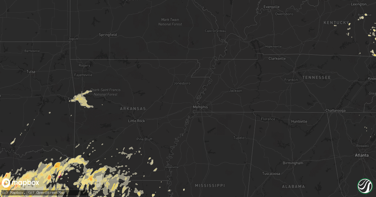
Hail Map in Texas on April 3, 2012
Get this storm
April 3 map
$229
one time, instant access
Download today. No call, no setup
Keep the $229
Bought the map and want the full workflow? Apply the entire $229 to a subscription within 7 days. None of it is wasted.
Every map, not just this one
This buys you this map. Subscription and you get every map we run, in the markets you choose from a few cities to whole states to nationwide. Plus real-time alerts the moment a storm fires.
Contact data
Name, contact info, occupancy, even credit band for addresses in the footprint. You go from where it hit to who to call.
Become the source they trust
Unlimited branding weather history reports on demand. You already have the documented answer ready for the property owner, and you are the one who showed up with it.
Property data and RoofTrace estimates
Pull up any address you have got, its value and the exact code rules for that jurisdiction, straight from One Click Code. Then RoofTrace estimates the squares, pitch, and roof value, priced the way you price.
Storm reports in Texas
Texas
| Date | Description |
|---|---|
| 04/03/20126:48 PM CDT | Several trees down across the county |
| 04/03/20126:44 PM CDT | Golf ball sized hail reported by broadcast media. |
| 04/03/20126:36 PM CDT | Several trees down |
| 04/03/20126:25 PM CDT | Quarter sized hail reported by trained spotter. |
| 04/03/20126:20 PM CDT | Quarter sized hail reported by broadcast media. |
| 04/03/20126:15 PM CDT | A local report indicates 1.00 inch wind near 1 S NOONDAY |
| 04/03/20126:11 PM CDT | Quarter size hail 1 mile west southwest of odds |
| 04/03/20125:50 PM CDT | Two and half inch size hail reported by emergency manager. |
| 04/03/20125:48 PM CDT | Several trees down around hagansport |
| 04/03/20125:45 PM CDT | Brief tornado reported 6 nw winnsboro. Tree damage |
| 04/03/20125:45 PM CDT | Numerous trees reported down across highway 11 northwest of winnsboro. |
| 04/03/20125:00 PM CDT | Two inch hail reported by emergency manager. |
| 04/03/20125:00 PM CDT | Numerous trees down reported downed along highway 259. |
| 04/03/20124:57 PM CDT | Hail fell for nearly two minutes |
| 04/03/20124:55 PM CDT | Trees down across highway 37 south...rotation was noted with the storm by law enforcement. |
| 04/03/20124:45 PM CDT | Emergency manager is reporting possible tornado east of hagansport in franklin county. |
| 04/03/20124:44 PM CDT | An ef0 tornado touched down 8 miles sw of de kalb tx... Just west of cr 4306 where a few trees were snapped and uprooted. The tornado crossed cr 4306 and continued ene |
| 04/03/20124:41 PM CDT | An ef0 tornado touched down along cr 4610...where a few trees were uprooted. The tornado traveled north northeast just east of cr 910...where additional trees were snap |
| 04/03/20124:41 PM CDT | At i-30 and highway 34 |
| 04/03/20124:39 PM CDT | An ef0 tornado touched down about 2 miles east of hagansport in an open field just north of fm 71...where several trees were snapped. The tornado traveled northeast acr |
| 04/03/20124:30 PM CDT | Trees down north of talco where rotation was indicated and reported |
| 04/03/20124:30 PM CDT | Quarter sized hail reported on county road 3275 |
| 04/03/20124:20 PM CDT | Very strong winds and penny hail. Roof and structural damage to a barn. Rv turned over and large trees uprooted. |
| 04/03/20124:20 PM CDT | A local report indicates 1.50 inch wind near 1 SE LACY-LAKEVIEW |
| 04/03/20124:14 PM CDT | Quarter size hail in northwest waco |
| 04/03/20124:10 PM CDT | Golfball and baseball sized hail in heath |
| 04/03/20124:10 PM CDT | Titus county sheriff reported witnessing a tornado touch down. |
| 04/03/20124:08 PM CDT | County em reports tornado near union valley |
| 04/03/20124:07 PM CDT | A local report indicates 1.00 inch wind near 2 SSW WEST |
| 04/03/20124:06 PM CDT | A local report indicates 1.75 inch wind near 5 SSW DEPORT |
| 04/03/20124:05 PM CDT | Sulphur springs pd reports tornado at hwy 19 n near loop 301 |
| 04/03/20124:02 PM CDT | Significant damage to business...possibly total loss on highway 276 and e highline dr. |
| 04/03/20124:01 PM CDT | Possible tornado near 548 and munson |
| 04/03/20124:00 PM CDT | Homes heavily damaged in s royce city near 548 and bent trl. |
| 04/03/20123:52 PM CDT | 2w waco airport |
| 04/03/20123:50 PM CDT | A local report indicates 1.75 inch wind near CHINA SPRING |
| 04/03/20123:45 PM CDT | Golfball sized hail reported by public. |
| 04/03/20123:45 PM CDT | Spotter reports car and shingle damage |
| 04/03/20123:43 PM CDT | A local report indicates 1.00 inch wind near 1 N MOUNT PLEASANT |
| 04/03/20123:40 PM CDT | On ground just west of walmart in forney |
| 04/03/20123:39 PM CDT | Brief tornado at fm3389 and fm1170 |
| 04/03/20123:35 PM CDT | Half dollar hail falling at the walmart on i30 and ridgeway rd. |
| 04/03/20123:34 PM CDT | Quarter size hail in red oak. |
| 04/03/20123:25 PM CDT | A local report indicates 1.00 inch wind near KILLEEN |
| 04/03/20123:23 PM CDT | Tornado reported just s of 30 at fm 1567w. |
| 04/03/20123:15 PM CDT | Just n of seagoville |
| 04/03/20123:12 PM CDT | Tornado that was on the ground between loan oak and campbell has lifted 3 e of campbell. |
| 04/03/20123:07 PM CDT | Possible tornado north of lone oak heading northeast |
| 04/03/20123:00 PM CDT | One inch hail west side of frisco. |
| 04/03/20123:00 PM CDT | A local report indicates 2.50 inch wind near ITASCA |
| 04/03/20122:54 PM CDT | In frisco |
| 04/03/20122:53 PM CDT | Nw of hwy 121 dallas north tollway |
| 04/03/20122:50 PM CDT | Quarters in frisco |
| 04/03/20122:34 PM CDT | A local report indicates 1.75 inch wind near THE COLONY |
| 04/03/20122:30 PM CDT | Hail up to hen egg size at i635 and royal lane in north dallas. |
| 04/03/20122:30 PM CDT | 1 s the colony |
| 04/03/20122:30 PM CDT | Hen egg size hail in southeast lewisville at sh 121 and macarthur rd. |
| 04/03/20122:29 PM CDT | Near lewisville lake |
| 04/03/20122:25 PM CDT | Baseball hail near 360 and harwood in euless |
| 04/03/20122:25 PM CDT | Quarter size hail and strong wind hwy 287 bus. Downtown waxahachie |
| 04/03/20122:23 PM CDT | Up to baseball sized hail is falling in north irving. |
| 04/03/20122:23 PM CDT | Teacup size hail reported in coppell |
| 04/03/20122:23 PM CDT | William stadium area |
| 04/03/20122:21 PM CDT | Near duncan drive |
| 04/03/20122:21 PM CDT | Very large hail to hen egg size noted at i635 and beltline rd. |
| 04/03/20122:18 PM CDT | A local report indicates 1.50 inch wind near IRVING |
| 04/03/20122:16 PM CDT | Hail damaged more than 100 aircraft at dfw international. |
| 04/03/20122:15 PM CDT | Golfball hail broke windshields at cleburne henderson country club. |
| 04/03/20122:05 PM CDT | A local report indicates 2.75 inch wind near EULESS |
| 04/03/20122:02 PM CDT | Tornado on ground near mesquite rodeo stadium area |
| 04/03/20121:56 PM CDT | 110th street in grand prairie. Funnel noted 100 yds from location. Evidence of some roof damage in the area. |
| 04/03/20121:54 PM CDT | Quarter to baseball sized hail was reported at the cwsu at dfw airport |
| 04/03/20121:54 PM CDT | Cwsu reported quarter size hail at the zfw/artcc. |
| 04/03/20121:50 PM CDT | A local report indicates 1.75 inch wind near EULESS |
| 04/03/20121:25 PM CDT | Spotter reported roof and structural damage north of willow park. |
| 04/03/20121:21 PM CDT | Spotters observed tornado on ground near lancaster |
| 04/03/20121:16 PM CDT | Spotters confirm large and dangerous tornado located near lancaster |
| 04/03/20121:13 PM CDT | Hail 11 miles nw lufkin...power out |
| 04/03/20121:07 PM CDT | Spotters observe developing tornado near oak leaf |
| 04/03/20121:00 PM CDT | Quarter hail in aledo. Time estimated. |
| 04/03/201212:50 PM CDT | 4 homes damaged in cleburne with injuries. Time is approximate. |
| 04/03/201212:35 PM CDT | Spotters report tornado damage in cleburne |
| 04/03/201211:50 AM CDT | 5 e gordon near i-20 |
| 04/03/201211:20 AM CDT | Quarters from dennis rd and i-20 north to greenwood |
| 04/03/201210:18 AM CDT | Semi blown over on hwy 287 nr roadside park |
| 04/03/201210:18 AM CDT | Ping pong ball size hail reported at intersection of grassy ridge road and hwy 337. |
| 04/03/20129:08 AM CDT | A local report indicates 1.75 inch wind near 3 S CARBON |
| 04/03/20128:38 AM CDT | A local report indicates 1.00 inch wind near CISCO |
| 04/03/20128:06 AM CDT | Golfball size hail in graham |
| 04/03/20127:59 AM CDT | Reported by graham fire and rescue |
| 04/03/20127:50 AM CDT | A local report indicates 1.50 inch wind near GRAHAM |
| 04/03/20127:50 AM CDT | Dime to quarter size hail reported near the airport |
| 04/03/20123:14 AM CDT | Dime sized hail increased to quarter sized for a few minutes in providence. |
| 04/03/20122:52 AM CDT | A local report indicates 1.00 inch wind near 2 SW GOODRICH |
| 04/03/20121:13 AM CDT | Hail 11 miles nw lufkin...power out |
| 04/03/201212:58 AM CDT | On highway 94 |
| 04/02/201210:00 PM CDT | Trees down along hwy 259 north of henderson |
| 04/02/20129:15 PM CDT | Tree down on sh. 323 just north of sh. 42. |
| 04/02/20128:42 PM CDT | Tree downed near u.s. Hwy 259 just south of kilgore. |
| 04/02/20128:30 PM CDT | Tree down in harleton. |
| 04/02/20128:19 PM CDT | West side of palestine |
| 04/02/20127:52 PM CDT | A local report indicates 1.00 inch wind near LONG LAKE |
| 04/02/20127:50 PM CDT | A local report indicates 1.50 inch wind near TUCKER |
| 04/02/20127:45 PM CDT | Tree downed on fm 344 |
| 04/02/20127:35 PM CDT | Several powerlines downed across the texas side of the city |
| 04/02/20127:16 PM CDT | Quarter sized hail reported in gladewater by trained spotter. |
| 04/02/20127:05 PM CDT | Emergency manager is reporting a measured wind of 60 mph in redlick. |
All States Impacted by Hail Map on April 3, 2012
Cities Impacted by Hail Map on April 3, 2012
- Manchester, KY
- Annona, TX
- Flower Mound, TX
- Grapevine, TX
- Lewisville, TX
- Madill, OK
- Vivian, LA
- Oil City, LA
- Jasper, TX
- Woodville, TX
- Kerens, TX
- Austin, TX
- Livingston, TX
- Coldspring, TX
- Goodrich, TX
- Shepherd, TX
- Cleveland, TX
- Milano, TX
- Gause, TX
- Caldwell, TX
- Hemphill, TX
- Grandview, TX
- Itasca, TX
- Hillsboro, TX
- Shreveport, LA
- Keithville, LA
- Huntsville, TX
- Annville, KY
- Clinton, LA
- Simsboro, LA
- Arcadia, LA
- Graham, TX
- Sidney, TX
- Comanche, TX
- Rockwall, TX
- Ranger, TX
- Waynesville, NC
- Ellabell, GA
- Shelbyville, TX
- London, KY
- Atlanta, TX
- Fort Smith, AR
- Hilliard, FL
- Folkston, GA
- Saint George, GA
- Glenmora, LA
- Oakdale, LA
- Marshall, TX
- Henderson, TX
- Azle, TX
- Morgan, TX
- Meridian, TX
- Clifton, TX
- Mabank, TX
- Eustace, TX
- Jacksonville, FL
- Monticello, FL
- Tallahassee, FL
- Carthage, TX
- Como, TX
- Sulphur Bluff, TX
- Sulphur Springs, TX
- Deport, TX
- Quitman, TX
- Yantis, TX
- Winnsboro, TX
- Lake Creek, TX
- Saltillo, TX
- Brashear, TX
- Dike, TX
- Mount Vernon, TX
- Pickton, TX
- Bogata, TX
- Cumby, TX
- Covington, TX
- Milford, TX
- Meadowview, VA
- Mount Calm, TX
- Hubbard, TX
- Coolidge, TX
- Groesbeck, TX
- Riesel, TX
- Marlin, TX
- Thornton, TX
- Canton, NC
- Shongaloo, LA
- Cotton Valley, LA
- Haynesville, LA
- Minden, LA
- Plain Dealing, LA
- Merryville, LA
- Warrenton, GA
- West Monroe, LA
- Downsville, LA
- Batchelor, LA
- Navasota, TX
- Montgomery, TX
- Plantersville, TX
- New Waverly, TX
- Conroe, TX
- Willis, TX
- Waco, TX
- Crawford, TX
- China Spring, TX
- Valley Mills, TX
- Woodway, TX
- Ruston, LA
- Hamburg, AR
- Montrose, AR
- Paige, TX
- Smithville, TX
- Palo Pinto, TX
- Graford, TX
- Oak Grove, LA
- Bryan, OH
- Ney, OH
- Edgerton, OH
- Dallas, TX
- Fordyce, AR
- Rison, AR
- Strawn, TX
- Caddo Mills, TX
- Greenville, TX
- Mason, OH
- Cincinnati, OH
- Maineville, OH
- Loveland, OH
- Pioneer, TN
- Eidson, TN
- Colmesneil, TX
- West, TX
- Bruceville, TX
- Lorena, TX
- Chilton, TX
- Mansfield, LA
- Biloxi, MS
- Gulfport, MS
- Bossier City, LA
- Lake Park, GA
- Stephenville, TX
- Lipan, TX
- Santo, TX
- Weatherford, TX
- Millsap, TX
- Burkeville, TX
- Lake Charles, LA
- Tyler, TX
- Bullard, TX
- Lindale, TX
- Palestine, TX
- Flint, TX
- Whitehouse, TX
- Winona, TX
- Hawkins, TX
- Arp, TX
- Frankston, TX
- Big Sandy, TX
- Gilmer, TX
- Jacksonville, TX
- Krotz Springs, LA
- Carrollton, TX
- Irving, TX
- Fouke, AR
- Wise, VA
- Pound, VA
- Washburn, TN
- Rutledge, TN
- Taylor, AR
- Lewisville, AR
- Arlington, TX
- Mansfield, TX
- Grand Prairie, TX
- Junction City, AR
- Emerson, AR
- Lexington, TX
- Lincoln, TX
- New Orleans, LA
- Austinville, VA
- Hillsville, VA
- Ridge Spring, SC
- Batesburg, SC
- Silverstreet, SC
- Leesville, SC
- Ward, SC
- Johnston, SC
- Newberry, SC
- Prosperity, SC
- Saluda, SC
- Whitney, TX
- Crockett, TX
- Midlothian, TX
- Cedar Hill, TX
- Waxahachie, TX
- Covington, LA
- Folsom, LA
- Madisonville, LA
- Maurice, LA
- Duson, LA
- Lafayette, LA
- Hackett, AR
- Nashville, AR
- Mineral Wells, TX
- Seminary, MS
- Collins, MS
- Bivins, TX
- Circleville, OH
- Chillicothe, OH
- Kingston, OH
- Morgan City, LA
- Homer, LA
- Boston, GA
- Quitman, GA
- Dixie, GA
- Jennings, FL
- Athens, TN
- Chapin, SC
- Jacksboro, TX
- Bryson, TX
- Nocona, TX
- Montague, TX
- Bowie, TX
- Saint Jo, TX
- Mineola, TX
- Bedford, TX
- Hurst, TX
- Coppell, TX
- Frisco, TX
- Colleyville, TX
- Fort Worth, TX
- Euless, TX
- The Colony, TX
- Richland, TX
- Wortham, TX
- Streetman, TX
- Corsicana, TX
- Randlett, OK
- Burneyville, OK
- Wilson, OK
- Overbrook, OK
- Reserve, LA
- Garyville, LA
- Edgard, LA
- Doddridge, AR
- Bremond, TX
- Malone, TX
- Penelope, TX
- Abbott, TX
- Bynum, TX
- Williamsburg, KY
- Siler, KY
- Booneville, KY
- Ricetown, KY
- Abbeville, LA
- Erath, LA
- Quitman, LA
- Pavo, GA
- Burlington, TX
- Rogers, TX
- Lott, TX
- Temple, TX
- Rosebud, TX
- Holden, LA
- Independence, LA
- Fairfield, TX
- Powell, TX
- Kemp, TX
- Rice, TX
- Chatfield, TX
- Springhill, LA
- Sarepta, LA
- Jermyn, TX
- Henrietta, TX
- Loving, TX
- Springtown, TX
- Paradise, TX
- Poolville, TX
- Rosser, TX
- Scurry, TX
- Campbell, TX
- College Station, TX
- Bryan, TX
- Bellevue, TX
- Breckenridge, TX
- Farmerville, LA
- Rising Star, TX
- Carbon, TX
- Gorman, TX
- Eastland, TX
- Nevada, TX
- Farmersville, TX
- Larue, TX
- Grapeland, TX
- Elkhart, TX
- Pittsburg, TX
- Teague, TX
- Mexia, TX
- Chandler, TX
- Oakwood, TX
- Montalba, TX
- Brownsboro, TX
- Ben Wheeler, TX
- Tennessee Colony, TX
- Lovelady, TX
- Trinidad, TX
- Midway, TX
- Buffalo, TX
- Kosse, TX
- Rusk, TX
- Benton, LA
- Leonard, TX
- Pineville, KY
- Joshua, TX
- Keene, TX
- Cleburne, TX
- Cornettsville, KY
- Hallie, KY
- Blackey, KY
- Barksdale Afb, LA
- Wells, TX
- Alto, TX
- Roanoke, LA
- Welsh, LA
- Jennings, LA
- Franklin, TX
- Calvert, TX
- Hendersonville, NC
- Whitesburg, KY
- Jena, LA
- Sibley, LA
- Olney, TX
- Hope, AR
- Viper, KY
- Mount Pleasant, TX
- North Richland Hills, TX
- Winnsboro, LA
- Fort Necessity, LA
- Kiln, MS
- Bay Saint Louis, MS
- Diamondhead, MS
- Picayune, MS
- Kountze, TX
- Magnolia, AR
- Cisco, TX
- Cross Plains, TX
- Rogersville, TN
- Greeneville, TN
- El Dorado, AR
- Mount Holly, AR
- Granbury, TX
- Mckinney, TX
- Allen, TX
- Anderson, SC
- Ravenna, KY
- Bunkie, LA
- Woodville, MS
- Southlake, TX
- Saint Francisville, LA
- Frost, TX
- Italy, TX
- Mertens, TX
- Prentiss, MS
- Bedias, TX
- Danielsville, GA
- Maggie Valley, NC
- Emory, TX
- Coeburn, VA
- Clintwood, VA
- Richmond, KY
- Center, TX
- Blum, TX
- Charleston, AR
- Ocean Springs, MS
- Gautier, MS
- Murchison, TX
- Lake Junaluska, NC
- Newcastle, TX
- Lone Grove, OK
- Ardmore, OK
- Ashdown, AR
- Bean Station, TN
- Wapakoneta, OH
- Madisonville, TX
- Berea, KY
- Paint Lick, KY
- Statham, GA
- Bogart, GA
- Monroe, GA
- Bishop, GA
- Forney, TX
- Mesquite, TX
- Rowlett, TX
- Sunnyvale, TX
- Monterey, LA
- Moreauville, LA
- Killeen, TX
- Talco, TX
- Detroit, TX
- Rodessa, LA
- Hosston, LA
- Bradley, AR
- Ida, LA
- Jefferson, TX
- Kinder, LA
- McKee, KY
- Louann, AR
- Camden, AR
- Ballinger, TX
- Evans, LA
- Aquilla, TX
- Vicksburg, MS
- Florien, LA
- Townsend, TN
- Grambling, LA
- Cable, OH
- North Lewisburg, OH
- Prestonsburg, KY
- Cameron, TX
- Chester, SC
- Dubach, LA
- Choudrant, LA
- Gladewater, TX
- Pattison, MS
- Statenville, GA
- Toccoa, GA
- Silver Creek, MS
- Duff, TN
- Garland, TX
- Fayette, MS
- Godley, TX
- Cresson, TX
- Moultrie, GA
- Hagerhill, KY
- Harvey, LA
- Mountainburg, AR
- Alma, AR
- Coolidge, GA
- Crowell, TX
- Hermanville, MS
- Monticello, AR
- Coalgate, OK
- Moselle, MS
- Hattiesburg, MS
- Jewett, TX
- Donie, TX
- McGregor, TX
- Little Mountain, SC
- Calvin, KY
- Middlesboro, KY
- Terrell, TX
- Commerce, TX
- Balch Springs, TX
- Quinlan, TX
- Wilmer, TX
- Hutchins, TX
- Lone Oak, TX
- Lancaster, TX
- Royse City, TX
- Thomasville, GA
- Lettsworth, LA
- Gonzales, TX
- Sparkman, AR
- Bearden, AR
- Laurel Springs, NC
- Gainesville, GA
- Galax, VA
- Independence, VA
- Max Meadows, VA
- Napoleonville, LA
- Pierre Part, LA
- Pendleton, SC
- Williamston, SC
- Pelzer, SC
- Clairfield, TN
- Frakes, KY
- Simms, TX
- De Kalb, TX
- Yazoo City, MS
- Booneville, AR
- Greenwood, AR
- Monroe, LA
- Sterlington, LA
- Mozelle, KY
- Warbranch, KY
- Newark, TX
- Abilene, TX
- Tuscola, TX
- Belcher, LA
- Norwood, GA
- Ermine, KY
- Thornton, KY
- Premium, KY
- Isom, KY
- Millstone, KY
- Pine Top, KY
- Deane, KY
- Thornton, AR
- Van Buren, AR
- Lavaca, AR
- Nora, VA
- Ennis, TX
- Blooming Grove, TX
- Barry, TX
- Cookville, TX
- Greenback, TN
- Evergreen, LA
- Forest Hill, LA
- Hooks, TX
- Texarkana, TX
- Foreman, AR
- New Boston, TX
- Kaufman, TX
- La Follette, TN
- Jellico, TN
- Rayville, LA
- Duffield, VA
- Surgoinsville, TN
- McDade, TX
- Talpa, TX
- Waldo, AR
- Harker Heights, TX
- Gillsville, GA
- Blue River, KY
- Church Hill, TN
- Augusta, GA
- Pennington, TX
- Apple Springs, TX
- Trinity, TX
- Groveton, TX
- Bronson, TX
- Winfield, TX
- Avery, TX
- New Roads, LA
- Rayne, LA
- Holliday, TX
- Statesboro, GA
- Campbellsville, KY
- Sontag, MS
- Brookhaven, MS
- Sachse, TX
- Addison, TX
- Plano, TX
- Wylie, TX
- Lake Dallas, TX
- Roanoke, TX
- Barbourville, KY
- Krum, TX
- Gloster, LA
- Frierson, LA
- Stonewall, LA
- Amite, LA
- Lancaster, KY
- Blanco, TX
- Memphis, TX
- Point, TX
- Kaplan, LA
- Nacogdoches, TX
- Tuckasegee, NC
- Burleson, TX
- Crowley, TX
- Gibsland, LA
- Athens, LA
- Elm Mott, TX
- Bluff Dale, TX
- Desdemona, TX
- Mingus, TX
- Dublin, TX
- Gordon, TX
- De Leon, TX
- Plaquemine, LA
- Stanton, KY
- Slade, KY
- Aledo, TX
- Hoboken, GA
- Klondike, TX
- Ferris, TX
- Red Oak, TX
- Crandall, TX
- Palmer, TX
- Seagoville, TX
- Tolar, TX
- Thorndale, TX
- San Augustine, TX
- Natchitoches, LA
- Wills Point, TX
- Canton, TX
- Tyner, KY
- Georgetown, TX
- Round Rock, TX
- Longview, TX
- White Oak, TX
- Lexington, IL
- Towanda, IL
- Boyd, TX
- Ponder, TX
- Rhome, TX
- Decatur, TX
- Haslet, TX
- Justin, TX
- Ventress, LA
- Blue Ridge, TX
- Nahunta, GA
- Patterson, GA
- Waycross, GA
- Blackshear, GA
- Terral, OK
- Ryan, OK
- Eddy, TX
- Burkett, TX
- Bernice, LA
- Buckner, AR
- Linden, TX
- Stamps, AR
- Mooringsport, LA
- Avinger, TX
- Queen City, TX
- Bloomburg, TX
- Garland City, AR
- Texarkana, AR
- Bellefontaine, OH
- Basile, LA
- Eunice, LA
- Jackson, KY
- Vest, KY
- White Castle, LA
- Donaldsonville, LA
- May, TX
- Helton, KY
- Jonesboro, LA
- Chatham, LA
- Livingston, LA
- Athens, TX
- Cullowhee, NC
- Glenville, NC
- Union Church, MS
- Bledsoe, KY
- Grays Knob, KY
- Harlan, KY
- Ages Brookside, KY
- Coalgood, KY
- Baxter, KY
- Cawood, KY
- Chireno, TX
- Elkhorn City, KY
- Rockdale, TX
- McClure, VA
- Lufkin, TX
- Ringgold, TX
- Healdton, OK
- Ringling, OK
- Coleman, TX
- Crowley, LA
- Iota, LA
- Dauphin Island, AL
- Grand Chenier, LA
- Commerce, GA
- Dripping Springs, TX
- Fargo, GA
- Gays Creek, KY
- Centerville, TX
- Desoto, TX
- Estill, SC
- Luray, SC
- Alvarado, TX
- Lillian, TX
- Anna, TX
- Princeton, TX
- Kirbyville, TX
- Yoakum, TX
- Eolia, KY
- Leesville, LA
- Clinchco, VA
- Dante, VA
- Belle Rose, LA
- Lakeview, OH
- Huntsville, OH
- Russells Point, OH
- Salyersville, KY
- East Bernstadt, KY
- Robeline, LA
- Thrall, TX
- Guyton, GA
- Brevard, NC
- Perrin, TX
- Magazine, AR
- Maysville, GA
- Haughton, LA
- Elm Grove, LA
- Ellijay, GA
- Dawsonville, GA
- Lima, OH
- Saint Martinville, LA
- Pisgah Forest, NC
- Angola, LA
- Mclean, TX
- Pageland, SC
- Cranfills Gap, TX
- Appalachia, VA
- Norton, VA
- Big Stone Gap, VA
- Pass Christian, MS
- Transylvania, LA
- Redwood, MS
- Alexandria, LA
- Pineville, LA
- Oil Springs, KY
- Axtell, TX
- Forreston, TX
- Barataria, LA
- Marrero, LA
- Lafitte, LA
- Doyline, LA
- Hoschton, GA
- Jefferson, GA
- Morton, MS
- Pelahatchie, MS
- Belton, TX
- Warren, TX
- Jefferson, NC
- Scottville, NC
- Jeanerette, LA
- Little Elm, TX
- Grand Saline, TX
- Mart, TX
- Maypearl, TX
- Troy, TX
- Oglesby, TX
- Venus, TX
- Denton, TX
- Prosper, TX
- Cooper, TX
- Edgewood, TX
- Alba, TX
- Lavon, TX
- Kopperl, TX
- Hewitt, TX
- Haltom City, TX
- Paris, TX
- Celeste, TX
- Keller, TX
- Richardson, TX
- Nemo, TX
- Duncanville, TX
- Wolfe City, TX
- Rainbow, TX
- Nash, TX
- Kennedale, TX
- Pattonville, TX
- Clarksville, TX
- Van, TX
- Scroggins, TX
- Leesburg, TX
- Moody, TX
- Naval Air Station Jrb, TX
- Cloverdale, OH
- Long Branch, TX
- Diana, TX
- Ben Franklin, TX
- Lillie, LA
- Archer City, TX
- Karnack, TX
- Ore City, TX
- Elgin, TX
- Summerfield, LA
- Buckholts, TX
- Keatchie, LA
- Rio Vista, TX
- Greenwood, LA
- Dawson, TX
- Malakoff, TX
- Ogden, AR
- Enloe, TX
- Lisbon, LA
- Reagan, TX
- Heflin, LA
- Stephens, AR
- Wichita Falls, TX
- Hamilton, TX
- Troup, TX
- Scotland, TX
- Spearsville, LA
- Blanchard, LA
- Princeton, LA
- Roxton, TX
- McNeil, AR
- Ringgold, LA
- Haworth, OK
- Hico, TX
- Fruitvale, TX
- Leon, OK
- Glen Rose, TX
- Jonesboro, TX
- Windthorst, TX
- Pennington Gap, VA
- Jonesville, VA
- Jonesville, LA
- Maryville, TN
- Corrigan, TX
- Daviston, AL
- Jacksons Gap, AL
- Alexander City, AL
- Wallins Creek, KY
- Monroe, NC
- Maurepas, LA
- Sylvania, GA
- Maud, TX
- Oberlin, LA
- Deridder, LA
- Church Point, LA
- Dahlonega, GA
- Longville, LA
- Arnaudville, LA
- Carencro, LA
- Ponchatoula, LA
- Hammond, LA
- Springfield, LA
- Iola, TX
- Hueysville, KY
- Martin, KY
- Mineral Springs, AR
- Ozan, AR
- Long Beach, MS
- Delphos, OH
- Franklinton, LA
- Mount Hermon, LA
- Winters, TX
- Dequincy, LA
- Smithdale, MS
- McCall Creek, MS
- Bogue Chitto, MS
- Grand Cane, LA
- Hamilton, IN
- Butler, IN
- Abita Springs, LA
- New Edinburg, AR
- Sulphur, OK
- Meadville, MS
- Harrisonburg, LA
- Sicily Island, LA
- Marion, LA
- De Queen, AR
- Clarendon, TX
- Nancy, KY
- Atoka, OK
- Irmo, SC
- Pomaria, SC
- Stennis Space Center, MS
- Dandridge, TN
- Royston, GA
- Wesson, MS
- Hornbeck, LA
- Pampa, TX
- Castor, LA
- West Liberty, KY
- Lorman, MS
- Oakdale, TN
- Strunk, KY
- Delphia, KY
- Lakeview, TX
- Wardville, OK
- Saint Landry, LA
- Anderson, TX
- Mamou, LA
- Lavonia, GA
- Martin, GA
- Carnesville, GA
- Delight, AR
- Maringouin, LA
- Strong, AR
- Newton, TX
- Pascagoula, MS
- Edwards, MS
- Kennard, TX
- Roland, OK
- Spiro, OK
- Pocola, OK
- Muldrow, OK
- Arkoma, OK
- Dyer, AR
- Barling, AR
- Rudy, AR
- Mulberry, AR
- Ozark, AR
- Westwego, LA
- Omaha, TX
- Carrizo Springs, TX
- Thorn Hill, TN
- Lancing, TN
- Sextons Creek, KY
- Elton, LA
- Brownwood, TX
- Revelo, KY
- Pine Knot, KY
- Stearns, KY
- Shiner, TX
- Purdon, TX
- Redfox, KY
- Sulphur, LA
- Westlake, LA
- Englewood, TN
- Hollandale, MS
- Pearl River, LA
- Cecil, OH
- Fort Blackmore, VA
- Buda, TX
- Epworth, GA
- Lake Providence, LA
- Geismar, LA
- Lecompte, LA
- Blanchester, OH
- Chidester, AR
- Lenoir City, TN
- Breaux Bridge, LA
- Hustonville, KY
- Tishomingo, OK
- Milburn, OK
- Scott, LA
- Quincy, FL
- Gatesville, TX
- Fort Hood, TX
- Du Pont, GA
- Tenaha, TX
- Hampton, AR
- Celina, TX
- Wilburton, OK
- Muenster, TX
- Talmo, GA
- Rayle, GA
- Watkinsville, GA
- Waynesfield, OH
- Goldonna, LA
- Somerville, TX
- Carriere, MS
- Bush, LA
- East Point, KY
- Caryville, TN
- Hahnville, LA
- Luling, LA
- Grovetown, GA
- Harlem, GA
- Giddings, TX
- Naples, TX
- Clyde, NC
- Leicester, NC
- Candler, NC
- Port Gibson, MS
- Crosby, MS
- Hempstead, TX
- Zanesfield, OH
- West Liberty, OH
- Kiowa, OK
- Ivan, AR
- Saint Amant, LA
- Jeremiah, KY
- Gordon, KY
- Letcher, KY
- Olla, LA
- Vincent, KY
- Port Allen, LA
- Brusly, LA
- Slidell, LA
- Rockwood, TN
- Lueders, TX
- Winder, GA
- Roanoke, AL
- Hartsville, SC
- Kenefic, OK
- Beattyville, KY
- Trenton, SC
- Aiken, SC
- Brookeland, TX
- Wiergate, TX
- Sunset, LA
- Opelousas, LA
- Kingsland, AR
- Daingerfield, TX
- Douglass, TX
- Gunlock, KY
- Goshen, OH
- Provencal, LA
- Jenkins, KY
- Pikeville, KY
- Branch, LA
- Monticello, MS
- Waurika, OK
- Saratoga, TX
- Waelder, TX
- Emmet, AR
- Neon, KY
- Sanger, TX
- Lebanon, VA
- Fairfield, OH
- Kenner, LA
- Metairie, LA
- Stanford, KY
- Continental, OH
- Brooklet, GA
- Cranks, KY
- Kilgore, TX
- Athens, GA
- Gray, KY
- Hutto, TX
- Starks, LA
- Trout, LA
- Ragley, LA
- Soperton, GA
- North Augusta, SC
- Beech Island, SC
- Windsor, KY
- Liberty, KY
- Paris, AR
- Sneedville, TN
- Loudon, TN
- Georgetown, LA
- Waveland, MS
- Hughes Springs, TX
- Braselton, GA
- Saratoga, AR
- Heavener, OK
- Mount Enterprise, TX
- Harriman, TN
- Bluff City, AR
- Rosston, AR
- Thibodaux, LA
- Deville, LA
- Center Point, LA
- Eastanollee, GA
- Franklin, LA
- Wilmar, AR
- Rockholds, KY
- Lockesburg, AR
- Crossett, AR
- Crumpler, NC
- Piney Creek, NC
- Sparta, NC
- Des Allemands, LA
- Coden, AL
- Cumming, GA
- Converse, LA
- Clarkesville, GA
- Long Creek, SC
- Blair, SC
- Valera, TX
- Raceland, LA
- Cullom, IL
- Carlisle, SC
- Penrose, NC
- Kings Mountain, KY
- Middleburg, KY
- Yosemite, KY
- Clarksville, OH
- Oregonia, OH
- Ceres, VA
- Tazewell, VA
- Arkadelphia, AR
- Wadley, AL
- Haskell, TX
- Stamford, TX
- Grand Bay, AL
- Marksville, LA
- Dearing, GA
- David, KY
- Ochlocknee, GA
- Bogalusa, LA


