Hail Map in Olathe, KS on April 3, 2011
Get this storm
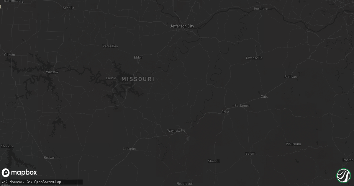
April 3 map
$229
one time, instant access
Download today. No call, no setup
Keep the $229
Bought the map and want the full workflow? Apply the entire $229 to a subscription within 7 days. None of it is wasted.
Every map, not just this one
This buys you this map. Subscription and you get every map we run, in the markets you choose from a few cities to whole states to nationwide. Plus real-time alerts the moment a storm fires.
Contact data
Name, contact info, occupancy, even credit band for addresses in the footprint. You go from where it hit to who to call.
Become the source they trust
Unlimited branding weather history reports on demand. You already have the documented answer ready for the property owner, and you are the one who showed up with it.
Property data and RoofTrace estimates
Pull up any address you have got, its value and the exact code rules for that jurisdiction, straight from One Click Code. Then RoofTrace estimates the squares, pitch, and roof value, priced the way you price.
Storm reports in Olathe, KS
Olathe, KS
| Date | Description |
|---|---|
| 04/02/20119:15 PM CDT | 2 miles ne of ojc airport. Roof damage reported. |
| 04/02/20119:06 PM CDT | A local report indicates 1.50 inch wind near OLATHE |
| 04/02/20119:04 PM CDT | A local report indicates 1.75 inch wind near 2 SSW OLATHE |
| 04/02/20118:56 PM CDT | A local report indicates 1.25 inch wind near 2 N OLATHE |
All States Impacted by Hail Map on April 3, 2011
All Cities Impacted by Hail Map on April 3, 2011
- Marengo, IA
- Watkins, IA
- Norway, IA
- Hidalgo, IL
- Wheeler, IL
- Newton, IL
- Effingham, IL
- Teutopolis, IL
- Jewett, IL
- Montrose, IL
- Dieterich, IL
- Spring Valley, IL
- Dalzell, IL
- Peru, IL
- Cherry, IL
- Mendota, IL
- La Salle, IL
- Ladd, IL
- Arlington, IL
- Neodesha, KS
- Winfield, KS
- Sully, IA
- Archie, MO
- Troy, KS
- Norman, AR
- Mount Ida, AR
- Waupun, WI
- Fox Lake, WI
- Burnett, WI
- Mecosta, MI
- Morley, MI
- Lakeview, MI
- Stanwood, MI
- Meridian, TX
- Cranfills Gap, TX
- Terre Haute, IN
- Farmersburg, IN
- Fairbanks, IN
- Maquoketa, IA
- Latham, MO
- Fortuna, MO
- Versailles, MO
- Rosebud, MO
- Cuba, MO
- Belle, MO
- Eureka, MO
- Beaufort, MO
- Leslie, MO
- Gerald, MO
- Washington, MO
- Saint Albans, MO
- Labadie, MO
- Bland, MO
- Sullivan, MO
- Owensville, MO
- Villa Ridge, MO
- Vichy, MO
- Pacific, MO
- Union, MO
- Wildwood, MO
- Gray Summit, MO
- Saint Clair, MO
- Marion, IA
- Palo, IA
- Hiawatha, IA
- Cedar Rapids, IA
- Robins, IA
- Edgerton, WI
- Brooklyn, WI
- Evansville, WI
- Stoughton, WI
- Dalton, WI
- Pardeeville, WI
- Saint Louis, MO
- Parker, KS
- Clifton, TX
- Irving, IL
- Hillsboro, IL
- Delavan, WI
- White Cloud, MI
- Weatherby, MO
- Trenton, MO
- Jameson, MO
- Spickard, MO
- Gilman City, MO
- Jamesport, MO
- Pattonsburg, MO
- Coffey, MO
- Sibley, MO
- Independence, MO
- Orrick, MO
- Muskegon, MI
- Whitehall, MI
- Morrison, MO
- Hermann, MO
- Garden City, MO
- Harrisonville, MO
- New Lenox, IL
- Antlers, OK
- Cambria, WI
- Almond, WI
- Alta Vista, KS
- Junction City, KS
- Dwight, KS
- Scales Mound, IL
- Apple River, IL
- Topeka, KS
- Baldwin City, KS
- Overbrook, KS
- Lecompton, KS
- Lawrence, KS
- Wakarusa, KS
- Berryton, KS
- Saint Peter, IL
- Adell, WI
- Kewaskum, WI
- Cascade, WI
- Campbellsport, WI
- Plymouth, WI
- Rufe, OK
- Jessieville, AR
- Fort Worth, TX
- Crowley, TX
- Humphreys, MO
- Laredo, MO
- Galt, MO
- Lost Springs, KS
- Lincolnville, KS
- Muscatine, IA
- El Dorado, KS
- Cazenovia, WI
- Hillsboro, WI
- Richland Center, WI
- Wonewoc, WI
- Centerview, MO
- Annawan, IL
- Kewanee, IL
- Atkinson, IL
- Wyanet, IL
- Tiskilwa, IL
- Ohio, IL
- Buda, IL
- Malden, IL
- Geneseo, IL
- Cambridge, IL
- Manlius, IL
- Utica, IL
- Mineral, IL
- Neponset, IL
- Sheffield, IL
- Ottawa, IL
- Dover, IL
- Princeton, IL
- Troy Grove, IL
- Seatonville, IL
- La Moille, IL
- Plainview, AR
- Green Castle, MO
- Sedan, KS
- Havana, KS
- Peru, KS
- Newark, IL
- Morris, IL
- Marseilles, IL
- Seneca, IL
- Waunakee, WI
- Cross Plains, WI
- Middleton, WI
- Terrell, TX
- Royse City, TX
- Lebo, KS
- Greenville, TX
- Platteville, WI
- Potosi, WI
- Dubuque, IA
- Durango, IA
- Sherrill, IA
- Ringold, OK
- Rattan, OK
- Paola, KS
- Drexel, MO
- La Cygne, KS
- Amsterdam, MO
- Louisburg, KS
- Olathe, KS
- Gardner, KS
- Eureka, KS
- Odessa, MO
- Stanwood, IA
- Olin, IA
- Durham, KS
- Neosho Rapids, KS
- Hillsboro, KS
- Wilsey, KS
- Admire, KS
- Council Grove, KS
- Elmdale, KS
- Emporia, KS
- Ramona, KS
- Strong City, KS
- Americus, KS
- Marion, KS
- Allen, KS
- Tampa, KS
- Cottonwood Falls, KS
- Burdick, KS
- Reading, KS
- Herington, KS
- Franklin, IN
- Longton, KS
- Elk Falls, KS
- Dallas, TX
- Mauston, WI
- Richmond, MO
- Rayville, MO
- Theresa, WI
- West Bend, WI
- Mayville, WI
- Allenton, WI
- Waldo, WI
- Unionville, MO
- Meriden, KS
- Ozawkie, KS
- Hoyt, KS
- Eudora, KS
- Darlington, WI
- Belmont, WI
- Mineral Point, WI
- Madison, WI
- Dublin, TX
- Sulphur Bluff, TX
- Concordia, MO
- Fall River, WI
- Mount Horeb, WI
- Rio, WI
- Columbus, WI
- Windsor, WI
- Verona, WI
- Deforest, WI
- Sun Prairie, WI
- Beaver Dam, WI
- Randolph, WI
- Kearney, MO
- Kansas City, MO
- Excelsior Springs, MO
- Liberty, MO
- Smithville, MO
- Irving, TX
- Grand Prairie, TX
- De Witt, MO
- Brunswick, MO
- Slater, MO
- Miami, MO
- Dalton, MO
- Chadwick, IL
- Sterling, IL
- Saint Francis, WI
- Brookfield, WI
- Milwaukee, WI
- South Milwaukee, WI
- Waukesha, WI
- New Berlin, WI
- Cudahy, WI
- Fredonia, KS
- Arena, WI
- Bunceton, MO
- Oak Grove, MO
- Lodi, WI
- Shelbyville, IN
- Edinburgh, IN
- Fairland, IN
- Needham, IN
- Boggstown, IN
- Riverside, IA
- La Harpe, KS
- Colony, KS
- Piggott, AR
- Lenox, IA
- Gravity, IA
- Solon, IA
- Mount Vernon, IA
- Lisbon, IA
- Iola, KS
- Letts, IA
- Illinois City, IL
- Loganville, WI
- North Freedom, WI
- Plain, WI
- Swisher, IA
- North Liberty, IA
- Middle Amana, IA
- Oxford, IA
- Conroy, IA
- Williamsburg, IA
- Amana, IA
- Homestead, IA
- Ely, IA
- Ladora, IA
- South Amana, IA
- Fairfax, IA
- Mechanicsville, IA
- Bedford, IA
- Eddyville, IA
- Oskaloosa, IA
- Albia, IA
- Cedar, IA
- Lyndon, KS
- Quenemo, KS
- Pomona, KS
- Vassar, KS
- Wills Point, TX
- Lockwood, MO
- Lamar, MO
- Golden City, MO
- Fremont, IA
- Bonham, TX
- Ravenna, TX
- Bells, TX
- Savoy, TX
- Monticello, IA
- Dixon, IA
- Donahue, IA
- Sulphur Springs, TX
- Brashear, TX
- Cleveland, MO
- Freeman, MO
- Peculiar, MO
- Moran, KS
- Kalona, IA
- Blum, TX
- Grandview, TX
- Rio Vista, TX
- Cleburne, TX
- Alvarado, TX
- Venus, TX
- Bonner Springs, KS
- Alma, KS
- Linwood, KS
- Tecumseh, KS
- Auburn, KS
- De Soto, KS
- Eskridge, KS
- White City, KS
- Scranton, KS
- Carbondale, KS
- Hope, KS
- Burlingame, KS
- Harveyville, KS
- Woodbine, KS
- Perry, KS
- Lancaster, TX
- Hutchins, TX
- Minooka, IL
- Channahon, IL
- Shorewood, IL
- Elwood, IL
- Joliet, IL
- New Glarus, WI
- Montezuma, IA
- Leighton, IA
- New Sharon, IA
- Wellsville, KS
- Rantoul, KS
- Batavia, IA
- Packwood, IA
- Dover, MO
- Bennington, OK
- Boswell, OK
- Saint Paul, KS
- Erie, KS
- Hopkinton, IA
- Keota, IA
- Washington, IA
- West Chester, IA
- Shullsburg, WI
- Malcom, IA
- Lexington, MO
- Milan, IL
- Rock Island, IL
- Broken Bow, OK
- Kendall, WI
- Tomah, WI
- Camp Douglas, WI
- Wilton, WI
- Benton, KS
- Burns, KS
- Wichita, KS
- Valley Center, KS
- Whitewater, KS
- Potwin, KS
- Sedgwick, KS
- Columbus Junction, IA
- Ainsworth, IA
- Yates Center, KS
- Valley Falls, KS
- Effingham, KS
- Hamilton, KS
- Virgil, KS
- Gridley, KS
- Madison, KS
- Oostburg, WI
- Cedar Grove, WI
- Telephone, TX
- Ivanhoe, TX
- Kingston, MO
- Hamilton, MO
- Worthington, IA
- Prairieburg, IA
- Central City, IA
- Alburnett, IA
- Dyersville, IA
- Epworth, IA
- Coggon, IA
- New Vienna, IA
- Atkins, IA
- Holy Cross, IA
- Farley, IA
- Springville, IA
- Anamosa, IA
- Toronto, KS
- Juneau, WI
- Douglass, KS
- Rock, KS
- Augusta, KS
- Dexter, KS
- Cedar Vale, KS
- Oxford, KS
- Leon, KS
- Udall, KS
- Burden, KS
- Geuda Springs, KS
- Cambridge, KS
- Atlanta, KS
- Saint Patrick, MO
- Williamstown, MO
- Monticello, MO
- La Belle, MO
- Canton, MO
- Lewistown, MO
- Crane, MO
- Aurora, MO
- Abilene, TX
- Hollandale, WI
- Belton, MO
- Oconomowoc, WI
- Melvern, KS
- Oxford, WI
- Lees Summit, MO
- Greenwood, MO
- Blanchardville, WI
- Argyle, WI
- Pleasant Hill, MO
- Braymer, MO
- Norborne, MO
- Carrollton, MO
- Lost Nation, IA
- Oklahoma City, OK
- Lonedell, MO
- Robertsville, MO
- Catawissa, MO
- Cedar Hill, MO
- House Springs, MO
- Butler, MO
- Kingsville, MO
- Holden, MO
- Cumby, TX
- Quinlan, TX
- Emory, TX
- Yantis, TX
- Point, TX
- Lone Oak, TX
- Hutsonville, IL
- West Union, IL
- West York, IL
- Hugo, OK
- Alexandria, MO
- Lebanon, WI
- Waterloo, WI
- Ashippun, WI
- Watertown, WI
- Neosho, WI
- Johnson Creek, WI
- Rubicon, WI
- Hartford, WI
- Lake Mills, WI
- Ixonia, WI
- Iron Ridge, WI
- Hustisford, WI
- Hartland, WI
- Stoystown, PA
- Table Rock, NE
- Steinauer, NE
- Arlington, TX
- Mansfield, TX
- Clarence, IA
- Oxford Junction, IA
- Otterville, MO
- Thayer, KS
- Galesburg, KS
- Bellevue, IA
- Kaw City, OK
- Copan, OK
- Niotaze, KS
- Pawhuska, OK
- Newkirk, OK
- Ponca City, OK
- Shidler, OK
- Caney, KS
- Booneville, AR
- Magazine, AR
- Belgium, WI
- Barrington, IL
- Lake Zurich, IL
- West Chicago, IL
- Kansas City, KS
- Waverly, KS
- Guernsey, IA
- Victor, IA
- Martelle, IA
- Big Rapids, MI
- Wheatland, IA
- Easton, KS
- Platte City, MO
- Hardin, MO
- Lansing, KS
- Camden, MO
- Lawson, MO
- Fort Leavenworth, KS
- Waldron, MO
- De Kalb, MO
- Holton, KS
- Cummings, KS
- Delia, KS
- Rushville, MO
- Belvue, KS
- Silver Lake, KS
- Nortonville, KS
- Rossville, KS
- Denison, KS
- Easton, MO
- Higginsville, MO
- Manhattan, KS
- Wamego, KS
- Leavenworth, KS
- Paxico, KS
- Emmett, KS
- Winchester, KS
- Saint George, KS
- Henrietta, MO
- Maple Hill, KS
- Wellington, MO
- Saint Joseph, MO
- Saint Marys, KS
- Atchison, KS
- Mayview, MO
- McLouth, KS
- Mayetta, KS
- Agency, MO
- McFarland, KS
- Faucett, MO
- Waverly, MO
- Oskaloosa, KS
- Holt, MO
- Farley, MO
- Lancaster, KS
- Stover, MO
- Osawatomie, KS
- Fruitland, IA
- New Boston, IL
- Reynolds, IL
- Lone Tree, IA
- Joy, IL
- Taylor Ridge, IL
- Conesville, IA
- Fulton, KS
- Mapleton, KS
- Stephenville, TX
- East Dubuque, IL
- Peosta, IA
- Rochelle, IL
- Muscoda, WI
- Plymouth, IL
- Lake Geneva, WI
- Burlington, WI
- Elkhorn, WI
- Overland Park, KS
- Lenexa, KS
- Leawood, KS
- Ashton, IL
- Ottawa, KS
- Walnut Ridge, AR
- Catron, MO
- Parma, MO
- Wyoming, IA
- Greeley, KS
- Hartford, KS
- Williamsburg, KS
- Lehigh, KS
- Florence, KS
- Westphalia, KS
- Osage City, KS
- Fontana, KS
- Adrian, MO
- Garnett, KS
- Peabody, KS
- Princeton, KS
- Cedar Point, KS
- Burlington, KS
- Lane, KS
- Richmond, KS
- Kansasville, WI
- Benedict, KS
- Weaubleau, MO
- Collins, MO
- Reeds, MO
- Carthage, MO
- Avilla, MO
- Bedford, TX
- Colleyville, TX
- Haltom City, TX
- Hurst, TX
- North Richland Hills, TX
- Grapevine, TX
- Southlake, TX
- Valley Mills, TX
- Moline, KS
- Elk City, KS
- Monticello, WI
- Colona, IL
- Silvis, IL
- Carbon Cliff, IL
- Moline, IL
- East Moline, IL
- New Market, IA
- Rulo, NE
- Craig, MO
- Burlington Junction, MO
- Falls City, NE
- Elmo, MO
- Fairfax, MO
- Clearmont, MO
- Braddyville, IA
- Clarinda, IA
- Skidmore, MO
- Howard, KS
- Bronson, KS
- Blue Mound, KS
- Hazel Green, WI
- Galena, IL
- Newark, AR
- Hills, IA
- Iowa City, IA
- Blue Mounds, WI
- Black Earth, WI
- Mazomanie, WI
- Orion, IL
- Lynn Center, IL
- Tampico, IL
- Osco, IL
- Calamus, IA
- Grand Mound, IA
- Bennett, IA
- Tipton, IA
- De Witt, IA
- Lowden, IA
- Mountainburg, AR
- Salisbury, MO
- Burleson, TX
- Joshua, TX
- Marshall, AR
- Witts Springs, AR
- Green City, MO
- Pollock, MO
- Pelsor, AR
- Mount Judea, AR
- Uniontown, KS
- Pella, IA
- Barnes City, IA
- Keswick, IA
- Atalissa, IA
- Wellman, IA
- Gibson, IA
- Webster, IA
- Buffalo, IA
- South English, IA
- West Liberty, IA
- What Cheer, IA
- North English, IA
- Wapello, IA
- Andalusia, IL
- Dane, WI
- Barneveld, WI
- Otley, IA
- Comanche, TX
- Grandview, MO
- Raymore, MO
- Briggsville, WI
- Endeavor, WI
- Shawnee, OK
- Cedar Hill, TX
- Duncanville, TX
- Holliday, MO
- Janesville, WI
- Gallatin, MO
- La Harpe, IL
- Blandinsville, IL
- Big Bend, WI
- Muskego, WI
- Glen Rose, TX
- Mckinney, TX
- Celina, TX
- Yale, MI
- Anna, TX
- Prosper, TX
- Winfield, IA
- Deerfield, WI
- Mcfarland, WI
- Benton, WI
- Belleville, WI
- Gratiot, WI
- Oregon, WI
- Cottage Grove, WI
- Arlington, WI
- Morrisonville, WI
- Malta Bend, MO
- Sweet Springs, MO
- Blackburn, MO
- Ontario, WI
- Montello, WI
- Elroy, WI
- Wisconsin Dells, WI
- Grand Marsh, WI
- Lyndon Station, WI
- Friesland, WI
- Portage, WI
- Plainwell, MI
- Bernard, IA
- Cuba City, WI
- Hattieville, AR
- Atkins, AR
- Pottsville, AR
- Solgohachia, AR
- Lewisville, TX
- Soper, OK
- Chanute, KS
- Humboldt, KS
- The Colony, TX
- Midlothian, TX
- Melissa, TX
- Godley, TX
- Scurry, TX
- Sunnyvale, TX
- Crandall, TX
- Granbury, TX
- Seagoville, TX
- Mesquite, TX
- Keene, TX
- Wilmer, TX
- Ferris, TX
- Desoto, TX
- Plano, TX
- Flower Mound, TX
- Lipan, TX
- Aledo, TX
- Naval Air Station Jrb, TX
- Kennedale, TX
- Kaufman, TX
- Lake Dallas, TX
- Keller, TX
- Rockwall, TX
- Rowlett, TX
- Lillian, TX
- Coppell, TX
- Cresson, TX
- Palmer, TX
- Addison, TX
- Waxahachie, TX
- Carrollton, TX
- Red Oak, TX
- Euless, TX
- Forney, TX
- Argyle, TX
- Frisco, TX
- Weatherford, TX
- Balch Springs, TX
- Stilwell, KS
- Winigan, MO
- Kirksville, MO
- Milan, MO
- Browning, MO
- New Boston, MO
- Novinger, MO
- Hamilton, IL
- Argyle, IA
- Carthage, IL
- Kahoka, MO
- Keokuk, IA
- Montrose, IA
- Nauvoo, IL
- Wayland, MO
- Neal, KS
- Lockridge, IA
- Brighton, IA
- Hedrick, IA
- Fairfield, IA
- Mount Pleasant, IA
- Wayland, IA
- Basehor, KS
- Chana, IL
- Prairie Du Sac, WI
- Diagonal, IA
- East Lynne, MO
- Stanton, MI
- Sidney, MI
- Cunningham, KY
- New Bloomfield, MO
- Alicia, AR
- New Liberty, IA
- Reasnor, IA
- Monroe, IA
- Cascade, IA
- Buckner, MO
- Grain Valley, MO
- Shawnee, KS
- Blue Springs, MO
- Lone Jack, MO
- Prairie Village, KS
- Alma, MO
- New Century, KS
- Mission, KS
- Tonganoxie, KS
- Warrensburg, MO
- Bates City, MO
- Ottumwa, IA
- Deep River, IA
- Clearfield, IA
- Edwards, MO
- Mount Carroll, IL
- Sussex, WI
- Delafield, WI
- Dousman, WI
- Okauchee, WI
- Sullivan, WI
- Nashotah, WI
- Pewaukee, WI
- Hico, TX
- Elm Grove, WI
- Coal Valley, IL
- Delaplaine, AR
- Beech Grove, AR
- Bucyrus, KS
- Warsaw, IL
- Doylestown, WI
- Valliant, OK
- Jasper, MO
- Fairmount, IL
- Catlin, IL
- Cole Camp, MO
- Slinger, WI
- Pollard, AR
- Campbell, MO
- Qulin, MO
- Kingston, AR
- Pettigrew, AR
- Rosalia, KS
- Prophetstown, IL
- Hamilton, IA
- Arkansas City, KS
- Clifton Hill, MO
- Keytesville, MO
- Arlington, KY
- Mequon, WI
- Cedar Springs, MI
- Fox River Grove, IL
- Ola, AR
- Rothville, MO
- Marceline, MO
- Mendon, MO
- Allegan, MI
- Parnell, IA
- Story, AR
- Poynette, WI
- Elizabeth, IL
- Spring Green, WI
- Marshall, WI
- Langworthy, IA
- La Motte, IA
- Warren, IL
- South Wayne, WI
- Cambridge, WI
- Oakfield, WI
- Sauk City, WI
- Morning Sun, IA
- Richardson, TX
- Iredell, TX
- Dike, TX
- Cooper, TX
- Deport, TX
- Weston, MO
- Montague, MI
- Hepler, KS
- Walnut, KS
- Farlington, KS
- Fort Scott, KS
- Neosho Falls, KS
- Le Roy, KS
- Kincaid, KS
- Piqua, KS
- Severy, KS
- Annapolis, IL
- Martinsville, IL
- Reeseville, WI
- Wyocena, WI
- Zwingle, IA
- Markesan, WI
- Baraboo, WI
- Merrimac, WI
- Browntown, WI
- Horicon, WI
- Blairstown, MO
- Urich, MO
- Morrison, IL
- Fulton, IL
- Payson, IL
- Plainville, IL
- Corning, AR
- Malden, MO
- Hanover, IL
- Savanna, IL
- Saint Joe, AR
- Everton, AR
- Columbia, MO
- Newton, KS
- Springfield, AR
- Sigourney, IA
- Napoleon, MO
- Greentop, MO
- Sherman, TX
- Whitewright, TX
- Strasburg, MO
- Henry, IL
- Magnolia, IL
- Alma, AR
- Mulberry, AR
- Westfield, WI
- Idabel, OK
- Garvin, OK
- Commerce, TX
- Maypearl, TX
- Queen City, MO
- Worthington, MO
- Sand Lake, MI
- Wheatland, MO
- Quincy, MO
- Caddo Gap, AR
- Necedah, WI
- Osceola, MO
- Sharon, WI
- Darien, WI
- Elbing, KS
- Lostant, IL
- Tonica, IL
- Monett, MO
- Verona, MO
- Gillham, AR
- De Queen, AR
- Prescott, KS
- Redfield, KS
- Piedmont, KS
- Mound City, KS
- Sheridan, MI
- Greenville, MI
- Anabel, MO
- Mound Valley, KS
- New Cambria, MO
- Dakota, IL
- Rock City, IL
- Gilliam, MO
- Princeton, IA
- Eldridge, IA
- McCausland, IA
- Camanche, IA
- Long Grove, IA
- Girard, KS
- Arcadia, KS
- Altoona, KS
- Garland, KS
- Oden, AR
- Pencil Bluff, AR
- Woosung, IL
- Milledgeville, IL
- Polo, IL
- Dixon, IL
- Malta, IL
- Oregon, IL
- Franklin Grove, IL
- Clinton, IA
- Mokane, MO
- Tebbetts, MO
- Fulton, MO
- Sparta, WI
- Holland, MI
- Zeeland, MI
- Dallas City, IL
- Grinnell, IA
- Searsboro, IA
- Hubertus, WI
- Germantown, WI
- Richfield, WI
- Russellville, MO
- California, MO
- Mundelein, IL
- Lake Forest, IL
- Libertyville, IL
- Vernon Hills, IL
- Kokomo, IN
- Caledonia, IL
- Poplar Grove, IL
- Burbank, OK
- Russellville, AR
- Linneus, MO
- Beloit, WI
- Spring Hill, KS
- Riverside, MO
- Dodgeville, WI
- Ridgeway, WI
- Winslow, IL
- McConnell, IL
- Butler, WI
- Independence, KS
- Coffeyville, KS
- Wedron, IL
- Carol Stream, IL
- Watson, OK
- Appleton City, MO
- Bringhurst, IN
- Flora, IN
- Prague, OK
- Campbell, TX
- Ponca, AR
- Bismarck, AR
- Jacksonville, AR
- Vilonia, AR
- Sherwood, AR
- Cabot, AR
- Austin, AR
- Savonburg, KS
- Union Grove, WI
- Avoca, WI
- Ballwin, MO
- Whiteland, IN
- Trafalgar, IN
- Sciota, IL
- Good Hope, IL
- Benton, AR
- Hasty, AR
- Macon, MO
- Bevier, MO
- Liberty, IL
- Breckenridge, MO
- Grannis, AR
- Ashland, MO
- Hiawatha, KS
- Sarcoxie, MO
- Mena, AR
- Spencerville, OK
- Allen, TX
- Wylie, TX
- Spragueville, IA
- Memphis, MO
- Harper, IA
- Wilton, IA
- Lena, IL
- Blue River, WI
- Monroe, WI
- Durant, IA
- Erie, IL
- Depue, IL
- Hayesville, IA
- Stockton, IL
- Stockton, IA
- Gotham, WI
- Columbus City, IA
- Tiffin, IA
- Mount Union, IA
- Goose Lake, IA
- Hooppole, IL
- Lowell, WI
- Port Washington, WI
- Saukville, WI
- West Branch, IA
- Andover, IL
- Walcott, IA
- Montpelier, IA
- Nora, IL
- Ollie, IA
- Davenport, IA
- Blue Grass, IA
- Moscow, IA
- Galva, IL
- Onslow, IA
- Grandview, IA
- Rose Hill, IA
- Nichols, IA
- Delta, IA
- Hillsdale, IL
- Walnut, IL
- Fredonia, WI
- Sherrard, IL
- Richland, IA
- Crawfordsville, IA
- Lone Rock, WI
- Mcloud, OK
- Bryant, AR
- Alexander, AR
- Little Rock, AR
- Morgan, TX
- Walnut Springs, TX
- Olpe, KS
- Creighton, MO
- South Haven, KS
- Bosworth, MO
- Matfield Green, KS
- Cassoday, KS
- Levasy, MO
- Walton, KS
- Huntsville, MO
- Canton, KS
- Hume, MO
- Grenola, KS
- Pleasanton, KS
- Corder, MO
- Edgerton, KS
- Maple City, KS
- Marshall, MO
- Foster, MO
- Latham, KS
- Glasgow, MO
- Newtown, MO
- Tecumseh, OK
- Kidder, MO
- Cameron, MO
- Winston, MO
- Arlington Heights, IL
- Parsons, KS
- Altamont, KS
- Hagarville, AR
- Jamestown, MO
- Wooldridge, MO
- Bluff Dale, TX
- Newaygo, MI
- Hye, TX
- Johnson City, TX
- Mound City, MO
- Tarkio, MO
- Hoxie, AR
- Hull, IL
- Colgate, WI
- Chesterfield, MO
- Princeton, MO
- Harris, MO
- Gatesville, TX
- Saint Charles, IL
- Maize, KS
- Dekalb, IL
- Bussey, IA
- Tracy, IA
- Norwalk, WI
- Bronaugh, MO
- Kopperl, TX
- Brodhead, WI
- Chillicothe, MO
- Grafton, WI
- Prospect Heights, IL
- Wheeling, IL
- Dierks, AR
- Wickes, AR
- Umpire, AR
- Coral, MI
- Howard City, MI
- Pierson, MI
- Elsmore, KS
- Gower, MO
- Dearborn, MO
- Morgantown, IN
- Bargersville, IN
- Downing, MO
- Brashear, MO
- Glenwood, MO
- Mooresville, MO
- Monmouth, IA
- Baldwin, IA
- Clinton, WI
- Dyer, AR
- Van Buren, AR
- Sharpsburg, IA
- Whitney, TX
- Nokomis, IL
- Fillmore, IL
- Mabank, TX
- Martinsville, IN
- Ozone, AR
- Hooversville, PA
- Churubusco, IN
- Cross Timbers, MO
- Garland, TX
- Millersburg, IA
- Coralville, IA
- Elgin, IL
- Sparta, MI
- Rockford, MI
- Fort Atkinson, WI
- Climax Springs, MO
- McRae, AR
- Searcy, AR
- Garner, AR
- Cary, IL
- La Valle, WI
- Reedsburg, WI
- Jefferson City, MO
- Cedarburg, WI
- Jackson, WI
- Bardwell, KY
- Eagletown, OK
- Luray, MO
- Pearl City, IL
- Freeport, IL
- Clinton, MO
- Chula, MO
- Rector, AR
- Paragould, AR
- Knobel, AR
- Sturtevant, WI
- Centerville, KS
- Earlville, IL
- Livonia, MO
- Lucerne, MO
- Fennville, MI
- Tolar, TX
- Polo, MO
- Rich Hill, MO
- Davis, IL
- Durand, IL
- Hartsburg, MO
- Liberty, KS
- Vienna, MO
- Blanchard, IA
- Knox City, MO
- Elvaston, IL
- Casa, AR
- Morrilton, AR
- Adona, AR
- Hamilton, TX
- Edina, MO
- Menomonee Falls, WI
- Conway, AR
- Harvey, IA
- Knoxville, IA
- Delton, MI
- Columbus, KY
- Clinton, KY
- Barry, IL
- Roseville, IL
- Smithshire, IL
- Cove, AR
- Hatfield, AR
- Humboldt, NE
- Rhineland, MO
- Helenville, WI
- Jefferson, WI
- Thomson, IL
- New Lisbon, WI
- Bloomfield, IA
- Northbrook, IL
- Fort Towson, OK
- Shambaugh, IA
- Purdin, MO
- Wheeling, MO
- Lancaster, MO
- Florence, MO
- Yale, IL
- Casey, IL


