Hail Map in Maryland on April 1, 2023
Get this storm
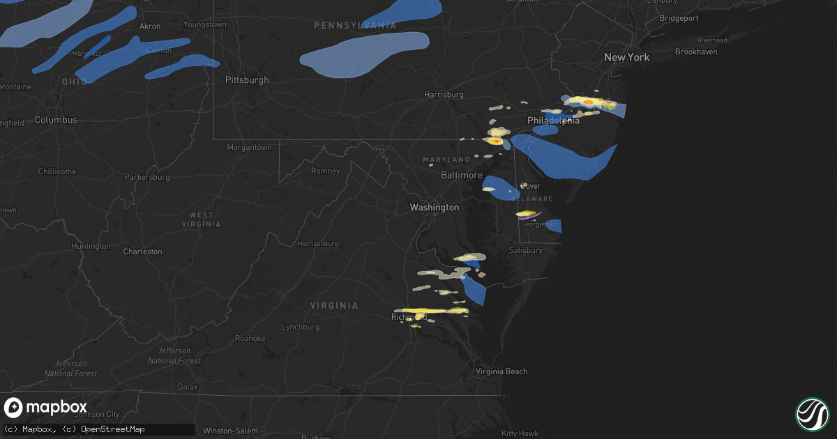
April 1 map
$229
one time, instant access
Download today. No call, no setup
Keep the $229
Bought the map and want the full workflow? Apply the entire $229 to a subscription within 7 days. None of it is wasted.
Every map, not just this one
This buys you this map. Subscription and you get every map we run, in the markets you choose from a few cities to whole states to nationwide. Plus real-time alerts the moment a storm fires.
Contact data
Name, contact info, occupancy, even credit band for addresses in the footprint. You go from where it hit to who to call.
Become the source they trust
Unlimited branding weather history reports on demand. You already have the documented answer ready for the property owner, and you are the one who showed up with it.
Property data and RoofTrace estimates
Pull up any address you have got, its value and the exact code rules for that jurisdiction, straight from One Click Code. Then RoofTrace estimates the squares, pitch, and roof value, priced the way you price.
Storm reports in Maryland
Maryland
| Date | Description |
|---|---|
| 04/01/20236:53 PM CDT | A local report indicates 1.00 inch wind near 1 WSW CALIFORNIA |
| 04/01/20236:50 PM CDT | A local report indicates 70 MPH wind near PATUXENT RIVER NAS |
| 04/01/20236:43 PM CDT | Multiple trees down on the south side of lusby. |
| 04/01/20236:15 PM CDT | Reports of several trees down across kent county. Time estimated from radar. |
| 04/01/20236:15 PM CDT | Report of a tree blown down into a house. Time estimated from radar. |
| 04/01/20235:45 PM CDT | A local report indicates 71 MPH wind near NORTH EAST MD-LANDFILL |
| 04/01/20235:43 PM CDT | Multiple trees down along route 213. |
| 04/01/20235:40 PM CDT | Delayed report. Cecil county em reported trees down on roadways north of north east... Md. Including near intersections of stevenson rd and mechanics valley rd... And n |
| 04/01/20235:39 PM CDT | A local report indicates 1.50 inch wind near HAVRE DE GRACE |
| 04/01/20235:36 PM CDT | A tree fell onto a house along locust street. |
| 04/01/20235:35 PM CDT | An ef-1 tornado with estimated 90 mph winds caused damage to trees... Power poles... And a few structures along a 4.4 mile path... With a width of 125 yards. |
| 04/01/20235:35 PM CDT | Delayed report. Cecil county emergency management reported numerous trees and power lines downed along roadways north and east of perryville. Including... Md-222... Jac |
| 04/01/20235:35 PM CDT | A local report indicates 1.50 inch wind near 1 NE RISING SUN |
| 04/01/20235:32 PM CDT | Delayed report. Cecil county em reported several trees and power lines down on roadways around woodlawn... Including on principio rd... Jackson park rd... And liberty g |
| 04/01/20235:30 PM CDT | Trees down in the rising sun area. |
| 04/01/20235:20 PM CDT | Trees down onto a vehicle. Minor structural damage to a roof top. |
| 04/01/20235:20 PM CDT | A local report indicates 1.00 inch wind near 4 NW LONG GREEN |
| 03/31/20237:50 PM CDT | Tree down on marshall creek road. |
| 03/31/20237:35 PM CDT | Tree downed on old state road at md-413. Report via social media. |
| 03/31/20237:31 PM CDT | Tree downed and partially blocking us-13 north of princess anne. |
| 03/31/20237:27 PM CDT | Corrects previous tstm wnd dmg report from 2 w salisbury-wicomico. Several large tree limbs downed along ward road just east of us-13. Time is radar estimated. |
| 03/31/20237:27 PM CDT | Power pole downed and sparking on allen road. |
| 03/31/20237:17 PM CDT | Several large tree limbs downed along ward road just east of us-13. Tim is radar estimated. |
| 03/31/20237:14 PM CDT | A local report indicates 63 MPH wind near WEBSTER FIELD |
| 03/31/20237:12 PM CDT | A local report indicates 62 MPH wind near 7 SSE SAINT GEORGE ISLA |
| 03/31/20237:03 PM CDT | Numerous trees down. Windows broken and shingles blown off homes. Road signs bent over. |
All States Impacted by Hail Map on April 1, 2023
Cities Impacted by Hail Map on April 1, 2023
- Corydon, KY
- Henderson, KY
- Robards, KY
- Sturgis, KY
- Morganfield, KY
- Murray, KY
- Hollow Rock, TN
- Bruceton, TN
- Camden, TN
- Mansfield, TN
- Big Sandy, TN
- Charleston, MS
- Enid, MS
- Blue Springs, MS
- Guntown, MS
- Bluffton, OH
- Harrod, OH
- Jenera, OH
- Forest, OH
- Arlington, OH
- Ada, OH
- Williamstown, OH
- Findlay, OH
- Mount Cory, OH
- Rawson, OH
- Benton Ridge, OH
- Liberty Center, OH
- McClure, OH
- Napoleon, OH
- Grand Rapids, OH
- Weston, OH
- Bowling Green, OH
- Waterville, OH
- Whitehouse, OH
- Haskins, OH
- Pemberville, OH
- Tontogany, OH
- Perrysburg, OH
- Dunbridge, OH
- Stony Ridge, OH
- Millbury, OH
- Walbridge, OH
- Luckey, OH
- Upper Sandusky, OH
- Carey, OH
- McCutchenville, OH
- Wharton, OH
- Vanlue, OH
- Mount Blanchard, OH
- Sycamore, OH
- Alvada, OH
- Arcadia, OH
- Tiffin, OH
- Bascom, OH
- New Riegel, OH
- Fostoria, OH
- La Rue, OH
- New Bloomington, OH
- Marion, OH
- Morral, OH
- Caledonia, OH
- Bucyrus, OH
- Bloomville, OH
- Republic, OH
- Green Springs, OH
- Elmore, OH
- Genoa, OH
- Woodville, OH
- Graytown, OH
- Williston, OH
- Curtice, OH
- Clay Center, OH
- Martin, OH
- Oak Harbor, OH
- Rocky Ridge, OH
- Port Clinton, OH
- Clyde, OH
- Attica, OH
- Bellevue, OH
- Crestline, OH
- Galion, OH
- Tiro, OH
- New Washington, OH
- Shelby, OH
- Willard, OH
- Monroeville, OH
- Castalia, OH
- Sandusky, OH
- Huron, OH
- Collins, OH
- Norwalk, OH
- Milan, OH
- Berlin Heights, OH
- Plymouth, OH
- Shiloh, OH
- Greenwich, OH
- Sullivan, OH
- Nova, OH
- Wellington, OH
- New London, OH
- Vermilion, OH
- Mansfield, OH
- Ashland, OH
- Polk, OH
- Homerville, OH
- Spencer, OH
- Litchfield, OH
- West Salem, OH
- Lagrange, OH
- Grafton, OH
- Lodi, OH
- Medina, OH
- Valley City, OH
- Brunswick, OH
- Strongsville, OH
- Hinckley, OH
- Columbia Station, OH
- North Royalton, OH
- Brecksville, OH
- Richfield, OH
- Broadview Heights, OH
- Fredericktown, OH
- Mount Gilead, OH
- Bellville, OH
- Butler, OH
- Perrysville, OH
- Lucas, OH
- Loudonville, OH
- Jeromesville, OH
- Shreve, OH
- Wooster, OH
- Lakeville, OH
- Apple Creek, OH
- Smithville, OH
- Orrville, OH
- Sterling, OH
- Marshallville, OH
- Rittman, OH
- Doylestown, OH
- Cleveland, OH
- Independence, OH
- Maple Heights, OH
- Bedford, OH
- Euclid, OH
- Beachwood, OH
- Chagrin Falls, OH
- Solon, OH
- Wickliffe, OH
- Eastlake, OH
- Willoughby, OH
- Mentor, OH
- Gates Mills, OH
- Perry, OH
- Novelty, OH
- Grand River, OH
- Painesville, OH
- Chardon, OH
- Chesterland, OH
- Madison, OH
- Rome, OH
- Thompson, OH
- Montville, OH
- Newbury, OH
- Huntsburg, OH
- Geneva, OH
- Rock Creek, OH
- Ashtabula, OH
- North Kingsville, OH
- Conneaut, OH
- Austinburg, OH
- Kingsville, OH
- Jefferson, OH
- Windsor, OH
- Burton, OH
- Orwell, OH
- Middlefield, OH
- Dorset, OH
- Williamsfield, OH
- Pierpont, OH
- Andover, OH
- Albion, PA
- Conneautville, PA
- East Springfield, PA
- Girard, PA
- Lake City, PA
- Cranesville, PA
- Springboro, PA
- West Springfield, PA
- Fairview, PA
- Erie, PA
- Linesville, PA
- North Springfield, PA
- Dover, OH
- New Philadelphia, OH
- Sugarcreek, OH
- Sherrodsville, OH
- Mineral City, OH
- Dellroy, OH
- Somerdale, OH
- Carrollton, OH
- Magnolia, OH
- Mechanicstown, OH
- Minerva, OH
- Salineville, OH
- Hanoverton, OH
- Kensington, OH
- Summitville, OH
- East Rochester, OH
- Hammondsville, OH
- Lisbon, OH
- Wellsville, OH
- East Liverpool, OH
- Newell, WV
- Chester, WV
- Georgetown, PA
- Midland, PA
- Industry, PA
- Hookstown, PA
- Shippingport, PA
- Aliquippa, PA
- Cambridge Springs, PA
- Saegertown, PA
- Meadville, PA
- Hartstown, PA
- Jamestown, PA
- Edinboro, PA
- Harmonsburg, PA
- McKean, PA
- Venango, PA
- Conneaut Lake, PA
- Wattsburg, PA
- Union City, PA
- Waterford, PA
- Ripley, NY
- North East, PA
- Harborcreek, PA
- Centerville, PA
- Findley Lake, NY
- Guys Mills, PA
- Sherman, NY
- Townville, PA
- Corry, PA
- Spartansburg, PA
- Clymer, NY
- Chautauqua, NY
- Fredonia, NY
- Brocton, NY
- Bear Lake, PA
- Westfield, NY
- Dunkirk, NY
- Van Buren Point, NY
- Stockton, NY
- Mayville, NY
- Dewittville, NY
- Ashville, NY
- Columbus, PA
- Portland, NY
- Panama, NY
- Arlington, AL
- Thomaston, AL
- Catherine, AL
- Pine Hill, AL
- Camden, AL
- Americus, GA
- Parrott, GA
- Smithville, GA
- Preston, GA
- Plains, GA
- Dawson, GA
- Alberta, AL
- Magnolia, AL
- Bemus Point, NY
- Cassadaga, NY
- Celoron, NY
- Lakewood, NY
- Stow, NY
- Gerry, NY
- Sinclairville, NY
- Jamestown, NY
- Sugar Grove, PA
- Lily Dale, NY
- Pittsfield, PA
- Spring Creek, PA
- Cherry Creek, NY
- Sheridan, NY
- Forestville, NY
- Silver Creek, NY
- Falconer, NY
- Frewsburg, NY
- Little Valley, NY
- Conewango Valley, NY
- Gowanda, NY
- Randolph, NY
- Perrysburg, NY
- South Dayton, NY
- Irving, NY
- Dayton, NY
- Salamanca, NY
- Cattaraugus, NY
- Kennedy, NY
- Lake View, NY
- North Collins, NY
- Hamburg, NY
- Eden, NY
- Lawtons, NY
- Collins, NY
- Angola, NY
- Derby, NY
- Machias, NY
- Delevan, NY
- East Concord, NY
- East Otto, NY
- Boston, NY
- Ellicottville, NY
- Springville, NY
- West Valley, NY
- Holland, NY
- Chaffee, NY
- Yorkshire, NY
- Orchard Park, NY
- Colden, NY
- Sardinia, NY
- Glenwood, NY
- Arcade, NY
- West Falls, NY
- Java Village, NY
- South Wales, NY
- Varysburg, NY
- East Aurora, NY
- Java Center, NY
- North Java, NY
- Strykersville, NY
- Buffalo, NY
- Elma, NY
- Osceola Mills, PA
- Philipsburg, PA
- Ramey, PA
- La Jose, PA
- New Millport, PA
- Smithmill, PA
- Morrisdale, PA
- Glen Hope, PA
- Irvona, PA
- Madera, PA
- West Decatur, PA
- Coalport, PA
- Brisbin, PA
- Curwensville, PA
- Houtzdale, PA
- Beccaria, PA
- Olanta, PA
- Glen Campbell, PA
- Mahaffey, PA
- Cherry Tree, PA
- Burnside, PA
- Westover, PA
- Marion Center, PA
- Starford, PA
- Dixonville, PA
- Clymer, PA
- Arcadia, PA
- Commodore, PA
- Indiana, PA
- Home, PA
- Rochester Mills, PA
- Hillsdale, PA
- Ernest, PA
- Emeigh, PA
- Saint Benedict, PA
- Penn Run, PA
- Northern Cambria, PA
- Ebensburg, PA
- Hastings, PA
- Strongstown, PA
- Mentcle, PA
- Spangler, PA
- Nicktown, PA
- Heilwood, PA
- Marsteller, PA
- Alverda, PA
- Patton, PA
- Elmora, PA
- Colver, PA
- Carrolltown, PA
- Saint Boniface, PA
- Loretto, PA
- Ashville, PA
- Flinton, PA
- Chest Springs, PA
- Gallitzin, PA
- Dysart, PA
- Duncansville, PA
- Cresson, PA
- Fallentimber, PA
- Altoona, PA
- Bellwood, PA
- Hollidaysburg, PA
- Blandburg, PA
- Tipton, PA
- Tyrone, PA
- Munson, PA
- Hawk Run, PA
- Bellefonte, PA
- Howard, PA
- Port Matilda, PA
- Pennsylvania Furnace, PA
- Warriors Mark, PA
- Alexandria, PA
- University Park, PA
- Snow Shoe, PA
- Spruce Creek, PA
- Milesburg, PA
- Fleming, PA
- Sandy Ridge, PA
- Julian, PA
- State College, PA
- Lanse, PA
- Pine Grove Mills, PA
- Centre Hall, PA
- Lemont, PA
- Petersburg, PA
- Boalsburg, PA
- Williamsburg, PA
- Huntingdon, PA
- Spring Mills, PA
- Great Valley, NY
- Hinsdale, NY
- Allegany, NY
- Cuba, NY
- Bolivar, NY
- Franklinville, NY
- Kill Buck, NY
- Olean, NY
- Portville, NY
- Limestone, NY
- Friendship, NY
- Caneadea, NY
- Belfast, NY
- Black Creek, NY
- Houghton, NY
- Freedom, NY
- Farmersville Station, NY
- Rushford, NY
- Dalton, NY
- Swain, NY
- Hunt, NY
- Fillmore, NY
- Angelica, NY
- Portageville, NY
- Nunda, NY
- Gainesville, NY
- Bliss, NY
- Castile, NY
- Mill Hall, PA
- North Bend, PA
- Lock Haven, PA
- Cammal, PA
- Renovo, PA
- Beech Creek, PA
- Frenchville, PA
- Moshannon, PA
- Orviston, PA
- Karthaus, PA
- Pottersdale, PA
- Clarence, PA
- Millheim, PA
- Woodward, PA
- Madisonburg, PA
- Aaronsburg, PA
- Coburn, PA
- Rebersburg, PA
- Loganton, PA
- Waterville, PA
- Jersey Shore, PA
- Jersey Mills, PA
- Alfred, NY
- Canisteo, NY
- Cameron Mills, NY
- Scio, NY
- Campbell, NY
- Arkport, NY
- Almond, NY
- Alfred Station, NY
- Canaseraga, NY
- Savona, NY
- Bath, NY
- Cameron, NY
- Hornell, NY
- Avoca, NY
- Dansville, NY
- Andover, NY
- Belmont, NY
- Cohocton, NY
- Wayland, NY
- Wellsville, NY
- Roulette, PA
- Coudersport, PA
- Genesee, PA
- Galeton, PA
- Ulysses, PA
- Sabinsville, PA
- Westfield, PA
- Gaines, PA
- Morris, PA
- Liberty, PA
- Wellsboro, PA
- Trout Run, PA
- Blossburg, PA
- Ralston, PA
- Roaring Branch, PA
- Cogan Station, PA
- Mansfield, PA
- Morris Run, PA
- Tioga, PA
- Middlebury Center, PA
- Troy, PA
- Mainesburg, PA
- Canton, PA
- Covington, PA
- Alba, PA
- Columbia Cross Roads, PA
- Millerton, PA
- Linden, PA
- Avis, PA
- Williamsport, PA
- Milroy, PA
- Wray, GA
- Ocilla, GA
- Ambrose, GA
- Douglas, GA
- Granville Summit, PA
- Shunk, PA
- Forksville, PA
- Dushore, PA
- East Smithfield, PA
- Monroeton, PA
- Ulster, PA
- Towanda, PA
- Milan, PA
- New Albany, PA
- Athens, PA
- Sayre, PA
- Gillett, PA
- Laurelton, PA
- Mifflinburg, PA
- Millmont, PA
- McClure, PA
- Beavertown, PA
- Beaver Springs, PA
- Middleburg, PA
- Vancleave, MS
- Jasper, NY
- Painted Post, NY
- Addison, NY
- Greenwood, NY
- Corning, NY
- Pine City, NY
- Big Flats, NY
- Elmira, NY
- Pine Valley, NY
- Horseheads, NY
- Beaver Dams, NY
- Trumansburg, NY
- Dundee, NY
- Bradford, NY
- Millport, NY
- Watkins Glen, NY
- Burdett, NY
- Rock Stream, NY
- Hammondsport, NY
- Odessa, NY
- Montour Falls, NY
- Hector, NY
- Lodi, NY
- Interlaken, NY
- Branchport, NY
- Himrod, NY
- Prattsburgh, NY
- Penn Yan, NY
- Pulteney, NY
- Naples, NY
- Atlanta, NY
- Keuka Park, NY
- Breesport, NY
- Erin, NY
- Alpine, NY
- Cayuta, NY
- Lowman, NY
- Wellsburg, NY
- Waverly, NY
- Chemung, NY
- Newfield, NY
- Lockwood, NY
- Van Etten, NY
- Ithaca, NY
- Spencer, NY
- Nichols, NY
- Barton, NY
- Willseyville, NY
- Apalachin, NY
- Owego, NY
- Candor, NY
- Chenango Forks, NY
- Dryden, NY
- Glen Aubrey, NY
- Newark Valley, NY
- Port Crane, NY
- Slaterville Springs, NY
- Castle Creek, NY
- Whitney Point, NY
- Richford, NY
- Lisle, NY
- Berkshire, NY
- Afton, NY
- Harpursville, NY
- Brooktondale, NY
- Maine, NY
- Greene, NY
- Johnson City, NY
- Freeville, NY
- Binghamton, NY
- Bainbridge, NY
- Endicott, NY
- Rome, PA
- Wysox, PA
- Montoursville, PA
- Warren Center, PA
- Little Meadows, PA
- Le Raysville, PA
- Oxford, NY
- Mount Upton, NY
- Guilford, NY
- South New Berlin, NY
- Federalsburg, MD
- Greenwood, DE
- Denton, MD
- Bridgeville, DE
- Lincoln, DE
- Ellendale, DE
- Feasterville Trevose, PA
- Langhorne, PA
- Richboro, PA
- Southampton, PA
- Newtown, PA
- Warminster, PA
- Peach Bottom, PA
- Nottingham, PA
- Rising Sun, MD
- Colora, MD
- North East, MD
- Levittown, PA
- Bensalem, PA
- Morrisville, PA
- Fairless Hills, PA
- Willacoochee, GA
- Alapaha, GA
- Bonifay, FL
- Caryville, FL
- Chipley, FL
- Trenton, NJ
- Bristol, PA
- Riverton, NJ
- Palmyra, NJ
- Moorestown, NJ
- Riverside, NJ
- Florence, NJ
- Bordentown, NJ
- Chesterfield, NJ
- Robbinsville, NJ
- Allentown, NJ
- Cream Ridge, NJ
- Millstone Township, NJ
- Hightstown, NJ
- Elkton, MD
- Englishtown, NJ
- Freehold, NJ
- Roosevelt, NJ
- Jackson, NJ
- New Egypt, NJ
- Lakewood, NJ
- Manchester Township, NJ
- Toms River, NJ
- Howell, NJ
- Philadelphia, PA
- Gladwyne, PA
- Glenside, PA
- Wyncote, PA
- Elkins Park, PA
- Bala Cynwyd, PA
- Merion Station, PA
- Narberth, PA
- Cheltenham, PA
- Lafayette Hill, PA
- Conshohocken, PA
- Havertown, PA
- Ardmore, PA
- Wynnewood, PA
- Upper Darby, PA
- Camden, NJ
- Pennsauken, NJ
- Merchantville, NJ
- Mount Laurel, NJ
- Willingboro, NJ
- Mount Holly, NJ
- Rancocas, NJ
- Maple Shade, NJ
- Hainesport, NJ
- Wrightstown, NJ
- Chester, PA
- Brookhaven, PA
- Swarthmore, PA
- Norwood, PA
- Folsom, PA
- Ridley Park, PA
- Sharon Hill, PA
- Folcroft, PA
- Gibbstown, NJ
- Crum Lynne, PA
- Woodlyn, PA
- Wallingford, PA
- Prospect Park, PA
- Holmes, PA
- Glenolden, PA
- Westville, NJ
- Bridgeport, NJ
- Essington, PA
- Paulsboro, NJ
- National Park, NJ
- Thorofare, NJ
- Swedesboro, NJ
- Morton, PA
- Marcus Hook, PA
- Media, PA
- Wilmington, DE
- Aston, PA
- Garnet Valley, PA
- Claymont, DE
- Yorklyn, DE
- Newark, DE
- Hockessin, DE
- Landenberg, PA
- Middletown, DE
- New Castle, DE
- Bear, DE
- Delaware City, DE
- Pennsville, NJ
- Penns Grove, NJ
- Salem, NJ
- Woodstown, NJ
- Newfield, NJ
- Mullica Hill, NJ
- Williamstown, NJ
- Malaga, NJ
- Elmer, NJ
- Newtonville, NJ
- Pedricktown, NJ
- Franklinville, NJ
- Monroeville, NJ
- Clayton, NJ
- Bridgeton, NJ
- Alloway, NJ
- Millville, NJ
- Minotola, NJ
- Buena, NJ
- Shiloh, NJ
- Greenwich, NJ
- Vineland, NJ
- Landisville, NJ
- Cedarville, NJ
- Clarksboro, NJ
- Mickleton, NJ
- Wenonah, NJ
- Mantua, NJ
- Woodbury Heights, NJ
- Mount Royal, NJ
- Woodbury, NJ
- Sewell, NJ
- Bellmawr, NJ
- Gloucester City, NJ
- Dorothy, NJ
- Milmay, NJ
- Richland, NJ
- Newport, NJ
- Mays Landing, NJ
- Hammonton, NJ
- Lavallette, NJ
- Brick, NJ
- Spring Lake, NJ
- Belmar, NJ
- Mantoloking, NJ
- Point Pleasant Beach, NJ
- Allenwood, NJ
- Sea Girt, NJ
- Brielle, NJ
- Manasquan, NJ
- Farmingdale, NJ
- Harrington, DE
- Dorchester, NJ
- Egg Harbor Township, NJ
- Cape May, NJ
- Wildwood, NJ
- Ocean View, NJ
- Villas, NJ
- Delmont, NJ
- Woodbine, NJ
- Mauricetown, NJ
- Leesburg, NJ
- Cape May Court House, NJ
- Rio Grande, NJ
- Port Norris, NJ
- Port Elizabeth, NJ
- Heislerville, NJ
- Fortescue, NJ
- Estell Manor, NJ
- Brigantine, NJ
- Pleasantville, NJ
- Linwood, NJ
- Absecon, NJ
- Somers Point, NJ
- Northfield, NJ
- Atlantic City, NJ
- Ocean City, NJ
- Margate City, NJ
- Ventnor City, NJ
- Longport, NJ
- Marmora, NJ
- Chestertown, MD
- Worton, MD
- Rock Hall, MD
- Centreville, MD
- Church Hill, MD
- Goldsboro, MD
- Queen Anne, MD
- Marydel, MD
- Barclay, MD
- Marydel, DE
- Camden Wyoming, DE
- Ingleside, MD
- Felton, DE
- Sudlersville, MD
- Henderson, MD
- Ridgely, MD
- Greensboro, MD
- Great Mills, MD
- Patuxent River, MD
- California, MD
- Leonardtown, MD
- Valley Lee, MD
- Lexington Park, MD
- Callaway, MD
- Hollywood, MD
- Saint Inigoes, MD
- Drayden, MD
- Park Hall, MD
- Dameron, MD
- Mechanicsville, VA
- Ridge, MD
- Heathsville, VA
- Kinsale, VA
- Piney Point, MD
- Callao, VA
- Lottsburg, VA
- Scotland, MD
- Farnham, VA
- Lancaster, VA
- Reedville, VA
- Burgess, VA
- King William, VA
- New Kent, VA
- West Point, VA
- Lewes, DE
- Harbeson, DE
- Georgetown, DE
- Milton, DE
- Rehoboth Beach, DE
- Millsboro, DE
- Bethany Beach, DE
- Kilmarnock, VA
- Weems, VA
- Saluda, VA
- Urbanna, VA
- Church View, VA
- Mascot, VA
- Shacklefords, VA
- Little Plymouth, VA
- Mattaponi, VA
- Barnegat Light, NJ
- Manahawkin, NJ
- West Creek, NJ
- Port Republic, NJ
- Tuckerton, NJ
- Beach Haven, NJ
- Egg Harbor City, NJ
- Henrico, VA
- Richmond, VA
- Glen Allen, VA
- Kirkwood, PA
- Oxford, PA
- Quarryville, PA
- Fallston, MD
- Bel Air, MD
- Jobstown, NJ
- Joint Base Mdl, NJ
- Cookstown, NJ
- Christiana, PA
- Strasburg, PA
- Paradise, PA
- Ronks, PA
- Loretto, VA
- Caret, VA
- Cherry Hill, NJ
- Tappahannock, VA
- Saint Stephens Church, VA
- New Holland, PA
- East Earl, PA
- Narvon, PA
- Leola, PA
- Hartly, DE
- Dover, DE
- Honey Brook, PA
- Elverson, PA
- Woodbine, MD
- Mount Airy, MD
- Fawn Grove, PA
- Stewartstown, PA
- Parkton, MD
- Conowingo, MD
- Port Deposit, MD
- Havre De Grace, MD
- Aberdeen, MD
- Aberdeen Proving Ground, MD
- West Grove, PA
- Cochranville, PA
- Lincoln University, PA
- Lusby, MD
- Avenue, MD
- Solomons, MD
- Jenkintown, PA
- Hooksett, NH
- Dunnsville, VA
- Bruington, VA
- Warsaw, VA
- Spring City, PA
- Phoenixville, PA
- Pottstown, PA
- Tall Timbers, MD
- Bowling Green, VA
- Hague, VA
- Montross, VA
- Colonial Beach, VA
- Port Royal, VA
- Champlain, VA
- Hustle, VA
- Burlington, NJ
- Columbus, NJ
- Lakehurst, NJ
- Perryville, MD
- Cranbury, NJ
- Monroe Township, NJ
- Jamaica, VA
- Whiteford, MD
- Delta, PA
- Princeton Junction, NJ
- Lawrence Township, NJ
- Wayne, PA
- Bryn Mawr, PA
- Huntingdon Valley, PA
- King Of Prussia, PA
- Villanova, PA
- Newtown, VA
- Milford, VA
- Aylett, VA
- Ruther Glen, VA
- Water View, VA
- Gloucester, VA
- Sandston, VA
- Quinton, VA
- Providence Forge, VA
- Locust Hill, VA
- Mount Vernon, OH
- Glenmont, OH
- Howard, OH
- Danville, OH
- Fredericksburg, OH
- Big Prairie, OH
- Millersburg, OH
- Holmesville, OH
- Mount Eaton, OH
- Navarre, OH
- Dalton, OH
- Dundee, OH
- North Lawrence, OH
- Massillon, OH
- Canton, OH
- Canal Fulton, OH
- East Canton, OH
- Damascus, OH
- Sebring, OH
- North Canton, OH
- Paris, OH
- Homeworth, OH
- Clinton, OH
- Beloit, OH
- Salem, OH
- Alliance, OH
- Louisville, OH
- Middlebranch, OH


