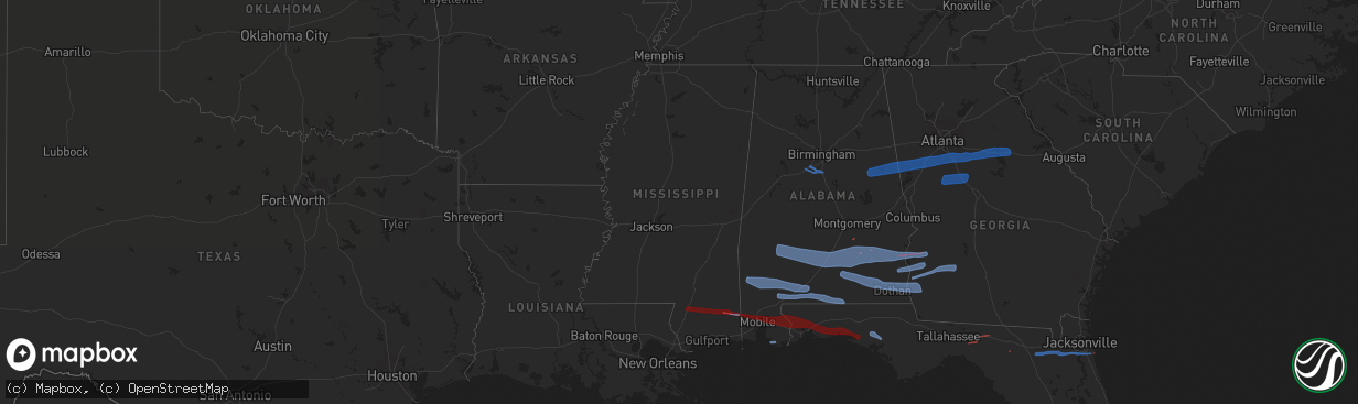
Hail Map in Mississippi on March 31, 2020
The weather event in Mississippi on March 31, 2020 includes Wind, Tornado, and Hail maps. 6 states and 205 cities were impacted and suffered possible damage. The total estimated number of properties impacted is 0.
Want more than just the map?
Turn this storm into a full workflow.
- Owner + property data so you know who to knock
- OnDemand branded weather history reports to win the "did we even have hail?" argument
- RoofTrace estimate so reps stop guessing numbers at the door
Bought this map? Upgrade within 7 days and we'll credit the $230. (10-15 min setup call)
Wind
Tornado
Hail
0
Estimated number of impacted properties by a 1.00" hail or larger0
Estimated number of impacted properties by a 1.75" hail or larger0
Estimated number of impacted properties by a 2.50" hail or largerStorm reports in Mississippi
Mississippi
| Date | Description |
|---|---|
| 03/31/20209:40 AM CDT | Trees snapped and several power poles broken and snapped along basin refuge rd near hwy 63. Likely part of tornadic circulation. Time estimated from radar. |
| 03/31/20209:35 AM CDT | Trees reported down on river road. Part of likely tornadic circulation. |
| 03/31/20209:34 AM CDT | Numerous trees power and lines down on east wilkerson ferry rd. Part of likely tornado path. |
| 03/31/20208:42 AM CDT | Damage to faith fellowship on purvis to brooklyn road. Time estimated based on radar data. |
| 03/31/20208:15 AM CDT | Wayne county ema reports damage to a barn... A church with roof damage... A mobile home with roof damage... And a tree that fell on a home along boyd brewer drive. Time |
| 03/31/20207:20 AM CDT | Tree down on james street in shubuta. |
| 03/31/20207:14 AM CDT | Corrects previous tstm wnd dmg report from 1 w mannassa. Powerline downed on county road 511. |
| 03/31/20207:10 AM CDT | Powerline downed on willow grove church road. |
| 03/31/20207:10 AM CDT | Corrects previous tstm wnd dmg report from 1 ese de soto. Tree downed on county road 693. |
| 03/31/20207:05 AM CDT | Tree downed at intersection of highway 84 and providence church road. |
| 03/31/20207:02 AM CDT | Tree downed on west lynda street. |
| 03/31/20205:26 AM CDT | At 1026 AM CDT, severe thunderstorms were located along a line extending from 5 miles southwest of I65 And AL 225 to near Chickasaw to 3 miles northeast of Tanner Williams, moving east at 60 mph. HAZARD...70 mph wind gusts. SOURCE...Radar indicated. IMPACT...Expect considerable tree damage. Damage is likely to mobile homes, roofs, and outbuildings. Locations impacted include... Midtown Mobile, Downtown Mobile, Prichard, Saraland, Bay Minette, Chickasaw, Satsuma, Spanish Fort, Creola, Stapleton, Semmes, Tanner Williams, I65 And I165, Mobile Regional Airport, Wilmer and I65 And AL 158. |
| 03/31/20204:46 AM CDT | At 945 AM CDT, severe thunderstorms were located along a line extending from 5 miles west of Citronelle to 8 miles northwest of Wilmer to 11 miles southwest of Lucedale, moving east at 45 mph. HAZARD...70 mph wind gusts. SOURCE...Radar indicated. IMPACT...Expect considerable tree damage. Damage is likely to mobile homes, roofs, and outbuildings. Locations impacted include... Downtown Mobile, Prichard, Saraland, Chickasaw, Satsuma, Citronelle, Lucedale, Creola, Chunchula, Gulfcrest, Axis, Mount Vernon, Semmes, Tanner Williams, I65 And I165, Wilmer, I65 And AL 158 and Movico. |
| 03/31/20204:08 AM CDT | At 907 AM CDT, a severe thunderstorm was located 12 miles south of McLain, or 14 miles east of Wiggins, moving east at 80 mph. HAZARD...70 mph wind gusts. SOURCE...Radar indicated. IMPACT...Expect considerable tree damage. Damage is likely to mobile homes, roofs, and outbuildings. Locations impacted include... Citronelle, Lucedale, Chunchula, Gulfcrest, Semmes, Tanner Williams and Wilmer. |
| 03/31/20203:41 AM CDT | At 840 AM CDT, a severe thunderstorm was located 6 miles west of Maxie, or 12 miles northwest of Wiggins, moving east at 35 mph. HAZARD...70 mph wind gusts. SOURCE...Radar indicated. IMPACT...Expect considerable tree damage. Damage is likely to mobile homes, roofs, and outbuildings. Locations impacted include... Wiggins. |
| 03/31/20203:37 AM CDT | At 837 AM CDT, severe thunderstorms were located along a line extending from Yellow Bluff to 9 miles east of Fulton to Grove Hill to near State Line, moving east at 70 mph. HAZARD...60 mph wind gusts. SOURCE...Radar indicated. IMPACT...Expect damage to roofs, siding, and trees. Locations impacted include... Monroeville, Jackson, Thomasville, Camden, Frisco City, Grove Hill, Chatom, Peterman, Saint Stephens, Wagarville, Leroy, Whatley, Tibbie, Pine Hill, Beatrice, Fruitdale, Vredenburgh, Fulton, Yellow Bluff and Pine Apple. |
| 03/31/20203:33 AM CDT | At 833 AM CDT, a severe thunderstorm was located near Lumberton, or 13 miles northeast of Poplarville, moving east at 35 mph. HAZARD...60 mph wind gusts. SOURCE...Radar indicated. IMPACT...Expect damage to roofs, siding, and trees. This severe thunderstorm will remain over mainly rural areas of northeastern Pearl River County. |
| 03/31/20203:32 AM CDT | At 832 AM CDT, a severe thunderstorm was located near Maxie, or 13 miles northwest of Wiggins, moving east at 50 mph. HAZARD...60 mph wind gusts. SOURCE...Radar indicated. IMPACT...Expect damage to roofs, siding, and trees. This severe thunderstorm will be near... Maxie and Brooklyn around 840 AM CDT. |
| 03/31/20202:50 AM CDT | At 750 AM CDT, a severe thunderstorm was located over Ovett, or 10 miles northwest of Richton, moving east at 50 mph. HAZARD...60 mph wind gusts. SOURCE...Radar indicated. IMPACT...Expect damage to roofs, siding, and trees. This severe thunderstorm will remain over mainly rural areas of southeastern Jones County. |
| 03/31/20202:13 AM CDT | At 712 AM CDT, a severe thunderstorm was located 10 miles southeast of Taylorsville, or 10 miles northwest of Ellisville, moving east at 60 mph. HAZARD...60 mph wind gusts. SOURCE...Radar indicated. IMPACT...Expect damage to roofs, siding, and trees. This severe thunderstorm will be near... Laurel around 720 AM CDT. Tuckers Crossing around 725 AM CDT. Sandersville around 730 AM CDT. Mill Creek around 735 AM CDT.Other locations impacted by this severe thunderstorm include Soso. |
| 03/31/20201:44 AM CDT | At 644 AM CDT, a severe thunderstorm was located over Clem, or 13 miles south of Magee, moving east at 45 mph. HAZARD...60 mph wind gusts. SOURCE...Radar indicated. IMPACT...Expect damage to roofs, siding, and trees. This severe thunderstorm will be near... Mount Olive around 655 AM CDT. Collins around 705 AM CDT. |
| 03/31/20201:26 AM CDT | At 625 AM CDT, a severe thunderstorm was located near Taylorsville, or 7 miles west of Stringer, moving east at 50 mph. HAZARD...60 mph wind gusts. SOURCE...Radar indicated. IMPACT...Expect damage to roofs, siding, and trees. This severe thunderstorm will be near... Stringer and Bay Springs around 635 AM CDT. Moss around 640 AM CDT. Vernon around 645 AM CDT. Heidelberg around 655 AM CDT. Stafford Springs around 700 AM CDT.Other locations impacted by this severe thunderstorm includeSylvarena and Mize. |
| 03/31/202012:41 AM CDT | At 541 AM CDT, a severe thunderstorm was located over Hazlehurst, moving east at 50 mph. HAZARD...60 mph wind gusts. SOURCE...Radar indicated. IMPACT...Expect damage to roofs, siding, and trees. This severe thunderstorm will be near... Crystal Springs around 545 AM CDT. Hopewell around 555 AM CDT. Rockport around 600 AM CDT. Union and Harrisville around 605 AM CDT. Shivers around 610 AM CDT. Pinola around 615 AM CDT. Mendenhall around 620 AM CDT. Sanatorium around 625 AM CDT.Other locations impacted by this severe thunderstorm include D'Lo,Braxton and Georgetown. |
| 03/31/202012:30 AM CDT | At 530 AM CDT, severe thunderstorms were located along a line extending from near Pelahatchie to near Brandon to near Star, moving east at 50 mph. HAZARD...60 mph wind gusts. SOURCE...Radar indicated. IMPACT...Expect damage to roofs, siding, and trees. Severe thunderstorms will be near... Pelahatchie around 535 AM CDT. Morton and Cato around 545 AM CDT. Johns around 550 AM CDT. Pulaski around 555 AM CDT. Forest and White Oak around 600 AM CDT. Homewood around 605 AM CDT. Burns around 610 AM CDT. Pineville around 620 AM CDT.Other locations impacted by these severe thunderstorms includePolkville, Puckett and Lake. |
All States Impacted by Hail Map on March 31, 2020
Cities Impacted by Hail Map on March 31, 2020
- Flasher, ND
- Almont, ND
- Carson, ND
- Beulah, ND
- Hebron, ND
- Glen Ullin, ND
- Solen, ND
- San Perlita, TX
- Lyford, TX
- Golden Valley, ND
- Raymondville, TX
- Foley, AL
- Bon Secour, AL
- Lamont, FL
- Middleburg, FL
- Lake Butler, FL
- Saint Johns, FL
- Lulu, FL
- Orange Park, FL
- Lake City, FL
- Lawtey, FL
- Jacksonville, FL
- Ponte Vedra, FL
- Raiford, FL
- Fleming Island, FL
- Glen Saint Mary, FL
- Madison, FL
- Live Oak, FL
- Ponte Vedra Beach, FL
- Eglin Afb, FL
- Lumberton, MS
- Shalimar, FL
- Bagdad, FL
- Fort Walton Beach, FL
- Freeport, FL
- Milton, FL
- Daphne, AL
- Cantonment, FL
- Wiggins, MS
- Defuniak Springs, FL
- Lucedale, MS
- Vernon, FL
- Poplarville, MS
- Stapleton, AL
- Loxley, AL
- Eight Mile, AL
- Valparaiso, FL
- Semmes, AL
- Molino, FL
- Robertsdale, AL
- Bay Minette, AL
- Perkinston, MS
- Niceville, FL
- Mobile, AL
- Wilmer, AL
- McDavid, FL
- Jackson, AL
- Castleberry, AL
- Gainestown, AL
- Little River, AL
- Brewton, AL
- Uriah, AL
- Range, AL
- Deer Park, AL
- Frisco City, AL
- Wagarville, AL
- Sunflower, AL
- Tibbie, AL
- Repton, AL
- Leroy, AL
- Atmore, AL
- McIntosh, AL
- Chatom, AL
- Rutledge, AL
- Fort Gaines, GA
- Pine Hill, AL
- Glenwood, AL
- Grady, AL
- Peterman, AL
- Banks, AL
- Clayton, AL
- Morris, GA
- Troy, AL
- Brundidge, AL
- Beatrice, AL
- Lower Peach Tree, AL
- Luverne, AL
- Forest Home, AL
- Cuthbert, GA
- Pine Apple, AL
- Clio, AL
- Coy, AL
- Eufaula, AL
- Evergreen, AL
- McKenzie, AL
- Vredenburgh, AL
- Brantley, AL
- Lapine, AL
- Georgetown, GA
- Honoraville, AL
- Thomasville, AL
- Louisville, AL
- Highland Home, AL
- Georgiana, AL
- Camden, AL
- Abbeville, AL
- Fort Deposit, AL
- Greenville, AL
- Goshen, AL
- Dickinson, AL
- Lockhart, AL
- Perdido, AL
- Andalusia, AL
- Flomaton, AL
- Florala, AL
- Wing, AL
- Blakely, GA
- Ashford, AL
- Webb, AL
- Ozark, AL
- Fort Rucker, AL
- Dozier, AL
- Newton, AL
- Dothan, AL
- Daleville, AL
- New Brockton, AL
- Enterprise, AL
- Midland City, AL
- Colquitt, GA
- Opp, AL
- Columbia, AL
- Elba, AL
- Headland, AL
- Cowarts, AL
- Newville, AL
- Edison, GA
- Bluffton, GA
- Shorterville, AL
- Coleman, GA
- McCalla, AL
- Helena, AL
- Montevallo, AL
- Bessemer, AL
- West Blocton, AL
- Alabaster, AL
- Calera, AL
- Panama City, FL
- Youngstown, FL
- Chipley, FL
- Ebro, FL
- Ramer, AL
- Morgan, GA
- Leesburg, GA
- Albany, GA
- Arlington, GA
- Leary, GA
- Dawson, GA
- Riverdale, GA
- Woodland, AL
- Sharpsburg, GA
- Locust Grove, GA
- Roopville, GA
- Wadley, AL
- Wedowee, AL
- Cragford, AL
- Buckhead, GA
- Peachtree City, GA
- Hampton, GA
- Franklin, GA
- Moreland, GA
- Union Point, GA
- Roanoke, AL
- Newnan, GA
- Greensboro, GA
- Newborn, GA
- Carrollton, GA
- Ashland, AL
- White Plains, GA
- Mcdonough, GA
- Stockbridge, GA
- Senoia, GA
- Jonesboro, GA
- Covington, GA
- Grantville, GA
- Hogansville, GA
- Lineville, AL
- Rutledge, GA
- Shady Dale, GA
- Tyrone, GA
- Fayetteville, GA
- Brooks, GA
- Jackson, GA
- Madison, GA
- Monticello, GA
- Mansfield, GA
- Molena, GA
- Zebulon, GA
- Griffin, GA
- Williamson, GA
- Forsyth, GA
- Milner, GA
- Meansville, GA
- Barnesville, GA
- Concord, GA
- The Rock, GA


