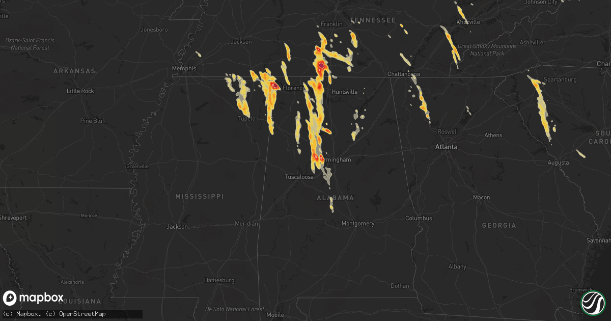
Hail Map on March 31, 2012
Get this storm
March 31 map
$229
one time, instant access
Download today. No call, no setup
Keep the $229
Bought the map and want the full workflow? Apply the entire $229 to a subscription within 7 days. None of it is wasted.
Every map, not just this one
This buys you this map. Subscription and you get every map we run, in the markets you choose from a few cities to whole states to nationwide. Plus real-time alerts the moment a storm fires.
Contact data
Name, contact info, occupancy, even credit band for addresses in the footprint. You go from where it hit to who to call.
Become the source they trust
Unlimited branding weather history reports on demand. You already have the documented answer ready for the property owner, and you are the one who showed up with it.
Property data and RoofTrace estimates
Pull up any address you have got, its value and the exact code rules for that jurisdiction, straight from One Click Code. Then RoofTrace estimates the squares, pitch, and roof value, priced the way you price.
States Impacted by Hail Map on March 31, 2012
Storm reports
Tennessee
| Date | Description |
|---|---|
| 03/31/20126:57 PM CDT | Dime to quarter size hail in madge near the shelby/tipton county border. |
| 03/31/20126:26 PM CDT | Quarter size hail covering the ground. |
| 03/31/20126:24 PM CDT | A local report indicates 1.00 inch wind near MUNFORD |
| 03/31/20125:45 PM CDT | Quarter sized hail was reported on highway 50 near the lincoln county line. Time estimated by radar. |
| 03/31/20125:35 PM CDT | Trees and power lines were knocked down on highway 129 near the bedford county line. Time estimated by radar. |
| 03/31/20125:20 PM CDT | A local report indicates 1.00 inch wind near PETERSBURG |
| 03/31/20125:01 PM CDT | A local report indicates 1.00 inch wind near 2 S LEWISBURG |
| 03/31/20124:56 PM CDT | Hail reported near highway 31 just south of lewisburg |
| 03/31/20124:55 PM CDT | A local report indicates 1.25 inch wind near LEWISBURG |
| 03/31/20124:30 PM CDT | A local report indicates 1.75 inch wind near COLLINWOOD |
| 03/31/20124:20 PM CDT | A local report indicates 2.00 inch wind near PULASKI |
| 03/31/20124:11 PM CDT | A local report indicates 2.75 inch wind near 8 S PULASKI |
| 03/31/20124:10 PM CDT | Wind damage to carports and some roof damage in minor hill. |
| 03/31/20124:10 PM CDT | A local report indicates 1.25 inch wind near WAYNESBORO |
| 03/31/20124:08 PM CDT | 1.4 inch hail reported in minor hill |
| 03/31/20124:00 PM CDT | Quarter size hail was reported. |
| 03/31/20124:00 PM CDT | A local report indicates 1.75 inch wind near WAYNESBORO |
| 03/31/20124:00 PM CDT | Some metal blown off roof barns and some trees were downed along with windows broken in some buildings across the county. Some of this damage was reported in goodspring |
| 03/31/20123:58 PM CDT | A local report indicates 1.75 inch wind near 8 S PULASKI |
| 03/31/20123:36 PM CDT | A local report indicates 1.75 inch wind near TARIFFVILLE |
| 03/31/20123:36 PM CDT | Baseball to softball sized hail reported just south of pulaski. |
| 03/31/20123:35 PM CDT | Reported to have occurred in flatwoods. |
| 03/31/20123:25 PM CDT | Hail ranged from dime to half dollar size. |
| 03/31/20123:24 PM CDT | A local report indicates 1.00 inch wind near SODDY-DAISY |
| 03/31/20123:19 PM CDT | A local report indicates 1.25 inch wind near 1 S PULASKI |
| 03/31/20123:18 PM CDT | A local report indicates 1.00 inch wind near KNOXVILLE |
| 03/31/20123:12 PM CDT | Penny to quarter sized hail. |
| 03/31/20123:12 PM CDT | A local report indicates 1.75 inch wind near TARIFFVILLE |
| 03/31/20122:45 PM CDT | Quarter size hail was reported in the eastern portion of the chestnut ridge community. |
| 03/31/20122:42 PM CDT | A local report indicates 1.50 inch wind near 1 ENE CLINTON |
| 03/31/20122:35 PM CDT | A local report indicates 1.75 inch wind near LOUDON |
| 03/31/20122:32 PM CDT | A local report indicates 1.00 inch wind near COLUMBIA |
| 03/31/20122:30 PM CDT | A local report indicates 1.25 inch wind near COLUMBIA |
| 03/31/20122:11 PM CDT | Hail reported on terrapin branch road |
| 03/31/20122:11 PM CDT | A local report indicates 1.75 inch wind near 3 E SPARTA |
| 03/31/20122:07 PM CDT | A local report indicates 2.00 inch wind near MOUNT PLEASANT |
| 03/31/20122:00 PM CDT | Few trees down. |
| 03/31/20121:54 PM CDT | A local report indicates 1.75 inch wind near 2 SE COLUMBIA |
| 03/31/20121:37 PM CDT | A local report indicates 1.00 inch wind near 9 SE MURFREESBORO |
| 03/31/20121:35 PM CDT | Golf ball sized hail. |
| 03/31/20121:10 PM CDT | Few trees down in the fairview area. |
| 03/31/20121:09 PM CDT | A local report indicates 1.75 inch wind near 5 S MURFREESBORO |
| 03/30/20128:49 PM CDT | Golf ball size hail 5 miles north of corinth. |
| 03/30/20127:28 PM CDT | Half dollar to golf ball size hail. |
| 03/30/20127:25 PM CDT | A local report indicates 1.00 inch wind near 3 W COUNCE |
| 03/30/20127:25 PM CDT | A local report indicates 1.00 inch wind near SOUTHSIDE |
Georgia
| Date | Description |
|---|---|
| 03/31/20126:47 PM CDT | Public reported mainly quarter sized hail...with possibly some larger hail...in the thompson bridge road area of hall county around 747 pm edt. |
| 03/31/20126:15 PM CDT | Public reported ground covered with hail up to the size of golf balls off richards road in bartow county. Hail reported between 715 pm edt and 730 pm edt. |
| 03/31/20125:38 PM CDT | Numerous public reports were received indicating quarter to golf ball size hail fell in the calhoun area between 638 pm and 650 pm. The first reports were received alon |
| 03/31/20125:35 PM CDT | Public reported hail larger than an inch in diameter littering his lawn off nicklasville road in resaca between 635 pm edt and 645 pm edt. Hail damaged truck and window |
| 03/31/20125:33 PM CDT | Public reported quarter size hail from a location off of brackett ridge road. |
| 03/31/20125:32 PM CDT | Several reports of quarter to golf ball size hail were reported in the resaca area. Public relayed a report to the media of golf ball sized hail causing damage to cars |
| 03/31/20124:58 PM CDT | Driver reports quarter sized hail on interstate 75 in whitfield county at 558 pm edt. |
| 03/31/20124:50 PM CDT | Numerous reports of pea to penny size hail were received from the emergency manager and the public. Reports indicated hail began around 550 pm in the tunnel hill area.. |
South Carolina
| Date | Description |
|---|---|
| 03/31/20126:15 PM CDT | Hail was piled up in inches...b street near judson. |
| 03/31/20125:45 PM CDT | Grove station apartments. |
| 03/31/20125:42 PM CDT | Hail up to quarter sized fell at the moonville fire department near the intersection of the southern connector and highway 25. Hail covered the ground. |
| 03/31/20125:07 PM CDT | Quarter sized hail reported by spotter near cheerydale point. |
| 03/31/20125:07 PM CDT | A local report indicates 1.00 inch wind near 5 S CAESARS HEAD |
| 03/31/20125:05 PM CDT | Anniston way...old buncombe rd area. |
| 03/31/20125:05 PM CDT | Quarter sized hail reported by spotter at intersection of highway 183 and highway 25 white horse road. |
| 03/31/20125:04 PM CDT | Pittman circle...nw side of greenville. |
| 03/31/20125:00 PM CDT | Along southcreek drive. |
| 03/31/20124:46 PM CDT | Brief quarter sized hail reported by a spotter at intersection of crow creek road and highway 183. |
| 03/31/20124:15 PM CDT | Altamont and old buncombe roads |
| 03/31/20124:10 PM CDT | Spotter had hail for 12 to 15 minutes with the largest hail around the size of a quarter. Hail covered the ground about 2 inches deep. |
| 03/30/20127:54 PM CDT | Ping pong ball sized hail fell on hanover road near the greenwood and abbeville county line. Strong wind as well but no known damage in the area. |
| 03/30/20127:25 PM CDT | Quarter sized hail reported by the public in hodges. Time obtained from radar data. |
| 03/30/20127:24 PM CDT | County em relayed report from ware shoals pd. |
| 03/30/20127:23 PM CDT | A local report indicates 1.00 inch wind near NINETY SIX |
| 03/30/20127:10 PM CDT | Near the intersection of williamson hill rd and highway 252. |
Mississippi
| Date | Description |
|---|---|
| 03/31/20126:44 PM CDT | A local report indicates 1.75 inch wind near BELMONT |
| 03/31/20126:44 PM CDT | A local report indicates 1.25 inch wind near DENNIS |
| 03/31/20126:30 PM CDT | Viewer reported golf ball size hail to wtva news. |
| 03/31/20126:25 PM CDT | A local report indicates 1.00 inch wind near DENNIS |
| 03/31/20125:45 PM CDT | Golf ball size hail near the valley grove area. |
| 03/31/20125:40 PM CDT | Golf ball size hail reported near midway. |
| 03/31/20125:25 PM CDT | Quarter size hail at pizza hut in iuka. |
| 03/31/20124:40 PM CDT | Golf ball size hail reported by tishomingo s.o. Near the north crossroads area. |
| 03/31/20122:23 AM CDT | A local report indicates 1.75 inch wind near 2 NE PARKS |
| 03/31/20121:50 AM CDT | Half dollar to ping pong ball size hail falling in guntown. Reported by a trained spotter and law enforcement. |
| 03/31/20121:00 AM CDT | A local report indicates 1.75 inch wind near SALTILLO |
| 03/31/201212:45 AM CDT | A local report indicates 1.00 inch wind near 1 W SALTILLO |
| 03/31/201212:09 AM CDT | Quarter size hail east of ripley on hwy 2. There was also a big gust of wind but there was no damage and a speed could not be estimated. |
| 03/31/201212:00 AM CDT | Quarter to half dollar size |
| 03/30/201211:51 PM CDT | Quarter size hail...possibly large...reported by an officer in guntown. |
| 03/30/201211:43 PM CDT | A local report indicates 1.25 inch wind near BLAIR |
| 03/30/201211:30 PM CDT | Nickel to quarter size |
| 03/30/201211:25 PM CDT | A local report indicates 1.00 inch wind near WALNUT |
| 03/30/201210:28 PM CDT | Golf ball size hail on us 78 on the state line. |
| 03/30/201210:11 PM CDT | Lots of heavy rain also. |
| 03/30/20128:55 PM CDT | Nickel to quarter size hail in corinth |
| 03/30/20128:30 PM CDT | A local report indicates 1.00 inch wind near BURNSVILLE |
| 03/30/20128:17 PM CDT | A local report indicates 1.00 inch wind near CORINTH |
| 03/30/20127:55 PM CDT | A local report indicates 1.75 inch wind near MIDWAY |
North Carolina
| Date | Description |
|---|---|
| 03/31/20125:30 PM CDT | A local report indicates 1.00 inch wind near 7 W MURPHY |
| 03/30/201211:10 PM CDT | Reported off of simpkins rd. |
| 03/30/201211:10 PM CDT | Mostly pea to dime-sized...but some quarter-sized hail.. Occurred between 1210 and 1215 am and covered the ground. |
| 03/30/201211:04 PM CDT | Skywarn spotter reports measured quarter size hail fell for approximately 15 minutes near the intersection of trailwood dr and lineberry rd in raleigh. |
| 03/30/201211:01 PM CDT | Half dollar hail for five minutes... Hillsborough and western blvd |
| 03/30/201211:00 PM CDT | Quarter to half-dollar size hail fell for approximately 7 minutes near the intersection of hillsborough st and wolf wood dr in west raleigh. Several dozen vehicles with |
| 03/30/201211:00 PM CDT | Hail up to golf ball size fell for 10 minutes near the intersection of jones franklin rd and tryon rd. Hail covered the ground. |
| 03/30/201211:00 PM CDT | Paramedic reported golf ball-sized hail at jones franklin rd. And i-440. |
| 03/30/201210:59 PM CDT | Half dollar size hail fell for approx 5 min at the sumter square apartments. |
| 03/30/201210:58 PM CDT | Half dollar size hail fell for 5-10 min on wilmot dr in raleigh. |
| 03/30/201210:55 PM CDT | Golf ball-sized hail at pnc arena. |
| 03/30/201210:52 PM CDT | Quarter size hail fell for 5 min at harrison and chatham streets in cary. |
| 03/30/201210:48 PM CDT | Pea to quarter-sized hail reported by a meteorologist. |
| 03/30/20129:06 PM CDT | A local report indicates 1.00 inch wind near 2 NE ELKVILLE |
| 03/30/20128:06 PM CDT | A local report indicates 1.00 inch wind near 2 NE ELKVILLE |
| 03/30/20127:30 PM CDT | 1 inch of hail covering the ground. Largest size is quarter. |
Oregon
| Date | Description |
|---|---|
| 03/31/20125:02 PM CDT | A local report indicates 68 MPH wind near 1 SE BROOKINGS |
Arkansas
| Date | Description |
|---|---|
| 03/31/20126:44 PM CDT | Quarter to golf ball size hail 3 miles east of maynard. Relayed by randolph county sheriff. |
| 03/31/20125:00 PM CDT | Quarter size hail in imboden |
California
| Date | Description |
|---|---|
| 03/31/20125:30 PM CDT | Trained weather spotter reported a thunderstorm wind gust of 85 mph at patricks point. |
| 03/31/20125:20 PM CDT | Crescent city airport asos reported a wind gust of 66 mph. |
Florida
| Date | Description |
|---|---|
| 03/31/20125:00 PM CDT | Quarter size hail was reported on a1a. Hail dented cars in restaurant parking lot. |
| 03/31/20124:45 PM CDT | A spotter reported a gust to 60 mph on a personal weather station. |
| 03/31/20123:35 PM CDT | Quarter size reported in a grocery store parking lot on merrill road. |
| 03/31/20121:28 PM CDT | Tree down near intersection of us 98 and us 319. Communications pedestal heavily damaged in the same area. |
| 03/31/201210:35 AM CDT | Emergency manager reported power lines down that sparked a wildfire at 22209 nw 188 street in high springs. |
| 03/30/20128:00 PM CDT | Flagler county fire and rescue reported several trees and lines downed in north bunnell. |
Missouri
| Date | Description |
|---|---|
| 03/31/20124:50 PM CDT | Late report....quarter to ping pong ball size hail reported northeast of the community. |
Texas
| Date | Description |
|---|---|
| 03/31/20127:50 AM CDT | Quarter to half dollar size hail in roxton |
Illinois
| Date | Description |
|---|---|
| 03/31/20123:40 AM CDT | Measured at eoc |
| 03/31/20123:38 AM CDT | A local report indicates 1.00 inch wind near MORTON |
| 03/31/20121:30 AM CDT | A local report indicates 1.75 inch wind near RIO |
| 03/31/201212:40 AM CDT | Time estimated from radar |
Iowa
| Date | Description |
|---|---|
| 03/30/201210:33 PM CDT | Dime to quarter sized hail. Relayed by law enforecement. |
| 03/30/201210:03 PM CDT | Half dollar sized hail. Tn spotter. |
| 03/30/20129:55 PM CDT | Up to golf ball sized hail. Time estimated. Hail lasted for 5 to 7 minutes. Relayed by trained spotter. |
| 03/30/20129:55 PM CDT | A local report indicates 1.00 inch wind near LOWDEN |
| 03/30/20129:51 PM CDT | Silver dollar to quarter sized hail about 1 mile east of clarence. Be69. |
| 03/30/20129:50 PM CDT | Time estimated from radar. Spotter reported hail at his location from 950 through 1020 pm. |
| 03/30/20129:28 PM CDT | Nickel to quarter sized hail on northeast side of cedar rapids. Li251. |
| 03/30/20129:25 PM CDT | Pea to quarter sized hail near blairsferry and 10th between cedar rapids and hiawatha. The hail covered the ground. Li122. |
| 03/30/20129:17 PM CDT | A local report indicates 1.00 inch wind near SHELLSBURG |
| 03/30/20129:00 PM CDT | A few hailstones measured right at 1 inch. Li6. |
Alabama
| Date | Description |
|---|---|
| 03/31/20126:59 PM CDT | Golf ball size hail covered the ground in parrish. |
| 03/31/20126:54 PM CDT | Tennis ball size hail was reported. |
| 03/31/20126:52 PM CDT | Quarter inch hail was reported at mile marker 362. |
| 03/31/20126:51 PM CDT | Reported by firefighter |
| 03/31/20126:49 PM CDT | Golf ball size hail was reported. |
| 03/31/20126:45 PM CDT | Golf ball size hail reported in the nesmith community in eastern winston county. |
| 03/31/20126:45 PM CDT | Quarter sized hail was reported in holland gin at 29859 old scrouge road. The hail produced damage to vehicles at the residence. Based on radar...the hail likely occurr |
| 03/31/20126:40 PM CDT | Quarter sized hail was reported in holland gin at 29859 old scrouge road. The hail produced damage to vehicles at the residence. Based on radar...the hail likely occurr |
| 03/31/20126:32 PM CDT | Golf ball size hail was reported on cr 59 approximately 3 miles sw of moulton. |
| 03/31/20126:31 PM CDT | Golf ball was reported. |
| 03/31/20126:30 PM CDT | Dime to quarter sized hail reported south of moulton. |
| 03/31/20126:29 PM CDT | Quarter sized hail on county road 39. |
| 03/31/20126:29 PM CDT | Quarter sized hail on county road 39. Corrected. |
| 03/31/20126:27 PM CDT | Half dollar size hail was reported at the moulton eoc. |
| 03/31/20126:25 PM CDT | Golf ball sized hail was reported. |
| 03/31/20126:24 PM CDT | Softball size hail was reported at tva campground in the riverton area. |
| 03/31/20126:16 PM CDT | Quarter size hail was reported at the intersection of freeman road. |
| 03/31/20126:15 PM CDT | Trees and power lines were reported down. |
| 03/31/20126:10 PM CDT | Hail slightly larger than golfballs just west of sipsey near u.s. Highway 78. |
| 03/31/20126:10 PM CDT | Quarter sized hail in altoona. |
| 03/31/20126:10 PM CDT | Estimated 60 to 70 mph winds just west of sispey near u.s. Highway 78. |
| 03/31/20126:04 PM CDT | Quarter size hail was reported in speake. |
| 03/31/20126:04 PM CDT | Golf ball size hail was reported. |
| 03/31/20126:04 PM CDT | Trees and power lines were reported down. |
| 03/31/20126:03 PM CDT | Quarter size hail was reported. |
| 03/31/20125:59 PM CDT | Trees and powerlines were blown down. Winds were estimated to be between 50 and 60 mph. |
| 03/31/20125:59 PM CDT | Golf ball sized hail in manchester. Up to 40 cars suffered damage to windows and sunroofs from the hail along curry highway. In addition several roofs sustained damage |
| 03/31/20125:58 PM CDT | A local report indicates 2.00 inch wind near SIPSEY |
| 03/31/20125:54 PM CDT | Quarter size hail was reported. |
| 03/31/20125:42 PM CDT | A local report indicates 1.00 inch wind near TRINITY |
| 03/31/20125:40 PM CDT | A tree was knocked across the road at the intersection of county roads 317 and 434. Time estimated by radar. |
| 03/31/20125:39 PM CDT | Half dollar size hail reported 5 miles south of ardmore. |
| 03/31/20125:39 PM CDT | A barn was destroyed. |
| 03/31/20125:39 PM CDT | Quarter sized hail was reported at the intersection of new cut road and highway 72. |
| 03/31/20125:35 PM CDT | Two 3 to 4 foot in diameter trees blown down. No injuries or roads blocked. |
| 03/31/20125:33 PM CDT | Golfball size hail was reported. |
| 03/31/20125:28 PM CDT | Quarter sized hail was reported at browns ferry nuclear power plant. |
| 03/31/20125:28 PM CDT | Quarter size hail was reported in arab. |
| 03/31/20125:15 PM CDT | Quarter size hail was reported in arab. |
| 03/31/20125:13 PM CDT | Half dollar size hail reported in curry. |
| 03/31/20125:11 PM CDT | Golf ball size hail reported at the corinth recreation area causing damage to vehicles. |
| 03/31/20125:07 PM CDT | Half dollar size hail was reported. |
| 03/31/20125:05 PM CDT | Tennis ball size hail was reported. |
| 03/31/20124:59 PM CDT | Nickel to quarter size hail was reported. |
| 03/31/20124:57 PM CDT | Golfball size hail was reported. |
| 03/31/20124:56 PM CDT | Quarter size hail was reported. |
| 03/31/20124:55 PM CDT | Hail from quarter to hen egg size was reported covering the ground. |
| 03/31/20124:53 PM CDT | Golfball size hail was reported. |
| 03/31/20124:52 PM CDT | Golfball size reported. |
| 03/31/20124:52 PM CDT | Nickel to quarter size hail was reported. |
| 03/31/20124:51 PM CDT | Golfball size hail was reported. |
| 03/31/20124:50 PM CDT | Golfball size hail was reported. |
| 03/31/20124:48 PM CDT | Quarter to half dollar size hail reported. |
| 03/31/20124:41 PM CDT | Quarter sized hail covering the ground on county road 89 between county roads 50 and 88 in the whitehead community. |
| 03/31/20124:39 PM CDT | Quarter size hail was reported. |
| 03/31/20124:23 PM CDT | Golfball size hail was reported on highway 99 just south of lester. |
| 03/31/20124:15 PM CDT | Quarter size hail was reported. |
| 03/30/201211:05 PM CDT | Storm chaser reported ping pong ball size hail along highway 17 northeast of detroit. |
| 03/30/201210:25 PM CDT | Storm chaser reported golf ball hail falling near the state line on u.s. Highway 78. |
| 03/30/20129:30 PM CDT | Quarter sized hail was reported. |
| 03/30/20129:05 PM CDT | Half dollar size hail in bull city on groundhog rd. |
| 03/30/20128:55 PM CDT | A local report indicates 1.00 inch wind near MONTEVALLO |
| 03/30/20128:46 PM CDT | Half dollar size hail near bankhead lake on smith camp rd. |
| 03/30/20128:29 PM CDT | Quarter size hail reported at the natural bridge restaurant. Corrected for time and location based on radar. |
| 03/30/20128:23 PM CDT | Quarter size hail reported at the natural bridge restaurant. Time estimated from radar. |
| 03/30/20128:03 PM CDT | Tree down on hwy 511 near rockhouse road. Estimated wind speed 40 mph. |
| 03/30/20128:03 PM CDT | Quarter size hail near oak grove. |
| 03/30/20128:03 PM CDT | Half dollar sized hail covering the ground in oak grove. |
| 03/30/20127:56 PM CDT | Quarter size hail covering the ground in oak grove. |
| 03/30/20127:55 PM CDT | Quarter size hail covering the ground in oak grove. |
| 03/30/20127:39 PM CDT | Golf ball hail reported just west of birmingport. |
| 03/30/20127:37 PM CDT | Hail up to the size of golfballs was observed for a second time near curry or 6 miles north of jasper on curry highway. This report was from the second storm that moved |
| 03/30/20127:31 PM CDT | 3 inch hail covering the ground reported at bluff creek on the warrior river at the jefferson/walker county line. Tree debris was also reported on the ground due to the |
| 03/30/20127:30 PM CDT | Quarter size hail reported just to the east of birmingport. |
| 03/30/20127:14 PM CDT | Golf ball size hail reported in birmingport |
| 03/30/20127:14 PM CDT | A few trees and power lines down. |
| 03/30/20127:07 PM CDT | 3 inch hail reported at bluff creek on the warrior river. |
| 03/30/20127:03 PM CDT | Quarter size hail covering the ground in parrish...hail was still falling. |
| 03/30/20127:02 PM CDT | Golf ball size hail reported in the community of helicon. The large hail damaged several vehicles in the area. Time estimated from radar. |
| 03/30/20127:00 PM CDT | Minor shingle damage to a home on county road 146. Large antenna attached to roof was also blown over. |
Cities Impacted by Hail Map on March 31, 2012
- Princeville, IL
- Jacksonville, FL
- Oneonta, AL
- Altoona, AL
- Mulga, AL
- Parrish, AL
- Quinton, AL
- Bessemer, AL
- Adger, AL
- Oakman, AL
- Pulaski, TN
- Sulligent, AL
- Detroit, AL
- Calhoun, GA
- Woodhull, IL
- Williamsfield, IL
- Wataga, IL
- New Windsor, IL
- Joy, IL
- Mapleton, IL
- Hanna City, IL
- Dahinda, IL
- Reynolds, IL
- Pekin, IL
- Edwards, IL
- Speer, IL
- East Peoria, IL
- Bloomington, IL
- Morton, IL
- Altona, IL
- Dunlap, IL
- Deer Creek, IL
- Sherrard, IL
- Galesburg, IL
- Taylor Ridge, IL
- Mossville, IL
- Rio, IL
- Brimfield, IL
- Creve Coeur, IL
- Groveland, IL
- Metamora, IL
- Knoxville, IL
- Victoria, IL
- Oneida, IL
- Eureka, IL
- Alexis, IL
- Glasford, IL
- Illinois City, IL
- North Henderson, IL
- Viola, IL
- Tremont, IL
- Washington, IL
- Matherville, IL
- Peoria, IL
- Laura, IL
- Edelstein, IL
- Aledo, IL
- Alpha, IL
- Chillicothe, IL
- Trivoli, IL
- Danvers, IL
- Goodfield, IL
- Toulon, IL
- Mackinaw, IL
- Mechanicsville, IA
- Clarence, IA
- Olin, IA
- Stanwood, IA
- Atoka, TN
- Dalton, GA
- Gratiot, WI
- South Wayne, WI
- Elizabeth, IL
- Scales Mound, IL
- Saint Augustine, FL
- Ponte Vedra Beach, FL
- Ponte Vedra, FL
- Waynesboro, TN
- Clifton, TN
- Linden, TN
- Greenville, SC
- Primm Springs, TN
- Franklin, TN
- Creston, NC
- Warrensville, NC
- Logan, AL
- Vinemont, AL
- Addison, AL
- Hartselle, AL
- Trinity, AL
- Danville, AL
- Decatur, AL
- Moulton, AL
- Arley, AL
- Cullman, AL
- Falkville, AL
- Houston, AL
- Easley, SC
- Resaca, GA
- Chatsworth, GA
- Crane Hill, AL
- Hanceville, AL
- Bremen, AL
- Wheatland, IA
- Lisbon, IA
- Martelle, IA
- Lowden, IA
- Bennett, IA
- New Liberty, IA
- Dixon, IA
- Springville, IA
- Mount Vernon, IA
- Wartrace, TN
- Salley, SC
- Wagener, SC
- Stanford, IL
- Orange Park, FL
- Waterloo, AL
- Rienzi, MS
- Booneville, MS
- Dumas, MS
- Walnut, MS
- Tiplersville, MS
- Corinth, MS
- Ripley, MS
- Plantersville, AL
- Brookwood, AL
- Ardmore, TN
- Leoma, TN
- Anderson, AL
- Culleoka, TN
- Athens, AL
- Minor Hill, TN
- Prospect, TN
- Cornersville, TN
- Summertown, TN
- Ethridge, TN
- Petersburg, TN
- Lawrenceburg, TN
- Rogersville, AL
- Santa Fe, TN
- Lewisburg, TN
- Columbia, TN
- Jasper, AL
- Lynnville, TN
- Cordova, AL
- Northport, AL
- Town Creek, AL
- Lexington, AL
- Goodspring, TN
- Lester, AL
- Mount Pleasant, TN
- Tanner, AL
- Double Springs, AL
- Hillsboro, AL
- Belfast, TN
- Elkmont, AL
- Maryville, TN
- Dahlonega, GA
- Murrayville, GA
- Pioneer, TN
- Oneida, TN
- Sparta, TN
- Tellico Plains, TN
- Rocky Top, TN
- Belton, SC
- Pelzer, SC
- Donalds, SC
- Bradley, SC
- Fountain Inn, SC
- Piedmont, SC
- Troy, SC
- Greenwood, SC
- Simpsonville, SC
- McCormick, SC
- Hodges, SC
- Ware Shoals, SC
- Honea Path, SC
- Abbeville, SC
- Travelers Rest, SC
- Taylors, SC
- Due West, SC
- Bronson, FL
- Baldwyn, MS
- Tupelo, MS
- Blue Springs, MS
- Guntown, MS
- Saltillo, MS
- Lynn, AL
- Carbon Hill, AL
- Haleyville, AL
- Eldridge, AL
- Nauvoo, AL
- Kingston, TN
- Kent, IL
- Stockton, IL
- Pearl City, IL
- Lena, IL
- Durham, NC
- Morrisville, NC
- Raleigh, NC
- Apex, NC
- Garner, NC
- Cary, NC
- Killen, AL
- Glade Spring, VA
- Damascus, VA
- Meadowview, VA
- Ardmore, AL
- Soddy Daisy, TN
- Dunlap, TN
- Burnsville, MS
- Glen, MS
- Tishomingo, MS
- Iuka, MS
- Olivehill, TN
- Collinwood, TN
- Saint Johns, FL
- Fleming Island, FL
- Green Cove Springs, FL
- Savannah, TN
- Powell, TN
- Heiskell, TN
- Maynard, AR
- Hixson, TN
- Counce, TN
- Michie, TN
- Lutts, TN
- Spencer, TN
- Pikeville, TN
- Crossville, TN
- Sulphur Bluff, TX
- Lake Creek, TX
- Florence, AL
- Cypress Inn, TN
- Palm Coast, FL
- Jacksboro, TN
- Caryville, TN
- Lake City, FL
- Fort White, FL
- Rock Island, IL
- Freeport, IL
- Russellville, AL
- Chapel Hill, TN
- Spring Hill, TN
- College Grove, TN
- Berry, AL
- Ramer, TN
- Guys, TN
- Murfreesboro, TN
- Christiana, TN
- Arlington, TN
- Brighton, TN
- Millington, TN
- Knoxville, TN
- Coal Valley, IL
- Milan, IL
- Moline, IL
- Montevallo, AL
- Helena, AL
- Cherokee, AL
- Maplesville, AL
- Stanton, AL
- Jones, AL
- Belmont, MS
- Golden, MS
- Dennis, MS
- Red Bay, AL
- Empire, AL
- Mulberry, TN
- Fayetteville, TN
- Bryceville, FL
- Titusville, FL
- Vonore, TN
- Palatka, FL
- Elkton, FL
- Monticello, IA
- Fulton, MS
- Hamilton, AL
- Tremont, MS
- Vina, AL
- Greenwood Springs, MS
- Doniphan, MO
- Albertville, AL
- Shelbyville, TN
- Clayton, NC
- Plum Branch, SC
- Norris, TN
- Clinton, TN
- Andersonville, TN
- Ninety Six, SC
- Ashland, MS
- Falkner, MS
- Fairmount, GA
- Rydal, GA
- Adairsville, GA
- Brierfield, AL
- Randolph, AL
- White, GA
- La Fayette, GA
- Rock Spring, GA
- Bell Buckle, TN
- Michigan City, MS
- Guntersville, AL
- Horton, AL
- Oxford Junction, IA
- Marietta, SC
- Pickens, SC
- Armuchee, GA
- Dyersville, IA
- Farley, IA
- Worthington, IA
- Todd, NC
- Fleetwood, NC
- West Jefferson, NC
- Sumner, TX
- New Albany, MS
- Newberry, FL
- Cambridge, IL
- Lynn Center, IL
- Bernard, IA
- Zwingle, IA
- Courtland, AL
- Cedar Rapids, IA
- Hiawatha, IA
- Madisonville, TN
- Keystone Heights, FL
- Philadelphia, TN
- Loudon, TN
- Sweetwater, TN
- Blue Grass, IA
- Davenport, IA
- Galena, IL
- Selmer, TN
- Woodville, AL
- Honey Grove, TX
- Petty, TX
- Roxton, TX
- Chattanooga, TN
- Aiken, SC
- Middleton, TN
- Saulsbury, TN
- Blue Mountain, MS
- Mooreville, MS
- Dora, AL
- Leighton, AL
- West Blocton, AL
- McCalla, AL
- Alabaster, AL
- Lynchburg, TN
- Kelso, TN
- Vance, AL
- Adamsville, AL
- Birmingham, AL
- Canton, TX
- Cooper, TX
- Paris, TX
- Cartersville, GA
- Murphy, NC
- Florahome, FL
- Graysville, TN
- Edgefield, SC
- Modoc, SC
- Ryan, IA
- Chapel Hill, NC
- Lake Butler, FL
- Bluff City, TN
- Orangeville, IL
- Monroe, WI
- Tunnel Hill, GA
- Lost Nation, IA
- Orlando, FL
- Smithfield, NC
- Cleveland, SC
- Lascassas, TN
- Donahue, IA
- Anamosa, IA
- Marion, IA
- Calamus, IA
- Gainesville, GA
- Chiefland, FL
- Ooltewah, TN
- Ringgold, GA
- Apison, TN
- Graysville, AL
- Baldwin, IA
- Maquoketa, IA
- Monmouth, IA
- Central City, IA
- Palo, IA
- Sale Creek, TN
- Shellsburg, IA
- Atkins, IA
- Bristol, TN
- Cascade, IA
- Onslow, IA
- Eldridge, IA
- Long Grove, IA
- Hampton, FL
- Starke, FL
- Waldo, FL
- Hugo, OK
- Earleton, FL
- Melrose, FL
- Gadsden, AL
- Gainesville, FL
- Grand Junction, TN
- Bunnell, FL
- Wyoming, IA
- Boaz, AL
- Summerville, GA
- Vinton, IA
- Peosta, IA
- Clutier, IA
- Hopedale, IL
- Minier, IL
- Maynardville, TN
- Satsuma, FL
- Greer, SC
- Mountain City, TN
- Chester, VA
- Chesterfield, VA
- Alachua, FL
- Butler, TN
- Vilas, NC
- Springville, AL
- Batesburg, SC
- Harriman, TN
- Lenoir City, TN
- High Springs, FL
- Powderly, TX
- Rock Island, TN
- Toddville, IA
- Dysart, IA
- Garrison, IA
- San Mateo, FL
- Mineral Point, WI
- Phil Campbell, AL
- Flagler Beach, FL
- Orion, IL
- Lamont, FL
- Monticello, FL