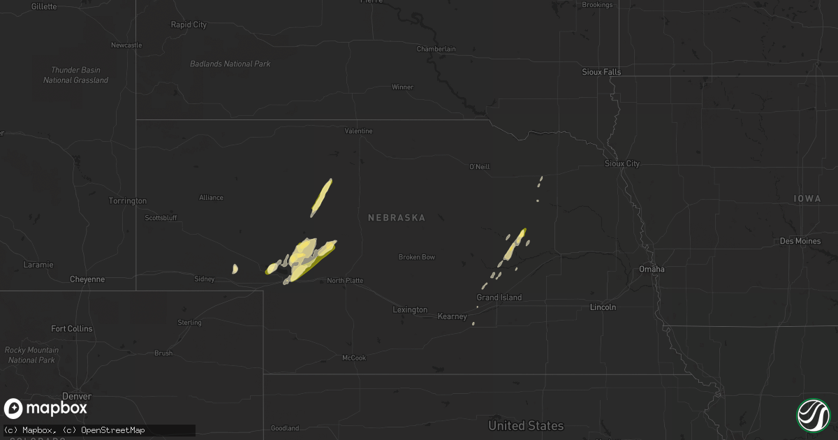
Hail Map in Nebraska on March 29, 2016
Get this storm
March 29 map
$229
one time, instant access
Download today. No call, no setup
Keep the $229
Bought the map and want the full workflow? Apply the entire $229 to a subscription within 7 days. None of it is wasted.
Every map, not just this one
This buys you this map. Subscription and you get every map we run, in the markets you choose from a few cities to whole states to nationwide. Plus real-time alerts the moment a storm fires.
Contact data
Name, contact info, occupancy, even credit band for addresses in the footprint. You go from where it hit to who to call.
Become the source they trust
Unlimited branding weather history reports on demand. You already have the documented answer ready for the property owner, and you are the one who showed up with it.
Property data and RoofTrace estimates
Pull up any address you have got, its value and the exact code rules for that jurisdiction, straight from One Click Code. Then RoofTrace estimates the squares, pitch, and roof value, priced the way you price.
Storm reports in Nebraska
Nebraska
| Date | Description |
|---|---|
| 03/29/201611:48 AM CDT | Hail nearly covered the ground. Had to send out a snow plow to clear the highway. |
| 03/28/20169:05 PM CDT | A local report indicates 1.00 inch wind near 9 ENE ROSCOE |
| 03/28/20168:58 PM CDT | Quarter size hail and 50 mph wind gusts |
| 03/28/20168:04 PM CDT | A local report indicates 1.00 inch wind near 11 N MULLEN |
| 03/28/20168:00 PM CDT | Hail covering the ground |
| 03/28/20167:58 PM CDT | A local report indicates 1.00 inch wind near 6 NW MULLEN |
| 03/28/20167:45 PM CDT | Dime to quarter size hail along hwy 2 mm 178. Time estimated by radar |
| 03/28/20167:20 PM CDT | A local report indicates 1.00 inch wind near 6 WSW LEMOYNE |
All States Impacted by Hail Map on March 29, 2016
Cities Impacted by Hail Map on March 29, 2016
- Keystone, NE
- Lumberton, MS
- Poplarville, MS
- Winter Haven, FL
- Englewood, FL
- Saint Paul, NE
- Palmer, NE
- Cedar Rapids, NE
- Belgrade, NE
- Wolbach, NE
- Perkinston, MS
- Kenansville, FL
- Saint Cloud, FL
- Saint Edward, NE
- Albion, NE
- Paxton, NE
- Ogallala, NE
- Clewiston, FL
- Arthur, NE
- Tryon, NE
- Sutherland, NE
- Labelle, FL
- Lemoyne, NE
- Cairo, NE
- Dannebrog, NE
- Homestead, FL
- Mamou, LA
- Oshkosh, NE
- Brule, NE
- Mullen, NE
- Valentine, NE
- Central City, NE
- Boca Raton, FL
- Kenesaw, NE
- Heartwell, NE
- Lake Wales, FL
- Fort Myers, FL
- Franklinton, LA
- Bogalusa, LA
- Moore Haven, FL
- Osmond, NE
- Pierce, NE
- Delray Beach, FL
- Miami, FL
- Sarasota, FL
- Okeechobee, FL
- Boca Grande, FL
- Lewellen, NE
- Meadow Grove, NE
- Primrose, NE
- Hammond, LA
- Robert, LA
- Loranger, LA
- Carriere, MS
- Wood River, NE
- Minden, NE
- Big Springs, NE
- Folsom, LA


