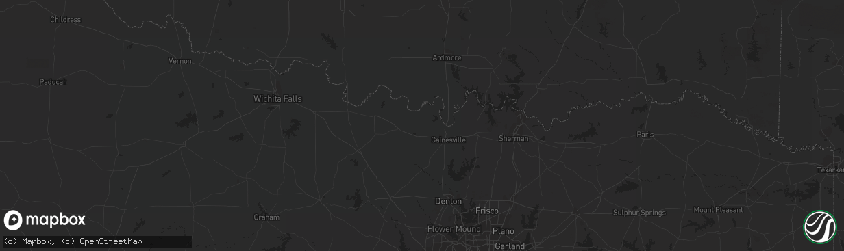
Hail Map in Woodward, OK on March 29, 2012
The weather event in Woodward, OK on March 29, 2012 includes Hail map. 8 states and 287 cities were impacted and suffered possible damage. The total estimated number of properties impacted is 0.
Hail
0
Estimated number of impacted properties by a 1.00" hail or larger13,680
Estimated number of impacted properties by a 1.75" hail or larger0
Estimated number of impacted properties by a 2.50" hail or largerStorm reports in Woodward, OK
Woodward, OK
| Date | Description |
|---|---|
| 03/28/20127:35 PM CDT | A local report indicates 1.75 inch wind near WOODWARD |
| 03/28/20127:28 PM CDT | The report was reported over the west side of woodward. Relayed via social media. |
| 03/28/20127:25 PM CDT | A local report indicates 1.00 inch wind near WOODWARD |
| 03/28/20127:24 PM CDT | A local report indicates 1.00 inch wind near 1 N WOODWARD |
All States Impacted by Hail Map on March 29, 2012
All Cities Impacted by Hail Map on March 29, 2012
- Caldwell, TX
- Arnett, OK
- Shattuck, OK
- Lipscomb, TX
- Canadian, TX
- Follett, TX
- Higgins, TX
- Bolckow, MO
- Barnard, MO
- Imogene, IA
- Cook, NE
- Sidney, IA
- Talmage, NE
- Farragut, IA
- Shenandoah, IA
- Percival, IA
- Hamburg, IA
- Nebraska City, NE
- Thurman, IA
- Essex, IA
- Riverton, IA
- Rock Port, MO
- Laredo, TX
- Encino, TX
- Hargill, TX
- Edinburg, TX
- Sharon, OK
- Fargo, OK
- Mooreland, OK
- Gage, OK
- Fort Supply, OK
- Woodward, OK
- Fairview, OK
- Lamoni, IA
- Davis City, IA
- Maysville, MO
- Louise, TX
- Midfield, TX
- Ganado, TX
- Blessing, TX
- Lolita, TX
- Cedar Rapids, NE
- Saint Edward, NE
- Gravity, IA
- Bedford, IA
- New Market, IA
- Gause, TX
- Jansen, NE
- Fairbury, NE
- Hebbronville, TX
- Cheyenne, OK
- Crawford, OK
- Durham, OK
- Table Rock, NE
- Auburn, NE
- Humboldt, NE
- Big Lake, TX
- Mission, TX
- Mcallen, TX
- Pharr, TX
- Linn, TX
- Wichita, KS
- Kechi, KS
- Maize, KS
- Nehawka, NE
- Union, NE
- Avoca, NE
- Otoe, NE
- Carson, IA
- Palacios, TX
- Brownville, NE
- Peru, NE
- Watson, MO
- Rio Grande City, TX
- Garciasville, TX
- Fairfax, MO
- Dawson, NE
- Nemaha, NE
- Verdon, NE
- Falls City, NE
- Shubert, NE
- Stella, NE
- Robstown, TX
- Corpus Christi, TX
- Roma, TX
- Macedonia, IA
- Elmo, MO
- Clearmont, MO
- Santa Elena, TX
- Bruni, TX
- Mirando City, TX
- Goddard, KS
- Garden Plain, KS
- Mount Ayr, IA
- Plattsmouth, NE
- Valley Center, KS
- Barnhart, TX
- Mertzon, TX
- Ames, OK
- Meno, OK
- Isabella, OK
- Ringwood, OK
- Hancock, IA
- Walnut, IA
- Oakland, IA
- Grulla, TX
- Armstrong, TX
- Breckenridge, MO
- Malvern, IA
- Cainsville, MO
- San Perlita, TX
- Port Mansfield, TX
- San Angelo, TX
- Somerville, TX
- Clarinda, IA
- Coin, IA
- Penitas, TX
- La Joya, TX
- Atlantic, IA
- Brayton, IA
- Lineville, IA
- Mercer, MO
- Belgrade, NE
- Hastings, IA
- Shambaugh, IA
- Sheridan, MO
- Braddyville, IA
- Redding, IA
- Hatfield, MO
- Kellerton, IA
- Burlington Junction, MO
- College Springs, IA
- Westboro, MO
- Blockton, IA
- Hopkins, MO
- Grant City, MO
- Tarkio, MO
- Sinton, TX
- Mathis, TX
- Pleasantville, IA
- Swan, IA
- Frederick, SD
- Westport, SD
- Beeville, TX
- Jamesport, MO
- Eureka, SD
- Bennet, NE
- Eagle, NE
- Walton, NE
- Palmyra, NE
- Unadilla, NE
- Gallatin, MO
- Altamont, MO
- Salem, NE
- Skidmore, MO
- Chester, OK
- Long Lake, SD
- Ashley, ND
- Chillicothe, MO
- Winston, MO
- Weatherby, MO
- Bentley, KS
- Towanda, KS
- Benton, KS
- Augusta, KS
- Greenwich, KS
- Andover, KS
- Colwich, KS
- Sedgwick, KS
- El Dorado, KS
- Red Oak, IA
- Emerson, IA
- King City, MO
- Helena, MO
- Union Star, MO
- Cameron, MO
- Amity, MO
- Anita, IA
- Craig, MO
- Pattonsburg, MO
- Lewis, IA
- Kidder, MO
- Hamilton, MO
- Griswold, IA
- Elliott, IA
- Grant, IA
- Cumberland, IA
- Villisca, IA
- Lamont, IA
- Diagonal, IA
- San Juan, TX
- Donna, TX
- Massena, IA
- Randolph, IA
- Tabor, IA
- Independence, IA
- Alvo, NE
- Lincoln, NE
- Murdock, NE
- Elmwood, NE
- Weeping Water, NE
- Silver City, IA
- Council Bluffs, IA
- Pacific Junction, IA
- Bellevue, NE
- Mineola, IA
- Stanton, IA
- Papillion, NE
- Henderson, IA
- Glenwood, IA
- Treynor, IA
- Edcouch, TX
- Delmita, TX
- Elsa, TX
- San Isidro, TX
- Hidalgo, TX
- Raymondville, TX
- Alamo, TX
- Weslaco, TX
- Waukee, IA
- Halstead, KS
- Burrton, KS
- Union, IA
- Mooresville, MO
- Stanberry, MO
- Ludlow, MO
- Guilford, MO
- Darlington, MO
- Rea, MO
- Altoona, IA
- Leedey, OK
- Odem, TX
- Greenfield, IA
- Mount Hope, KS
- Rose Hill, KS
- Viola, KS
- Leon, KS
- Eagleville, MO
- Plattsburg, MO
- Louisville, NE
- Blythedale, MO
- Durham, KS
- Moundridge, KS
- Alexandria, NE
- Bay City, TX
- Lock Springs, MO
- Leola, SD
- Syracuse, NE
- Brock, NE
- Corning, IA
- Fredonia, ND
- Ackworth, IA
- Milo, IA
- Mercedes, TX
- Freeport, TX
- Yorktown, IA
- Blanchard, IA
- Pickering, MO
- Benton, IA
- Johnson, NE
- Zapata, TX
- San Ygnacio, TX
- Muscatine, IA
- Dunbar, NE
- Murray, NE
- Sterling, NE
- Clive, IA
- West Des Moines, IA
- Urbandale, IA
- Okeene, OK
- Ankeny, IA
- Des Moines, IA
- Barnard, SD
- Johnston, IA
- Lathrop, MO
- Hillsboro, KS
- Winterset, IA
- Bridgewater, IA
- Clearfield, IA
- Indianola, IA
- Strawberry Point, IA
- Elkader, IA
- McFall, MO
- Runnells, IA
- Prairie City, IA
- Monroe, IA
- Volga, IA


