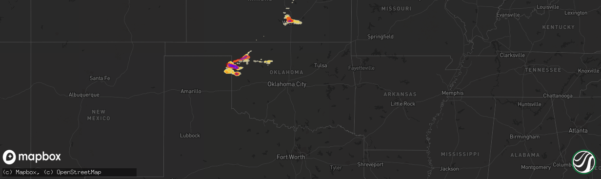
Hail Map on March 29, 2012
The weather event on March 29, 2012 includes Hail map. 8 states and 287 cities were impacted and suffered possible damage. The total estimated number of properties impacted is 0.
Want more than just the map?
Turn this storm into a full workflow.
- Owner + property data so you know who to knock
- OnDemand branded weather history reports to win the "did we even have hail?" argument
- RoofTrace estimate so reps stop guessing numbers at the door
Bought this map? Upgrade within 7 days and we'll credit the $230. (10-15 min setup call)
Hail
0
Estimated number of impacted properties by a 1.00" hail or larger119,366
Estimated number of impacted properties by a 1.75" hail or larger61,920
Estimated number of impacted properties by a 2.50" hail or largerStates Impacted by Hail Map on March 29, 2012
Storm reports
Texas
| Date | Description |
|---|---|
| 03/29/20126:29 PM CDT | Spotter reported quarter size hail ne of beeville. |
| 03/29/20126:22 PM CDT | Several hail reports ranging from pea to quarter size reported in beeville. |
| 03/29/20125:13 PM CDT | Telephone pole snapped at cr79 and old robstown road. Nickel size hail also reported. Corr for lat/long. |
| 03/29/20125:13 PM CDT | Telephone pole snapped at cr79 and old robstown road. Nickel size hail also reported. |
| 03/29/20125:12 PM CDT | Reported just west of robstown. |
| 03/29/20125:10 PM CDT | Reported just west of fairgrounds. |
| 03/29/20125:02 PM CDT | 50 to 60 mph winds approx 8 miles west of robstown at hwy 44 and cr83. Possible microburt a few miles to the south. Dust curl noted in field. Time is approx. |
| 03/29/20125:02 PM CDT | 50 to 60 mph winds approx 8 miles west of robstown at hwy 44 and cr83. Possible microburt a few miles to the south. Dust curl noted in field. Time is approx. Updated fo |
| 03/29/20125:02 PM CDT | Reported at intersection of highway 44 and 77. |
| 03/29/20124:35 PM CDT | Nws employee observed microburst just east of highway 77. |
| 03/29/20124:23 PM CDT | Reported from stripes convenience store. Corr for lat/long. |
| 03/28/201210:50 PM CDT | A local report indicates 1.00 inch wind near 2 N LAKE MARVIN |
| 03/28/201210:40 PM CDT | A local report indicates 1.75 inch wind near LAKE MARVIN |
| 03/28/201210:31 PM CDT | A local report indicates 1.00 inch wind near 2 N LAKE MARVIN |
| 03/28/201210:00 PM CDT | Public reported that baseball size hail occurred in mcallen at the corner of harvey and 16th street at around 10 pm at calvary baptist church. 10 vehicles severely dama |
| 03/28/201210:00 PM CDT | Public reported large hail and sheet metal flying. Strong winds tornado warning in effect. |
| 03/28/20129:49 PM CDT | 6 inch deep hail up to quarter size at nolana and ware rd. Broken windows |
| 03/28/20129:47 PM CDT | Small town of el manana reported quarter size hail |
| 03/28/20129:40 PM CDT | Southeast part of town at intersection of highways 359 and 20. Updated for lat/long. |
| 03/28/20129:40 PM CDT | Southeast part of town at intersection of highways 359 and 20 |
| 03/28/20129:29 PM CDT | Quarter size hail near doctors hospital. Street flooding observerd. |
| 03/28/20129:24 PM CDT | Several windows in apartment broken hail piling up to 6 inches. |
| 03/28/20129:23 PM CDT | At lindenwood and del mar. Updated for lat/long. |
| 03/28/20129:23 PM CDT | At lindenwood and del mar |
| 03/28/20129:20 PM CDT | Public reported golf ball size hail at fairway and bryan. Winds blowing parts of roofs off. |
| 03/28/20129:20 PM CDT | Windows broken with quarter size hail. |
| 03/28/20129:19 PM CDT | Hail up to one inch deep covering the ground. |
| 03/28/20129:17 PM CDT | Near del mar blvd and interstate 35 |
| 03/28/20129:17 PM CDT | Near del mar blvd and interstate 35. Updated for lat/long. |
| 03/28/20129:05 PM CDT | Skywarn district 3 s shary road golfball size hail and 40 mph wind with higher gusts. Large tree branches down. |
| 03/28/20129:04 PM CDT | Mcallen miller airport asos peak wind gusts at minimal hurricane force |
| 03/28/20129:03 PM CDT | General public reported hail quarter to half dollar size at la homa rd monte christo |
| 03/28/20129:00 PM CDT | Public reported quarter size hail some possibly larger. |
| 03/28/20129:00 PM CDT | A local report indicates 2.00 inch wind near HIGGINS |
| 03/28/20128:58 PM CDT | Reported golfball size a few possible larger. |
| 03/28/20128:55 PM CDT | A local report indicates 1.50 inch wind near HIGGINS |
| 03/28/20128:45 PM CDT | Relayed report from krgv channel 5... Two reports of golfball size hail near edinburg. 1 mile north of hwy 107 and deco rd 835-845pm and 107 and ware at 850 pm |
| 03/28/20128:35 PM CDT | Ellis county oklahoma emergency manager report relayed via nws norman. |
| 03/28/20128:30 PM CDT | Via facebook report. Hail was covering the ground. Neighbor had a broken window. |
| 03/28/20128:27 PM CDT | A local report indicates 1.75 inch wind near 5 N HIGGINS |
| 03/28/20127:25 PM CDT | Hidalgo s.o. Relayed report of 1.5 inch hail 12w of san isidro from general public. |
Oklahoma
| Date | Description |
|---|---|
| 03/29/201212:23 AM CDT | A local report indicates 1.50 inch wind near 1 NNW ROLL |
| 03/29/201212:20 AM CDT | Time estimated based on radar |
| 03/29/201212:15 AM CDT | A local report indicates 4.00 inch wind near 3 N ROLL |
| 03/28/20129:45 PM CDT | A local report indicates 1.00 inch wind near ARNETT |
| 03/28/20129:40 PM CDT | A local report indicates 2.75 inch wind near 6 SW ARNETT |
| 03/28/20128:35 PM CDT | A local report indicates 1.75 inch wind near S SHATTUCK |
| 03/28/20127:52 PM CDT | A local report indicates 1.00 inch wind near GAGE |
| 03/28/20127:35 PM CDT | A local report indicates 1.75 inch wind near WOODWARD |
| 03/28/20127:28 PM CDT | The report was reported over the west side of woodward. Relayed via social media. |
| 03/28/20127:25 PM CDT | A local report indicates 1.00 inch wind near WOODWARD |
| 03/28/20127:24 PM CDT | A local report indicates 1.00 inch wind near 1 N WOODWARD |
Iowa
| Date | Description |
|---|---|
| 03/28/20129:53 PM CDT | On interstate 80. |
| 03/28/20129:17 PM CDT | A local report indicates 1.00 inch wind near SIDNEY |
| 03/28/20128:42 PM CDT | A local report indicates 1.00 inch wind near 1 N BRADDYVILLE |
| 03/28/20128:13 PM CDT | A local report indicates 1.00 inch wind near 5 NE EMERSON |
| 03/28/20128:10 PM CDT | A local report indicates 1.00 inch wind near 3 S GRISWOLD |
| 03/28/20127:54 PM CDT | A local report indicates 1.75 inch wind near 4 NE GRISWOLD |
Nebraska
| Date | Description |
|---|---|
| 03/29/20126:57 PM CDT | A local report indicates 1.00 inch wind near 1 S PLATTSMOUTH |
| 03/29/20126:52 PM CDT | A local report indicates 2.00 inch wind near 5 ESE AUBURN |
| 03/29/20126:44 PM CDT | A local report indicates 1.75 inch wind near 2 NNE TALMAGE |
| 03/29/20126:41 PM CDT | A local report indicates 1.00 inch wind near 11 SW NEBRASKA CITY |
| 03/29/20126:22 PM CDT | A local report indicates 1.75 inch wind near 3 E COOK |
| 03/29/20126:10 PM CDT | Pea to quarter size hail |
| 03/29/20126:10 PM CDT | A local report indicates 1.00 inch wind near 6 N TECUMSEH |
| 03/28/20129:07 PM CDT | A local report indicates 1.25 inch wind near 2 SSE UNION |
| 03/28/20128:09 PM CDT | A local report indicates 1.75 inch wind near 1 N PALMYRA |
| 03/28/20128:00 PM CDT | A local report indicates 2.50 inch wind near 4 E HUMBOLDT |
| 03/28/20127:59 PM CDT | A local report indicates 1.00 inch wind near 2 S HUMBOLDT |
| 03/28/20127:53 PM CDT | A local report indicates 1.00 inch wind near BENNET |
| 03/28/20127:48 PM CDT | A local report indicates 1.00 inch wind near JANSEN |
| 03/28/20127:18 PM CDT | A local report indicates 1.00 inch wind near 4 S ALVO |
| 03/28/20127:08 PM CDT | A local report indicates 1.00 inch wind near PERU |
| 03/28/20127:00 PM CDT | Hail fell for 10 mins pea to half dollar size |
Kansas
| Date | Description |
|---|---|
| 03/29/20126:06 PM CDT | Relayed through nssl shave project |
| 03/28/201210:01 PM CDT | A local report indicates 58 MPH wind near JABARA AIRPORT |
| 03/28/20129:56 PM CDT | A local report indicates 1.00 inch wind near AUGUSTA |
| 03/28/20129:00 PM CDT | Hail ranging from one inch to tennis ball near 34th and amidon |
| 03/28/20128:49 PM CDT | Spotter reports that hail was covering the road. |
| 03/28/20128:46 PM CDT | Half dollar to golf ball sized hail reported at 37th and broadway in wichita |
| 03/28/20128:45 PM CDT | A local report indicates 1.00 inch wind near 2 N DOWNTOWN WICHITA |
| 03/28/20128:35 PM CDT | Hail covering the ground at 29th n and ridge ranging in size from marbles to golf balls |
| 03/28/20128:25 PM CDT | 12 minutes of hail ranging from dime size to a few jagged pieces to 1 inch |
| 03/28/20128:22 PM CDT | Reported at 29th n and ridge road |
| 03/28/20128:14 PM CDT | A local report indicates 1.00 inch wind near 2 SSE MAIZE |
| 03/28/20128:14 PM CDT | A local report indicates 1.00 inch wind near 2 N WEST WICHITA |
| 03/28/20128:14 PM CDT | A local report indicates 1.25 inch wind near PARK CITY |
| 03/28/20128:14 PM CDT | Hail ranging in size from 3/8 to 1 inch |
| 03/28/20128:08 PM CDT | A local report indicates 1.00 inch wind near 2 E MAIZE |
| 03/28/20128:08 PM CDT | A local report indicates 1.00 inch wind near PARK CITY |
| 03/28/20127:53 PM CDT | A local report indicates 1.00 inch wind near 1 N MAIZE |
| 03/28/20127:51 PM CDT | A local report indicates 1.00 inch wind near 1 NE VALLEY CENTER |
| 03/28/20127:42 PM CDT | A local report indicates 1.50 inch wind near 2 N COLWICH |
| 03/28/20127:37 PM CDT | A local report indicates 1.00 inch wind near 4 N MAIZE |
| 03/28/20127:35 PM CDT | Relayed through spotternetwork.org |
| 03/28/20127:23 PM CDT | Relayed through spotternetwork.org |
| 03/28/20127:22 PM CDT | Relayed through the spotter network |
Tennessee
| Date | Description |
|---|---|
| 03/29/20123:45 PM CDT | Couple trees down on callahan road and airbase road in the louisville area. |
| 03/29/20123:17 PM CDT | A local report indicates 1.00 inch wind near MARYVILLE |
Missouri
| Date | Description |
|---|---|
| 03/29/201212:30 PM CDT | A local report indicates 1.00 inch wind near GALLATIN |
| 03/29/201212:15 PM CDT | Hail fell at lake viking |
| 03/28/20128:59 PM CDT | A local report indicates 1.75 inch wind near 3 W CLEARMONT |
| 03/28/20128:51 PM CDT | A local report indicates 60 MPH wind near CLEARMONT |
| 03/28/20128:48 PM CDT | Dawsonville...aprox 3 miles northwest burlington junction ping pong to golf ball size hail |
| 03/28/20128:43 PM CDT | A local report indicates 1.00 inch wind near ELMO |
| 03/28/20128:42 PM CDT | A local report indicates 1.25 inch wind near 3 N CLEARMONT |
| 03/28/20128:28 PM CDT | A local report indicates 1.75 inch wind near 2 S WESTBORO |
| 03/28/20128:04 PM CDT | A local report indicates 1.50 inch wind near WESTBORO |
| 03/28/20127:35 PM CDT | Pea size to quarter sized hail falling. |
| 03/28/20127:33 PM CDT | A local report indicates 1.75 inch wind near TARKIO |
| 03/28/20127:21 PM CDT | 5 miles south of iowa border/5 miles east of missouri river. Pea sized to quarter sized hail. |
| 03/28/20127:19 PM CDT | A local report indicates 1.00 inch wind near ROCKPORT |
| 03/28/20127:08 PM CDT | A local report indicates 1.50 inch wind near 1 E PHELPS CITY |
North Dakota
| Date | Description |
|---|---|
| 03/29/20127:45 AM CDT | Hail covering the ground |
Cities Impacted by Hail Map on March 29, 2012
- Caldwell, TX
- Arnett, OK
- Shattuck, OK
- Lipscomb, TX
- Canadian, TX
- Follett, TX
- Higgins, TX
- Bolckow, MO
- Barnard, MO
- Imogene, IA
- Cook, NE
- Sidney, IA
- Talmage, NE
- Farragut, IA
- Shenandoah, IA
- Percival, IA
- Hamburg, IA
- Nebraska City, NE
- Thurman, IA
- Essex, IA
- Riverton, IA
- Rock Port, MO
- Laredo, TX
- Encino, TX
- Hargill, TX
- Edinburg, TX
- Sharon, OK
- Fargo, OK
- Mooreland, OK
- Gage, OK
- Fort Supply, OK
- Woodward, OK
- Fairview, OK
- Lamoni, IA
- Davis City, IA
- Maysville, MO
- Louise, TX
- Midfield, TX
- Ganado, TX
- Blessing, TX
- Lolita, TX
- Cedar Rapids, NE
- Saint Edward, NE
- Gravity, IA
- Bedford, IA
- New Market, IA
- Gause, TX
- Jansen, NE
- Fairbury, NE
- Hebbronville, TX
- Cheyenne, OK
- Crawford, OK
- Durham, OK
- Table Rock, NE
- Auburn, NE
- Humboldt, NE
- Big Lake, TX
- Mission, TX
- Mcallen, TX
- Pharr, TX
- Linn, TX
- Wichita, KS
- Kechi, KS
- Maize, KS
- Nehawka, NE
- Union, NE
- Avoca, NE
- Otoe, NE
- Carson, IA
- Palacios, TX
- Brownville, NE
- Peru, NE
- Watson, MO
- Rio Grande City, TX
- Garciasville, TX
- Fairfax, MO
- Dawson, NE
- Nemaha, NE
- Verdon, NE
- Falls City, NE
- Shubert, NE
- Stella, NE
- Robstown, TX
- Corpus Christi, TX
- Roma, TX
- Macedonia, IA
- Elmo, MO
- Clearmont, MO
- Santa Elena, TX
- Bruni, TX
- Mirando City, TX
- Goddard, KS
- Garden Plain, KS
- Mount Ayr, IA
- Plattsmouth, NE
- Valley Center, KS
- Barnhart, TX
- Mertzon, TX
- Ames, OK
- Meno, OK
- Isabella, OK
- Ringwood, OK
- Hancock, IA
- Walnut, IA
- Oakland, IA
- Grulla, TX
- Armstrong, TX
- Breckenridge, MO
- Malvern, IA
- Cainsville, MO
- San Perlita, TX
- Port Mansfield, TX
- San Angelo, TX
- Somerville, TX
- Clarinda, IA
- Coin, IA
- Penitas, TX
- La Joya, TX
- Atlantic, IA
- Brayton, IA
- Lineville, IA
- Mercer, MO
- Belgrade, NE
- Hastings, IA
- Shambaugh, IA
- Sheridan, MO
- Braddyville, IA
- Redding, IA
- Hatfield, MO
- Kellerton, IA
- Burlington Junction, MO
- College Springs, IA
- Westboro, MO
- Blockton, IA
- Hopkins, MO
- Grant City, MO
- Tarkio, MO
- Sinton, TX
- Mathis, TX
- Pleasantville, IA
- Swan, IA
- Frederick, SD
- Westport, SD
- Beeville, TX
- Jamesport, MO
- Eureka, SD
- Bennet, NE
- Eagle, NE
- Walton, NE
- Palmyra, NE
- Unadilla, NE
- Gallatin, MO
- Altamont, MO
- Salem, NE
- Skidmore, MO
- Chester, OK
- Long Lake, SD
- Ashley, ND
- Chillicothe, MO
- Winston, MO
- Weatherby, MO
- Bentley, KS
- Towanda, KS
- Benton, KS
- Augusta, KS
- Greenwich, KS
- Andover, KS
- Colwich, KS
- Sedgwick, KS
- El Dorado, KS
- Red Oak, IA
- Emerson, IA
- King City, MO
- Helena, MO
- Union Star, MO
- Cameron, MO
- Amity, MO
- Anita, IA
- Craig, MO
- Pattonsburg, MO
- Lewis, IA
- Kidder, MO
- Hamilton, MO
- Griswold, IA
- Elliott, IA
- Grant, IA
- Cumberland, IA
- Villisca, IA
- Lamont, IA
- Diagonal, IA
- San Juan, TX
- Donna, TX
- Massena, IA
- Randolph, IA
- Tabor, IA
- Independence, IA
- Alvo, NE
- Lincoln, NE
- Murdock, NE
- Elmwood, NE
- Weeping Water, NE
- Silver City, IA
- Council Bluffs, IA
- Pacific Junction, IA
- Bellevue, NE
- Mineola, IA
- Stanton, IA
- Papillion, NE
- Henderson, IA
- Glenwood, IA
- Treynor, IA
- Edcouch, TX
- Delmita, TX
- Elsa, TX
- San Isidro, TX
- Hidalgo, TX
- Raymondville, TX
- Alamo, TX
- Weslaco, TX
- Waukee, IA
- Halstead, KS
- Burrton, KS
- Union, IA
- Mooresville, MO
- Stanberry, MO
- Ludlow, MO
- Guilford, MO
- Darlington, MO
- Rea, MO
- Altoona, IA
- Leedey, OK
- Odem, TX
- Greenfield, IA
- Mount Hope, KS
- Rose Hill, KS
- Viola, KS
- Leon, KS
- Eagleville, MO
- Plattsburg, MO
- Louisville, NE
- Blythedale, MO
- Durham, KS
- Moundridge, KS
- Alexandria, NE
- Bay City, TX
- Lock Springs, MO
- Leola, SD
- Syracuse, NE
- Brock, NE
- Corning, IA
- Fredonia, ND
- Ackworth, IA
- Milo, IA
- Mercedes, TX
- Freeport, TX
- Yorktown, IA
- Blanchard, IA
- Pickering, MO
- Benton, IA
- Johnson, NE
- Zapata, TX
- San Ygnacio, TX
- Muscatine, IA
- Dunbar, NE
- Murray, NE
- Sterling, NE
- Clive, IA
- West Des Moines, IA
- Urbandale, IA
- Okeene, OK
- Ankeny, IA
- Des Moines, IA
- Barnard, SD
- Johnston, IA
- Lathrop, MO
- Hillsboro, KS
- Winterset, IA
- Bridgewater, IA
- Clearfield, IA
- Indianola, IA
- Strawberry Point, IA
- Elkader, IA
- McFall, MO
- Runnells, IA
- Prairie City, IA
- Monroe, IA
- Volga, IA