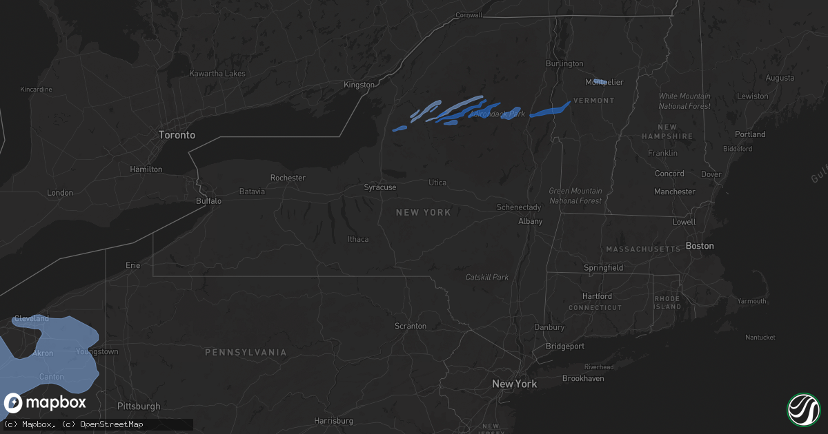
Hail Map in New York on March 26, 2021
Get this storm
March 26 map
$229
one time, instant access
Download today. No call, no setup
Keep the $229
Bought the map and want the full workflow? Apply the entire $229 to a subscription within 7 days. None of it is wasted.
Every map, not just this one
This buys you this map. Subscription and you get every map we run, in the markets you choose from a few cities to whole states to nationwide. Plus real-time alerts the moment a storm fires.
Contact data
Name, contact info, occupancy, even credit band for addresses in the footprint. You go from where it hit to who to call.
Become the source they trust
Unlimited branding weather history reports on demand. You already have the documented answer ready for the property owner, and you are the one who showed up with it.
Property data and RoofTrace estimates
Pull up any address you have got, its value and the exact code rules for that jurisdiction, straight from One Click Code. Then RoofTrace estimates the squares, pitch, and roof value, priced the way you price.
Storm reports in New York
New York
| Date | Description |
|---|---|
| 03/26/202112:20 PM CDT | Reports of a lot of trees down between schroon lake... Crown point and ticoderoga. |
| 03/26/202112:14 PM CDT | Tree down on powerlines on river road just off of route 74. |
| 03/26/202111:24 AM CDT | Tree damage with large branches along ludlowville rd. |
| 03/26/202111:16 AM CDT | Numerous trees uprooted and wires downed along route 30 in long lake |
| 03/26/202111:14 AM CDT | Trees downed |
| 03/26/202111:02 AM CDT | Trees and wires down on white hill road |
| 03/26/202110:17 AM CDT | Numerous trees and powerlines down in croghan. |
| 03/26/202110:10 AM CDT | Numerous trees blown down and damage to a shed and barn on cr 33 and naumburg rd. |
| 03/26/202110:08 AM CDT | Damage to a house on route 26. |
| 03/26/20217:16 AM CDT | At 1216 PM EDT, a line of severe thunderstorms were located along a line extending from near Wawbeek to near Lake Eaton Campground to 6 miles west of Lewey Lake Campground to 12 miles south of Limekiln Lake Campground to near Ohio, moving east at 40 mph. HAZARD...60 mph wind gusts. SOURCE...Radar indicated. IMPACT...Expect damage to roofs, siding, and trees. Locations impacted include... Indian Lake, Speculator, Ohio, Lake Pleasant, Wells, Blue Mountain Lake, Lake Eaton Campground, Lake Durant Campground, Lewey Lake Campground, North Creek, Moffitt Beach Campground, Russia, Long Lake, Eagle Nest, Gilmantown, Nobleboro, Perkins Clearing, Clockmill Corners, Edwards Hill and Blackbridge. |
| 03/26/20217:13 AM CDT | At 1213 PM EDT, severe thunderstorms were located along a line extending from near Stark to near Childwold to Piercefield to 11 miles southeast of Horseshoe Lake to 24 miles west of Vanderwhacker Mountain, moving northeast at 50 mph. HAZARD...60 mph wind gusts. SOURCE...Radar indicated. IMPACT...Expect damage to trees and powerlines. Locations impacted include... Tupper Lake, Adirondack Regional Airport, Saranac Lake, Lake Placid, Wilmington, Keene, Minerva, Newcomb, Piercefield, Bryants Mill, Wawbeek, Schroon Lake, Lyon Mountain, Clayburg, Merrill, Carry Falls Reservoir, Keene Valley, Au Sable Forks, Debar Mountain and Mount Marcy. |
| 03/26/20216:30 AM CDT | At 1129 AM EDT, severe thunderstorms were located along a line extending from Fowler to 10 miles south of Aldrich to 21 miles south of Star Lake to 32 miles southwest of Wanakena, moving east at 45 mph. HAZARD...60 mph wind gusts. SOURCE...Radar indicated. IMPACT...Expect damage to trees and powerlines. Locations impacted include... Gouverneur, Tupper Lake, Oswegatchie, Fowler, Piercefield, Degrasse, Carry Falls Reservoir, Horseshoe Lake, Cranberry Lake, Star Lake, Fine, Pitcairn, Stark, Edwards, Conifer, Talcville, South Edwards, Gale, Newton Falls and Childwold. |
| 03/26/20216:29 AM CDT | At 1129 AM EDT, severe thunderstorms were located along a line extending from near Star Lake to near Boonville, moving east at 55 mph. HAZARD...60 mph wind gusts and nickel size hail. SOURCE...Radar indicated. IMPACT...Expect damage to roofs, siding, and trees. Locations impacted include... Speculator, Old Forge, Inlet, Blue Mountain Lake, Lake Eaton Campground, Brown Tract Pond Campground, Big Moose, Lake Durant Campground, Eighth Lake Campground, McKeever, Golden Beach Campground, Limekiln Lake Campground, Nicks Lake Campground, Eagle Bay, Forked Lake Public Campground, Raquette Lake, Alger Island Public Campground, Long Lake, Eagle Nest and Beaver River. |
| 03/26/20215:44 AM CDT | At 1044 AM EDT, severe thunderstorms were located along a line extending from near Barnes Corners to near Pulaski, moving east at 45 mph. HAZARD...60 mph wind gusts. SOURCE...Radar indicated. IMPACT...Expect damage to roofs, siding, and trees. Locations impacted include... Carthage, Lowville, West Carthage, Redfield, Highmarket, Barnes Corners, Whetstone Gulf State Park, Richland, Denmark and New Bremen. |
| 03/26/20212:47 AM CDT | At 746 AM EDT, severe thunderstorms were located along a line extending from near Lockport to Lancaster, moving northeast at 65 mph. HAZARD...60 mph wind gusts. SOURCE...Radar indicated. IMPACT...Expect damage to roofs, siding, and trees. Locations impacted include... Brockport, Medina, Albion, Hilton, Hamlin Beach State Park, Darien Lakes State Park, Pembroke, Oakfield, Akron, Alden and Middleport. This includes Interstate 90 near exit 48A. |
| 03/26/20212:15 AM CDT | At 714 AM EDT, severe thunderstorms were located along a line extending from 13 miles southwest of Grand Island to 8 miles northwest of Silver Creek, moving northeast at 70 mph. HAZARD...60 mph wind gusts. SOURCE...Radar indicated. IMPACT...Expect damage to roofs, siding, and trees. Locations impacted include... Buffalo, Cheektowaga, Niagara Falls, West Seneca, North Tonawanda, Clarence, Lockport, Lackawanna, Hamburg, Kenmore and Depew. This includes Interstate 90 between exits 57A and 49. |
All States Impacted by Hail Map on March 26, 2021
Cities Impacted by Hail Map on March 26, 2021
- Cedar Grove, TN
- Yuma, TN
- Campbell, NE
- Bladen, NE
- Sparta, TN
- Clifton, TN
- Kingston Springs, TN
- White Bluff, TN
- Saulsbury, TN
- Nashville, TN
- Centerville, TN
- Lobelville, TN
- Chattanooga, TN
- Whitwell, TN
- Signal Mountain, TN
- Tracy City, TN
- Ripley, MS
- Blue Mountain, MS
- Dumas, MS
- Charlotte, TN
- Buckhead, GA
- Eatonton, GA
- Stevenson, AL
- Hollywood, AL
- Scottsboro, AL
- Flat Rock, AL
- Stanton, TN
- Greensboro, GA
- Goodlettsville, TN
- Fackler, AL
- Hodges, SC
- Bon Aqua, TN
- Dickson, TN
- McDonald, TN
- Apison, TN
- Cleveland, TN
- Hohenwald, TN
- Laurens, SC
- Waterloo, SC
- Donalds, SC
- Abbeville, SC
- Due West, SC
- Ware Shoals, SC
- Moscow, TN
- McEwen, TN
- Madison, GA
- Collierville, TN
- Brentwood, TN
- Lexington, TN
- Washington, GA
- Memphis, TN
- Lebanon, TN
- Whiteville, TN
- Smithville, TN
- Antioch, TN
- Lyles, TN
- Franklin, TN
- Myrtle, MS
- Old Fort, TN
- Ocoee, TN
- Hurricane Mills, TN
- Linn, KS
- Palmer, KS
- Greenleaf, KS
- Rossville, TN
- Holladay, TN
- Sugar Tree, TN
- Parsons, TN
- Linden, TN
- Darden, TN
- Waverly, TN
- Enville, TN
- Reagan, TN
- Henderson, TN
- Medon, TN
- Germantown, TN
- Corinth, MS
- Walnut, MS
- Rienzi, MS
- Crawfordville, GA
- Rayle, GA
- Lincolnton, GA
- Chapmansboro, TN
- Ashland City, TN
- Fairview, TN
- Cumberland Furnace, TN
- Burns, TN
- Only, TN
- Nunnelly, TN
- Somerville, TN
- Crossville, TN
- Edgar, NE
- Primm Springs, TN
- Duck River, TN
- Tignall, GA
- Rossville, GA
- Fort Oglethorpe, GA
- Rock Island, TN
- Doyle, TN
- Quebeck, TN
- Byhalia, MS
- Olive Branch, MS
- Westport, TN
- Huntingdon, TN
- Buena Vista, TN
- Hermitage, TN
- La Grange, TN
- Grand Junction, TN
- New Albany, MS
- Sequatchie, TN
- Dunlap, TN
- Palmer, TN
- Spring City, TN
- Middleton, TN
- Oakland, TN
- Williston, TN
- Lake Cormorant, MS
- Walls, MS
- Pocahontas, TN
- Hornsby, TN
- Jasper, TN
- Crump, TN
- Adamsville, TN
- Savannah, TN
- Pinson, TN
- Robinsonville, MS
- Cordova, TN
- Horn Lake, MS
- Nesbit, MS
- Eads, TN
- Southaven, MS
- Hernando, MS
- Santa Fe, TN
- Liberty, TN
- Mount Juliet, TN
- Bath Springs, TN
- Stantonville, TN
- Selmer, TN
- Hickory Flat, MS
- Auburntown, TN
- Arapahoe, NE
- Wildwood, GA
- Rising Fawn, GA
- Ringgold, GA
- Ooltewah, TN
- Flintstone, GA
- Lookout Mountain, GA
- Trenton, GA
- Benton, TN
- Camden, TN
- Millington, TN
- Gallatin, TN
- Granville, TN
- Gainesboro, TN
- Bolivar, TN
- Springfield, TN
- Cross Plains, TN
- Luray, TN
- Huron, TN
- Beech Bluff, TN
- Summertown, TN
- Alexandria, TN
- Hickman, TN
- Lancaster, TN
- Pikeville, TN
- Hickory Valley, TN
- Wildersville, TN
- Sardis, TN
- Milledgeville, TN
- Holbrook, NE
- Cambridge, NE
- Holstein, NE
- Edison, NE
- Pleasant Shade, TN
- Dixon Springs, TN
- Riddleton, TN
- Carthage, TN
- Washington, KS
- Barnes, KS
- Mountville, SC
- Iva, SC
- Huntsville, OH
- Solon, OH
- Columbus, OH
- Danville, OH
- Mount Sterling, OH
- Twinsburg, OH
- West Liberty, OH
- Delaware, OH
- Doylestown, OH
- Sterling, OH
- South Charleston, OH
- Hiram, OH
- Bellville, OH
- Lima, OH
- Fairborn, OH
- Limaville, OH
- Paris, OH
- Mogadore, OH
- Carrollton, OH
- Washingtonville, OH
- Northfield, OH
- Richwood, OH
- Holmesville, OH
- Wooster, OH
- Brookpark, OH
- Westlake, OH
- East Sparta, OH
- Cardington, OH
- Wilmington, OH
- Marysville, OH
- Southington, OH
- Mechanicstown, OH
- Jeffersonville, OH
- Damascus, OH
- London, OH
- Vienna, OH
- Mineral Ridge, OH
- Middlebranch, OH
- Frazeysburg, OH
- Lakewood, OH
- New Waterford, OH
- Killbuck, OH
- Ashley, OH
- Creston, OH
- Aurora, OH
- Barberton, OH
- Fredericktown, OH
- Lake Milton, OH
- Homerville, OH
- Xenia, OH
- Lewis Center, OH
- Zanesfield, OH
- Maplewood, OH
- Macedonia, OH
- Washington Court House, OH
- Hartville, OH
- West Mansfield, OH
- Hayesville, OH
- Kensington, OH
- Tiro, OH
- Glenmont, OH
- New Hampshire, OH
- Seville, OH
- Granville, OH
- Lagrange, OH
- Avon Lake, OH
- Minerva, OH
- South Solon, OH
- Johnstown, OH
- Alliance, OH
- Waynesfield, OH
- Centerburg, OH
- Malvern, OH
- Shreve, OH
- Chardon, OH
- Springfield, OH
- Leetonia, OH
- Kent, OH
- Lodi, OH
- Medina, OH
- Garrettsville, OH
- Niles, OH
- Ridgeway, OH
- Sebring, OH
- Spring Valley, OH
- Raymond, OH
- Roundhead, OH
- Ostrander, OH
- Lakeview, OH
- Loudonville, OH
- Bellbrook, OH
- Salem, OH
- Russells Point, OH
- Waynesburg, OH
- Shelby, OH
- North Lewisburg, OH
- Wakeman, OH
- Berlin Heights, OH
- Newbury, OH
- Radnor, OH
- Tallmadge, OH
- Broadway, OH
- Utica, OH
- Mingo, OH
- Port William, OH
- Irwin, OH
- East Liberty, OH
- Galena, OH
- Kipton, OH
- Atwater, OH
- Alger, OH
- Cable, OH
- Grove City, OH
- Cedarville, OH
- Ashland, OH
- Homeworth, OH
- Galion, OH
- Millersburg, OH
- Mount Victory, OH
- Beloit, OH
- Bristolville, OH
- Bedford, OH
- Dayton, OH
- Edison, OH
- Croton, OH
- Rushsylvania, OH
- Cleveland, OH
- Urbana, OH
- Crestline, OH
- Wapakoneta, OH
- Ravenna, OH
- Fulton, OH
- Powell, OH
- Rocky River, OH
- Salineville, OH
- Butler, OH
- Bellefontaine, OH
- Smithville, OH
- Deerfield, OH
- Brewster, OH
- Sullivan, OH
- Uniontown, OH
- Woodstock, OH
- Newton Falls, OH
- Middlefield, OH
- North Olmsted, OH
- Chesterville, OH
- Youngstown, OH
- Leavittsburg, OH
- Summitville, OH
- Prospect, OH
- Independence, OH
- Akron, OH
- East Rochester, OH
- Columbiana, OH
- Stow, OH
- Green Camp, OH
- West Salem, OH
- Magnetic Springs, OH
- Miamisburg, OH
- Martinsburg, OH
- Big Prairie, OH
- Nova, OH
- North Bloomfield, OH
- North Jackson, OH
- Rogers, OH
- Burton, OH
- Ada, OH
- Clinton, OH
- Westerville, OH
- Enon, OH
- Huntsburg, OH
- Wadsworth, OH
- North Canton, OH
- Brecksville, OH
- Warren, OH
- Morral, OH
- Norwalk, OH
- Mount Vernon, OH
- Novelty, OH
- Canfield, OH
- North Lawrence, OH
- Marengo, OH
- Windham, OH
- Chagrin Falls, OH
- Dublin, OH
- Plymouth, OH
- Olmsted Falls, OH
- Milford Center, OH
- Uniopolis, OH
- Beach City, OH
- Oberlin, OH
- Avon, OH
- Newark, OH
- Mechanicsburg, OH
- McGuffey, OH
- Caledonia, OH
- Marion, OH
- Coshocton, OH
- Canal Fulton, OH
- Amherst, OH
- Burbank, OH
- Walhonding, OH
- Diamond, OH
- Rootstown, OH
- Amlin, OH
- Kenton, OH
- Dalton, OH
- Massillon, OH
- Girard, OH
- West Farmington, OH
- Beachwood, OH
- Lucas, OH
- Collins, OH
- Gates Mills, OH
- Yellow Springs, OH
- Perrysville, OH
- Robertsville, OH
- Sabina, OH
- Hilliard, OH
- Jamestown, OH
- Fredericksburg, OH
- Alpha, OH
- Lakeville, OH
- De Graff, OH
- Shiloh, OH
- Howard, OH
- Cuyahoga Falls, OH
- Spencer, OH
- Lakemore, OH
- Jeromesville, OH
- Orrville, OH
- Apple Creek, OH
- Warsaw, OH
- Bay Village, OH
- Mount Gilead, OH
- Saint Louisville, OH
- Munroe Falls, OH
- Bucyrus, OH
- Hanoverton, OH
- Farmdale, OH
- Gambier, OH
- New London, OH
- North Lima, OH
- Rittman, OH
- Wilberforce, OH
- Marshallville, OH
- West Jefferson, OH
- New Bloomington, OH
- Sparta, OH
- North Benton, OH
- Hudson, OH
- Quincy, OH
- South Vienna, OH
- North Fairfield, OH
- Mount Eaton, OH
- Belle Center, OH
- Lewistown, OH
- Harrod, OH
- Greenwich, OH
- Mantua, OH
- Litchfield, OH
- East Canton, OH
- Richfield, OH
- Plain City, OH
- Catawba, OH
- Galloway, OH
- Fowler, OH
- Streetsboro, OH
- Alexandria, OH
- La Rue, OH
- Polk, OH
- Waldo, OH
- Mansfield, OH
- Louisville, OH
- Bloomingburg, OH
- Cortland, OH
- Dundee, OH
- Maple Heights, OH
- Canton, OH
- Jackson Center, OH
- Brinkhaven, OH
- Peninsula, OH
- Sunbury, OH
- Lisbon, OH
- Navarre, OH
- Wellington, OH
- Berlin Center, OH
- Lorraine, NY
- Lacona, NY
- Copenhagen, NY
- Lowville, NY
- Mannsville, NY
- Croghan, NY
- Carthage, NY
- Castorland, NY
- Long Lake, NY
- Eagle Bay, NY
- Piseco, NY
- Blue Mountain Lake, NY
- Schroon Lake, NY
- North Hudson, NY
- Minerva, NY
- Olmstedville, NY
- Newcomb, NY
- Ticonderoga, NY
- Bridport, VT
- Whiting, VT
- Crown Point, NY
- Paradox, NY
- Shoreham, VT
- Middlebury, VT
- Moretown, VT
- Montpelier, VT
- McCormick, SC


