Hail Map on March 23, 2012
Get this storm
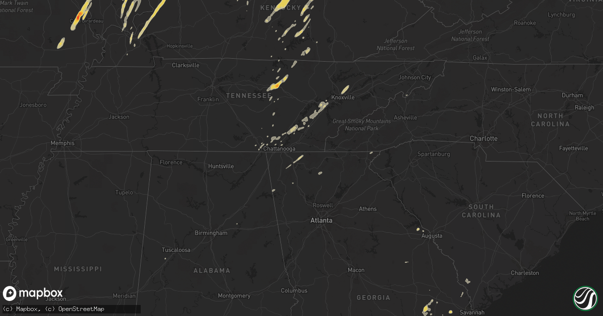
March 23 map
$229
one time, instant access
Download today. No call, no setup
Keep the $229
Bought the map and want the full workflow? Apply the entire $229 to a subscription within 7 days. None of it is wasted.
Every map, not just this one
This buys you this map. Subscription and you get every map we run, in the markets you choose from a few cities to whole states to nationwide. Plus real-time alerts the moment a storm fires.
Contact data
Name, contact info, occupancy, even credit band for addresses in the footprint. You go from where it hit to who to call.
Become the source they trust
Unlimited branding weather history reports on demand. You already have the documented answer ready for the property owner, and you are the one who showed up with it.
Property data and RoofTrace estimates
Pull up any address you have got, its value and the exact code rules for that jurisdiction, straight from One Click Code. Then RoofTrace estimates the squares, pitch, and roof value, priced the way you price.
States Impacted by Hail Map on March 23, 2012
Storm reports
Missouri
| Date | Description |
|---|---|
| 03/23/201211:33 AM CDT | Fire department reports possible brief tornado touchdown |
| 03/23/201211:11 AM CDT | A local report indicates 2.50 inch wind near JACKSON |
| 03/23/201211:07 AM CDT | Spotter also reported 50 mph. |
North Carolina
| Date | Description |
|---|---|
| 03/23/20126:39 AM CDT | Hail covered ground nickle to quarter size. |
| 03/23/20126:30 AM CDT | Hail covered ground nickle to quarter size. |
Georgia
| Date | Description |
|---|---|
| 03/23/20125:31 PM CDT | The public reported half dollar size hail near collins georgia. |
| 03/23/20125:17 PM CDT | The public reported penny to quarter size hail covering the ground and lasting 10 addtional minutes. |
| 03/23/20125:14 PM CDT | A trained spotter reported a tree down in reidsville georgia along highway 23. |
| 03/23/20125:14 PM CDT | The public reported dime to quarter size hail. |
| 03/23/20122:25 PM CDT | Law enforcement reported seeing tornado on the ground. Minor roof damage and trees down |
Illinois
| Date | Description |
|---|---|
| 03/23/20124:52 PM CDT | A local report indicates 1.00 inch wind near HOOPESTON |
| 03/23/20124:46 PM CDT | A local report indicates 60 MPH wind near HENNING |
| 03/23/20124:15 PM CDT | Siding peeled away from building in downtown area. |
| 03/23/20124:10 PM CDT | Spotters reported large pine tree uprooted. |
| 03/23/20123:20 PM CDT | A local report indicates 1.00 inch wind near MARTINSVILLE |
| 03/23/20123:15 PM CDT | A local report indicates 1.00 inch wind near MARTINSVILLE |
| 03/23/20122:20 PM CDT | A local report indicates 1.75 inch wind near BELLMONT |
| 03/23/20122:16 PM CDT | Spotter had to pull over due to large hail on route 15. |
| 03/23/20122:15 PM CDT | Trees blown down. |
| 03/23/20122:12 PM CDT | A local report indicates 1.00 inch wind near BELLMONT |
| 03/23/20121:57 PM CDT | Tornado briefly touched down 2 miles southeast of carter. |
| 03/23/20121:57 PM CDT | Tornado briefly touched down 3 miles south of iuka. |
| 03/23/20121:35 PM CDT | A local report indicates 1.25 inch wind near CARMI |
| 03/23/20121:31 PM CDT | A local report indicates 1.00 inch wind near CARMI |
| 03/23/20121:26 PM CDT | A local report indicates 1.75 inch wind near 2 WSW ETNA |
| 03/23/20121:10 PM CDT | A local report indicates 1.00 inch wind near EFFINGHAM |
| 03/23/20121:09 PM CDT | A local report indicates 1.75 inch wind near 1 S EFFINGHAM |
| 03/23/201212:47 PM CDT | A local report indicates 1.75 inch wind near DU QUOIN |
| 03/23/201212:46 PM CDT | A local report indicates 1.50 inch wind near DU QUOIN |
| 03/23/201212:42 PM CDT | Brief rope tornado touchdown and golf ball size hail |
| 03/23/201212:32 PM CDT | Just north of siu carbondale airport. Brief touchdown and it went back up. |
| 03/23/201212:30 PM CDT | Public report relayed by law enforcement of a tornado near truax and trayer road. |
| 03/23/201212:30 PM CDT | Brief touchdown just outside the city limits of dowell. It touched down and then went back up into the clouds. |
| 03/23/201212:26 PM CDT | A local report indicates 1.75 inch wind near 2 NW HARRISBURG |
| 03/23/201212:24 PM CDT | The following is the preliminary damage assessment for jackson county illinois. * event type.........ef1 tornado * event date.........friday march 23 2012 * event time. |
Kentucky
| Date | Description |
|---|---|
| 03/23/20123:58 PM CDT | Numerous large tree limbs around 8 to 12 inches in diameter reported down within the state park. Time estimated from radar. |
| 03/23/20121:28 PM CDT | Ef1 tornado damaged barns and uprooted trees along 2.25 mile path |
| 03/23/20121:14 PM CDT | Tornado touchdown in the heritage creek area |
| 03/23/20121:07 PM CDT | Ef1 tornado touchdown in the heritage creek area. Path length 2.5 mi...width 40 yd. Lifted at 212pm edt |
| 03/23/201212:19 PM CDT | A local report indicates 1.00 inch wind near REIDLAND |
| 03/22/201211:08 PM CDT | Trees were downed along with minor property damage at the intersection of belvedere and frankfort pike. Local dispatch also reported a few other trees down throughout t |
| 03/22/201211:03 PM CDT | Several trees down...horse shed upended |
| 03/22/20129:40 PM CDT | Taylor county mesonet reports 62 mph gust |
| 03/22/20129:40 PM CDT | Dispatch relayed report of large tree down on phillips rd. Near hwy 210 just northwest of campbellsville |
Ohio
| Date | Description |
|---|---|
| 03/23/20126:55 PM CDT | Damage to three structures including a large limb down on a house. Also reports of tree damage and power lines down. Corrected time. |
| 03/23/20126:50 PM CDT | A brief tornado touched down in the village of clarksville. |
| 03/23/20126:48 PM CDT | Pole barn destroyed. Wires and trees down. |
| 03/23/20126:33 PM CDT | Wind damage occurred to three properties. Time estimated by radar. |
| 03/23/20126:30 PM CDT | A brief tornado touched down near the intersection of highways 123 and 132 in harlan township. |
| 03/23/20125:42 PM CDT | Trees reported down on beechwood road and baldwin road. Time estimated by radar. |
| 03/22/20127:10 PM CDT | Damage to three structures including a large limb down on a house. Also reports of tree damage and power lines down. Time estimated from radar. |
Tennessee
| Date | Description |
|---|---|
| 03/23/20124:15 PM CDT | Few trees down. |
| 03/23/201212:55 AM CDT | A local report indicates 1.00 inch wind near 3 SE DECATUR |
| 03/22/201210:41 PM CDT | A local report indicates 1.75 inch wind near 5 NW MONTEREY |
| 03/22/201210:35 PM CDT | A local report indicates 1.00 inch wind near 3 W BIG SPRING |
| 03/22/20129:24 PM CDT | A local report indicates 1.00 inch wind near WHITWELL |
Indiana
| Date | Description |
|---|---|
| 03/23/20126:56 PM CDT | A local report indicates 1.00 inch wind near BEANBLOSSOM |
| 03/23/20126:54 PM CDT | A local report indicates 1.00 inch wind near NASHVILLE |
| 03/23/20125:50 PM CDT | A local report indicates 1.00 inch wind near MOROCCO |
| 03/23/20125:45 PM CDT | Hail lasted about 10 minutes. |
| 03/23/20125:38 PM CDT | A local report indicates 1.25 inch wind near BLOOMINGTON |
| 03/23/20125:23 PM CDT | A local report indicates 1.00 inch wind near 4 NW HARRODSBURG |
| 03/23/20124:32 PM CDT | A local report indicates 1.00 inch wind near 5 S ODON |
| 03/23/20123:54 PM CDT | Relayed from nwschat |
| 03/23/20123:45 PM CDT | Hail is covering the ground |
| 03/23/20123:39 PM CDT | Report of a brief tornado touchdown in an open field north of center square. Tornado then lifted and the funnel cloud continued moving northeast. |
| 03/23/20123:31 PM CDT | A local report indicates 1.00 inch wind near CARLISLE |
| 03/23/20123:29 PM CDT | A local report indicates 1.00 inch wind near 1 W FREELANDVILLE |
| 03/22/201210:30 PM CDT | A local report indicates 1.75 inch wind near 1 SW MUNCIE |
| 03/22/201210:20 PM CDT | A local report indicates 1.00 inch wind near 2 SE MUNCIE |
| 03/22/201210:15 PM CDT | A local report indicates 1.25 inch wind near MUNCIE |
| 03/22/20129:41 PM CDT | Spotter reported nickel to quarter size hail falling |
| 03/22/20128:25 PM CDT | A local report indicates 1.00 inch wind near FAIRLAND |
| 03/22/20127:15 PM CDT | A local report indicates 1.00 inch wind near S SPEARSVILLE |
| 03/22/20127:10 PM CDT | Tree limbs and other litter at weber hill and east washington |
| 03/22/20127:00 PM CDT | Hailstones found on ground a while after storm passage |
Alabama
| Date | Description |
|---|---|
| 03/23/20124:05 PM CDT | Shingles blown off roofs of three homes on king martin court. Several privacy fences also blow down. |
| 03/23/201212:49 PM CDT | 911 call center had reports of houses with minor damage and roofs damaged at/near 1984 n county rd 49. Trees down near intersection of county rd 73 and scott rd. |
| 03/23/20129:34 AM CDT | House and barn sustained damage along oak grove road just south of the airport. |
| 03/23/20129:29 AM CDT | Tornado reported by troy airport west of the airport moving toward the airport. |
South Carolina
| Date | Description |
|---|---|
| 03/23/20124:51 PM CDT | Tree down on hwy 18 and shrine club rd |
| 03/23/20123:53 PM CDT | Tree down on sherard rd |
| 03/22/20128:51 PM CDT | Tree down on hwy 18 and shrine club rd |
Florida
| Date | Description |
|---|---|
| 03/23/20122:08 PM CDT | Tree downed along hwy 83 near co rd 185 |
Cities Impacted by Hail Map on March 23, 2012
- Iuka, IL
- Salem, IL
- Talking Rock, GA
- Ellijay, GA
- Manchester, OH
- Maysville, KY
- Vine Grove, KY
- Ekron, KY
- Mayfield, KY
- Shepherdsville, KY
- Cape Girardeau, MO
- Jackson, MO
- Decatur, TN
- Niota, TN
- Evensville, TN
- Athens, TN
- Corryton, TN
- Knoxville, TN
- Luttrell, TN
- Eddyville, IL
- Milford, IL
- Rineyville, KY
- Elizabethtown, KY
- Cecilia, KY
- Parkersburg, IL
- Albion, IL
- West Salem, IL
- Golden Gate, IL
- Ellery, IL
- Mattoon, IL
- Humboldt, IL
- West York, IL
- Annapolis, IL
- Puxico, MO
- Dexter, MO
- Dudley, MO
- Bloomfield, MO
- Whitewater, MO
- Carmi, IL
- Sullivan, IN
- Merom, IN
- Waynesburg, KY
- Kings Mountain, KY
- Ralph, AL
- Watson, IL
- Effingham, IL
- Grand Tower, IL
- Altenburg, MO
- Jasper, TN
- South Pittsburg, TN
- Sequatchie, TN
- Linton, IN
- Carlisle, IN
- Dugger, IN
- Odum, GA
- Thomasboro, IL
- Gifford, IL
- Rantoul, IL
- Hilham, TN
- Chattanooga, TN
- Bloomfield, IN
- Solsberry, IN
- West Union, OH
- Morocco, IN
- Paducah, KY
- Symsonia, KY
- Boaz, KY
- Ledbetter, KY
- North Middletown, KY
- Paris, KY
- Oran, MO
- Wolf Lake, IL
- Chaffee, MO
- Advance, MO
- Climax, GA
- Bainbridge, GA
- Oakland City, IN
- Rickman, TN
- Crawford, TN
- Cookeville, TN
- Monterey, TN
- Nicholasville, KY
- Richmond, KY
- Lancaster, KY
- Science Hill, KY
- Louisville, KY
- Mount Washington, KY
- Finchville, KY
- Coxs Creek, KY
- Taylorsville, KY
- Fisherville, KY
- Montgomery, IN
- Allendale, IL
- Owensville, IN
- Mount Carmel, IL
- Sumner, IL
- Bellmont, IL
- Crossville, IL
- Grayville, IL
- Browns, IL
- Griffin, IN
- Summersville, KY
- Greensburg, KY
- Heltonville, IN
- Norman, IN
- Bloomington, IN
- Mackville, KY
- Springfield, KY
- Willisburg, KY
- Campbellsville, KY
- Lebanon, KY
- Birchwood, TN
- Nashville, IN
- Unionville, IN
- Stonefort, IL
- Carrier Mills, IL
- Urbana, IL
- Tolono, IL
- Philo, IL
- Norris City, IL
- Harrisburg, IL
- Omaha, IL
- Equality, IL
- Ridgway, IL
- Stilesville, IN
- Coatesville, IN
- Stanford, KY
- Martinsville, IN
- Raleigh, IL
- Galatia, IL
- Franklin, IN
- Farmland, IN
- Ridgeville, IN
- Somerville, OH
- Hamilton, OH
- Seven Mile, OH
- Trenton, OH
- Otwell, IN
- Crane, IN
- Winslow, IN
- Calvert City, KY
- Springville, IN
- Cannelburg, IN
- Owensburg, IN
- Clay, KY
- Evansville, IN
- Washington, IN
- Marion, KY
- Corydon, KY
- Grand Rivers, KY
- Odon, IN
- Tiline, KY
- Salem, KY
- Waverly, KY
- Loogootee, IN
- Elberfeld, IN
- Haubstadt, IN
- Morganfield, KY
- Petersburg, IN
- Chandler, IN
- Smithland, KY
- Sturgis, KY
- Henderson, KY
- Muncie, IN
- Selma, IN
- Greenfield, IN
- Laconia, IN
- Villa Grove, IL
- Pesotum, IL
- Sidney, IL
- Tuscola, IL
- Burnside, KY
- Saint Joseph, IL
- Penfield, IL
- West Point, KY
- Elizabeth, IN
- Brandenburg, KY
- Muldraugh, KY
- Wellington, IL
- Hoopeston, IL
- Kingston, TN
- Loudon, TN
- Murphysboro, IL
- Shelburn, IN
- Lawrenceville, IL
- Bicknell, IN
- Edwardsport, IN
- Oaktown, IN
- Coalmont, IN
- Jasonville, IN
- Flat Rock, IL
- Clay City, IN
- Lewis, IN
- Bruceville, IN
- Frankfort, KY
- Fort Branch, IN
- Lynnville, IN
- Mulkeytown, IL
- Benton, IL
- Christopher, IL
- Monticello, KY
- Texico, IL
- Bluford, IL
- Mount Vernon, IL
- Johnsonville, IL
- Du Quoin, IL
- Elkville, IL
- Vergennes, IL
- Tamaroa, IL
- Burnt Prairie, IL
- Sparta, TN
- Gravel Switch, KY
- Harrodsburg, KY
- Nancy, KY
- Armstrong, IL
- Claxton, GA
- Register, GA
- Mason, IL
- Spencer, TN
- Pikeville, TN
- Terre Haute, IN
- Farmersburg, IN
- Claremont, IL
- Mill Shoals, IL
- Calhoun, IL
- Olney, IL
- Fairfield, IL
- Albany, KY
- Fairland, IN
- Fountaintown, IN
- Shelbyville, IN
- Boggstown, IN
- New Palestine, IN
- Needham, IN
- Corydon, IN
- Jamestown, KY
- Columbia, KY
- Simpson, IL
- Golconda, IL
- Charlottesville, IN
- Middleburg, KY
- Yosemite, KY
- Eldorado, IL
- Ozark, IL
- Sheldon, IL
- New Castle, IN
- Middletown, IN
- Shirley, IN
- Nineveh, IN
- Morgantown, IN
- Trafalgar, IN
- Salem, IN
- Ragland, AL
- Livingston, TN
- Russell Springs, KY
- Marshall, IL
- Hilliard, FL
- Coolidge, GA
- Screven, GA
- Jesup, GA
- Enfield, IL
- Alpine, TN
- Kentland, IN
- Brook, IN
- Thompsonville, IL
- Tompkinsville, KY
- Burkesville, KY
- Reidsville, GA
- Collins, GA
- Philadelphia, TN
- Sweetwater, TN
- Lenoir City, TN
- Amo, IN
- North Vernon, IN
- Paris Crossing, IN
- Commiskey, IN
- Metropolis, IL
- Salvisa, KY
- Bedford, IN
- Greencastle, IN
- Saint Francisville, IL
- Neoga, IL
- Gays, IL
- Windsor, IL
- Glens Fork, KY
- Paris, IL
- Lawrenceburg, KY
- Daleville, IN
- Yorktown, IN
- Albany, IN
- Hustonville, KY
- Defuniak Springs, FL
- Crandall, GA
- Chatsworth, GA
- Dalton, GA
- Broughton, IL
- New Burnside, IL
- Grantsburg, IL
- Shelbyville, KY
- Eminence, KY
- Pleasureville, KY
- Pekin, IN
- Lyons, GA
- Wilkinson, IN
- Knightstown, IN
- Markleville, IN
- Eubank, KY
- Cincinnati, OH
- Indianapolis, IN
- Greenwood, IN
- Morristown, IN
- Carthage, IN
- Appling, GA
- West Union, IL
- Elizabethtown, IL
- Herod, IL
- Black, AL
- Hartford, AL
- Springport, IN
- Kennard, IN
- Mooreland, IN
- Edinburgh, IN
- Whiteland, IN
- Parker City, IN
- Stearns, KY
- Thomasville, GA
- Flag Pond, TN
- Ellettsville, IN
- Gosport, IN
- Signal Mountain, TN
- Whitwell, TN
- Soddy Daisy, TN
- Estill, SC
- Garnett, SC
- Pineland, SC
- Dunlap, TN
- Rome, GA
- Indianola, IL
- Metcalf, IL
- Lupton City, TN
- Hixson, TN
- Brownstown, IN
- Freetown, IN
- Fredericksburg, IN
- Danville, KY
- Allred, TN
- Baxter, TN
- Wilder, TN
- Georgetown, TN
- Palmyra, IN
- Frohna, MO
- Gorham, IL
- Pomona, IL
- Jamestown, TN
- Pall Mall, TN
- Glendale, KY
- Glennville, GA
- Dayton, TN
- Sale Creek, TN
- Springfield, GA
- Clyo, GA
- West Frankfort, IL
- Borden, IN
- Seymour, IN
- Hutsonville, IL
- Palestine, IL
- Benton, KY
- Rocky Face, GA
- La Fayette, GA
- Medora, IN
- Metter, GA
- Warsaw, KY
- Glencoe, KY
- Bagdad, KY
- Simpsonville, KY
- Bethlehem, KY
- Raywick, KY
- Scottsburg, IN
- Keenes, IL
- Rossville, IL
- Dillard, GA
- Plainville, GA
- Adairsville, GA
- Ludowici, GA
- Marshall, IN
- Sewanee, TN
- Herscher, IL
- Williamsport, IN
- Surrency, GA
- Middletown, OH
- Opdyke, IL
- Wing, AL
- Chrisman, IL
- Rockville, IN
- Decker, IN
- Patoka, IN
- Royalton, IL
- Georgetown, IN
- Baxley, GA
- Guyton, GA
- Liberty, KY
- Dunnville, KY
- Scheller, IL
- Pendleton, IN
- Evans, GA
- Laurel Hill, FL
- Lexington, KY
- Coalmont, TN
- Arcola, IL
- Garfield, KY
- Big Clifty, KY
- Calhoun, TN
- Riceville, TN
- Austin, IN
- Crothersville, IN
- Brookport, IL
- Bartow, GA
- Davisboro, GA