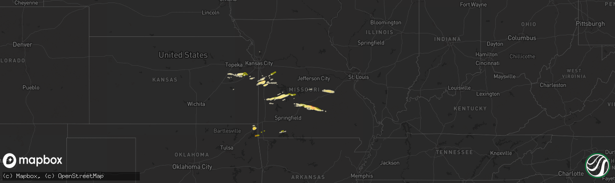
Hail Map in Missouri on March 22, 2025
The weather event in Missouri on March 22, 2025 includes Hail map. 3 states and 108 cities were impacted and suffered possible damage. The total estimated number of properties impacted is 20,310.
Want more than just the map?
Turn this storm into a full workflow.
- Owner + property data so you know who to knock
- OnDemand branded weather history reports to win the "did we even have hail?" argument
- RoofTrace estimate so reps stop guessing numbers at the door
Bought this map? Upgrade within 7 days and we'll credit the $230. (10-15 min setup call)
Hail
20,310
Estimated number of impacted properties by a 1.00" hail or larger865
Estimated number of impacted properties by a 1.75" hail or larger0
Estimated number of impacted properties by a 2.50" hail or largerStorm reports in Missouri
Missouri
| Date | Description |
|---|---|
| 03/22/20252:15 AM CDT | A local report indicates 1.00 inch wind near Holden |
| 03/22/202512:25 AM CDT | Between versailles and eldon. |
| 03/22/202512:11 AM CDT | Report from social media. |
| 03/22/202512:10 AM CDT | Report via social media. |
| 03/22/202512:03 AM CDT | Southwest of camdenton near lake valley drive. |
| 03/21/202511:55 PM CDT | A local report indicates 1.00 inch wind near Roby |
| 03/21/202511:52 PM CDT | A local report indicates 2.00 inch wind near 3 N Roby |
| 03/21/202511:52 PM CDT | A local report indicates 1.25 inch wind near 3 N Roby |
| 03/21/202511:45 PM CDT | A measured 77 mph wind gust downed multiple four to six inch diameter limbs and took down powerlines. |
| 03/21/202511:41 PM CDT | A local report indicates 1.00 inch wind near Cape Fair |
| 03/21/202511:35 PM CDT | Report from mping ping pong ball size hail. |
| 03/21/202511:32 PM CDT | A local report indicates 1.00 inch wind near Falcon |
| 03/21/202511:32 PM CDT | A local report indicates 1.50 inch wind near Collins |
| 03/21/202511:17 PM CDT | Reports of large trees down near morgan. |
| 03/21/202511:17 PM CDT | Report of a barn destroyed north of morgan. |
| 03/21/202511:07 PM CDT | Numerous pictures and reports of hail in lebanon with maximum size hail at 1 inch in diameter. The hail accumulated several inches deep in lebanon. |
| 03/21/202511:01 PM CDT | Report from mping half dollar size hail. |
| 03/21/202510:42 PM CDT | Time estimated via radar. |
| 03/21/202510:00 PM CDT | Quarter size hail five miles north of south west city on highway 43. |
Cities Impacted by Hail Map on March 22, 2025
- Goodman, MO
- Fairland, OK
- Miami, OK
- Neosho, MO
- Wyandotte, OK
- South West City, MO
- Quapaw, OK
- Buffalo, MO
- Windyville, MO
- Long Lane, MO
- Lebanon, MO
- El Dorado Springs, MO
- Phillipsburg, MO
- Collins, MO
- Butler, MO
- Osceola, MO
- Weaubleau, MO
- Falcon, MO
- Laquey, MO
- Cape Fair, MO
- Lynchburg, MO
- Plato, MO
- Roby, MO
- Licking, MO
- Quincy, MO
- Wheatland, MO
- Amsterdam, MO
- La Cygne, KS
- Clinton, MO
- Success, MO
- Galena, MO
- Adrian, MO
- Hermitage, MO
- Drexel, MO
- Cross Timbers, MO
- Reeds Spring, MO
- Aurora, MO
- Shell Knob, MO
- Urich, MO
- Preston, MO
- Archie, MO
- Tunas, MO
- Macks Creek, MO
- Salem, MO
- Climax Springs, MO
- Burlington, KS
- Ozark, MO
- Spokane, MO
- Bucyrus, MO
- Sparta, MO
- Mountain Grove, MO
- Mansfield, MO
- Seymour, MO
- Highlandville, MO
- Bruner, MO
- Huggins, MO
- Fordland, MO
- Hartville, MO
- Graff, MO
- Garden City, MO
- Freeman, MO
- Harrisonville, MO
- Kingsville, MO
- Plattsburg, MO
- Creighton, MO
- Holden, MO
- Centerview, MO
- Warrensburg, MO
- Walker, MO
- Nevada, MO
- Stockton, MO
- Sheldon, MO
- Jerico Springs, MO
- Harwood, MO
- Burlingame, KS
- Osage City, KS
- Reading, KS
- Harveyville, KS
- Humansville, MO
- Scranton, KS
- Lyndon, KS
- Flemington, MO
- Pomona, KS
- Ottawa, KS
- Overbrook, KS
- Quenemo, KS
- Paola, KS
- Osawatomie, KS
- Baldwin City, KS
- Wellsville, KS
- Vassar, KS
- Louisburg, KS
- Blairstown, MO
- Tuscumbia, MO
- Saint Elizabeth, MO
- Iberia, MO
- Meta, MO
- Saint James, MO
- Vichy, MO
- Cuba, MO
- Bland, MO
- Belle, MO
- Leasburg, MO
- Bourbon, MO
- Owensville, MO
- Grove, OK
- Anderson, MO
- Noel, MO


