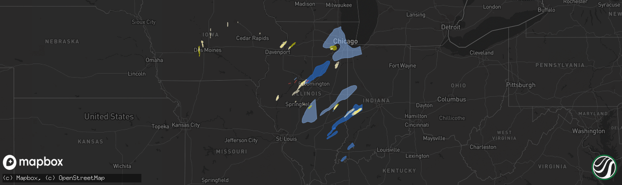
Hail Map in Illinois on March 19, 2025
The weather event in Illinois on March 19, 2025 includes Hail, Wind, and Tornado maps. 7 states and 825 cities were impacted and suffered possible damage. The total estimated number of properties impacted is 115,060.
Want more than just the map?
Turn this storm into a full workflow.
- Owner + property data so you know who to knock
- OnDemand branded weather history reports to win the "did we even have hail?" argument
- RoofTrace estimate so reps stop guessing numbers at the door
Bought this map? Upgrade within 7 days and we'll credit the $230. (10-15 min setup call)
Hail
Wind
Tornado
115,060
Estimated number of impacted properties by a 1.00" hail or larger0
Estimated number of impacted properties by a 1.75" hail or larger0
Estimated number of impacted properties by a 2.50" hail or largerStorm reports in Illinois
Illinois
| Date | Description |
|---|---|
| 03/19/20256:56 PM CDT | Westerly wind gust 64 mph at champaign airport. |
| 03/19/20256:55 PM CDT | A local report indicates 62 MPH wind near 3 NW Willard Airport |
| 03/19/20255:50 PM CDT | A local report indicates 1.00 inch wind near Blue Mound |
| 03/19/20255:44 PM CDT | Quarter size hail at nevada road and mt auburn road. |
| 03/19/20255:33 PM CDT | Report from mping: half dollar |
| 03/19/20255:30 PM CDT | A local report indicates 67 MPH wind near 4 WNW Wenonah |
| 03/19/20255:30 PM CDT | Report from mping: half dollar |
| 03/19/20255:30 PM CDT | A local report indicates 1.00 inch wind near 1 W Kankakee |
| 03/19/20255:30 PM CDT | Outbuilding damaged from strong gusty winds. |
| 03/19/20255:29 PM CDT | Reported by personal weather station kilparkf15. |
| 03/19/20255:28 PM CDT | Roof torn off industrial building. Report via social media. Time estimated by radar. |
| 03/19/20255:18 PM CDT | Report from mping: quarter |
| 03/19/20255:15 PM CDT | A local report indicates 60 MPH wind near Lawrenceville Airport |
| 03/19/20255:15 PM CDT | Reported by personal weather station west of monee. |
| 03/19/20255:10 PM CDT | A local report indicates 60 MPH wind near 1 SSW Buckley |
| 03/19/20255:06 PM CDT | Romeoville ema called in a report of quarter sized with the passing storm. |
| 03/19/20255:06 PM CDT | Tree down. Social media report. |
| 03/19/20255:02 PM CDT | A local report indicates 1.25 inch wind near Newman |
| 03/19/20255:01 PM CDT | Power poles leaning... Possibly broken on prince crossing just south of il-64. Time estimated by radar. |
| 03/19/20255:00 PM CDT | Semi truck overturned on i-74 in oakwood il. Social media report with photo. |
| 03/19/20254:57 PM CDT | Large branch broken off. |
| 03/19/20254:54 PM CDT | Reported by personal weather station kilauror58. |
| 03/19/20254:53 PM CDT | 6 inch diameter limbs down on route 30 before route 59. |
| 03/19/20254:52 PM CDT | Ef1... Peak wind speed 110 mph. Path length 0.7 miles... Max width 50 yards. Structural damage was found near the start of the track... West of the intersection of coun |
| 03/19/20254:51 PM CDT | Measured by an ambient weather station. |
| 03/19/20254:50 PM CDT | Six power poles blown down and trees damaged. |
| 03/19/20254:48 PM CDT | Two power poles snapped. |
| 03/19/20254:47 PM CDT | Measured by an ambient weather station. Outflow associated with a thunderstorm just to the northwest. |
| 03/19/20254:45 PM CDT | Power pole down by dewey bank. |
| 03/19/20254:45 PM CDT | Reported by personal weather station kilmorri23. |
| 03/19/20254:45 PM CDT | Gutter torn off building and large branches broken. |
| 03/19/20254:45 PM CDT | Corrects previous tstm wnd dmg report from 3 wsw rardin. Large tree branches broken. Time estimated from radar. |
| 03/19/20254:40 PM CDT | Partial roof loss on farm outbuilding. Time estimated from radar. |
| 03/19/20254:40 PM CDT | Tree branches were blown down onto highway 54. |
| 03/19/20254:32 PM CDT | Semi overturned on i-55 southbound south of mile marker 191. Relayed by broadcast media. |
| 03/19/20254:30 PM CDT | A power pole was snapped and leaning over... Resulting in a detour on state route 10 near beason. |
| 03/19/20254:30 PM CDT | Power outages from strong winds and small hail. |
| 03/19/20254:30 PM CDT | Power pole blown down. |
| 03/19/20254:23 PM CDT | Measured by an ambient weather station. |
| 03/19/20254:19 PM CDT | Large tree branch broken. Time estimated from radar. |
| 03/19/20254:15 PM CDT | A local report indicates a tornado near Kappa |
| 03/19/20254:10 PM CDT | Tornado west of comlara park. |
| 03/19/20254:10 PM CDT | Semi-truck overturned by high winds at mile marker 7 on i-39 in median. Driver transported to hospital. |
| 03/19/20254:10 PM CDT | A local report indicates 1.00 inch wind near 3 NNE Lakewood |
| 03/19/20254:05 PM CDT | Some damage to outbuildings from strong thunderstorm wind gusts. Photos provided. |
| 03/19/20254:05 PM CDT | A local report indicates 73 MPH wind near 5 SE Sullivan |
| 03/19/20254:00 PM CDT | A local report indicates a tornado near 3 W Carlock |
| 03/19/20254:00 PM CDT | Estimated wind gust along with dime size hail. |
| 03/19/20253:57 PM CDT | Power lines down and tree branches broken. Time estimated by radar. |
| 03/19/20253:55 PM CDT | A local report indicates a tornado near 2 SW Congerville |
| 03/19/20253:55 PM CDT | Reported by a personal weather station. |
| 03/19/20253:48 PM CDT | A large oak tree was snapped. |
| 03/19/20253:45 PM CDT | Power poles blown down. Ameren notified. |
| 03/19/20253:45 PM CDT | Large tree branches broken. Time estimated from radar. |
| 03/19/20253:44 PM CDT | Trained spotter seeing a tornado approaching mackinaw. |
| 03/19/20253:40 PM CDT | Three power poles blown down on horse barn road. Ameren notified. |
| 03/19/20253:26 PM CDT | Report from mping: quarter |
| 03/19/20253:25 PM CDT | Power pole bent and 12 inch tree snapped 2.5 miles nw of delavan. |
| 03/19/20252:49 PM CDT | Trained storm spotter looking west at a tornado. |
| 03/19/20252:49 PM CDT | Corrects previous tornado report from pekin. Storm spotter looking wsw from pekin at a tornado. |
| 03/19/20252:47 PM CDT | Storm spotter looking wsw from pekin at a tornado. |
| 03/19/20252:30 PM CDT | A local report indicates a tornado near Saint David |
| 03/19/20252:00 PM CDT | Portion of barn roof removed... Shingles on home blown off... And section of a large tree fell. Relayed be county ema. Time estimated from radar. |
| 03/18/20257:35 PM CDT | A local report indicates 63 MPH wind near Danville |
| 03/18/20257:35 PM CDT | Awos station kdnv danville arpt. |
All States Impacted by Hail Map on March 19, 2025
Cities Impacted by Hail Map on March 19, 2025
- Nevada, IA
- Radcliffe, IA
- Roland, IA
- Winterset, IA
- Dike, IA
- Grundy Center, IA
- Van Meter, IA
- Adel, IA
- De Soto, IA
- Dallas Center, IA
- Parkersburg, IA
- Evansdale, IA
- Waterloo, IA
- Granger, IA
- Grimes, IA
- Woodward, IA
- Madrid, IA
- Anamosa, IA
- Le Claire, IA
- Princeton, IA
- Long Grove, IA
- Eldridge, IA
- Camanche, IA
- Cordova, IL
- Clinton, IA
- Fulton, IL
- Erie, IL
- Albany, IL
- De Witt, IA
- Low Moor, IA
- Prophetstown, IL
- Lyndon, IL
- Morrison, IL
- Sterling, IL
- Genoa, IL
- Sycamore, IL
- Hampshire, IL
- Versailles, IL
- Mount Sterling, IL
- Frederick, IL
- Rushville, IL
- Canton, IL
- Manito, IL
- Glasford, IL
- Hanna City, IL
- Mapleton, IL
- Kingston Mines, IL
- Easton, IL
- Petersburg, IL
- Oakford, IL
- Mason City, IL
- San Jose, IL
- Green Valley, IL
- Tremont, IL
- Pleasant Plains, IL
- Delavan, IL
- Hopedale, IL
- Mackinaw, IL
- Morton, IL
- Danvers, IL
- Cantrall, IL
- Athens, IL
- Emden, IL
- Deer Creek, IL
- Mechanicsburg, IL
- Dawson, IL
- Congerville, IL
- Goodfield, IL
- Carlock, IL
- Bloomington, IL
- Hudson, IL
- Secor, IL
- Lexington, IL
- Gridley, IL
- El Paso, IL
- Eureka, IL
- Roanoke, IL
- Sullivan, IL
- Findlay, IL
- Windsor, IL
- Shelbyville, IL
- Gays, IL
- Humboldt, IL
- Arthur, IL
- Mattoon, IL
- Arcola, IL
- Chenoa, IL
- Flanagan, IL
- Pontiac, IL
- Graymont, IL
- Newman, IL
- Camargo, IL
- Villa Grove, IL
- Tuscola, IL
- Oakland, IL
- Hindsboro, IL
- Murdock, IL
- Longview, IL
- Clay City, IL
- Sailor Springs, IL
- Willow Hill, IL
- Newton, IL
- Yale, IL
- Ingraham, IL
- Louisville, IL
- Noble, IL
- Buffalo, IL
- Flora, IL
- Fairbury, IL
- Odell, IL
- Minonk, IL
- Cornell, IL
- Long Point, IL
- Streator, IL
- Blackstone, IL
- Dwight, IL
- Kinsman, IL
- Hidalgo, IL
- Oblong, IL
- Casey, IL
- Dundas, IL
- Emington, IL
- Verona, IL
- Mazon, IL
- Gardner, IL
- Charleston, IL
- Brocton, IL
- Plainfield, IL
- Oswego, IL
- Aurora, IL
- Naperville, IL
- Bolingbrook, IL
- Lockport, IL
- Crest Hill, IL
- Joliet, IL
- Romeoville, IL
- Lemont, IL
- Woodridge, IL
- Lisle, IL
- Downers Grove, IL
- Homer Glen, IL
- Darien, IL
- Willowbrook, IL
- Orland Park, IL
- Ancona, IL
- Dana, IL
- Ransom, IL
- Big Rock, IL
- Plano, IL
- Elburn, IL
- Sugar Grove, IL
- North Aurora, IL
- Montgomery, IL
- Bristol, IL
- Yorkville, IL
- Batavia, IL
- Saint Charles, IL
- Geneva, IL
- South Elgin, IL
- Elgin, IL
- Wasco, IL
- Warrenville, IL
- Mooseheart, IL
- Wayne, IL
- West Chicago, IL
- Bartlett, IL
- Dundee, IL
- Wheaton, IL
- Streamwood, IL
- Roselle, IL
- Glendale Heights, IL
- Glen Ellyn, IL
- Oak Brook, IL
- Lombard, IL
- Bloomingdale, IL
- Hanover Park, IL
- Hoffman Estates, IL
- Winfield, IL
- Carol Stream, IL
- Westmont, IL
- Elk Grove Village, IL
- Medinah, IL
- Itasca, IL
- Carpentersville, IL
- Addison, IL
- Villa Park, IL
- Schaumburg, IL
- Barrington, IL
- Rolling Meadows, IL
- Lake Zurich, IL
- Palatine, IL
- Arlington Heights, IL
- Oak Park, IL
- Wood Dale, IL
- Stone Park, IL
- Hillside, IL
- Berkeley, IL
- Bensenville, IL
- Harwood Heights, IL
- Chicago, IL
- River Grove, IL
- Franklin Park, IL
- Westchester, IL
- Elmwood Park, IL
- Schiller Park, IL
- Broadview, IL
- Melrose Park, IL
- Hines, IL
- Forest Park, IL
- Bellwood, IL
- Des Plaines, IL
- River Forest, IL
- Elmhurst, IL
- Maywood, IL
- Mount Prospect, IL
- Bonfield, IL
- Herscher, IL
- Kankakee, IL
- Chebanse, IL
- Annapolis, IL
- West York, IL
- Martinsville, IL
- Paris, IL
- Marshall, IL
- West Union, IL
- Dennison, IL
- Olney, IL
- West Liberty, IL
- Claremont, IL
- Terre Haute, IN
- West Terre Haute, IN
- Rosedale, IN
- Hume, IL
- Collison, IL
- Fairmount, IL
- Fithian, IL
- Danville, IL
- Muncie, IL
- Allerton, IL
- Homer, IL
- Oakwood, IL
- Broadlands, IL
- Georgetown, IL
- Sidell, IL
- Indianola, IL
- Catlin, IL
- Ridge Farm, IL
- Westville, IL
- Cayuga, IN
- Covington, IN
- Tilton, IL
- Perrysville, IN
- Williamsport, IN
- West Lebanon, IN
- Bismarck, IL
- Alvin, IL
- State Line, IN
- Potomac, IL
- Irving, IL
- Hillsboro, IL
- Butler, IL
- Harvel, IL
- Nokomis, IL
- Morrisonville, IL
- Raymond, IL
- Palmer, IL
- Witt, IL
- Pana, IL
- Owaneco, IL
- Edinburg, IL
- Stonington, IL
- Taylorville, IL
- Rosamond, IL
- Blue Mound, IL
- Moweaqua, IL
- Bingham, IL
- Oconee, IL
- Fillmore, IL
- Assumption, IL
- Ohlman, IL
- Ramsey, IL
- Bourbonnais, IL
- Oak Lawn, IL
- Worth, IL
- Alsip, IL
- Chicago Ridge, IL
- Hometown, IL
- Evergreen Park, IL
- Park Ridge, IL
- Wauconda, IL
- Buffalo Grove, IL
- Mundelein, IL
- Wheeling, IL
- Prospect Heights, IL
- Lincolnwood, IL
- Lake Bluff, IL
- Highland Park, IL
- Niles, IL
- Highwood, IL
- Winnetka, IL
- Vernon Hills, IL
- Libertyville, IL
- Deerfield, IL
- Lake Forest, IL
- Wilmette, IL
- Glenview, IL
- Morton Grove, IL
- North Chicago, IL
- Golf, IL
- Northbrook, IL
- Glencoe, IL
- Skokie, IL
- Lincolnshire, IL
- Great Lakes, IL
- Kenilworth, IL
- Evanston, IL
- Whiting, IN
- Hammond, IN
- Griffith, IN
- Crown Point, IN
- Gary, IN
- East Chicago, IN
- Merrillville, IN
- Hobart, IN
- Schererville, IN
- Highland, IN
- Dyer, IN
- Chicago Heights, IL
- Calumet City, IL
- Saint John, IN
- South Holland, IL
- Riverdale, IL
- Lowell, IN
- Munster, IN
- Cedar Lake, IN
- Dolton, IL
- Lansing, IL
- Crete, IL
- Glenwood, IL
- Thornton, IL
- Homewood, IL
- Harvey, IL
- Steger, IL
- Beecher, IL
- Robbins, IL
- Country Club Hills, IL
- Park Forest, IL
- Crestwood, IL
- Matteson, IL
- Peotone, IL
- Olympia Fields, IL
- Richton Park, IL
- Posen, IL
- Oak Forest, IL
- Flossmoor, IL
- Markham, IL
- Monee, IL
- Midlothian, IL
- Blue Island, IL
- University Park, IL
- Hazel Crest, IL
- Tinley Park, IL
- Frankfort, IL
- Burbank, IL
- Summit Argo, IL
- Hickory Hills, IL
- Willow Springs, IL
- New Lenox, IL
- Palos Heights, IL
- Palos Hills, IL
- Cicero, IL
- Manteno, IL
- Berwyn, IL
- Palos Park, IL
- Manhattan, IL
- Elwood, IL
- Bridgeview, IL
- Wilmington, IL
- Mokena, IL
- Justice, IL
- Channahon, IL
- Hinsdale, IL
- Brookfield, IL
- La Grange Park, IL
- Western Springs, IL
- La Grange, IL
- Riverside, IL
- Lyons, IL
- Clarendon Hills, IL
- Lake Station, IN
- Mount Vernon, IN
- Corydon, KY
- Evansville, IN
- Uniontown, KY
- Princeton, IN
- Fort Branch, IN
- Francisco, IN
- Petersburg, IN
- Oakland City, IN
- Winslow, IN
- Rockville, IN
- Farmersburg, IN
- Brazil, IN
- Bridgeton, IN
- Staunton, IN
- Harmony, IN
- Knightsville, IN
- Carbon, IN
- Greencastle, IN
- Reelsville, IN
- Bainbridge, IN
- Attica, IN
- Veedersburg, IN
- Pine Village, IN
- Otterbein, IN
- Portage, IN
- Chesterton, IN
- Valparaiso, IN
- Michigan City, IN
- Beverly Shores, IN
- Westville, IN
- Wanatah, IN
- Hebron, IN
- Tower Hill, IL
- Boody, IL
- Decatur, IL
- Forsyth, IL
- Macon, IL
- Lakewood, IL
- Herrick, IL
- Cowden, IL
- Dalton City, IL
- Bethany, IL
- Mt Zion, IL
- Velpen, IN
- Otwell, IN
- New Ross, IN
- Jamestown, IN
- Ladoga, IN
- Fillmore, IN
- Stendal, IN
- Lynnville, IN
- Coatesville, IN
- Danville, IN
- North Salem, IN
- Huntingburg, IN
- Shoals, IN
- Loogootee, IN
- La Place, IL
- Monticello, IL
- Milmine, IL
- Maroa, IL
- Oreana, IL
- De Land, IL
- Cisco, IL
- Cerro Gordo, IL
- Lovington, IL
- Argenta, IL
- Hammond, IL
- Bement, IL
- Strasburg, IL
- White Heath, IL
- Mansfield, IL
- Seymour, IL
- Ivesdale, IL
- Atwood, IL
- Sadorus, IL
- Pesotum, IL
- Tolono, IL
- Champaign, IL
- Jasper, IN
- Dubois, IN
- Montgomery, IN
- Cannelburg, IN
- Washington, IN
- Crane, IN
- Williams, IN
- Springville, IN
- Bedford, IN
- Princeton, KY
- Eddyville, KY
- Kuttawa, KY
- Fredonia, KY
- Tennyson, IN
- Lizton, IN
- Santa Claus, IN
- Lincoln City, IN
- Grandview, IN
- Dale, IN
- Mitchell, IN
- Ferdinand, IN
- Chrisney, IN
- Lamar, IN
- Rockport, IN
- Holland, IN
- Avoca, IN
- French Lick, IN
- Saint Anthony, IN
- West Baden Springs, IN
- Gentryville, IN
- Newburgh, IN
- Spurgeon, IN
- Richland, IN
- Chandler, IN
- Boonville, IN
- Elberfeld, IN
- Henderson, KY
- Haubstadt, IN
- Oolitic, IN
- Celestine, IN
- Orleans, IN
- Heltonville, IN
- Schnellville, IN
- Norman, IN
- Birdseye, IN
- Saint Meinrad, IN
- Evanston, IN
- Roachdale, IN
- Crawfordsville, IN
- Pittsboro, IN
- Brownsburg, IN
- Lebanon, IN
- Colfax, IN
- Rossville, IN
- Thorntown, IN
- Frankfort, IN
- Lafayette, IN
- Cutler, IN
- Clarks Hill, IN
- Darlington, IN
- Mulberry, IN
- Advance, IN
- Kirklin, IN
- Whitestown, IN
- Michigantown, IN
- Sheridan, IN
- Westfield, IN
- Zionsville, IN
- Tipton, IN
- Atlanta, IN
- Russiaville, IN
- Goldsmith, IN
- Sharpsville, IN
- Arcadia, IN
- Flora, IN
- Burlington, IN
- Kempton, IN
- Forest, IN
- Kokomo, IN
- Bringhurst, IN
- La Porte, IN
- New Buffalo, MI
- Rolling Prairie, IN
- Three Oaks, MI
- Union Mills, IN
- Union Pier, MI
- Savoy, IL
- Urbana, IL
- Philo, IL
- Thomasboro, IL
- Bondville, IL
- Dewey, IL
- Rantoul, IL
- Mahomet, IL
- Fisher, IL
- Dawson Springs, KY
- Madisonville, KY
- Nebo, KY
- Eckerty, IN
- Bristow, IN
- Taswell, IN
- Sacramento, KY
- Island, KY
- Medora, IN
- English, IN
- Paoli, IN
- Tunnelton, IN
- Campbellsburg, IN
- Brownstown, IN
- Hardinsburg, IN
- Salem, IN
- Saint Croix, IN
- Leopold, IN
- Sulphur, IN
- Tell City, IN
- Marengo, IN
- Branchville, IN
- Grantsburg, IN
- Columbus, IN
- Seymour, IN
- Nashville, IN
- Freetown, IN
- Jonesville, IN
- Elizabethtown, IN
- Vallonia, IN
- Windfall, IN
- Fairmount, IN
- Amboy, IN
- Sweetser, IN
- Marion, IN
- Greentown, IN
- La Fontaine, IN
- Swayzee, IN
- Converse, IN
- Cicero, IN
- Noblesville, IN
- Jonesboro, IN
- Elwood, IN
- Anderson, IN
- Summitville, IN
- Frankton, IN
- Alexandria, IN
- Rossville, IL
- Sidney, IL
- Wellington, IL
- Hoopeston, IL
- Gifford, IL
- Fowler, IN
- Rankin, IL
- Penfield, IL
- Milford, IL
- Royal, IL
- Ogden, IL
- Armstrong, IL
- Ambia, IN
- Saint Joseph, IL
- Chrisman, IL
- Dana, IN
- Clinton, IN
- Henning, IL
- Metcalf, IL
- Boswell, IN
- Hillsdale, IN
- Oxford, IN
- Kingman, IN
- Templeton, IN
- Mecca, IN
- Bloomingdale, IN
- Montezuma, IN
- West Lafayette, IN
- Rumsey, KY
- Livermore, KY
- Utica, KY
- Calhoun, KY
- Hartford, KY
- Centertown, KY
- Philpot, KY
- Whitesville, KY
- Reynolds Station, KY
- Fordsville, KY
- Hawesville, KY
- Cadiz, KY
- Hopkinsville, KY
- Gracey, KY
- Crofton, KY
- Leavenworth, IN
- New Johnsonville, TN
- Cannelton, IN
- Hope, IN
- Westpoint, IN
- Newtown, IN
- Waynetown, IN
- Romney, IN
- Wingate, IN
- Mellott, IN
- Hillsboro, IN
- New Richmond, IN
- Marshall, IN
- Linden, IN
- Waveland, IN
- Alamo, IN
- New Market, IN
- Van Buren, IN
- Gas City, IN
- Upland, IN
- Warren, IN
- Fowlerton, IN
- Gaston, IN
- Montpelier, IN
- Poneto, IN
- Hartford City, IN
- Liberty Center, IN
- Bluffton, IN
- Grammer, IN
- Hartsville, IN
- Westport, IN
- Central City, KY
- Rockport, KY
- Milltown, IN
- Scipio, IN
- Waverly, TN
- McEwen, TN
- Depauw, IN
- Cloverport, KY
- Flat Rock, IN
- Saint Paul, IN
- Greensburg, IN
- Scottsburg, IN
- McHenry, KY
- Hardinsburg, KY
- Beaver Dam, KY
- Horse Branch, KY
- Lewisport, KY
- Erin, TN
- Elkton, KY
- Greenville, KY
- Beechmont, KY
- Beech Creek, KY
- Belton, KY
- Drakesboro, KY
- Browder, KY
- Falls Of Rough, KY
- Harned, KY
- McDaniels, KY
- Westview, KY
- Hudson, KY
- Leitchfield, KY
- North Vernon, IN
- Commiskey, IN
- Fredericksburg, IN
- Crothersville, IN
- Butlerville, IN
- Vernon, IN
- Paris Crossing, IN
- Austin, IN
- Pekin, IN
- Deputy, IN
- Palmyra, IN
- Borden, IN
- Dupont, IN
- New Salisbury, IN
- Ramsey, IN
- Madison, IN
- Underwood, IN
- Holton, IN
- Lexington, IN
- Henryville, IN
- Charlestown, IN
- Corydon, IN
- Marysville, IN
- Georgetown, IN
- Sellersburg, IN
- New Washington, IN
- New Albany, IN
- Greenville, IN
- Bedford, KY
- Hanover, IN
- Milton, KY
- Floyds Knobs, IN
- Memphis, IN
- Otisco, IN
- Nabb, IN
- Bethlehem, IN
- Battletown, KY
- Crandall, IN
- Lanesville, IN
- Central, IN
- Mauckport, IN
- Derby, IN
- Payneville, KY
- Olaton, KY
- Milroy, IN
- Rushville, IN
- Laurel, IN
- Oldenburg, IN
- Morgantown, KY
- Caneyville, KY
- Webster, KY
- Guston, KY
- Brandenburg, KY
- Canaan, IN
- Versailles, IN
- Cross Plains, IN
- Dillsboro, IN
- Vevay, IN
- Bennington, IN
- Carrollton, KY
- Aurora, IN
- Rising Sun, IN
- Moores Hill, IN
- Florence, IN
- Petersburg, KY
- Union, KY
- Patriot, IN
- Ghent, KY
- Burlington, KY
- Warsaw, KY
- Sanders, KY
- Campbellsburg, KY
- Sparta, KY
- West Point, KY
- Brooks, KY
- Shepherdsville, KY
- Irvington, KY
- Custer, KY
- Ekron, KY
- Garfield, KY
- Vine Grove, KY
- Laconia, IN
- Elizabeth, IN
- Fort Knox, KY
- Cecilia, KY
- Muldraugh, KY
- Rineyville, KY
- Louisville, KY
- Fairdale, KY
- Radcliff, KY
- Glenview, KY
- Masonic Home, KY
- Prospect, KY
- Crestwood, KY
- Fisherville, KY
- Simpsonville, KY
- Pewee Valley, KY
- Mount Washington, KY
- Finchville, KY
- Buckner, KY
- La Grange, KY
- Smithfield, KY
- Shelbyville, KY
- Eminence, KY
- Florence, KY
- Walton, KY
- Verona, KY
- Belvidere, NC


