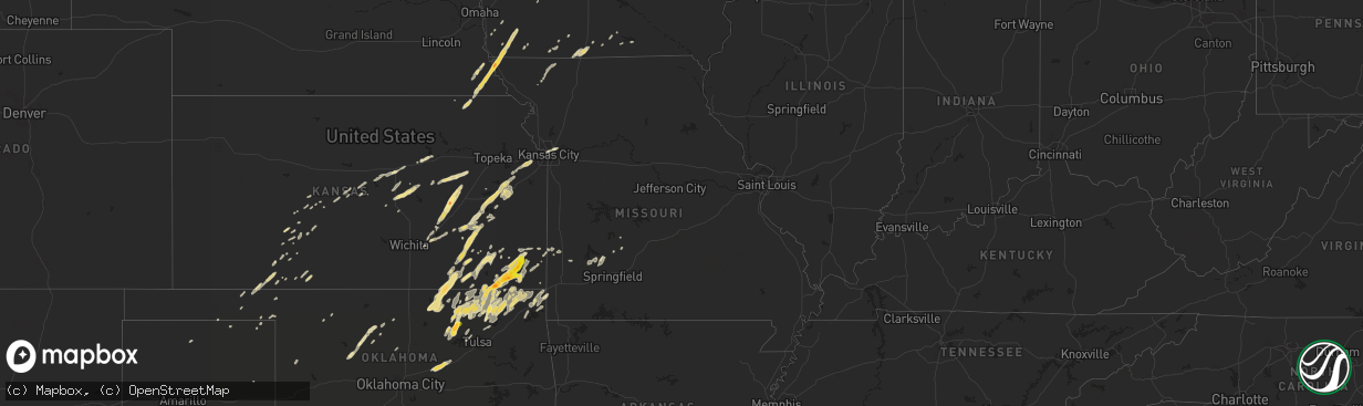
Hail Map in Texas on March 19, 2011
The weather event in Texas on March 19, 2011 includes Hail map. 9 states and 474 cities were impacted and suffered possible damage. The total estimated number of properties impacted is 0.
Want more than just the map?
Turn this storm into a full workflow.
- Owner + property data so you know who to knock
- OnDemand branded weather history reports to win the "did we even have hail?" argument
- RoofTrace estimate so reps stop guessing numbers at the door
Bought this map? Upgrade within 7 days and we'll credit the $230. (10-15 min setup call)
Hail
0
Estimated number of impacted properties by a 1.00" hail or larger0
Estimated number of impacted properties by a 1.75" hail or larger0
Estimated number of impacted properties by a 2.50" hail or largerStorm reports in Texas
Texas
| Date | Description |
|---|---|
| 03/19/20116:07 PM CDT | A local report indicates 1.75 inch wind near 6 SE ANTON |
| 03/18/201110:47 PM CDT | One inch hail reported on the road along 54 near county road z. |
| 03/18/201110:27 PM CDT | One inch hail on the ground. |
| 03/18/201110:13 PM CDT | One half to 1 inch hail on ground in downtown abernathy. |
| 03/18/20119:18 PM CDT | A local report indicates 1.00 inch wind near 6 NE LUBBOCK |
| 03/18/20118:58 PM CDT | A local report indicates 2.75 inch wind near 1 E SHALLOWATER |
| 03/18/20118:55 PM CDT | A local report indicates 1.75 inch wind near SHALLOWATER |
| 03/18/20118:54 PM CDT | A local report indicates 1.50 inch wind near SHALLOWATER |
| 03/18/20118:40 PM CDT | A local report indicates 1.00 inch wind near PLAINVIEW |
| 03/18/20118:35 PM CDT | A local report indicates 1.00 inch wind near PLAINVIEW |
| 03/18/20118:28 PM CDT | A local report indicates 1.75 inch wind near 2 NE SMYER |
| 03/18/20118:25 PM CDT | A local report indicates 1.00 inch wind near 1 S PLAINVIEW |
| 03/18/20117:57 PM CDT | A local report indicates 1.00 inch wind near 4 S LOCKNEY |
| 03/18/20117:46 PM CDT | A local report indicates 1.00 inch wind near LEVELLAND |
| 03/18/20117:45 PM CDT | A local report indicates 1.75 inch wind near LEVELLAND |
All States Impacted by Hail Map on March 19, 2011
Cities Impacted by Hail Map on March 19, 2011
- Delaware, OK
- Ramona, OK
- Talala, OK
- Dewey, OK
- Edna, KS
- Lenapah, OK
- Hominy, OK
- Caney, KS
- Altamont, KS
- Copan, OK
- Chelsea, OK
- Bartlesville, OK
- Mound Valley, KS
- McCune, KS
- Pawhuska, OK
- Wann, OK
- Vinita, OK
- Nowata, OK
- Cleveland, OK
- Parsons, KS
- S Coffeyville, OK
- Wynona, OK
- Coffeyville, KS
- Walnut, KS
- Osage, OK
- Girard, KS
- Barnsdall, OK
- Saint Paul, KS
- Ochelata, OK
- Oswego, KS
- Tyro, KS
- Liberty, KS
- Galesburg, KS
- Minneola, KS
- Lubbock, TX
- Whiteface, TX
- Shallowater, TX
- Idalou, TX
- Levelland, TX
- Neodesha, KS
- Altoona, KS
- Fredonia, KS
- Elk City, KS
- Afton, OK
- Thayer, KS
- Strong City, KS
- Cottonwood Falls, KS
- Olton, TX
- Augusta, KS
- Olathe, KS
- Lawrence, KS
- Linwood, KS
- Shawnee, KS
- Lenexa, KS
- De Soto, KS
- Bonner Springs, KS
- Baldwin City, KS
- Eudora, KS
- Sand Springs, OK
- Anton, TX
- Honea Path, SC
- Belton, SC
- Decatur, IA
- Davis City, IA
- Lamoni, IA
- Kellerton, IA
- Leon, IA
- Ash Grove, MO
- Spearville, KS
- Ninety Six, SC
- Chappells, SC
- Saluda, SC
- Glidden, IA
- Lohrville, IA
- Churdan, IA
- Lake City, IA
- Carroll, IA
- Carnesville, GA
- Toccoa, GA
- Hudson, IA
- Cedar Falls, IA
- Audubon, IA
- Chapman, KS
- Abilene, KS
- Howard, KS
- Gypsum, KS
- Roxbury, KS
- Mcpherson, KS
- Galva, KS
- Hope, KS
- Durham, KS
- Tampa, KS
- Canton, KS
- Alden, IA
- Kamrar, IA
- Blairsburg, IA
- Williams, IA
- Jewell, IA
- Gray Court, SC
- Laurens, SC
- Fountain Inn, SC
- Baxter, IA
- Melbourne, IA
- Conrad, IA
- State Center, IA
- Rhodes, IA
- Beaman, IA
- Maxwell, IA
- Marshalltown, IA
- Mingo, IA
- Albion, IA
- Bondurant, IA
- Collins, IA
- Meno, OK
- Enid, OK
- Lahoma, OK
- Drummond, OK
- Auburn, NE
- Johnson, NE
- Greenville, SC
- Shidler, OK
- Kansas City, MO
- Watson, MO
- Farragut, IA
- Brownville, NE
- Riverton, IA
- Hamburg, IA
- Rock Port, MO
- Peru, NE
- Brock, NE
- Stella, NE
- Humboldt, NE
- Nemaha, NE
- Farnhamville, IA
- Lanesboro, IA
- Rockwell City, IA
- Stroud, OK
- Depew, OK
- Davenport, OK
- Chandler, OK
- Westminster, SC
- Pomona, KS
- Pawnee Rock, KS
- Beaver, OK
- Balko, OK
- Hale Center, TX
- Royston, GA
- Cross Hill, SC
- Waterloo, SC
- Mountville, SC
- Leesville, SC
- Batesburg, SC
- Pelzer, SC
- Piedmont, SC
- Easley, SC
- Gilbert, SC
- Mauldin, SC
- Ware Shoals, SC
- Ward, SC
- Ridge Spring, SC
- Simpsonville, SC
- Monetta, SC
- Alta Vista, KS
- Alma, KS
- Council Grove, KS
- Eskridge, KS
- Wilsey, KS
- Plainview, TX
- Lockney, TX
- Arcadia, KS
- Fairland, OK
- Miami, OK
- Pawnee, OK
- Herington, KS
- Bluejacket, OK
- Welch, OK
- Virgil, KS
- Hamilton, KS
- Madison, KS
- Gridley, KS
- Hanston, KS
- Essex, IA
- Red Oak, IA
- Malvern, IA
- Floydada, TX
- Littlefield, TX
- Lyons, KS
- Dexter, KS
- Burbank, OK
- Ponca City, OK
- Fairfax, OK
- Cedar Vale, KS
- Kaw City, OK
- Blockton, IA
- Benton, IA
- Weldon, IA
- Garden Grove, IA
- Wagner, SD
- Tripp, SD
- Inman, KS
- Moline, KS
- Princeton, KS
- Lebo, KS
- Neal, KS
- Severy, KS
- Williamsburg, KS
- Toronto, KS
- Ottawa, KS
- Yates Center, KS
- Melvern, KS
- Fall River, KS
- Waverly, KS
- Eureka, KS
- Grenola, KS
- Richmond, KS
- Burlington, KS
- Hartford, KS
- Quenemo, KS
- Osage City, KS
- Guthrie Center, IA
- Rush Center, KS
- Burdett, KS
- Le Roy, KS
- Hammon, OK
- Cheyenne, OK
- Leedey, OK
- Buffalo, MO
- Stanhope, IA
- Ellsworth, IA
- Stratford, IA
- Boone, IA
- Lorenzo, TX
- New Deal, TX
- Abernathy, TX
- Petersburg, TX
- Smyer, TX
- Columbus, KS
- Chetopa, KS
- Claremore, OK
- Oologah, OK
- Picher, OK
- Commerce, OK
- Bartlett, KS
- Independence, KS
- North Miami, OK
- Jennings, OK
- Dennis, KS
- Terlton, OK
- Cherryvale, KS
- Waynoka, OK
- Kimballton, IA
- Harlan, IA
- Kinsley, KS
- Reinbeck, IA
- Grundy Center, IA
- Lincoln, IA
- Gladbrook, IA
- Watonga, OK
- Canton, OK
- Longton, KS
- Elk Falls, KS
- Walnut Grove, MO
- Meade, KS
- Larned, KS
- Tulsa, OK
- Hubbard, IA
- McCallsburg, IA
- Zearing, IA
- Dante, SD
- Dawson, IA
- Yale, IA
- Panora, IA
- Linden, IA
- Ogden, IA
- Perry, IA
- Seneca, KS
- Dawson, NE
- Westboro, MO
- Du Bois, NE
- Shenandoah, IA
- Bern, KS
- Ellinwood, KS
- El Dorado, KS
- Westphalia, KS
- Salina, KS
- Naper, NE
- Eldora, IA
- Spencer, NE
- Bristow, NE
- Fairfax, SD
- Burns, KS
- Bucklin, KS
- Ames, OK
- Isabella, OK
- Okeene, OK
- Mullinville, KS
- Crescent, OK
- Casey, IA
- Bayard, IA
- Tulia, TX
- Kress, TX
- Sedan, KS
- Emporia, KS
- Cedar Point, KS
- Coldwater, KS
- Baileyville, KS
- Anita, IA
- Amherst, TX
- Fieldton, TX
- Prue, OK
- Leon, KS
- Glenwood, IA
- Tabor, IA
- Corydon, IA
- Chariton, IA
- Traer, IA
- Toledo, IA
- Butte, NE
- Otho, IA
- Americus, KS
- Matfield Green, KS
- Humeston, IA
- Henderson, IA
- Hastings, IA
- Independence, MO
- Liberty, MO
- Duncombe, IA
- Fort Dodge, IA
- Callender, IA
- Gowrie, IA
- Tingley, IA
- Shannon City, IA
- Ellsworth, KS
- Lorraine, KS
- Waukomis, OK
- Hennessey, OK
- Niotaze, KS
- Peru, KS
- Junction City, KS
- Hardesty, OK
- Ankeny, IA
- Altoona, IA
- Forgan, OK
- Offerle, KS
- Ashland, KS
- Webster City, IA
- Diagonal, IA
- Peterson, IA
- Stanberry, MO
- Worth, MO
- Sheridan, MO
- Ravenwood, MO
- Grant City, MO
- Clyde, MO
- Jefferson, IA
- Scranton, IA
- Cassoday, KS
- Waterloo, IA
- Washington, GA
- Tignall, GA
- Elk Horn, IA
- Templeton, IA
- Dedham, IA
- Vermillion, KS
- Moundridge, KS
- Perryton, TX
- Booker, TX
- Comer, GA
- Dewy Rose, GA
- Elberton, GA
- Bowman, GA
- Carlton, GA
- Grove, OK
- Wyandotte, OK
- Ruthven, IA
- Everton, MO
- Lavonia, GA
- Canon, GA
- Mooreland, OK
- Liberal, MO
- Mulberry, KS
- Mindenmines, MO
- Maple City, KS
- Morrisville, MO
- Urbana, MO
- Louisburg, MO
- Garber, OK
- Eastanollee, GA
- Rosston, OK
- Englewood, KS
- Seneca, MO
- Mills, NE
- West Mineral, KS
- Scammon, KS
- Weir, KS
- Pittsburg, KS
- Cherokee, KS
- Axtell, KS
- Quapaw, OK
- Fair Play, SC
- Eagle Grove, IA
- Benedict, KS
- Protection, KS
- Follett, TX
- Lehigh, IA
- Lexington, SC
- Pelion, SC
- Buffalo, KS
- Promise City, IA
- Plano, IA
- Mobeetie, TX
- Aldrich, MO
- Bolivar, MO
- Otis, KS
- Dadeville, MO
- Gruver, TX
- Sunray, TX
- Conception, MO
- Conception Junction, MO
- Bedford, IA
- Wright, KS
- Gaston, SC
- Swansea, SC
- Lamar, MO
- Golden City, MO
- Des Moines, IA
- Garwin, IA
- Haverhill, IA
- Berwick, IA
- Fort Riley, KS
- Riverton, KS
- Galena, KS
- New Providence, IA
- Rozel, KS
- La Porte City, IA
- Buckingham, IA
- Dysart, IA
- Clarinda, IA
- Great Bend, KS
- Mount Airy, GA
- Laverne, OK
- Geneseo, KS
- Bolckow, MO
- Solomon, KS
- New Cambria, KS
- Table Rock, NE
- Elk Creek, NE
- Chanute, KS
- Bristow, OK
- Russell, IA
- Half Way, MO
- Collinsville, OK
- Brookville, KS
- Manning, IA
- Gray, IA
- Walnut, IA
- Martin, GA
- Claflin, KS
- Holyrood, KS
- Wiota, IA
- Centerville, IA
- Mystic, IA
- Beattie, KS
- Hepler, KS
- Farlington, KS
- Ford, KS
- Greenfield, MO
- Hitchcock, OK
- Belpre, KS
- Lewis, KS
- Shattuck, OK
- Spencer, IA
- Assaria, KS
- Lindsborg, KS


