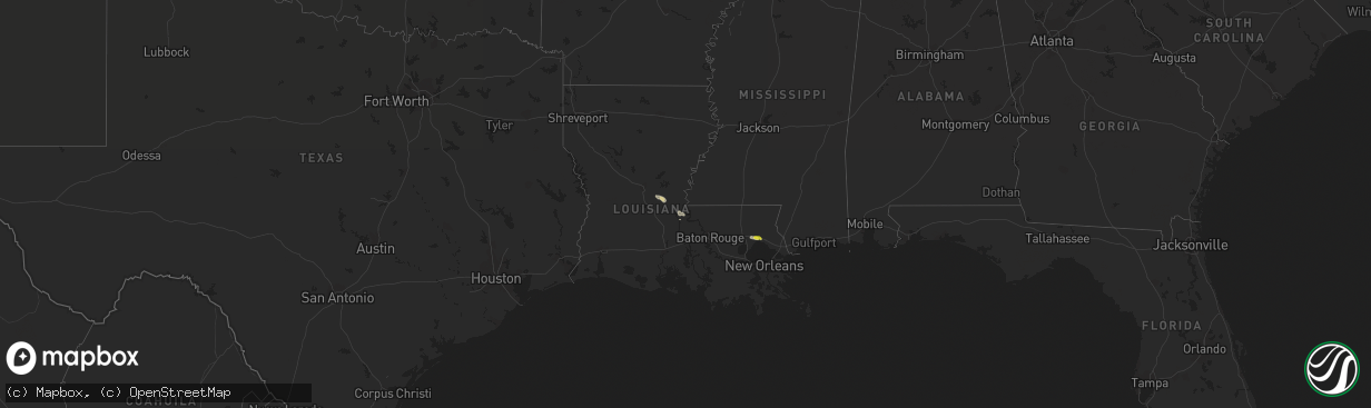
Hail Map in Louisiana on March 11, 2018
The weather event in Louisiana on March 11, 2018 includes Hail map. 1 state and 8 cities were impacted and suffered possible damage. The total estimated number of properties impacted is 4,798.
Want more than just the map?
Turn this storm into a full workflow.
- Owner + property data so you know who to knock
- OnDemand branded weather history reports to win the "did we even have hail?" argument
- RoofTrace estimate so reps stop guessing numbers at the door
Bought this map? Upgrade within 7 days and we'll credit the $230. (10-15 min setup call)
Hail
4,798
Estimated number of impacted properties by a 1.00" hail or larger0
Estimated number of impacted properties by a 1.75" hail or larger0
Estimated number of impacted properties by a 2.50" hail or largerStorm reports in Louisiana
Louisiana
| Date | Description |
|---|---|
| 03/11/201812:06 PM CDT | Fence downed on veronica drive in chalmette. |
| 03/11/201811:46 AM CDT | A local report indicates 64 MPH wind near LAKEFRONT AIRPORT |
| 03/11/201811:25 AM CDT | Large tree down across highway 190 near soult street. |
| 03/11/201811:20 AM CDT | 60 mph winds and two waterspouts reported by lake pontchartrain causeway officials. |
| 03/11/201811:12 AM CDT | A local report indicates 1.00 inch wind near MADISONVILLE |
| 03/11/20188:10 AM CDT | Fire dept reported damage to house with injuries. |
| 03/11/20188:10 AM CDT | *** 4 inj *** tornado hit double wide trailer and rolled it. Family of 4 sustained minor injuries. |
| 03/11/20187:39 AM CDT | Received image of large tree blown down. |
| 03/11/20187:21 AM CDT | At 1220 AM CST, a severe thunderstorm was located near Woodlawn, or 8 miles northwest of Marshall, moving southeast at 35 mph. HAZARD...Two inch hail and 60 mph wind gusts. SOURCE...Radar indicated. IMPACT...People and animals outdoors will be injured. Expect hail damage to roofs, siding, windows, and vehicles. Expect wind damage to roofs, siding, and trees. Locations impacted include... Marshall, Deberry, Elysian Fields, Woodlawn, Scottsville, Nesbitt and Darco. |
| 03/11/20186:55 AM CDT | At 1155 AM CDT, a severe thunderstorm was located over Chalmette, moving southeast at 35 mph. HAZARD...60 mph wind gusts. SOURCE...Radar indicated. IMPACT...Expect damage to roofs, siding, and trees. Locations impacted include... New Orleans, Chalmette, Violet, Meraux, Shell Beach, Arabi and Poydras.65 mph gust measured at Lakefront Airport. |
| 03/11/20186:37 AM CDT | At 1137 AM CDT, a severe thunderstorm was located near St. Rose, or 7 miles west of Metairie, moving southeast at 35 mph. HAZARD...60 mph wind gusts. SOURCE...Radar indicated. IMPACT...Expect damage to roofs, siding, and trees. Locations impacted include... Metairie, Avondale, Jefferson, Harahan, Westwego, Elmwood, Bridge City, River Ridge, Ama, Waggaman, St. Rose, Luling, Destrehan and New Orleans Armstrong Airport. |
| 03/11/20186:34 AM CDT | At 1133 AM CDT, a severe thunderstorm was located near East New Orleans, moving southeast at 30 mph. HAZARD...60 mph wind gusts. SOURCE...Radar indicated. IMPACT...Expect damage to roofs, siding, and trees. Locations impacted include... New Orleans, East New Orleans, Chalmette, Arabi and Lakefront Airport. |
| 03/11/20185:59 AM CDT | At 1059 AM CDT, a severe thunderstorm was located near Madisonville, or near Covington, moving east at 30 mph. HAZARD...60 mph wind gusts and quarter size hail. SOURCE...Radar indicated. IMPACT...Hail damage to vehicles is expected. Expect wind damage to roofs, siding, and trees. Locations impacted include... Covington, Abita Springs and Madisonville. |
| 03/11/20184:57 AM CDT | At 957 AM CDT, a severe thunderstorm was located near Baker, moving southeast at 35 mph. HAZARD...60 mph wind gusts. SOURCE...Radar indicated. IMPACT...Expect damage to roofs, siding, and trees. Locations impacted include... Baton Rouge, Zachary, Baker, Denham Springs, Port Allen, Oak Hills Place, Westminster, Old Jefferson, Merrydale, Inniswold, Village St. George, Shenandoah, Brownfields, Greenwell Spring, Gardere and Baton Rouge Airport. |
| 03/11/20184:07 AM CDT | At 907 AM CDT, a severe thunderstorm was located over Batchelor, or 7 miles east of Bayou Current, moving southeast at 30 mph. HAZARD...60 mph wind gusts and penny size hail. SOURCE...Radar indicated. IMPACT...Expect damage to roofs, siding, and trees. Locations impacted include... New Roads, St. Francisville, Livonia, Fordoche, Morganza, Wakefield, Batchelor and Lottie. |
| 03/10/201810:48 PM CST | At 448 AM CDT, a severe thunderstorm was located 7 miles west of Deberry, or 9 miles north of Carthage, moving southeast at 30 mph. HAZARD...60 mph wind gusts and quarter size hail. SOURCE...Radar indicated. IMPACT...Hail damage to vehicles is expected. Expect wind damage to roofs, siding, and trees. Locations impacted include... Carthage, Tatum, Beckville, Deberry, Gary City, Midyett, Deadwood, Dotson, Front, Woods and Fairplay. |
| 03/10/201810:23 PM CST | At 423 AM CDT, a severe thunderstorm was located 8 miles north of Coushatta, or 24 miles east of Mansfield, moving east at 30 mph. HAZARD...60 mph wind gusts and quarter size hail. SOURCE...Radar indicated. IMPACT...Hail damage to vehicles is expected. Expect wind damage to roofs, siding, and trees. Locations impacted include... Coushatta, Martin, Goldonna, Hall Summit, Saline, Ashland, Edgefield, Womack, Chestnut, Creston and Black Lake. |
| 03/10/201810:21 PM CST | At 421 AM CDT, a severe thunderstorm was located near Marshall, moving southeast at 30 mph. HAZARD...70 mph wind gusts and half dollar size hail. SOURCE...Radar indicated. IMPACT...Hail damage to vehicles is expected. Expect considerable tree damage. Wind damage is also likely to mobile homes, roofs, and outbuildings. Locations impacted include... Marshall, Waskom, Deberry, Elysian Fields, Scottsville, Darco, Midyett and Nesbitt. |
| 03/10/20189:43 PM CST | At 343 AM CDT, a severe thunderstorm was located 11 miles east of Stonewall, or 12 miles north of Mansfield, moving southeast at 30 mph. HAZARD...70 mph wind gusts and quarter size hail. SOURCE...Radar indicated. IMPACT...Hail damage to vehicles is expected. Expect considerable tree damage. Wind damage is also likely to mobile homes, roofs, and outbuildings. Locations impacted include... Coushatta, Edgefield, Carmel, Evelyn, Crichton, Grand Bayou, Kingston, Loggy Bayou, Rambin and Armistead. |


