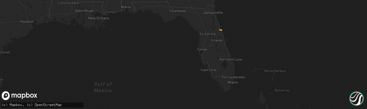
Hail Map in Florida on March 6, 2021
The weather event in Florida on March 6, 2021 includes Hail map. 1 state and 2 cities were impacted and suffered possible damage. The total estimated number of properties impacted is 8,634.
Want more than just the map?
Turn this storm into a full workflow.
- Owner + property data so you know who to knock
- OnDemand branded weather history reports to win the "did we even have hail?" argument
- RoofTrace estimate so reps stop guessing numbers at the door
Bought this map? Upgrade within 7 days and we'll credit the $230. (10-15 min setup call)
Hail
8,634
Estimated number of impacted properties by a 1.00" hail or larger1,549
Estimated number of impacted properties by a 1.75" hail or larger0
Estimated number of impacted properties by a 2.50" hail or largerStorm reports in Florida
Florida
| Date | Description |
|---|---|
| 03/06/202110:15 AM CST | Volusia county ocean rescue reports hail up to half dollar size on the beach... With considerable accumulation of hail seen along much of the beachfront. This is near t |
| 03/06/202110:08 AM CST | Delayed report. Trained spotter reported quarter sized hail along tropical lane in daytona beach. The spotter also reported significant hail accumulations on the ground |
| 03/06/202110:04 AM CST | Delayed report. Numerous pictures sent via social media fromt he public of quarter sized hail in daytona beach and daytona gardens area. Time estimated from radar. |
| 03/06/202110:02 AM CST | Local broadcast media relayed a report of ping pong ball sized hail on south peninsula drive in daytona beach. |
| 03/06/202110:01 AM CST | Daytona speedway em reports golf ball sized hail at the speedway. |
| 03/06/20219:56 AM CST | Correction of previous report. Daytona speedway em reports half dollar sized hail at the speedway. |
| 03/06/20219:53 AM CST | Daytona speedway em reports half dollar sized hail west of i-95 near lpga blvd. |
| 03/06/20219:35 AM CST | Public reports quarter sized hail near lpga blvd and azure court. |
| 03/06/20214:36 AM CST | At 1036 AM EST, a severe thunderstorm was located near Daytona International Speedway, or near Holly Hill, moving east at 10 mph. HAZARD...60 mph wind gusts and quarter size hail. SOURCE...Radar indicated. IMPACT...Hail damage to vehicles is expected. Expect wind damage to roofs, siding, and trees. Locations impacted include... Daytona Beach, Ormond Beach, South Daytona, Holly Hill and Ormond-By-the-Sea. |
| 03/05/202111:24 PM CST | At 523 PM EST, severe thunderstorms were located along a line extending from Miami Beach to Downtown Miami to Coral Gables, moving east at 15 mph. HAZARD...60 mph wind gusts and penny size hail. SOURCE...Radar indicated. IMPACT...Expect damage to roofs, siding, and trees. Locations impacted include... Miami Beach, Key Biscayne, Virginia Key and Fisher Island. |
| 03/05/202110:27 PM CST | At 426 PM EST, severe thunderstorms were located along a line extending from near Hard Rock Stadium to Doral, moving east at 15 mph. HAZARD...60 mph wind gusts and penny size hail. SOURCE...Radar indicated. IMPACT...Expect damage to roofs, siding, and trees. Locations impacted include... Miami, Hialeah, Pembroke Pines, Hollywood and Miramar. |


