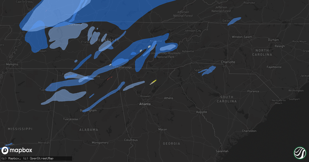
Hail Map on March 3, 2023
Get this storm
March 3 map
$229
one time, instant access
Download today. No call, no setup
Keep the $229
Bought the map and want the full workflow? Apply the entire $229 to a subscription within 7 days. None of it is wasted.
Every map, not just this one
This buys you this map. Subscription and you get every map we run, in the markets you choose from a few cities to whole states to nationwide. Plus real-time alerts the moment a storm fires.
Contact data
Name, contact info, occupancy, even credit band for addresses in the footprint. You go from where it hit to who to call.
Become the source they trust
Unlimited branding weather history reports on demand. You already have the documented answer ready for the property owner, and you are the one who showed up with it.
Property data and RoofTrace estimates
Pull up any address you have got, its value and the exact code rules for that jurisdiction, straight from One Click Code. Then RoofTrace estimates the squares, pitch, and roof value, priced the way you price.
States Impacted by Hail Map on March 3, 2023
Storm reports
Ohio
| Date | Description |
|---|---|
| 03/03/20235:52 PM CST | Vinton county 911 has reports of a tree down on garrett ridge road in jackson township. Time estimated by radar. |
| 03/03/20235:30 PM CST | Semi blown over on us-35. |
| 03/03/20235:30 PM CST | Spotter reported widespread damage from 6 se of chillicothe all the way into town. Trees... Wires down... And shingles off businesses. |
| 03/03/20234:45 PM CST | Barn down... Wires down... Trees down blocking sr 124. |
| 03/03/20234:35 PM CST | Ef0 tornado confirmed south of new vienna in highland county ohio with 80 mph winds. |
| 03/03/20234:34 PM CST | Two large evergreens uprooted. 10x16 shed blown up and into above ground pool. |
| 03/03/20234:26 PM CST | Ef1 tornado confirmed west of hillsboro in highland county ohio with 100 mph winds. |
| 03/03/20234:26 PM CST | Several reports of tornado producing damage in pricetown called in to law enforcement. Tornando likely. Unknown damage at this time. Time estimated from radar. |
| 03/03/20234:25 PM CST | Possible tornado. Tree and structure damage swath extends 1/3 of a mile sw to ne. |
| 03/03/20234:15 PM CST | Tree down... Numerous branches down. |
| 03/03/20234:10 PM CST | Jackson county 911 center has reports of a tree down state route 93 at tabernacle road. Time is estimated by radar. |
| 03/02/20237:56 PM CST | Power poles down at 73/71 |
| 03/02/20236:02 PM CST | Vinton county 911 has reports of trees down all along route 160. Time estimated by radar. |
| 03/02/20236:01 PM CST | Reports of a tree down on carpenter road. Passed along via vinton county 911. |
| 03/02/20236:01 PM CST | Reports of a tree down on carpenter road. Passed along via vinton county 911. Time estimated by radar. |
Georgia
| Date | Description |
|---|---|
| 03/03/20234:44 PM CST | A tree was downed on bright star road at biscayne way. |
| 03/03/20234:17 PM CST | A tree was downed on cherokee trail at heidi lane. |
| 03/03/20234:02 PM CST | 10 to 12 trees were downed onto the road at the intersection of cascade palmetto road and ga-92. |
| 03/03/20233:50 PM CST | A tree was downed on shirley rd near mt. Vernon rd. |
| 03/03/20233:50 PM CST | A tree was downed on phillips mill rd near hwy 166. |
| 03/03/20233:50 PM CST | Trees down in sky valley. |
| 03/03/20233:48 PM CST | Trees down in mountain city. |
| 03/03/20233:47 PM CST | A tree was downed on chestatee rd at cool springs rd. |
| 03/03/20233:45 PM CST | A tree was downed on mason creek rd near cougar trail. |
| 03/03/20233:44 PM CST | Corrects previous tstm wnd dmg report from 2 nne bill arp. A tree was downed on bright star road at biscayne way. |
| 03/03/20233:40 PM CST | A tree fell onto a vehicle on cambridge court. |
| 03/03/20233:25 PM CST | A tree was downed onto power lines on highway 136. |
| 03/03/20233:22 PM CST | A tree was downed onto the road on davis mill rd n at winndale rd. |
| 03/03/20233:15 PM CST | A tree was downed onto the 1300 block of cartersville hwy. |
| 03/03/20233:05 PM CST | A tree was downed in the 400 block of williams court. |
| 03/03/20233:05 PM CST | A tree was downed across highway 41 southbound one mile north of dabbs bridge road. |
| 03/03/20232:48 PM CST | Amateur radio network relayed report of damaged home off burnt mountain road. |
| 03/03/20232:34 PM CST | A tree was downed on power lines on morgan valley road. |
| 03/03/20232:25 PM CST | A barn was reported to have collapsed. |
| 03/03/20232:23 PM CST | A tree was downed onto a power line on henderson mountain rd at windwood way. |
| 03/03/20232:15 PM CST | Ham reported a downed tree 5 miles north of adairsville. Wind gusts were measured from non-nws station at 60 to 70mph. |
| 03/03/20232:13 PM CST | Power lines were downed on waleska lane. |
| 03/03/20232:10 PM CST | A tree was downed onto power lines on highway 282 just west of woodring branch road. |
| 03/03/20232:00 PM CST | Power pole down near the intersection of hwy 53 and edwards rd. |
| 03/03/20232:00 PM CST | The emergency manager relayed reported of a tree down over john jones road near gore. |
| 03/03/20231:59 PM CST | The emergency manager reported a tree down in roadway off temperance hall. |
| 03/03/20231:55 PM CST | Corrects previous tstm wnd dmg report from 3 wsw wood station. The emergency manager reported a tree down on a vehicle off temperance hall. |
| 03/03/20231:53 PM CST | Amateur radio network relayed report of a power pole snapped and across redmond road. |
| 03/03/20231:52 PM CST | The emergency manager reported tree down on campbell road in tunnell hill. |
| 03/03/20231:50 PM CST | A tree was downed onto a power line at the intersection of deep wood drive and tibbs bridge road. |
| 03/03/20231:48 PM CST | College staff reported a tree downed on a building on the shorter college campus. |
| 03/03/20231:46 PM CST | Barn collapse along avery road. Time estimated from radar. |
| 03/03/20231:45 PM CST | A tree was downed into the road in the 3000 block of mount pleasant road. |
| 03/03/20231:45 PM CST | Tree down across city view rd. |
| 03/03/20231:43 PM CST | Trees down in the stonebridge community in armuchee ga. |
| 03/03/20231:40 PM CST | A tree was downed onto 400 block of williams rd nw. |
| 03/03/20231:40 PM CST | A tree was downed on cleveland highway at nob north drive. |
| 03/03/20231:40 PM CST | Power lines were downed on varnell road at i-75. |
| 03/03/20231:38 PM CST | A tree was downed into the roadway on norris circle at old lake road. |
| 03/03/20231:36 PM CST | Tree down on houston valley rd. |
| 03/03/20231:35 PM CST | Tree on roadway near the intersection of martin ward and catoosa parkways. |
| 03/03/20231:35 PM CST | Multiple trees down around mitchell circle in gore community. |
| 03/03/20231:35 PM CST | The emergency manager reported a tree in the roadway off alabama highway near woodstation. |
| 03/03/20231:34 PM CST | Power lines were downed on the 4000 block of north jimmy drive. |
| 03/03/20231:30 PM CST | Tree down across the roadway along silver hill rd near gore... Ga. |
| 03/03/20231:25 PM CST | The emergency manager reported tree blocking the road at rocky hollow road and mahan road. |
| 03/03/20231:25 PM CST | Emergency manager reported tree down with powerlines at altanta anvnue and cloudland. |
| 03/03/20231:25 PM CST | The emergency manager reported a tree down on swanson road. |
| 03/03/20231:25 PM CST | The emergency manager reported a tree on an outbuilding on edmondson street. |
| 03/03/20231:15 PM CST | Trees blocking both lanes near the intersection of ga-337 and neal gap road. |
Indiana
| Date | Description |
|---|---|
| 03/03/20235:12 PM CST | Widespread branches down. |
| 03/03/20232:28 PM CST | The 9000 block of west state road 56 received widespread damage. A house was pushed off its block foundation. A garage lost its door and roof. Debris is scattered in a |
| 03/03/20232:10 PM CST | Dispatch reports trees down throughout the county. |
| 03/03/20232:05 PM CST | Dispatch reports a few trees down. |
| 03/03/20231:55 PM CST | Dispatch reports a few trees down across the county. |
| 03/03/20231:47 PM CST | 100 year old maple tree uprooted from thunderstorm winds. |
| 03/03/20231:44 PM CST | Trees down on 37 south near paoli. Several other reports of trees in the county as well. |
| 03/03/20231:40 PM CST | Trees down in leavenworth. |
| 03/03/20231:30 PM CST | Dispatch reports several trees down. |
| 03/03/20231:25 PM CST | Tree down at this address... Relayed via dubois county ema. |
| 03/03/20231:24 PM CST | Tree down 1/2 mile outside of jasper on sr56. |
| 03/03/20231:15 PM CST | Several tree limbs down... Some as large as 6” in diameter. |
| 03/03/20231:15 PM CST | Several tree limbs down... Some as large as 6â in diameter. |
| 03/03/20231:15 PM CST | Several tree limbs down... Some as large as 6” in diameter. |
| 03/03/20231:07 PM CST | Semi overturned at mile marker 58 on i-64. |
| 03/03/20231:00 PM CST | Trees down in rockport. 3 power poles down along with trees down on hwy 161 just north of owensboro. |
| 03/03/202312:57 PM CST | Shingles off roof... Siding off house... Trees down. |
| 03/03/202312:45 PM CST | A local report indicates 60 MPH wind near 5 SW DARMSTADT |
| 03/03/202312:30 PM CST | Roof blown off st joe catholic church in st joe. Multiple utility lines and poles down in the area as well. |
| 03/03/202312:30 PM CST | Tree 20inch in diameter blown over. A few sections of roofing on a house peeled up to sub-roofing. Scattered fencing down. |
| 03/02/20236:33 PM CST | 8 inch white pine tree snapped and struck a house. Thundersnow at the time. |
Alabama
| Date | Description |
|---|---|
| 03/03/20231:40 PM CST | Roof reported blown off house on cherokee county road 778. Time estimated from radar. |
| 03/03/20231:17 PM CST | Numerous trees down across cherokee county... Including tree on house along hwy 9 in cedar bluff. No injuries reported. |
| 03/03/20231:06 PM CST | Several trees were blown down near cropwell... Near pell city... And near ragland. |
| 03/03/20231:00 PM CST | Large tree down blocking noccalula road. Via social media... Time estimated from radar. |
| 03/03/202312:47 PM CST | A nws storm survey team found evidence of an ef-1 tornado in jackson county in pisgah... Al. |
| 03/03/202312:46 PM CST | Numerous trees down on cr 61 near pisgah. Possible tornado. |
| 03/03/202312:40 PM CST | A nws storm survey team found evidence of an ef-1 tornado in jackson county extending from section... Al into dutton... Al. |
| 03/03/202312:32 PM CST | Multiple trees reported down in springville... Including grove rd... Washington valley rd... Industrial dr... Burgess dr... Jones rd and evergreen rd. Roof damage on be |
| 03/03/202312:32 PM CST | Multiple trees reported down in springville... Including grove rd... Washington valley rd... And evergreen rd. Roof damage on beason lane. |
| 03/03/202312:24 PM CST | Facade torn off of the parking deck at 2nd ave and 19th street n across from mcwane center. Via social media. |
| 03/03/202312:13 PM CST | Structure damage on hytop rd |
| 03/03/202312:10 PM CST | Tree across residence unknown injury and trees down around blountsville elementary. School without power. Page street blountsville. Time based on radar. |
| 03/03/202312:10 PM CST | Roof blown off of mobile home on graves gap rd north of hayden. Time estimated from radar. |
| 03/03/202312:04 PM CST | Trees down on camp oliver road and paul oliver road in oak grove. A law enforcement vehicle was trapped by the downed tree... But no injuries reported. |
| 03/03/202311:45 AM CST | Widespread trees downed across the city of cullman. |
| 03/03/202311:40 AM CST | Multiple reports of trees down in research park. |
| 03/03/202311:36 AM CST | Numerous trees were blown down between oakman and berry. |
| 03/03/202311:28 AM CST | Khsv reports a gust of 58 kt. |
| 03/03/202311:25 AM CST | Roof and sign damage at the bank of walker county in jasper. Time estimated from radar. Via social media. |
| 03/03/202311:24 AM CST | Numerous trees were blown down all over the county. |
| 03/03/202311:18 AM CST | Kdcu reports a wind gust of 67 kt. |
| 03/03/202311:06 AM CST | Numerous trees were blown down across the northern part of walker county. Some roads remain impassable. |
| 03/03/202311:00 AM CST | Trees down near cr 87 and cr 331. |
| 03/03/202310:55 AM CST | Trees down and roads block at al 101/cr 406. |
| 03/03/202310:40 AM CST | A few trees were blown down on cr 391. |
| 03/03/202310:36 AM CST | Several trees down in multiple pickens county towns. |
| 03/03/202310:34 AM CST | Ksml reports a wind gust of 52 kt. |
| 03/03/202310:30 AM CST | Multiple downed trees reported along us43 in guin. |
| 03/03/202310:30 AM CST | Numerous reports of trees and power lines down near russellville. |
| 03/03/202310:30 AM CST | Co-op observer reported trees blown down in both marion and winston counties near haleyville. |
| 03/03/202310:14 AM CST | Trees and power lines down throughout sulligent... Also on highway 278. |
| 03/03/202310:11 AM CST | Reports coming in of trees down all along the line of storms in marion county west of hamilton. |
| 03/03/202310:03 AM CST | *** 1 inj *** trees down and report of a minor injury. |
| 03/03/20239:50 AM CST | Numerous reports of trees and power lines down near red bay. |
Illinois
| Date | Description |
|---|---|
| 03/03/202311:18 AM CST | Trees and power poles down in the uniontown area. Time estimated from radar. |
| 03/03/202311:10 AM CST | Large section of shingles removed on a home. Estimated at least 60 mph winds. |
North Carolina
| Date | Description |
|---|---|
| 03/03/20235:56 PM CST | Thunderstorm winds blew down one tree near the intersection of sparta road and painter lane. |
| 03/03/20235:44 PM CST | Thunderstorm winds blew down one tree along the 2500 block of mt. Zion road. |
| 03/03/20233:58 PM CST | Tree down in the roadway at the intersection of elk mountain rd and woodfin ave. |
| 03/03/20233:51 PM CST | Trees and power lines down. |
| 03/03/20233:42 PM CST | Numerous trees down in franklin... Nc. |
| 03/03/20233:40 PM CST | Trees down in roadways around the qualla boundary. |
| 03/03/20233:30 PM CST | Trees and power lines reported down county wide. |
| 03/03/20232:58 PM CST | Multiple trees reported down just north of kyle... Nc. |
| 03/03/20232:51 PM CST | Trees and power lines down across graham county. |
| 03/02/20237:55 PM CST | Tree down on power lines. |
| 03/02/20237:53 PM CST | Tree down and blocking roadway. |
| 03/02/20237:10 PM CST | 911 center reported powerlines down on w mountain st... As well as multiple tress down in other locations around winston-salem. Time estimated from radar based on locat |
| 03/02/20236:20 PM CST | Tree down on a house. |
Mississippi
| Date | Description |
|---|---|
| 03/03/20239:58 AM CST | A tree fell onto a house on mason drive. |
| 03/03/20239:58 AM CST | Several trees were blown down in columbus... And traffic lights were blown down at several intersections. |
| 03/03/20239:55 AM CST | A peak wind gust of 53 kts was measured by the kcbm asos. |
| 03/03/20239:54 AM CST | Strong storms this morning caused roof damage to a shed near lancaster rd. |
| 03/03/20239:45 AM CST | A hangar door was blown off at the monroe county airport. Additionally... A power pole was broken as well. |
| 03/03/20239:40 AM CST | Corrects time from previous tstm wnd dmg report from 5 ne aberdeen. A hangar door was blown off at the monroe county airport. Additionally... A power pole was downed. |
| 03/03/20239:35 AM CST | Corrects previous tstm wnd dmg report from west point. Corrects previous tstm wnd dmg report from west point. A few trees were blown down in west point including a few |
| 03/03/20239:35 AM CST | A tree was blown down in west point. |
| 03/03/20239:35 AM CST | Corrects previous tstm wnd dmg report from west point. A few trees were blown down in west point including a few which fell onto houses. |
| 03/03/20239:25 AM CST | Damage to a mobile home and an outbuilding. Suspected tornado damage. Time is radar estimated. |
| 03/03/20239:23 AM CST | Several trees were blown down in starkville. |
| 03/03/20239:23 AM CST | *** 1 inj *** corrects previous tstm wnd dmg report from starkville. Corrects previous tstm wnd dmg report from starkville. Several trees and power poles were blown dow |
| 03/03/20239:23 AM CST | *** 1 inj *** corrects previous tstm wnd dmg report from starkville. Several trees and power poles were blown down in starkville over a 15 minute period due to strong g |
| 03/03/20239:23 AM CST | Some trees and power lines were blown down in the noxapater area. |
| 03/03/20239:20 AM CST | *** 2 inj *** tree fell on house in mooreville. A couple of occupants were injured... But were able to evacuate premises. |
| 03/03/20239:05 AM CST | Scattered trees were blown down across parts of the county as a line of showers moved through. |
| 03/03/20239:05 AM CST | A few trees were blown down along ms highway 47 just south of the chickasaw county line. |
| 03/03/20238:30 AM CST | Trees were blown down on roads near kosciusko including ms highway 19e near the intersection with highway 14... Ms highway 43n... And ms highway 14w. Some power lines w |
| 03/03/20238:24 AM CST | Downed tree on a house just off of forest rd from storms this morning via photo on twitter. |
| 03/03/20238:24 AM CST | Downed tree on a house just off of forest rd from storms this morning v |
| 03/03/20238:21 AM CST | A peak wind gust of 50 knots from 260 degrees was measured by the kjan asos. |
| 03/03/20238:11 AM CST | Corrects previous tstm wnd dmg report for time. A tree was downed on utility lines at laurel st and howard st. Multiple other large limbs were downed in the belhaven ne |
| 03/03/20238:10 AM CST | A large tree at the governors mansion was blown down across n congress street and damaged some windows in a building across the street. Several pictures and a video wer |
| 03/03/20237:45 AM CST | Tree downed across gowall rd. |
| 03/02/20238:11 PM CST | A tree was downed on utility lines at laurel st and howard st. Multiple other large limbs were downed in the belhaven neighborhood. |
Pennsylvania
| Date | Description |
|---|---|
| 03/03/20232:21 PM CST | Report from mping: 3-inch tree limbs broken; power poles broken. |
| 03/02/20238:16 PM CST | Report from mping: 1-inch tree limbs broken; shingles blown off. |
| 03/02/20236:50 PM CST | Report from mping: 3-inch tree limbs broken; power poles broken. |
| 03/02/20236:08 PM CST | Report from mping: 1-inch tree limbs broken; shingles blown off. |
Virginia
| Date | Description |
|---|---|
| 03/03/20235:20 PM CST | Tree down on deerfield rd. |
| 03/03/20235:15 PM CST | Tree down along whittens mill road. |
| 03/03/20235:15 PM CST | Several trees down with numerous power outages. |
| 03/03/20234:35 PM CST | Several trees uprooted with numerous power outages. |
| 03/03/20234:35 PM CST | Several trees down with numerous power outages. |
| 03/03/20234:00 PM CST | Trees down. |
| 03/02/20236:30 PM CST | Tree down in 11000 block of woolwine highway. Time estimated from radar. |
| 03/02/20236:22 PM CST | Tree down near the intersection of willis gap road and brady pike. Time estimated from radar. |
South Carolina
| Date | Description |
|---|---|
| 03/03/20235:59 PM CST | Tree down on a power line along spartanburg rd. |
| 03/03/20235:53 PM CST | Trees down across bobo road. |
| 03/03/20235:52 PM CST | Trees reported down in belton. |
| 03/03/20235:48 PM CST | Power lines down. |
| 03/03/20235:42 PM CST | Tree down. |
| 03/03/20235:35 PM CST | Tree and power line fell on a house. |
| 03/03/20235:12 PM CST | 2 trees down north of pendleton. |
| 03/03/20234:40 PM CST | A few trees blown down on bumgardner dr near hwy 11. |
| 03/03/20234:25 PM CST | Few trees blown down on river road near old liberty rd. |
| 03/02/20239:02 PM CST | Large street sign damaged... Broken off its foundation legs. Time estimated by radar. |
| 03/02/20237:36 PM CST | *** 1 inj *** newberry county dispatch received a call at 8:36pm of a downed tree on a house with 1 injury. Time confirmed by radar. |
| 03/02/20237:15 PM CST | Several trees down. |
| 03/02/20236:55 PM CST | Several trees blow down around the city. |
| 03/02/20236:41 PM CST | Tree down on i-26 east bound near mile marker 46. |
| 03/02/20236:35 PM CST | Trees down near the intersection of hwy 92 and 49. |
| 03/02/20236:32 PM CST | Tree down. |
| 03/02/20236:30 PM CST | Tree down on emma cudd rd near bethesda rd. |
| 03/02/20236:30 PM CST | Tree down on interstate 26. |
| 03/02/20236:30 PM CST | Tree down across hwy 221 just south of enoree. |
| 03/02/20236:27 PM CST | Tree down. |
| 03/02/20236:25 PM CST | Tree blow down blocking roadway on country club road near farragut drive. |
| 03/02/20236:18 PM CST | Trees down. |
| 03/02/20236:12 PM CST | Power lines down. |
| 03/02/20236:10 PM CST | Power lines down on reining way. |
| 03/02/20236:06 PM CST | Tree down on roadway. |
| 03/02/20236:00 PM CST | Power lines down. |
Kentucky
| Date | Description |
|---|---|
| 03/03/20235:40 PM CST | Greenup county 911 has reports of a tree down blocking the road at 570 siloam ln in south shore. Time estimated by radar. |
| 03/03/20235:40 PM CST | Greenup county 911 passed along a report of a tree down blocking a lane of travel on state route 7 at brushy road in load. Time estimated by radar. |
| 03/03/20233:35 PM CST | A local report indicates 67 MPH wind near KYMESO OWENTON 5E |
| 03/03/20233:24 PM CST | A tree was down along johnson creek. The location and time is radar estimated. |
| 03/03/20233:13 PM CST | A local report indicates 70 MPH wind near 4 E CHESTNUT GROVE |
| 03/03/20233:07 PM CST | Trees down along harpers ferry road. |
| 03/03/20232:47 PM CST | Trees down along lake road near campbellsburg. |
| 03/03/20232:31 PM CST | Trees down along bourbon acres road. Additional trees down across the county with the storms. |
| 03/03/20232:30 PM CST | Trees were reported down along sandhill road. |
| 03/03/20231:50 PM CST | Corrects previous tstm wnd dmg report from science hill. Trees were reported to have been blow down. |
| 03/03/20231:50 PM CST | Tees were reported to have been blow down. |
| 03/03/20231:35 PM CST | Mesonet station brnd brandenburg 4 sw. |
| 03/03/20231:25 PM CST | Kentucky mesonet station hard hardinsburg. |
| 03/03/202312:55 PM CST | Awos station khop fort campbell ky. |
| 03/03/202312:52 PM CST | Trees down along knob lick road near edmonton. |
| 03/03/202312:45 PM CST | Mobile home home lifted and moved about 4 to 5 ft. Nearby carport moved into neighbors yard. Several barns destroyed in the area. |
| 03/03/202312:45 PM CST | Shingles off roofs... Some siding off of houses and trees down. |
| 03/03/202312:40 PM CST | Mesonet station 1578w logan aluminum. |
| 03/03/202312:39 PM CST | Trees down. |
| 03/03/202312:35 PM CST | A local report indicates 60 MPH wind near 4 E HEBBARDSVILLE |
| 03/03/202312:35 PM CST | Mesonet station ccty greenville ky 6 n. |
| 03/03/202312:30 PM CST | House with major roof shingle loss on hwy 531 just east of zion. Further down the road on hwy 531... A large barn lost part of its roof. |
| 03/03/202312:30 PM CST | Corrects previous tstm wnd dmg report from 4 sw spottsville. House with major roof shingle loss on hwy 351 just east of zion. Further down the road on hwy 351... A larg |
| 03/03/202312:29 PM CST | Trees and powerlines down near cave city. |
| 03/03/202312:15 PM CST | A local report indicates 63 MPH wind near 4 E MORGANFIELD |
| 03/03/202312:15 PM CST | Barn damaged on hwy 56... Shed damaged at wmsk radio station... A roof gone off a home on the union/henderson county line. |
| 03/03/202312:10 PM CST | A local report indicates 67 MPH wind near 6 N HOPKINSVILLE |
| 03/03/202312:00 PM CST | Several barns destroyed. Estimated at least 60 mph winds. |
| 03/03/202311:55 AM CST | A local report indicates 69 MPH wind near 3 SW CADIZ |
| 03/03/202311:38 AM CST | Personal weather station cwop - dw6462 murray. |
| 03/03/202311:35 AM CST | Pole barn damaged trees down. |
| 03/03/202311:26 AM CST | A local report indicates 70 MPH wind near CALVERT CITY |
| 03/03/202311:15 AM CST | Multiple power poles and power lines down in and around the city. |
| 03/03/202311:09 AM CST | Corrects previous tornado report from 5 wsw reidland. Damaged homes and trees down in the fremont area reported by off duty nws employee. Time determined from radar. |
| 03/03/202311:09 AM CST | Several trees down in greenville/central city area. |
| 03/03/202311:08 AM CST | Corrects previous tornado report from 5 nne boaz. An ef-2 tornado began at 1108 am cst just west of the intersection of old mayfield road and mcneil road. Traveling nne |
| 03/03/202311:07 AM CST | Damaged homes and trees down in the fremont area reported by off duty nws employee. |
| 03/03/202311:00 AM CST | Mesonet station pryb mayfield ky 6 sw. |
| 03/03/202310:40 AM CST | Mesonet station hckm hickman ky 2 e. |
| 03/02/202311:08 PM CST | An ef-2 tornado began at 1108 am cst just west of the intersection of old mayfield road and mcneil road. Traveling nne... The tornado paralleled old mayfield road... Do |
Tennessee
| Date | Description |
|---|---|
| 03/03/20234:00 PM CST | Multiple trees reported down in blountville. |
| 03/03/20233:43 PM CST | Multiple power lines down. Time estimated by radar. |
| 03/03/20233:40 PM CST | Tree down blocking traffic on highway 126 at ethel drive. |
| 03/03/20233:00 PM CST | *** 1 inj *** report of a tree that fell on a woman in a vehicle as a result of the storms that moved through. She was taken to the hospital with minor injuries. Time i |
| 03/03/20232:48 PM CST | Trees down in the dandridge area. Time estimated from radar. |
| 03/03/20232:40 PM CST | Tree down at old sevierville pike and newell station road intersection all lanes blocked. Time estimated from radar. |
| 03/03/20232:30 PM CST | Widespread trees and power lines down across the county. |
| 03/03/20232:26 PM CST | Corrects previous tstm wnd gst report from 2 n alcoa. Asos station ktys knoxville mcghee tyson. |
| 03/03/20232:25 PM CST | Trees down in ne madisonville... Off of stinnett road. Location estimated. |
| 03/03/20232:23 PM CST | Asos station ktys knoxville mcghee tyson. |
| 03/03/20232:17 PM CST | Multiple trees and power lines down. |
| 03/03/20232:15 PM CST | Tree knocked down power lines... Completely blocking robinson road. Time estimated by radar. |
| 03/03/20232:01 PM CST | Report from mping: trees uprooted or snapped; roof blown off. |
| 03/03/20232:01 PM CST | Lawn furniture and unsecured items blown away by the winds. Small branches breaking from trees. |
| 03/03/20231:45 PM CST | Multiple trees down. |
| 03/03/20231:40 PM CST | Trees down on hwy 11 between riceville and calhoun. |
| 03/03/20231:10 PM CST | Multiple trees down. |
| 03/03/20231:00 PM CST | Partial roof blown off and power is out. Radar verified at 1pm. |
| 03/03/20231:00 PM CST | Powerlines down blocking highway 41 in jasper. |
| 03/03/202312:50 PM CST | Trees down in dunlap and multiple locations western part of the county. |
| 03/03/202312:45 PM CST | Corrects previous tstm wnd dmg report from 1 se griffith creek. Trees down on top of whitwell mountain. Along hwy 108. Location approximate. Time estimated from radar. |
| 03/03/202312:40 PM CST | Trees down on top of whitwell mountain. Along hwy 108. Location approximate. Time estimated from radar. |
| 03/03/202312:35 PM CST | Tree down blocking the road at intersection of florence rd. And old jefferson pike. |
| 03/03/202312:35 PM CST | Multiple trees down in jasper area. Time estimated by radar. |
| 03/03/202312:30 PM CST | Tree across long island road in new hope tn. Location estimated. |
| 03/03/202312:10 PM CST | Corrects previous non-tstm wnd gst report from 8 se bradyville. Mesonet station fw5931 bradyville. |
| 03/03/202311:53 AM CST | Metal part of a roof became unattached during a strong windstorm. |
| 03/03/202311:37 AM CST | Medium-sized tree down near church parking lot blocking side road. Radar verified 11:37am. |
| 03/03/202311:37 AM CST | Powerlines down and dangling all throughout the city. Radar verified storm at 11:37am was severe warned. |
| 03/03/202311:37 AM CST | Large tree down near goodlettsville fire department. |
| 03/03/202311:24 AM CST | Structure collapse called in. Tree fallen straight through home. Verified on radar at 11:24am. |
| 03/03/202311:12 AM CST | Report from mping: tree limbs and power poles broken. Radar verified at 11:12am. |
| 03/03/202311:02 AM CST | Roof damage to a metal building. |
| 03/03/202310:51 AM CST | Report from mping: 3-inch tree limbs broken; power poles broken. |
West Virginia
| Date | Description |
|---|---|
| 03/03/20234:00 PM CST | Wayne county 911 has several reports of trees and power lines down in the town of crum... Wv. There are power outages associated with this as well. Time estimated by ra |
| 03/03/20233:56 PM CST | Wayne county 911 center advised there are several reports of trees and lines down in the dunlow area of the county. Time estimated by radar. |
| 03/02/20236:03 PM CST | Report from mping: 1-inch tree limbs broken; shingles blown off. |
Cities Impacted by Hail Map on March 3, 2023
- Aberdeen, MS
- Hamilton, MS
- Greenwood Springs, MS
- Amory, MS
- Caledonia, MS
- Sulligent, AL
- Gattman, MS
- Winfield, AL
- Detroit, AL
- Beaverton, AL
- Guin, AL
- Fayette, AL
- Brilliant, AL
- Hamilton, AL
- Hackleburg, AL
- Tremont, MS
- Smithville, MS
- Golden, MS
- Fulton, MS
- Vina, AL
- Red Bay, AL
- Hodges, AL
- Phil Campbell, AL
- Belmont, MS
- Leighton, AL
- Spruce Pine, AL
- Trinity, AL
- Mount Hope, AL
- Moulton, AL
- Danville, AL
- Courtland, AL
- Decatur, AL
- Russellville, AL
- Hillsboro, AL
- Town Creek, AL
- Tuscumbia, AL
- Dennis, MS
- New Site, MS
- Oak Grove, KY
- Herndon, KY
- Fort Campbell, KY
- Hopkinsville, KY
- Pembroke, KY
- Elkton, KY
- Crofton, KY
- Greenville, KY
- Central City, KY
- Tiptonville, TN
- Hickman, KY
- Portageville, MO
- Troy, TN
- Union City, TN
- Ridgely, TN
- Hornbeak, TN
- Rives, TN
- South Fulton, TN
- East Prairie, MO
- Fulton, KY
- Water Valley, KY
- Mayfield, KY
- Clinton, KY
- Wingo, KY
- Kirksey, KY
- Arlington, KY
- Bardwell, KY
- Columbus, KY
- Wickliffe, KY
- Fancy Farm, KY
- Cunningham, KY
- Hickory, KY
- Charleston, MO
- New Madrid, MO
- Kevil, KY
- Benton, KY
- Symsonia, KY
- Paducah, KY
- Melber, KY
- Boaz, KY
- Hartselle, AL
- Somerville, AL
- La Center, KY
- Calvert City, KY
- Brookport, IL
- West Paducah, KY
- Metropolis, IL
- Barlow, KY
- Ledbetter, KY
- Eldridge, AL
- Carbon Hill, AL
- Townley, AL
- Nauvoo, AL
- Jasper, AL
- Lynn, AL
- Double Springs, AL
- Haleyville, AL
- Houston, AL
- Bear Creek, AL
- Rogersville, AL
- Muscle Shoals, AL
- Smithland, KY
- Golconda, IL
- Grand Rivers, KY
- Madison, AL
- Huntsville, AL
- Tanner, AL
- Burna, KY
- Drakesboro, KY
- Centertown, KY
- Rockport, KY
- Powderly, KY
- Dunmor, KY
- Belton, KY
- Beaver Dam, KY
- Browder, KY
- Beechmont, KY
- Beech Creek, KY
- Gilbertsville, KY
- Tiline, KY
- Hampton, KY
- Marion, KY
- Kuttawa, KY
- Fredonia, KY
- Eddyville, KY
- Salem, KY
- Eddyville, IL
- Arley, AL
- Crane Hill, AL
- Addison, AL
- Bremen, AL
- Cullman, AL
- Logan, AL
- Princeton, KY
- Herod, IL
- Elizabethtown, IL
- Rosiclare, IL
- Brownsboro, AL
- Gurley, AL
- New Market, AL
- Hollytree, AL
- Princeton, AL
- Toney, AL
- Meridianville, AL
- Shelbyville, TN
- Fayetteville, TN
- Petersburg, TN
- Wartrace, TN
- Bell Buckle, TN
- Christiana, TN
- Beechgrove, TN
- Bradyville, TN
- Woodbury, TN
- Morrison, TN
- Manchester, TN
- Mcminnville, TN
- Obion, TN
- Dukedom, TN
- Almo, KY
- Cottage Grove, TN
- Martin, TN
- Dexter, KY
- Dresden, TN
- Sedalia, KY
- Hazel, KY
- Hardin, KY
- Palmersville, TN
- Puryear, TN
- Murray, KY
- Farmington, KY
- Cadiz, KY
- New Concord, KY
- Bumpus Mills, TN
- Dover, TN
- Gracey, KY
- Cerulean, KY
- Sturgis, KY
- Dawson Springs, KY
- Providence, KY
- Cave In Rock, IL
- Nebo, KY
- Morganfield, KY
- Clay, KY
- Five Points, TN
- Loretto, TN
- Anderson, AL
- Lexington, AL
- Leoma, TN
- Minor Hill, TN
- Prospect, TN
- Pulaski, TN
- Goodspring, TN
- Cornersville, TN
- Lewisburg, TN
- Lynnville, TN
- Belfast, TN
- Estillfork, AL
- Scottsboro, AL
- Stevenson, AL
- Sherwood, TN
- Belvidere, TN
- Huntland, TN
- Saint Charles, KY
- White Plains, KY
- Nortonville, KY
- Earlington, KY
- Graham, KY
- Madisonville, KY
- Mortons Gap, KY
- Hanson, KY
- Shawneetown, IL
- Sacramento, KY
- New Haven, IL
- Sebree, KY
- Uniontown, KY
- Henderson, KY
- Manitou, KY
- Bremen, KY
- Corydon, KY
- Rumsey, KY
- Robards, KY
- Island, KY
- Dixon, KY
- Mount Vernon, IN
- Equality, IL
- Junction, IL
- Slaughters, KY
- Waverly, KY
- Ridgway, IL
- Newburgh, IN
- Reed, KY
- Evansville, IN
- Calhoun, KY
- Owensboro, KY
- Spottsville, KY
- Wadesville, IN
- Utica, KY
- Smithville, TN
- Sparta, TN
- Cookeville, TN
- Sewanee, TN
- South Pittsburg, TN
- Bridgeport, AL
- Chattanooga, TN
- Jasper, TN
- Guild, TN
- Whitwell, TN
- Dunlap, TN
- Sequatchie, TN
- Signal Mountain, TN
- Tracy City, TN
- Livermore, KY
- Chandler, IN
- Morgantown, KY
- Rochester, KY
- McHenry, KY
- Hartford, KY
- Cromwell, KY
- Philpot, KY
- Richland, IN
- Whitesville, KY
- Rockport, IN
- Boonville, IN
- Hayden, AL
- Blountsville, AL
- Elberfeld, IN
- Lynnville, IN
- Haubstadt, IN
- Oakland City, IN
- Fort Branch, IN
- Maceo, KY
- Tennyson, IN
- Chrisney, IN
- Olaton, KY
- Rosine, KY
- Fordsville, KY
- Horse Branch, KY
- Dundee, KY
- Lewisport, KY
- Palmer, TN
- Hixson, TN
- Soddy Daisy, TN
- Falls Of Rough, KY
- Caneyville, KY
- Reynolds Station, KY
- Hawesville, KY
- Grandview, IN
- Troy, IN
- Spurgeon, IN
- Dale, IN
- Lincoln City, IN
- Lamar, IN
- Evanston, IN
- Santa Claus, IN
- Tell City, IN
- Cannelton, IN
- Stendal, IN
- Gentryville, IN
- Cloverport, KY
- Winslow, IN
- Velpen, IN
- Holland, IN
- Huntingburg, IN
- Ferdinand, IN
- Monterey, TN
- Rickman, TN
- Crawford, TN
- Dayton, TN
- Evensville, TN
- Decatur, TN
- Jasper, IN
- Saint Meinrad, IN
- Otwell, IN
- Saint Anthony, IN
- Montgomery, IN
- Bristow, IN
- Petersburg, IN
- Cannelburg, IN
- Garfield, KY
- Hardinsburg, KY
- Irvington, KY
- Rome, IN
- Harned, KY
- Schnellville, IN
- Birdseye, IN
- Rhodelia, KY
- Webster, KY
- Celestine, IN
- Eckerty, IN
- Leopold, IN
- Dubois, IN
- Saint Croix, IN
- English, IN
- Loogootee, IN
- Leavenworth, IN
- Battletown, KY
- Branchville, IN
- Union Star, KY
- Stephensport, KY
- Payneville, KY
- Derby, IN
- Harrison, TN
- Brandenburg, KY
- Guston, KY
- Shoals, IN
- French Lick, IN
- Sulphur, IN
- Fultondale, AL
- Birmingham, AL
- Fairfield, AL
- Docena, AL
- Mulga, AL
- Pleasant Grove, AL
- Bessemer, AL
- Dolomite, AL
- Trussville, AL
- Odenville, AL
- Springville, AL
- Pinson, AL
- Ashville, AL
- Oneonta, AL
- Steele, AL
- Attalla, AL
- Gadsden, AL
- Rainbow City, AL
- Centre, AL
- Leesburg, AL
- Taswell, IN
- Mitchell, IN
- West Baden Springs, IN
- Collinsville, AL
- Cedar Bluff, AL
- Paoli, IN
- Grantsburg, IN
- Marengo, IN
- Corydon, IN
- Milltown, IN
- Ekron, KY
- Mauckport, IN
- Central, IN
- Trion, GA
- Lyerly, GA
- Gaylesville, AL
- Summerville, GA
- Laconia, IN
- Elizabeth, IN
- Depauw, IN
- Hardinsburg, IN
- New Middletown, IN
- New Salisbury, IN
- Ramsey, IN
- Orleans, IN
- Williams, IN
- Salem, IN
- Palmyra, IN
- Pekin, IN
- Fredericksburg, IN
- Greenville, IN
- Georgetown, IN
- Lanesville, IN
- Campbellsburg, IN
- Crandall, IN
- Tunnelton, IN
- Bedford, IN
- Oolitic, IN
- Norman, IN
- Scottsburg, IN
- Heltonville, IN
- Floyds Knobs, IN
- Vallonia, IN
- Medora, IN
- Borden, IN
- Brownstown, IN
- Crothersville, IN
- Freetown, IN
- Englewood, TN
- Madisonville, TN
- Vonore, TN
- Greenback, TN
- Maryville, TN
- Friendsville, TN
- Alcoa, TN
- Louisville, TN
- Rockford, TN
- Knoxville, TN
- Lenoir City, TN
- Rome, GA
- Mount Berry, GA
- Kingston, GA
- Adairsville, GA
- Calhoun, GA
- Plainville, GA
- Rydal, GA
- Talking Rock, GA
- Jasper, GA
- Fairmount, GA
- Ranger, GA
- Simpsonville, KY
- Shelbyville, KY
- Eminence, KY
- Pleasureville, KY
- Bethlehem, KY
- Lockport, KY
- Owenton, KY
- Dahlonega, GA
- Bethel, OH
- Williamsburg, OH
- Mount Orab, OH
- Niota, TN
- Sweetwater, TN
- Philadelphia, TN
- Lynchburg, OH
- Hillsboro, OH
- New Vienna, OH
- Nettleton, MS
- Saltillo, MS
- Tupelo, MS
- Mooreville, MS
- Marietta, MS
- Mantachie, MS
- Prairie, MS
- West Point, MS
- Pearl, MS
- Flowood, MS
- Jackson, MS
- Richland, MS
- Brandon, MS
- Terry, MS
- Raymond, MS
- Byram, MS
- Florence, MS
- Utica, MS
- Woodruff, SC
- Duncan, SC
- Moore, SC
- Spartanburg, SC
- Roebuck, SC
- Glendale, SC
- Gaffney, SC
- Mount Airy, NC
- Lowgap, NC
- Ararat, VA
- Cana, VA
- Fancy Gap, VA
- Lambsburg, VA
- Hillsville, VA
- Meadows Of Dan, VA
- Laurel Fork, VA
- Stuart, VA
- Woolwine, VA
- Pauline, SC
- Jonesville, SC
- Pacolet, SC
- Blacksburg, SC
- Smyrna, SC
- Hickory Grove, SC
- Dawsonville, GA
- Section, AL
- Dutton, AL
- Pisgah, AL
- Henagar, AL
- Cedar Grove, TN
- Gleason, TN
- Medina, TN
- Friendship, TN
- Jackson, TN
- Oakfield, TN
- Trimble, TN
- Brownsville, TN
- Dyersburg, TN
- Sharon, TN
- Bells, TN
- Rutherford, TN
- Alamo, TN
- Atwood, TN
- Humboldt, TN
- Halls, TN
- Lavinia, TN
- Trenton, TN
- Trezevant, TN
- Finley, TN
- Kenton, TN
- McKenzie, TN
- Denmark, TN
- Newbern, TN
- Dyer, TN
- Huntingdon, TN
- Milan, TN
- Bradford, TN
- Greenfield, TN
- Gadsden, TN
- Lexington, TN
- Beech Bluff, TN
- Tennessee Ridge, TN
- Hurricane Mills, TN
- Holladay, TN
- Bruceton, TN
- Mansfield, TN
- Stewart, TN
- New Johnsonville, TN
- Hollow Rock, TN
- Paris, TN
- Springville, TN
- Eva, TN
- Big Sandy, TN
- Westport, TN
- Camden, TN
- Buena Vista, TN
- Waverly, TN
- Big Rock, TN
- Buchanan, TN
- Henry, TN
- Yuma, TN
- Parsons, TN
- Sugar Tree, TN
- Wildersville, TN
- Darden, TN
- Lobelville, TN
- Linden, TN
- Indian Mound, TN
- Erin, TN
- McEwen, TN
- Cumberland City, TN
- Dickson, TN
- Charlotte, TN
- Vanleer, TN
- Cumberland Furnace, TN
- Clarksville, TN
- Palmyra, TN
- Ashland City, TN
- Cunningham, TN
- Chapmansboro, TN
- Woodlawn, TN
- White Bluff, TN
- Southside, TN
- Joelton, TN
- Pleasant View, TN
- Springfield, TN
- Adams, TN
- Greenbrier, TN
- Cedar Hill, TN
- Only, TN
- Centerville, TN
- White House, TN
- Old Hickory, TN
- Madison, TN
- Whites Creek, TN
- Brentwood, TN
- Nashville, TN
- Hendersonville, TN
- Goodlettsville, TN
- Franklin, TN
- Gallatin, TN
- Cottontown, TN
- Nolensville, TN
- Murfreesboro, TN
- Arrington, TN
- Antioch, TN
- Smyrna, TN
- La Vergne, TN
- Lebanon, TN
- Mount Juliet, TN
- Hermitage, TN
- College Grove, TN
- Milton, TN
- Auburntown, TN
- Gordonsville, TN
- Watertown, TN
- Lascassas, TN
- Alexandria, TN
- Brush Creek, TN
- Dowelltown, TN
- Liberty, TN
- Readyville, TN
- Heiskell, TN
- Kingston, TN
- Rockwood, TN
- Grandview, TN
- Powell, TN
- Clinton, TN
- Ten Mile, TN
- Powder Springs, TN
- Briceville, TN
- Crossville, TN
- Crab Orchard, TN
- Oliver Springs, TN
- Maynardville, TN
- Luttrell, TN
- Oak Ridge, TN
- Harriman, TN
- Andersonville, TN
- Blaine, TN
- Farragut, TN
- Loudon, TN
- Rutledge, TN
- Wartburg, TN
- Spring City, TN
- Pikeville, TN
- Oakdale, TN
- Corryton, TN
- Washburn, TN
- Graysville, TN
- Coalmont, TN
- Gruetli Laager, TN
- Sale Creek, TN
- Birchwood, TN
- Athens, TN
- Georgetown, TN
- Riceville, TN
- Etowah, TN
- Calhoun, TN
- Delano, TN
- Charleston, TN
- Cleveland, TN
- Benton, TN
- Tellico Plains, TN
- Ocoee, TN
- Crandall, GA
- Old Fort, TN
- Cisco, GA
- Reliance, TN
- Tallassee, TN
- Mascot, TN
- Strawberry Plains, TN
- Seymour, TN
- Walland, TN
- Kodak, TN
- Townsend, TN
- Pigeon Forge, TN
- Dandridge, TN
- Jefferson City, TN
- New Market, TN
- Sevierville, TN
- Cosby, TN
- Gatlinburg, TN
- Robbinsville, NC
- Bryson City, NC
- Clyde, NC
- Hartford, TN
- Cherokee, NC
- Del Rio, TN
- Newport, TN
- Talbott, TN
- Morristown, TN
- Sharpsburg, KY
- Germantown, KY
- Lexington, KY
- Millersburg, KY
- Sadieville, KY
- Moorefield, KY
- Flemingsburg, KY
- West Union, OH
- Salvisa, KY
- North Middletown, KY
- Brooksville, KY
- Mayslick, KY
- Augusta, KY
- Manchester, OH
- Mount Olivet, KY
- Winchester, KY
- Stamping Ground, KY
- Ewing, KY
- Maysville, KY
- Nicholasville, KY
- Vanceburg, KY
- Winchester, OH
- Aberdeen, OH
- Tollesboro, KY
- Ripley, OH
- Versailles, KY
- Dover, KY
- Midway, KY
- Lawrenceburg, KY
- Cynthiana, KY
- Russellville, OH
- Paris, KY
- Wilmore, KY
- Carlisle, KY
- Georgetown, KY
- Bagdad, KY
- Frankfort, KY
- Corinth, KY
- Prospect, KY
- New Castle, KY
- Crestwood, KY
- Louisville, KY
- Shepherdsville, KY
- Glenview, KY
- Waddy, KY
- Jeffersonville, IN
- Mount Eden, KY
- Masonic Home, KY
- Brooks, KY
- Taylorsville, KY
- Fisherville, KY
- New Albany, IN
- Buckner, KY
- Clarksville, IN
- Finchville, KY
- Pewee Valley, KY
- Fairdale, KY
- La Grange, KY
- Sellersburg, IN
- Smithfield, KY
- Mount Washington, KY
- Horse Cave, KY
- Buffalo, KY
- Bloomfield, KY
- Lebanon, KY
- Summersville, KY
- Saint Catharine, KY
- Knob Lick, KY
- New Haven, KY
- Raywick, KY
- Springfield, KY
- Loretto, KY
- Boston, KY
- Cave City, KY
- Canmer, KY
- Gravel Switch, KY
- New Hope, KY
- Bradfordsville, KY
- Willisburg, KY
- Campbellsville, KY
- Bardstown, KY
- Center, KY
- Magnolia, KY
- Hodgenville, KY
- Hardyville, KY
- Coxs Creek, KY
- Greensburg, KY
- Munfordville, KY
- Saint Francis, KY
- Mount Sherman, KY
- Edmonton, KY
- Perryville, KY
- Fairfield, KY
- Chaplin, KY
- Harrodsburg, KY
- Mackville, KY
- Liberty, KY
- Elk Horn, KY
- Columbia, KY
- Mannsville, KY
- Knifley, KY
- Parksville, KY
- Gradyville, KY
- Glasgow, KY
- Dunnville, KY
- Russell Springs, KY
- Glens Fork, KY
- Summer Shade, KY
- Eighty Eight, KY
- Lawrenceburg, TN
- Ethridge, TN
- Burns, TN
- Lewisburg, KY
- Rockfield, KY
- Jetson, KY
- Russellville, KY
- Oakland, KY
- Auburn, KY
- Bee Spring, KY
- Roundhill, KY
- Brownsville, KY
- Bowling Green, KY
- Franklin, KY
- Alvaton, KY
- Sweeden, KY
- Woodburn, KY
- Scottsville, KY
- Portland, TN
- Holland, KY
- Adolphus, KY
- Gamaliel, KY
- Fountain Run, KY
- Tompkinsville, KY
- Etoile, KY
- Austin, KY
- Mount Hermon, KY
- West Point, KY
- Custer, KY
- White Mills, KY
- Leitchfield, KY
- Glendale, KY
- Rocky Hill, KY
- Fort Knox, KY
- Upton, KY
- Westmoreland, TN
- Sonora, KY
- Elizabethtown, KY
- Big Clifty, KY
- Smiths Grove, KY
- Mammoth Cave, KY
- Lucas, KY
- Westview, KY
- Radcliff, KY
- McDaniels, KY
- Beaumont, KY
- Eastview, KY
- Hudson, KY
- Cecilia, KY
- Clarkson, KY
- Vine Grove, KY
- Park City, KY
- Millwood, KY
- Bonnieville, KY
- Cub Run, KY
- Muldraugh, KY
- Adairville, KY
- Rineyville, KY
- Lebanon Junction, KY
- Clermont, KY
- Burkesville, KY
- Breeding, KY
- Hustonville, KY
- Junction City, KY
- Danville, KY
- Burgin, KY
- Lafayette, TN
- Lancaster, KY
- Byrdstown, TN
- Alpha, KY
- Stearns, KY
- Albany, KY
- Monticello, KY
- Hestand, KY
- Pall Mall, TN
- Science Hill, KY
- Nancy, KY
- Windsor, KY
- Jamestown, KY
- Yosemite, KY
- Middleburg, KY
- Kings Mountain, KY
- Stanford, KY
- Paint Lick, KY
- Berea, KY
- Richmond, KY
- Waynesburg, KY
- Crab Orchard, KY
- Waco, KY
- Stout, OH
- Wallingford, KY
- Friendship, OH
- Lynx, OH
- Oak Hill, OH
- Londonderry, OH
- Otway, OH
- Minford, OH
- Ray, OH
- Portsmouth, OH
- Jackson, OH
- Garrison, KY
- Piketon, OH
- Peebles, OH
- West Portsmouth, OH
- Lucasville, OH
- South Portsmouth, KY
- Blue Creek, OH
- Chillicothe, OH
- South Bloomingville, OH
- Beaver, OH
- Richmond Dale, OH
- McDermott, OH
- Waverly, OH
- Wheelersburg, OH
- Rarden, OH
- South Webster, OH
- Frankfort, OH
- Millersport, OH
- Thurston, OH
- Bainbridge, OH
- Kirkersville, OH
- Pataskala, OH
- Adelphi, OH
- Pickerington, OH
- Circleville, OH
- Stoutsville, OH
- Hebron, OH
- Ashville, OH
- Baltimore, OH
- Pleasantville, OH
- Kingston, OH
- Tarlton, OH
- Lancaster, OH
- Carroll, OH
- Canal Winchester, OH
- Latham, OH
- Granville, OH
- Laurelville, OH
- Amanda, OH
- Groveport, OH
- Williamsport, OH
- Lithopolis, OH
- South Salem, OH
- Alexandria, OH
- Etna, OH
- Clarksburg, OH
- Reynoldsburg, OH
- Grove City, OH
- Washington Court House, OH
- Mount Sterling, OH
- Blacklick, OH
- Orient, OH
- Greenfield, OH
- Columbus, OH
- Commercial Point, OH
- Lockbourne, OH
- New Holland, OH
- Seaman, OH
- Bloomingburg, OH
- Sabina, OH
- Leesburg, OH
- Wilmington, OH
- Blanchester, OH
- Martinsville, OH
- Pleasant Plain, OH
- Berry, KY
- Morning View, KY
- Melbourne, KY
- Owensville, OH
- Falmouth, KY
- Goshen, OH
- Loveland, OH
- Hamersville, OH
- Cincinnati, OH
- Neville, OH
- Batavia, OH
- California, KY
- Georgetown, OH
- Felicity, OH
- Foster, KY
- Milford, OH
- Sardinia, OH
- Fayetteville, OH
- New Richmond, OH
- Williamstown, KY
- Dry Ridge, KY
- De Mossville, KY
- Amelia, OH
- Midland, OH
- Moscow, OH
- Butler, KY
- Alexandria, KY
- Quincy, KY
- Charlestown, IN
- Goshen, KY
- South Shore, KY
- Westport, KY
- Marysville, IN
- Memphis, IN
- Bedford, KY
- Perry Park, KY
- New Liberty, KY
- Pendleton, KY
- Turners Station, KY
- Campbellsburg, KY
- Sulphur, KY
- Worthville, KY
- Bronston, KY
- Burnside, KY
- Ferguson, KY
- Eubank, KY
- Whitley City, KY
- Bethelridge, KY
- Somerset, KY
- Vest, KY
- Orlando, KY
- Brodhead, KY
- Dwale, KY
- West Van Lear, KY
- Jackson, KY
- Thelma, KY
- Garrett, KY
- Mousie, KY
- Hyden, KY
- Hazard, KY
- Langley, KY
- Printer, KY
- Lost Creek, KY
- Gunlock, KY
- Gays Creek, KY
- Keavy, KY
- Van Lear, KY
- River, KY
- Hueysville, KY
- Tyner, KY
- Chavies, KY
- Emmalena, KY
- Leburn, KY
- Hagerhill, KY
- Clayhole, KY
- Meally, KY
- Corbin, KY
- Annville, KY
- Royalton, KY
- Banner, KY
- Ary, KY
- Bulan, KY
- Sextons Creek, KY
- Allen, KY
- Ivel, KY
- Prestonsburg, KY
- Tutor Key, KY
- Wayland, KY
- David, KY
- Rowdy, KY
- East Point, KY
- Oneida, KY
- Lackey, KY
- Salyersville, KY
- Livingston, KY
- Minnie, KY
- Manchester, KY
- Garner, KY
- Williamsport, KY
- Buckhorn, KY
- Krypton, KY
- Staffordsville, KY
- Paintsville, KY
- Grethel, KY
- London, KY
- Eastern, KY
- Parkers Lake, KY
- Mount Vernon, KY
- Martin, KY
- Blue River, KY
- Dana, KY
- East Bernstadt, KY
- Drift, KY
- McDowell, KY
- Auxier, KY
- Harold, KY
- McKee, KY
- Vincent, KY
- Booneville, KY
- Fort Gay, WV
- Irvine, KY
- Campton, KY
- Rousseau, KY
- Zoe, KY
- Varney, KY
- Williamson, WV
- Boons Camp, KY
- Warfield, KY
- Kermit, WV
- Sitka, KY
- Sandgap, KY
- Slade, KY
- Pikeville, KY
- Ravenna, KY
- Lenore, WV
- Beattyville, KY
- Debord, KY
- Blaine, KY
- Lovely, KY
- Stambaugh, KY
- Whick, KY
- Vancleve, KY
- Sidney, KY
- Louisa, KY
- Lowmansville, KY
- Crum, WV
- Tram, KY
- Inez, KY
- Flatgap, KY
- Rogers, KY
- Tomahawk, KY
- Beauty, KY
- Cannel City, KY
- Keaton, KY
- Pine Ridge, KY
- Pilgrim, KY
- Ricetown, KY
- Belfry, KY
- Mize, KY
- Hazel Green, KY
- Oil Springs, KY
- Wittensville, KY
- Bays, KY
- Stanton, KY
- West Liberty, KY
- Ulysses, KY
- Stanville, KY
- Betsy Layne, KY
- Mistletoe, KY
- Isonville, KY
- Clearfield, KY
- Clay City, KY
- Wellington, KY
- Denniston, KY
- Martha, KY
- Means, KY
- Mount Sterling, KY
- Salt Lick, KY
- Frenchburg, KY
- Owingsville, KY
- Ezel, KY
- Sandy Hook, KY
- Morehead, KY
- Elkfork, KY
- Olympia, KY
- Jeffersonville, KY
- Hope, KY
- Adams, KY
- Webbville, KY
- Olive Hill, KY
- Hillsboro, KY
- Sharon Grove, KY
- La Fayette, KY
- Trenton, KY
- Olmstead, KY
- Allensville, KY
- Guthrie, KY
- Simpson, IL
- Karnak, IL
- Grand Chain, IL
- Belknap, IL
- Grantsburg, IL
- Cairo, IL
- Anniston, MO
- Lilbourn, MO
- Bertrand, MO
- Marston, MO
- Matthews, MO
- Orlinda, TN
- Red Boiling Springs, TN
- Jamestown, TN
- Allons, TN
- Celina, TN
- Hilham, TN
- Alpine, TN
- Livingston, TN
- Moss, TN
- Whitleyville, TN
- Monroe, TN
- Sheffield, AL
- Florence, AL
- Killen, AL
- Athens, AL
- Owens Cross Roads, AL
- Harvest, AL
- Woodville, AL
- Paint Rock, AL
- New Hope, AL
- Marshall, NC
- Greeneville, TN
- Hot Springs, NC
- Afton, TN
- Chuckey, TN
- Parrottsville, TN
- Medon, TN
- Mercer, TN
- Pinson, TN
- Henderson, TN
- Huron, TN
- Luray, TN
- Finger, TN
- Jacks Creek, TN
- Reagan, TN
- Enville, TN
- Olivehill, TN
- Saltillo, TN
- Waynesboro, TN
- Savannah, TN
- Scotts Hill, TN
- Sardis, TN
- Clifton, TN
- Bath Springs, TN
- Decaturville, TN
- Hohenwald, TN
- Summertown, TN
- Columbia, TN
- Mount Pleasant, TN
- Williamsport, TN
- Hampshire, TN
- Duck River, TN
- Fairview, TN
- Nunnelly, TN
- Kingston Springs, TN
- Bon Aqua, TN
- Primm Springs, TN
- Lyles, TN
- Santa Fe, TN
- Thompsons Station, TN