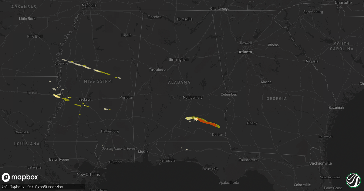
Hail Map in Alabama on March 3, 2016
Get this storm
March 3 map
$229
one time, instant access
Download today. No call, no setup
Keep the $229
Bought the map and want the full workflow? Apply the entire $229 to a subscription within 7 days. None of it is wasted.
Every map, not just this one
This buys you this map. Subscription and you get every map we run, in the markets you choose from a few cities to whole states to nationwide. Plus real-time alerts the moment a storm fires.
Contact data
Name, contact info, occupancy, even credit band for addresses in the footprint. You go from where it hit to who to call.
Become the source they trust
Unlimited branding weather history reports on demand. You already have the documented answer ready for the property owner, and you are the one who showed up with it.
Property data and RoofTrace estimates
Pull up any address you have got, its value and the exact code rules for that jurisdiction, straight from One Click Code. Then RoofTrace estimates the squares, pitch, and roof value, priced the way you price.
Storm reports in Alabama
Alabama
| Date | Description |
|---|---|
| 03/03/20165:30 PM CST | Golf ball size hail in reported in the town of goshen inside pike... County |
| 03/03/20165:30 PM CST | Numerous trees down and power lines down on hwy 2277 |
| 03/03/20165:30 PM CST | Barn roof torn off and mobile home damaged on hwy 2287 |
| 03/03/20165:30 PM CST | Numerous trees down in henderson and along hwy 2276 and 2278. Barn damage by trees down on hwy 2287. |
| 03/03/20165:20 PM CST | Storm spotter reports 1 inch hail near luverne. Time estimated via radar. |
| 03/03/20165:18 PM CST | Public reports 1 inch hail in crenshaw county. |
| 03/03/20165:15 PM CST | County em reports damage to 1 house along with numerous trees down across the southern portion of the county. |
| 03/02/20166:59 PM CST | Law enforcement reports numerous trees and powerlines down near lockhart church road in southern covington county. Time estimated from radar |
| 03/02/20166:36 PM CST | Law enforcement reports some damage to one residence and outbuildings with trees and powerlines down. Time estimated via radar. |
| 03/02/20166:25 PM CST | Trees beginning to go down. |
All States Impacted by Hail Map on March 3, 2016
Cities Impacted by Hail Map on March 3, 2016
- Luverne, AL
- Rutledge, AL
- Greenville, AL
- Ethel, MS
- Kosciusko, MS
- Durant, MS
- West, MS
- Mayersville, MS
- Goshen, AL
- Glenwood, AL
- Lexington, MS
- Cruger, MS
- Tallulah, LA
- Lake Providence, LA
- Vicksburg, MS
- Lake City, FL
- Fargo, GA
- Jasper, FL
- Troy, AL
- Brantley, AL
- Transylvania, LA
- Florence, MS
- McHenry, MS
- Itta Bena, MS
- Indianola, MS
- Inverness, MS
- Moorhead, MS
- Crestview, FL
- Taylorsville, MS
- Raleigh, MS
- Poplarville, MS
- Bay Springs, MS
- Baker, FL
- Louisville, MS
- Greenville, MS
- Leland, MS
- Tchula, MS
- Oak Grove, LA
- Jennings, FL
- Valley Park, MS
- Sondheimer, LA
- Byram, MS
- Utica, MS
- Terry, MS
- Raymond, MS
- Hazlehurst, MS
- Noxapater, MS
- McCool, MS
- Ariton, AL
- Skipperville, AL
- Abbeville, AL
- Honoraville, AL
- Jack, AL
- Midland City, AL
- Brundidge, AL
- Ozark, AL
- Newville, AL


