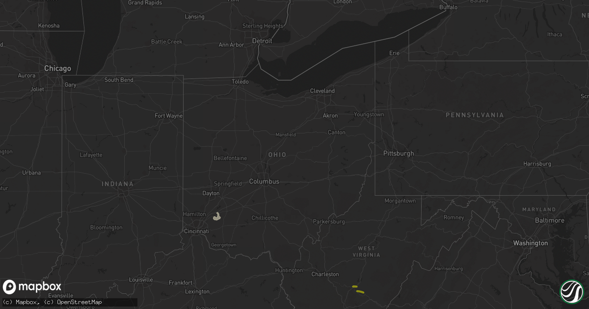
Hail Map in Ohio on March 1, 2017
Get this storm
March 1 map
$229
one time, instant access
Download today. No call, no setup
Keep the $229
Bought the map and want the full workflow? Apply the entire $229 to a subscription within 7 days. None of it is wasted.
Every map, not just this one
This buys you this map. Subscription and you get every map we run, in the markets you choose from a few cities to whole states to nationwide. Plus real-time alerts the moment a storm fires.
Contact data
Name, contact info, occupancy, even credit band for addresses in the footprint. You go from where it hit to who to call.
Become the source they trust
Unlimited branding weather history reports on demand. You already have the documented answer ready for the property owner, and you are the one who showed up with it.
Property data and RoofTrace estimates
Pull up any address you have got, its value and the exact code rules for that jurisdiction, straight from One Click Code. Then RoofTrace estimates the squares, pitch, and roof value, priced the way you price.
Storm reports in Ohio
Ohio
| Date | Description |
|---|---|
| 03/01/20173:53 PM CST | Tree down. |
| 03/01/20173:30 PM CST | Tree down. |
| 03/01/20173:29 PM CST | Tree down. |
| 03/01/20172:55 PM CST | Very large tree with 3 foot base uprooted. Photo verified on social media. |
| 03/01/20172:35 PM CST | Kcle asos. |
| 03/01/20178:29 AM CST | Trees down |
| 03/01/20178:15 AM CST | Tree down on a parked unoccupied car via twitter with picture |
| 03/01/20178:14 AM CST | A tree fell on a house along oliver street and a steeple was blown off a church on pearl street. |
| 03/01/20178:07 AM CST | Nws storm survey confirmed ef1 tornado. Major damage to a large barn... Porches torn off two houses... Aluminum shed ripped off its wooden foundation and mangled... Hea |
| 03/01/20178:05 AM CST | Damage to a pole barn and porch along dexter road. |
| 03/01/20177:31 AM CST | Part of the roof of a school bus damaged. Debris through windows of school bus. Trees down and roofs off houses. Barns down. |
| 03/01/20177:30 AM CST | Numerous large trees down due to thunderstorm winds. |
| 03/01/20177:22 AM CST | Power pole and wires down. Time estimated from radar. |
| 03/01/20177:16 AM CST | Extensive tree damage and minor structural damage along denver road. |
| 03/01/20177:08 AM CST | Trees down countywide. Time estimated from radar. |
| 03/01/20177:02 AM CST | Dozens of large trees down... One of which fell on and destroyed a fence. |
| 03/01/20176:55 AM CST | Trees down. Time estimated from radar. |
| 03/01/20176:53 AM CST | Damage to a house and barn near the intersection of unity rd and state route 247. |
| 03/01/20176:40 AM CST | 2-3 trailers destroyed on martin-alexandria road. Corrected time based on radar. |
| 03/01/20176:39 AM CST | Nws storm survey confirms an ef1 tornado south of new market in highland county. A dairy farm had extensive damage to outbuildings and barns...with other minor damage e |
| 03/01/20176:35 AM CST | Several trees uprooted or snapped. Shingles off a roof. Branches on a barn. Time estimated. Corrected location. |
| 03/01/20176:31 AM CST | Grain bin destroyed. Shingles off a home. Barn damaged and trees down. |
| 03/01/20176:30 AM CST | Several roofs are blown off in lucas road neighborhood. Time estimated based on radar. |
| 03/01/20176:30 AM CST | Roof blown off utitily company. Police chief reported damage to police station - damage appeared circular in nature. Time estimated based on radar. |
| 03/01/20176:30 AM CST | Multiple trees down. One healthy tree with one foot diameter snapped at the base. |
| 03/01/20176:30 AM CST | Several trees uprooted or snapped. Shingles off a roof. Branches on a barn. Time estimated. |
| 03/01/20176:27 AM CST | Many trees snapped. Deck rails broken. |
| 03/01/20176:24 AM CST | Trees down and other debris on meisman lane. Several properties affected. |
| 03/01/20176:24 AM CST | Few outbuildings heavily damaged or destroyed on saltair maple road east of hwy 222. |
| 03/01/20176:07 AM CST | Roofs blown off homes... Walls missing from homes. Multiple trees down in anderson township. |
| 03/01/20176:06 AM CST | Trees down countywide. Time estimated from radar. |
| 03/01/20176:05 AM CST | 20 pine trees and other trees down and uprooted. |
| 03/01/20176:04 AM CST | A local report indicates 1.00 inch wind near COLERAIN TOWNSHIP |
| 03/01/20176:03 AM CST | Nws storm survey confirms an ef0 tornado in anderson township. Numerous homes were damaged by the tornado and by downed trees. |
| 03/01/20176:03 AM CST | Trees down and other debris near the intersection of salem rd and kellogg ave. |
| 03/01/20176:02 AM CST | A local report indicates 1.00 inch wind near E MONTGOMERY |
| 03/01/20176:02 AM CST | Numerous trees were knocked down. House received siding damage from flying debris. Other homes had roof damage and windows broken. |
All States Impacted by Hail Map on March 1, 2017
Cities Impacted by Hail Map on March 1, 2017
- Ball Ground, GA
- Canton, GA
- Pickens, MS
- Smiths Grove, KY
- Brownsville, KY
- Clinton, SC
- Laurens, SC
- Sallis, MS
- Mantee, MS
- Mathiston, MS
- Bellefontaine, MS
- Eupora, MS
- Maben, MS
- West Point, MS
- Columbus, MS
- Ardmore, TN
- Taft, TN
- Prospect, TN
- Kannapolis, NC
- Lincolnton, NC
- Bessemer City, NC
- Iron Station, NC
- Mount Holly, NC
- Davidson, NC
- Concord, NC
- Rockwell, NC
- Stanley, NC
- Dallas, NC
- Alexis, NC
- Huntersville, NC
- Courtland, AL
- Town Creek, AL
- Leighton, AL
- Tuscumbia, AL
- Ethel, MS
- Kosciusko, MS
- Louisville, MS
- Macon, MS
- Noxapater, MS
- McCool, MS
- Alexander City, AL
- Jacksons Gap, AL
- Statesville, NC
- Harmony, NC
- Olin, NC
- Mocksville, NC
- Greenville, SC
- Liberty, SC
- Salem, SC
- Pickens, SC
- Central, SC
- Easley, SC
- Taylors, SC
- Seneca, SC
- Six Mile, SC
- Blackstock, SC
- Great Falls, SC
- Lancaster, SC
- Heath Springs, SC
- Michie, TN
- Counce, TN
- Tullahoma, TN
- Manchester, TN
- Altamont, TN
- Pelham, TN
- Prairie, MS
- Hamilton, MS
- Aberdeen, MS
- Caledonia, MS
- Savannah, TN
- Shiloh, TN
- Sawyerville, AL
- Boligee, AL
- Eutaw, AL
- Blanchester, OH
- Clarksville, OH
- Morrow, OH
- Gruetli Laager, TN
- Hillsboro, TN
- Coalmont, TN
- Estill Springs, TN
- Tracy City, TN
- Washington, NC
- Waynesboro, TN
- South Pittsburg, TN
- Jasper, TN
- Sherwood, TN
- Guin, AL
- Winfield, AL
- Randleman, NC
- Climax, NC
- Lexington, NC
- Pleasant Garden, NC
- Franklinville, NC
- Staley, NC
- High Point, NC
- Sophia, NC
- Trinity, NC
- Liberty, NC
- Thomasville, NC
- Greensboro, NC
- Julian, NC
- Snow Camp, NC
- Florence, AL
- Brent, AL
- Moundville, AL
- Mountville, SC
- Kinards, SC
- Joanna, SC
- Fayetteville, TN
- Dellrose, TN
- Gardendale, AL
- Graysville, AL
- Dora, AL
- Hickory, NC
- Conover, NC
- Walhalla, SC
- Quinton, AL
- Charlotte, NC
- College Grove, TN
- Olivehill, TN
- Hohenwald, TN
- Clifton, TN
- Franklin, TN
- Nolensville, TN
- Ethridge, TN
- Lawrenceburg, TN
- Vardaman, MS
- Charleston, MS
- Cleveland, NC
- Catawba, NC
- Claremont, NC
- Stony Point, NC
- Centreville, AL
- Gurley, AL
- Carnesville, GA
- Columbia, TN
- Eagleville, TN
- Chapel Hill, TN
- Lewisburg, TN
- Goodman, MS
- Lexington, MS
- Waterloo, SC
- Hodges, SC
- Fayette, AL
- Kennedy, AL
- Vernon, AL
- Millport, AL
- Dadeville, AL
- Berry, AL
- Alexandria, TN
- Liberty, TN
- Dowelltown, TN
- Watertown, TN
- Auburntown, TN
- Morton, MS
- Brandon, MS
- Mendenhall, MS
- Braxton, MS
- Raleigh, MS
- Florence, MS
- Whitwell, TN
- Decherd, TN
- Newnan, GA
- Huntsville, AL
- Shelbyville, TN
- Tremont, MS
- Saint Joseph, TN
- Iron City, TN
- Loretto, TN
- Advance, NC
- Woodleaf, NC
- Cooleemee, NC
- Russellville, AL
- Madison, AL
- Hillsboro, AL
- Tanner, AL
- Athens, AL
- Trinity, AL
- Brownsboro, AL
- Owens Cross Roads, AL
- Decatur, AL
- Carthage, MS
- Memphis, TN
- Leoma, TN
- Goodspring, TN
- Killen, AL
- Five Points, TN
- Minor Hill, TN
- Anderson, AL
- Rogersville, AL
- Hackleburg, AL
- Hamilton, AL
- Muscle Shoals, AL
- Lester, AL
- Elkmont, AL
- Honea Path, SC
- Belton, SC
- Ware Shoals, SC
- Donalds, SC
- Whitmire, SC
- Hazel Green, AL
- New London, NC
- Denton, NC
- Greer, SC
- Starr, SC
- Richburg, SC
- Carlisle, SC
- Bowersville, GA
- Chester, SC
- Union, SC
- Hartwell, GA
- Blair, SC
- Winnsboro, SC
- Anderson, SC
- Iva, SC
- Adairsville, GA
- Calhoun, GA
- Sulligent, AL
- Phil Campbell, AL
- Bear Creek, AL
- Double Springs, AL
- Graham, NC
- Opelousas, LA
- Church Point, LA
- Camden, AL
- Pikeville, KY
- Sidney, KY
- Tamassee, SC
- Somerville, TN
- La Grange, TN
- Hornsby, TN
- Hickory Valley, TN
- Bethel Springs, TN
- Middleton, TN
- Saulsbury, TN
- Williston, TN
- Grand Junction, TN
- Whiteville, TN
- Bolivar, TN
- Moscow, TN
- Mauldin, SC
- Simpsonville, SC
- Ellijay, GA
- Cherry Log, GA
- Pulaski, TN
- Lynnville, TN
- Union Grove, AL
- Eva, AL
- Falkville, AL
- Hartselle, AL
- Somerville, AL
- Tutwiler, MS
- Jemison, AL
- Thorsby, AL
- Randolph, AL
- Rome, GA
- Armuchee, GA
- Lavonia, GA
- Crouse, NC
- Decatur, TN
- Lascassas, TN
- Huntland, TN
- Toney, AL
- Belvidere, TN
- Stevenson, AL
- New Market, AL
- Estillfork, AL
- Ardmore, AL
- Sequatchie, TN
- Coffeeville, MS
- Bruce, MS
- Thomaston, GA
- Molena, GA
- Meansville, GA
- Rossville, GA
- Burlington, NC
- Hildebran, NC
- Linwood, NC
- Salisbury, NC
- Jasper, AL
- Shelby, NC
- Lawndale, NC
- Cherryville, NC
- Rockvale, TN
- Murfreesboro, TN
- Alexandria, AL
- Weaver, AL
- Anniston, AL
- Jacksonville, AL
- Cypress Inn, TN
- West Union, SC
- Sunset, SC
- Fort Deposit, AL
- Monteagle, TN
- Beersheba Springs, TN
- Mcminnville, TN
- Petersburg, TN
- Maplesville, AL
- Lawley, AL
- Clanton, AL
- Akron, AL
- Arley, AL
- Addison, AL
- Sontag, MS
- Brookhaven, MS
- Beaverton, AL
- Alto, GA
- Baileyton, AL
- Woodruff, SC
- Travelers Rest, SC
- Marietta, SC
- Mountain Rest, SC
- Piedmont, SC
- Westminster, SC
- Troy, NC
- Mount Gilead, NC
- Candor, NC
- Biscoe, NC
- Albemarle, NC
- Star, NC
- Morrison, TN
- Gainesville, AL
- Epes, AL
- Greensboro, AL
- Forrest City, AR
- Valdese, NC
- Morganton, NC
- Scottsboro, AL
- Cornersville, TN
- Kelso, TN
- Lutts, TN
- Lexington, AL
- Waterloo, AL
- Westpoint, TN
- Winchester, TN
- Frankewing, TN
- Mulberry, TN
- Kimberly, AL
- Pinson, AL
- Warrior, AL
- Mebane, NC
- Chapel Hill, NC
- Winston Salem, NC
- Asheboro, NC
- Connelly Springs, NC
- Bankston, AL
- Oakman, AL
- Pleasant Plain, OH
- Oregonia, OH
- Meridianville, AL
- Ranger, GA
- Fairmount, GA
- Letohatchee, AL
- Dickson, TN
- Bon Aqua, TN
- Nunnelly, TN
- Bath Springs, TN
- Linden, TN
- Collinwood, TN
- Dunlap, TN
- Danville, AL
- Brentwood, TN
- Weogufka, AL
- Arlington, TN
- Forkland, AL
- Emelle, AL
- Cedarbluff, MS
- Carbon Hill, AL
- Nauvoo, AL
- Old Fort, TN
- Milton, TN
- Seagrove, NC
- Goshen, OH
- Loveland, OH
- Talking Rock, GA
- Burnsville, MS
- Selmer, TN
- Corinth, MS
- Clover, SC
- Belmont, NC
- Odenville, AL
- McDonald, TN
- Cleveland, TN
- Elora, TN
- Bridgeport, AL
- Sewanee, TN
- Cherokee, AL
- Flintville, TN
- Harvest, AL
- Heth, AR
- Proctor, AR
- Northport, AL
- Fountain Inn, SC
- Gray Court, SC
- Culleoka, TN
- Canon, GA
- Commerce, GA
- Detroit, AL
- Crane Hill, AL
- Bremen, AL
- McEwen, TN
- Lyles, TN
- Cordova, AL
- Parrish, AL
- Only, TN
- Waverly, TN
- Burns, TN
- Hurricane Mills, TN
- Port Allen, LA
- Terry, MS
- Raymond, MS
- Utica, MS
- Crump, TN
- Adamsville, TN
- Morris Chapel, TN
- Belfast, TN
- Wartrace, TN
- Mount Pleasant, NC
- Kings Mountain, NC
- Holly Pond, AL
- Cullman, AL
- Lynchburg, TN
- Eldridge, AL
- Douglasville, GA
- Whitesburg, GA
- Winston, GA
- Palmetto, GA
- Unionville, TN
- Duncan, SC
- Lyman, SC
- Millington, TN
- Pinetown, NC
- Toxey, AL
- Smyrna, TN
- Fairview, TN
- Arab, AL
- Guntersville, AL
- Nashville, TN
- Antioch, TN
- Cornelius, NC
- Richfield, NC
- Gold Hill, NC
- Summerville, GA
- Dahlonega, GA
- Marble Hill, GA
- Dawsonville, GA
- Jasper, GA
- Plainville, GA
- Lebanon, OH
- Haleyville, AL
- Hodges, AL
- Olive Branch, MS
- Moulton, AL
- Vinemont, AL
- Houston, AL
- Grandview, TN
- Widener, AR
- Mount Pleasant, TN
- Benton, MS
- Salyersville, KY
- Pikeville, NC
- Goldsboro, NC
- Siler City, NC
- Bear Creek, NC
- Bennett, NC
- Ramseur, NC
- Cowan, TN
- Palmer, TN
- Fulton, MS
- Wesson, MS
- Niota, TN
- Annville, KY
- Guild, TN
- Whiteside, TN
- Lupton City, TN
- Signal Mountain, TN
- Chattanooga, TN
- Joppa, AL
- Grant, AL
- Langston, AL
- Valley Head, AL
- Ider, AL
- Menlo, GA
- Rising Fawn, GA
- Flat Rock, AL
- Hollywood, AL
- Pisgah, AL
- Steens, MS
- Mount Olive, AL
- Townley, AL
- Sumiton, AL
- Eagle Springs, NC
- Lebanon, TN
- Monterey, TN
- Hico, WV
- Lansing, WV
- Victor, WV
- Nallen, WV
- Quinwood, WV
- Rainelle, WV
- Canton, MS
- Camden, MS
- Byram, MS
- Union, MS
- Lena, MS
- Sebastopol, MS
- Walnut Grove, MS
- Forest, MS
- Lyerly, GA
- Cornelia, GA
- Toccoa, GA
- Lula, GA
- Gainesville, GA
- Mount Airy, GA
- Baldwin, GA
- Martin, GA
- Homer, GA
- Duluth, GA
- Suwanee, GA
- Alpharetta, GA
- Buford, GA
- Lawrenceville, GA
- Arnaudville, LA
- Port Barre, LA
- Cadiz, KY
- Herndon, KY
- Gracey, KY
- Pembroke, KY
- Hopkinsville, KY
- Indian Mound, TN
- Big Sandy, TN
- Greenbrier, TN
- Chapmansboro, TN
- Adairville, KY
- White House, TN
- Westmoreland, TN
- Cottontown, TN
- Portland, TN
- Palmyra, TN
- Cross Plains, TN
- Ashland City, TN
- Franklin, KY
- Dover, TN
- Clarksville, TN
- Springville, TN
- Orlinda, TN
- Elkton, KY
- Allensville, KY
- Scottsville, KY
- Fort Campbell, KY
- Olmstead, KY
- Pleasant View, TN
- Cedar Hill, TN
- Buchanan, TN
- Cumberland City, TN
- Oak Grove, KY
- Russellville, KY
- Guthrie, KY
- Stewart, TN
- Tennessee Ridge, TN
- Adolphus, KY
- Cunningham, TN
- Springfield, TN
- Woodlawn, TN
- Trenton, KY
- Adams, TN
- Big Rock, TN
- Hendersonville, TN
- Castalian Springs, TN
- Gallatin, TN
- Madison, TN
- Whites Creek, TN
- Goodlettsville, TN
- Kingston Springs, TN
- Charlotte, TN
- Southside, TN
- Erin, TN
- Hermitage, TN
- Mount Juliet, TN
- Pegram, TN
- Joelton, TN
- White Bluff, TN
- Vanleer, TN
- Cumberland Furnace, TN
- Old Hickory, TN
- Lancaster, TN
- Silver Point, TN
- Baxter, TN
- Smithville, TN
- La Vergne, TN
- Cookeville, TN
- Chestnut Mound, TN
- Centerville, TN
- Buffalo Valley, TN
- Primm Springs, TN
- Elmwood, TN
- Bloomington Springs, TN
- Carthage, TN
- Brush Creek, TN
- Sparta, TN
- Hickman, TN
- Gordonsville, TN
- Duck River, TN
- Bowling Green, KY


