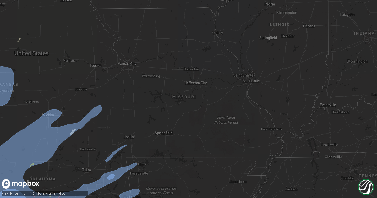
Hail Map in Missouri on February 26, 2023
Get this storm
February 26 map
$229
one time, instant access
Download today. No call, no setup
Keep the $229
Bought the map and want the full workflow? Apply the entire $229 to a subscription within 7 days. None of it is wasted.
Every map, not just this one
This buys you this map. Subscription and you get every map we run, in the markets you choose from a few cities to whole states to nationwide. Plus real-time alerts the moment a storm fires.
Contact data
Name, contact info, occupancy, even credit band for addresses in the footprint. You go from where it hit to who to call.
Become the source they trust
Unlimited branding weather history reports on demand. You already have the documented answer ready for the property owner, and you are the one who showed up with it.
Property data and RoofTrace estimates
Pull up any address you have got, its value and the exact code rules for that jurisdiction, straight from One Click Code. Then RoofTrace estimates the squares, pitch, and roof value, priced the way you price.
Storm reports in Missouri
Missouri
| Date | Description |
|---|---|
| 02/26/20234:10 AM CST | Asos station kvih vichy rolla asos. |
| 02/26/20233:54 AM CST | Several power lines and a tree down at east ave. Time estimated from radar. |
| 02/26/20233:35 AM CST | Tree in powerlines per social media. |
| 02/26/20233:20 AM CST | Two trees uprooted and blocking highway and a shed collapsed. |
| 02/26/20233:15 AM CST | Roof blown off a house. |
| 02/26/20233:05 AM CST | A local report indicates 70 MPH wind near 3 W BUNCETON |
| 02/26/20233:02 AM CST | 32 highway 3 miles east of lebanon. Wind destroyed a barn... And large tree limbs down on part of a house. |
| 02/26/20233:00 AM CST | Debris scattered on strip in front of stewarts restaurant.....looks like metal roofing. |
| 02/26/20232:59 AM CST | Corrects previous time of tstm wnd dmg report from 1 ene versailles. 1-inch tree limbs broken; shingles blown off. Time estimated based on radar. |
| 02/26/20232:55 AM CST | Damage to a metal outbuilding. Roof off. Time based on radar estimate. |
| 02/26/20232:50 AM CST | Delayed report: electric coop and emergency management reported power pole and electrical damage due to damaging winds. 3500 were without power... Mainly in the souther |
| 02/26/20232:48 AM CST | Electric utility damage with numerous outages in eastern benton county per como electric map. |
| 02/26/20232:48 AM CST | Tree on a house in niangua. Road is blocked as well... M highway & ac highway. |
| 02/26/20232:44 AM CST | Tree down on a home in niangua. |
| 02/26/20232:42 AM CST | Cottonwood tree downed blocking road. Time estimate via radar. |
| 02/26/20232:35 AM CST | A local report indicates 59 MPH wind near ALMA |
| 02/26/20232:30 AM CST | Barn destroyed. Time estimated via radar. |
| 02/26/20232:30 AM CST | Tree down on house. Wind gust measured at school as 59 mph. Time estimated via radar. |
| 02/26/20232:29 AM CST | Downed tree in urbana. |
| 02/26/20232:25 AM CST | Mesonet station fw9611 branson. |
| 02/26/20232:22 AM CST | Tree onto powerline. |
| 02/26/20232:22 AM CST | Highway nn is currently blocked by a tree near the hickory-dallas county line... East of county road 302. |
| 02/26/20232:21 AM CST | Several utility poles snapped. |
| 02/26/20232:20 AM CST | Corrects time of previous tstm wnd dmg report from 2 nw urbana. Two trees uprooted and blocking highway and a shed collapsed. |
| 02/26/20232:15 AM CST | Corrects time of previous tstm wnd dmg report from 4 sw hermitage. Fallen trees in the galmey area. |
| 02/26/20232:15 AM CST | Tree across roadway near pittsburg south of bullseye fuel station. |
| 02/26/20232:11 AM CST | A storage structure collapsed and a fallen tree blocking the road in the co 340 area. Time estimated by radar. |
| 02/26/20232:07 AM CST | Electric utility damage with numerous outages in southeast st clair county per sacosage electric map. |
| 02/26/20232:07 AM CST | Main street between slim wilson and aldersgate is closed because of damage to a downed power pole. |
| 02/26/20232:05 AM CST | Corrects previous tstm wnd dmg report from flemington. Limbs down in roadway in flemington... East of humansville. 2-4 inches in diamter limbs. Flemington is out of pow |
| 02/26/20232:05 AM CST | Limbs down in roadway in flemington... East of humansville. Unknown sizes at this time. |
| 02/26/20232:04 AM CST | Hickory county road 340 near flemington a sawmill building was damaged. |
| 02/26/20232:04 AM CST | Humansville fire reports east of humansville toward flemington on hwy v... Multiple limbs down... And barn damage from straight line winds. On 315 road... Feed troughs |
| 02/26/20231:52 AM CST | Small greenhouse picked up and thrown 100 yards. Metal pipes bent to a 90 degree angle. |
| 02/26/20231:49 AM CST | Public sent in pictures of large tree limbs down. |
| 02/26/20231:47 AM CST | A national weather service storm survey concluded that an ef-0 tornado... With maximum wind speeds of 76 mph... Uprooted a few weak trees with large branches also broke |
| 02/26/20231:45 AM CST | Delayed report: tree down blocking yy highway 1 mile east of 39. |
| 02/26/20231:33 AM CST | Two separate reports of trees down on highway 76 east of cassville. |
| 02/26/20231:30 AM CST | Straightline winds caused a barn to collapse. Time estimated by radar. |
| 02/26/20231:30 AM CST | Delayed report: 3 trailer homes lost roofs at this location off farm road 2000. |
| 02/26/20231:27 AM CST | Three separate reports of powerlines down in southeast monett near maple... Kyler and summit streets. |
| 02/26/20231:27 AM CST | Delayed report. Barns down and trees down off 37 highway. Powerpole also broken near this location. A cable was down in the roadway just south of this location at highw |
| 02/26/20231:27 AM CST | Delayed report: 2 large trees in the road just east of butterfield on highway u. |
| 02/26/20231:25 AM CST | A national weather service storm survey concluded that an ef-0 tornado... With maximum wind speeds of 77 mph... Heavily damaged a machine barn. Tin was blown in a cyclo |
| 02/26/20231:25 AM CST | An nws survey revealed that straight-line wind gusts caused roof damage to a turkey farm. Time estimated by radar. |
| 02/26/20231:24 AM CST | Corrects previous tstm wnd dmg report from 2 sw harwood. Two outbuildings and two barns destroyed. Debris thrown 500 yards to the north. |
| 02/26/20231:14 AM CST | Avilla fire dept is reporting pieces of a barn |
| 02/26/20231:04 AM CST | Tree down on a home. |
| 02/26/20231:02 AM CST | A national weather service storm survey concluded that an ef-1 tornado... With maximum wind speeds of 105 mph... Damaged or destroyed more than 10 outbuildings and over |
| 02/26/202312:59 AM CST | Significant damage to a barn and other farm outbuildings... Along with a power outage to the area ... On poppy drive between kodiak road and jaguar road in rural neosho |
| 02/26/202312:59 AM CST | Shed destroyed... Rolled rv... Downed trees... And debris blown onto powerlines. |
| 02/26/202312:57 AM CST | Report from mping: 1-inch tree limbs broken; shingles blown off. Time based on radar estimate. |
| 02/26/202312:56 AM CST | Downed trees and utility poles. |
Cities Impacted by Hail Map on February 26, 2023
- McIntire, IA
- Riceville, IA
- Chester, IA
- Stacyville, IA
- Richfield, KS
- Sunray, TX
- Stratford, TX
- Gruver, TX
- Panhandle, TX
- Lakin, KS
- Ulysses, KS
- Satanta, KS
- Amarillo, TX
- Pampa, TX
- Borger, TX
- Miami, TX
- Garden City, KS
- Stinnett, TX
- Spearman, TX
- Perryton, TX
- Sublette, KS
- Pierceville, KS
- Skellytown, TX
- Copeland, KS
- Ingalls, KS
- Montezuma, KS
- Dighton, KS
- Ness City, KS
- Cimarron, KS
- Beeler, KS
- Mclean, TX
- Guymon, OK
- Goodwell, OK
- Hooker, OK
- Kismet, KS
- Liberal, KS
- Plains, KS
- Meade, KS
- Forgan, OK
- Beaver, OK
- Hugoton, KS
- Turpin, OK
- Gate, OK
- Englewood, KS
- Fowler, KS
- Minneola, KS
- Ensign, KS
- Dodge City, KS
- Booker, TX
- Canadian, TX
- Mobeetie, TX
- Shamrock, TX
- Quitaque, TX
- Groom, TX
- White Deer, TX
- Claude, TX
- Wheeler, TX
- Ashland, KS
- Clarendon, TX
- Wright, KS
- Jetmore, KS
- Silverton, TX
- Spearville, KS
- Bazine, KS
- Brownell, KS
- Hanston, KS
- Offerle, KS
- Kinsley, KS
- Larned, KS
- Burdett, KS
- McCracken, KS
- Alexander, KS
- Ransom, KS
- Hays, KS
- Ellis, KS
- Briscoe, TX
- Reydon, OK
- Hedley, TX
- Lelia Lake, TX
- Lewis, KS
- Belpre, KS
- Rozel, KS
- Garfield, KS
- Nekoma, KS
- La Crosse, KS
- Rush Center, KS
- Memphis, TX
- Wellington, TX
- Childress, TX
- Lakeview, TX
- Crawford, OK
- Durham, OK
- Macksville, KS
- Bucklin, KS
- Ford, KS
- St John, KS
- Schoenchen, KS
- Hoisington, KS
- Gorham, KS
- Liebenthal, KS
- Pfeifer, KS
- Albert, KS
- Olmitz, KS
- Pawnee Rock, KS
- Otis, KS
- Victoria, KS
- Great Bend, KS
- Russell, KS
- Bison, KS
- Walker, KS
- Wakeeney, KS
- Paradise, KS
- Quail, TX
- Turkey, TX
- Matador, TX
- Paducah, TX
- Tell, TX
- Cee Vee, TX
- Erick, OK
- Texola, OK
- Arnett, OK
- Cheyenne, OK
- Sweetwater, OK
- Laverne, OK
- Sayre, OK
- Hollis, OK
- Dodson, TX
- Gould, OK
- Quanah, TX
- Mangum, OK
- Vinson, OK
- Hudson, KS
- Chase, KS
- Raymond, KS
- Ellinwood, KS
- Claflin, KS
- Holyrood, KS
- Bushton, KS
- Bunker Hill, KS
- Dorrance, KS
- Wilson, KS
- Gage, OK
- Fort Supply, OK
- Shattuck, OK
- Sharon, OK
- Buffalo, OK
- Fargo, OK
- Woodward, OK
- Higgins, TX
- Leedey, OK
- Hammon, OK
- Elk City, OK
- Carter, OK
- Willow, OK
- Eldorado, OK
- Duke, OK
- Dickens, TX
- Roaring Springs, TX
- Crowell, TX
- Chillicothe, TX
- Benjamin, TX
- Seymour, TX
- Altus, OK
- Elmer, OK
- Olustee, OK
- Headrick, OK
- Altus Afb, OK
- Mountain Park, OK
- Roosevelt, OK
- Blair, OK
- Lone Wolf, OK
- Granite, OK
- Sentinel, OK
- Butler, OK
- Canute, OK
- Foss, OK
- Dill City, OK
- Hobart, OK
- Vici, OK
- Taloga, OK
- Mutual, OK
- Camargo, OK
- Mooreland, OK
- Tipton, OK
- Vernon, TX
- Frederick, OK
- Odell, TX
- Davidson, OK
- Electra, TX
- Oklaunion, TX
- Munday, TX
- Goree, TX
- Harrold, TX
- Rocky, OK
- Cordell, OK
- Gotebo, OK
- Clinton, OK
- Arapaho, OK
- Custer City, OK
- Bessie, OK
- Corn, OK
- Seiling, OK
- Putnam, OK
- Snyder, TX
- Jayton, TX
- Aspermont, TX
- Sweetwater, TX
- Loraine, TX
- Roscoe, TX
- Hermleigh, TX
- Rotan, TX
- Roby, TX
- Old Glory, TX
- Rochester, TX
- O'Brien, TX
- Knox City, TX
- Mountain View, OK
- Snyder, OK
- Lawton, OK
- Sylvester, TX
- Hamlin, TX
- McCaulley, TX
- Rule, TX
- Weinert, TX
- Hollister, OK
- Haskell, TX
- Colony, OK
- Weatherford, OK
- Hydro, OK
- Geary, OK
- Chester, OK
- Carnegie, OK
- Binger, OK
- Oakwood, OK
- Fay, OK
- Greenfield, OK
- Canton, OK
- Hinton, OK
- Thomas, OK
- Lookeba, OK
- Watonga, OK
- Fort Cobb, OK
- Freedom, OK
- Waynoka, OK
- Alva, OK
- Carmen, OK
- Longdale, OK
- Southard, OK
- Cleo Springs, OK
- Dacoma, OK
- Okeene, OK
- Fairview, OK
- Aline, OK
- Burlington, OK
- Hitchcock, OK
- Isabella, OK
- Helena, OK
- Cherokee, OK
- Ringwood, OK
- Cache, OK
- Loveland, OK
- Medicine Park, OK
- Indiahoma, OK
- Apache, OK
- Elgin, OK
- Anson, TX
- Merkel, TX
- Stamford, TX
- Hennessey, OK
- Meno, OK
- Kingfisher, OK
- Omega, OK
- Ames, OK
- Calumet, OK
- Loyal, OK
- Okarche, OK
- Minco, OK
- Union City, OK
- Chickasha, OK
- Anadarko, OK
- El Reno, OK
- Cement, OK
- Verden, OK
- Gracemont, OK
- Cyril, OK
- Pocasset, OK
- Fletcher, OK
- Fort Sill, OK
- Amber, OK
- Chattanooga, OK
- Manter, KS
- Tyrone, OK
- Mankato, KS
- Elkhart, KS
- Moscow, KS
- Johnson, KS
- Holcomb, KS
- Walters, OK
- Geronimo, OK
- Grandfield, OK
- Faxon, OK
- Devol, OK
- Avoca, TX
- Lueders, TX
- Throckmorton, TX
- Lahoma, OK
- Enid, OK
- Nash, OK
- Jet, OK
- Drummond, OK
- Carrier, OK
- Goltry, OK
- Waukomis, OK
- Blanchard, OK
- Tuttle, OK
- Mustang, OK
- Abilene, TX
- Albany, TX
- Yukon, OK
- Newcastle, OK
- Oklahoma City, OK
- Bethany, OK
- Wheatland, OK
- Norman, OK
- Washington, OK
- Breckenridge, TX
- Amorita, OK
- Waldron, KS
- Kiowa, KS
- Manchester, OK
- Wakita, OK
- Hazelton, KS
- Anthony, KS
- Attica, KS
- Medicine Lodge, KS
- Sharon, KS
- Hardtner, KS
- Harper, KS
- Bluff City, KS
- Freeport, KS
- Danville, KS
- Wellington, KS
- Pond Creek, OK
- Milan, KS
- Conway Springs, KS
- Caldwell, KS
- Argonia, KS
- Clearwater, KS
- Mayfield, KS
- Medford, OK
- Kremlin, OK
- Milton, KS
- Spivey, KS
- Kingman, KS
- Norwich, KS
- Cheney, KS
- Viola, KS
- Goddard, KS
- Wichita, KS
- Valley Center, KS
- Peck, KS
- Haysville, KS
- Kechi, KS
- Hunter, OK
- Lamont, OK
- Belle Plaine, KS
- South Haven, KS
- Deer Creek, OK
- Newalla, OK
- Jones, OK
- Arcadia, OK
- Edmond, OK
- Choctaw, OK
- Spencer, OK
- Luther, OK
- Noble, OK
- Tecumseh, OK
- Harrah, OK
- Shawnee, OK
- Mcloud, OK
- Wellston, OK
- Rush Springs, OK
- Duncan, OK
- Marlow, OK
- Burkburnett, TX
- Iowa Park, TX
- Wichita Falls, TX
- Waurika, OK
- Comanche, OK
- Hastings, OK
- Temple, OK
- Randlett, OK
- Ringling, OK
- Loco, OK
- Healdton, OK
- Graham, OK
- Hennepin, OK
- Ratliff City, OK
- Lindsay, OK
- Foster, OK
- Elmore City, OK
- Tussy, OK
- Wilson, OK
- Springer, OK
- Maysville, OK
- Paoli, OK
- Davis, OK
- Pauls Valley, OK
- Wynnewood, OK
- Ardmore, OK
- Ryan, OK
- Strawn, TX
- Graford, TX
- Graham, TX
- Meeker, OK
- Earlsboro, OK
- Prague, OK
- Chandler, OK
- Davenport, OK
- Stroud, OK
- Sparks, OK
- Ada, OK
- Sulphur, OK
- Roff, OK
- Stratford, OK
- Dougherty, OK
- Seminole, OK
- Paden, OK
- Depew, OK
- Towanda, KS
- Greenwich, KS
- Rose Hill, KS
- Mulvane, KS
- Benton, KS
- Andover, KS
- Mcconnell Afb, KS
- Derby, KS
- Augusta, KS
- Douglass, KS
- El Dorado, KS
- Udall, KS
- Potwin, KS
- Oxford, KS
- Rock, KS
- Nardin, OK
- Blackwell, OK
- Newkirk, OK
- Arkansas City, KS
- Braman, OK
- Winfield, KS
- Geuda Springs, KS
- Atlanta, KS
- Burden, KS
- Garber, OK
- Tonkawa, OK
- Fairmont, OK
- Perry, OK
- Billings, OK
- Bison, OK
- Covington, OK
- Ponca City, OK
- Red Rock, OK
- Marland, OK
- Douglas, OK
- Hawley, TX
- Rolla, KS
- Ninnekah, OK
- Konawa, OK
- Fitzhugh, OK
- Stonewall, OK
- Mill Creek, OK
- Allen, OK
- Fittstown, OK
- Boley, OK
- Okemah, OK
- Castle, OK
- Wewoka, OK
- Sasakwa, OK
- Wetumka, OK
- Dexter, KS
- Tupelo, OK
- Holdenville, OK
- Calvin, OK
- Atwood, OK
- Weleetka, OK
- Okmulgee, OK
- Bristow, OK
- Beggs, OK
- Henryetta, OK
- Centrahoma, OK
- Morris, OK
- Haskell, OK
- Maple City, KS
- Cambridge, KS
- Cedar Vale, KS
- Latham, KS
- Howard, KS
- Moline, KS
- Grenola, KS
- Leon, KS
- Coalgate, OK
- Stuart, OK
- Wardville, OK
- Kiowa, OK
- Boynton, OK
- Elk Falls, KS
- Longton, KS
- Pittsburg, OK
- Council Hill, OK
- Oktaha, OK
- Porter, OK
- Taft, OK
- Muskogee, OK
- Coweta, OK
- Fall River, KS
- Fort Gibson, OK
- Hulbert, OK
- Wagoner, OK
- Locust Grove, OK
- Chouteau, OK
- Tahlequah, OK
- Stilwell, OK
- Park Hill, OK
- Proctor, OK
- Welling, OK
- Rose, OK
- Peggs, OK
- Oaks, OK
- Kansas, OK
- Twin Oaks, OK
- Westville, OK
- Fredonia, KS
- Yates Center, KS
- Buffalo, KS
- Humboldt, KS
- Chanute, KS
- Benedict, KS
- Toronto, KS
- Piqua, KS
- Iola, KS
- Watts, OK
- Big Cabin, OK
- Vinita, OK
- Adair, OK
- Afton, OK
- Fairland, OK
- Wyandotte, OK
- Miami, OK
- Seneca, MO
- Colcord, OK
- Siloam Springs, AR
- Gentry, AR
- Sallisaw, OK
- Muldrow, OK
- Gans, OK
- Roland, OK
- Bentonville, AR
- Decatur, AR
- Van Buren, AR
- Uniontown, AR
- Cedarville, AR
- Rudy, AR
- Chester, AR
- Cave Springs, AR
- Alma, AR
- Mountainburg, AR
- Nolan, TX
- Ira, TX
- Fort Smith, AR
- Arkoma, OK
- Mulberry, AR
- Piedmont, OK


