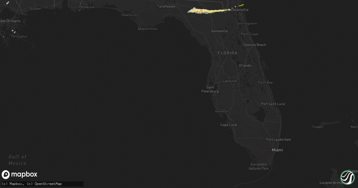
Hail Map in Florida on February 25, 2013
Get this storm
February 25 map
$229
one time, instant access
Download today. No call, no setup
Keep the $229
Bought the map and want the full workflow? Apply the entire $229 to a subscription within 7 days. None of it is wasted.
Every map, not just this one
This buys you this map. Subscription and you get every map we run, in the markets you choose from a few cities to whole states to nationwide. Plus real-time alerts the moment a storm fires.
Contact data
Name, contact info, occupancy, even credit band for addresses in the footprint. You go from where it hit to who to call.
Become the source they trust
Unlimited branding weather history reports on demand. You already have the documented answer ready for the property owner, and you are the one who showed up with it.
Property data and RoofTrace estimates
Pull up any address you have got, its value and the exact code rules for that jurisdiction, straight from One Click Code. Then RoofTrace estimates the squares, pitch, and roof value, priced the way you price.
Storm reports in Florida
Florida
| Date | Description |
|---|---|
| 02/25/201311:15 AM CST | Broadcast media relayed report of damage to boats at fisherman marina on the trout river. |
| 02/25/201310:15 AM CST | Quarter size hail reported on interstate 10. |
| 02/25/201310:10 AM CST | Em reported quarter size hail. |
| 02/25/20138:45 AM CST | Public reported two inch hail causing broken car windows and tree limbs downed. |
| 02/25/20138:25 AM CST | Em received multiple reports of golf-ball size hail. |
| 02/25/20138:20 AM CST | Utility company reported a tree down on fields ave and a few large limbs downing power lines on leora drive. |
| 02/25/20137:45 AM CST | Quarter size to half dollar size hail was observed for about 15 minutes. |
| 02/25/20135:00 AM CST | Two trees down around waukeenah and near highway 59. |
| 02/25/20135:00 AM CST | A few trees down across the jefferson county. |
| 02/25/20134:45 AM CST | Tree down along hidden lakes dr |
| 02/25/20134:45 AM CST | 75 foot pine tree blown down at apartment complex near southwood and capital circle southeast. |
| 02/25/20134:26 AM CST | Trees and powerlines down east of crawfordville on shadeville road. |
| 02/25/20133:24 AM CST | 67 knot wind gust measured at kaaf asos. |
| 02/25/20133:23 AM CST | Several trees and powerlines down on rosemont drive. Numerous transformers blown around apalachicola...eastpoint and saint george island. Power is out to the stoplight |
All States Impacted by Hail Map on February 25, 2013
Cities Impacted by Hail Map on February 25, 2013
- Mena, AR
- Vinton, LA
- Ashdown, AR
- Marietta, TX
- Simms, TX
- Naples, TX
- New Boston, TX
- Hooks, TX
- Gilliam, LA
- Plain Dealing, LA
- Hope, AR
- Morrilton, AR
- Atkins, AR
- Hattieville, AR
- Geismar, LA
- Gonzales, LA
- Abbeville, LA
- Kaplan, LA
- Maurice, LA
- Melville, LA
- Murfreesboro, AR
- Covington, LA
- Moreauville, LA
- Evergreen, LA
- Plaucheville, LA
- Morrow, LA
- Cottonport, LA
- Raceland, LA
- Houma, LA
- El Dorado, AR
- Junction City, AR
- Smackover, AR
- Ragley, LA
- Dequincy, LA
- Longville, LA
- Booneville, AR
- Havana, AR
- Blue Mountain, AR
- Magazine, AR
- Paris, AR
- Prescott, AR
- Arkadelphia, AR
- Gurdon, AR
- Madison, FL
- Lee, FL
- Wellborn, FL
- Live Oak, FL
- Lake Village, AR
- Waldo, AR
- Willisville, AR
- Bradley, AR
- Taylor, AR
- Lewisville, AR
- Stamps, AR
- Buckner, AR
- Bunkie, LA
- Ville Platte, LA
- Saint Landry, LA
- Donaldsonville, LA
- Gueydan, LA
- Rayne, LA
- Jacksonville, FL
- Hughes Springs, TX
- Rodessa, LA
- Doddridge, AR
- Ida, LA
- Marion, LA
- Sterlington, LA
- Farmerville, LA
- Bossier City, LA
- Benton, LA
- Dermott, AR
- Eudora, AR
- Portland, AR
- Arkansas City, AR
- Rohwer, AR
- Marksville, LA
- Lecompte, LA
- Alexandria, LA
- Pineville, LA
- Cheneyville, LA
- Hessmer, LA
- New Blaine, AR
- Scranton, AR
- Sanderson, FL
- Glen Saint Mary, FL
- Maud, TX
- Saint Amant, LA
- Mansura, LA
- Charleston, AR
- Fort Smith, AR
- Hodgen, OK
- Heavener, OK
- Mansfield, AR
- Waldron, AR
- Huntington, AR
- Hartford, AR
- Greenwood, AR
- Prairieville, LA
- French Settlement, LA
- Denham Springs, LA
- Emerson, AR
- Shongaloo, LA
- Sarepta, LA
- Springhill, LA
- Ardmore, OK
- Mill Creek, OK
- Darrow, LA
- Livingston, LA
- Donaldson, AR
- Mannsville, OK
- Sulphur, OK
- Woodville, MS
- Buna, TX
- Burkeville, TX
- Baton Rouge, LA
- Casa, AR
- Jennings, LA
- Saint Francisville, LA
- Braithwaite, LA
- Port Sulphur, LA
- Ruston, LA
- Dubach, LA
- Simsboro, LA
- Downsville, LA
- Converse, LA
- Cotton Valley, LA
- Shreveport, LA
- Lake City, FL
- Scotland, AR
- Clinton, AR
- Fox, AR
- Belcher, LA
- White Springs, FL
- Coalgate, OK
- Mineral Springs, AR
- Sicily Island, LA
- Orange, TX
- Cleveland, AR
- Pelican, LA
- Arcadia, LA
- Basile, LA
- Elton, LA
- Wewoka, OK
- Homer, LA
- Mayo, FL
- Day, FL
- Perry, FL
- Macclenny, FL
- De Kalb, TX
- Avery, TX
- Theriot, LA
- Norman, AR
- Walker, LA
- Starks, LA
- Clayton, OK
- Malvern, AR
- Deweyville, TX
- Call, TX
- Dennard, AR
- Maurepas, LA
- Emmet, AR
- Deridder, LA
- Dry Creek, LA
- Iota, LA
- Crowley, LA
- Egan, LA
- Evangeline, LA
- Convent, LA
- Sorrento, LA
- Paulina, LA
- Ozark, AR
- Bush, LA
- Haynesville, LA
- Minden, LA
- Broaddus, TX
- Nashville, AR
- Galliano, LA
- Cut Off, LA
- Texarkana, TX
- Douglassville, TX
- Atlanta, TX
- Saint Gabriel, LA
- Cecil, AR
- Merryville, LA
- Choudrant, LA
- Hartshorne, OK
- Broken Bow, OK
- Hardeeville, SC
- Rosston, AR
- Rattan, OK
- Maud, OK
- Washington, LA
- Eufaula, OK
- Sulphur, LA
- Bridge City, TX
- Centrahoma, OK
- Grambling, LA
- Eunice, LA
- Newhope, AR
- Bryceville, FL


