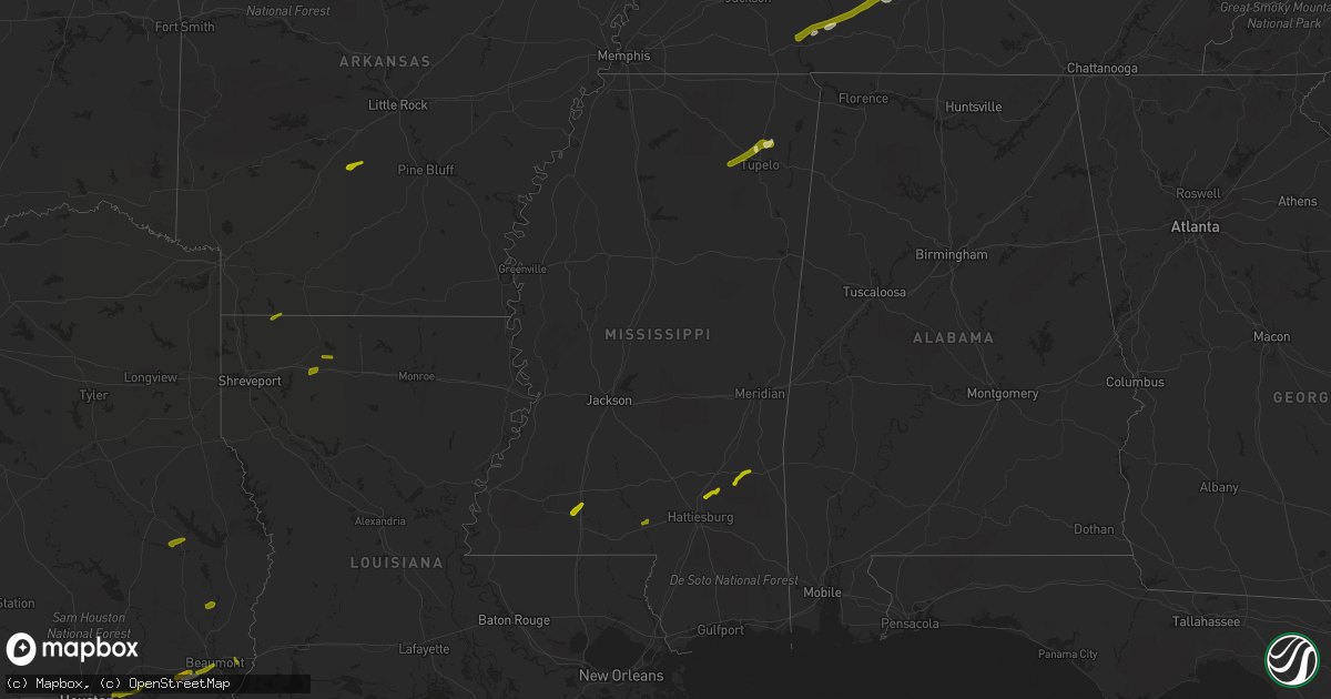
Hail Map in Mississippi on February 20, 2014
Get this storm
February 20 map
$229
one time, instant access
Download today. No call, no setup
Keep the $229
Bought the map and want the full workflow? Apply the entire $229 to a subscription within 7 days. None of it is wasted.
Every map, not just this one
This buys you this map. Subscription and you get every map we run, in the markets you choose from a few cities to whole states to nationwide. Plus real-time alerts the moment a storm fires.
Contact data
Name, contact info, occupancy, even credit band for addresses in the footprint. You go from where it hit to who to call.
Become the source they trust
Unlimited branding weather history reports on demand. You already have the documented answer ready for the property owner, and you are the one who showed up with it.
Property data and RoofTrace estimates
Pull up any address you have got, its value and the exact code rules for that jurisdiction, straight from One Click Code. Then RoofTrace estimates the squares, pitch, and roof value, priced the way you price.
Storm reports in Mississippi
Mississippi
| Date | Description |
|---|---|
| 02/20/20145:35 PM CST | A carport was damaged by strong winds |
| 02/20/20145:25 PM CST | A roof was blown off a mobile home on riverside road near ms highway 12 |
| 02/20/20145:15 PM CST | A couple of trees and several large limbs were down. |
| 02/20/20144:44 PM CST | Tree down on river road near the national guard. |
| 02/20/20144:20 PM CST | Tractor trailer overturned on side near highway 69. |
| 02/20/20144:05 PM CST | Trees down and roof damage in tunica county near dundee. Also power is out in some of tunica county. |
| 02/19/201411:52 PM CST | Reported strong straight line winds in the area with carports blown over and a couple of vehicles damaged from blown debris. Penny sized hail was also reported. |
| 02/19/201411:50 PM CST | Trees downed blocking ms highway 513 near the clarke/jasper county line...resulting in a car accident |
| 02/19/201411:32 PM CST | Recorded at khbg |
| 02/19/201411:20 PM CST | Beaverdam community reported some power outages. |
| 02/19/201410:50 PM CST | A couple of trees were reported down. |
| 02/19/201410:40 PM CST | Powerline down across hwy 84w. |
| 02/19/20149:50 PM CST | Downed several trees in a pattern indicative of a tornado. Max width 50 yards. Path length 0.5 miles. |
| 02/19/20149:46 PM CST | Trees downed along sand hill township road |
| 02/19/20149:46 PM CST | Trees downed at ms highway 588 and buffalo hill road |
| 02/19/20149:35 PM CST | Power poles snapped along sanford road east of i-59. A metal carport was damaged. An oak tree was blown down. Possible tornado. |
| 02/19/20149:29 PM CST | Tree downed partially blocking the roadway at monroe road and stanford road |
| 02/19/20149:28 PM CST | Significant damage to 5 chicken houses...minor damage to 2 homes...and uprooted and snapped many trees along 4.5 mile long path. Max winds 90 mph. Max width 100 yards. |
| 02/19/20149:27 PM CST | Minor damage occurred to a house...four chicken houses were damaged...and a shop was damaged along jenkins road. Possible tornado. |
| 02/19/20149:25 PM CST | Structural damage to buildings and tree damage along van buren road near fulton. |
| 02/19/20149:25 PM CST | A mobile home was shifted a foot...and the deck and canopy were blown away along eddie walker road. Possible tornado. |
| 02/19/20149:06 PM CST | Trees and powerlines down in the steens area on highway 12. Report via social media. |
| 02/19/20149:00 PM CST | Downed trees and powerlines on spivey road. Report via social media. |
| 02/19/20148:30 PM CST | Wind gusts estimated at 55-60 mph across the north side of starkville by msu meteorology instructor |
| 02/19/20148:13 PM CST | Spotter measured 58 mph wind gusts. |
| 02/19/20147:59 PM CST | Several trees down and shingles off roof. One tree fell on truck near highway 25 and old highway 25/on south end of dennis/. |
| 02/19/20147:55 PM CST | Trees down along highway 6 between nettleton and bigbee. |
| 02/19/20147:50 PM CST | Trees downed at us highway 98 near friendship church road |
| 02/19/20147:48 PM CST | Several trees downed or snapped along highway 98 in a manner consistent with tornadic damage. Maximum winds 75 mph. Max width 50 yards. Path length 0.25 miles. Time bas |
| 02/19/20147:40 PM CST | Quarter size hail near charleston blvd. |
| 02/19/20147:35 PM CST | Trees down in tupelo near briar ridge road. |
| 02/19/20147:35 PM CST | 65 mph winds just west of saltillo. |
| 02/19/20147:30 PM CST | A couple of trees down between spring hill and cadaretta. |
| 02/19/20147:30 PM CST | 60 mph winds with pea size hail. Some trees down. Lots of tree limbs down throughout the county. |
| 02/19/20147:11 PM CST | A weak tornado touched down in the vicnity of ms highway 48 and pigot easterling road. Several large pine trees were uprooted...and large tree branches were snapped. A |
| 02/19/20146:34 PM CST | Tree downed across cr 100 |
| 02/19/20146:30 PM CST | A local report indicates 1.00 inch wind near HIWANNEE |
| 02/19/20146:25 PM CST | Tree downed along cr 193 |
| 02/19/20146:23 PM CST | A local report indicates 1.00 inch wind near 4 ESE BROOKHAVEN |
| 02/19/20146:10 PM CST | Trees and utility poles downed along ms highway 7 in the southern part of the county |
| 02/19/20146:00 PM CST | A local report indicates 60 MPH wind near 4 NE ISOLA |
All States Impacted by Hail Map on February 20, 2014
Cities Impacted by Hail Map on February 20, 2014
- Beaumont, TX
- Clifton, TN
- Waynesboro, TN
- Saltillo, MS
- Bowling Green, KY
- Charlotte, TN
- Cumberland Furnace, TN
- Joelton, TN
- Pleasant View, TN
- Springfield, TN
- Chapmansboro, TN
- Ashland City, TN
- Shelbyville, IN
- Edinburgh, IN
- Senath, MO
- Hornersville, MO
- Arbyrd, MO
- Leachville, AR
- Evanston, IN
- Ferdinand, IN
- Saint Meinrad, IN
- Bristow, IN
- Fairland, IN
- Duck River, TN
- Centerville, TN
- Hohenwald, TN
- Hampshire, TN
- Alvaton, KY
- Shannon City, IA
- Afton, IA
- Humeston, IA
- Chariton, IA
- Derby, IA
- Santa Fe, TN
- Columbia, TN
- Franklin, TN
- Thompsons Station, TN
- Spring Hill, TN
- Clearfield, IA
- Kennett, MO
- Cardwell, MO
- Guntown, MS
- Baldwyn, MS
- Savannah, TN
- Morris Chapel, TN
- Oakland, KY
- Franklin, KY
- Rockfield, KY
- Woodburn, KY
- Santa Claus, IN
- Columbia, MS
- Foxworth, MS
- Summit, MS
- Bogue Chitto, MS
- Ellisville, MS
- Moselle, MS
- Malvern, AR
- Laurel, MS
- Waynesboro, MS
- Shubuta, MS
- Gibsland, LA
- Homer, LA
- Athens, LA
- Taylor, AR
- Springhill, LA
- Belden, MS
- Pontotoc, MS
- Tupelo, MS
- Blue Springs, MS
- College Grove, TN
- Arrington, TN
- Saltillo, TN
- Adamsville, TN
- Linden, TN
- Williamsport, TN
- Nolensville, TN
- Bath Springs, TN
- Greenbrier, TN
- Marble Hill, MO
- Leopold, MO
- Zalma, MO
- Huntingdon, TN
- Lavinia, TN
- Atwood, TN
- Johnston City, IL
- Grand Tower, IL
- De Soto, IL
- Murphysboro, IL
- Pomona, IL
- Springerton, IL
- Altenburg, MO
- Jackson, MO
- Herrin, IL
- West Frankfort, IL
- Burnt Prairie, IL
- McLeansboro, IL
- Mill Shoals, IL
- Benton, IL
- Oak Ridge, MO
- Macedonia, IL
- Enfield, IL
- Carmi, IL
- Carterville, IL
- Carbondale, IL
- Thompsonville, IL
- Cambria, IL
- Freeman Spur, IL
- Logan, IL
- Golden Gate, IL
- Wolf Lake, IL
- Millersville, MO
- Doniphan, MO
- Oxly, MO
- La Belle, MO
- Shelbyville, MO
- Bethel, MO
- Hannibal, MO
- Hull, IL
- Bellmont, IL
- Grayville, IL
- Albion, IL
- Mount Carmel, IL
- Browns, IL
- Franklin, IN
- Zavalla, TX
- Huntington, TX
- Highlands, TX
- Dayton, TX
- Baytown, TX
- Channelview, TX
- Houston, TX
- Devers, TX
- Fred, TX
- Spurger, TX
- Orange, TX


