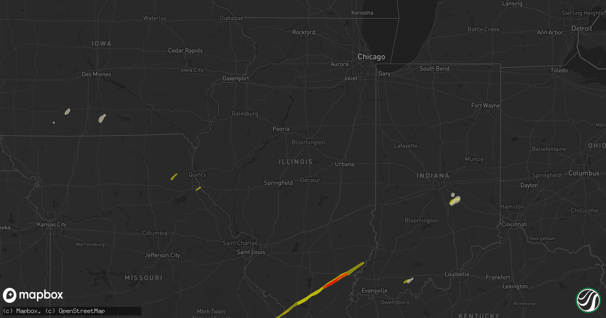
Hail Map in Illinois on February 20, 2014
Get this storm
February 20 map
$229
one time, instant access
Download today. No call, no setup
Keep the $229
Bought the map and want the full workflow? Apply the entire $229 to a subscription within 7 days. None of it is wasted.
Every map, not just this one
This buys you this map. Subscription and you get every map we run, in the markets you choose from a few cities to whole states to nationwide. Plus real-time alerts the moment a storm fires.
Contact data
Name, contact info, occupancy, even credit band for addresses in the footprint. You go from where it hit to who to call.
Become the source they trust
Unlimited branding weather history reports on demand. You already have the documented answer ready for the property owner, and you are the one who showed up with it.
Property data and RoofTrace estimates
Pull up any address you have got, its value and the exact code rules for that jurisdiction, straight from One Click Code. Then RoofTrace estimates the squares, pitch, and roof value, priced the way you price.
Storm reports in Illinois
Illinois
| Date | Description |
|---|---|
| 02/20/20145:55 PM CST | Late report. Quarter size hail reported. |
| 02/20/20145:55 PM CST | Several oil tank batteries blown over...roof peeled off trailer...barn blown down and trees blown down. |
| 02/20/20145:53 PM CST | No power in town |
| 02/20/20145:43 PM CST | Tornado on the ground for about 2 miles. About 75 yards wide. No damage reported at this time. |
| 02/20/20145:43 PM CST | Road sign blown down at intersection of rt. 49 and rt. 133. |
| 02/20/20145:33 PM CST | A local report indicates 60 MPH wind near CARBONDALE |
| 02/20/20145:30 PM CST | Limbs down along hwy 13. Scatter limbs down across county. |
| 02/20/20145:30 PM CST | Late report. Numerous tree limbs down and flag pole snapped. |
| 02/20/20145:25 PM CST | High tension tower twisted. Damage to farm buildings including at least one garage...one barn partially destroyed...and damage to a farm house and numerous trees. |
| 02/20/20145:22 PM CST | Grain elevator damaged. |
| 02/20/20145:20 PM CST | Power pole snapped with lines laying across a home. |
| 02/20/20145:18 PM CST | Power lines down near kinmundy |
| 02/20/20145:15 PM CST | A large shed damaged...grain bins destroyed and shingles torn off the roof of a house. |
| 02/20/20145:13 PM CST | ...unconfirmed...possible tornado between herrin and johnston city reported by public through social media. |
| 02/20/20145:11 PM CST | Shingles blown off of roofs of several buildings...damage to a grain elevator and fertilizer plant...damage to numerous machine sheds. |
| 02/20/20145:10 PM CST | Limbs down. Scattered limbs down across county |
| 02/20/20145:10 PM CST | Quarter size hail reported. |
| 02/20/20145:05 PM CST | Intersection of 43rd and western |
| 02/20/20145:01 PM CST | A local report indicates 59 MPH wind near EAST CAPE GIRARDEAU |
| 02/20/20144:59 PM CST | A local report indicates 60 MPH wind near CARBONDALE |
| 02/20/20144:59 PM CST | Power pole snapped north of colp and also in herrin |
| 02/20/20144:59 PM CST | Tornado crossed route 32 near shumway. Numerous power poles snapped. |
| 02/20/20144:53 PM CST | Tornado crossed route 33 near shumway. Numerous power poles snapped. Corrected location and time. |
| 02/20/20144:50 PM CST | A local report indicates 1.00 inch wind near CARBONDALE |
| 02/20/20144:40 PM CST | Trees and power lines down. Roof damage to some buildings in town. Time estimated. |
| 02/20/20144:40 PM CST | Power lines blown down. Large machine shed severely damaged. |
| 02/20/20144:40 PM CST | Ef1 tornado. 50 yards wide with maximum winds of 95 mph. 4/10 of a mile long. Trees snapped along poplar ridge road with siding/soffit damage to home on wiley road. Oth |
| 02/20/20144:30 PM CST | Damage to a house and outbuildings |
| 02/20/20144:30 PM CST | Shingles and sheeting blown off of the roof of a home |
| 02/20/20144:30 PM CST | 2 six foot sections of fence blown down. Awning on second home detached. Late report. |
| 02/20/20144:25 PM CST | Shed blown down one mile west of breese |
| 02/20/20144:24 PM CST | House damaged and outbuildings destroyed. |
| 02/20/20144:22 PM CST | Numerous trees down. Attached garage destroyed. Several outbuildings destroyed. |
| 02/20/20144:20 PM CST | Touchdown in an open field. No reports of damage. |
| 02/20/20144:20 PM CST | Trees and power lines down near town |
| 02/20/20144:15 PM CST | Tree blown down. |
| 02/20/20144:15 PM CST | Shingles blown off buildings |
| 02/20/20144:05 PM CST | Numerous power poles blown down on old rt. 36. |
| 02/20/20144:04 PM CST | 4 power poles blown down and several outbuildings destroyed. |
| 02/20/20144:00 PM CST | 2 outbuildings destroyed and 5 damaged. Minor damage to house. No injuries. Camper blown over. Several power poles snapped. Corrected location and damage. |
| 02/20/20144:00 PM CST | A local report indicates 60 MPH wind near 3 S HIGHLAND |
| 02/20/20144:00 PM CST | Siding and shingles blown off of homes...small trees also blown down. |
| 02/20/20144:00 PM CST | 7 outbuildings destroyed. Minor damage to house. Camper blown over. Several power poles snapped. |
| 02/20/20144:00 PM CST | Siding blown off houses...estimated winds over 60 mph |
| 02/20/20143:58 PM CST | 15 power poles snapped just east of power plant |
| 02/20/20143:43 PM CST | Tornado tore off a barn roof. On the ground for 0.2 mile and was 75 yards wide. |
| 02/20/20143:42 PM CST | Roof blown off barn. |
| 02/20/20143:40 PM CST | Damage to siding reported. Gusts estimated in excess of 60 mph |
| 02/20/20143:20 PM CST | Large tree limbs down approx 6-8 inches in diameter. Also 2 foot diameter healthy tree blown down. In vicinity of hwy 255 and hwy 140 |
| 02/20/20143:15 PM CST | *** 1 inj *** utility pole fell on car. 2200 block of college avenue in alton il. One occupant of the vehicle was injured. |
| 02/20/20142:55 PM CST | A local report indicates a tornado near ARENZVILLE |
| 02/20/20142:33 PM CST | Hog shelter destroyed between detroit and pittsfield. |
| 02/20/20142:33 PM CST | A local report indicates 60 MPH wind near GRIGGSVILLE |
| 02/20/20142:24 PM CST | One home had all windows shattered and most roof shingles removed. A 30 to 40 yard row of pine trees were sheared off near the base. Several large 2 to 3 foot diameter |
| 02/20/20142:24 PM CST | One home had all windows shattered and most roof shingles removed. A 30 to 40 yard row of pine trees were sheared off near the base. Several large 2 to 3 foot diameter |
| 02/20/20142:23 PM CST | Possible tornado began near martinsburg and traveled northeast to just west of detroit. Parks livestock sustained significant damage to a hog shelter 1w of detroit. Dam |
| 02/20/20142:23 PM CST | Hog shelter destroyed between detroit and pittsfield. |
| 02/19/20146:45 PM CST | Carport blown into roadway. |
| 02/19/20146:25 PM CST | A local report indicates 62 MPH wind near OBLONG |
| 02/19/20146:25 PM CST | Semi tractor trailer overturned along interstate 64. |
| 02/19/20146:15 PM CST | Power pole down. Reported through em office. |
| 02/19/20146:15 PM CST | Overturned tractor trailer along interstate 64. |
All States Impacted by Hail Map on February 20, 2014
Cities Impacted by Hail Map on February 20, 2014
- Beaumont, TX
- Clifton, TN
- Waynesboro, TN
- Saltillo, MS
- Bowling Green, KY
- Charlotte, TN
- Cumberland Furnace, TN
- Joelton, TN
- Pleasant View, TN
- Springfield, TN
- Chapmansboro, TN
- Ashland City, TN
- Shelbyville, IN
- Edinburgh, IN
- Senath, MO
- Hornersville, MO
- Arbyrd, MO
- Leachville, AR
- Evanston, IN
- Ferdinand, IN
- Saint Meinrad, IN
- Bristow, IN
- Fairland, IN
- Duck River, TN
- Centerville, TN
- Hohenwald, TN
- Hampshire, TN
- Alvaton, KY
- Shannon City, IA
- Afton, IA
- Humeston, IA
- Chariton, IA
- Derby, IA
- Santa Fe, TN
- Columbia, TN
- Franklin, TN
- Thompsons Station, TN
- Spring Hill, TN
- Clearfield, IA
- Kennett, MO
- Cardwell, MO
- Guntown, MS
- Baldwyn, MS
- Savannah, TN
- Morris Chapel, TN
- Oakland, KY
- Franklin, KY
- Rockfield, KY
- Woodburn, KY
- Santa Claus, IN
- Columbia, MS
- Foxworth, MS
- Summit, MS
- Bogue Chitto, MS
- Ellisville, MS
- Moselle, MS
- Malvern, AR
- Laurel, MS
- Waynesboro, MS
- Shubuta, MS
- Gibsland, LA
- Homer, LA
- Athens, LA
- Taylor, AR
- Springhill, LA
- Belden, MS
- Pontotoc, MS
- Tupelo, MS
- Blue Springs, MS
- College Grove, TN
- Arrington, TN
- Saltillo, TN
- Adamsville, TN
- Linden, TN
- Williamsport, TN
- Nolensville, TN
- Bath Springs, TN
- Greenbrier, TN
- Marble Hill, MO
- Leopold, MO
- Zalma, MO
- Huntingdon, TN
- Lavinia, TN
- Atwood, TN
- Johnston City, IL
- Grand Tower, IL
- De Soto, IL
- Murphysboro, IL
- Pomona, IL
- Springerton, IL
- Altenburg, MO
- Jackson, MO
- Herrin, IL
- West Frankfort, IL
- Burnt Prairie, IL
- McLeansboro, IL
- Mill Shoals, IL
- Benton, IL
- Oak Ridge, MO
- Macedonia, IL
- Enfield, IL
- Carmi, IL
- Carterville, IL
- Carbondale, IL
- Thompsonville, IL
- Cambria, IL
- Freeman Spur, IL
- Logan, IL
- Golden Gate, IL
- Wolf Lake, IL
- Millersville, MO
- Doniphan, MO
- Oxly, MO
- La Belle, MO
- Shelbyville, MO
- Bethel, MO
- Hannibal, MO
- Hull, IL
- Bellmont, IL
- Grayville, IL
- Albion, IL
- Mount Carmel, IL
- Browns, IL
- Franklin, IN
- Zavalla, TX
- Huntington, TX
- Highlands, TX
- Dayton, TX
- Baytown, TX
- Channelview, TX
- Houston, TX
- Devers, TX
- Fred, TX
- Spurger, TX
- Orange, TX


