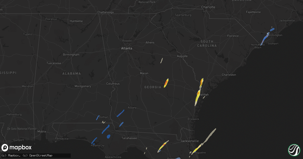
Hail Map in Georgia on February 15, 2021
Get this storm
February 15 map
$229
one time, instant access
Download today. No call, no setup
Keep the $229
Bought the map and want the full workflow? Apply the entire $229 to a subscription within 7 days. None of it is wasted.
Every map, not just this one
This buys you this map. Subscription and you get every map we run, in the markets you choose from a few cities to whole states to nationwide. Plus real-time alerts the moment a storm fires.
Contact data
Name, contact info, occupancy, even credit band for addresses in the footprint. You go from where it hit to who to call.
Become the source they trust
Unlimited branding weather history reports on demand. You already have the documented answer ready for the property owner, and you are the one who showed up with it.
Property data and RoofTrace estimates
Pull up any address you have got, its value and the exact code rules for that jurisdiction, straight from One Click Code. Then RoofTrace estimates the squares, pitch, and roof value, priced the way you price.
Storm reports in Georgia
Georgia
| Date | Description |
|---|---|
| 02/15/20215:53 PM CST | Multiple reports via social media of varying sized hail in richmond hill. One image shows hail stones that measure 1 inch |
| 02/15/20214:41 PM CST | Recieved a report of quarter sized hail from the 1600th block of norwood stephens rd. |
| 02/15/20214:40 PM CST | A local report indicates 1.75 inch wind near 1 N ADRIAN |
| 02/15/20214:05 PM CST | Tree down along dellwood road near highway 97. |
| 02/15/20213:50 PM CST | Tree and power lines down on russ st. The tree landed on a truck. |
| 02/15/20213:46 PM CST | Ag station with uga in northwest baker county reported a 65mph wind gust. |
| 02/15/20213:38 PM CST | *** 1 inj *** report from emergency manager in early county of significant damage to 1 double wide mobile home and 1 single family home near damascus. 1 injury reported |
| 02/15/20213:29 PM CST | Trees were reported down in seminole county with a brief tds visible from ktlh radar. |
| 02/15/20213:25 PM CST | Trees snapped/uprooted debris flying across the highway after very strong winds and very heavy rain stalled cars for atleast 10 minutes on 27. Trees down on side of hig |
| 02/15/20211:27 AM CST | At 726 PM EST, a severe thunderstorm was located near Ebenezer, moving north at 70 mph. HAZARD...Ping pong ball size hail and 60 mph wind gusts. SOURCE...Radar indicated. IMPACT...People and animals outdoors will be injured. Expect hail damage to roofs, siding, windows, and vehicles. Expect wind damage to trees and powerlines. Locations impacted include... Ridgeland, Hampton, Yemassee, Lake Warren State Park, Hardeeville, Varnville, Furman, Crocketville, Coosawhatchie, Tarboro, Grays, Switzerland, Pineland, Early Branch and Tillman.This warning includes I-95 in South Carolina between mile markers 7and 40. |
| 02/14/202111:39 PM CST | At 539 PM EST, a severe thunderstorm was located over Lothair, or near Soperton, moving northeast at 65 mph. HAZARD...60 mph wind gusts and quarter size hail. SOURCE...Radar indicated. IMPACT...Hail damage to vehicles is expected. Expect wind damage to roofs, siding, and trees. Locations impacted include... Swainsboro, Soperton, Adrian, Kite, Lothair, Covena, Orland, Rockledge, Orianna, Norristown, Barnhill, Minter, Norristown Junction, Dellwood, Meeks, Lowery, Blackville, Gillis Springs and Scott. |
| 02/14/202110:52 PM CST | At 452 PM EST, severe thunderstorms were located along a line extending from Leary to near Bainbridge, moving northeast at 50 mph. HAZARD...60 mph wind gusts and penny size hail. SOURCE...Radar indicated. IMPACT...Expect damage to roofs, siding, and trees. Locations impacted include... Newton, Morgan, Albany, Dawson, Leesburg, Pelham, Putney, Camilla, Baconton, Leary, East Albany, Marine Corps Logistics Base, Turner City, Smithville, Walker, Sale City, Sasser, Bronwood, Iveys Mill and Stocks. |
| 02/14/202110:03 PM CST | At 403 PM EST/303 PM CST/, severe thunderstorms were located along a line extending from 10 miles southeast of Cottonwood to 8 miles southwest of Blountstown, moving northeast at 35 mph. HAZARD...60 mph wind gusts and quarter size hail. SOURCE...Radar indicated. IMPACT...Hail damage to vehicles is expected. Expect wind damage to roofs, siding, and trees. Locations impacted include... Quincy, Blountstown, Bainbridge, Midway, Chattahoochee, Greensboro, West Bainbridge, Malone, Sneads, Gretna, Bristol, Grand Ridge, Greenwood, Altha, Attapulgus, Iron City, Brinson, Bascom, Rock Bluff and Clarksville. |
| 02/14/20219:24 PM CST | At 324 PM EST, severe thunderstorms were located along a line extending from 10 miles southwest of Madison to near Dowling Park to 10 miles southeast of Mayo, moving northeast at 65 mph. HAZARD...60 mph wind gusts and quarter size hail. SOURCE...Radar indicated. IMPACT...Hail damage to vehicles is expected. Expect wind damage to roofs, siding, and trees. Locations impacted include... Valdosta, Madison, Lake Park, Lakeland, Quitman, Adel, Hahira, Ray City, I-75 At Exit 16, Moody Air Force Base, Remerton, Meigs, Dasher, Greenville, Morven, Lee, Cecil, Barretts, Greggs and Pinetta. |
| 02/14/20219:22 PM CST | At 321 PM EST/221 PM CST/, severe thunderstorms were located along a line extending from 8 miles west of Graceville to near Tyndall Air Force Base, moving east at 50 mph. HAZARD...60 mph wind gusts and quarter size hail. SOURCE...Radar indicated. IMPACT...Hail damage to vehicles is expected. Expect wind damage to roofs, siding, and trees. Locations impacted include... Panama City, Lynn Haven, Callaway, Vernon, Bonifay, Blountstown, Marianna, Chipley, Graceville, Springfield, Hiland Park, Stonemill Creek, Tyndall Air Force Base, Orange, Bradford, Parker, Malone, Wewahitchka, Sneads and Bristol. |
| 02/14/20216:07 PM CST | A trained spotter reported approximate ping-pong ball size hail via a social media image near the intersection of pooler pkwy and outlets way. |
| 02/14/20216:00 PM CST | Numerous reports from the public of quarter-size hail in the pooler/bloomingdale area. |
All States Impacted by Hail Map on February 15, 2021
Cities Impacted by Hail Map on February 15, 2021
- Soperton, GA
- Adrian, GA
- Wrightsville, GA
- Rockledge, GA
- Kite, GA
- Saint Augustine, FL
- Ponte Vedra Beach, FL
- Lake City, FL
- Wellborn, FL
- McAlpin, FL
- O'Brien, FL
- Interlachen, FL
- Ridgeland, SC
- Pineland, SC
- Tillman, SC
- Richmond Hill, GA
- Midway, GA
- Riceboro, GA
- Varnville, SC
- Branford, FL
- Savannah, GA
- Pooler, GA
- Port Wentworth, GA
- Cottonwood, AL
- Rincon, GA
- Townsend, GA
- Bloomingdale, GA
- Delco, NC
- Green Cove Springs, FL
- Palatka, FL
- Sparta, GA
- Perry, FL
- Burgaw, NC
- Slocomb, AL
- Hardeeville, SC
- Panama City, FL
- Chipley, FL
- Panama City Beach, FL
- Altha, FL
- Clarksville, FL
- Arlington, GA
- Colquitt, GA
- Damascus, GA
- Leary, GA
- Greenwood, FL
- Bascom, FL
- Alford, FL
- Marianna, FL
- Cottondale, FL
- Melrose, FL
- Earleton, FL
- Gainesville, FL
- Williston, FL
- Micanopy, FL
- Hawthorne, FL
- Bainbridge, GA
- Brinson, GA
- Newton, AL
- Hartford, AL
- Glenwood, GA
- Fort Stewart, GA
- Shallotte, NC
- Ash, NC
- Leland, NC
- Ocean Isle Beach, NC
- Sunset Beach, NC
- Riegelwood, NC
- Supply, NC
- Calabash, NC
- Currie, NC
- Rocky Point, NC


