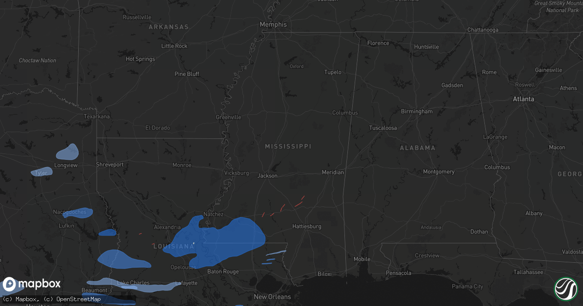
Hail Map in Mississippi on February 14, 2026
Get this storm
February 14 map
$229
one time, instant access
Download today. No call, no setup
Keep the $229
Bought the map and want the full workflow? Apply the entire $229 to a subscription within 7 days. None of it is wasted.
Every map, not just this one
This buys you this map. Subscription and you get every map we run, in the markets you choose from a few cities to whole states to nationwide. Plus real-time alerts the moment a storm fires.
Contact data
Name, contact info, occupancy, even credit band for addresses in the footprint. You go from where it hit to who to call.
Become the source they trust
Unlimited branding weather history reports on demand. You already have the documented answer ready for the property owner, and you are the one who showed up with it.
Property data and RoofTrace estimates
Pull up any address you have got, its value and the exact code rules for that jurisdiction, straight from One Click Code. Then RoofTrace estimates the squares, pitch, and roof value, priced the way you price.
Storm reports in Mississippi
Mississippi
| Date | Description |
|---|---|
| 02/14/20261:55 AM CST | Reports of multiple trees down... Fences down... And some roof and siding damage to homes on hillsdale rd. Possible tornado. Time estimated by radar. |
| 02/14/20261:12 AM CST | Three chicken houses were damaged on gaylons drive. Tds evident from dgx radar. |
| 02/14/20261:00 AM CST | Report of multiple power lines downed across the city of prentiss. |
| 02/14/202612:27 AM CST | Tree downed on a powerline near ms hwy 184 and arm rd. Tds noted on dgx radar. |
| 02/14/202612:23 AM CST | Trees downed on oak grove rd. |
| 02/14/202612:23 AM CST | Three site built homes and two mobile homes were damaged along john peyton ln... With one of the mobile homes destroyed. Several sheds in the area were also damaged or |
| 02/14/202612:22 AM CST | Trees down blocking ethel johnson rd. |
| 02/14/202612:19 AM CST | Trees downed along foster rd. Possible tornado. |
| 02/14/202612:13 AM CST | Power lines and tree limbs downed on us 84. |
| 02/14/202612:05 AM CST | Report of tree downed on corner of house on mt. Pleasant and a tree on vehicle and detached carport on albritton lane both in bogue chitto. And trees downed in north an |
| 02/14/202612:01 AM CST | This ef1 tornado began near mount olive road and tracked northeastward across shell oil lane and ms highway 583 before lifting near highway 583 and bethel road. Along t |
| 02/14/202612:00 AM CST | Report of multiple trees downed and skirting blown off of trailer. |
| 02/13/202611:46 PM CST | This ef1 tornado began near the pike lincoln county line and tracked northeastward across southern lincoln county... Snapping and uprooted numerous trees along its path |
| 02/13/202611:40 PM CST | Trees reported down on deer creek lane. Time estimated by radar. |
| 02/13/202611:39 PM CST | Multiple trees reported down on highway 570 near the tangipahoa river and county line. Possible tornado. Time estimated by radar. |
| 02/13/202611:37 PM CST | Multiple trees reported down at the intersection of tangipahoa road and moak road. Possible tornado. Time estimated by radar. |
| 02/13/202611:37 PM CST | Mulitple trees reported down on bales road between thompson road and brown road. Possible tornado. Time estimated by radar. |
| 02/13/202611:33 PM CST | Multiple trees reported down on barron road. Possible tornado. Time estimated by radar. |
| 02/13/202611:29 PM CST | Multiple trees reported down on highway 24 between fire house rd. And east fork rd. Possible tornado. Time estimated by radar. |
| 02/13/202611:28 PM CST | Multiple trees reported down on peoria rd. Possible tornado. Time estimated by radar. |
| 02/13/202611:26 PM CST | Multiple trees reported down on patterson road. Possible tornado. Time estimated by radar. |
| 02/13/202611:25 PM CST | 4-5 downed trees reported scattered across franklin county. |
| 02/13/202611:20 PM CST | Mulitple trees reported down near mt. Zion church on highway 584. Possible tornado. Time estimated by radar. |
| 02/13/202611:02 PM CST | Roof damage to press box at high school football stadium. Possible tornado. Time estimated by radar. |
| 02/13/202611:02 PM CST | Freestanding wooden light pole at baseball stadium snapped. Metal batting cage thrown. Partial roof loss on well built shed. Possible tornado. Time estimated by radar. |
| 02/13/202611:00 PM CST | Multiple trees down in centreville. Possible tornado. Report relayed by broadcast media. |
All States Impacted by Hail Map on February 14, 2026
Cities Impacted by Hail Map on February 14, 2026
- Sweetwater, TX
- Fort Stockton, TX
- Merkel, TX
- Rising Star, TX
- Dryden, TX
- Carbon, TX
- Gorman, TX
- Lohn, TX
- Melvin, TX
- Rochelle, TX
- Comstock, TX
- Brownwood, TX
- Mullin, TX
- Comanche, TX
- Zephyr, TX
- Early, TX
- Priddy, TX
- Gustine, TX
- Hamilton, TX
- Goldthwaite, TX
- Dublin, TX
- Carlton, TX
- Quemado, TX
- Eagle Pass, TX
- Crystal City, TX
- La Pryor, TX
- Batesville, TX
- Chandler, TX
- Gilmer, TX
- Ore City, TX
- Diana, TX
- Longview, TX
- Tyler, TX
- Flint, TX
- Whitehouse, TX
- Arp, TX
- Floresville, TX
- Lone Star, TX
- Avinger, TX
- Jefferson, TX
- Hallsville, TX
- Harleton, TX
- Laredo, TX
- Poth, TX
- Falls City, TX
- Pleasanton, TX
- Hobson, TX
- Karnes City, TX
- Stockdale, TX
- Gillett, TX
- Ecleto, TX
- Yorktown, TX
- Westhoff, TX
- Cuero, TX
- Yoakum, TX
- Childress, TX
- Calliham, TX
- Tilden, TX
- Three Rivers, TX
- George West, TX
- Edna, TX
- Inez, TX
- Magnolia, TX
- Pinehurst, TX
- Hallettsville, TX
- Victoria, TX
- Ganado, TX
- Louise, TX
- Beeville, TX
- Waller, TX
- Hockley, TX
- Hempstead, TX
- Chappell Hill, TX
- Bellville, TX
- Prairie View, TX
- Tomball, TX
- Washington, TX
- Brenham, TX
- Navasota, TX
- Plantersville, TX
- Montgomery, TX
- Concepcion, TX
- Boling, TX
- Pledger, TX
- Sweeny, TX
- Damon, TX
- Guy, TX
- Richmond, TX
- Sugar Land, TX
- Missouri City, TX
- Fresno, TX
- Stafford, TX
- Rosharon, TX
- Houston, TX
- Wharton, TX
- Alice, TX
- West Columbia, TX
- Kingsville, TX
- Pearland, TX
- Manvel, TX
- Alvin, TX
- Angleton, TX
- Brookeland, TX
- Pineland, TX
- Wiergate, TX
- Hemphill, TX
- Needville, TX
- Friendswood, TX
- Webster, TX
- League City, TX
- Seabrook, TX
- Liverpool, TX
- Santa Fe, TX
- Dickinson, TX
- Texas City, TX
- Kemah, TX
- Bishop, TX
- La Marque, TX
- Burkeville, TX
- Kirbyville, TX
- Corpus Christi, TX
- Bacliff, TX
- Call, TX
- Bon Wier, TX
- Port Bolivar, TX
- Lumberton, TX
- Vidor, TX
- Port Aransas, TX
- Kountze, TX
- Merryville, LA
- Newton, TX
- Buna, TX
- Orange, TX
- Beaumont, TX
- Port Arthur, TX
- Nederland, TX
- Groves, TX
- Port Neches, TX
- Leesville, LA
- Bridge City, TX
- Cameron, LA
- Deweyville, TX
- Vinton, LA
- Starks, LA
- Dequincy, LA
- Longville, LA
- Singer, LA
- Deridder, LA
- Ragley, LA
- Sulphur, LA
- Dry Creek, LA
- Kinder, LA
- Reeves, LA
- Winnie, TX
- Westlake, LA
- Lake Charles, LA
- Mittie, LA
- Oberlin, LA
- Glenmora, LA
- Creole, LA
- Bell City, LA
- Lacassine, LA
- Iowa, LA
- Ville Platte, LA
- Saint Landry, LA
- Cheneyville, LA
- Welsh, LA
- Lake Arthur, LA
- Bunkie, LA
- Jennings, LA
- Marksville, LA
- Hessmer, LA
- Alexandria, LA
- Lecompte, LA
- Morrow, LA
- Evergreen, LA
- Pineville, LA
- Cottonport, LA
- Mansura, LA
- Effie, LA
- Gueydan, LA
- Morse, LA
- Mermentau, LA
- Washington, LA
- Plaucheville, LA
- Crowley, LA
- Simmesport, LA
- Moreauville, LA
- Jonesville, LA
- Monterey, LA
- Melville, LA
- Batchelor, LA
- Lettsworth, LA
- Acme, LA
- Angola, LA
- Woodville, MS
- Saint Francisville, LA
- Vidalia, LA
- Krotz Springs, LA
- Palmetto, LA
- Port Barre, LA
- Morganza, LA
- Fordoche, LA
- Lottie, LA
- Deville, LA
- New Roads, LA
- Livonia, LA
- Maringouin, LA
- Estherwood, LA
- Rayne, LA
- Duson, LA
- Scott, LA
- Ventress, LA
- Oscar, LA
- Jarreau, LA
- Gloster, MS
- Jackson, LA
- Port Allen, LA
- Erwinville, LA
- Lakeland, LA
- Centreville, MS
- Rougon, LA
- Norwood, LA
- Glynn, LA
- Crosby, MS
- Zachary, LA
- Ethel, LA
- Slaughter, LA
- Wilson, LA
- Meadville, MS
- Liberty, MS
- Clinton, LA
- Roxie, MS
- Bude, MS
- Greensburg, LA
- Brookhaven, MS
- Sontag, MS
- Monticello, MS
- Silver Creek, MS
- Kentwood, LA
- Mccomb, MS
- Osyka, MS
- Tylertown, MS
- Magnolia, MS
- Summit, MS
- Smithdale, MS
- McCall Creek, MS
- Bogue Chitto, MS
- Amite, LA
- Mount Hermon, LA
- Prentiss, MS
- Collins, MS
- Taylorsville, MS
- Bay Springs, MS
- Winona, TX
- Ben Wheeler, TX
- Ruth, MS
- Nacogdoches, TX
- Chireno, TX
- San Augustine, TX
- Center, TX
- Thibodaux, LA
- Franklinton, LA
- Bogalusa, LA
- Angie, LA
- Folsom, LA
- Covington, LA
- Loranger, LA
- Gladewater, TX
- Galveston, TX
- Van Vleck, TX
- Saratoga, TX
- Silsbee, TX
- Nome, TX
- China, TX
- White Oak, TX
- Lafayette, LA
- Breaux Bridge, LA
- Church Point, LA
- Carencro, LA
- Belle Rose, LA
- Donaldsonville, LA
- Saint James, LA
- Convent, LA
- Paulina, LA
- Gramercy, LA
- Jayess, MS
- Foxworth, MS
- Carson, MS
- Oak Vale, MS
- Soso, MS
- Ellisville, MS
- Bassfield, MS
- Seminary, MS
- Laurel, MS
- Mount Olive, MS
- Magee, MS
- Heidelberg, MS
- Mize, MS
- Newhebron, MS
- Stringer, MS
- Paulding, MS
- Wesson, MS
- Mendenhall, MS
- Pinola, MS
- Pitkin, LA
- Sugartown, LA
- Grant, LA
- Elizabeth, LA
- Evans, LA
- Rosepine, LA
- Darrow, LA
- Geismar, LA
- Sorrento, LA
- White Castle, LA


