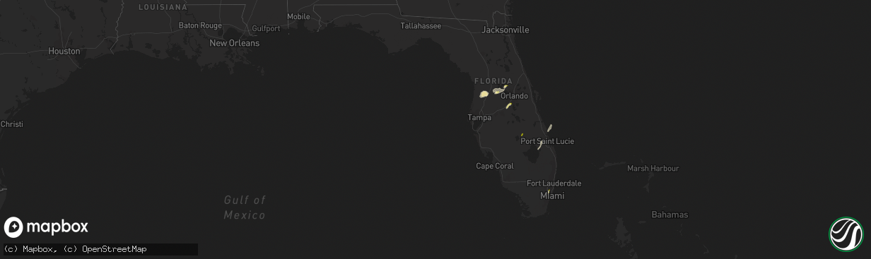
Hail Map in Florida on February 12, 2014
The weather event in Florida on February 12, 2014 includes Hail map. 1 state and 27 cities were impacted and suffered possible damage. The total estimated number of properties impacted is 8,856.
Want more than just the map?
Turn this storm into a full workflow.
- Owner + property data so you know who to knock
- OnDemand branded weather history reports to win the "did we even have hail?" argument
- RoofTrace estimate so reps stop guessing numbers at the door
Bought this map? Upgrade within 7 days and we'll credit the $230. (10-15 min setup call)
Hail
8,856
Estimated number of impacted properties by a 1.00" hail or larger0
Estimated number of impacted properties by a 1.75" hail or larger0
Estimated number of impacted properties by a 2.50" hail or largerStorm reports in Florida
Florida
| Date | Description |
|---|---|
| 02/12/20145:10 PM CST | Roof damage |
| 02/12/20145:10 PM CST | Roof was blown off of house. |
| 02/12/20145:08 PM CST | After examining photos and information provided by emergency management officials and wsr-88d radar data...it has been determined that straight line westerly winds of 6 |
| 02/12/20145:00 PM CST | Updated...roof porch blown away by winds estimated at 50 mph by nws damage survey team. |
| 02/12/20145:00 PM CST | Wftv ch9 relayed report from social media of quarter size hail in kissimmee at indian creek subdivision on poinciana blvd four miles south of 192. |
| 02/12/20144:50 PM CST | Trees up to one foot diameter down. Fences down in middle of road and other debris near intersection of e e williamson rd and markham woods rd. In longwood |
| 02/12/20144:50 PM CST | Wftv broadcast media relayed an image via social media of a large tree down in longwood. Time estimated via radar. |
| 02/12/20144:25 PM CST | Social media report of quarter size hail in mount dora. |
| 02/12/20144:00 PM CST | Branches down and estimated wind gust received via social media. |
| 02/12/20143:46 PM CST | Hail at least the size of quarters was reported through social media in carol city. |
| 02/12/20143:46 PM CST | Hail at least the size of quarters was reported through social media in carol city. |
| 02/12/20143:45 PM CST | Public report of estimated 60 mph gust. |
| 02/12/20143:40 PM CST | A thunderstorm produced a wind gust of 67 mph at opa locka airport. |
| 02/12/20143:39 PM CST | A thunderstorm produced a wind gust of 70 mph at miami dade fire rescue at opa locka airport. |
| 02/12/20143:30 PM CST | Large tree fell on house. Reported by hernando county s.0. |
| 02/12/20143:10 PM CST | Large tree fell on house. Reported by hernando county sheriffs office. |
| 02/12/20142:50 PM CST | Section of wood fence blown out near intersection of de cubellis road and ridge road. |
All States Impacted by Hail Map on February 12, 2014
Cities Impacted by Hail Map on February 12, 2014
- Brooksville, FL
- Mount Dora, FL
- Tavares, FL
- Groveland, FL
- Fort Pierce, FL
- Vero Beach, FL
- Davenport, FL
- Kissimmee, FL
- Miami, FL
- Hialeah, FL
- Opa Locka, FL
- Nobleton, FL
- Bushnell, FL
- Webster, FL
- Indiantown, FL
- Port Saint Lucie, FL
- Howey In The Hills, FL
- Leesburg, FL
- Center Hill, FL
- Astatula, FL
- Clermont, FL
- Okahumpka, FL
- Mascotte, FL
- Sumterville, FL
- Yalaha, FL
- Okeechobee, FL
- Sorrento, FL


