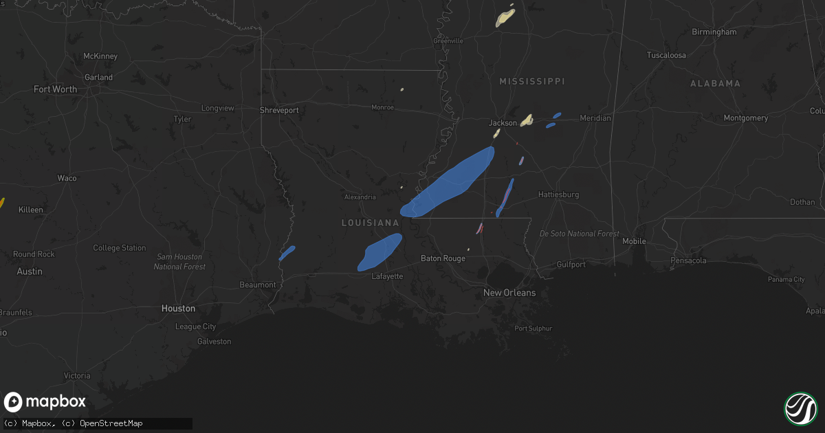
Hail Map in Louisiana on February 8, 2023
Get this storm
February 8 map
$229
one time, instant access
Download today. No call, no setup
Keep the $229
Bought the map and want the full workflow? Apply the entire $229 to a subscription within 7 days. None of it is wasted.
Every map, not just this one
This buys you this map. Subscription and you get every map we run, in the markets you choose from a few cities to whole states to nationwide. Plus real-time alerts the moment a storm fires.
Contact data
Name, contact info, occupancy, even credit band for addresses in the footprint. You go from where it hit to who to call.
Become the source they trust
Unlimited branding weather history reports on demand. You already have the documented answer ready for the property owner, and you are the one who showed up with it.
Property data and RoofTrace estimates
Pull up any address you have got, its value and the exact code rules for that jurisdiction, straight from One Click Code. Then RoofTrace estimates the squares, pitch, and roof value, priced the way you price.
Storm reports in Louisiana
Louisiana
| Date | Description |
|---|---|
| 02/08/20235:54 PM CST | Emergency management reported damage to manufactured homes on tangipahoa road and martin luther king road. Law enforcement reported damage to a gas station. Likely torn |
| 02/08/20235:54 PM CST | Emergency management reported damage to manufactured homes on tangipa |
| 02/08/20235:51 PM CST | A weak ef2 tornado impacted the western portions of the village of tangipahoa. Maximum winds were 115 mph... Maximum width of 175 yards and the path length was 3.4 mile |
| 02/08/20235:05 PM CST | Tree down across hwy 130 near liddieville. |
| 02/08/20234:30 PM CST | Pictures show an auto zone sign blown down as well as another pole/sign damaged. |
| 02/08/20233:12 PM CST | Multiple locations where trees have been blown down on power lines from severe thunderstorm wind gusts. |
| 02/07/20237:02 PM CST | Parish officials report storms damaged a home causing a partial roof collapse in the big cane area. Possible tornado. |
| 02/07/20237:01 PM CST | Corrects previous tstm wnd dmg report from 1 w big cane. A national weather service storm survey revealed than an ef-1 tornado touched down just of highway 107 and trac |
| 02/07/20236:47 PM CST | Numerous reports of powerlines down along and near hwy 363 and point verte rd. Time estimated by radar. |
All States Impacted by Hail Map on February 8, 2023
Cities Impacted by Hail Map on February 8, 2023
- Lampasas, TX
- East Prairie, MO
- Matthews, MO
- Charleston, MO
- Bertrand, MO
- Bernie, MO
- Malden, MO
- Corning, AR
- Qulin, MO
- Knobel, AR
- Pollard, AR
- Tylertown, MS
- Osyka, MS
- Monticello, MS
- Jayess, MS
- Mccomb, MS
- Oak Vale, MS
- Silver Creek, MS
- Fayette, MS
- Union Church, MS
- Brookhaven, MS
- Gloster, MS
- Pattison, MS
- Monterey, LA
- Crosby, MS
- Vidalia, LA
- Wesson, MS
- Hazlehurst, MS
- Moreauville, LA
- Bude, MS
- Roxie, MS
- Hermanville, MS
- Marksville, LA
- Meadville, MS
- Liberty, MS
- Woodville, MS
- McCall Creek, MS
- Crystal Springs, MS
- Natchez, MS
- Smithdale, MS
- Fluker, LA
- Roseland, LA
- Mendenhall, MS
- Newhebron, MS
- Magee, MS
- Forest, MS
- Lake, MS
- Conehatta, MS
- Decatur, MS
- Lawrence, MS
- Clay, KY
- Morganfield, KY
- Marion, KY
- Dixon, KY
- Waverly, KY
- Slaughters, KY
- Corydon, KY
- Cave In Rock, IL
- Sebree, KY
- Sturgis, KY
- Uniontown, KY
- Henderson, KY
- Robards, KY
- Providence, KY
- Magnolia, MS
- Kentwood, LA
- Amite, LA
- Braxton, MS
- Pomona, IL
- Harrisburg, IL
- Goreville, IL
- Omaha, IL
- Murphysboro, IL
- Galatia, IL
- Stonefort, IL
- Creal Springs, IL
- Pittsburg, IL
- Carterville, IL
- Alto Pass, IL
- Simpson, IL
- Herod, IL
- Ozark, IL
- Dongola, IL
- Eddyville, IL
- Jonesboro, IL
- Thompsonville, IL
- New Burnside, IL
- Anna, IL
- De Soto, IL
- Cypress, IL
- Marion, IL
- Energy, IL
- Makanda, IL
- Carrier Mills, IL
- Raleigh, IL
- Johnston City, IL
- Cambria, IL
- Ridgway, IL
- Grantsburg, IL
- Vienna, IL
- Equality, IL
- Buncombe, IL
- Golconda, IL
- Carbondale, IL
- Herrin, IL
- Eldorado, IL
- Cobden, IL
- Sumner, IL
- Lawrenceville, IL
- Oaktown, IN
- Bridgeport, IL
- Flat Rock, IL
- Byram, MS
- Florence, MS
- Canton, MS
- Bastrop, LA
- Mer Rouge, LA
- Morton, MS
- Pelahatchie, MS
- Brandon, MS
- Philipp, MS
- Holcomb, MS
- Greenwood, MS
- Terry, MS
- Cascilla, MS
- Schlater, MS
- Walker, LA
- Holden, LA
- Singer, LA
- Merryville, LA
- Starks, LA
- Iota, LA
- Branch, LA
- Sunset, LA
- Crowley, LA
- Port Barre, LA
- Opelousas, LA
- Church Point, LA
- Bunkie, LA
- Washington, LA
- Arnaudville, LA
- Ville Platte, LA
- Plaucheville, LA
- Melville, LA
- Eunice, LA
- Palmetto, LA
- Rayne, LA


