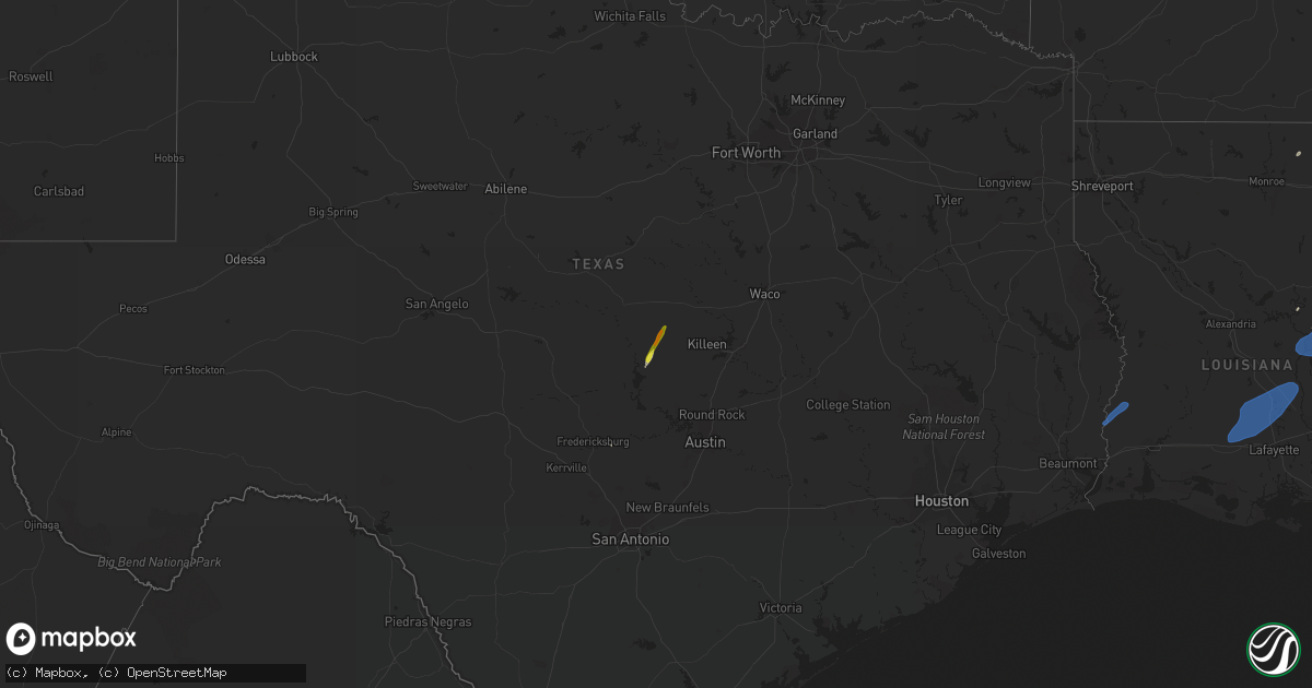
Hail Map on February 8, 2023
Get this storm
February 8 map
$229
one time, instant access
Download today. No call, no setup
Keep the $229
Bought the map and want the full workflow? Apply the entire $229 to a subscription within 7 days. None of it is wasted.
Every map, not just this one
This buys you this map. Subscription and you get every map we run, in the markets you choose from a few cities to whole states to nationwide. Plus real-time alerts the moment a storm fires.
Contact data
Name, contact info, occupancy, even credit band for addresses in the footprint. You go from where it hit to who to call.
Become the source they trust
Unlimited branding weather history reports on demand. You already have the documented answer ready for the property owner, and you are the one who showed up with it.
Property data and RoofTrace estimates
Pull up any address you have got, its value and the exact code rules for that jurisdiction, straight from One Click Code. Then RoofTrace estimates the squares, pitch, and roof value, priced the way you price.
States Impacted by Hail Map on February 8, 2023
Storm reports
Missouri
| Date | Description |
|---|---|
| 02/07/20237:24 PM CST | Time estimated from radar. Relayed by kfvs. |
| 02/07/20236:10 PM CST | Part of a carport was damaged. Time estimated from radar. Report relayed by kfvs. |
Illinois
| Date | Description |
|---|---|
| 02/08/20233:55 AM CST | Public report of shingle damage to a home in bluford from passing line of showers. Time estimated from radar. Report relayed by wsil tv. |
| 02/08/20233:55 AM CST | Report of tree down at intersection of il route 14 and county road 525e west of mcleansboro. Time estimated by radar. |
| 02/08/20233:55 AM CST | Public report of flag pole bent over and broken as line of showers moved through. Time estimated from radar. Report relayed by wsil tv. |
| 02/08/20233:50 AM CST | Time estimated by radar. Power outages throughout saline county due to band of showers moved through shortly before 4 am. Roughly 1778 customers still without power at |
| 02/08/20233:40 AM CST | Trees down near harrisburg. Report received via social media. |
| 02/08/20233:25 AM CST | Public report of a tree down from passing line of showers. Time estimated from radar. Report relayed by wsil tv. |
| 02/08/20233:22 AM CST | Tree damage reported in the carbondale area due to strong wind gusts with passing line of showers. Winds were estimated at 60 mph. |
| 02/08/20233:20 AM CST | Large tree uprooted and on a fence. Time estimated by radar with a line of showers moving through. |
| 02/08/20233:17 AM CST | Peak wind gust at kmdh carbondale il asos associated with passing line of showers. |
| 02/08/20233:10 AM CST | Public report of damage to siding on a home in vienna. Winds associated with passing line of showers. Time estimated from radar. Report relayed by wsil tv. |
| 02/07/20238:31 PM CST | Large tree blown down. |
Mississippi
| Date | Description |
|---|---|
| 02/08/20235:18 PM CST | Large limb on a roof... Damaged the roof. |
| 02/08/20235:08 PM CST | Tree down across bogue chitto rd near pillars rd. |
| 02/07/20239:12 PM CST | Two windows were blown out of a house and debris was blown into vehicles and a garage door off carroll dr. |
| 02/07/20239:12 PM CST | Two windows were blown out of a |
| 02/07/20239:02 PM CST | A couple trees down along hwy 51 in gallman. |
| 02/07/20238:50 PM CST | A couple trees down off sylvarena rd. |
| 02/07/20238:25 PM CST | Tds... Larry walker dr. |
| 02/07/20238:22 PM CST | Trees down on mt zion road. |
| 02/07/20238:22 PM CST | This ef0 tornado began just east of ms highway 13 and just north of the jefferson davis county line and tracked north northeastward across mt zion rd... Hb smith rd... |
| 02/07/20238:10 PM CST | Trees down near sawmill road and highway 149... Blocking the road. |
| 02/07/20238:10 PM CST | Tds... Old pinola/braxton rd. |
| 02/07/20238:05 PM CST | This ef1 tornado began near ms highway 540 just east of sanders creek... Downing a few trees. It continued northward across old pinola braxton rd... Gum springs rd... S |
| 02/07/20237:30 PM CST | This brief ef1 tornado occurred along givens rd north of the intersection of tanksley ln and on the west side of the tilton community. A metal shed was heavily damaged. |
| 02/07/20237:29 PM CST | Shingles off a home and windows blown out. Barn with tin blown off and roughly 800f the roof off. This is along givens mullins rd. |
| 02/07/20237:29 PM CST | Shingles off a home and windows blown out. Barn with tin blown off and rou |
| 02/07/20237:22 PM CST | Trees down and damage to a home on jk givens rd. |
| 02/07/20237:22 PM CST | This brief ef0 tornado began near jk givens rd... Where a hay barn was damaged... Then tracked northward across holmes rd... Damaging another small shed and destroying |
| 02/07/20237:15 PM CST | One tree was down across county road 105. |
| 02/07/20237:11 PM CST | Structural damage to a church. |
| 02/07/20236:30 PM CST | Sheriffs office reported trees down on irene road and hood road. |
Arkansas
| Date | Description |
|---|---|
| 02/08/20235:18 PM CST | Several power poles were down on both sides of highway 67 just west of corning. A portable storage building was blown down. |
| 02/08/20235:15 PM CST | A local report indicates 64 MPH wind near 4 W CORNING |
Louisiana
| Date | Description |
|---|---|
| 02/08/20235:54 PM CST | Emergency management reported damage to manufactured homes on tangipahoa road and martin luther king road. Law enforcement reported damage to a gas station. Likely torn |
| 02/08/20235:54 PM CST | Emergency management reported damage to manufactured homes on tangipa |
| 02/08/20235:51 PM CST | A weak ef2 tornado impacted the western portions of the village of tangipahoa. Maximum winds were 115 mph... Maximum width of 175 yards and the path length was 3.4 mile |
| 02/08/20235:05 PM CST | Tree down across hwy 130 near liddieville. |
| 02/08/20234:30 PM CST | Pictures show an auto zone sign blown down as well as another pole/sign damaged. |
| 02/08/20233:12 PM CST | Multiple locations where trees have been blown down on power lines from severe thunderstorm wind gusts. |
| 02/07/20237:02 PM CST | Parish officials report storms damaged a home causing a partial roof collapse in the big cane area. Possible tornado. |
| 02/07/20237:01 PM CST | Corrects previous tstm wnd dmg report from 1 w big cane. A national weather service storm survey revealed than an ef-1 tornado touched down just of highway 107 and trac |
| 02/07/20236:47 PM CST | Numerous reports of powerlines down along and near hwy 363 and point verte rd. Time estimated by radar. |
Kentucky
| Date | Description |
|---|---|
| 02/08/20233:25 AM CST | 1-inch tree limbs broken. Shingles blown off. Wind gusts associated with passing line of showers. Time estimated from radar. |
| 02/07/20238:18 PM CST | Large tree limb blown down. |
Cities Impacted by Hail Map on February 8, 2023
- Lampasas, TX
- East Prairie, MO
- Matthews, MO
- Charleston, MO
- Bertrand, MO
- Bernie, MO
- Malden, MO
- Corning, AR
- Qulin, MO
- Knobel, AR
- Pollard, AR
- Tylertown, MS
- Osyka, MS
- Monticello, MS
- Jayess, MS
- Mccomb, MS
- Oak Vale, MS
- Silver Creek, MS
- Fayette, MS
- Union Church, MS
- Brookhaven, MS
- Gloster, MS
- Pattison, MS
- Monterey, LA
- Crosby, MS
- Vidalia, LA
- Wesson, MS
- Hazlehurst, MS
- Moreauville, LA
- Bude, MS
- Roxie, MS
- Hermanville, MS
- Marksville, LA
- Meadville, MS
- Liberty, MS
- Woodville, MS
- McCall Creek, MS
- Crystal Springs, MS
- Natchez, MS
- Smithdale, MS
- Fluker, LA
- Roseland, LA
- Mendenhall, MS
- Newhebron, MS
- Magee, MS
- Forest, MS
- Lake, MS
- Conehatta, MS
- Decatur, MS
- Lawrence, MS
- Clay, KY
- Morganfield, KY
- Marion, KY
- Dixon, KY
- Waverly, KY
- Slaughters, KY
- Corydon, KY
- Cave In Rock, IL
- Sebree, KY
- Sturgis, KY
- Uniontown, KY
- Henderson, KY
- Robards, KY
- Providence, KY
- Magnolia, MS
- Kentwood, LA
- Amite, LA
- Braxton, MS
- Pomona, IL
- Harrisburg, IL
- Goreville, IL
- Omaha, IL
- Murphysboro, IL
- Galatia, IL
- Stonefort, IL
- Creal Springs, IL
- Pittsburg, IL
- Carterville, IL
- Alto Pass, IL
- Simpson, IL
- Herod, IL
- Ozark, IL
- Dongola, IL
- Eddyville, IL
- Jonesboro, IL
- Thompsonville, IL
- New Burnside, IL
- Anna, IL
- De Soto, IL
- Cypress, IL
- Marion, IL
- Energy, IL
- Makanda, IL
- Carrier Mills, IL
- Raleigh, IL
- Johnston City, IL
- Cambria, IL
- Ridgway, IL
- Grantsburg, IL
- Vienna, IL
- Equality, IL
- Buncombe, IL
- Golconda, IL
- Carbondale, IL
- Herrin, IL
- Eldorado, IL
- Cobden, IL
- Sumner, IL
- Lawrenceville, IL
- Oaktown, IN
- Bridgeport, IL
- Flat Rock, IL
- Byram, MS
- Florence, MS
- Canton, MS
- Bastrop, LA
- Mer Rouge, LA
- Morton, MS
- Pelahatchie, MS
- Brandon, MS
- Philipp, MS
- Holcomb, MS
- Greenwood, MS
- Terry, MS
- Cascilla, MS
- Schlater, MS
- Walker, LA
- Holden, LA
- Singer, LA
- Merryville, LA
- Starks, LA
- Iota, LA
- Branch, LA
- Sunset, LA
- Crowley, LA
- Port Barre, LA
- Opelousas, LA
- Church Point, LA
- Bunkie, LA
- Washington, LA
- Arnaudville, LA
- Ville Platte, LA
- Plaucheville, LA
- Melville, LA
- Eunice, LA
- Palmetto, LA
- Rayne, LA