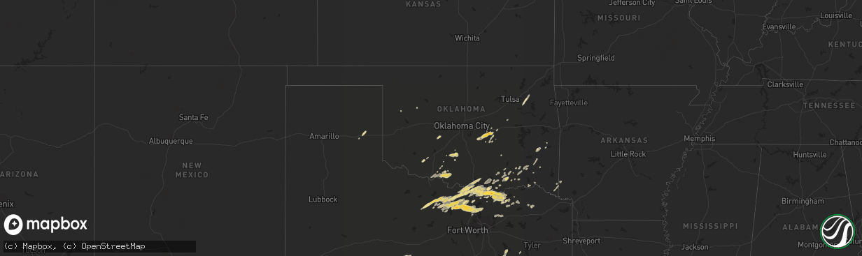
Hail Map in Oklahoma on February 3, 2012
The weather event in Oklahoma on February 3, 2012 includes Hail map. 5 states and 212 cities were impacted and suffered possible damage. The total estimated number of properties impacted is 0.
Want more than just the map?
Turn this storm into a full workflow.
- Owner + property data so you know who to knock
- OnDemand branded weather history reports to win the "did we even have hail?" argument
- RoofTrace estimate so reps stop guessing numbers at the door
Bought this map? Upgrade within 7 days and we'll credit the $230. (10-15 min setup call)
Hail
0
Estimated number of impacted properties by a 1.00" hail or larger0
Estimated number of impacted properties by a 1.75" hail or larger0
Estimated number of impacted properties by a 2.50" hail or largerStorm reports in Oklahoma
Oklahoma
| Date | Description |
|---|---|
| 02/03/20125:52 PM CST | Hwy 77 in town |
| 02/03/20125:10 PM CST | A local report indicates 1.75 inch wind near SEMINOLE |
| 02/03/20123:54 PM CST | A local report indicates 1.00 inch wind near WAURIKA |
| 02/03/20123:45 PM CST | Hwy 81 |
| 02/02/20126:25 PM CST | A local report indicates 1.00 inch wind near WILLIS |
All States Impacted by Hail Map on February 3, 2012
Cities Impacted by Hail Map on February 3, 2012
- Cache, OK
- Indiahoma, OK
- Bonham, TX
- Dodd City, TX
- Windom, TX
- Decatur, TX
- Krum, TX
- Burkett, TX
- Windthorst, TX
- Olney, TX
- Aubrey, TX
- Jacksboro, TX
- Henrietta, TX
- Bellevue, TX
- Temple, TX
- Lott, TX
- Burlington, TX
- Rosebud, TX
- Bowie, TX
- Ponder, TX
- Gainesville, TX
- Era, TX
- Chico, TX
- Muenster, TX
- Celina, TX
- Alvord, TX
- Sanger, TX
- Pilot Point, TX
- Forestburg, TX
- Sunset, TX
- Denton, TX
- Rosston, TX
- Saint Jo, TX
- Meadville, MS
- Taylor, TX
- Coupland, TX
- Thrall, TX
- Kerens, TX
- Caldwell, TX
- Bryan, TX
- Valley View, TX
- Waurika, OK
- Temple, OK
- Hastings, OK
- Wewoka, OK
- Macomb, OK
- Maud, OK
- Earlsboro, OK
- Seminole, OK
- Tecumseh, OK
- Farmersville, TX
- Somerville, TX
- College Station, TX
- Thorndale, TX
- Denison, TX
- Talihina, OK
- Wister, OK
- Red Oak, OK
- Pennington, TX
- Kennard, TX
- Groveton, TX
- Sulphur Bluff, TX
- Talco, TX
- Ladonia, TX
- Leonard, TX
- Honey Grove, TX
- Sherman, TX
- San Antonio, TX
- Rogers, TX
- Snow, OK
- Iola, TX
- Eola, TX
- Vancourt, TX
- Inola, OK
- Coweta, OK
- Broken Arrow, OK
- Paden, OK
- Ardmore, OK
- Marietta, OK
- Overbrook, OK
- Madill, OK
- Savoy, TX
- Ector, TX
- Cross Plains, TX
- Saint Hedwig, TX
- Jbsa Ft Sam Houston, TX
- Adkins, TX
- Converse, TX
- Byers, TX
- Comanche, OK
- Pottsboro, TX
- Stringtown, OK
- Rush Springs, OK
- Lindsay, OK
- Pryor, OK
- Ravenna, TX
- Hendrix, OK
- Bells, TX
- Soper, OK
- Boswell, OK
- Taloga, OK
- Fort Towson, OK
- Foster, OK
- Marlow, OK
- Crosby, MS
- Woodville, MS
- Durant, OK
- Burneyville, OK
- Leedey, OK
- Centrahoma, OK
- Coalgate, OK
- Mclean, TX
- Snook, TX
- Marble Falls, TX
- Walters, OK
- Caddo Mills, TX
- Princeton, TX
- Greenville, TX
- Hearne, TX
- Milano, TX
- Gause, TX
- Bradley, OK
- Montague, TX
- Thackerville, OK
- Mead, OK
- Pitkin, LA
- Hineston, LA
- Trenton, TX
- Cartwright, OK
- Tom Bean, TX
- Whitesboro, TX
- Whitewright, TX
- Kingston, OK
- Gordonville, TX
- Nocona, TX
- Telephone, TX
- Sadler, TX
- Leon, OK
- Ivanhoe, TX
- Horseshoe Bay, TX
- Bokchito, OK
- Bennington, OK
- Malakoff, TX
- Mabank, TX
- Trinidad, TX
- Howe, TX
- Konawa, OK
- Leesville, LA
- Cameron, TX
- Broken Bow, OK
- Rattan, OK
- Coleman, TX
- Roxie, MS
- Lane, OK
- Atoka, OK
- De Queen, AR
- Ben Franklin, TX
- Roxton, TX
- Cooper, TX
- Rockdale, TX
- Bulverde, TX
- Calvert, TX
- Argyle, TX
- Natchez, MS
- Gloster, MS
- Caddo, OK
- Bogata, TX
- Haworth, OK
- Winthrop, AR
- Duncan, OK
- La Vernia, TX
- Marion, TX
- Seguin, TX
- Antlers, OK
- Pineville, LA
- Randlett, OK
- Chouteau, OK
- Okemah, OK
- Rising Star, TX
- Wolfe City, TX
- Clarendon, TX
- Helotes, TX
- Streetman, TX
- Nashoba, OK
- Anadarko, OK
- Elgin, TX
- Asher, OK
- Lake Creek, TX
- Calera, OK
- Colbert, OK
- Holdenville, OK
- Lovelady, TX
- Moyers, OK
- Pecan Gap, TX
- Houston, TX
- Larue, TX
- Collinsville, TX
- Hugo, OK
- Grant, OK
- Gracemont, OK
- Deville, LA
- Eagletown, OK
- Okmulgee, OK
- Cleveland, TX
- Conroe, TX
- Willis, TX
- Caney, OK
- Coleman, OK
- Kenefic, OK
- Finley, OK
- Wichita Falls, TX
- Anderson, TX


