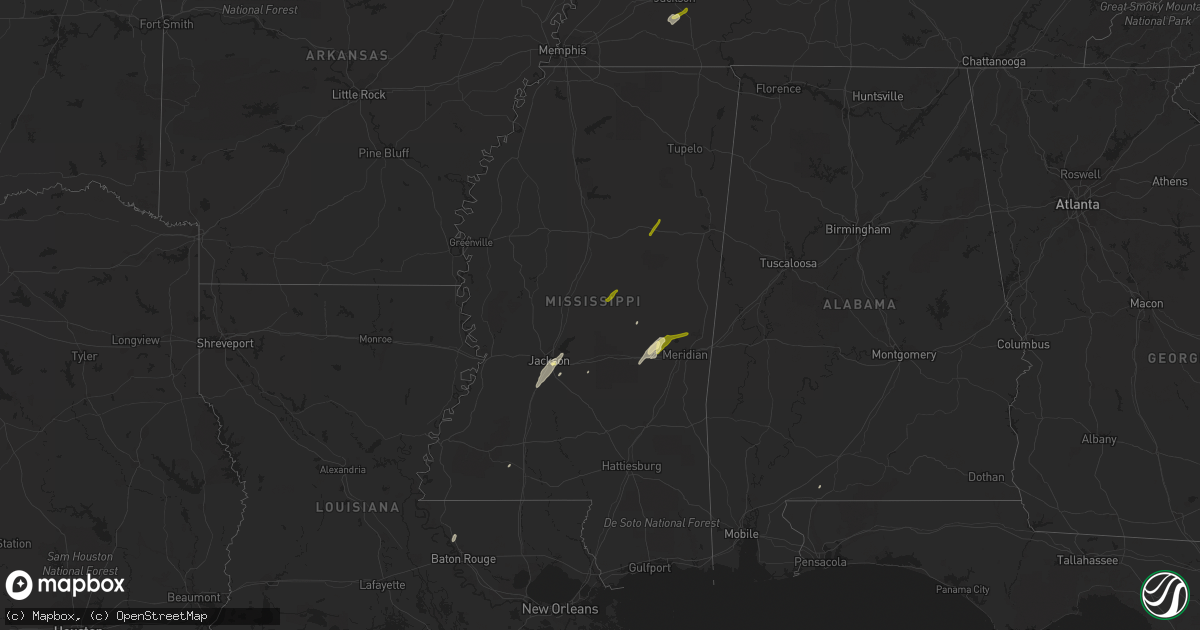
Hail Map in Mississippi on February 2, 2016
Get this storm
February 2 map
$229
one time, instant access
Download today. No call, no setup
Keep the $229
Bought the map and want the full workflow? Apply the entire $229 to a subscription within 7 days. None of it is wasted.
Every map, not just this one
This buys you this map. Subscription and you get every map we run, in the markets you choose from a few cities to whole states to nationwide. Plus real-time alerts the moment a storm fires.
Contact data
Name, contact info, occupancy, even credit band for addresses in the footprint. You go from where it hit to who to call.
Become the source they trust
Unlimited branding weather history reports on demand. You already have the documented answer ready for the property owner, and you are the one who showed up with it.
Property data and RoofTrace estimates
Pull up any address you have got, its value and the exact code rules for that jurisdiction, straight from One Click Code. Then RoofTrace estimates the squares, pitch, and roof value, priced the way you price.
Storm reports in Mississippi
Mississippi
| Date | Description |
|---|---|
| 02/02/20165:31 PM CST | Roof off of a house and store on highway 145 on the n side of shuqualak. Time based on radar. |
| 02/02/20165:27 PM CST | The tornado began near church street in shuqualak where it snapped a few large branches. The tornado continued northeast across highway 145 where it caused significant |
| 02/02/20165:00 PM CST | Large pine tree blown down and other large limbs. |
| 02/02/20164:31 PM CST | *** 1 inj *** a large tornado moved through pickens county with damage in mcmullen and near aliceville. Several homes were damaged and the federal prison was damaged. O |
| 02/02/20164:25 PM CST | Trees down on the east mississippi community college campus... Some impacting buildings. |
| 02/02/20164:10 PM CST | Confirmed tornado on the ground. Reported via storm spotter and livestream video and pictures. |
| 02/02/20164:00 PM CST | Trees down east of dekalb. Possible tornado. |
| 02/02/20163:53 PM CST | This tornado touched down near graham rd where it snapped a few trees. The tornado continued northeast to northwest of scooba and destroyed an outbuilding north of scoo |
| 02/02/20163:40 PM CST | Structural damage in prismatic. Relayed via emergency manager. |
| 02/02/20163:39 PM CST | Trees downed and a roof damaged along blackwater 493 rd |
| 02/02/20163:23 PM CST | Reports of damage to a trailer and house across the road from west lauderdale high school. Also a field house was damaged at west lauderdale high school. |
| 02/02/20163:23 PM CST | Reports of damage in collinsville. First baptist church in collinsville heavily damaged on hwy 19n. Barns damaged. Trees down in the area and across roads. Near lake ro |
| 02/02/20163:20 PM CST | Reports of damage to homes...including roofs blown off...and mobile homes flipped near sharp road and highway 494. Numerous trees down across the area. |
| 02/02/20163:20 PM CST | This tornado touched down near schamberville ln where it caused roof damage to a home and snapped trees. The tornado continued northeast through collinsville where it c |
| 02/02/20163:19 PM CST | This tornado touched down near schamberville ln where it caused roof damage to a home and snapped trees. The tornado continued northeast through collinsville where it c |
| 02/02/20163:05 PM CST | Large tree was blown down and blocked carlisle street. |
| 02/02/20163:00 PM CST | Report of homes damaged near hwy 15. Relayed via mhp. |
| 02/02/20162:48 PM CST | This tornado touched down just west of hwy 15 and tracked northeast across hwy 15 and hwy 504 damaging two homes and a mobile home. The tornado continued northeast acro |
| 02/02/20161:10 PM CST | Trees were downed along ms highway 43 north of puckett |
| 02/02/201612:00 PM CST | Large tree was blown down on sandy lane in a backyard. The tree fell on a deck and damaged the deck and other contents. Via social media. |
| 02/01/20168:26 PM CST | Report of trees down on pinola-braxton road. |
| 02/01/20166:39 PM CST | This tornado started just south of county road 236 where it tore the tin roof off of a home and destroyed an outbuilding. A few hardwood trees were also snapped at this |
All States Impacted by Hail Map on February 2, 2016
Cities Impacted by Hail Map on February 2, 2016
- Medon, TN
- Little Rock, MS
- Hickory, MS
- Decatur, MS
- Newton, MS
- Brewton, AL
- Pearl, MS
- Flowood, MS
- Florence, MS
- Zachary, LA
- Richland, MS
- Smithdale, MS
- Philadelphia, MS
- Union, MS
- Byram, MS
- Terry, MS
- Brandon, MS
- Jackson, MS
- Henderson, TN
- Pinson, TN
- Pelahatchie, MS
- Chunky, MS
- Kosciusko, MS
- Carthage, MS
- Meridian, MS
- Collinsville, MS
- Daleville, MS
- Bailey, MS
- Pheba, MS
- Mathiston, MS
- Maben, MS


