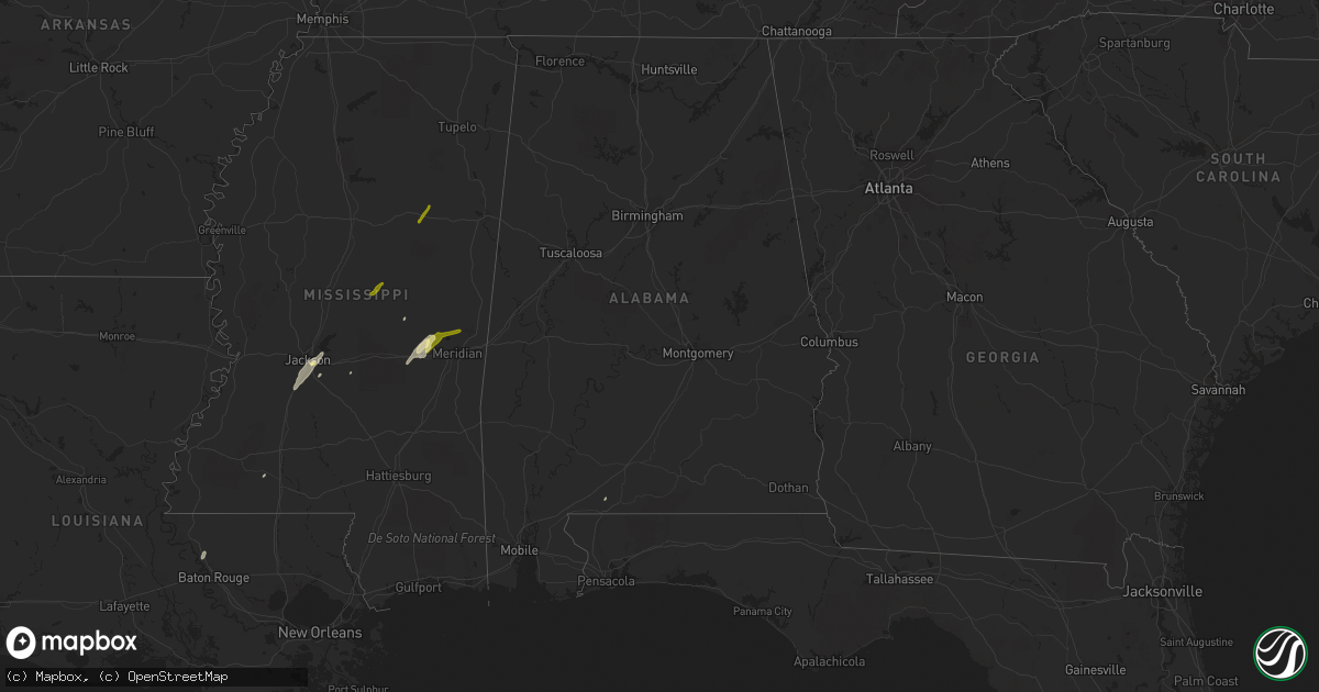
Hail Map in Alabama on February 2, 2016
Get this storm
February 2 map
$229
one time, instant access
Download today. No call, no setup
Keep the $229
Bought the map and want the full workflow? Apply the entire $229 to a subscription within 7 days. None of it is wasted.
Every map, not just this one
This buys you this map. Subscription and you get every map we run, in the markets you choose from a few cities to whole states to nationwide. Plus real-time alerts the moment a storm fires.
Contact data
Name, contact info, occupancy, even credit band for addresses in the footprint. You go from where it hit to who to call.
Become the source they trust
Unlimited branding weather history reports on demand. You already have the documented answer ready for the property owner, and you are the one who showed up with it.
Property data and RoofTrace estimates
Pull up any address you have got, its value and the exact code rules for that jurisdiction, straight from One Click Code. Then RoofTrace estimates the squares, pitch, and roof value, priced the way you price.
Storm reports in Alabama
Alabama
| Date | Description |
|---|---|
| 02/02/20165:51 PM CST | Large tornado spotted in mcmullen... Al and aliceville... Al several homes were damaged with minor injuries on mlk road. Trees and power lines down are also reported along (b |
| 02/02/20165:45 PM CST | Several trees down several miles south of kennedy. Possible tornado. |
| 02/02/20165:36 PM CST | Tornado touched down along ashcraft corner cutoff and tracked northeast paralelling portions of al hwy 159 and owens rd before lifting along cr 4. Damage consisted most |
| 02/02/20165:14 PM CST | Large tornado spotted in mcmullen... Al and aliceville... Al several homes were damaged with minor injuries on mlk road. Trees and power lines down are also reported along (b |
| 02/02/20164:51 PM CST | Large tornado spotted in mcmullen and aliceville. Several homes were damaged with minor injuries on mlk road. Trees and power lines down are also reported along with sm |
| 02/02/20164:34 PM CST | *** 1 inj *** a large tornado moved through pickens county with damage in mcmullen and near carrollton. Many homes were damaged and the federal prison received some dam |
| 02/02/20165:48 AM CST | Tree down. Winds estimated 40 to 50 miles per hour. |
| 02/02/20165:32 AM CST | Tree down across intersection of alabama highway 30 and alabama highway 5. Winds estimated 40 to 50 miles per hour. |
| 02/02/20165:10 AM CST | Tree down across alabama highway 30 westbound... Blocking traffic in columbiana. Winds estimated 40 to 50 miles per hour. |
| 02/02/20164:43 AM CST | Tree down blocking able road. Winds estimated 40 to 50 miles per hour. |
| 02/02/20164:19 AM CST | Nws storm survey confirmed the damage located on demetropolis road hear us highway 90 was the result of straight line winds near 60 mph. The winds resulted in roof dama |
| 02/02/20164:15 AM CST | Trees down across alabama highway 42 and alabama highway 145. Winds estimated 40 to 45 miles per hour. |
| 02/02/20163:32 AM CST | Tree down blocking alabama highway 148 near mile marker 332. Winds estimated 40 to 50 miles per hour. |
| 02/02/20162:30 AM CST | Power line down across alabama highway 113. Estimated winds 40 to 50 miles per hour. |
| 02/02/20162:20 AM CST | Four houses on riverside drive received minor damage. One house had shingle damage... One house had windows blown out and two houses had siding blown off. Power lines wer (bm |
| 02/02/20162:00 AM CST | Tree down near the intersection of alabama highway 49 and alabama highway 77. Winds estimated 40 to 50 miles per hour. Corrected time. |
| 02/02/20161:43 AM CST | Trained spotter reports power line down across alabama highway 113. Estimated winds 40 to 50 miles per hour. Time estimated by radar. |
| 02/02/201612:10 AM CST | 27 trees reported down across hale county. One vehicle accident with no injuries on alabama county road 34. One home damaged and two outbuildings damaged. Time estimate |
| 02/02/201612:00 AM CST | 27 trees reported down across hale county. One vehicle accident with no injuries on alabama county road 34. One home damaged and two outbuildings damaged. Time estimate |
| 02/01/201611:58 PM CST | Approximately 20 to 30 trees downed or damaged by winds. Time estimated by radar. |
| 02/01/201611:48 PM CST | Approximately 20 to 30 trees downed or damaged by winds. Time estimated by radar. Updated for event time. |
| 02/01/201611:07 PM CST | Tornado caused minor tree damage along price rd just before it lifted. |
| 02/01/201611:02 PM CST | Tornado touched down between keasler rd and heritage rd. It moved northeast causing only tree damage as it crossed cr 30...us hwy 82 and price rd. The tornado lifted be |
| 02/01/20169:00 PM CST | Tornado confirmed by ema... Several trees are down and blocking the taylor springs... Turkey branch and piney grove roads. |
| 02/01/20168:16 PM CST | House roof blown off due to a tornado on pond road |
| 02/01/20168:16 PM CST | Tornado caused minor tree damage along deer run rd and sorghum hollow rd just before it lifted. |
| 02/01/20168:15 PM CST | Tornado confirmed by ema... Several trees are down and blocking the taylor springs... Turkey branch and piney grove roads. |
| 02/01/20168:10 PM CST | Tornado touched down along chastain rd and moved northeast producing major roof damage to one residence near the intersection of pond rd and garrison rd. It continued n |
| 02/01/20166:00 PM CST | Several trees are down along hwy 159 between cr 1 and 2. Possible tornado |
All States Impacted by Hail Map on February 2, 2016
Cities Impacted by Hail Map on February 2, 2016
- Medon, TN
- Little Rock, MS
- Hickory, MS
- Decatur, MS
- Newton, MS
- Brewton, AL
- Pearl, MS
- Flowood, MS
- Florence, MS
- Zachary, LA
- Richland, MS
- Smithdale, MS
- Philadelphia, MS
- Union, MS
- Byram, MS
- Terry, MS
- Brandon, MS
- Jackson, MS
- Henderson, TN
- Pinson, TN
- Pelahatchie, MS
- Chunky, MS
- Kosciusko, MS
- Carthage, MS
- Meridian, MS
- Collinsville, MS
- Daleville, MS
- Bailey, MS
- Pheba, MS
- Mathiston, MS
- Maben, MS


