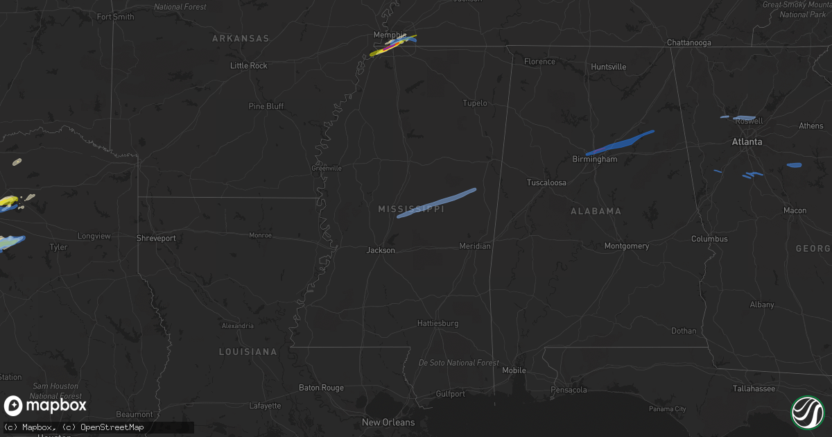
Hail Map in Mississippi on January 25, 2021
Get this storm
January 25 map
$229
one time, instant access
Download today. No call, no setup
Keep the $229
Bought the map and want the full workflow? Apply the entire $229 to a subscription within 7 days. None of it is wasted.
Every map, not just this one
This buys you this map. Subscription and you get every map we run, in the markets you choose from a few cities to whole states to nationwide. Plus real-time alerts the moment a storm fires.
Contact data
Name, contact info, occupancy, even credit band for addresses in the footprint. You go from where it hit to who to call.
Become the source they trust
Unlimited branding weather history reports on demand. You already have the documented answer ready for the property owner, and you are the one who showed up with it.
Property data and RoofTrace estimates
Pull up any address you have got, its value and the exact code rules for that jurisdiction, straight from One Click Code. Then RoofTrace estimates the squares, pitch, and roof value, priced the way you price.
Storm reports in Mississippi
Mississippi
| Date | Description |
|---|---|
| 01/25/20213:35 PM CST | Golfball sized hail near dale's restaraunt on state line road in southaven. |
| 01/25/20213:30 PM CST | One inch hail in southaven. |
| 01/25/20213:29 PM CST | Hail from one inch to golf ball sized fell in the community of walls. |
| 01/25/20215:12 AM CST | At 1111 PM CST, a severe thunderstorm was located near Steele, or near Harperville, moving east at 55 mph. HAZARD...60 mph wind gusts and half dollar size hail. SOURCE...Radar indicated. IMPACT...Hail damage to vehicles is expected. Expect wind damage to roofs, siding, and trees. This severe thunderstorm will be near... Conehatta around 1120 PM CST. Prospect around 1125 PM CST. Decatur and Stratton around 1130 PM CST. Little Rock around 1140 PM CST. Duffee and Herbert Springs around 1145 PM CST. Martin and Suqualena around 1150 PM CST. Liberty and Prismatic around 1155 PM CST. Daleville and Blackwater around 1200 AM CST.Other locations impacted by this severe thunderstorm includeSebastopol. |
| 01/25/20214:59 AM CST | At 1059 PM CST, a severe thunderstorm was located over Gallman, or near Crystal Springs, moving east at 40 mph. HAZARD...Golf ball size hail and 60 mph wind gusts. SOURCE...Radar indicated. IMPACT...People and animals outdoors will be injured. Expect hail damage to roofs, siding, windows, and vehicles. Expect wind damage to roofs, siding, and trees. This severe thunderstorm will be near... Crystal Springs around 1105 PM CST. Hopewell around 1115 PM CST. Whites around 1120 PM CST. Harrisville around 1130 PM CST. Star around 1135 PM CST. Piney Woods around 1140 PM CST. Mendenhall around 1145 PM CST. Cato around 1150 PM CST.Other locations impacted by this severe thunderstorm include D'Lo,Braxton and Puckett. |
| 01/25/202112:54 AM CST | At 654 PM CST, a severe thunderstorm was located over Zama, or 11 miles northwest of Edinburg, moving northeast at 50 mph. HAZARD...60 mph wind gusts and quarter size hail. SOURCE...Radar indicated. IMPACT...Hail damage to vehicles is expected. Expect wind damage to roofs, siding, and trees. This severe thunderstorm will be near... Louisville around 720 PM CST. Millcreek around 730 PM CST.Other locations impacted by this severe thunderstorm includeNoxapater. |
| 01/25/202112:46 AM CST | Social media report of quarter size hail just south of bogue chitto. |
| 01/25/202112:23 AM CST | At 623 PM CST, a severe thunderstorm was located over Camden, or 17 miles northeast of Canton, moving northeast at 40 mph. HAZARD...60 mph wind gusts and quarter size hail. SOURCE...Radar indicated. IMPACT...Hail damage to vehicles is expected. Expect wind damage to roofs, siding, and trees. This severe thunderstorm will be near... Thomastown around 640 PM CST. Singleton around 650 PM CST. Renfroe around 655 PM CST. Smyrna around 700 PM CST. Zama around 705 PM CST. |
| 01/24/202111:45 PM CST | Quarter size hail in union. Public report via wtok broadcast media. |
| 01/24/202111:03 PM CST | Quarter size hail reported in crystal springs. |
| 01/24/20219:39 PM CST | At 339 PM CST, a severe thunderstorm was located over Southeast Memphis, or near Germantown, moving northeast at 55 mph. HAZARD...Golf ball size hail and 60 mph wind gusts. SOURCE...Radar indicated. IMPACT...People and animals outdoors will be injured. Expect hail damage to roofs, siding, windows, and vehicles. Expect wind damage to roofs, siding, and trees. Locations impacted include... Bartlett, Collierville, Germantown, Cordova, Memphis, Lakeland, Arlington, Eads, Warren, Macon, Oakland, Piperton, Rossville, Moscow, Lenow, Fisherville, Elba, Canadaville, Lambert and Kirk. |
| 01/24/20219:09 PM CST | At 308 PM CST, a severe thunderstorm was located near Robinsonville, or 7 miles southeast of Hughes, moving northeast at 55 mph. HAZARD...Quarter size hail. SOURCE...Radar indicated. IMPACT...Damage to vehicles is expected. Locations impacted include... Bartlett, Southaven, Collierville, Germantown, Olive Branch, Horn Lake, Hernando, T O Fuller State Park, Memphis, Walls, Horseshoe Lake, Pinckney, Lake Cormorant, Southwest Memphis, Lynchburg, Southeast Memphis, Whitehaven, Robinsonville, Midtown Memphis and Newport. |
| 01/24/20217:40 PM CST | Large tree limbs were downed across eastern winston county along highway 14 and across roads to the north. |
| 01/24/20216:40 PM CST | *** 1 fatal... 2 inj *** trees down on the natchez trace parkway. 1 fatality occurred from a tree falling on a car with 2 additional injuries from a separate car hittin |
All States Impacted by Hail Map on January 25, 2021
Cities Impacted by Hail Map on January 25, 2021
- Royse City, TX
- Quinlan, TX
- Greenville, TX
- Thompsons Station, TN
- Canton, TX
- Kemp, TX
- Mabank, TX
- Terrell, TX
- Memphis, TN
- Lone Oak, TX
- Walls, MS
- Lake Cormorant, MS
- Southaven, MS
- Horn Lake, MS
- Honey Grove, TX
- Ladonia, TX
- Point, TX
- Brashear, TX
- Cumby, TX
- Farner, TN
- Turtletown, TN
- Murphy, NC
- Kaufman, TX
- Scurry, TX
- Duck River, TN
- Hampshire, TN
- Williamsport, TN
- Centerville, TN
- Chatfield, TX
- Eustace, TX
- Bynum, TX
- Whitney, TX
- Aquilla, TX
- Milford, TX
- Italy, TX
- Mertens, TX
- Hillsboro, TX
- Ennis, TX
- Emory, TX
- Caddo Mills, TX
- Germantown, TN
- Cordova, TN
- Clifton, TX
- Wolfe City, TX
- Frost, TX
- Abbott, TX
- Sulphur Springs, TX
- Burkesville, KY
- Edmonton, KY
- Breeding, KY
- Bethelridge, KY
- Windsor, KY
- Liberty, KY
- Science Hill, KY
- Columbia, KY
- Russell Springs, KY
- Nancy, KY
- Glens Fork, KY
- Dunnville, KY
- Dallas, GA
- Cartersville, GA
- Acworth, GA
- Marietta, GA
- Kennesaw, GA
- Alpharetta, GA
- Woodstock, GA
- Roswell, GA
- Newnan, GA
- Fayetteville, GA
- Locust Grove, GA
- Griffin, GA
- Hampton, GA
- Brooks, GA
- Shady Dale, GA
- Mansfield, GA
- Monticello, GA
- Newborn, GA
- Madison, GA
- Noxapater, MS
- Louisville, MS
- Kosciusko, MS
- Macon, MS
- Camden, MS
- Carthage, MS
- Philadelphia, MS
- Glendale, AZ
- Phoenix, AZ
- El Mirage, AZ
- Sun City, AZ
- Avondale, AZ
- Litchfield Park, AZ
- Youngtown, AZ
- Peoria, AZ
- Paradise Valley, AZ
- Luke Air Force Base, AZ
- Scottsdale, AZ
- Waddell, AZ
- Surprise, AZ
- Balch Springs, TX
- Mesquite, TX
- Hutchins, TX
- Forney, TX
- Sunnyvale, TX
- Dallas, TX
- Rockwall, TX
- Wills Point, TX
- Rice, TX
- Collierville, TN
- Eads, TN
- Hughes, AR
- Franklin, TN
- College Grove, TN
- Santa Fe, TN
- Columbia, TN
- Spring Hill, TN
- Trussville, AL
- Ashville, AL
- Ohatchee, AL
- Fultondale, AL
- Adamsville, AL
- Gadsden, AL
- Birmingham, AL
- Odenville, AL
- Jacksonville, AL
- Moody, AL
- Ragland, AL
- Mount Olive, AL
- Gardendale, AL
- Pinson, AL
- Springville, AL
- Wellington, AL


