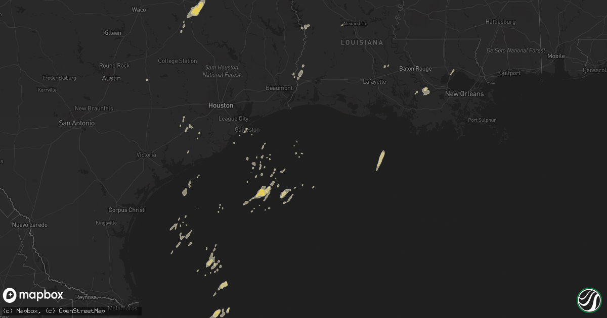
Hail Map on January 25, 2012
Get this storm
January 25 map
$229
one time, instant access
Download today. No call, no setup
Keep the $229
Bought the map and want the full workflow? Apply the entire $229 to a subscription within 7 days. None of it is wasted.
Every map, not just this one
This buys you this map. Subscription and you get every map we run, in the markets you choose from a few cities to whole states to nationwide. Plus real-time alerts the moment a storm fires.
Contact data
Name, contact info, occupancy, even credit band for addresses in the footprint. You go from where it hit to who to call.
Become the source they trust
Unlimited branding weather history reports on demand. You already have the documented answer ready for the property owner, and you are the one who showed up with it.
Property data and RoofTrace estimates
Pull up any address you have got, its value and the exact code rules for that jurisdiction, straight from One Click Code. Then RoofTrace estimates the squares, pitch, and roof value, priced the way you price.
States Impacted by Hail Map on January 25, 2012
Storm reports
Mississippi
| Date | Description |
|---|---|
| 01/24/20127:00 PM CST | Wall cloud also reported in the area |
| 01/24/20126:55 PM CST | Trees down blocking the road near the intersection of beasley rd and harrison lane rd |
| 01/24/20126:49 PM CST | This tornado was rated ef1 with max winds of 90 mph. Trees were snapped and uprooted and one fell across a power line snapping the pole. Part of the tin roof of a barn |
| 01/24/20126:25 PM CST | Power lines were downed along new sight dr |
Louisiana
| Date | Description |
|---|---|
| 01/25/20125:19 PM CST | Rapides sheriff reports a transformer on fire along hwy 1204 in the ball community. |
| 01/25/20125:15 PM CST | Rapides sheriff reports trees down on powerlines on fletcher and brannon roads. |
| 01/25/20124:45 PM CST | F1 tornado touched down at the corner of evergreen and verret roads in westlake. Tornado traveled northeast 4 miles lifting at north perkins ferry road in moss bluff. W |
| 01/25/20124:45 PM CST | Along evergreen street between sulphur and westlake...a tornado touched down...blowing trees down and damaging several homes when trees fell on the roof. This storm con |
| 01/25/20124:30 PM CST | Rapides sheriff reports a tree down on a garage and vehicle |
| 01/25/20124:19 PM CST | Rapides sheriff reports the roof blown off one of the buildings of ruby-wise elementary school in the 5200 block of old marksville highway and la 107. |
| 01/25/20124:06 PM CST | An ef0 tornado touched down along palmer chapel road...blowing several trees down. It dissipated near the ruby-wise school on la hwy 107 where it damaged part of a roof |
| 01/25/20124:06 PM CST | Rapides sheriff reports trees down along palmer chapel road in the ruby wise community off of la 107. |
| 01/25/20123:58 PM CST | Rapides sheriff reports a blown transformer in the 700 block of palmer chapel rd off of la 107 in the ruby wise community. |
| 01/25/20123:47 PM CST | Rapides sheriff reports a tree down on a house in the 6100 block of mcray drive in the ball community. |
| 01/25/20123:35 PM CST | Ef0 tornado touched down near harper road...before crossing la hwy 112 and dissipating along twin bridges road. Several trees were blown down or snapped in half...and o |
| 01/25/20123:35 PM CST | Rapides sheriff reports trees and powerlines down along harper rd and hwy 112 |
| 01/25/20123:35 PM CST | Rapides sheriff reports trees down on moss point drive and la highway 1 n. |
| 01/25/20123:35 PM CST | Rapides sheriff reports trees down in the 6900 block of shreveport highway near mary goff school in the tioga community |
| 01/25/20123:18 PM CST | Rapides sheriff reports power lines down along the 1800 block of clifton rd in the flatwoods community. |
| 01/25/20123:13 PM CST | Ef0 tornado touched down near cotile lake on vanzart and bath house roads...before dissipating near la hwy 1200. Many trees were blown down or snapped in half. Path len |
| 01/25/20123:13 PM CST | Rapides sheriff reports trees and powerlines down along vanzant and bathouse roads. |
| 01/25/20123:13 PM CST | Rapides sheriff reports a tree down on a patio in the 8400 block of twin bridges rd. |
| 01/25/20123:05 PM CST | *** 1 inj *** rapides sheriff reports an injury associated with a a tree falling on a vehicle on hwy 112 and l. Warren rd. |
| 01/25/20122:51 PM CST | Suv blown off interstate 49 near mile marker 113. |
| 01/25/20122:43 PM CST | Metal roof partially blown off a house at marco la |
| 01/25/20122:30 PM CST | Ef0 tornado touched down in the middle of the woods near fort polk...crossing la hwy 10. Many pine trees were snapped or blown down. Path length was 1 mile and path wid |
| 01/25/20122:10 PM CST | Numerous trees and power lines down on highway 118 near the peason community. Numerous trees down near pine grove church and bridges road as well as its intersection wi |
| 01/25/20122:06 PM CST | Tornado sighted near the peason community on clear branch road near peason ridge. Numerous trees are down with multiple trees blocking the roadways. |
| 01/25/20122:06 PM CST | An ef0 tornado touched down in sabine parish near peason along hwy 118 and moved east southeast along hwy 118. Numerous trees were snapped and uprooted across the hwy o |
| 01/25/20121:35 PM CST | Trees down across southern sabine parish. |
| 01/25/20121:35 PM CST | Ef0 tornado touched down on lynn nash road...blowing over and snapping trees along a 3 mile path that crossed la hwy 111. Path width was 20 yards. |
| 01/25/20121:15 PM CST | Significant tree damage along with some roof damage and light pole damage in the city park across from the webster parish library. A car was also damaged from the debri |
| 01/25/201212:16 PM CST | Treees down along friendship road in frierson |
| 01/25/201212:12 PM CST | Several trees down throughout the parish |
| 01/24/20129:00 PM CST | Klfy tv10 meteorologists reported partial roof blown off on fieldspan road in duson |
| 01/24/20126:16 PM CST | Rapides sheriff reports a breaker panel on fire in the 5100 block of moser. |
Texas
| Date | Description |
|---|---|
| 01/25/20123:50 PM CST | Retired nws employee reported gusts 50 to 70 mph. |
| 01/25/20121:02 PM CST | A tornado touched down along fm 1005...blowning some trees down. It was on the ground for 0.8 miles and its width was 10 yards. |
| 01/25/20121:02 PM CST | Ham radio operator relayed a report via facebook of a tornado spotted near magnolia springs. |
| 01/25/20121:00 PM CST | Kbmt relayed a public report of a tornado touchdown near kirbyville. Reported damage includes a trailer and multiple mailboxes. |
| 01/25/20121:00 PM CST | A tornado touched down near the kirbyville airport where it tore part of a metal roof off a home...and went into western sections of kirbyville...blowing trees down and |
| 01/25/201212:58 PM CST | Trees down near yellowpine. |
| 01/25/201212:35 PM CST | Ham radio operator relayed a report via facebook of quarter size hail near jasper. |
| 01/25/201212:30 PM CST | A couple miles south of fred...several trees were blown down...a carport was damaged...and a shed lost some tin from its roof. The tornado path was 0.4 miles and its wi |
| 01/25/201212:30 PM CST | Ham radio operator relayed a report via facebook of a tornado on the ground near fred. |
| 01/25/201212:05 PM CST | Ef0 tornado near highway 35 and plum street. Chevron gas station had the gas pump awning destroyed and a business south of plum street had its roof peeled back. Damage |
| 01/25/201212:05 PM CST | Several trees were blown down or snapped along sections of post oak road...extending over highway 69. The path length was 3 miles and its width was 20 yards. |
| 01/25/201211:35 AM CST | Power lines down and pole down with low hanging lines on fm 360. |
| 01/25/201210:56 AM CST | An ef0 tornado touched down 11 miles northeast of mt enterprise tx along hwy 315 and moved east northeast crossing cr 164 and cr 163. Several trees were snapped and upr |
| 01/25/201210:40 AM CST | Trees down in angelina county. |
| 01/25/201210:40 AM CST | Report of roof blown off house and blocking parts of highway 259. |
| 01/25/201210:35 AM CST | Wooden guard shack at food plant blown over and moved about 50 feet. |
| 01/25/201210:32 AM CST | *** 1 inj *** an ef1 tornado touched down southwest of mt enterprise and moved through town. 1 large tree fell on a house and a carport was torn from another injuring 1 |
| 01/25/201210:20 AM CST | Several downed trees along highway 204. |
| 01/25/201210:00 AM CST | Tree down near fm road 1911. |
| 01/25/20129:10 AM CST | A ef0 tornado briefly touched down in a residential section of huntsville on roundabout rd. Causing siginificant tree damage. One of the trees did fall on nearby house |
| 01/25/20129:06 AM CST | Tornado touched down in home depot parking lot on i-45 then crossed freeway into dodge dealership and then lifted back into clouds near motel. Damage to a portable buil |
| 01/25/20129:05 AM CST | *** 1 inj *** widespread damage in and around huntsville from 900 to 915 time frame. Numerous trees down throughout the city. Light pole blown down on new truck. Roof d |
| 01/25/20129:00 AM CST | Two storage buildings blown down. Trees also blown down in the same location. Cr 181 and cr 179 |
| 01/25/20128:42 AM CST | Downed trees in montgomery county. |
| 01/25/20128:40 AM CST | Trees and power lines blown down near county road 444 and fm 315 |
| 01/25/20128:30 AM CST | Widespread damage in and around huntsville from 830 to 930 time frane. |
| 01/25/20128:30 AM CST | Trees down across houston county. |
| 01/25/20128:12 AM CST | 18 wheeler truck blown over on interstate 45 at the 145 mile marker. |
| 01/25/20128:05 AM CST | Home destroyed by possible downburst near the intersection of us287 and fm2706 |
| 01/25/20128:00 AM CST | County wide damage including roof damage and downed power lines. |
| 01/25/20128:00 AM CST | Trees snapped or uprooted along a narrow path. Barn destroyed with tin from roof fanned out in different directions and thrown in some cases about 200 yards. Minor roof |
| 01/25/20128:00 AM CST | Barn damage. Roof and structure damage to house on cr 116 in caldwell. |
| 01/25/20127:24 AM CST | Building wall veneer fell down at texas avenue and university. |
| 01/25/20127:20 AM CST | County wide damage including roof damage and downed power lines. |
| 01/25/20127:17 AM CST | Ef0 tornado touched down west of county road 50 just to the north of brenham municipal airport. The tornado traveled to near the intersection of fm262 and cr65. It dest |
| 01/25/20127:15 AM CST | Damage to garage door and and roof damage to house at intersection of hwy 30 and fm 158. |
| 01/25/20127:15 AM CST | 70 mph gust at brenham awos. |
| 01/25/20127:00 AM CST | Several trees blown down and some buildings destroyed. |
| 01/25/20127:00 AM CST | Tin constucted tire shop on hwy 36 destroyed. |
| 01/25/20126:45 AM CST | Trees down and roof damage at fm 975 at second creek. 1 home and 4 barns damaged in deanville at cr 116 and fm 111. Tree and roof damage at fm 111 and cr 121. Building |
| 01/25/20126:43 AM CST | Swath of damage extended from just northeast of deanville to just southeast of caldwell. Damage appeared tornadic along southern portion of that area with numerous tree |
| 01/25/20126:30 AM CST | Trees down along fm 975 in caldwell. |
Cities Impacted by Hail Map on January 25, 2012
- Convent, LA
- Saint James, LA
- Wharton, TX
- East Bernard, TX
- Anacoco, LA
- Florien, LA
- Merryville, LA
- Ponchatoula, LA
- Galveston, TX
- Starks, LA
- Timpson, TX
- Garrison, TX
- Krotz Springs, LA
- Buffalo, TX
- Oakwood, TX
- Orange, TX
- Palestine, TX
- Napoleonville, LA
- Belle Rose, LA
- Jewett, TX
- Marquez, TX
- Pierre Part, LA
- Normangee, TX
- Wesson, MS
- Hazlehurst, MS
- Georgetown, MS
- Boyce, LA
- Eagle Lake, TX
- Damon, TX
- Giddings, TX
- Lottie, LA
- Atlanta, LA
- Winnfield, LA