Hail Map in Houston, TX on January 9, 2012
The weather event in Houston, TX on January 9, 2012 includes Hail map. 1 state and 48 cities were impacted and suffered possible damage. The total estimated number of properties impacted is 13,757.
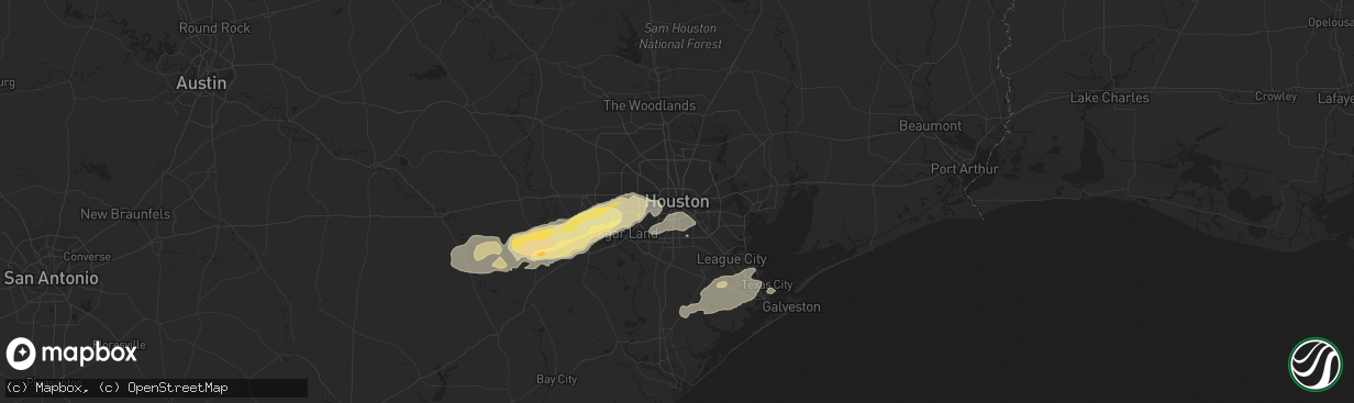
Hail
13,757
Estimated number of impacted properties by a 1.00" hail or larger0
Estimated number of impacted properties by a 1.75" hail or larger0
Estimated number of impacted properties by a 2.50" hail or largerStorm reports in Houston, TX
Houston, TX
| Date | Description |
|---|---|
| 01/09/20129:40 AM CST | 60 mph wind gust at hcfcd at hwy 290 and loop 610. |
| 01/09/20129:05 AM CST | Roof damage to homes in the mission bend area. Garage doors blown in. Possible tornado. Time estimated. |
| 01/09/20129:05 AM CST | An ef-1 tornado with winds of 95 mph touched down near the intersection of bissonnet street and gains road in mission bend of fort bend county. Several homes were damag |
| 01/09/20128:55 AM CST | A local report indicates 1.00 inch wind near MISSION BEND |
All States Impacted by Hail Map on January 9, 2012
All Cities Impacted by Hail Map on January 9, 2012
- Wallis, TX
- Round Mountain, TX
- Johnson City, TX
- Eagle Lake, TX
- Rosenberg, TX
- Beasley, TX
- Richmond, TX
- Sugar Land, TX
- Fulshear, TX
- East Bernard, TX
- Houston, TX
- Stafford, TX
- Katy, TX
- Angleton, TX
- Fredericksburg, TX
- Stonewall, TX
- Magnolia, TX
- Montgomery, TX
- Dickinson, TX
- Boerne, TX
- Center Point, TX
- Boling, TX
- Rosharon, TX
- Shepherd, TX
- Needville, TX
- Santa Fe, TX
- Alvin, TX
- Horseshoe Bay, TX
- Llano, TX
- Canton, TX
- Wharton, TX
- Texas City, TX
- Guy, TX
- Damon, TX
- El Campo, TX
- Garwood, TX
- Bellaire, TX
- Alleyton, TX
- Comfort, TX
- Sealy, TX
- Freeport, TX
- Clute, TX
- Lake Jackson, TX
- Liverpool, TX
- Hitchcock, TX
- La Marque, TX
- Danbury, TX
- Pledger, TX


