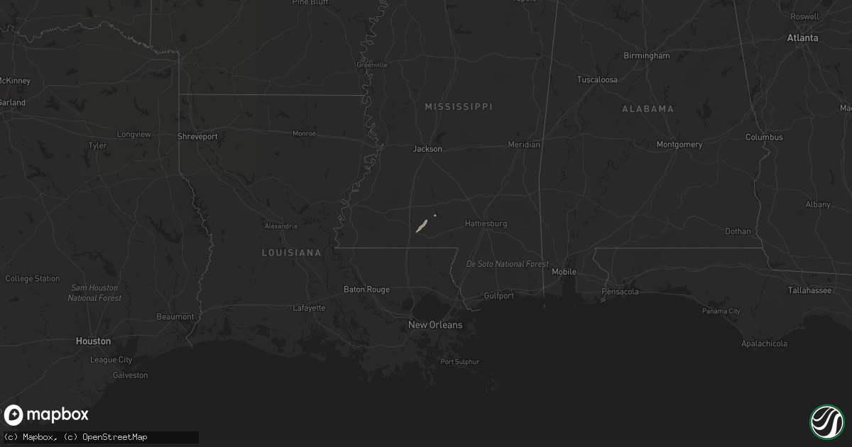
Hail Map in Mississippi on January 3, 2015
Get this storm
January 3 map
$229
one time, instant access
Download today. No call, no setup
Keep the $229
Bought the map and want the full workflow? Apply the entire $229 to a subscription within 7 days. None of it is wasted.
Every map, not just this one
This buys you this map. Subscription and you get every map we run, in the markets you choose from a few cities to whole states to nationwide. Plus real-time alerts the moment a storm fires.
Contact data
Name, contact info, occupancy, even credit band for addresses in the footprint. You go from where it hit to who to call.
Become the source they trust
Unlimited branding weather history reports on demand. You already have the documented answer ready for the property owner, and you are the one who showed up with it.
Property data and RoofTrace estimates
Pull up any address you have got, its value and the exact code rules for that jurisdiction, straight from One Click Code. Then RoofTrace estimates the squares, pitch, and roof value, priced the way you price.
Storm reports in Mississippi
Mississippi
| Date | Description |
|---|---|
| 01/03/20154:53 PM CST | A brief tornado snapped the tops of multiple pine trees on the north side of grant rd. Path length 1/4 mile...est max winds 70 mph...max path width 50 yards. |
| 01/03/20154:32 PM CST | Limbs and a couple trees down on kewanee rd. |
| 01/03/20154:31 PM CST | Tornado began near the intersection of kewanee rd and cuba rd...and ended just east of luther ray cobb rd. Multiple trees were either uprooted or snapped and one buildi |
| 01/03/20154:30 PM CST | Report of roof damage and numerous trees uprooted. |
| 01/03/20154:20 PM CST | Large limbs and a couple trees down along willow lake rd. |
| 01/03/20154:11 PM CST | Tree down partially blocking blackjack rd. Additionally...one home had a large limb through the front window of a home. |
| 01/03/20154:08 PM CST | Tree down in aspen heights on blackjack road in starkville. |
| 01/03/20154:00 PM CST | Damage to home at 710 south montgomery street. Tree limb fell through window frame. |
| 01/03/20153:48 PM CST | Tornado began near the intersection of king rd and ms hwy 495 and tracked northeast along king rd. It then moved across ms hwy 493 and espey hedgepeth rd before ending |
| 01/03/20153:45 PM CST | Multiple trees down in sturgis. Report relayed via social media. |
| 01/03/20153:45 PM CST | Multiple trees and powerlines down in lauderdale county around meehan/bailey areas. Damage also occurred to a barn in meehan. Possible tornado. |
| 01/03/20153:40 PM CST | Report of a tree down on hwy 12. Report relayed via social media. |
| 01/03/20153:35 PM CST | Report of trees down on eastbound lanes of i-20 east of chunky. Possible tornado. |
| 01/03/20153:35 PM CST | Report of a tree down in ackerman. |
| 01/03/20153:24 PM CST | Tornado began along griffis fountain rd...tracking newd into w lauderdale county. It continued across point wanita lake rd...the chunky river...us hwy 80... Suqualena m |
| 01/03/20153:16 PM CST | Numerous trees down near the fellowship community |
| 01/03/20153:16 PM CST | Numerous trees down near the fellowship community. Also reports of trees twisted along highway 24 near highway 2420. |
| 01/03/20153:14 PM CST | Tree down along i-20 at mile marker 63 |
| 01/03/20153:07 PM CST | Trees and powerlines down at 3449 highway 503 near rose hill. Also reports of damage on county road 20. Reports of structural damage in the same area. Four mobile homes |
| 01/03/20153:05 PM CST | A few trees were down across the se part of smith co. |
| 01/03/20153:04 PM CST | Tornado began just south of cr 20 and tracked northeast crossing the cr 20/ms hwy 503 intersection...paralleling ms hwy 503...then paralleling the east segment of cr 20 |
| 01/03/20153:00 PM CST | Possible roof and structural damage. Possible tornado. |
| 01/03/20152:45 PM CST | Power lines downed along ms highway 532 near william warren rd |
| 01/03/20152:40 PM CST | Trees downed on rock hill rd. Possible tornado. |
| 01/03/20152:40 PM CST | Trees downed on rock hill rd. |
| 01/03/20152:39 PM CST | This tornado snapped numerous trees along its path from the east end of stroud rd...east northeastward across burtons creek rd...and ending near rock hill rd. Most impr |
| 01/03/20152:39 PM CST | Several trees downed on stroud rd and burton creek rd. |
| 01/03/20152:37 PM CST | A house and a mobile home were damaged along cooley springs rd. Power lines and trees were also downed. Possible tornado. |
| 01/03/20152:37 PM CST | A house and a mobile home were damaged along cooley springs rd. Power lines and trees were also downed. |
| 01/03/20152:36 PM CST | Tornado began along sunset rd...where the roof of a mobile home was damaged...then continued ne snapping trees along cooley spring-coulter rd and stroud rd before lifti |
| 01/03/20152:36 PM CST | Mobile home with roof damage on the 500 block sunset rd. Possible tornado. |
| 01/03/20152:05 PM CST | Couple of spotter and ham reports of a tornado on the ground near oak vale |
| 01/03/20152:05 PM CST | Brief tornado touchdown was observed by multiple trained spotters near the oak vale community. No notable damage was identified. Estimated max wind 70 mph...path length |
| 01/03/20151:09 PM CST | Online submitted report of large tree limbs and branches down. |


