Hail Map on January 3, 2015
Get this storm
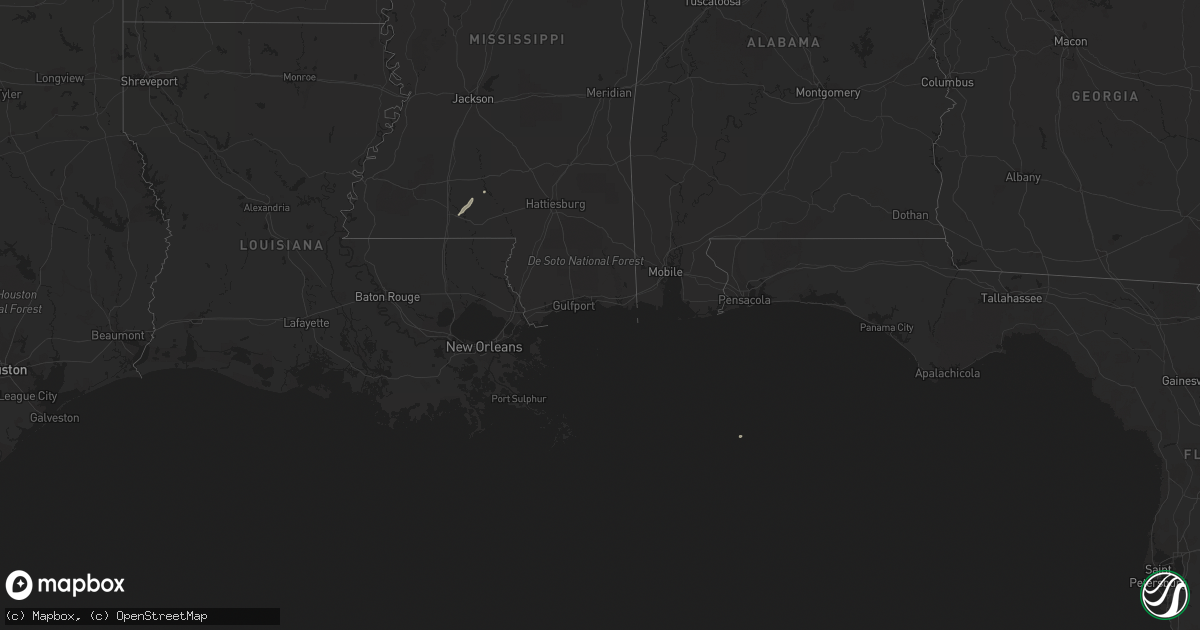
January 3 map
$229
one time, instant access
Download today. No call, no setup
Keep the $229
Bought the map and want the full workflow? Apply the entire $229 to a subscription within 7 days. None of it is wasted.
Every map, not just this one
This buys you this map. Subscription and you get every map we run, in the markets you choose from a few cities to whole states to nationwide. Plus real-time alerts the moment a storm fires.
Contact data
Name, contact info, occupancy, even credit band for addresses in the footprint. You go from where it hit to who to call.
Become the source they trust
Unlimited branding weather history reports on demand. You already have the documented answer ready for the property owner, and you are the one who showed up with it.
Property data and RoofTrace estimates
Pull up any address you have got, its value and the exact code rules for that jurisdiction, straight from One Click Code. Then RoofTrace estimates the squares, pitch, and roof value, priced the way you price.
States Impacted by Hail Map on January 3, 2015
Storm reports
Georgia
| Date | Description |
|---|---|
| 01/03/20154:35 AM CST | Several trees down near applewood court and braithwood road...cosmos dr...jasmine ct and canna ridge cir. |
| 01/03/20154:30 AM CST | A report of around ten trees down near applewood court and braithwood road |
Alabama
| Date | Description |
|---|---|
| 01/03/20155:52 PM CST | Measured by haleyville airport awos. |
| 01/03/20155:50 PM CST | *** 1 inj *** tree fell on a house along 6th st e. A 3 yr old boy was taken to local hospital for minor injuries. Winds estimated around 50 mph. Time estimated from rad |
| 01/03/20155:33 PM CST | Barn damaged on county highway 108 near highway 253 between hamilton and hackleburg. Several trees also knocked down along highway 253. |
| 01/03/20155:33 PM CST | Barn damaged on county highway 108 off highway 253 between hamilton and hackleburg. Possible tornado |
| 01/03/20155:30 PM CST | Barn damaged on county highway 108 off highway 253 between hamilton and hackleburg. Possible tornado |
| 01/03/20155:23 PM CST | Numerous trees down and multiple structures damaged in the area of highway 43 north and beecher street within the city limits of hamilton. The tornado was brief with a |
| 01/03/20155:22 PM CST | Numerous trees and powerlines down on highway 74 and highway 45 between guin and hamilton. Possible tornado. |
| 01/03/20155:22 PM CST | Numerous trees and powerlines nne of guin...including along cr 45 just south of us 78 and along cr 45 near pea ridge. Max winds est at 75mph. |
| 01/03/20155:20 PM CST | Numerous trees and powerlines down on highway 74 and highway 45 between guin and hamilton. Possible tornado. |
| 01/03/20155:20 PM CST | Numerous trees down and multiple structures damaged in the area of highway 43 north and beecher street within the city limits of hamilton. Possible tornado. |
| 01/03/20155:19 PM CST | National weather service meteorologists surveyed damage in greene and tuscaloosa counties and confirmed a weak tornado. The tornado touched down near the greene-tuscalo |
| 01/03/20155:04 PM CST | Numerous trees down on county lake road and aberdeen road. |
| 01/03/20155:02 PM CST | Numerous trees down on county lake road and aberdeen road. |
| 01/03/20154:55 PM CST | A tornado moved parallel to couty road 117 in northern greene county. The tornado was rated an ef1 as dozens of hardwood and softwood trees were snapped off or were upr |
| 01/03/20154:48 PM CST | Monroe county ema relayed a report of trees down near monroe county road 42 and bill cater road. Time estimated by radar. |
| 01/03/20154:37 PM CST | Trees down on highway 116 near the intersection of highway 17. |
| 01/03/20154:36 PM CST | Hundreds of trees down on highway 116 near highway 17 and old bodka road. |
| 01/03/20154:30 PM CST | Monroe county ema reports power line down on golf drive road in monroeville. Time estimated by radar. |
| 01/03/20154:23 PM CST | Trees down in the friendship community. Time estimated from radar. |
| 01/03/20154:06 PM CST | An ef0 tornado with winds of 80mph touched down east of cuba and tracked 0.67 miles to the northeast along the norfolk southern rr causing minor tree damage and roof da |
| 01/03/20154:06 PM CST | Damage to an outbuilding and trees down on pretty branch road in cuba. |
| 01/03/20154:04 PM CST | Damage to an outbuilding and trees down on pretty branch road in cuba. |
| 01/03/20154:04 PM CST | Trees down along franconia rd between aliceville and carrollton. Time estimated from radar. |
| 01/03/20153:32 AM CST | Reports of homes damaged near gin creek rd and glenwood. Extent of damage unknown. Trees down as well. |
| 01/03/20153:18 AM CST | Public report of chicken houses destroyed and homes damaged on cameron chapel rd. Crenshaw county 911 reports trees on homes in spring hill area. Extent of damage unkno |
| 01/02/20158:20 PM CST | Porch and partial roof blown off residence along sunset dr on weiss lake. Winds estimated at 45-50 mph coming off the lake waters. Time estimated from radar. |
| 01/02/20157:43 PM CST | Damage to a business sign. |
| 01/02/20157:42 PM CST | Roof damage to an apartment building. A few softwood trees with large limbs snapped. |
| 01/02/20157:10 PM CST | A tree fell on a manufactured home near remlap. Winds est at 45 mph. Time est from radar. |
Mississippi
| Date | Description |
|---|---|
| 01/03/20154:53 PM CST | A brief tornado snapped the tops of multiple pine trees on the north side of grant rd. Path length 1/4 mile...est max winds 70 mph...max path width 50 yards. |
| 01/03/20154:32 PM CST | Limbs and a couple trees down on kewanee rd. |
| 01/03/20154:31 PM CST | Tornado began near the intersection of kewanee rd and cuba rd...and ended just east of luther ray cobb rd. Multiple trees were either uprooted or snapped and one buildi |
| 01/03/20154:30 PM CST | Report of roof damage and numerous trees uprooted. |
| 01/03/20154:20 PM CST | Large limbs and a couple trees down along willow lake rd. |
| 01/03/20154:11 PM CST | Tree down partially blocking blackjack rd. Additionally...one home had a large limb through the front window of a home. |
| 01/03/20154:08 PM CST | Tree down in aspen heights on blackjack road in starkville. |
| 01/03/20154:00 PM CST | Damage to home at 710 south montgomery street. Tree limb fell through window frame. |
| 01/03/20153:48 PM CST | Tornado began near the intersection of king rd and ms hwy 495 and tracked northeast along king rd. It then moved across ms hwy 493 and espey hedgepeth rd before ending |
| 01/03/20153:45 PM CST | Multiple trees down in sturgis. Report relayed via social media. |
| 01/03/20153:45 PM CST | Multiple trees and powerlines down in lauderdale county around meehan/bailey areas. Damage also occurred to a barn in meehan. Possible tornado. |
| 01/03/20153:40 PM CST | Report of a tree down on hwy 12. Report relayed via social media. |
| 01/03/20153:35 PM CST | Report of a tree down in ackerman. |
| 01/03/20153:35 PM CST | Report of trees down on eastbound lanes of i-20 east of chunky. Possible tornado. |
| 01/03/20153:24 PM CST | Tornado began along griffis fountain rd...tracking newd into w lauderdale county. It continued across point wanita lake rd...the chunky river...us hwy 80... Suqualena m |
| 01/03/20153:16 PM CST | Numerous trees down near the fellowship community |
| 01/03/20153:16 PM CST | Numerous trees down near the fellowship community. Also reports of trees twisted along highway 24 near highway 2420. |
| 01/03/20153:14 PM CST | Tree down along i-20 at mile marker 63 |
| 01/03/20153:07 PM CST | Trees and powerlines down at 3449 highway 503 near rose hill. Also reports of damage on county road 20. Reports of structural damage in the same area. Four mobile homes |
| 01/03/20153:05 PM CST | A few trees were down across the se part of smith co. |
| 01/03/20153:04 PM CST | Tornado began just south of cr 20 and tracked northeast crossing the cr 20/ms hwy 503 intersection...paralleling ms hwy 503...then paralleling the east segment of cr 20 |
| 01/03/20153:00 PM CST | Possible roof and structural damage. Possible tornado. |
| 01/03/20152:45 PM CST | Power lines downed along ms highway 532 near william warren rd |
| 01/03/20152:40 PM CST | Trees downed on rock hill rd. |
| 01/03/20152:40 PM CST | Trees downed on rock hill rd. Possible tornado. |
| 01/03/20152:39 PM CST | This tornado snapped numerous trees along its path from the east end of stroud rd...east northeastward across burtons creek rd...and ending near rock hill rd. Most impr |
| 01/03/20152:39 PM CST | Several trees downed on stroud rd and burton creek rd. |
| 01/03/20152:37 PM CST | A house and a mobile home were damaged along cooley springs rd. Power lines and trees were also downed. |
| 01/03/20152:37 PM CST | A house and a mobile home were damaged along cooley springs rd. Power lines and trees were also downed. Possible tornado. |
| 01/03/20152:36 PM CST | Tornado began along sunset rd...where the roof of a mobile home was damaged...then continued ne snapping trees along cooley spring-coulter rd and stroud rd before lifti |
| 01/03/20152:36 PM CST | Mobile home with roof damage on the 500 block sunset rd. Possible tornado. |
| 01/03/20152:05 PM CST | Couple of spotter and ham reports of a tornado on the ground near oak vale |
| 01/03/20152:05 PM CST | Brief tornado touchdown was observed by multiple trained spotters near the oak vale community. No notable damage was identified. Estimated max wind 70 mph...path length |
| 01/03/20151:09 PM CST | Online submitted report of large tree limbs and branches down. |