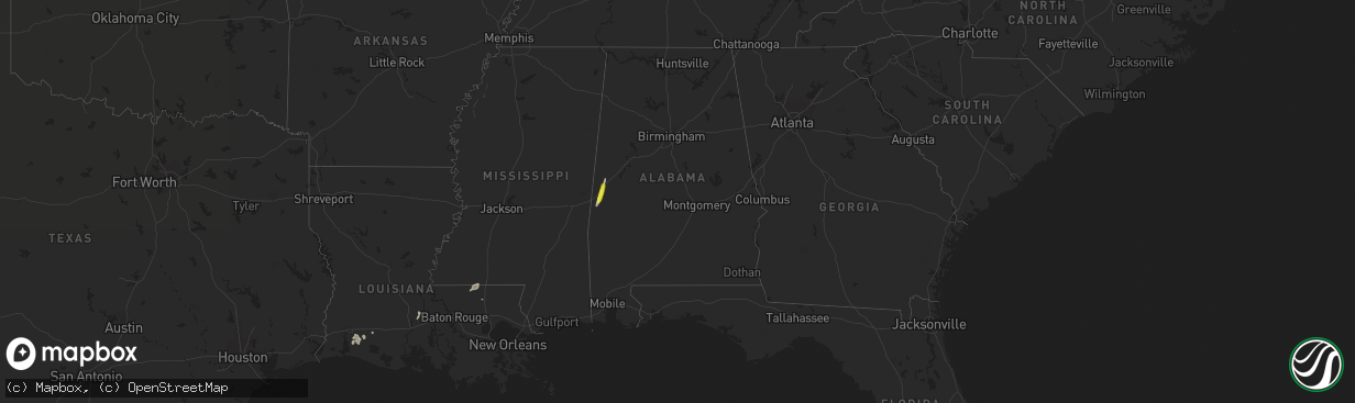
Hail Map in Alabama on December 27, 2018
The weather event in Alabama on December 27, 2018 includes Hail map. 3 states and 17 cities were impacted and suffered possible damage. The total estimated number of properties impacted is 1,704.
Want more than just the map?
Turn this storm into a full workflow.
- Owner + property data so you know who to knock
- OnDemand branded weather history reports to win the "did we even have hail?" argument
- RoofTrace estimate so reps stop guessing numbers at the door
Bought this map? Upgrade within 7 days and we'll credit the $230. (10-15 min setup call)
Hail
1,704
Estimated number of impacted properties by a 1.00" hail or larger0
Estimated number of impacted properties by a 1.75" hail or larger0
Estimated number of impacted properties by a 2.50" hail or largerStorm reports in Alabama
Alabama
| Date | Description |
|---|---|
| 12/27/20185:16 PM CST | Trees and power lines down in the southern part of thomasville... Al. |
| 12/27/20185:16 PM CST | Windows blown out of a building on front st in thomasville. Trees blown down along highway 43 through thomasville. Port-o-pots blown 50 yards. |
| 12/27/20185:15 PM CST | Trees down along huggins rd off tallahatta springs rd. |
| 12/27/20185:15 PM CST | Trees down near harper hill rd and tallahatta springs roads west of thomasville. |


