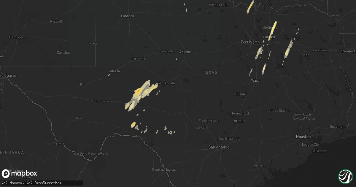
Hail Map in Texas on December 26, 2015
Get this storm
December 26 map
$229
one time, instant access
Download today. No call, no setup
Keep the $229
Bought the map and want the full workflow? Apply the entire $229 to a subscription within 7 days. None of it is wasted.
Every map, not just this one
This buys you this map. Subscription and you get every map we run, in the markets you choose from a few cities to whole states to nationwide. Plus real-time alerts the moment a storm fires.
Contact data
Name, contact info, occupancy, even credit band for addresses in the footprint. You go from where it hit to who to call.
Become the source they trust
Unlimited branding weather history reports on demand. You already have the documented answer ready for the property owner, and you are the one who showed up with it.
Property data and RoofTrace estimates
Pull up any address you have got, its value and the exact code rules for that jurisdiction, straight from One Click Code. Then RoofTrace estimates the squares, pitch, and roof value, priced the way you price.
Storm reports in Texas
Texas
| Date | Description |
|---|---|
| 12/26/20152:03 PM CST | Report of a confirmed tornado roughly 5 miles north of hubbard via vfd. |
| 12/26/20151:07 PM CST | A local report indicates 1.00 inch wind near CROWELL |
| 12/26/20151:03 AM CST | A local report indicates 58 MPH wind near 2 SSE HAMBY |
| 12/26/201512:19 AM CST | A local report indicates 58 MPH wind near 3 ESE ABILENE |
| 12/26/201512:01 AM CST | Severe damage was sustained to a car port. A large storage container was also laying on its side. Time estimated from radar. |
| 12/25/20159:40 PM CST | Pecan tree limbs down. Time estimated from radar. |
| 12/25/20159:40 PM CST | A local report indicates 1.00 inch wind near BIG LAKE |
| 12/25/20159:38 PM CST | A local report indicates 1.75 inch wind near BIG LAKE |
| 12/25/20158:55 PM CST | Rainfall observer reported tree limbs down and power out approximately 8 miles nne of sheffield. |
| 12/25/20157:37 PM CST | Hwy 78 near fm 1778 gas station destroyed. Welding shop next door damaged. 6-8 inch tree limbs on road. |
| 12/25/20157:28 PM CST | People trapped underneath collapsed building near fm546 and hwy 78. Several buildings damaged. |
| 12/25/20157:00 PM CST | Highway 34 and novy road |
| 12/25/20157:00 PM CST | Numerous power lines down... Trees down... Building damage and roofs missing. |
| 12/25/20156:46 PM CST | Off bobtown rd on the nw side of sunnyvale |
| 12/25/20156:18 PM CST | A local report indicates 105 MPH wind near 5 SE MIDLOTHIAN |
| 12/25/20156:13 PM CST | Tornado 1 mile west of i-35 near bear creek road |
| 12/25/20156:03 PM CST | Spotters report tornado on ovilla road just south of ovilla. |
Cities Impacted by Hail Map on December 26, 2015
- Hubbard, TX
- Strafford, MO
- Fair Grove, MO
- Big Lake, TX
- Malone, TX
- Frost, TX
- Brumley, MO
- Kaiser, MO
- Montreal, MO
- Camdenton, MO
- Tuscumbia, MO
- Linn Creek, MO
- Ulman, MO
- Prairie Grove, AR
- Lincoln, AR
- Comstock, TX
- Natural Dam, AR
- West Fork, AR
- Fruitvale, TX
- Edgewood, TX
- Canton, TX
- Barnhart, TX
- Mertzon, TX
- Rocksprings, TX
- Barksdale, TX
- Walnut Grove, MO
- Aldrich, MO
- Morrisville, MO
- Bolivar, MO
- Lynchburg, MO
- Laquey, MO
- Falcon, MO
- Polk, MO
- Everton, MO
- Stuart, OK
- Coalgate, OK
- Half Way, MO
- Springfield, MO
- Muskogee, OK
- Oktaha, OK
- Dallas, TX
- Desoto, TX
- Lancaster, TX
- Anadarko, OK
- Apache, OK
- Pineville, MO
- Garland, TX
- Fayetteville, AR
- Mountainburg, AR
- Elkins, AR
- Winslow, AR
- Eustace, TX
- Proctor, OK
- Tahlequah, OK
- Mabank, TX
- Ozona, TX
- Sterling City, TX
- Fair Play, MO
- Greenfield, MO
- Dadeville, MO
- Buffalo, MO
- Urbana, MO
- Tunas, MO
- Farmersville, TX
- Anna, TX
- Princeton, TX
- Blue Ridge, TX
- Leonard, TX
- Wylie, TX
- Sheffield, TX
- Dryden, TX
- Cove, AR
- Elkland, MO
- Trinidad, TX
- Sulphur Springs, TX
- Marietta, OK
- Muenster, TX
- Gainesville, TX
- Overbrook, OK
- Ardmore, OK
- Saint Jo, TX
- Burneyville, OK
- Iraan, TX
- Farmington, AR
- Canehill, AR
- Jay, OK
- Colcord, OK
- Mulberry, AR
- Midlothian, TX
- Oconee, IL
- Pana, IL
- Nokomis, IL
- Ramsey, IL
- Bingham, IL
- Fillmore, IL
- Ennis, TX
- Nevada, TX
- Rowlett, TX
- Stilwell, OK
- Sachse, TX
- Grandview, TX
- Hatfield, AR
- Mena, AR
- Okmulgee, OK
- Maypearl, TX
- Cedar Hill, TX
- Venus, TX
- Red Oak, TX
- Park Hill, OK
- Marshfield, MO
- Centrahoma, OK
- Mesquite, TX
- Hickman, KY
- Clinton, KY
- China Spring, TX
- Clifton, TX
- Whitney, TX
- Valley Mills, TX
- Aquilla, TX
- Kerens, TX
- Odessa, TX
- Allen, TX
- Trenton, TX
- Beggs, OK
- Waxahachie, TX
- Crowell, TX
- Del Rio, TX
- Preston, MO
- Mount Carmel, IL
- Blooming Grove, TX
- Mount Calm, TX
- Alba, TX
- Emory, TX
- Atoka, OK
- Neosho, MO
- Bristow, OK
- Itasca, TX
- Lockwood, MO
- Dunnegan, MO
- Flemington, MO
- South Greenfield, MO
- Seymour, TX
- Wingate, TX
- Tuscola, TX
- Watts, OK
- Kansas, OK
- Westville, OK
- Gravette, AR
- Maysville, AR
- Tupelo, OK
- Wills Point, TX
- Athens, TX
- Grand Saline, TX
- Galena, MO
- Ponce De Leon, MO
- Highlandville, MO
- Ozark, MO
- Rockwall, TX


