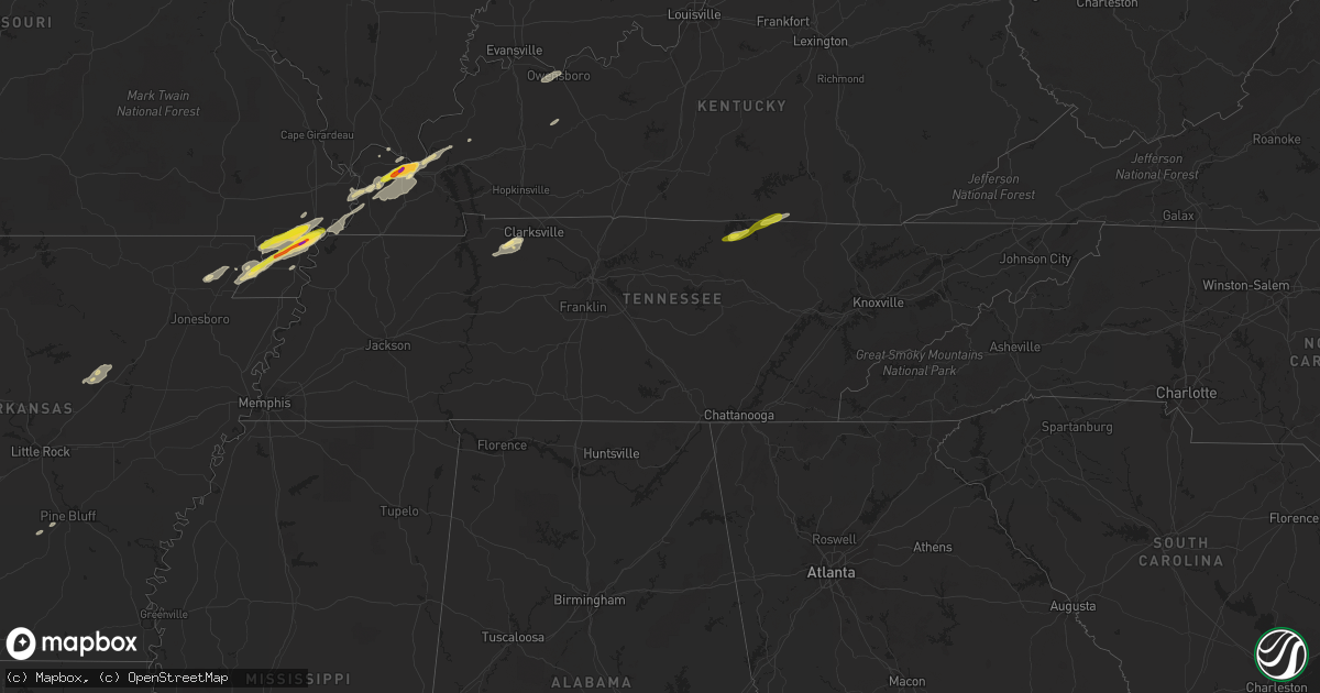
Hail Map in Tennessee on December 17, 2016
Get this storm
December 17 map
$229
one time, instant access
Download today. No call, no setup
Keep the $229
Bought the map and want the full workflow? Apply the entire $229 to a subscription within 7 days. None of it is wasted.
Every map, not just this one
This buys you this map. Subscription and you get every map we run, in the markets you choose from a few cities to whole states to nationwide. Plus real-time alerts the moment a storm fires.
Contact data
Name, contact info, occupancy, even credit band for addresses in the footprint. You go from where it hit to who to call.
Become the source they trust
Unlimited branding weather history reports on demand. You already have the documented answer ready for the property owner, and you are the one who showed up with it.
Property data and RoofTrace estimates
Pull up any address you have got, its value and the exact code rules for that jurisdiction, straight from One Click Code. Then RoofTrace estimates the squares, pitch, and roof value, priced the way you price.
Storm reports in Tennessee
Tennessee
| Date | Description |
|---|---|
| 12/17/20164:17 PM CST | Brief touchdown reported with no damage. |
| 12/17/201611:59 AM CST | Tree on highway 52 just east of macon county line. Car ran into tree on roadway. |
| 12/17/20161:48 AM CST | Tspotter report and photo of a tree down on power lines and pickup truck on east lincoln street near cobb road. Time estimated based on radar |
| 12/17/20161:45 AM CST | Power pole blown down on north jackson street. Time estimated based on radar. |
| 12/17/20161:10 AM CST | Trees reportedly blown down in putnam county |
| 12/17/20161:08 AM CST | Power lines down on delk creek road near pall mall. Time estimated based on radar. |
| 12/17/20161:05 AM CST | Trees down on highway 127 near pall mall. Time estimated based on radar. |
| 12/17/201612:54 AM CST | Quarter size hail on obey river bridge in byrdstown. |
| 12/17/201612:51 AM CST | Trees down on 41a and pinkston road |
| 12/17/201612:48 AM CST | Trees down blocking road on hillham highway near flat creek bridge. Also report of roof damage in the same area due to trees down. |
| 12/17/201612:40 AM CST | Several trees and power lines down with widespread power outages in the dodson branch area |
| 12/17/201612:36 AM CST | Tree through the roof at cherry creek apartments. 2 people displaced. |
| 12/17/201612:30 AM CST | Power lines and possibly poles down on mccoinsville road |
| 12/17/201612:18 AM CST | Six inch diameter limbs down on long branch road. |
| 12/17/201612:18 AM CST | Trees down on power lines along mahr avenue. |
| 12/17/201612:18 AM CST | Trees down along the 500 block of main street in loretto. |
| 12/17/201612:12 AM CST | Tspotter report of a tree blown down across highway 70. Car drove into tree and wrecked. |
| 12/17/201612:10 AM CST | Powerlines down on grandaddy road. |
| 12/17/201612:03 AM CST | Power lines and possibly poles down on pine lick road in the whitleyville area |
| 12/16/201611:59 PM CST | Tree on highway 52 just east of macon county line. Car ran into tree on roadway. |
| 12/16/201611:53 PM CST | Several trees blown down...sheet metal torn off a house...and a shed knocked over on dog branch road in pleasant shade |
| 12/16/201611:49 PM CST | Small barn blown in the road and a large barn had a tin removed from the roof. In the pleasant shade community on sloan branch road. |
| 12/16/201611:45 PM CST | Significant wind damage was reported across northern smith county. A roof was ripped off a barn on hiwassee road. In dixon springs...a playhouse was destroyed...a house |
| 12/16/201611:25 PM CST | Tspotter photo showed tree down across creekside crossing in brentwood. Time estimated based on radar. |
| 12/16/201611:21 PM CST | A nws storm survey found an intense 1/4 mi wide by 1/2 mi long microburst struck laguardo. One home was severely damaged by a fallen tree on northview circle. Another h |
| 12/16/201611:19 PM CST | A tree was blown down onto benders ferry road at crestview drive |
| 12/16/201611:18 PM CST | A tspotter report and photos showed the cedar creek marina dock was damaged and several trees were blown down nearby. |
| 12/16/201611:17 PM CST | Tin roof blown off a barn at 102 starr drive in mount juliet |
| 12/16/201611:16 PM CST | Tree fell on vehicle at 337 vanderbilt road in mount juliet |
| 12/16/201611:16 PM CST | Trees blocking roadway at 3960 saudersville ferry road and 2883 saundersville ferry road in mount juliet |
| 12/16/201611:16 PM CST | Telephone lines down on idlewood drive |
| 12/16/201611:15 PM CST | Tree down on road entrance to nws office. Another tree down at needmore road at saundersville road. |
| 12/16/201611:15 PM CST | A tree was blown down on a car with occupants inside on saundersville rd. Power lines down as well. |
| 12/16/201611:15 PM CST | Tree blocking roadway at grandview drive and indian lake in green hill |
| 12/16/201611:12 PM CST | Tspotter photo showed tree uprooted in backyard of home on the indian lake peninsula in hendersonville |
| 12/16/201611:05 PM CST | 3 large trees were blown down on franklin road south of tyne road. |
| 12/16/201610:17 PM CST | Tspotter report of a tree blown down on highway 47 just outside charlotte city limits. Another tree was blown down on highway 48 north near the same area. |
| 12/16/20168:45 PM CST | Roof damage reported in cedar hill |
| 12/16/20168:30 PM CST | Three large trees down. |
| 12/16/20168:25 PM CST | Power line blown down on proctor ct at proctor dr |
| 12/16/20168:09 PM CST | Tree reportedly blown down in stewart county. Estimated location. |
| 12/16/20168:07 PM CST | Tree reportedly blown down in northern houston county |
| 12/16/20167:56 PM CST | A tree was blown down in the yard of a home on dogwood drive |
| 12/16/20167:23 PM CST | Multiple power flashes... Trees and power lies down. |
| 12/16/20167:10 PM CST | Multiple trees down in the bean switch community... Near greenfield. |
| 12/16/20167:00 PM CST | Multiple trees down in the ralston coummunity... Near martin. |
| 12/16/20166:20 PM CST | Trees... Power lines and poles down over parts of dyer county. |
| 12/16/20166:00 PM CST | Lots of limbs down... Car port top torn off... Lots of shingles ripped off... Windows broken... And large trees uprooted. Possible tornado. |
All States Impacted by Hail Map on December 17, 2016
Cities Impacted by Hail Map on December 17, 2016
- Paducah, KY
- Kennett, MO
- Cumberland City, TN
- Portageville, MO
- Boaz, KY
- Rector, AR
- Pine Bluff, AR
- Kevil, KY
- Leesville, LA
- Owensboro, KY
- Arlington, KY
- Symsonia, KY
- Brookport, IL
- Melber, KY
- Bardwell, KY
- Ledbetter, KY
- Cunningham, KY
- Charleston, MO
- Smithland, KY
- Central City, KY
- Wardell, MO
- Woodlawn, TN
- Indian Mound, TN
- Palmyra, TN
- Bald Knob, AR
- Judsonia, AR
- Bragg City, MO
- Hayti, MO
- Deville, LA
- Metropolis, IL
- Monroe, TN
- Allons, TN
- Hilham, TN
- Livingston, TN
- Hickman, KY
- Senath, MO
- Marston, MO
- Gibson, MO
- Holcomb, MO
- Tiptonville, TN
- Gideon, MO
- Piggott, AR
- Campbell, MO
- New Madrid, MO
- Clarkton, MO
- Parma, MO
- Paragould, AR
- Marmaduke, AR
- Lilbourn, MO
- Greenway, AR
- Beech Grove, AR
- West Paducah, KY
- Bradford, AR
- Searcy, AR
- Monticello, KY
- Lafe, AR
- Cumberland Furnace, TN
- Tennessee Ridge, TN
- Erin, TN
- Rockport, IN
- Clinton, KY
- East Prairie, MO
- Centertown, KY
- Bremen, KY
- Island, KY
- Fredonia, KY
- Marion, KY
- Mayfield, KY
- Wickliffe, KY
- Grand Rivers, KY
- Salem, KY
- Tiline, KY
- Hickory, KY
- Fancy Farm, KY
- Pall Mall, TN
- Albany, KY
- Grapevine, AR
- Byrdstown, TN


