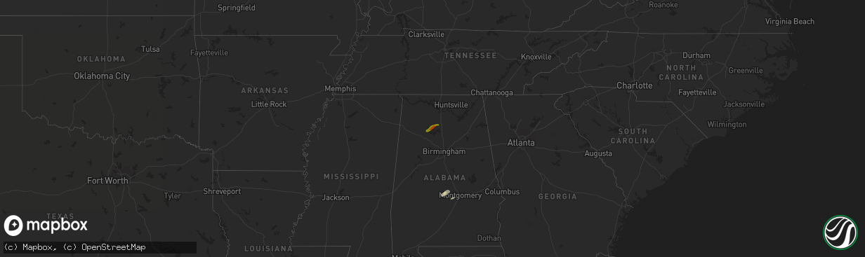
Hail Map on November 30, 2016
The weather event on November 30, 2016 includes Hail map. 1 state and 13 cities were impacted and suffered possible damage. The total estimated number of properties impacted is 2,950.
Want more than just the map?
Turn this storm into a full workflow.
- Owner + property data so you know who to knock
- OnDemand branded weather history reports to win the "did we even have hail?" argument
- RoofTrace estimate so reps stop guessing numbers at the door
Bought this map? Upgrade within 7 days and we'll credit the $230. (10-15 min setup call)
Hail
2,950
Estimated number of impacted properties by a 1.00" hail or larger662
Estimated number of impacted properties by a 1.75" hail or larger0
Estimated number of impacted properties by a 2.50" hail or largerStates Impacted by Hail Map on November 30, 2016
Storm reports
Virginia
| Date | Description |
|---|---|
| 11/30/201610:00 AM CST | Several trees down. |
Tennessee
| Date | Description |
|---|---|
| 11/30/20169:30 AM CST | Several trees down. |
| 11/30/20166:00 AM CST | A few trees down on roadways. |
Louisiana
| Date | Description |
|---|---|
| 11/30/20168:45 AM CST | Nws storm survey finds ef0 tornado damage with winds up to 85 mph... Width up to 30 yards wide... Track 3/4 of a mile long from about ave c and columbus st to klein st |
| 11/30/20168:45 AM CST | Sheet metal off building... And light roof damage... One tree and utility line down at avenue c and columbus street. |
Georgia
| Date | Description |
|---|---|
| 11/30/20163:35 PM CST | Several trees were blown down in the holiday shores area of hancock county. |
| 11/30/20163:12 PM CST | Emergency manager reported a couple of trees down. |
| 11/30/20163:00 PM CST | A tree was blown down on roberts quarters rd. |
| 11/30/20162:53 PM CST | Four trees down in the area between colbert and carlton in southern madison county. |
| 11/30/20162:53 PM CST | Five trees were reported down on roads between 353pm and 401pm...including dora bush hill road in carlton...arnoldsville road in arnoldville...collier church road in co |
| 11/30/20162:39 PM CST | One tree down at a location on hamm road. |
| 11/30/20162:25 PM CST | A tree was blown down on i-75s at mile marker 198. |
| 11/30/20162:13 PM CST | A tree was blown down on young road. |
| 11/30/20162:12 PM CST | A tree was blown down at north expressway and glenwood drive. |
| 11/30/20162:05 PM CST | Wind damage occurred to utility trailers. Some trailer doors were blown off. |
| 11/30/20162:05 PM CST | A tree was blown down on lovic davis rd. |
| 11/30/20162:04 PM CST | A tree was blown down on drew allen rd |
| 11/30/20162:00 PM CST | Numerous trees reported down across the county. |
| 11/30/20162:00 PM CST | A tree was blown down on roberts quarters rd. |
| 11/30/20162:00 PM CST | Trees down in the area of hi roc road and arlin street ne. |
| 11/30/20161:55 PM CST | Trees down in the area of ebenezer road and goode road. |
| 11/30/20161:53 PM CST | A tree was blown down on lawrence mill road. |
| 11/30/20161:10 PM CST | A large tree fell onto a home on tina court. |
| 11/30/20161:10 PM CST | A large tree was blown down onto north peachtree street near sunset drive. |
| 11/30/20161:05 PM CST | Wind damage occurred to utility trailers. Some trailer doors were blown off. |
| 11/30/20161:05 PM CST | A tree was blown down on windward parkway near clubhouse drive. |
| 11/30/20161:05 PM CST | A tree was blown down on lovic davis rd. |
| 11/30/201612:55 PM CST | Trees were blown down at the intersection of west paces ferry rd nw and habersham rd nw. |
| 11/30/201612:53 PM CST | A tree was blown down near the intersection of northside dr nw and moores mill rd nw. |
| 11/30/201612:46 PM CST | A tree was blown down at the intersection of bolton rd nw and main st nw. |
| 11/30/201612:44 PM CST | Trees were blown down on nash road northwest. |
| 11/30/201612:42 PM CST | Roof damage and multiple trees and power lines were reported down in the area of discovery blvd and mableton parkway. |
| 11/30/201611:52 AM CST | A weak tornado embedded within a line of thunderstorms... Touched down just north of the mount zion community... Along lee williams road. Several large tree branches we |
Florida
| Date | Description |
|---|---|
| 11/30/201611:40 AM CST | Web cam and okaloosa county law enforcement confirm a tornado moved onshore between destin and miramar beach. |
| 11/30/201610:38 AM CST | Additional information from an okaloosa county ema survey of the damage pattern in mary esther indicates the damage was likely the result of straight line winds of at l |
| 11/30/201610:38 AM CST | Okaloosa county ema reports 5 homes damaged in mary esther. Two houses had significant roof damage with numerous vehicles damaged. Time estimated via radar. |
South Carolina
| Date | Description |
|---|---|
| 11/30/20165:20 PM CST | Fairfield county highway maintenance reported trees down on sc 213 near jackson creek rd. Time estimated from radar data. |
| 11/30/20165:05 PM CST | Several clusters of trees down around clover. |
| 11/30/20164:58 PM CST | Trees down along highway 97 |
| 11/30/20164:47 PM CST | Dispatch reported trees down in the vicinity of st. Phillips church road and bachman chapel road near jolly street road. |
| 11/30/20164:05 PM CST | Large tree broken off 15 ft above the ground on south almond drive |
| 11/30/20164:00 PM CST | Power line blown down on cambridge avenue near emerald farm road. |
| 11/30/20164:00 PM CST | Power lines down at highway 14 and howard drive. |
| 11/30/20163:55 PM CST | Power lines down have started a fire in simponville |
| 11/30/20163:55 PM CST | Exterior wall collapse at baileys heating and air |
| 11/30/20163:52 PM CST | Public reports numerous trees and power lines snapped at the intersection of e georgia rd. And lee vaughn rd. |
| 11/30/20163:50 PM CST | Trees down... Shutters blown off... And backyard playsets destroyed in southern simpsonville. Time estimated from radar. |
| 11/30/20163:45 PM CST | Tree down on martin dr |
| 11/30/20163:40 PM CST | Woodmont high school gym reported wind damage. |
| 11/30/20163:40 PM CST | Damage to a roof and power lines down at denver downs. Time estimated from radar |
| 11/30/20163:40 PM CST | Tree down on clamp rd |
| 11/30/20163:40 PM CST | Tree down on hickory ln |
| 11/30/20163:15 PM CST | Debris reported on i-85 at mile marker 21. |
| 11/30/20163:14 PM CST | School official reports large limb down blocking lebanon road. |
District of Columbia
| Date | Description |
|---|---|
| 11/30/20165:13 PM CST | Roof damage to a couple apartment buildings in the 400 block of cedar street northwest. |
North Carolina
| Date | Description |
|---|---|
| 11/30/20165:40 PM CST | Damage to microsoft building located just off arrowwood rd. |
| 11/30/20165:30 PM CST | Powerlines down near i-77 overpass. |
| 11/30/20165:30 PM CST | Tractor trailer truck overturned by wind around 2300 block of westinghouse blvd. |
| 11/30/20165:15 PM CST | Trees down on hwy 21 north of statesville |
| 11/30/20164:48 PM CST | Wind gusts over 60mph breaking off tree limbs near the mountain view community at the intersection of nc-127 and deerfield ln. |
| 11/30/20164:35 PM CST | Trees down in wittenburg community in the vicinity of nc-16 and friendship church rd. |
| 11/30/20164:32 PM CST | Tree down on power line on 2nd ave. Nw near hickory regional airport |
| 11/30/20164:30 PM CST | A tree is blocking old landfill rd near taylorsville. |
| 11/30/20164:30 PM CST | Trees down at address 7904 nc 18. |
Alabama
| Date | Description |
|---|---|
| 11/30/20162:40 PM CST | Tree down on grimes street |
| 11/30/20162:22 PM CST | A large tree limb snapped off and fell onto a power line...resulting in a power outage to 33 customers along county roads 518 and 522. |
| 11/30/20161:32 PM CST | Vfds working to clear trees in roadway: 6000 block of lee rd 390... Also on lee rd 182. Winds estimated 40-50mph based on radar. |
| 11/30/201612:35 PM CST | An ef1 tor with peak winds of 90 mph touched down e of camp hill and moved into far sw chambers co. Path length of 3.2 mi. Path width of 300 yds. The duration of the to |
| 11/30/201612:34 PM CST | Trees down along lee rd 72 between lee rd 188 & lee rd 86. Time estimated from radar. Structural damage also reported along lee rd 453 just to the ne. Possible tornado. |