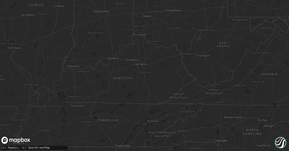
Hail Map on November 27, 2019
Get this storm
November 27 map
$229
one time, instant access
Download today. No call, no setup
Keep the $229
Bought the map and want the full workflow? Apply the entire $229 to a subscription within 7 days. None of it is wasted.
Every map, not just this one
This buys you this map. Subscription and you get every map we run, in the markets you choose from a few cities to whole states to nationwide. Plus real-time alerts the moment a storm fires.
Contact data
Name, contact info, occupancy, even credit band for addresses in the footprint. You go from where it hit to who to call.
Become the source they trust
Unlimited branding weather history reports on demand. You already have the documented answer ready for the property owner, and you are the one who showed up with it.
Property data and RoofTrace estimates
Pull up any address you have got, its value and the exact code rules for that jurisdiction, straight from One Click Code. Then RoofTrace estimates the squares, pitch, and roof value, priced the way you price.
Storm reports
Michigan
| Date | Description |
|---|---|
| 11/27/201910:27 AM CST | Trees down. |
| 11/27/201910:25 AM CST | Trees down. |
| 11/27/201910:23 AM CST | Kmbs asos |
| 11/27/20195:00 AM CST | At 1100 AM EST, a severe thunderstorm was located near Romeo, moving northeast at 55 mph. HAZARD...60 mph wind gusts. SOURCE...Radar indicated. IMPACT...Expect damage to roofs, siding, and trees. This severe thunderstorm will be near... Capac and Memphis around 1110 AM EST. Emmett around 1115 AM EST. Yale around 1120 AM EST. Lakeport around 1135 AM EST.Other locations impacted by this severe thunderstorm include NorthStreet, Adair, Rattle Run, Goodells, Ray Center, Brockway, SmithsCreek, Washington, Wadhams and Riley Center. |
Ohio
| Date | Description |
|---|---|
| 11/27/20193:00 PM CST | Trees down near hwy 11. |
Illinois
| Date | Description |
|---|---|
| 11/27/20196:02 AM CST | At 1201 AM CST, a severe thunderstorm was located near Odin, moving east at 45 mph. HAZARD...60 mph wind gusts. SOURCE...Radar indicated. IMPACT...Expect damage to roofs, siding, and trees. Locations impacted include... Salem, Centralia, Sandoval, Odin, Omega, Helm, Iuka, Junction City, Kell, Walnut Hill, Cartter and Selmaville.This includes Interstate 57 in Illinois between exits 109 and 116. |
| 11/26/20197:03 PM CST | At 102 AM CST, severe thunderstorms were located along a line extending from near Earlville to near Naplate, moving northeast at 55 mph. HAZARD...60 mph wind gusts. SOURCE...Radar indicated. IMPACT...Expect damage to roofs, siding, and trees. Locations impacted include... Oswego, Ottawa, Yorkville, Little Rock, Minooka, Plano, Sandwich, Marseilles, Serena, Montgomery, Sheridan, Somonauk, Earlville, Newark, Leland, Naplate, Millington, Lisbon and Boulder Hill.Including the following interstate... I-80 between mile markers 84 and 105, and between mile markers 115and 122. This includes...Buffalo Rock State Park, and Grundy County Speedway and Fairgrounds. |
Pennsylvania
| Date | Description |
|---|---|
| 11/26/20196:00 PM CST | 2300 bigelow blvd... Tree fell on a vehicle. Injuries unknown. |
Indiana
| Date | Description |
|---|---|
| 11/27/201911:11 AM CST | Report from mping: trees uprooted or snapped; roof blown off. |
| 11/27/20199:56 AM CST | Trees down. Report from mping. |
| 11/26/20198:12 PM CST | At 211 AM CST, severe thunderstorms were located along a line extending from near West Salem to 6 miles west of Grayville, moving east at 40 mph. HAZARD...60 mph wind gusts. SOURCE...Radar indicated. IMPACT...Expect damage to roofs, siding, and trees. Locations impacted include... Mount Carmel, Albion, Grayville, Lancaster, West Salem, Allendale, Bellmont, Bone Gap, Keensburg and Browns. |
Alabama
| Date | Description |
|---|---|
| 11/27/20199:26 AM CST | A brief ef-0 tornado occurred just east of the town of clio. Minor tree damage was noted along its path. |
| 11/27/20199:24 AM CST | Power lines down. Possible tornado. Time estimated by radar. |
| 11/27/20199:19 AM CST | Doppler radar showed a tds on the northwest side of clio in an area that was not accessible. An ef-0 track was assigned per velocity strength and tds height... Plus ins |
| 11/27/20199:18 AM CST | Damage to a portion of a roof on a home by a weak fallen tree. Time estimated by radar. Possible tornado. |
| 11/27/20199:05 AM CST | A brief ef-0 tornado resulted in minor tree and structural damage just east of the town of brundidge in southeast pike county. |
| 11/27/20199:03 AM CST | Corrects and updates previous tstm wnd dmg report and location from 2 nw brundidge. Damage to 5 mobile homes with damage to windows... Roofs and doors. 1 mobile home of |
| 11/27/20198:58 AM CST | Damage to mobile homes... Windows blown out... Damage to doors. Trees down. Location roughly 1 mile west of brundidge on al sr 10. Time estimated by radar. Possible tor |
| 11/27/20196:00 AM CST | 40 to 50 trees down. Location estimated to be in clarke county just west of claiborne lock and dam. Time estimated by radar. |
| 11/26/201911:24 PM CST | At 524 AM CST, a severe thunderstorm was located 5 miles northeast of Saint Stephens, or 8 miles northwest of Jackson, moving east at 40 mph. HAZARD...60 mph wind gusts. SOURCE...Radar indicated. IMPACT...Expect damage to roofs, siding, and trees. Locations impacted include... Jackson, Saint Stephens and Whatley. |
Mississippi
| Date | Description |
|---|---|
| 11/27/20196:21 AM CST | At 1221 AM CST, severe thunderstorms were located along a line extending from near Pelahatchie to Johns to near Mendenhall, moving northeast at 45 mph. HAZARD...60 mph wind gusts. SOURCE...Radar indicated. IMPACT...Expect damage to roofs, siding, and trees. Severe thunderstorms will be near... Pelahatchie around 1225 AM CST. Morton around 1235 AM CST. White Oak and Pulaski around 1245 AM CST. Forest, Homewood and Hillsboro around 1250 AM CST. Burns around 1255 AM CST. Steele around 100 AM CST. Pineville around 105 AM CST.Other locations impacted by these severe thunderstorms includePolkville, D'Lo, Lake and Puckett. |