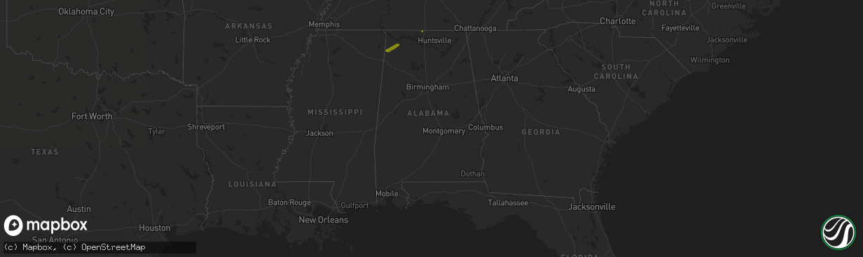
Hail Map in Alabama on November 22, 2019
The weather event in Alabama on November 22, 2019 includes Hail map. 1 state and 6 cities were impacted and suffered possible damage. The total estimated number of properties impacted is 1,865.
Want more than just the map?
Turn this storm into a full workflow.
- Owner + property data so you know who to knock
- OnDemand branded weather history reports to win the "did we even have hail?" argument
- RoofTrace estimate so reps stop guessing numbers at the door
Bought this map? Upgrade within 7 days and we'll credit the $230. (10-15 min setup call)
Hail
1,865
Estimated number of impacted properties by a 1.00" hail or larger0
Estimated number of impacted properties by a 1.75" hail or larger0
Estimated number of impacted properties by a 2.50" hail or largerStorm reports in Alabama
Alabama
| Date | Description |
|---|---|
| 11/22/20194:26 AM CST | At 1025 PM CST, a severe thunderstorm was located near Rogersville, or 17 miles east of Muscle Shoals, moving northeast at 60 mph. This storm has a history of producing dime to quarter size hail. HAZARD...60 mph wind gusts and quarter size hail. SOURCE...Radar indicated. IMPACT...Hail damage to vehicles is expected. Expect wind damage to roofs, siding, and trees. Locations impacted include... Athens, Rogersville, Town Creek, Courtland, North Courtland, Elkmont, Anderson, Lester, Good Springs and Cartwright. |
| 11/22/20193:52 AM CST | At 952 PM CST, a severe thunderstorm was located near Belgreen, or 7 miles west of Russellville, moving northeast at 55 mph. At 950 PM, quarter sized hail was reported at Belgreen. HAZARD...60 mph wind gusts and quarter size hail. SOURCE...Emergency management. IMPACT...Hail damage to vehicles is expected. Expect wind damage to roofs, siding, and trees. Locations impacted include... Florence, Muscle Shoals, Russellville, Sheffield, Tuscumbia, Rogersville, Killen, Town Creek, Littleville and Leighton. |
| 11/21/201910:55 PM CST | Quarter sized hail reported on compton road in elkmont. |
| 11/21/20199:50 PM CST | Quarter sized hail reported near belgreen. Time estimated by radar. |


