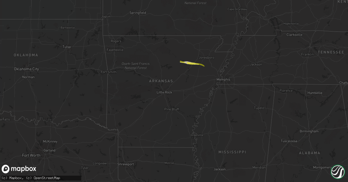
Hail Map in Arkansas on November 21, 2021
Get this storm
November 21 map
$229
one time, instant access
Download today. No call, no setup
Keep the $229
Bought the map and want the full workflow? Apply the entire $229 to a subscription within 7 days. None of it is wasted.
Every map, not just this one
This buys you this map. Subscription and you get every map we run, in the markets you choose from a few cities to whole states to nationwide. Plus real-time alerts the moment a storm fires.
Contact data
Name, contact info, occupancy, even credit band for addresses in the footprint. You go from where it hit to who to call.
Become the source they trust
Unlimited branding weather history reports on demand. You already have the documented answer ready for the property owner, and you are the one who showed up with it.
Property data and RoofTrace estimates
Pull up any address you have got, its value and the exact code rules for that jurisdiction, straight from One Click Code. Then RoofTrace estimates the squares, pitch, and roof value, priced the way you price.
Storm reports in Arkansas
Arkansas
| Date | Description |
|---|---|
| 11/21/202112:47 PM CST | Hail was covering the ground. |
| 11/21/202112:45 PM CST | Hail was covering the ground |
| 11/21/20216:56 AM CST | At 1256 PM CST, a severe thunderstorm was located near Grubbs, or near Newport, moving east at 45 mph. HAZARD...Quarter size hail. SOURCE...Radar indicated. IMPACT...Damage to vehicles is expected. Locations impacted include... Trumann, Marked Tree, Harrisburg, Weiner, Waldenburg, Greenfield, Payneway, Tulot, Weona Junction, Weona, Hatchie Coon, Stewart, Maple Grove, Promised Land, Uno, Judd Hill, Pitts, Landers, Boat Run and Cassidy. |
| 11/21/20216:28 AM CST | At 1228 PM CST, a severe thunderstorm was located over Magness, or 9 miles southeast of Batesville, moving east at 45 mph. HAZARD...Half dollar size hail. SOURCE...Radar indicated. IMPACT...Damage to vehicles is expected. Locations impacted include... Newport... Tuckerman... Diaz... Newark... Grubbs... Oil Trough... Jacksonport... Magness... Campbell Station... Amagon... Balch... Rosie... Stegall... Erwin... Macks... This includes US Highway 67 between mile markers 80 and 96. |


