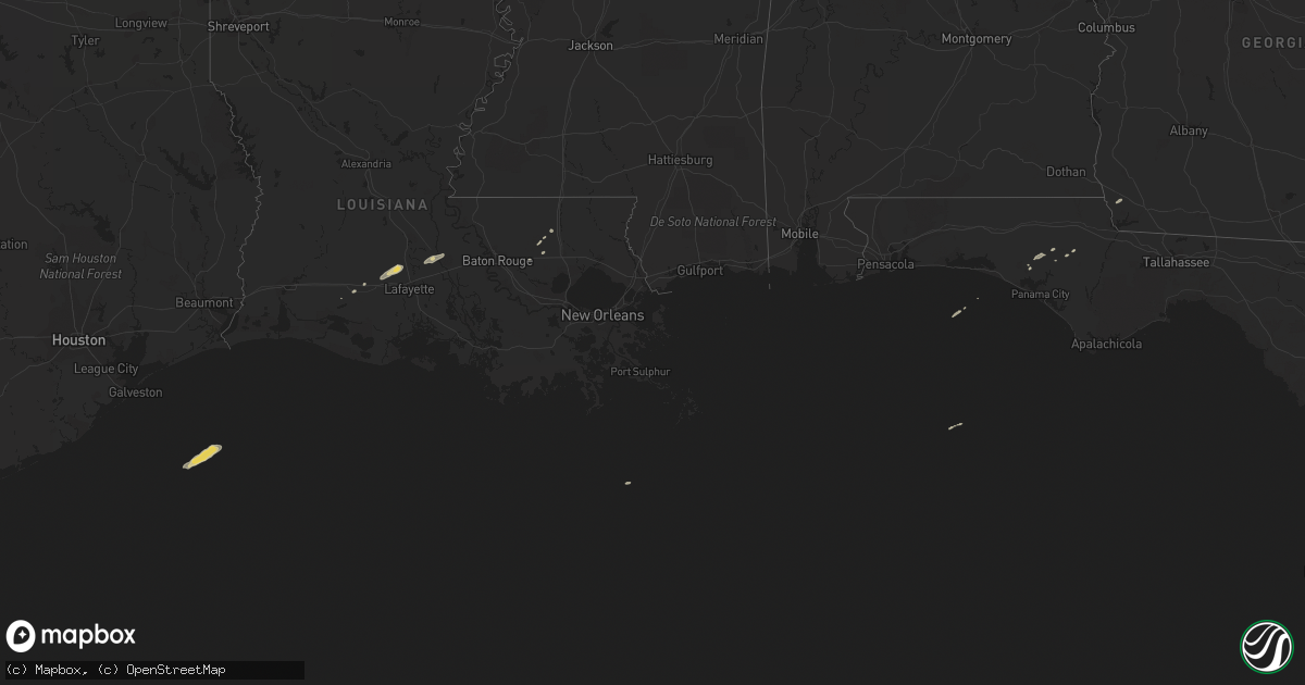
Hail Map on November 16, 2014
Get this storm
November 16 map
$229
one time, instant access
Download today. No call, no setup
Keep the $229
Bought the map and want the full workflow? Apply the entire $229 to a subscription within 7 days. None of it is wasted.
Every map, not just this one
This buys you this map. Subscription and you get every map we run, in the markets you choose from a few cities to whole states to nationwide. Plus real-time alerts the moment a storm fires.
Contact data
Name, contact info, occupancy, even credit band for addresses in the footprint. You go from where it hit to who to call.
Become the source they trust
Unlimited branding weather history reports on demand. You already have the documented answer ready for the property owner, and you are the one who showed up with it.
Property data and RoofTrace estimates
Pull up any address you have got, its value and the exact code rules for that jurisdiction, straight from One Click Code. Then RoofTrace estimates the squares, pitch, and roof value, priced the way you price.
Storm reports
Mississippi
| Date | Description |
|---|---|
| 11/16/20145:30 PM CST | Emergency manager relayed report from highway patrol of a brief tornado touchdown near the intersection of ms higway 583 and higway 98. No damage reported at this time. |
| 11/16/20148:24 AM CST | Additional reports of power poles snapped and structural damage to one or two residences around the myrick community relayed through social media. Possible tornado. |
| 11/15/201411:30 PM CST | A few trees downed around rockhill brooklyn road. |
| 11/15/201410:35 PM CST | Tree and power line down |
| 11/15/20148:27 PM CST | An ef-1 tornado touched down along pavillion rd...tracking ne across holifield rd...us hwy 84...and lifting along charlie green rd. Two power poles were snapped...a bar |
| 11/15/20148:24 PM CST | Additional reports of power poles snapped and structural damage to one or two residences around the myrick community relayed through social media. Possible tornado. |
| 11/15/20148:24 PM CST | Update... A national weather service storm survey team confirms this damage was caused by a tornado with a rating of ef-1. More details will follow shortly. Initial dmage (ja |
| 11/15/20148:16 PM CST | Tree down |
Florida
| Date | Description |
|---|---|
| 11/16/20145:57 AM CST | 3 mobile homes damaged in grand ridge |
| 11/16/20144:45 AM CST | Tornado touched down in gadsden county at intersection of sycamore and winding creek rd. |
| 11/16/20144:20 AM CST | Damage to buildings and perimeter fence at calhoun correctional institute state prison |
| 11/16/20144:20 AM CST | Trees down near rock bluff |
| 11/16/20144:19 AM CST | Nws storm survey confirms long-track 22.3 mile tornado path through parts of calhoun...liberty...and gadsden counties. Max rating ef2 at calhoun correctional institutio |
| 11/16/20143:05 AM CST | Power flashes at inlet beach. |
| 11/16/20142:51 AM CST | Tornado debris signature detected via dual-pol radar. |
| 11/16/20142:12 AM CST | Tornado debris signature detected via dual-pol radar. |
Louisiana
| Date | Description |
|---|---|
| 11/16/201412:58 PM CST | Storm spotter reported a portion of a shed blown into a neighbors yard. Time estimated from radar. |
| 11/16/201412:55 PM CST | Tractor trailer overturned at hwy 365 and hwy 95. |
| 11/16/201412:24 PM CST | 911 reported branches and power lines down at morrow road and highway 13. |
| 11/15/20148:40 PM CST | Emergency manager relayed report from electric power untility of several trees down in the vicinity of highway 1036 and highway 441. Time estimated on radar. |
| 11/15/20148:20 PM CST | Sherrifs office reported tornado touched down near the intersection of louisiana highway 63 and highway 442. Trees reported down. Time based on radar. |
| 11/15/20147:50 PM CST | Sheriffs office relayed a public report of a brief tornado touchdown. Damage was reported to fences. |
Georgia
| Date | Description |
|---|---|
| 11/16/20145:25 AM CST | Few trees down on sykes mill road. Time estimated by radar. |
| 11/16/20145:20 AM CST | Media reported trees down in decatur county. Exact time and location approximated. |
Alabama
| Date | Description |
|---|---|
| 11/16/20145:52 AM CST | Several trees down. At least one road blocked near the communities of shellhorn and ansley. Possible tornado. |
| 11/16/20144:45 AM CST | A tornado crossed from crenshaw county into northwest pike county about one-half mile north of cr 30. The tornado traveled through northern pike county and into southwe |
| 11/16/20141:50 AM CST | Multiple reports from across clarke county including damaged houses... Overturned campers... Downed trees and power lines and roads in the area are blocked. |
| 11/16/20141:37 AM CST | Multiple trees down along hwy 56 south of hobson |
| 11/16/20141:15 AM CST | Trees in the road on giffin cemetary rd half mile west of cr23. Radar indicated tds. Possible tornado. |
| 11/16/20141:11 AM CST | A tornado touched down near polecat creek in western perry county just west of boots northcutt rd. The tornado traveled northeastward through western perry county befor |