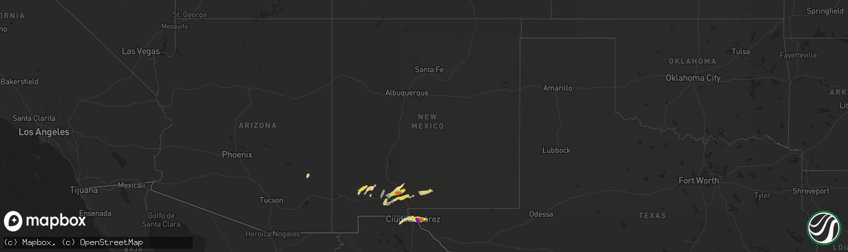
Hail Map in New Mexico on November 4, 2016
The weather event in New Mexico on November 4, 2016 includes Hail map. 4 states and 27 cities were impacted and suffered possible damage. The total estimated number of properties impacted is 14,226.
Want more than just the map?
Turn this storm into a full workflow.
- Owner + property data so you know who to knock
- OnDemand branded weather history reports to win the "did we even have hail?" argument
- RoofTrace estimate so reps stop guessing numbers at the door
Bought this map? Upgrade within 7 days and we'll credit the $230. (10-15 min setup call)
Hail
14,226
Estimated number of impacted properties by a 1.00" hail or larger418
Estimated number of impacted properties by a 1.75" hail or larger0
Estimated number of impacted properties by a 2.50" hail or largerStorm reports in New Mexico
New Mexico
| Date | Description |
|---|---|
| 11/04/20165:40 PM CDT | Public reported numerous cars damaged along hwy 180 near hwy 61 exit. 2 inch diameter hail and covering the ground. |
| 11/03/201610:42 PM CDT | Off-duty nws employee reports half dollar size hail |
| 11/03/201610:34 PM CDT | 1 inch diameter hail reported by trained spotter near nmsu |
| 11/03/20168:24 PM CDT | Quarter sized hail reported just north of dona ana |
All States Impacted by Hail Map on November 4, 2016
Cities Impacted by Hail Map on November 4, 2016
- Thermopolis, WY
- Riverton, WY
- Shoshoni, WY
- El Paso, TX
- Lander, WY
- Thatcher, AZ
- Pima, AZ
- Las Cruces, NM
- Pavillion, WY
- Mesilla, NM
- Mesilla Park, NM
- Safford, AZ
- Deming, NM
- Bayard, NM
- Dubois, WY
- Jeffrey City, WY
- Cloudcroft, NM
- Alamogordo, NM
- Kinnear, WY
- White Sands Missile Range, NM
- Fort Washakie, WY
- Arapahoe, WY
- Lysite, WY
- Casper, WY
- Crowheart, WY
- Boulder, WY
- Clint, TX


