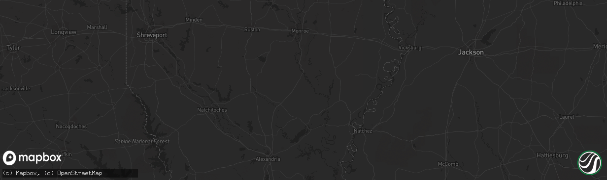
Hail Map in Memphis, TN on November 3, 2012
The weather event in Memphis, TN on November 3, 2012 includes Hail map. 6 states and 229 cities were impacted and suffered possible damage. The total estimated number of properties impacted is 0.
Hail
0
Estimated number of impacted properties by a 1.00" hail or larger0
Estimated number of impacted properties by a 1.75" hail or larger0
Estimated number of impacted properties by a 2.50" hail or largerStorm reports in Memphis, TN
Memphis, TN
| Date | Description |
|---|---|
| 11/03/20125:35 PM CDT | Quarter size hail reported by a spotter on presidents island. |
| 11/03/20125:23 PM CDT | Public report...via local media...of quarter to golfball size hail at intersection of elmore park and yale roads in bartlett. |
| 11/03/20125:15 PM CDT | Spotter reports quarter size hail near the wolfchase mall in bartlett. |
| 11/03/20125:15 PM CDT | Quarter size hail and 50 mph winds reported by the public at stage and appling roads in bartlett. |
| 11/03/20125:10 PM CDT | Quarter size hail near intersection of yale and old brownsville. |
All States Impacted by Hail Map on November 3, 2012
All Cities Impacted by Hail Map on November 3, 2012
- Memphis, TN
- Eldorado, TX
- Kingsville, TX
- Riviera, TX
- Sardis, MS
- Stanton, TN
- Greenville, TX
- Caddo Mills, TX
- Huntsville, TX
- New Waverly, TX
- Royse City, TX
- Forney, TX
- Rockwall, TX
- Stuttgart, AR
- Clarksville, TN
- Groveton, TX
- De Kalb, TX
- New Boston, TX
- North Zulch, TX
- Portland, TX
- Taft, TX
- Corpus Christi, TX
- Whiteville, TN
- Somerville, TN
- Sledge, MS
- Norman, AR
- Mena, AR
- McEwen, TN
- Waverly, TN
- Scroggins, TX
- Winnsboro, TX
- Marianna, AR
- Coldspring, TX
- Moscow, TN
- Rossville, TN
- Moro, AR
- Brinkley, AR
- Wheatley, AR
- Albany, TX
- Paint Rock, TX
- Whites Creek, TN
- Goodlettsville, TN
- Old Hickory, TN
- Hendersonville, TN
- Joelton, TN
- Madison, TN
- Port Aransas, TX
- Pioneer, LA
- Mer Rouge, LA
- Oak Grove, LA
- Aransas Pass, TX
- Ferris, TX
- Wilmer, TX
- Palmer, TX
- Waxahachie, TX
- Ennis, TX
- Seagoville, TX
- Pleasant View, TN
- Springfield, TN
- Cedar Hill, TN
- Chapmansboro, TN
- Erin, TN
- Bolivar, TN
- Goliad, TX
- Adams, TN
- Tennessee Colony, TX
- Huntsville, AL
- Mason, TN
- Woodsboro, TX
- Morris Chapel, TN
- Saltillo, TN
- Toone, TN
- Denmark, TN
- Bells, TN
- Brownsville, TN
- Miles, TX
- Eola, TX
- San Angelo, TX
- Southaven, MS
- Olive Branch, MS
- Henderson, TN
- Pinson, TN
- Greenbrier, TN
- Gallatin, TN
- Talco, TX
- Mount Pleasant, TX
- Cookville, TX
- Mereta, TX
- Prescott, AR
- Killen, AL
- Bauxite, AR
- Mabelvale, AR
- Refugio, TX
- Enville, TN
- Finger, TN
- West Memphis, AR
- Marion, AR
- Willis, TX
- De Valls Bluff, AR
- Palestine, AR
- Ozona, TX
- Wills Point, TX
- Forrest City, AR
- Big Sandy, TX
- Tynan, TX
- Skidmore, TX
- Beeville, TX
- Mathis, TX
- Big Sandy, TN
- Leesburg, TX
- Shepherd, TX
- Livingston, TX
- Tchula, MS
- Sardis, TN
- Milledgeville, TN
- Corrigan, TX
- Diboll, TX
- Only, TN
- Centerville, TN
- Nunnelly, TN
- Gilmer, TX
- Ore City, TX
- El Campo, TX
- Benton, AR
- Emory, TX
- Elkmont, AL
- Lake Cormorant, MS
- Walls, MS
- Oakland, TN
- Lufkin, TX
- Collierville, TN
- Eads, TN
- Cordova, TN
- Arlington, TN
- Ashland City, TN
- Ingleside, TX
- De Witt, AR
- Sonora, TX
- Terrell, TX
- Conroe, TX
- Florence, AL
- Marathon, TX
- Bryan, TX
- Goodwin, AR
- Biscoe, AR
- Cherokee, AL
- Tishomingo, MS
- Hughes, AR
- Brandon, MS
- Sumner, TX
- Red Oak, TX
- Montalba, TX
- Palestine, TX
- White Hall, AR
- Grapevine, AR
- Walnut Springs, TX
- Glen Rose, TX
- Sunnyvale, TX
- Crandall, TX
- Quinlan, TX
- Lancaster, TX
- Caldwell, TX
- Milano, TX
- Gause, TX
- Hearne, TX
- Eva, TN
- Mart, TX
- Carthage, AR
- Sheridan, AR
- Oxford, MS
- Lawrenceburg, TN
- Proctor, AR
- Germantown, TN
- Crawfordsville, AR
- Huntington, TX
- Morgan, TX
- Fairfield, TX
- Charlotte, TN
- Vanleer, TN
- Dickson, TN
- Hurricane Mills, TN
- Clarendon, AR
- Saulsbury, TN
- Lyles, TN
- Duck River, TN
- Lindale, TX
- Dryden, TX
- Lebanon, TN
- Mount Juliet, TN
- Bayside, TX
- Rowena, TX
- Rison, AR
- Bethel Springs, TN
- White Bluff, TN
- England, AR
- Scott, AR
- Somerville, TX
- Victoria, TX
- Nacogdoches, TX
- Alba, TX
- Hickory Valley, TN
- Quitman, TX
- Yantis, TX
- Tuscumbia, AL
- Hawkins, TX
- Carlisle, AR
- Annona, TX
- Avery, TX
- Reagan, TN
- Emmet, AR
- Pittsburg, TX
- Hazen, AR
- Cleveland, TX
- Mesquite, TX
- Campbell, TX
- Hernando, MS
- Nesbit, MS
- Holladay, TN
- Altheimer, AR
- Sherrill, AR
- Del Rio, TX
- Alpine, TX
- Groesbeck, TX
- Cottontown, TN
- White House, TN
- Gregory, TX
- Jackson, TN
- Medon, TN
- Mercer, TN


